|
|
|
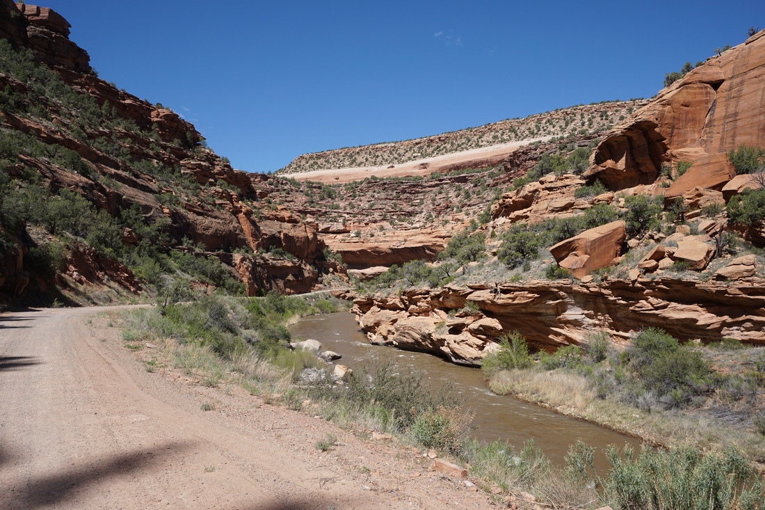
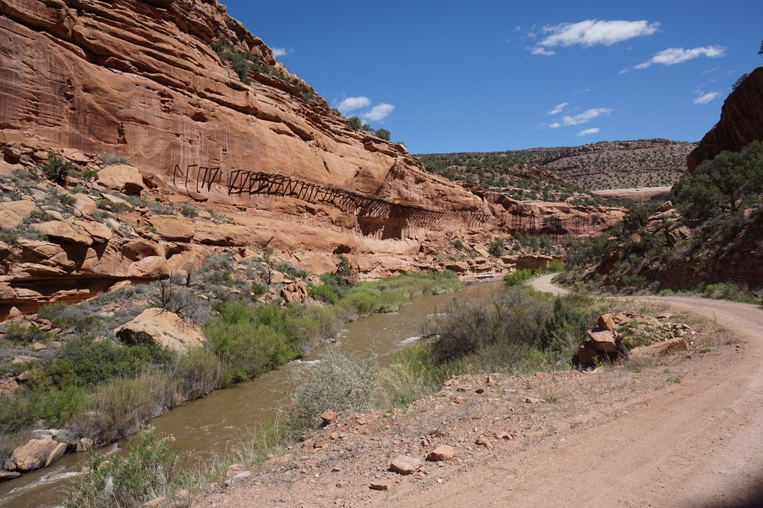
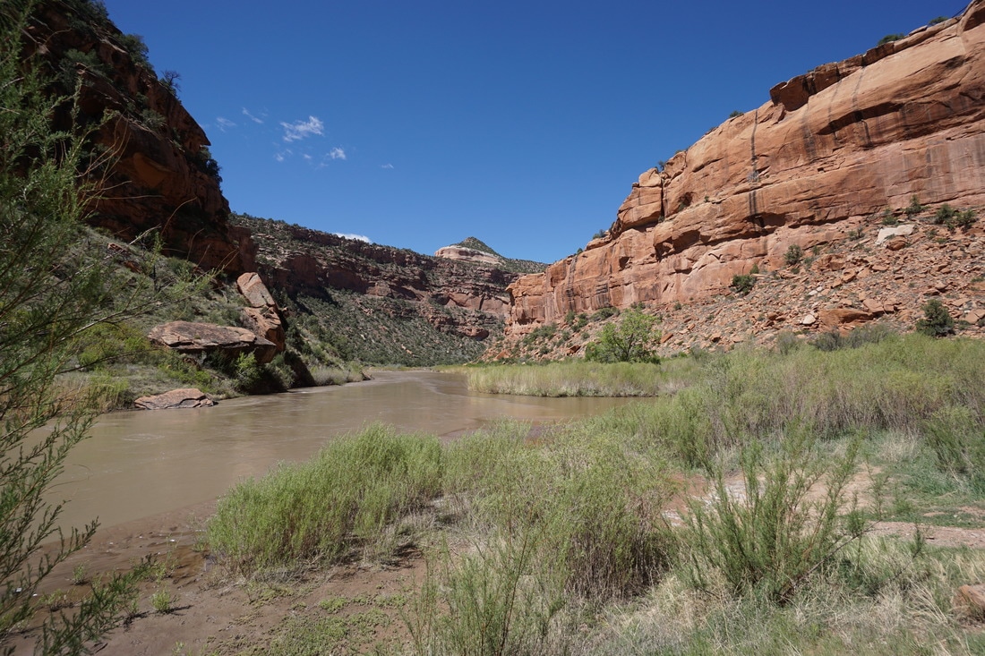
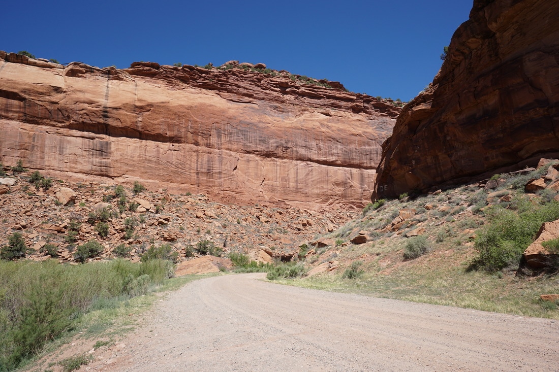
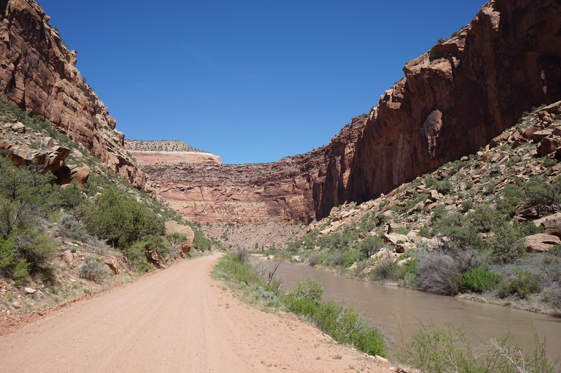
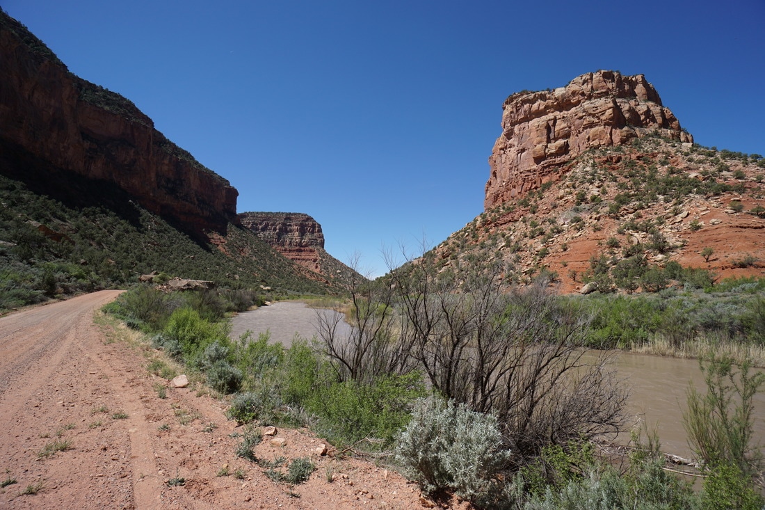
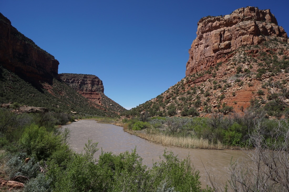
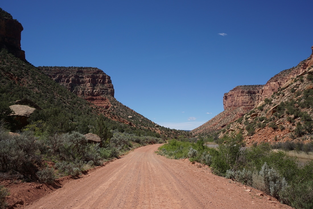
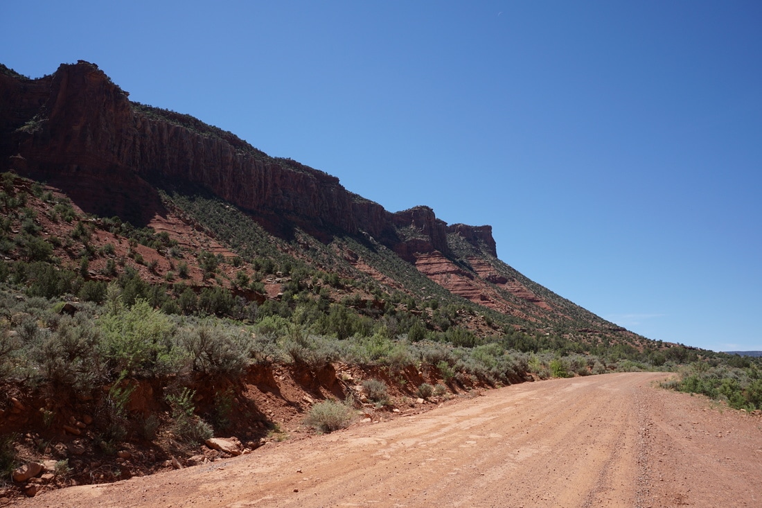
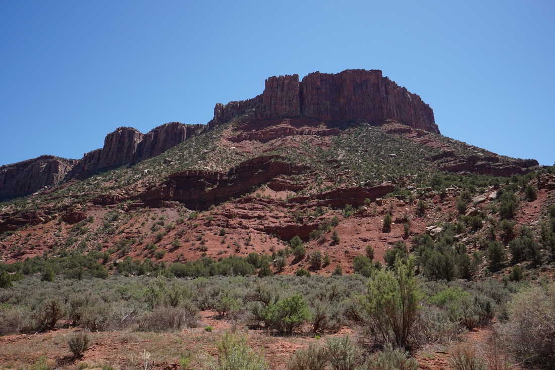
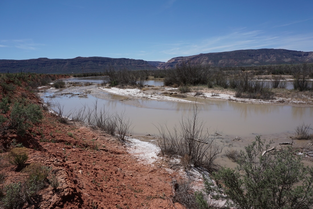
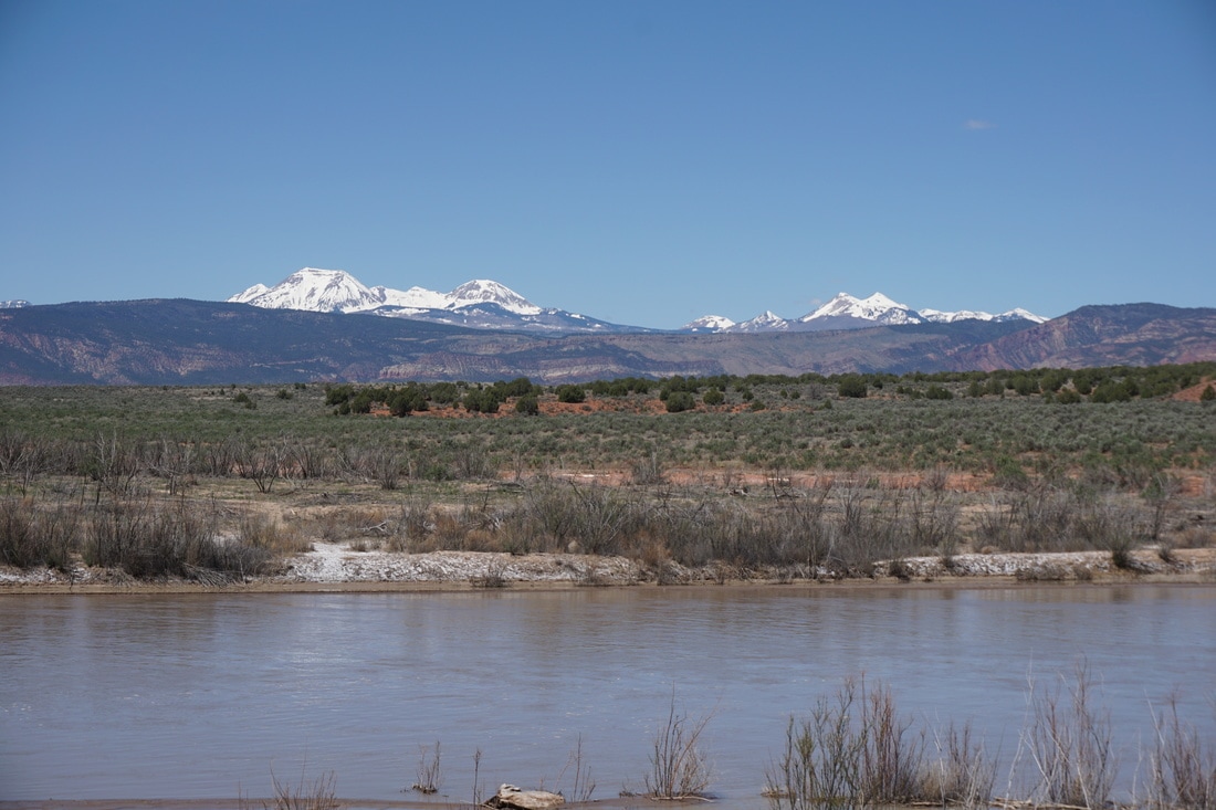
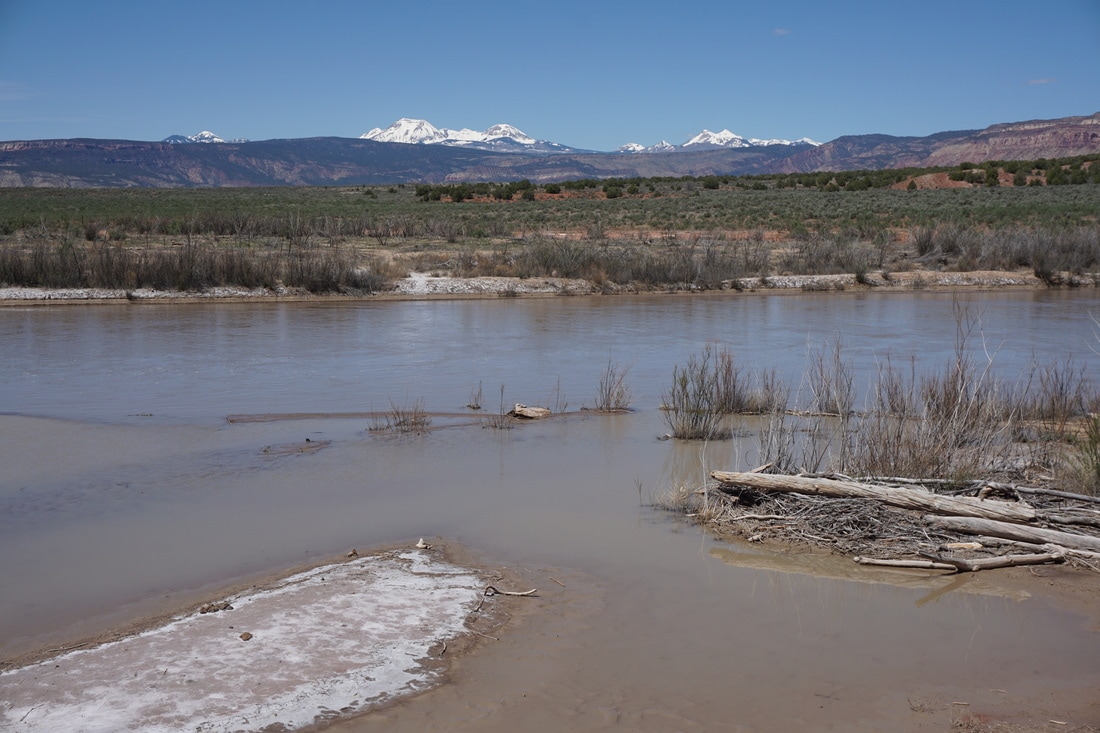
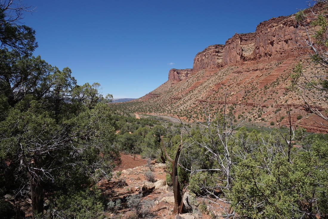
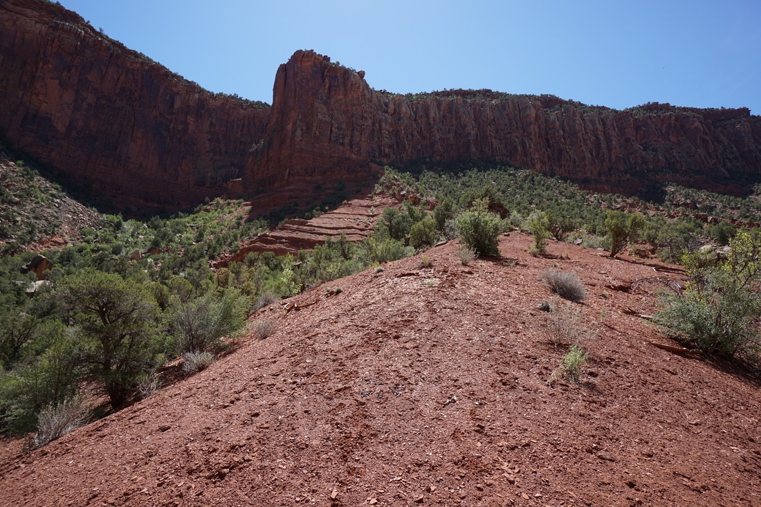
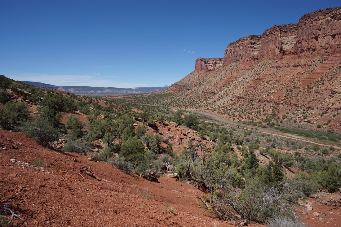
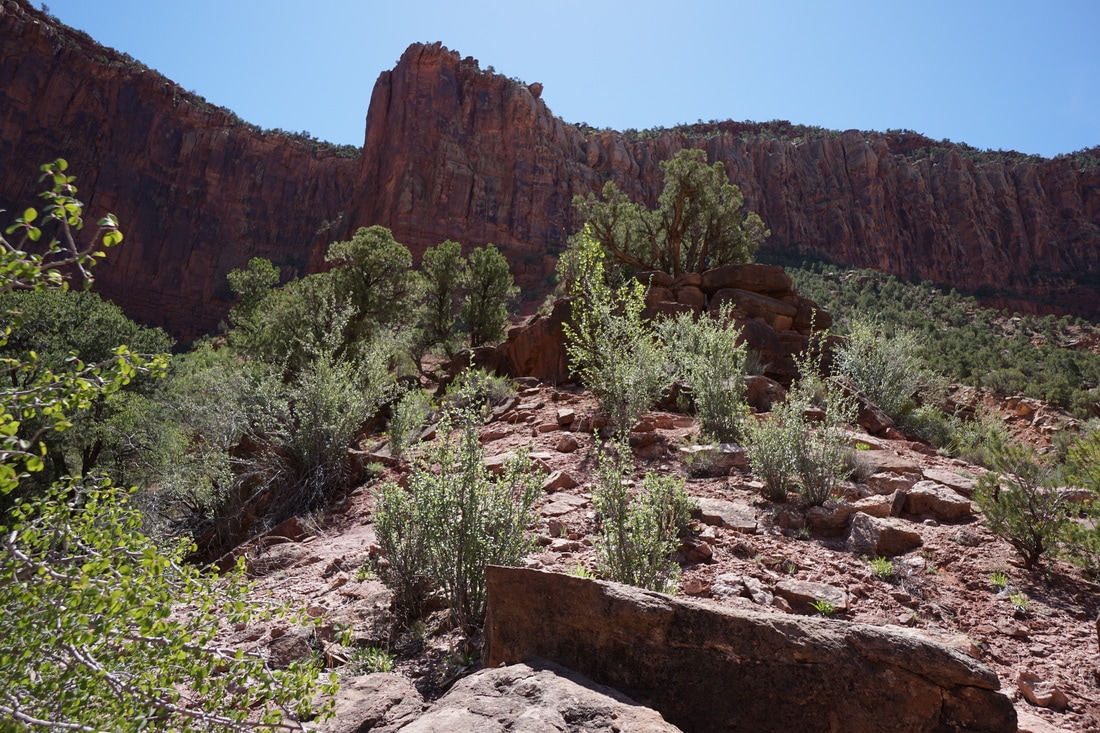
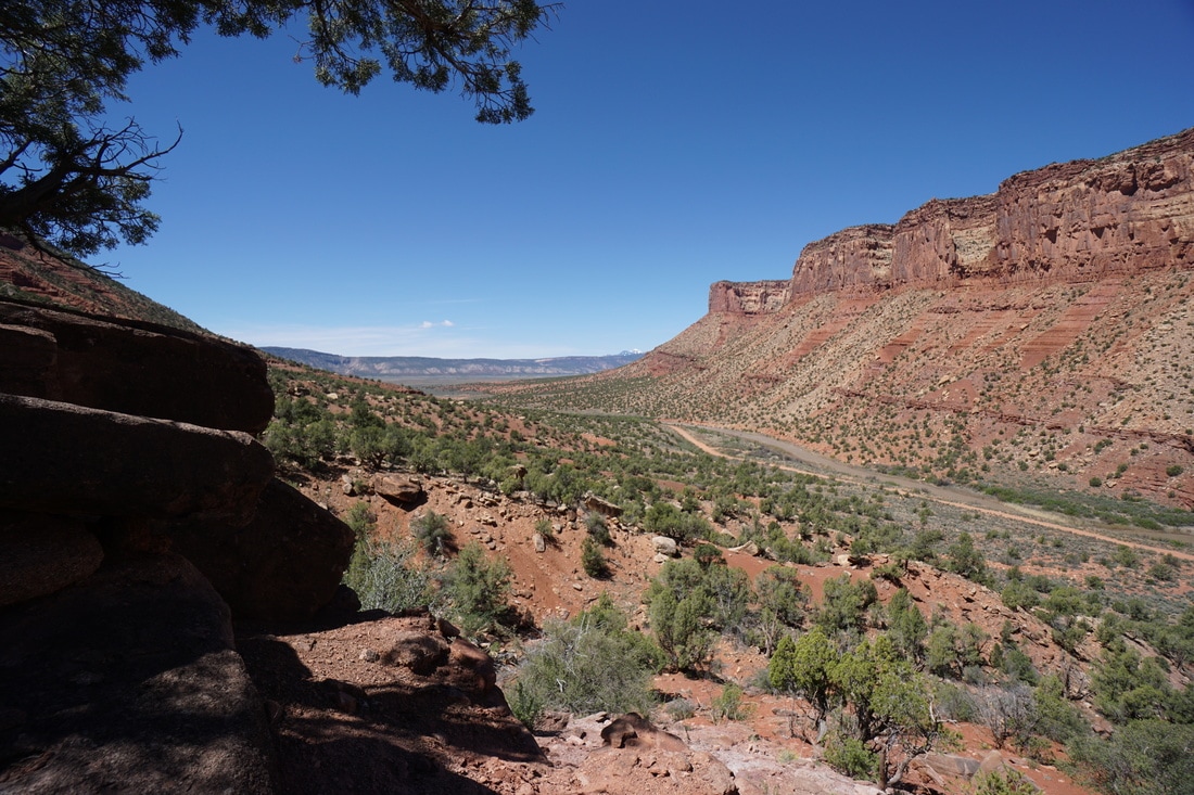
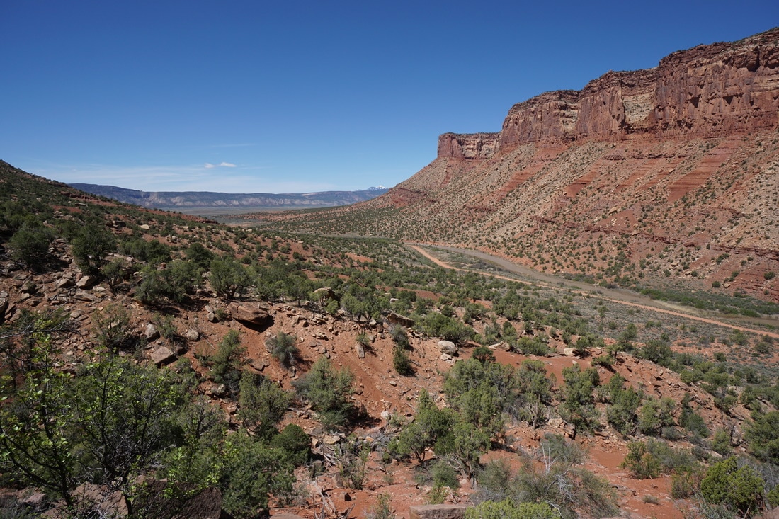
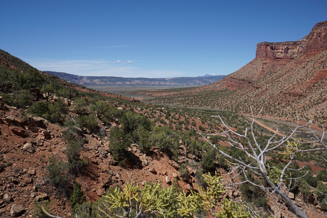
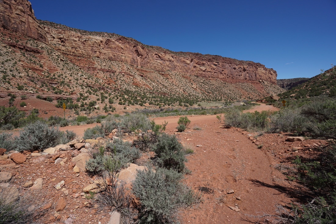
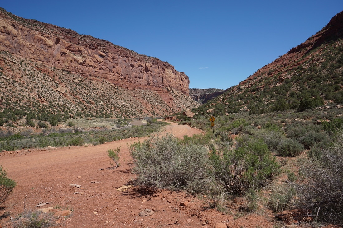
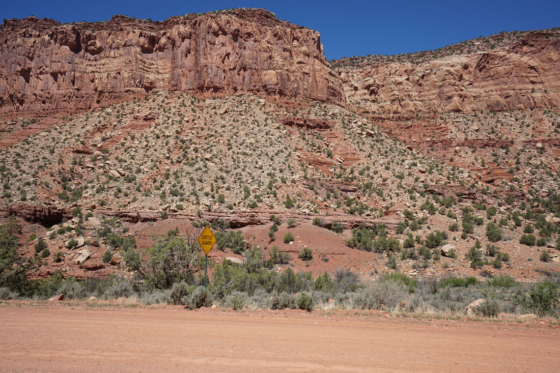
The Dolores River Canyon running south from Gateway is absolutely beautiful. The Unaweep-Tabaguache Scenic Highway runs through the canyon but there is a little known side canyon that is even more impressive. The Y-11 road (well graded dirt road) runs south from highway 141 to Paradox Valley and provides a "short cut" to the town of Bedrock. After leaving 141, the road follows the San Miguel River to it's confluence with the Dolores River, then heads south along the Dolores River. While driving along the San Miguel you get an up close and personal view of the historic "Hanging Flume." In good weather the road should be passable to most vehicles, but having some extra clearance and 4WD or AWD will make the journey more comfortable. I can't overstate the beauty of this canyon...
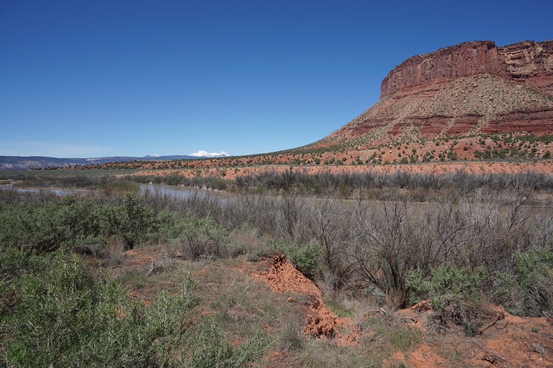
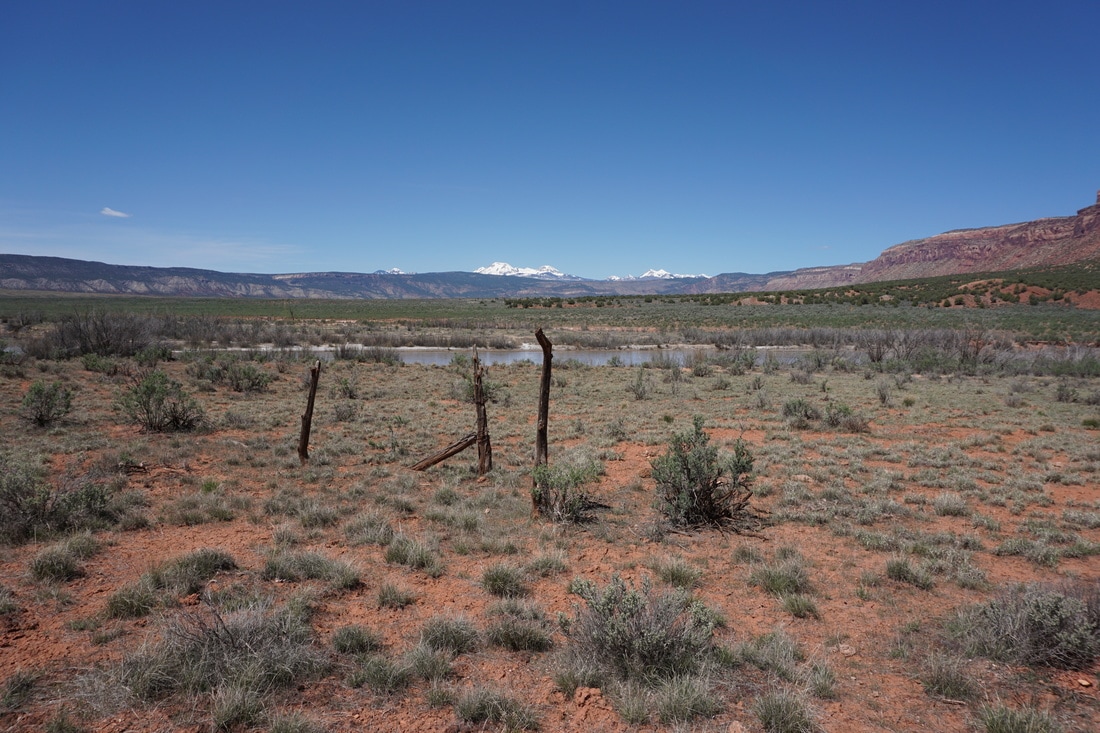
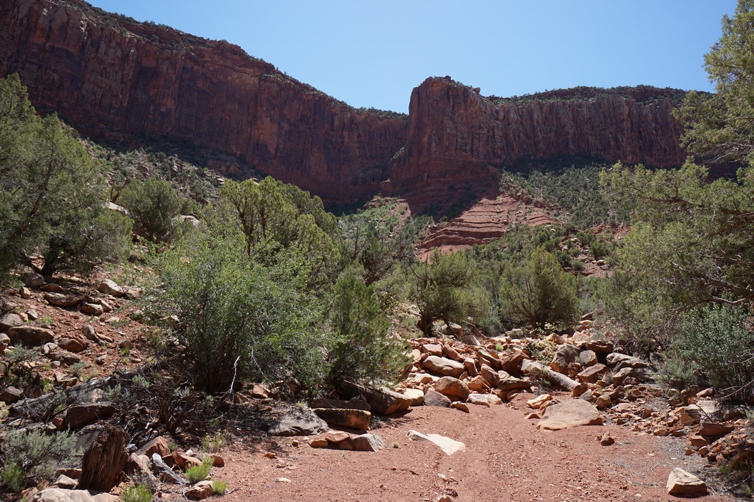
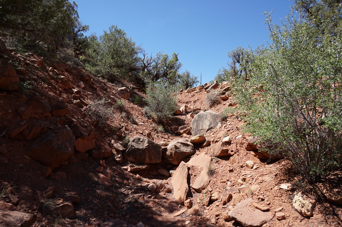
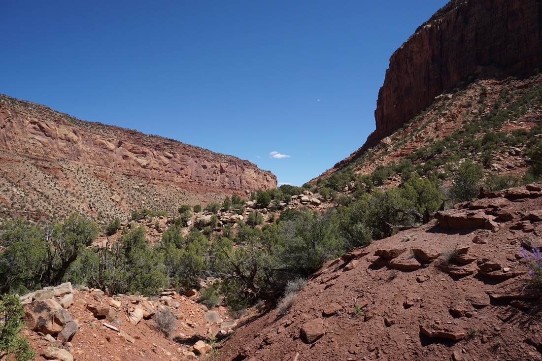
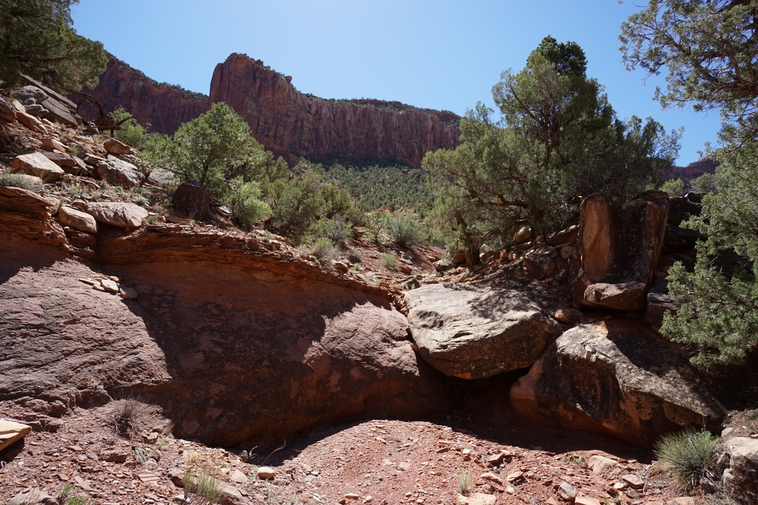
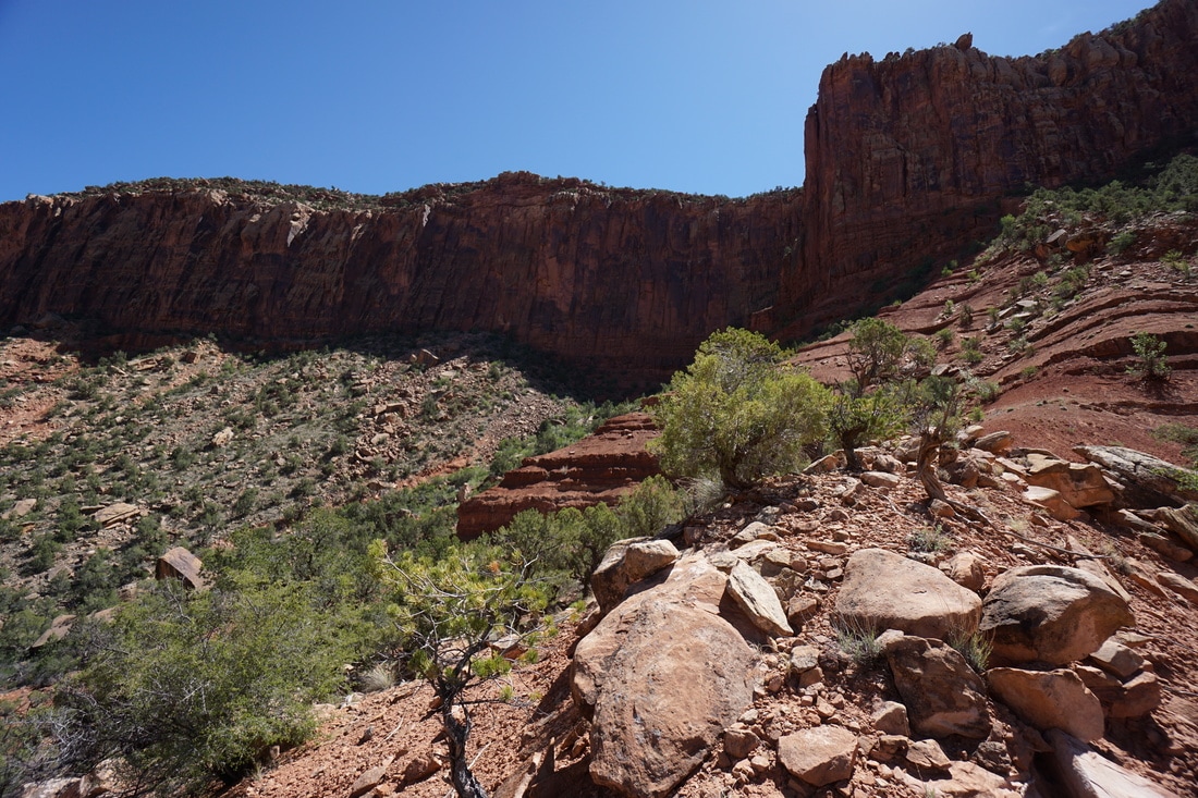
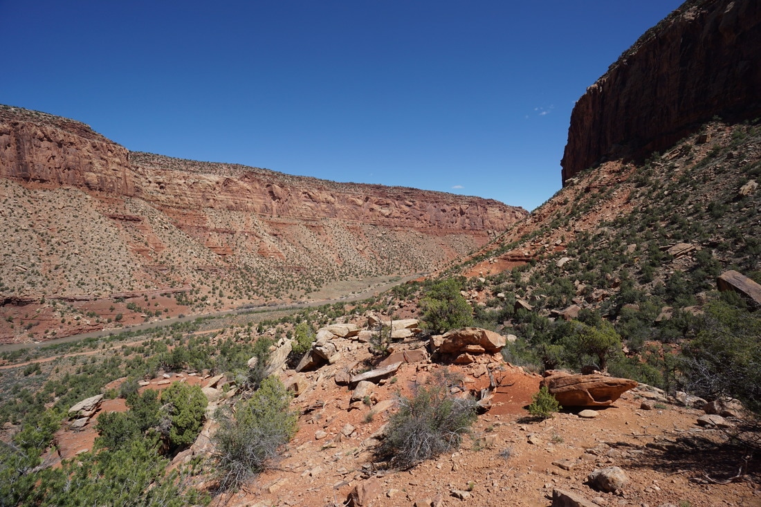
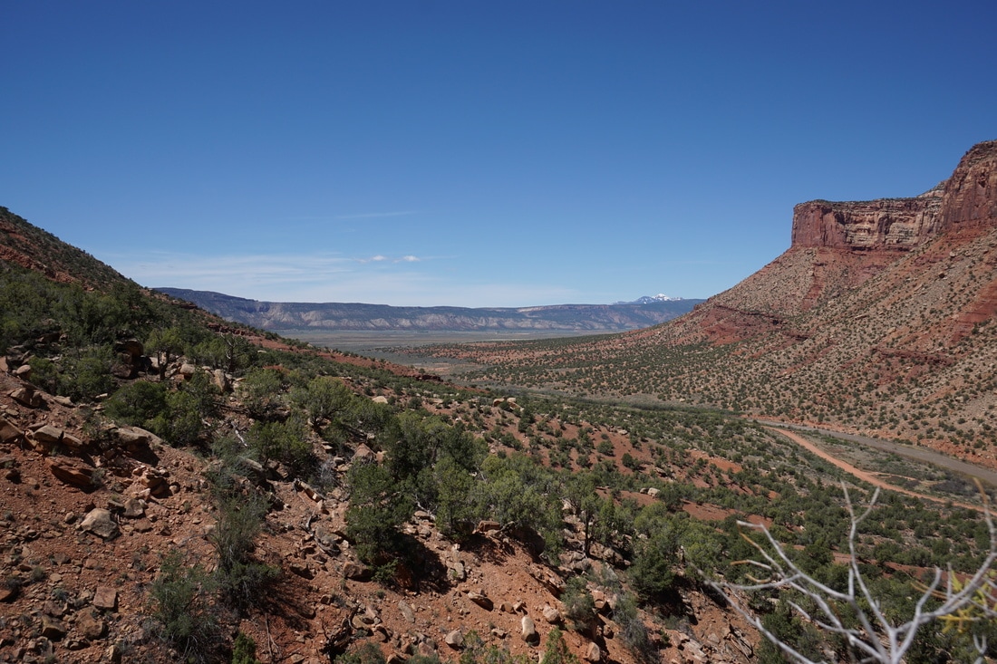
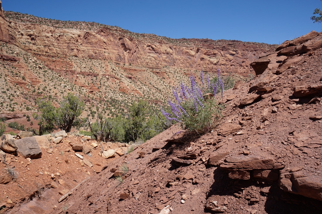
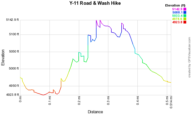
Although you'll be looking for trailheads the entire time, there are not many hiking options along the road as the canyon walls are tall and sheer. Apparently, there is an old cow trail just south of the confluence that climbs up to a bench running along the top of the canyon but the trail was not obvious at the time and will have to be left for future exploration. This hike follows a wash near the southern end of the canyon that was obvious enough from the road that I found it without knowing it was there ahead of time. This is also one of the few places where the road is wide enough to safely pull over and park. The "trail" follows a sandy dry wash up to a ridge with great views into Paradox Valley with the La Sal Mountains in the distance. This wash also gets you closer to the towering red rock monoliths that make us the canyon walls. This hike is near the southern mouth of the canyon and since you'll be drooling for a hike the entire drive through the canyon, this gives you a chance to get out and play in the red dirt for a little while. You can climb as far as you want, just keep the wash in mind so you can find your way back, with no official trail you need to take extra caution. For an official hike along the Dolores River, see the Dolores River Canyon Trail south of this hike on the other side of Paradox Valley near the town of Bedrock. |
Y-11 RoadWash Hike |