GO HIKE COLORADO
Get in Touch:
  • HOME
  • ABOUT
  • HIKES BY REGION
    • DENVER AREA >
      • Denver Mountain Parks
      • Jefferson County Open Space
      • Lakewood Parks
      • Denver Area Greenways
    • BOULDER AREA
    • DOUGLAS COUNTY
    • FORT COLLINS AREA
    • COLORADO SPRINGS AREA
    • FRONT RANGE
    • TENMILE & MOSQUITO RANGES
    • GORE RANGE
    • SANGRE DE CRISTO MOUNTAINS
    • PARK RANGE
    • SAWATCH RANGE
    • ELK MOUNTAINS
    • SAN JUAN MOUNTAINS
    • THE FLAT TOPS
    • GRAND MESA
    • COLORADO PLATEAU
    • EASTERN PLAINS
  • NATIONAL PARK HIKES
    • BENT'S OLD FORT NATIONAL HISTORIC SITE
    • BLACK CANYON OF THE GUNNISON NATIONAL PARK
    • COLORADO NATIONAL MONUMENT
    • CURECANTI NATIONAL RECREATION AREA
    • DINOSAUR NATIONAL MONUMENT
    • FLORISSANT FOSSIL BEDS NATIONAL MONUMENT
    • MESA VERDE NATIONAL PARK
    • ROCKY MOUNTAIN NATIONAL PARK
    • GREAT SAND DUNES NATIONAL PARK
    • HOVENWEEP NATIONAL MONUMENT
    • SAND CREEK MASSACRE NATIONAL HISTORIC SITE
    • YUCCA HOUSE NATIONAL MONUMENT
  • HIKES BY CATEGORY
    • HIKES TO ALPINE LAKES
    • HIKES TO PEAKS & PASSES
    • HIKES THROUGH CANYONS
    • HIKES WITH FALL COLORS
    • HIKES ALONG THE I-70 CORRIDOR
    • HIKES ON PAVED TRAILS
    • HIKES FOR KIDS
    • HIKES TO WATERFALLS
    • HIKES ALONG RIVERS
    • HIKES WITH ROCK FORMATIONS
    • HIKES WITH WILDFLOWERS
    • WINTER HIKES
  • NEWS
  • WEBCAMS
  • $UPPORT GHC
  • INTERACTIVE MAP

Strontia Reservoir View
Colorado Trail Segment 1
Pike National Forest

Date Hiked: May 5, 2013

​Distance: 8.5 mi (RT)
Elevation Gain: 1,993ft
Elevation Min/Max: 5,983 to 7,537ft
Trailhead Lat/Long: 39.400245 N; 105.167679 W
Managing Agency: U.S. Forest Service
Fee: None

Colorado Trail Foundation Website
Picture

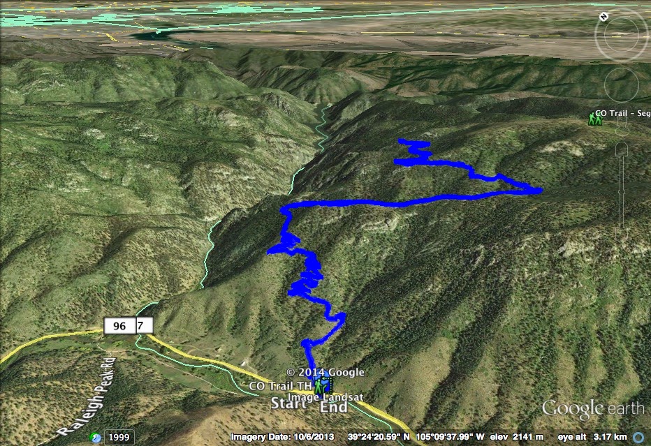
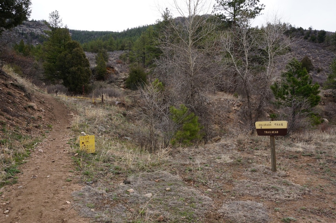
Directions:  From Denver, take Hwy 285 South to S. Foxton Road.  Follow Foxton Road through Reynolds Park till you hit the S. Platte River.  Turn east and follow W. Platte River Road through a small town to the Gudy Gaskill Bridge and the Colorado Trail Trailhead.  This hike heads east along the Colorado Trail and starts across the street from the Bridge.

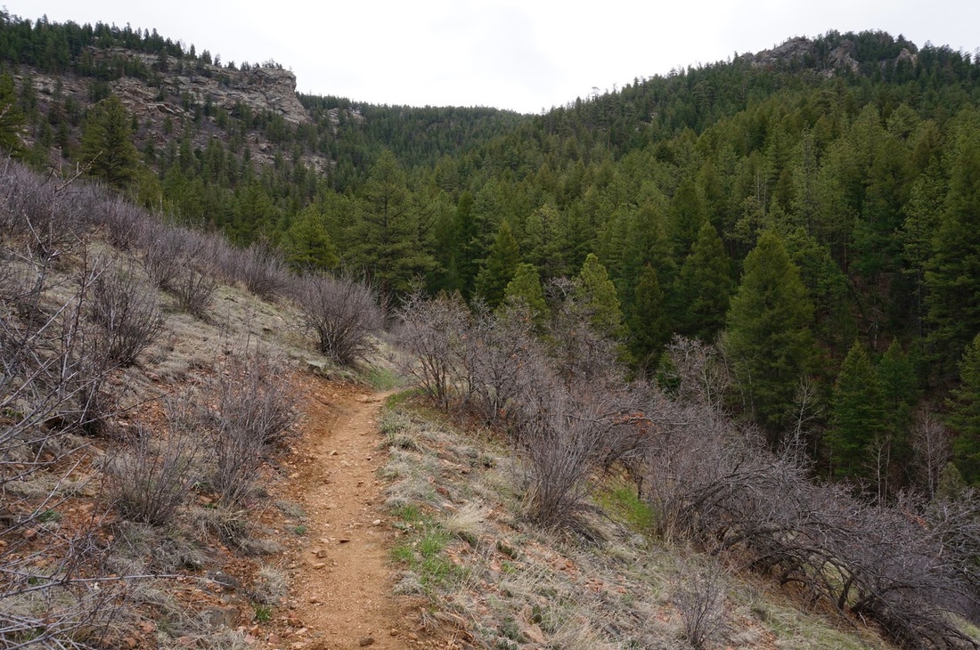
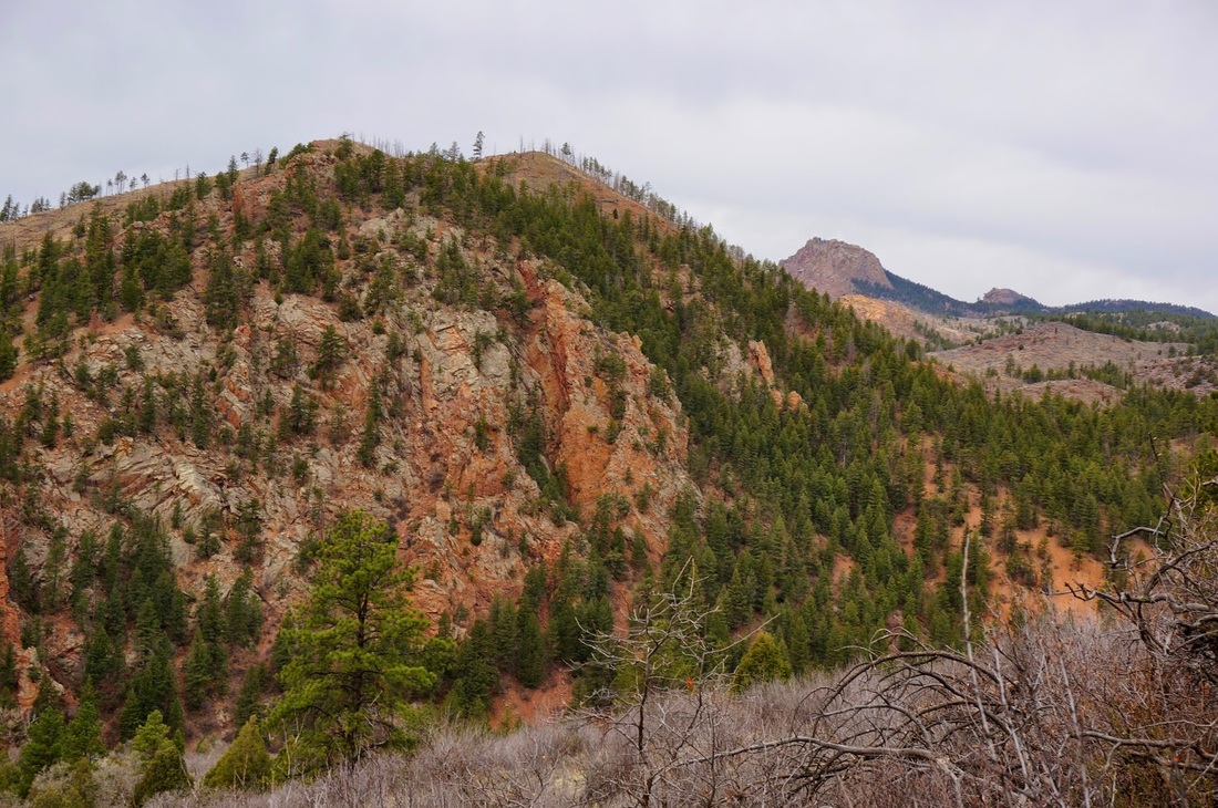
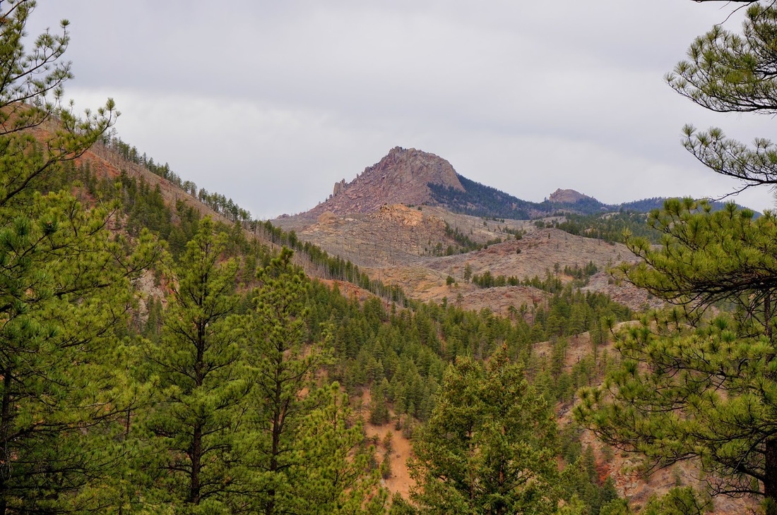
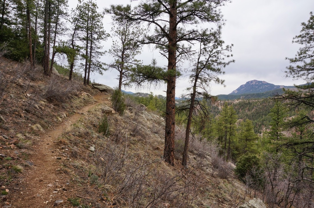
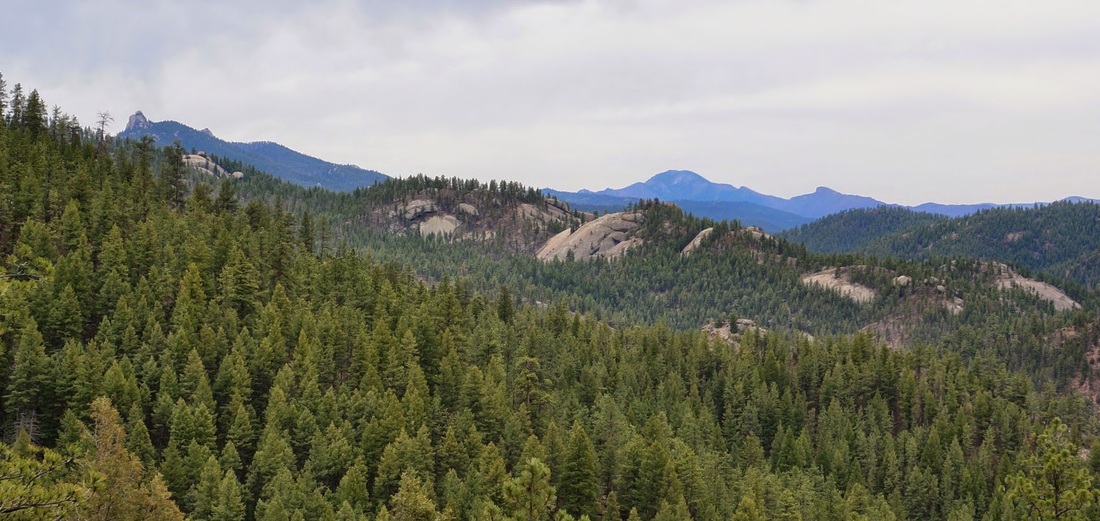
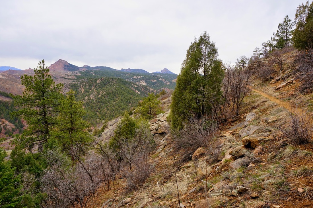
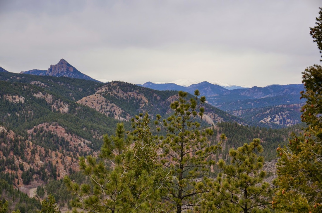
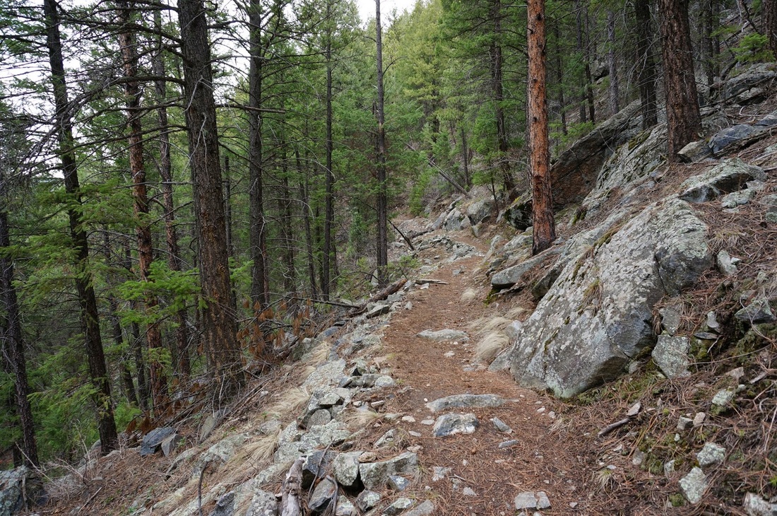
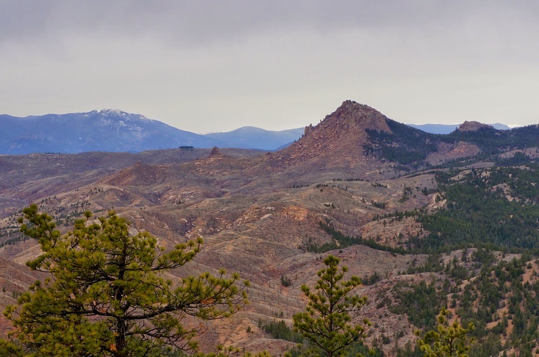
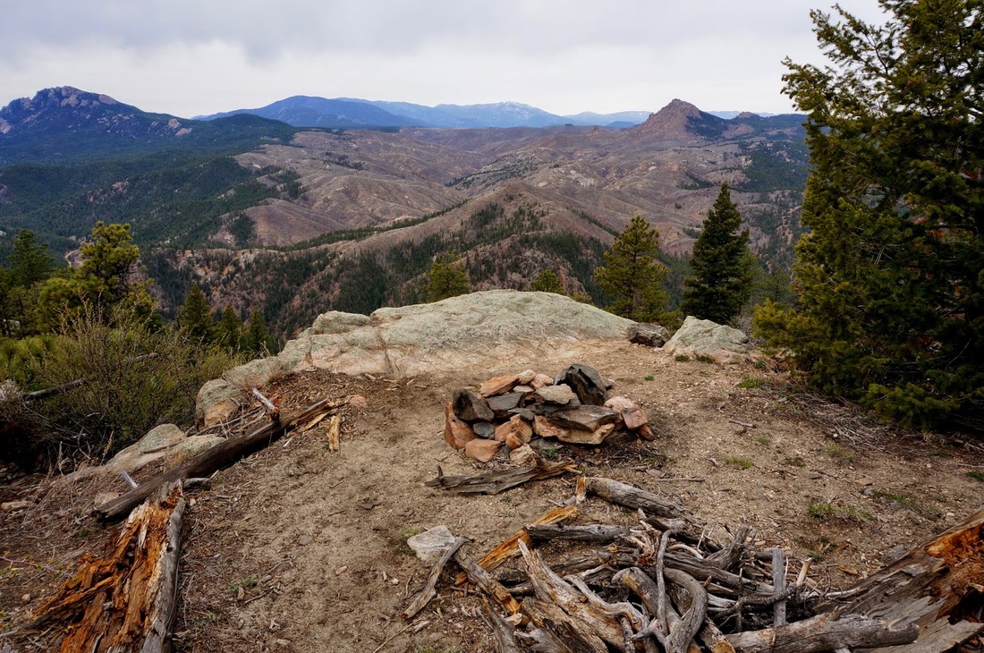
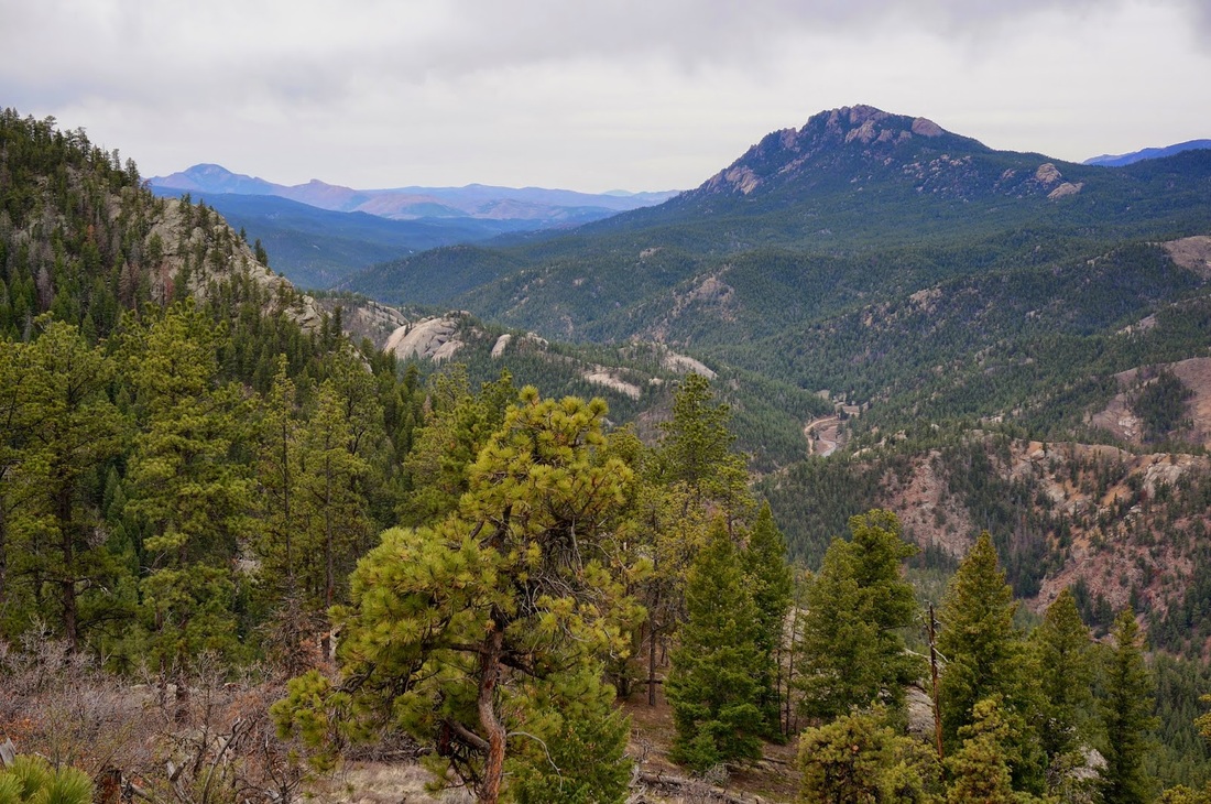
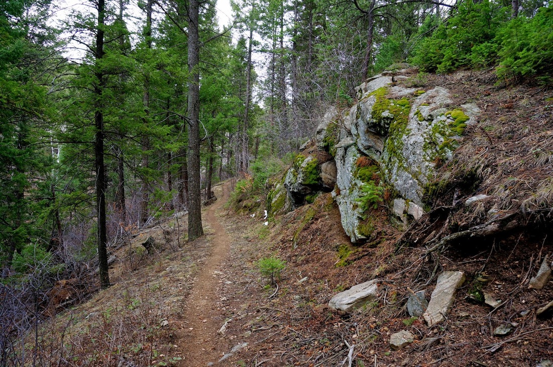
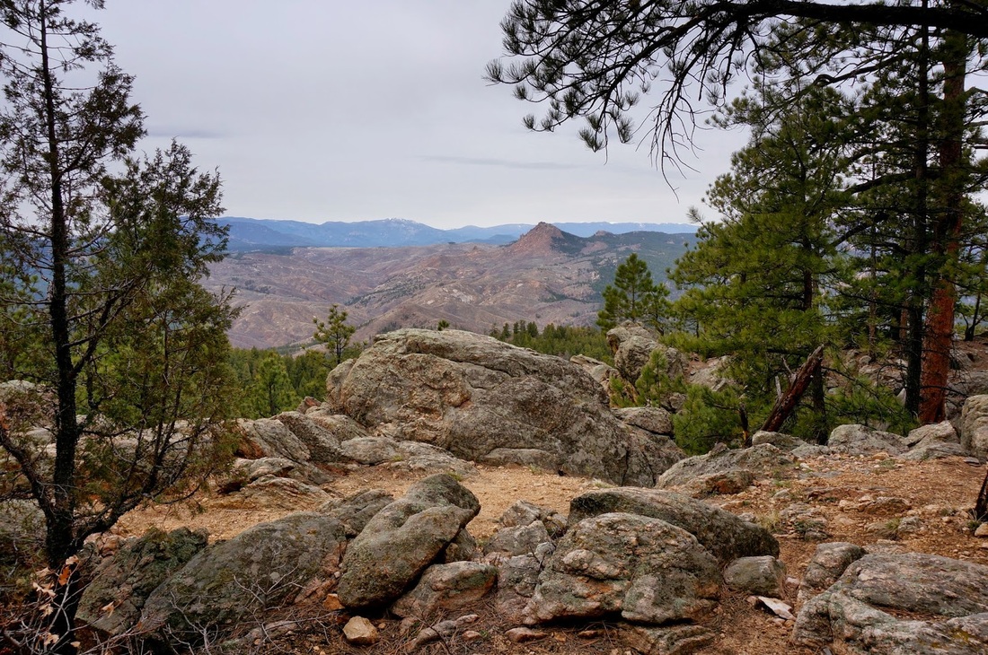
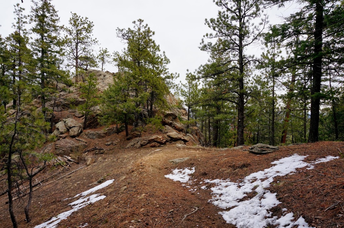
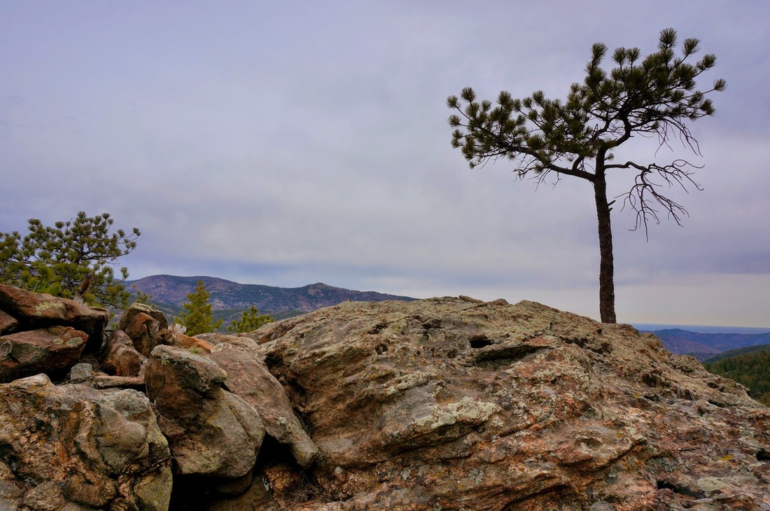
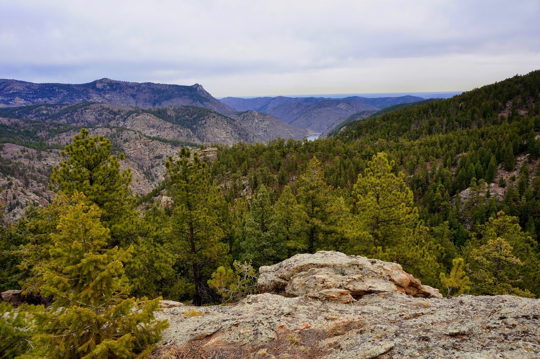
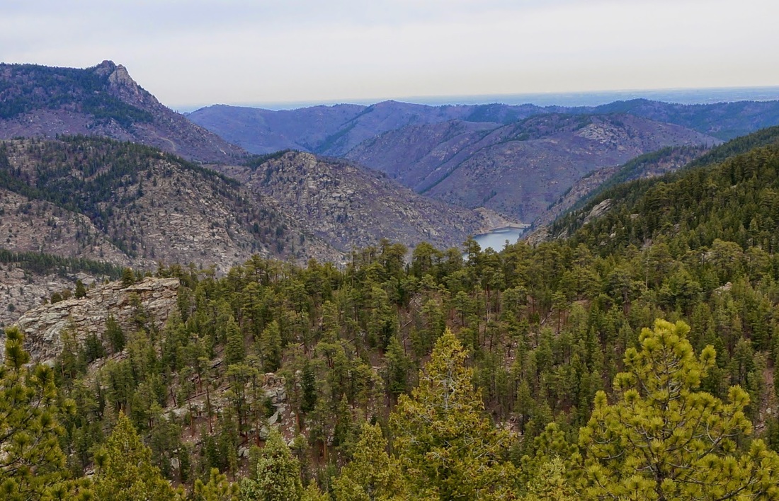
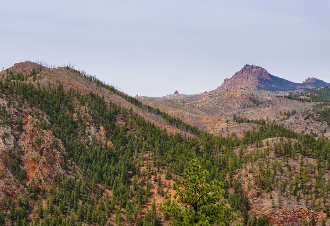
The Colorado Trail may stretch all the way from Durango to Denver, but hiking portions of the trail can result in a wonderful day hike.  This stretch is a good example of this.  The trail is very well maintained and easy to follow, although you gain almost 2,000 feet in 4 miles, the grade is very gentle resulting in a long hike that feels short.

The trail switchbacks up the west slope of the hillside offering great views of Raleigh Peak and the Cathedral Spires to the west and Scraggy Peak to the south.  The first portion of the hike travels through a recovering wildfire burn area, then enters the forest for the remainder of the hike.  Once you top out, you'll see a large rock outcropping, scramble up this rock to reach your destination.  From the top of the rock you'll be looking down on the Strontia Reservoir at the end of Waterton Canyon.  It is still about 5 miles further to the Reservoir so this is the turnaround point for this hike.  Just a quick taste of the Colorado Trail but there are small segments like this that can be hiked all through the front range leading to Kenosha Pass and beyond.

Powered by Create your own unique website with customizable templates.