GO HIKE COLORADO
Get in Touch:
  • HOME
  • ABOUT
  • HIKES BY REGION
    • DENVER AREA >
      • Denver Mountain Parks
      • Jefferson County Open Space
      • Lakewood Parks
      • Denver Area Greenways
    • BOULDER AREA
    • DOUGLAS COUNTY
    • FORT COLLINS AREA
    • COLORADO SPRINGS AREA
    • FRONT RANGE
    • TENMILE & MOSQUITO RANGES
    • GORE RANGE
    • SANGRE DE CRISTO MOUNTAINS
    • PARK RANGE
    • SAWATCH RANGE
    • ELK MOUNTAINS
    • SAN JUAN MOUNTAINS
    • THE FLAT TOPS
    • GRAND MESA
    • COLORADO PLATEAU
    • EASTERN PLAINS
  • NATIONAL PARK HIKES
    • BENT'S OLD FORT NATIONAL HISTORIC SITE
    • BLACK CANYON OF THE GUNNISON NATIONAL PARK
    • COLORADO NATIONAL MONUMENT
    • CURECANTI NATIONAL RECREATION AREA
    • DINOSAUR NATIONAL MONUMENT
    • FLORISSANT FOSSIL BEDS NATIONAL MONUMENT
    • MESA VERDE NATIONAL PARK
    • ROCKY MOUNTAIN NATIONAL PARK
    • GREAT SAND DUNES NATIONAL PARK
    • HOVENWEEP NATIONAL MONUMENT
    • SAND CREEK MASSACRE NATIONAL HISTORIC SITE
    • YUCCA HOUSE NATIONAL MONUMENT
  • HIKES BY CATEGORY
    • HIKES TO ALPINE LAKES
    • HIKES TO PEAKS & PASSES
    • HIKES THROUGH CANYONS
    • HIKES WITH FALL COLORS
    • HIKES ALONG THE I-70 CORRIDOR
    • HIKES ON PAVED TRAILS
    • HIKES FOR KIDS
    • HIKES TO WATERFALLS
    • HIKES ALONG RIVERS
    • HIKES WITH ROCK FORMATIONS
    • HIKES WITH WILDFLOWERS
    • WINTER HIKES
  • NEWS
  • WEBCAMS
  • $UPPORT GHC
  • INTERACTIVE MAP

Sleepy Lion Trail
Button Rock Preserve

Date Hiked: January 29, 2012 ​

Distance: 5.1 mi (RT)

  • Elevation Gain: 900ft
  • Elevation Min/Max:  5,842 to 6,640 ft
  • Managing Agency: City of Longmont
  • Fee: None

Button Rock Preserve Website
Picture

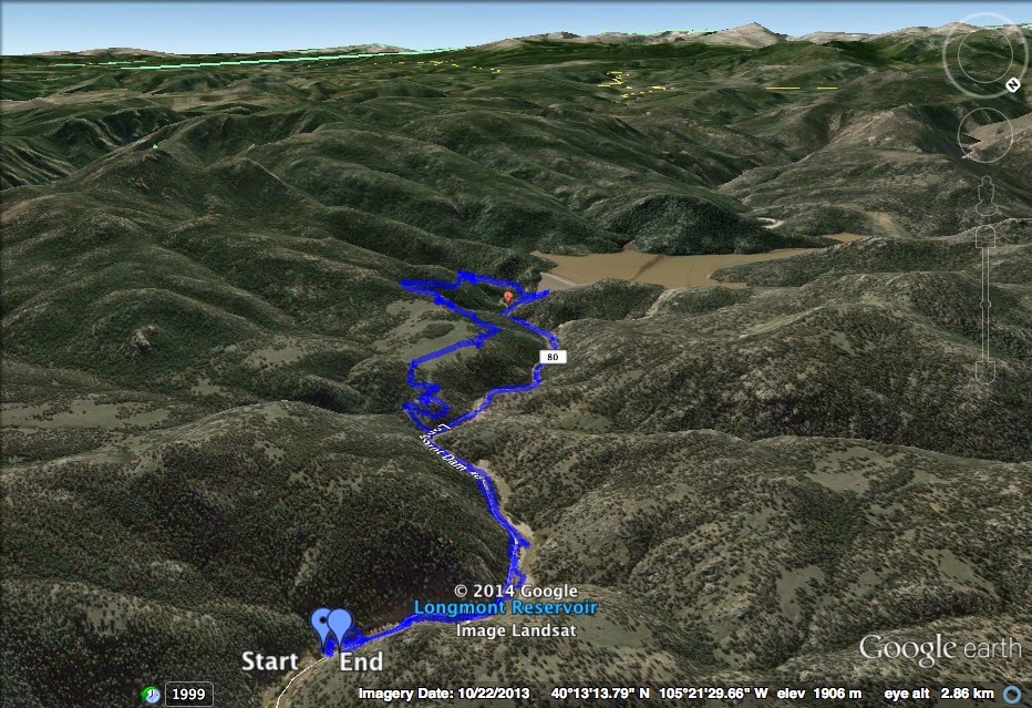
Directions: From Boulder, head north on on 36 to Lyons.  From Lyons, continue on 36 up the canyon to the Longmont Dam Road (80) on the left.  Follow Longmont Dam Rd to the Preserve, there is a small parking area near the gate.

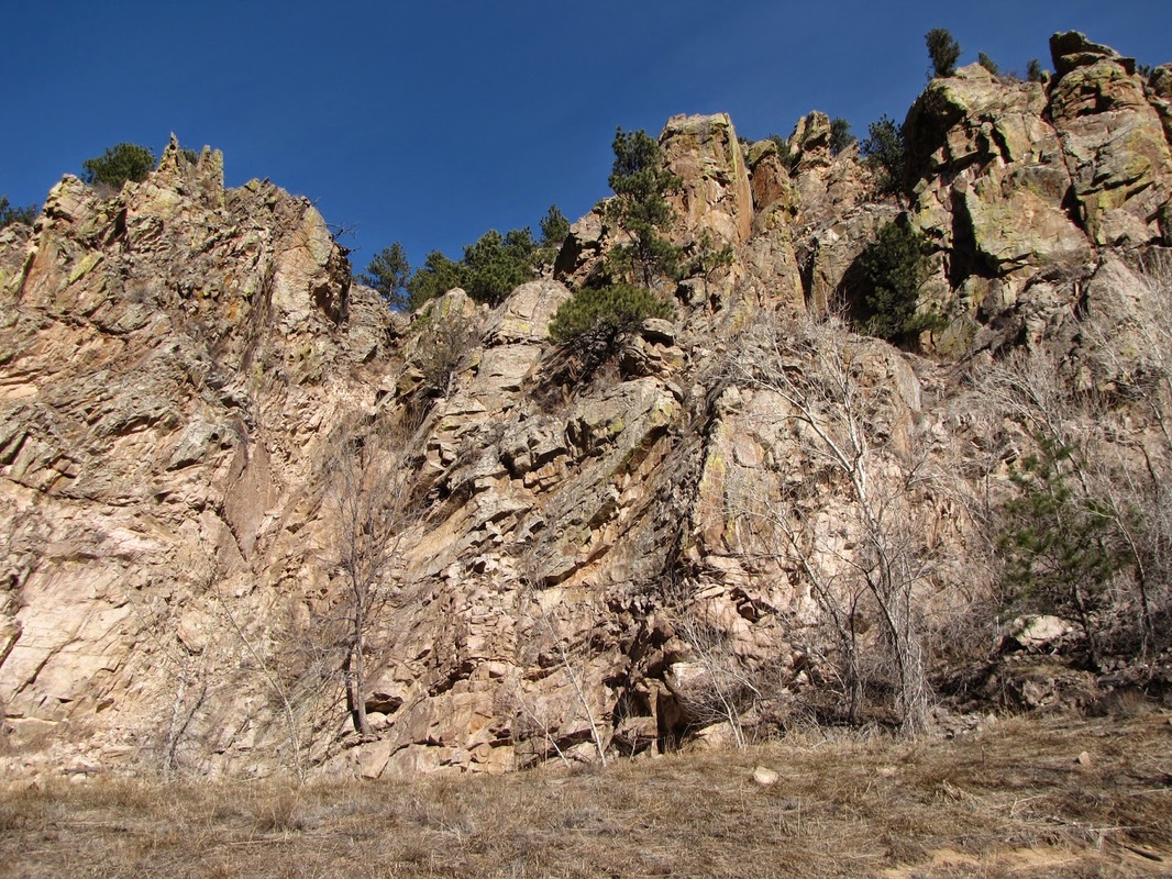
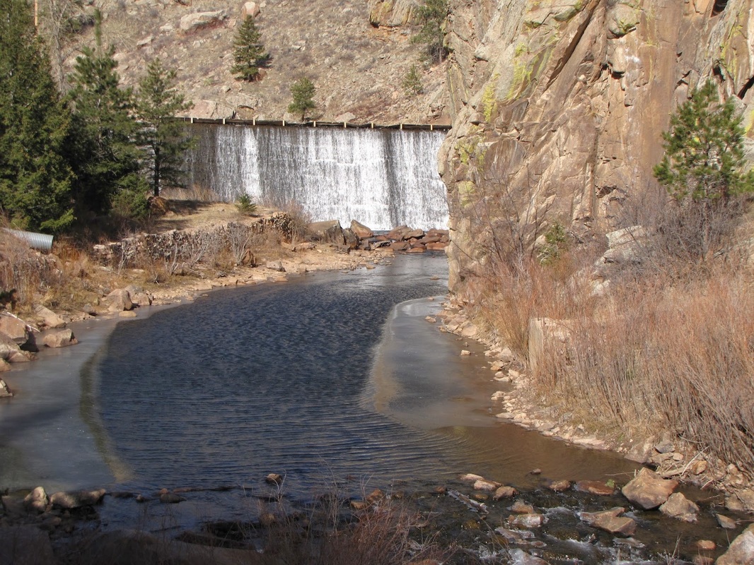
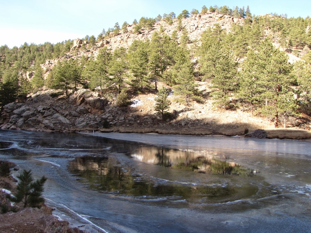
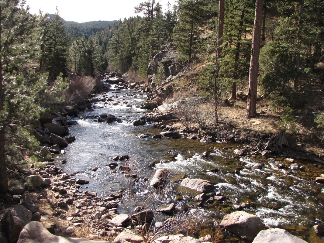
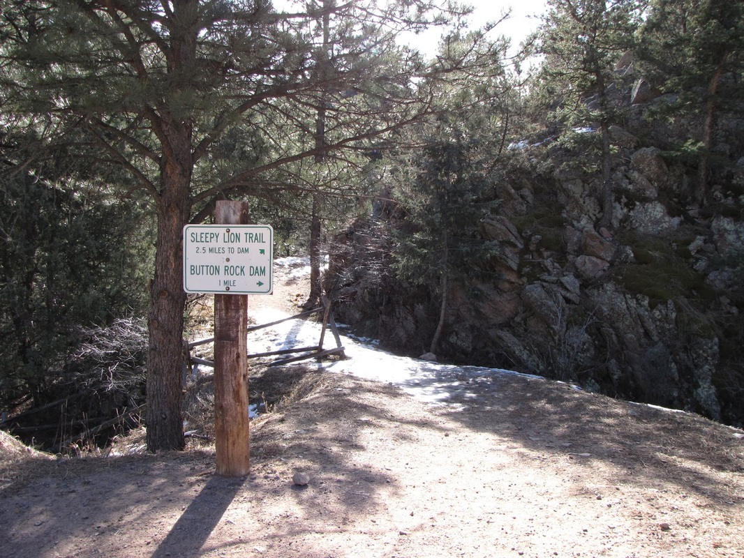
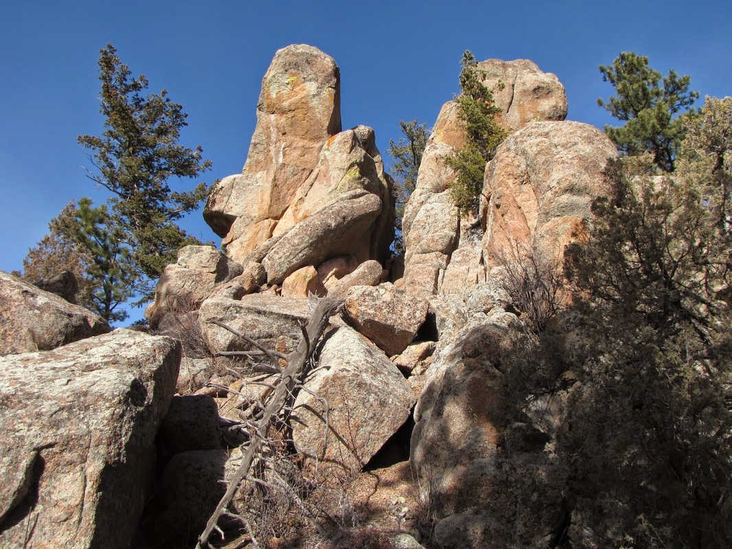
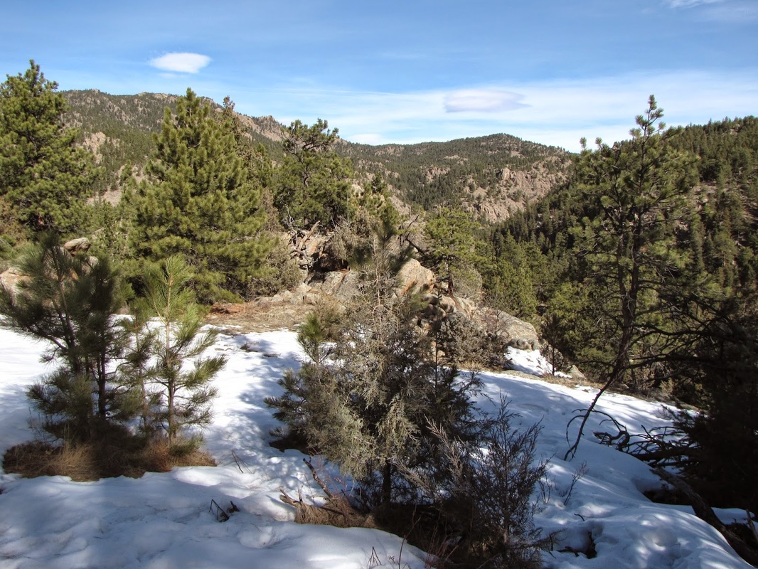
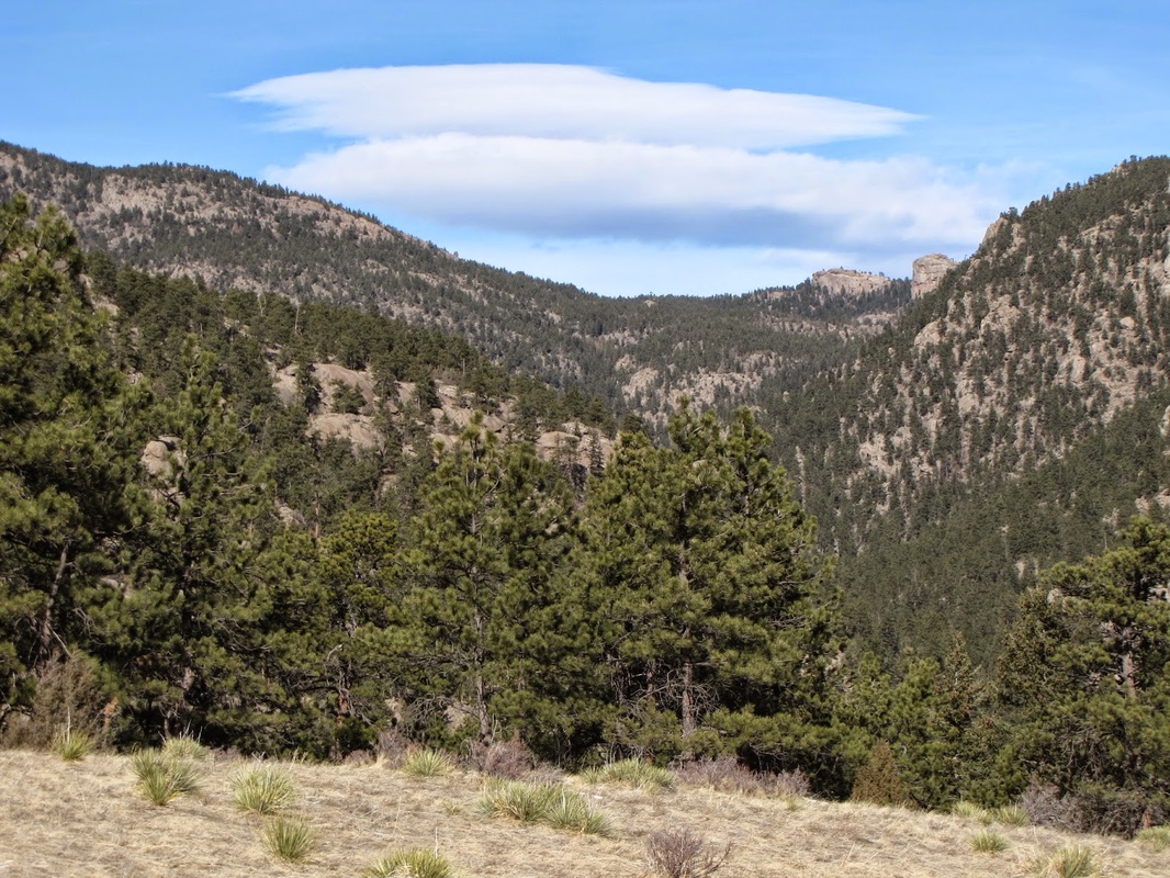
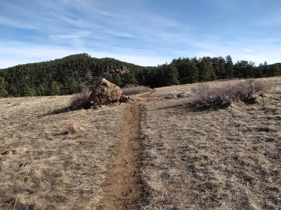
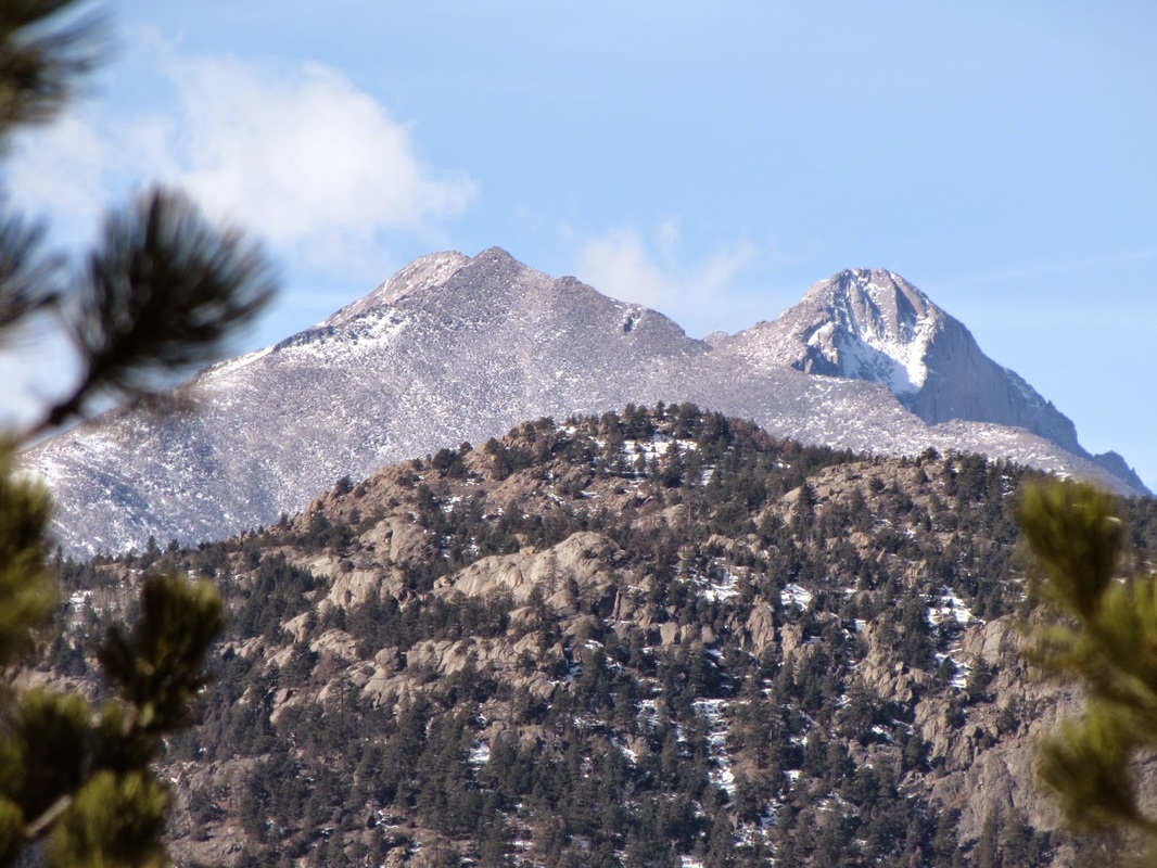
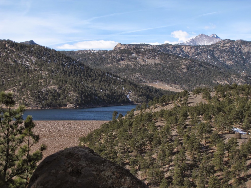
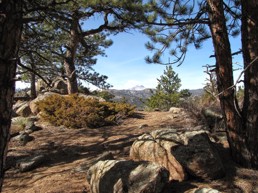
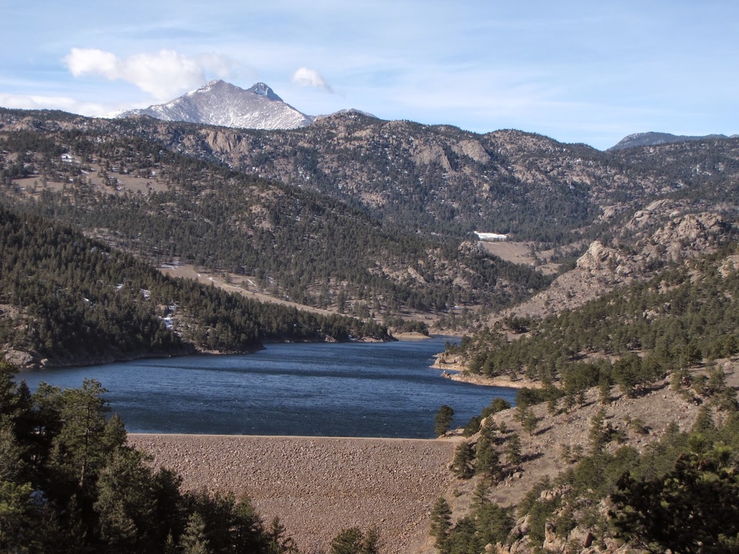
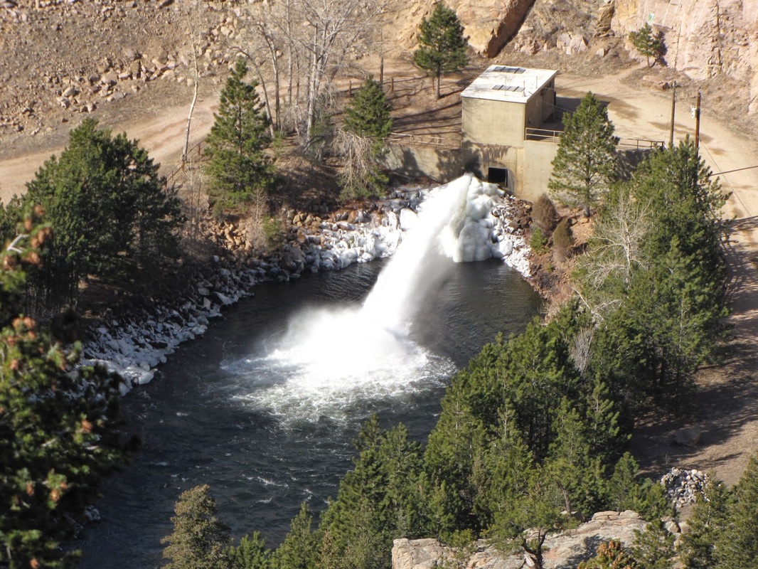
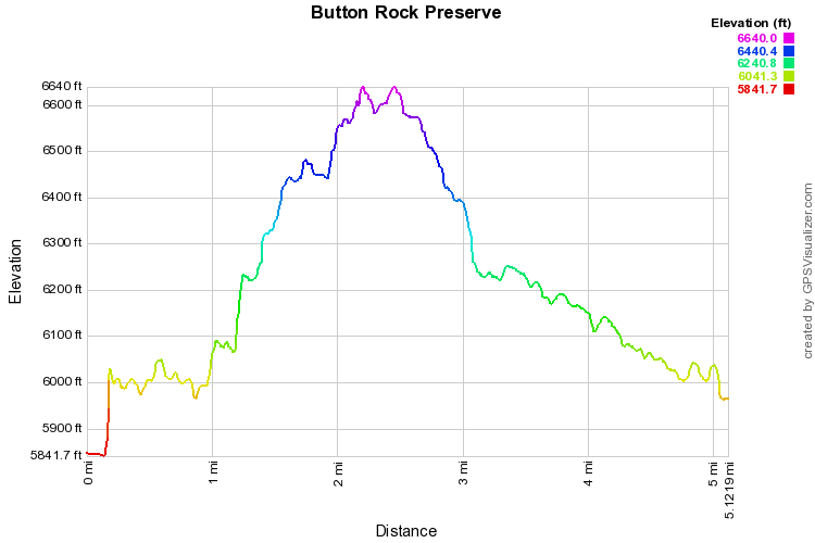
Button Rock Preserve, is a fantastic open space park just west of Lyons.  The Preserve does not see as many visitors as nearby parks such as Heil Valley Ranch or Hall Ranch.  The trail starts at the gate on Longmont Dam road and for the 1st .5 mile you follow the dirt road along the creek and towering cliff walls.  When you get to the trail junction with the Sleepy Lion Trail it is 2.5 miles of ups and downs until you reach Button Rock Reservoir.

The trail weaves through aspen and evergreen forest with the occasional meadow until you reach a high point with a great view of Button Rock Dam and Longs & Meeker Peaks beyond.  From here you head back down and eventually are deposited at the foot of Button Rock Dam. There is a short trail that you can take that leads up to the reservoir.  The way back follows Longmont Dam Road back to the entrance gate. 
Powered by Create your own unique website with customizable templates.