GO HIKE COLORADO
Get in Touch:
  • HOME
  • ABOUT
  • HIKES BY REGION
    • DENVER AREA >
      • Denver Mountain Parks
      • Jefferson County Open Space
      • Lakewood Parks
      • Denver Area Greenways
    • BOULDER AREA
    • DOUGLAS COUNTY
    • FORT COLLINS AREA
    • COLORADO SPRINGS AREA
    • FRONT RANGE
    • TENMILE & MOSQUITO RANGES
    • GORE RANGE
    • SANGRE DE CRISTO MOUNTAINS
    • PARK RANGE
    • SAWATCH RANGE
    • ELK MOUNTAINS
    • SAN JUAN MOUNTAINS
    • THE FLAT TOPS
    • GRAND MESA
    • COLORADO PLATEAU
    • EASTERN PLAINS
  • NATIONAL PARK HIKES
    • BENT'S OLD FORT NATIONAL HISTORIC SITE
    • BLACK CANYON OF THE GUNNISON NATIONAL PARK
    • COLORADO NATIONAL MONUMENT
    • CURECANTI NATIONAL RECREATION AREA
    • DINOSAUR NATIONAL MONUMENT
    • FLORISSANT FOSSIL BEDS NATIONAL MONUMENT
    • MESA VERDE NATIONAL PARK
    • ROCKY MOUNTAIN NATIONAL PARK
    • GREAT SAND DUNES NATIONAL PARK
    • HOVENWEEP NATIONAL MONUMENT
    • SAND CREEK MASSACRE NATIONAL HISTORIC SITE
    • YUCCA HOUSE NATIONAL MONUMENT
  • HIKES BY CATEGORY
    • HIKES TO ALPINE LAKES
    • HIKES TO PEAKS & PASSES
    • HIKES THROUGH CANYONS
    • HIKES WITH FALL COLORS
    • HIKES ALONG THE I-70 CORRIDOR
    • HIKES ON PAVED TRAILS
    • HIKES FOR KIDS
    • HIKES TO WATERFALLS
    • HIKES ALONG RIVERS
    • HIKES WITH ROCK FORMATIONS
    • HIKES WITH WILDFLOWERS
    • WINTER HIKES
  • NEWS
  • WEBCAMS
  • $UPPORT GHC
  • INTERACTIVE MAP

Silver Cascade Falls
N. Cheyenne Canon Park

  • Date Hiked: October 13, 2014

  • Distance: .8 mi (RT)
  • Elevation Gain: 547ft
  • Elevation Min/Max: 7,162 to 7,703ft
  • Managing Agency: City of Colorado Springs Parks, Recreation & Cultural Services
  • Fee: None

N. Cheyenne Canon Park Map
Picture

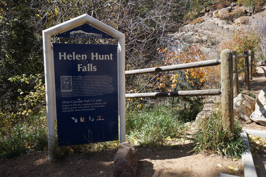
Directions:  From I-25, take Exit 140B and follow the signs to North Cheyenne Canon Park.  make a right onto W. Cheyenne Road and follow the road to a large sign for the park.  Turn right into North Cheyenne Canon and drive up the road until you reach the Helen Hunt Falls Visitor Center.


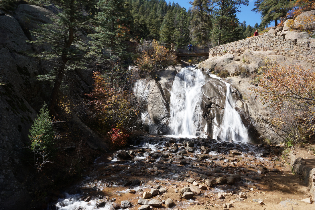
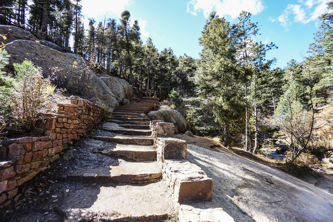
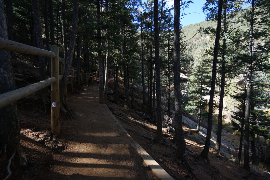
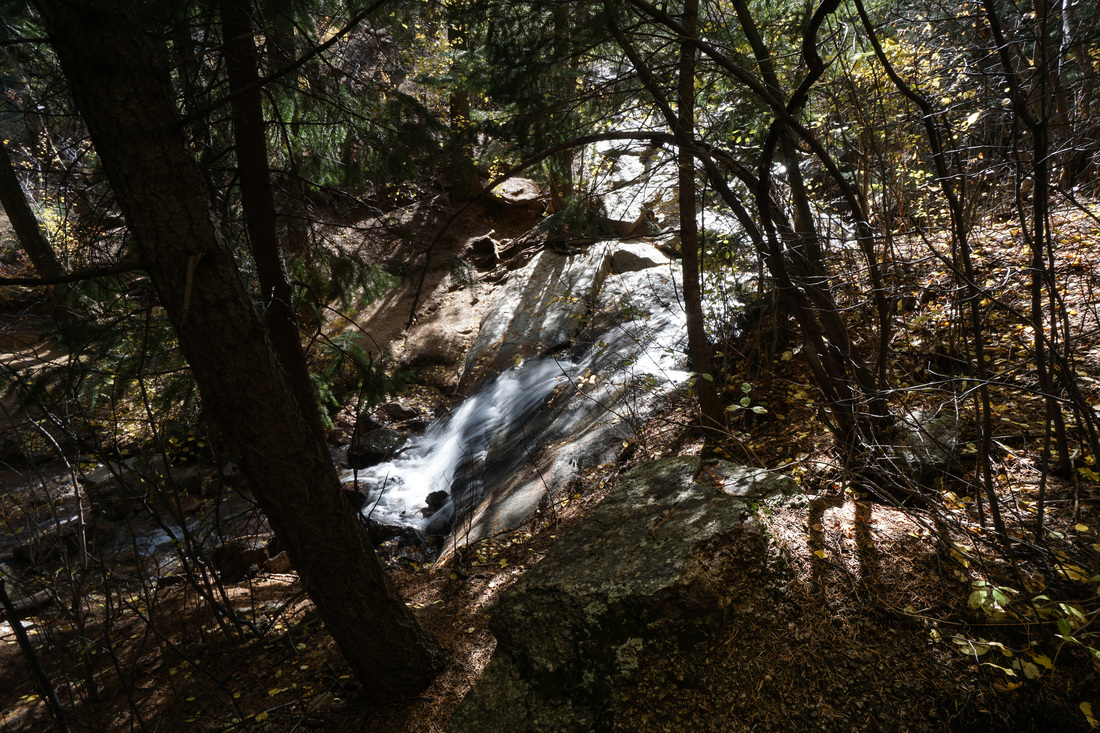
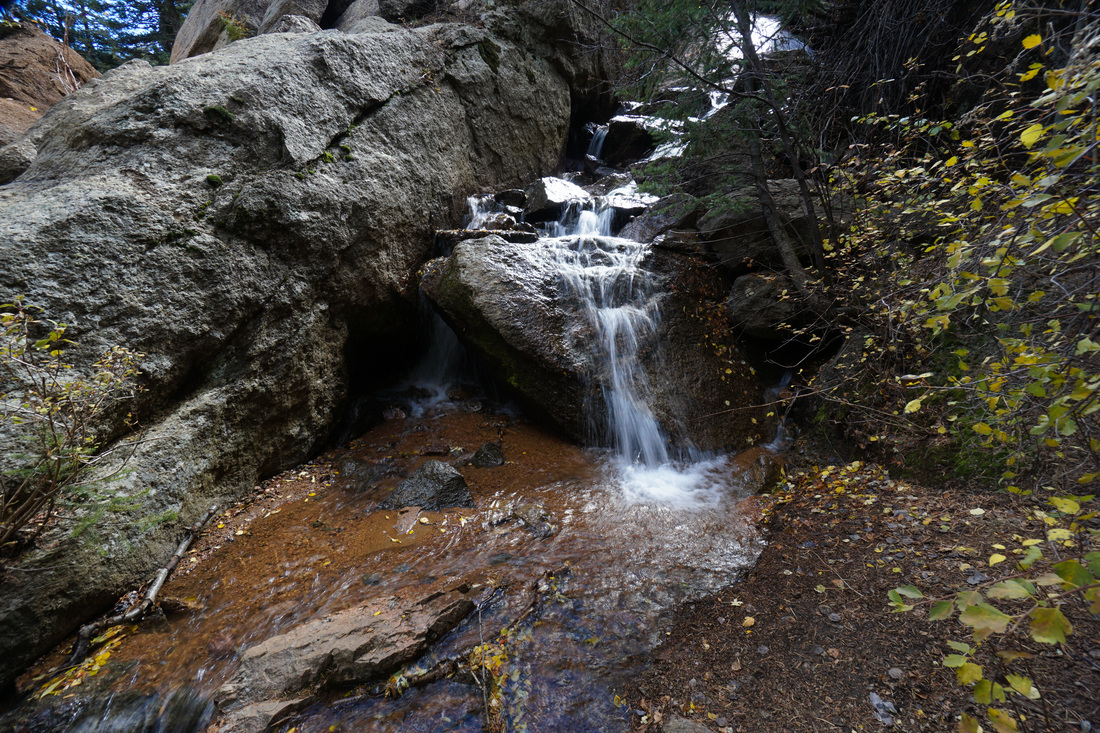
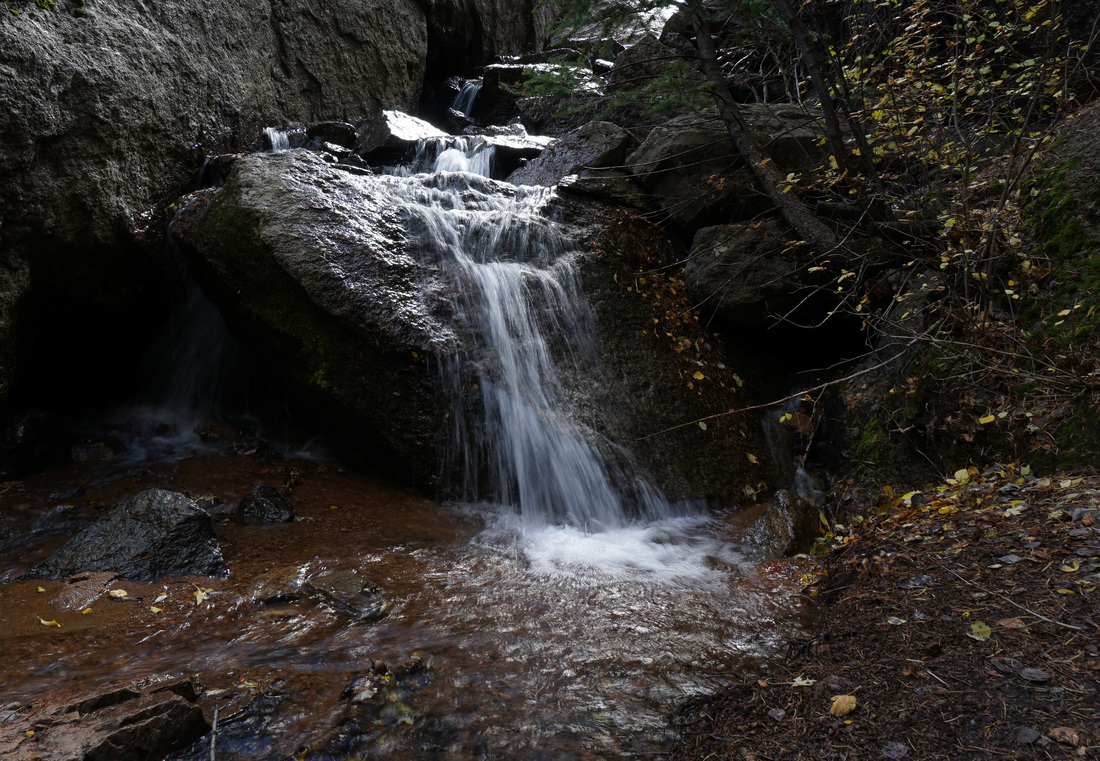
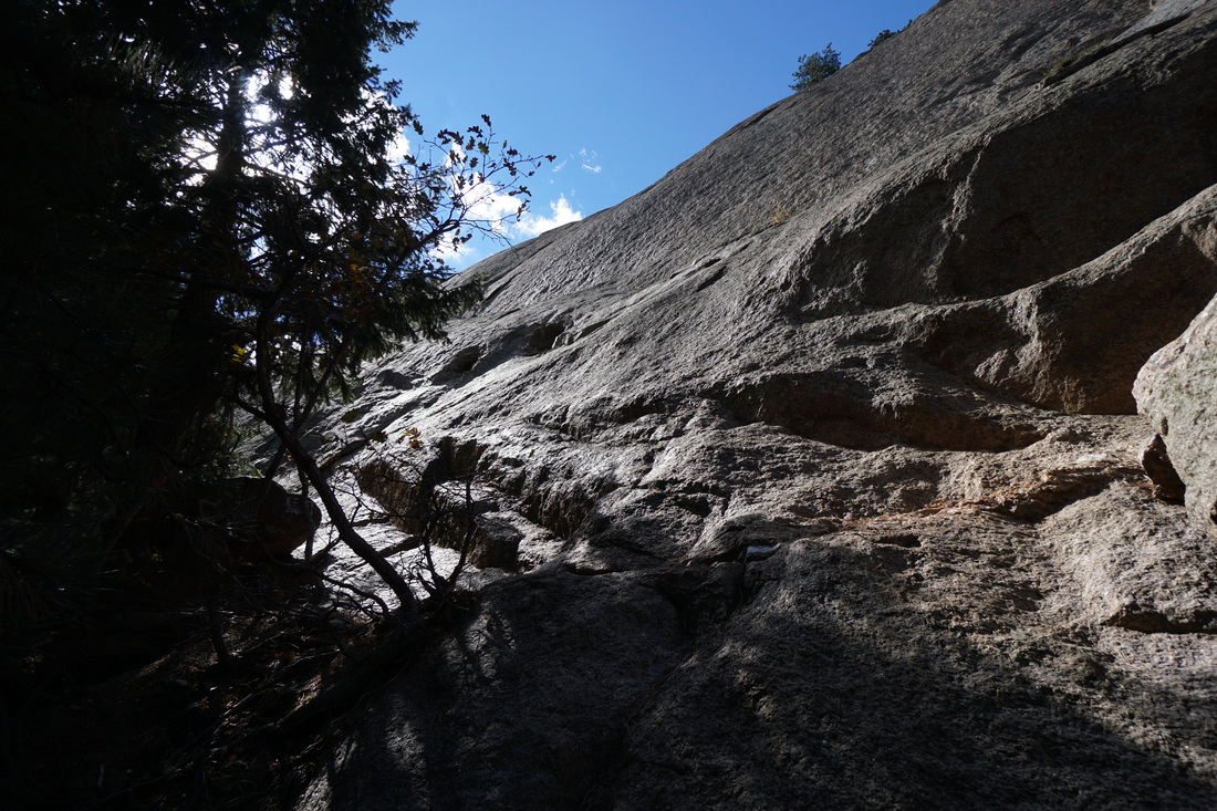
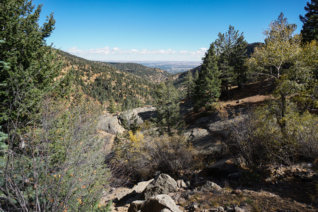
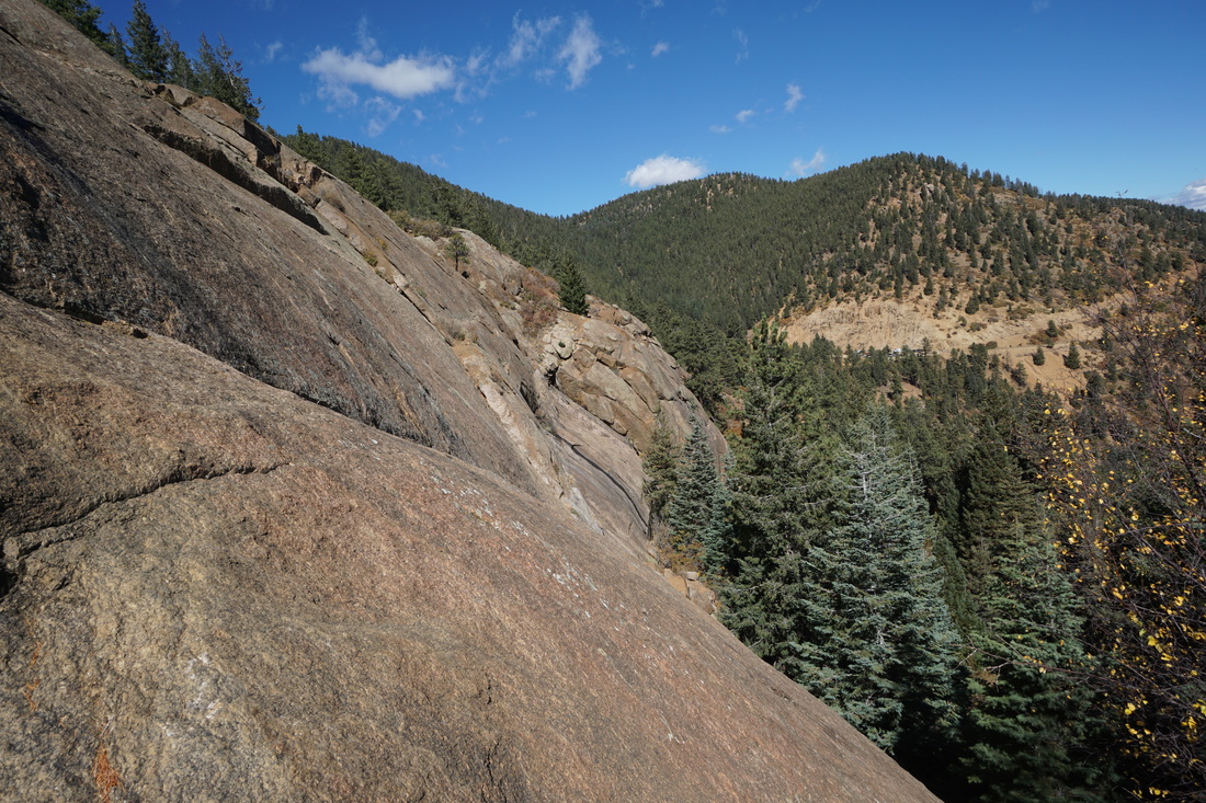
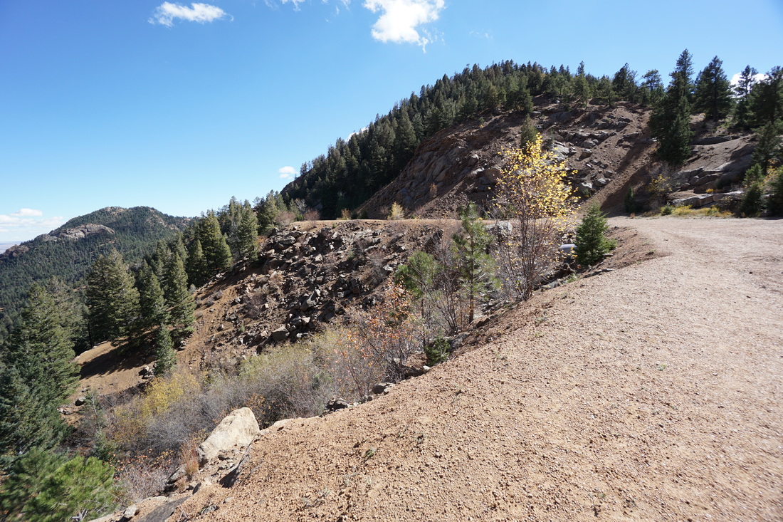
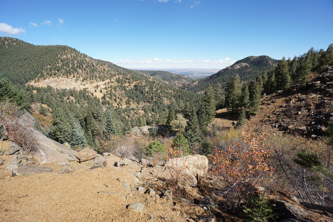
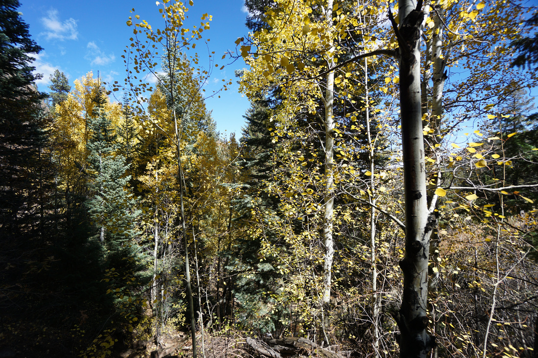
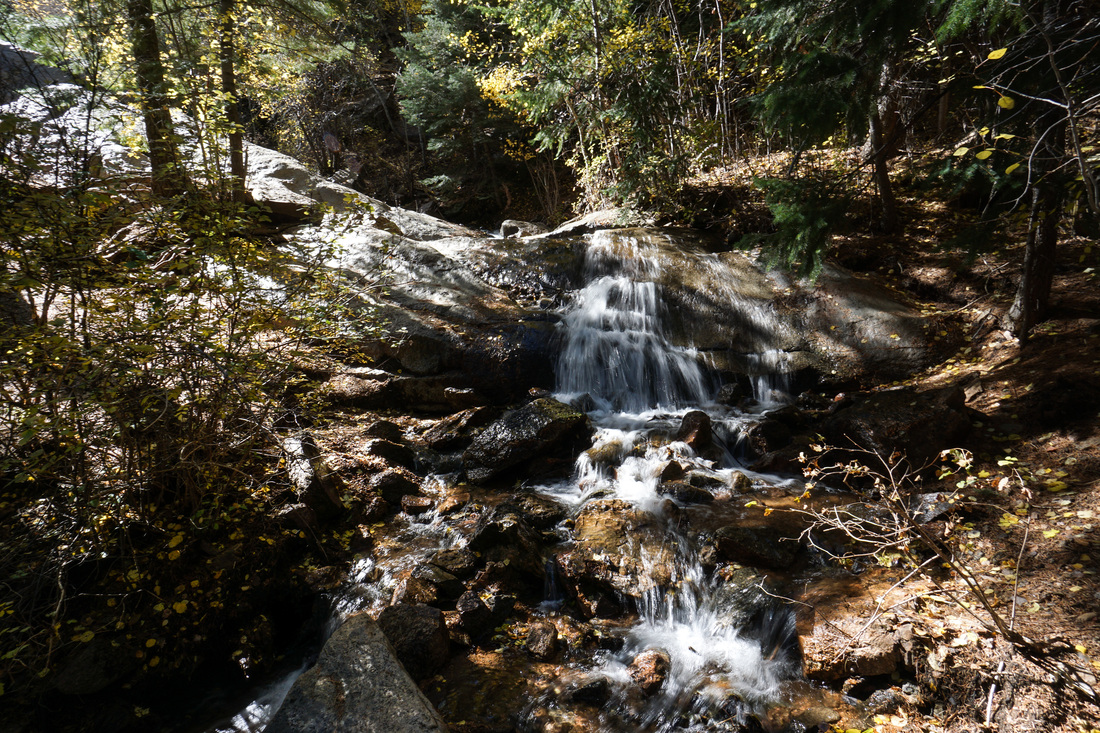
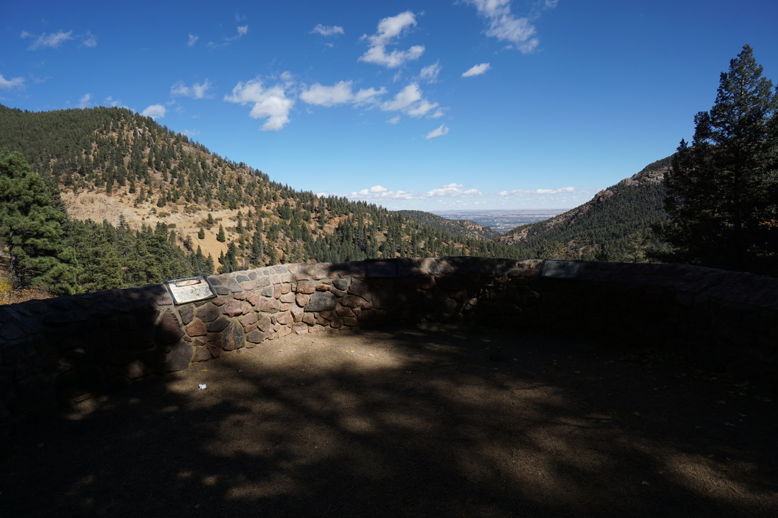
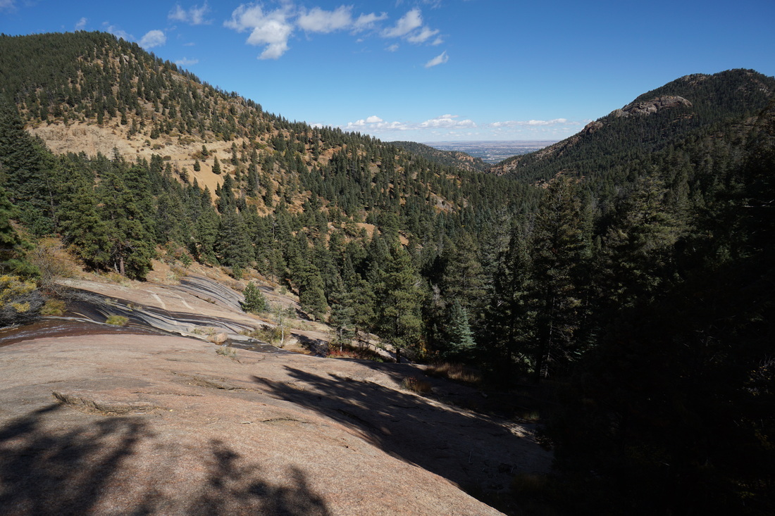
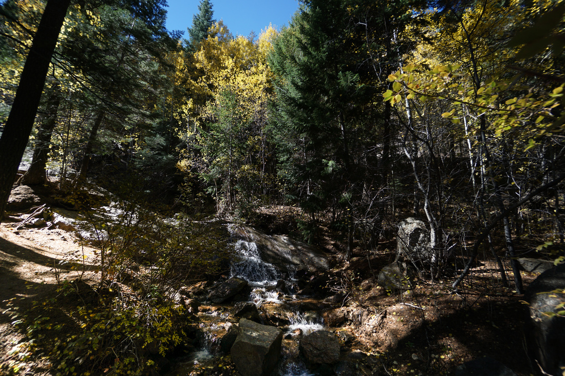
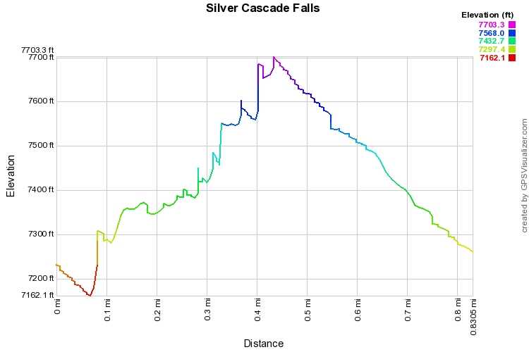
The Silver Cascade Falls Trail is an easy, popular trail that focuses on two beautiful waterfalls.  The trail starts at Helen Hunt Falls (no, it's not named after the actress) and follows a well maintained, but steep and times, trail up the creek that feeds the falls.  As you follow the trail you leave the creek feeding Helen Hunt Falls and start following the steep dome-like slickrock of Silver Cascade Falls.  After a short hike you'll wind up at the top of Silver Creek Falls at a brick overlook with a wonderful view back east over North Cheyenne Canon. 

If you are feeling more adventurous, follow the unofficial trail up from the overlook.  Before you reach the overlook you'll pass over a small wooden foot bridge.  Just before this bridge the trail will head off to the right towards the small waterfall.  To the right of the falls is a rocky, steep trail.  Take this trail up-canyon and you'll trace the creek feeding into Silver Cascade Falls.  You'll reach a large rock dome and eventually Gold Camp Road and the closed tunnel.  Following the trail to the road gets you almost .5 mi but with 500ft of elevation gain.  This spot on Gold Camp Road is also the start of the St. Mary's Falls trail which I am eager to explore in the future.

Powered by Create your own unique website with customizable templates.