GO HIKE COLORADO
Get in Touch:
  • HOME
  • ABOUT
  • HIKES BY REGION
    • DENVER AREA >
      • Denver Mountain Parks
      • Jefferson County Open Space
      • Lakewood Parks
      • Denver Area Greenways
    • BOULDER AREA
    • DOUGLAS COUNTY
    • FORT COLLINS AREA
    • COLORADO SPRINGS AREA
    • FRONT RANGE
    • TENMILE & MOSQUITO RANGES
    • GORE RANGE
    • SANGRE DE CRISTO MOUNTAINS
    • PARK RANGE
    • SAWATCH RANGE
    • ELK MOUNTAINS
    • SAN JUAN MOUNTAINS
    • THE FLAT TOPS
    • GRAND MESA
    • COLORADO PLATEAU
    • EASTERN PLAINS
  • NATIONAL PARK HIKES
    • BENT'S OLD FORT NATIONAL HISTORIC SITE
    • BLACK CANYON OF THE GUNNISON NATIONAL PARK
    • COLORADO NATIONAL MONUMENT
    • CURECANTI NATIONAL RECREATION AREA
    • DINOSAUR NATIONAL MONUMENT
    • FLORISSANT FOSSIL BEDS NATIONAL MONUMENT
    • MESA VERDE NATIONAL PARK
    • ROCKY MOUNTAIN NATIONAL PARK
    • GREAT SAND DUNES NATIONAL PARK
    • HOVENWEEP NATIONAL MONUMENT
    • SAND CREEK MASSACRE NATIONAL HISTORIC SITE
    • YUCCA HOUSE NATIONAL MONUMENT
  • HIKES BY CATEGORY
    • HIKES TO ALPINE LAKES
    • HIKES TO PEAKS & PASSES
    • HIKES THROUGH CANYONS
    • HIKES WITH FALL COLORS
    • HIKES ALONG THE I-70 CORRIDOR
    • HIKES ON PAVED TRAILS
    • HIKES FOR KIDS
    • HIKES TO WATERFALLS
    • HIKES ALONG RIVERS
    • HIKES WITH ROCK FORMATIONS
    • HIKES WITH WILDFLOWERS
    • WINTER HIKES
  • NEWS
  • WEBCAMS
  • $UPPORT GHC
  • INTERACTIVE MAP

Sandstone Ranch
City of Longmont

Date Hiked: October 10, 2016

Distance: 1 mi (RT)
Elevation Gain: 200 ft
Elevation Min/Max:4,838 to 4,973 ft
Trailhead Lat/Long:40º 09' 15" N;105º 02' 14" W 
Managing Agency: City of Longmont
​Fee: None

Sandstone Ranch Website
Picture

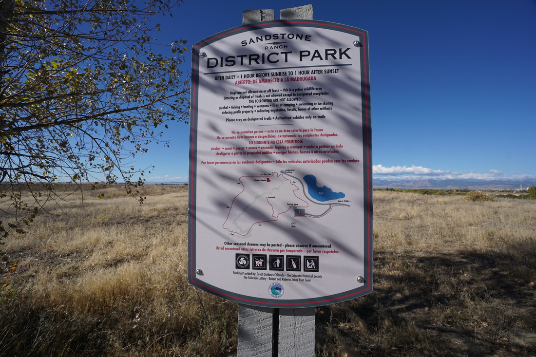
Directions:  From I-25 head west on Hwy 119 and turn left (south) onto Sandstone Drive.  Follow the road past the fields and picnic areas to the end of the road and the trailhead and large parking area.

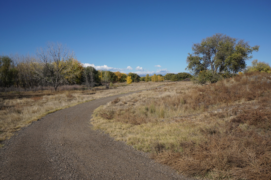
Sandstone Ranch is a popular park with ball fields, multiple playgrounds, a skate park, and on the south end, an easy but pleasant 1 mi trail and historic house turned visitor's center.  The trail connects to the St. Vrain Greenway providing longer hikes as well.

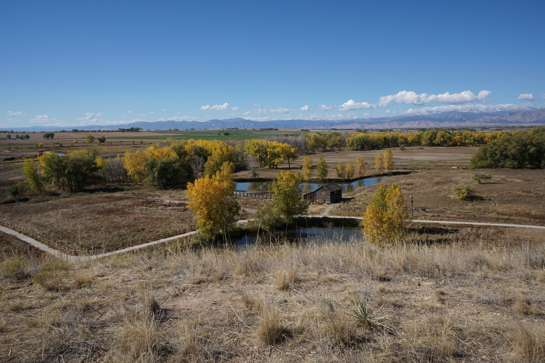
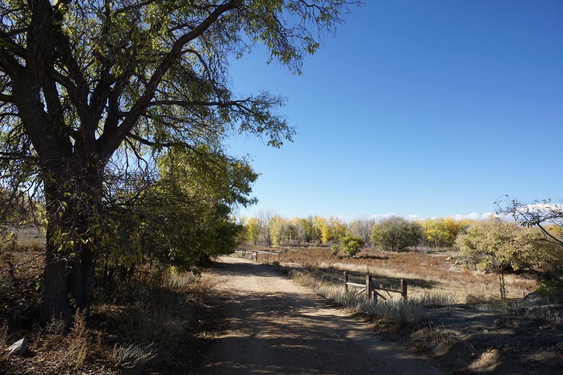
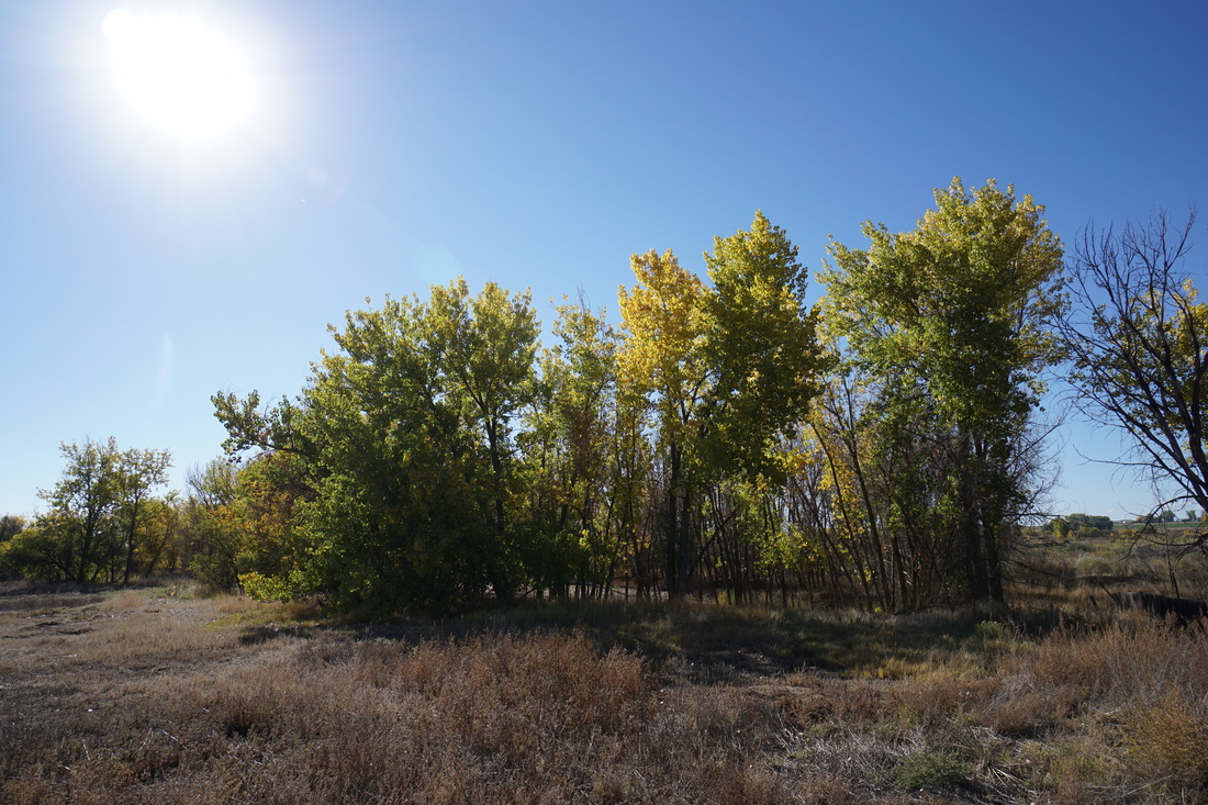
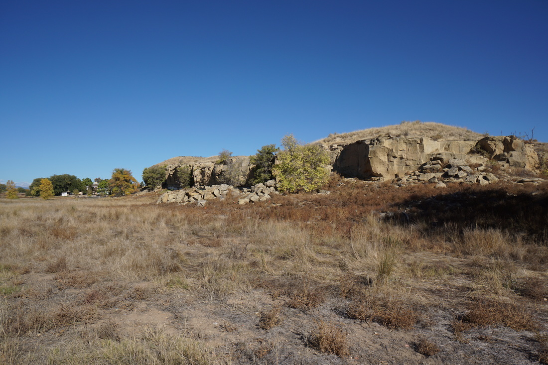
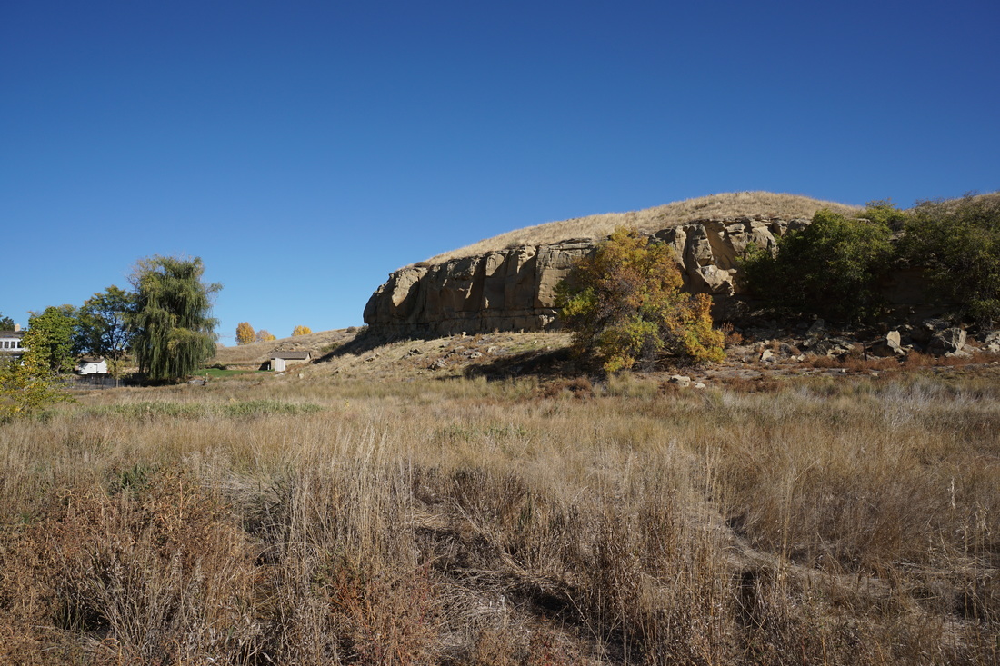
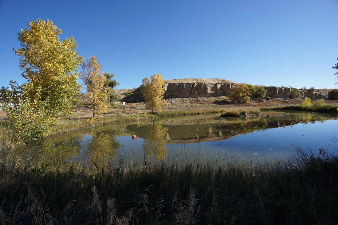
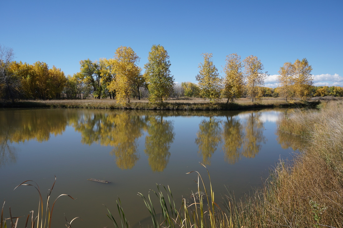
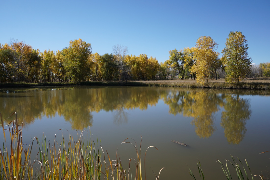
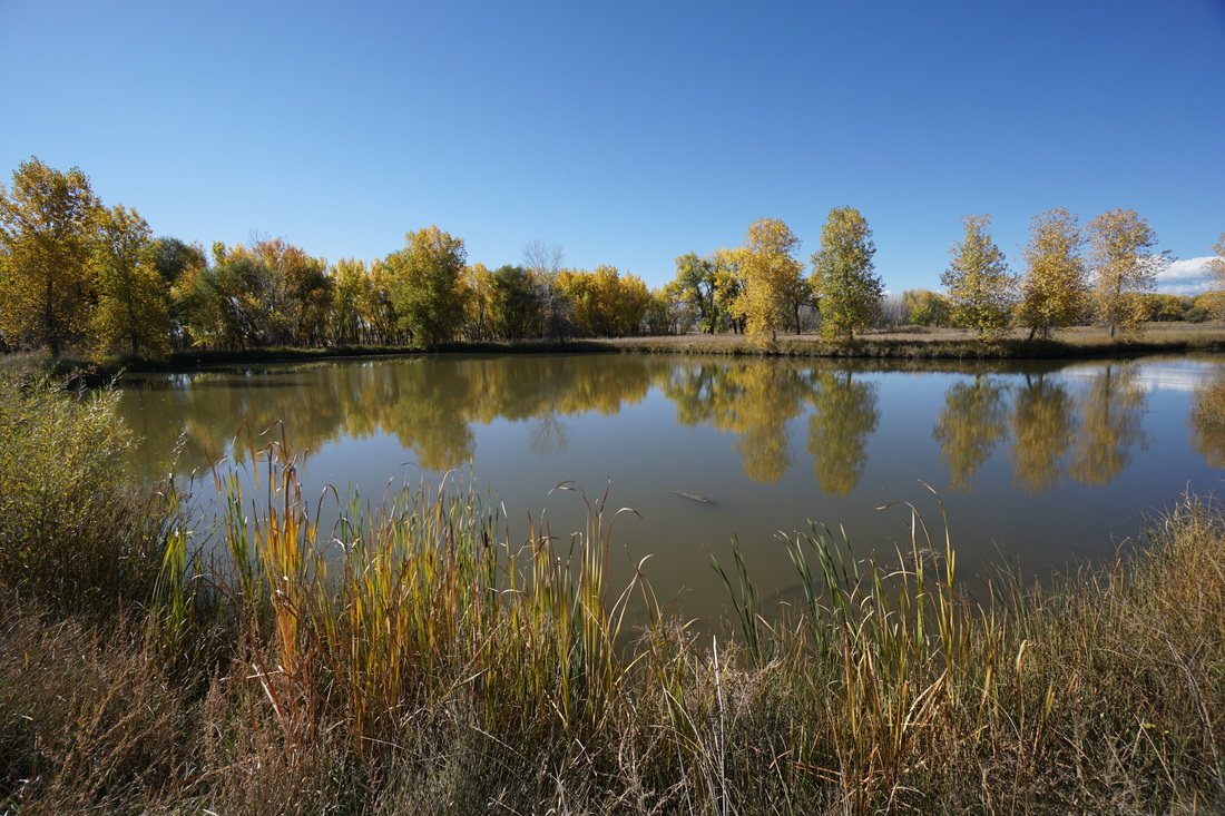
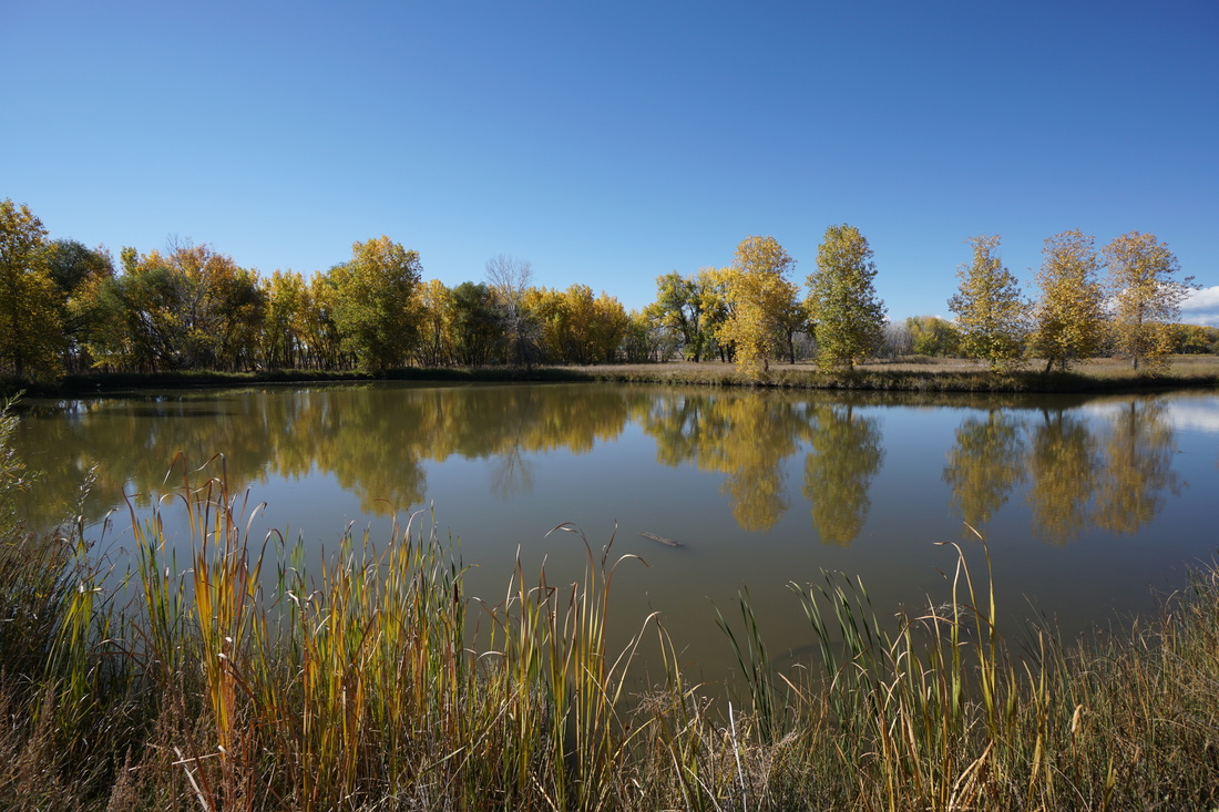
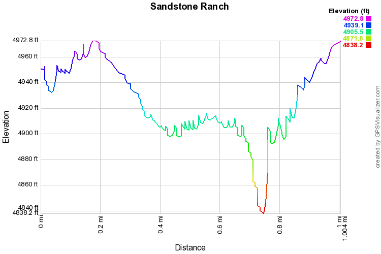
The trail starts on top of the sandstone bluffs that give the park it's name and a short spur trail leads to a magnificent overlook.  From the overlook you are treated to great views of the ponds, the St. Vrain river, and the Front Range Mountains beyond (Longs Peak taking center stage).  The trail then continues down to the river's edge and a nice grove of cottonwood trees, with wonderful fall colors.

The trail then leads to a small pond with a good view of the bluffs and just across the trail, an old historic barn and another, larger, pond.  This pond is one of the nicest parts of the hike and a great place to relax.  Following the loop leads you to the old house, cemetery, gardens, and the visitor's center.  Continue past the visitor center along the road to the trail leading back up to the top of the bluffs and the trailhead.  

Sandstone Ranch is an easy pleasant hike great for kids and great for fall weather.  I highly suggest exploring the St. Vrain Greenway, especially in the fall as the majority of the trail follows the river and colorful cottonwood trees.  However, as of this report, access to the St. Vrain Greenway is closed.  Check with the City of Longmont before heading out to see if it has been re-opened.  

 
© Go Hike Colorado, 2020.  All Rights Reserved. 
Use of photographs without prior authorization is
​strictly prohibited.


Contact us at:
[email protected]
Legal Disclaimer - Information provided on this site is based upon our own observations, always double check information with the appropriate land management agency before heading into the backcountry.  Backcountry travel is inherently dangerous, please take all proper precautions.  Go Hike Colorado is not responsible for injury or incident.