GO HIKE COLORADO
Get in Touch:
  • HOME
  • ABOUT
  • HIKES BY REGION
    • DENVER AREA >
      • Denver Mountain Parks
      • Jefferson County Open Space
      • Lakewood Parks
      • Denver Area Greenways
    • BOULDER AREA
    • DOUGLAS COUNTY
    • FORT COLLINS AREA
    • COLORADO SPRINGS AREA
    • FRONT RANGE
    • TENMILE & MOSQUITO RANGES
    • GORE RANGE
    • SANGRE DE CRISTO MOUNTAINS
    • PARK RANGE
    • SAWATCH RANGE
    • ELK MOUNTAINS
    • SAN JUAN MOUNTAINS
    • THE FLAT TOPS
    • GRAND MESA
    • COLORADO PLATEAU
    • EASTERN PLAINS
  • NATIONAL PARK HIKES
    • BENT'S OLD FORT NATIONAL HISTORIC SITE
    • BLACK CANYON OF THE GUNNISON NATIONAL PARK
    • COLORADO NATIONAL MONUMENT
    • CURECANTI NATIONAL RECREATION AREA
    • DINOSAUR NATIONAL MONUMENT
    • FLORISSANT FOSSIL BEDS NATIONAL MONUMENT
    • MESA VERDE NATIONAL PARK
    • ROCKY MOUNTAIN NATIONAL PARK
    • GREAT SAND DUNES NATIONAL PARK
    • HOVENWEEP NATIONAL MONUMENT
    • SAND CREEK MASSACRE NATIONAL HISTORIC SITE
    • YUCCA HOUSE NATIONAL MONUMENT
  • HIKES BY CATEGORY
    • HIKES TO ALPINE LAKES
    • HIKES TO PEAKS & PASSES
    • HIKES THROUGH CANYONS
    • HIKES WITH FALL COLORS
    • HIKES ALONG THE I-70 CORRIDOR
    • HIKES ON PAVED TRAILS
    • HIKES FOR KIDS
    • HIKES TO WATERFALLS
    • HIKES ALONG RIVERS
    • HIKES WITH ROCK FORMATIONS
    • HIKES WITH WILDFLOWERS
    • WINTER HIKES
  • NEWS
  • WEBCAMS
  • $UPPORT GHC
  • INTERACTIVE MAP

Grazing Elk Loop via Valley View
South Valley Park

Date Hiked: March 7, 2013

Distance: 5.6 mi (RT)

  • Elevation Gain: 300ft
  • Elevation Min/Max: 5,761 to 6,122ft
  • Managing Agency: Jefferson County Open Space
  • Fee: None
  • Note: This trail is subject to seasonal closures so check the park's website before heading out.

South Valley Park Website
Picture

Directions:  From Denver take I-70 to C-470 east.  Exit at Ken Caryl and head west on Ken Caryl Avenue.  Turn Left onto S. Valley Road and take this to the main parking area.  The Valley View Trail starts across the street from the main parking lot.  Alternatively, Take C470 to Deer Creek Canyon Road west to the Southern Trailhead. 

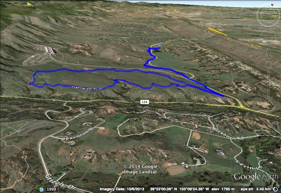
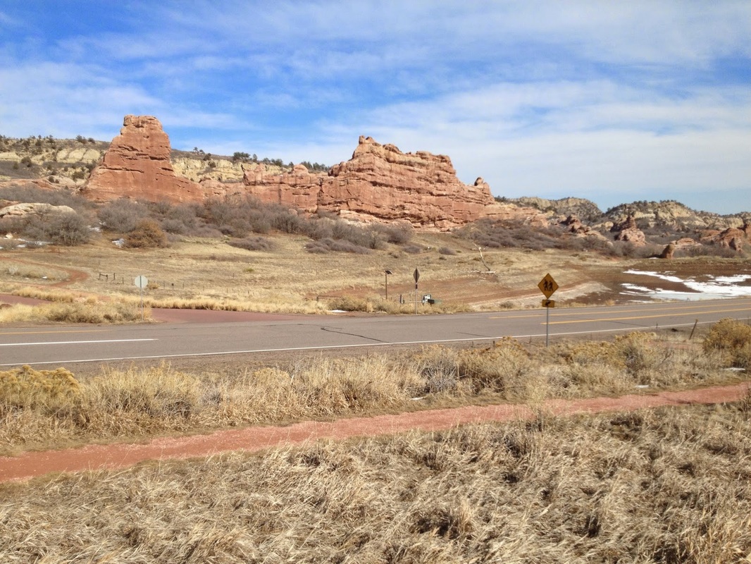
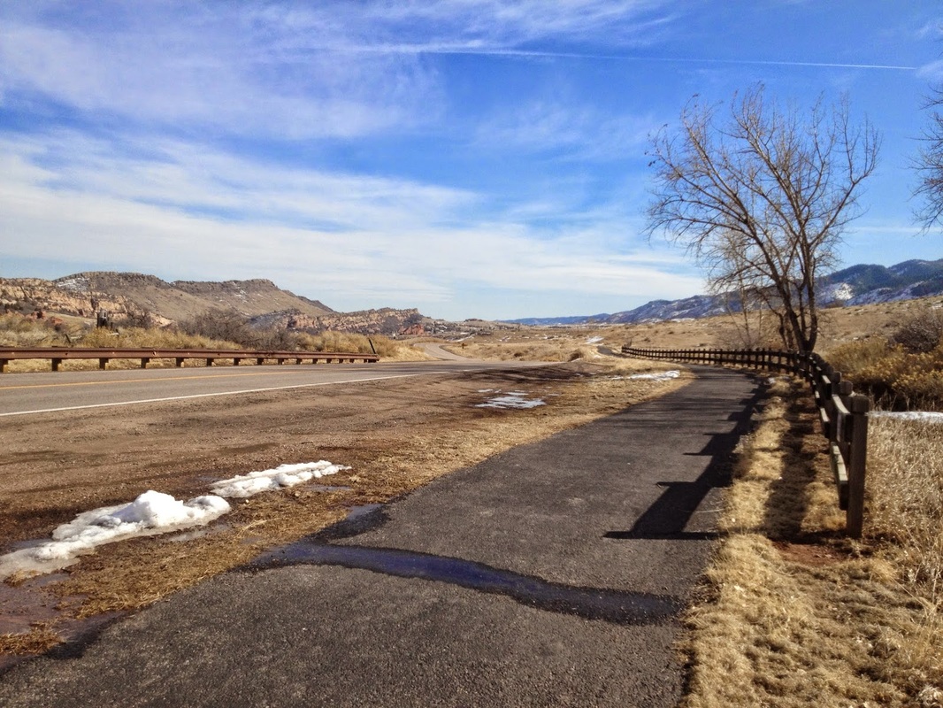
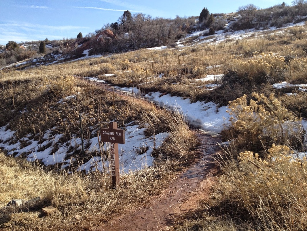
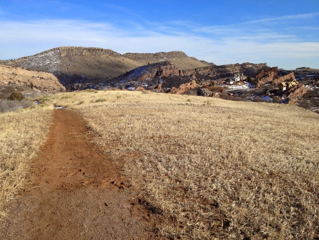
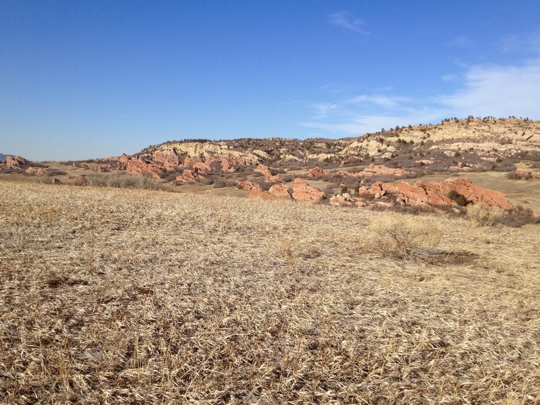
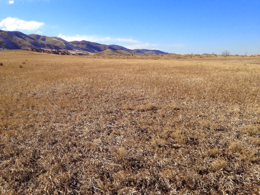
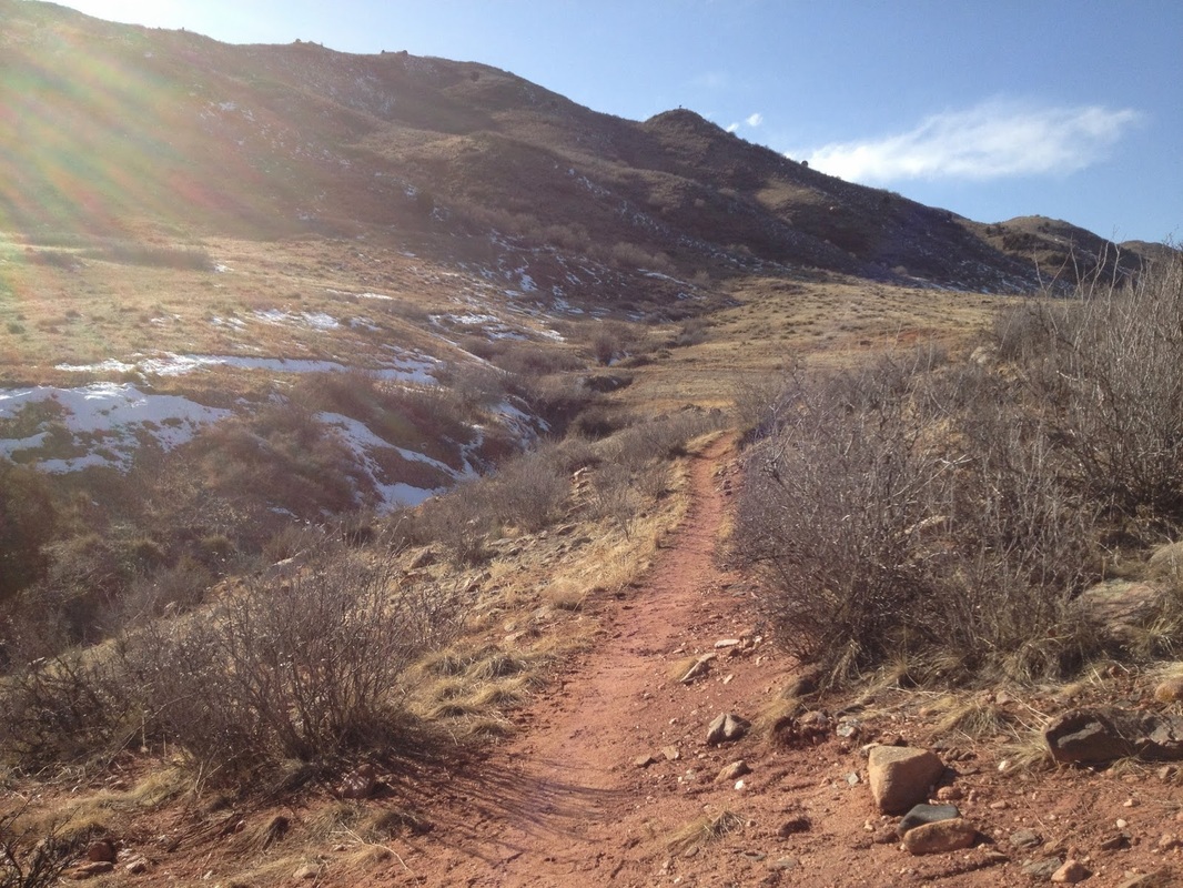
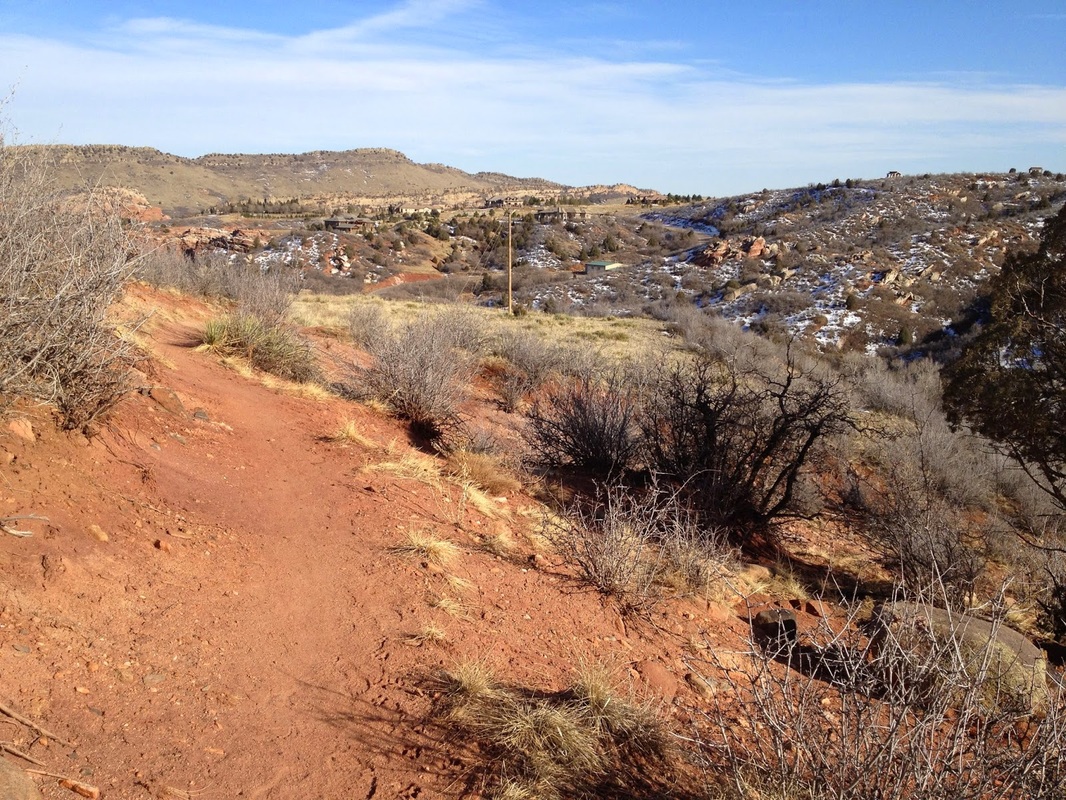
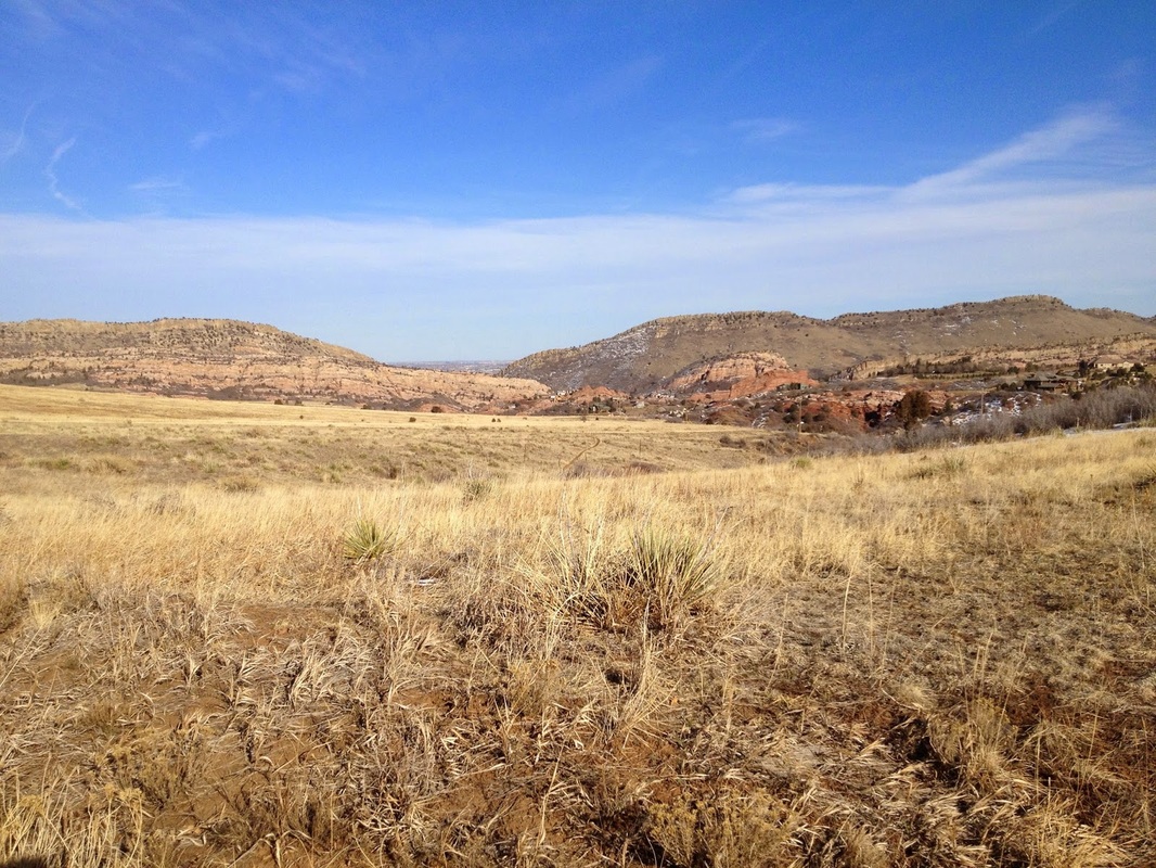
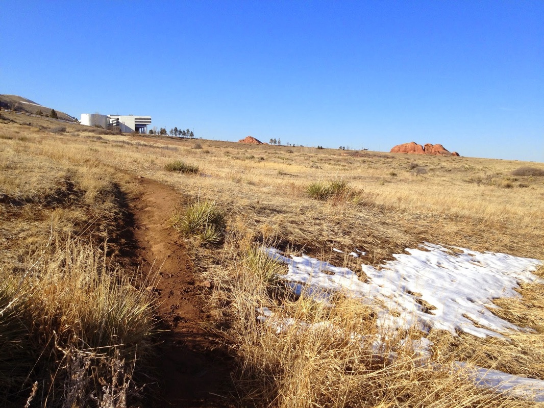
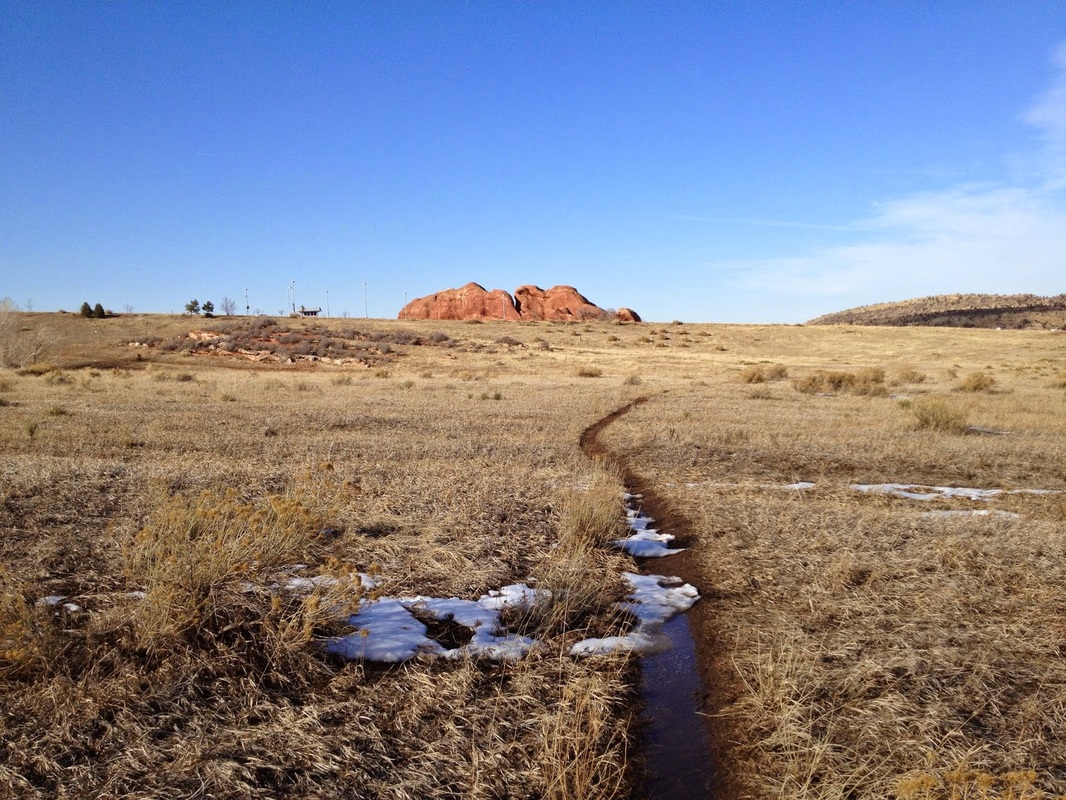
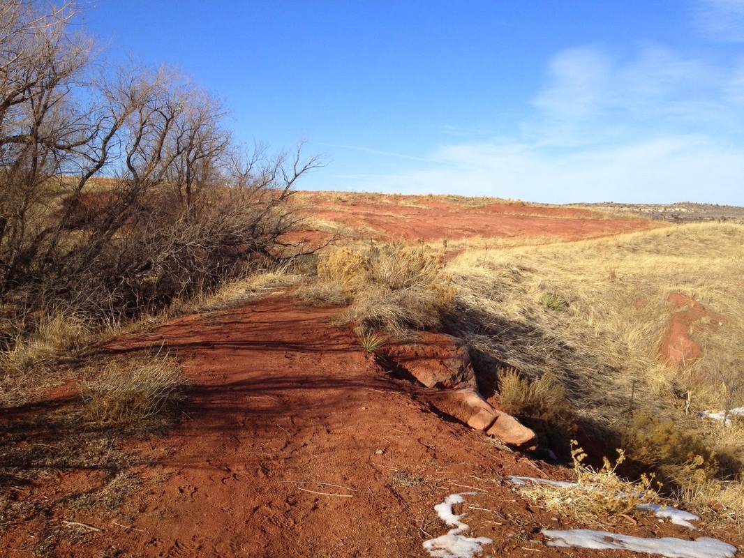
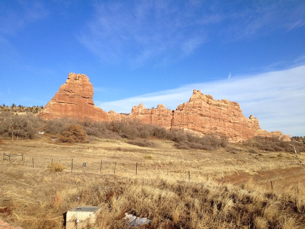
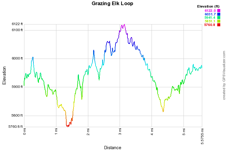
There is little to no parking at the start of the Grazing Elk trail so you really have two options.  The quickest access is to park at the Southern Trailhead along Dear Creek Canyon Road.  However, I like to start at the main parking lot on S. Valley Road and hike the 1.2 mile Valley View trail.  This trail is paved, but it gives you a nice overview of the Red Rock formations and adds 2.4 miles to the hike, making an otherwise quick 2.8 mile hike into an easy 5 1/2 mile hike.  Once the paved trail ends at the road, cross over to the other side of Deer Creek Canyon Road and look for the trail sign.

If you start from the Southern Trailhead, follow the trail towards the Swallow Trail, at the junction with the Coyote Song Trail head left on the Swallow Trail for .2 miles and turn left on the trail that leads back to Deer Creek Canyon Road.  The Grazing Elk trail starts just across the Road.

From Deer Creek Canyon Road the trail switchbacks up a short ridge and levels out into open meadow.  Take the loop whichever direction you want, the trail is level the entire way.  From the meadow you get nice views down the valley with the hogbacks and red rock spires adding an interesting landscape to your walk.

The Grazing Elk Loop lacks the red rock formation that the park is famous for, but it does offer a quiet, peaceful stroll through a stunning meadow nestled up agains the foothills.  Hike this trail in the evening and the grasses will glow. 
Powered by Create your own unique website with customizable templates.