GO HIKE COLORADO
Get in Touch:
  • HOME
  • ABOUT
  • HIKES BY REGION
    • DENVER AREA >
      • Denver Mountain Parks
      • Jefferson County Open Space
      • Lakewood Parks
      • Denver Area Greenways
    • BOULDER AREA
    • DOUGLAS COUNTY
    • FORT COLLINS AREA
    • COLORADO SPRINGS AREA
    • FRONT RANGE
    • TENMILE & MOSQUITO RANGES
    • GORE RANGE
    • SANGRE DE CRISTO MOUNTAINS
    • PARK RANGE
    • SAWATCH RANGE
    • ELK MOUNTAINS
    • SAN JUAN MOUNTAINS
    • THE FLAT TOPS
    • GRAND MESA
    • COLORADO PLATEAU
    • EASTERN PLAINS
  • NATIONAL PARK HIKES
    • BENT'S OLD FORT NATIONAL HISTORIC SITE
    • BLACK CANYON OF THE GUNNISON NATIONAL PARK
    • COLORADO NATIONAL MONUMENT
    • CURECANTI NATIONAL RECREATION AREA
    • DINOSAUR NATIONAL MONUMENT
    • FLORISSANT FOSSIL BEDS NATIONAL MONUMENT
    • MESA VERDE NATIONAL PARK
    • ROCKY MOUNTAIN NATIONAL PARK
    • GREAT SAND DUNES NATIONAL PARK
    • HOVENWEEP NATIONAL MONUMENT
    • SAND CREEK MASSACRE NATIONAL HISTORIC SITE
    • YUCCA HOUSE NATIONAL MONUMENT
  • HIKES BY CATEGORY
    • HIKES TO ALPINE LAKES
    • HIKES TO PEAKS & PASSES
    • HIKES THROUGH CANYONS
    • HIKES WITH FALL COLORS
    • HIKES ALONG THE I-70 CORRIDOR
    • HIKES ON PAVED TRAILS
    • HIKES FOR KIDS
    • HIKES TO WATERFALLS
    • HIKES ALONG RIVERS
    • HIKES WITH ROCK FORMATIONS
    • HIKES WITH WILDFLOWERS
    • WINTER HIKES
  • NEWS
  • WEBCAMS
  • $UPPORT GHC
  • INTERACTIVE MAP

Lubahn Trail
South Table Mountain Park

Date Hiked: November 3, 2012

Distance: 1.8 mi (RT)

  • Elevation Gain: 500ft
  • Elevation Max: 6,329ft
  • Managing Agency: Jefferson County Open Space/City of Golden
  • Fee: None
  • NOTE: THIS TRAIL MAY HAVE BEEN CLOSED BY JEFFERSON COUNTY OPEN SPACE, CHECK SIGNS AT THE TRAILHEAD OR THE WEBSITE

South Table Mountain Website
Picture

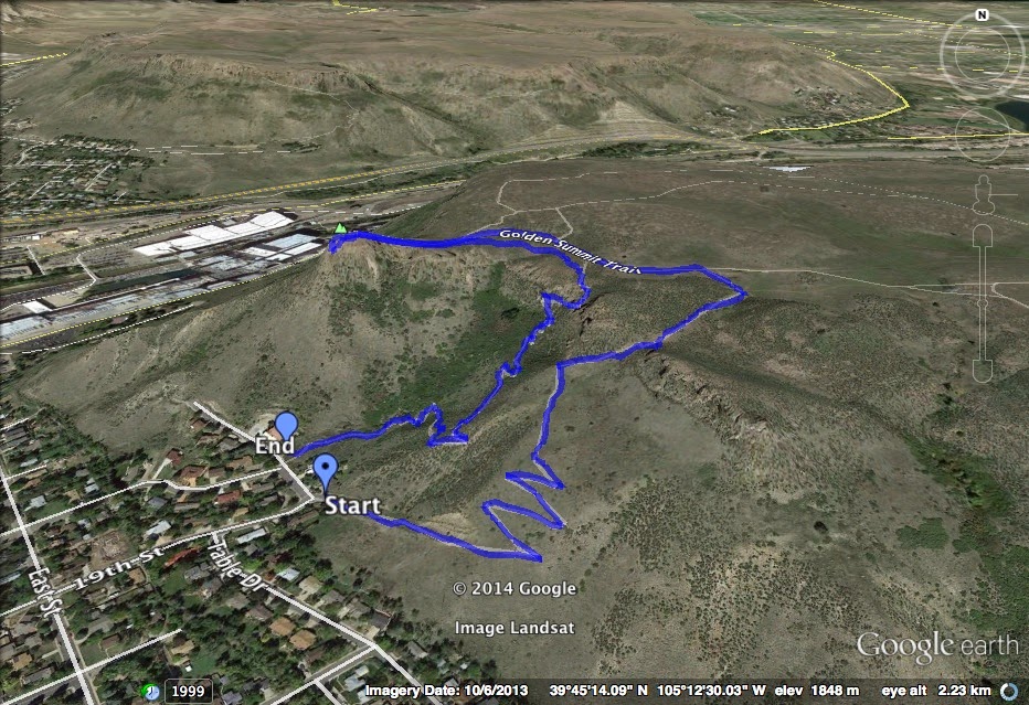
Directions: The trailhead is located in downtown Golden, on Table Drive between 18th and 19th Streets.  Be sure to pay attention to the parking signs at both the Trailhead and on the street.  There is limited parking.

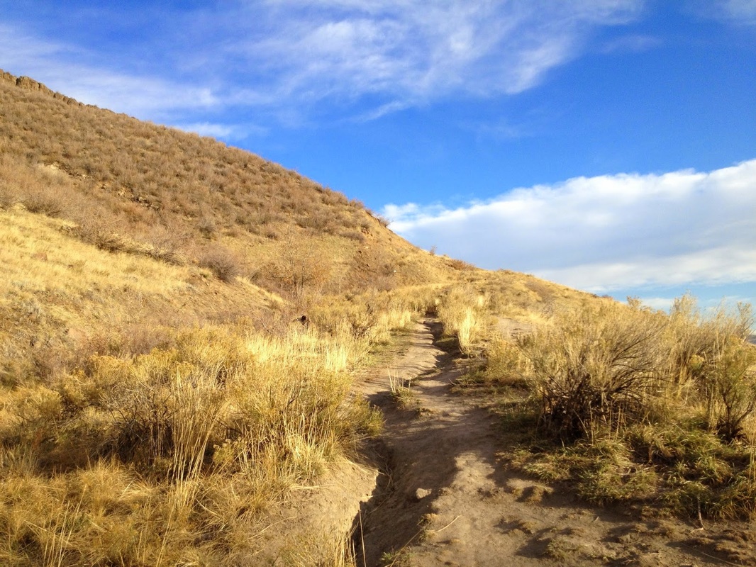
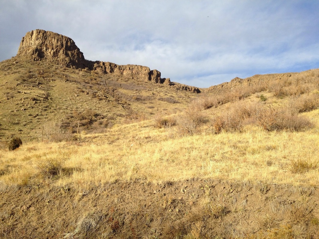
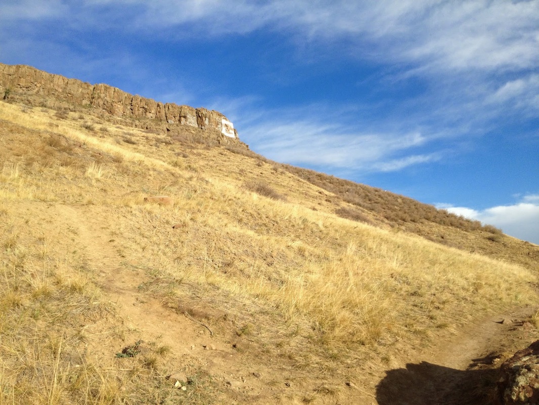
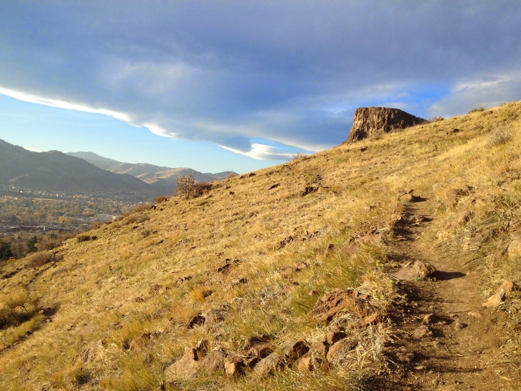
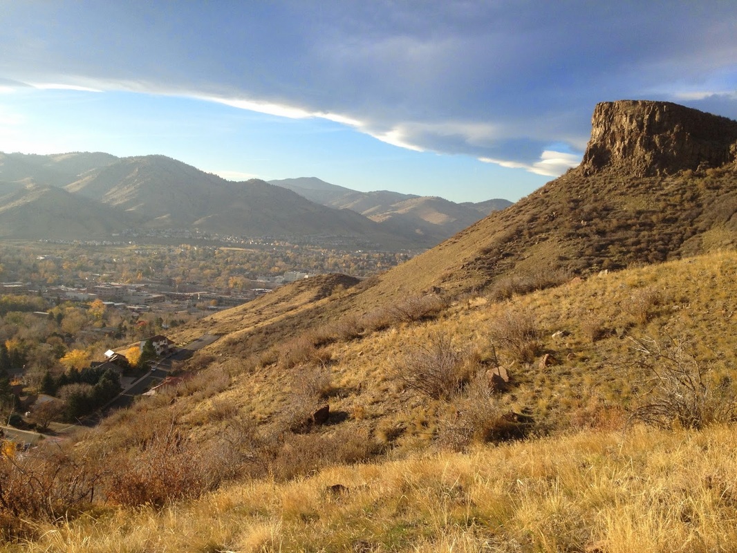
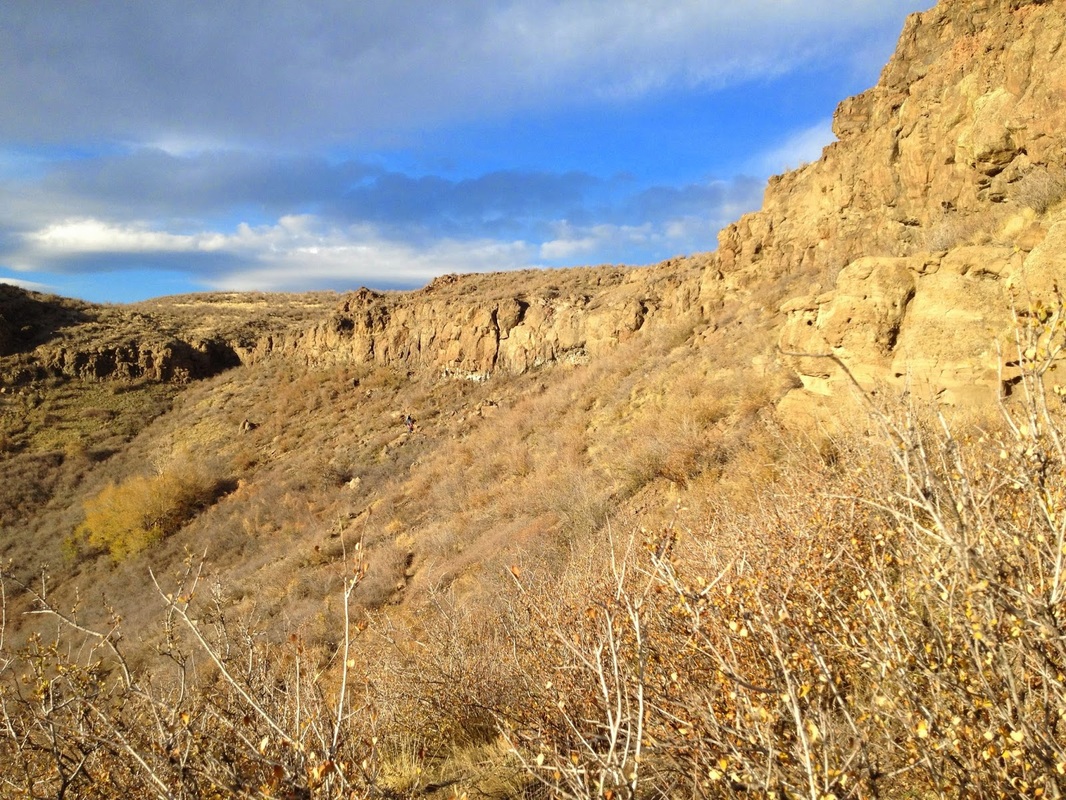
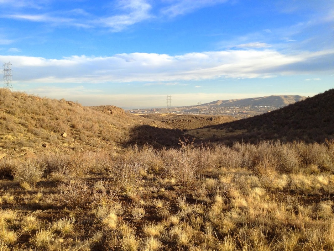
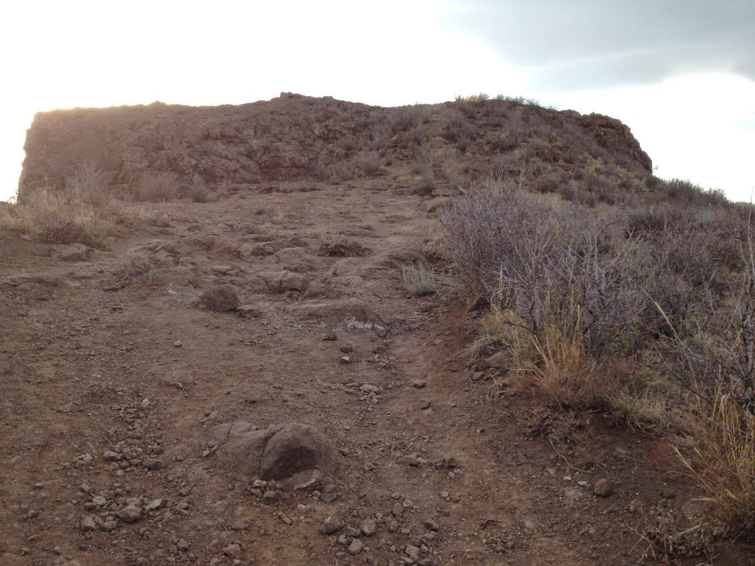
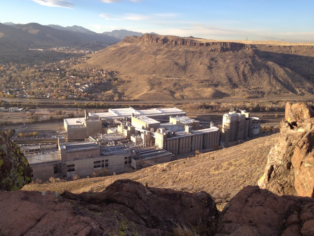
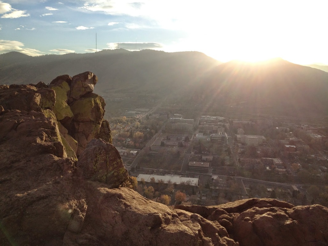
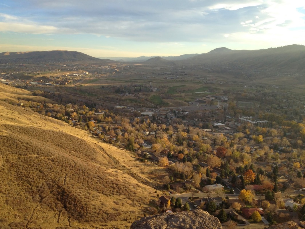
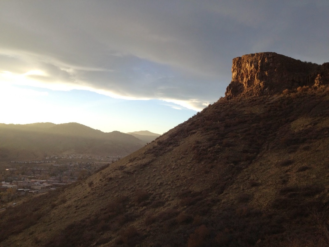
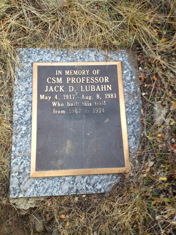
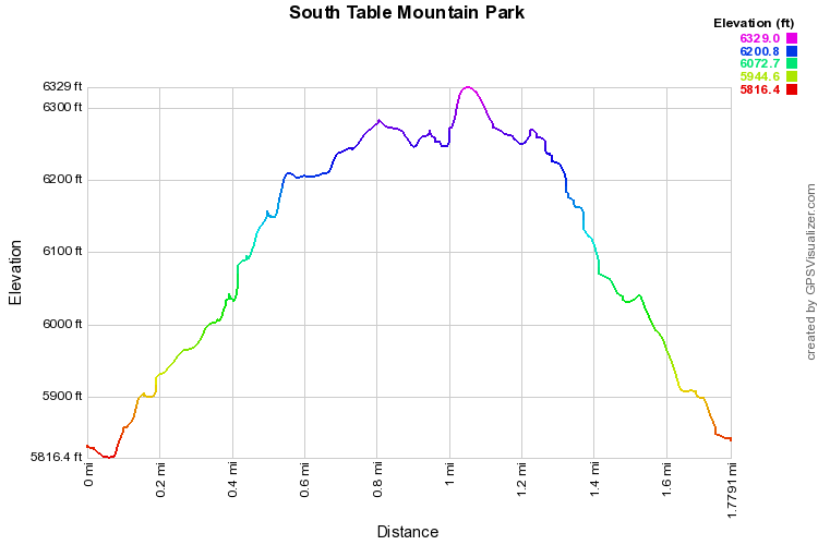
The Lubahn Trail is a wonderful short but steep loop that take you up the western slopes of S. Table Mountain and up to Castle Rock, the prominent land feature towering over Golden and the Coors Brewery.

From the small parking area, take the trail that leads south switchbacking up S. Table Mountain.  There are some social trails leading down into the neighborhoods below, but keep heading uphill and you should find your way.  As you near the cliffs, the trail will find a weak point and deposit you on top of the mesa.  From here the trail leads back north towards the impressive Castle Rock.  There are many more trails up here in the mesa top so explore as you wish.  Keep heading north and the trail will lead to cement steps climbing up to the top of Castle Rock.  The views from the top are outstanding.  You can look down on Golden and the Brewery and north to N. Table Mountain and the foothills or south along the foothills leading down to Douglas County.  Be careful on the rocky cliffs but enjoy your time up here.  There used to be a tram leading to a lodge at the top but it's long been dismantled, you can still find some ruins as a reminder of Colorado History.

When you are satisfied with the view head down but instead of going the way you came, look for a closer trail leading down the gully.  This is the Lubahn Trail and it will switchback down the gully straight to your car. 
© Go Hike Colorado, 2020.  All Rights Reserved. 
Use of photographs without prior authorization is
​strictly prohibited.


Contact us at:
[email protected]
Legal Disclaimer - Information provided on this site is based upon our own observations, always double check information with the appropriate land management agency before heading into the backcountry.  Backcountry travel is inherently dangerous, please take all proper precautions.  Go Hike Colorado is not responsible for injury or incident.