GO HIKE COLORADO
Get in Touch:
  • HOME
  • ABOUT
  • HIKES BY REGION
    • DENVER AREA >
      • Denver Mountain Parks
      • Jefferson County Open Space
      • Lakewood Parks
      • Denver Area Greenways
    • BOULDER AREA
    • DOUGLAS COUNTY
    • FORT COLLINS AREA
    • COLORADO SPRINGS AREA
    • FRONT RANGE
    • TENMILE & MOSQUITO RANGES
    • GORE RANGE
    • SANGRE DE CRISTO MOUNTAINS
    • PARK RANGE
    • SAWATCH RANGE
    • ELK MOUNTAINS
    • SAN JUAN MOUNTAINS
    • THE FLAT TOPS
    • GRAND MESA
    • COLORADO PLATEAU
    • EASTERN PLAINS
  • NATIONAL PARK HIKES
    • BENT'S OLD FORT NATIONAL HISTORIC SITE
    • BLACK CANYON OF THE GUNNISON NATIONAL PARK
    • COLORADO NATIONAL MONUMENT
    • CURECANTI NATIONAL RECREATION AREA
    • DINOSAUR NATIONAL MONUMENT
    • FLORISSANT FOSSIL BEDS NATIONAL MONUMENT
    • MESA VERDE NATIONAL PARK
    • ROCKY MOUNTAIN NATIONAL PARK
    • GREAT SAND DUNES NATIONAL PARK
    • HOVENWEEP NATIONAL MONUMENT
    • SAND CREEK MASSACRE NATIONAL HISTORIC SITE
    • YUCCA HOUSE NATIONAL MONUMENT
  • HIKES BY CATEGORY
    • HIKES TO ALPINE LAKES
    • HIKES TO PEAKS & PASSES
    • HIKES THROUGH CANYONS
    • HIKES WITH FALL COLORS
    • HIKES ALONG THE I-70 CORRIDOR
    • HIKES ON PAVED TRAILS
    • HIKES FOR KIDS
    • HIKES TO WATERFALLS
    • HIKES ALONG RIVERS
    • HIKES WITH ROCK FORMATIONS
    • HIKES WITH WILDFLOWERS
    • WINTER HIKES
  • NEWS
  • WEBCAMS
  • $UPPORT GHC
  • INTERACTIVE MAP

Carpenter Peak
Roxborough State Park

Date Hiked: August 24, 2012

​Distance: 6.5 mi (RT)

Elevation Gain: 1,000ft
Elevation Min/Max: 6,186 to 7,149ft
Managing Agency: Colorado Parks & Wildlife
Fee: Yes

Roxborough State Park Trail Map
Picture

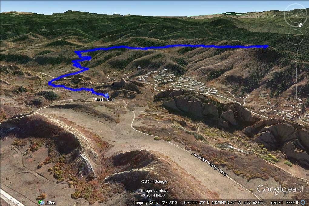
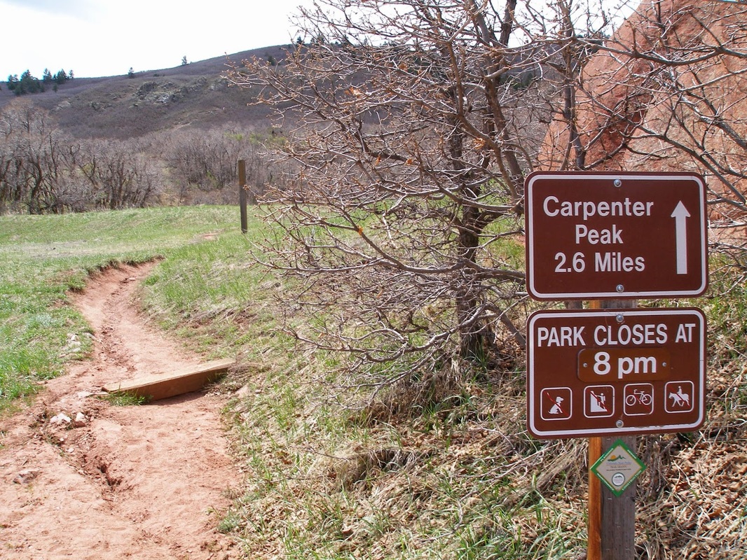
Directions:  This hike starts at the main parking area for Roxborough State Park (Park Fees are required).  From Denver take C470 and exit at S. Wadsworth Blvd.  Follow S. Wadsworth south until you pass by the Waterton Canyon Parking Area.  The road then becomes Waterton Road as you bear left.  Make a right on N. Rampart Range Rd.  Take this road until it ends and you see the signs for Roxborough SP.  When you enter the park you follow the good dirt road to the parking area and visitor's center.  The trail starts across from the flag pole at the main trailhead.

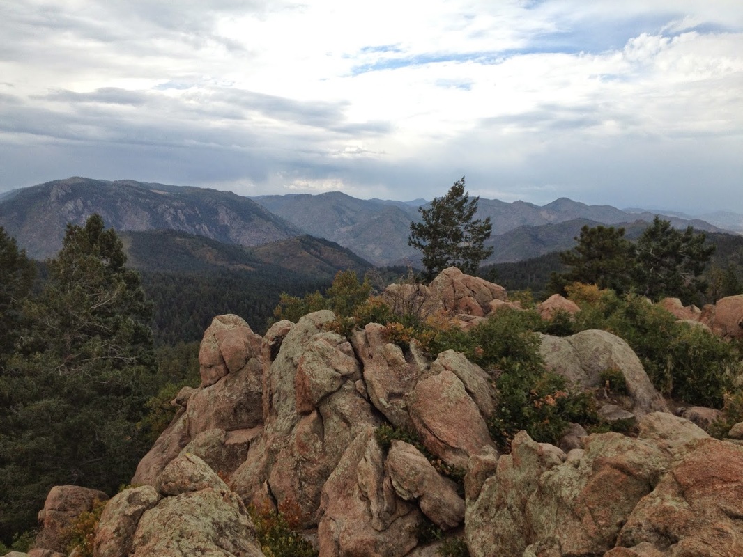
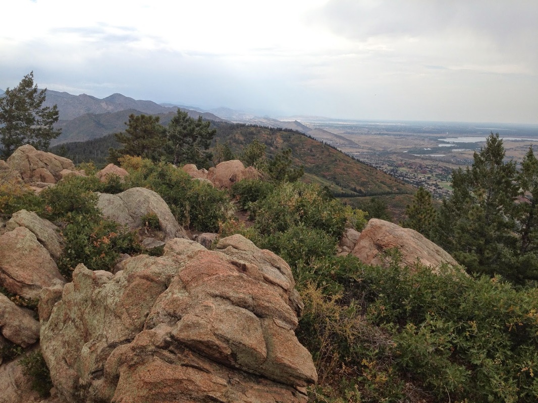
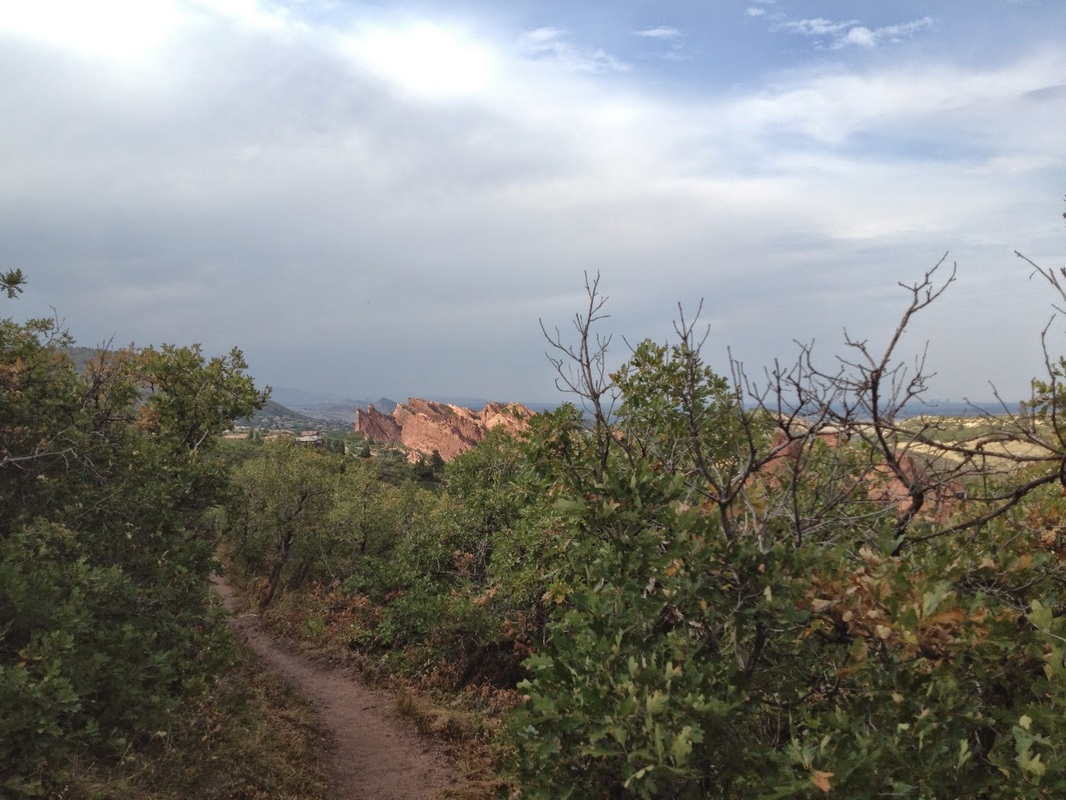
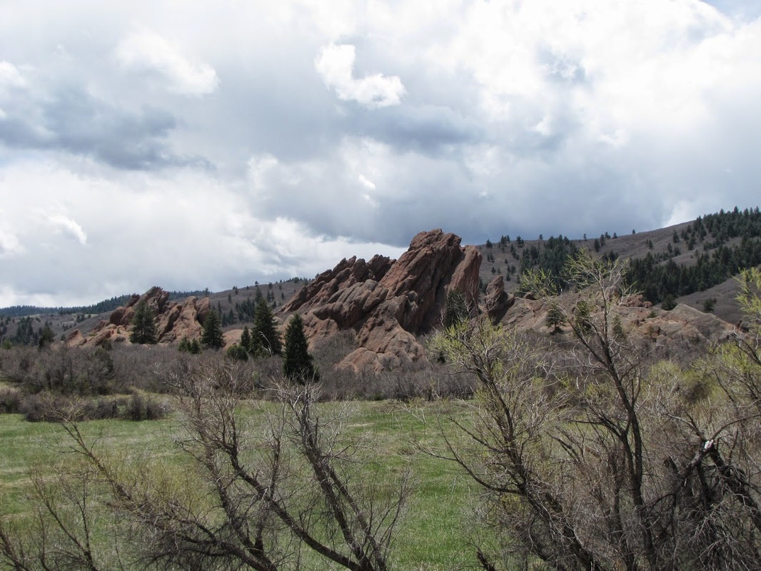
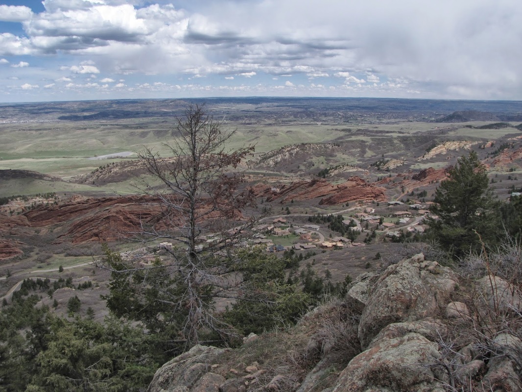
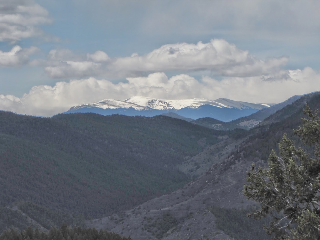
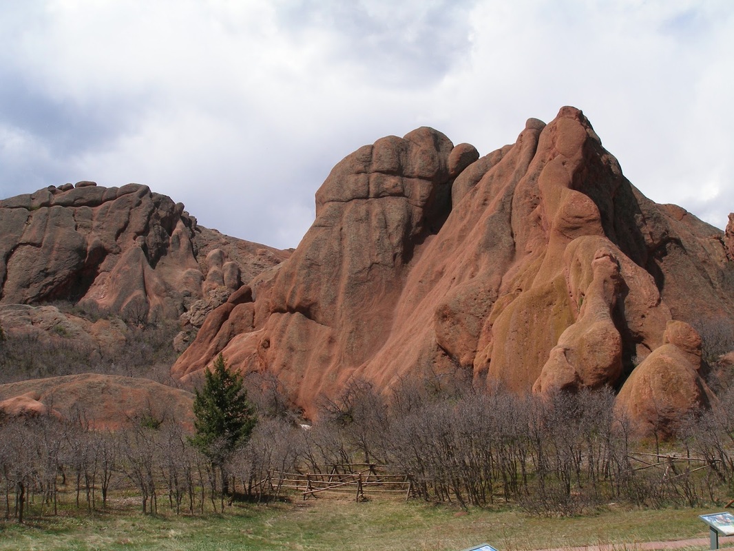
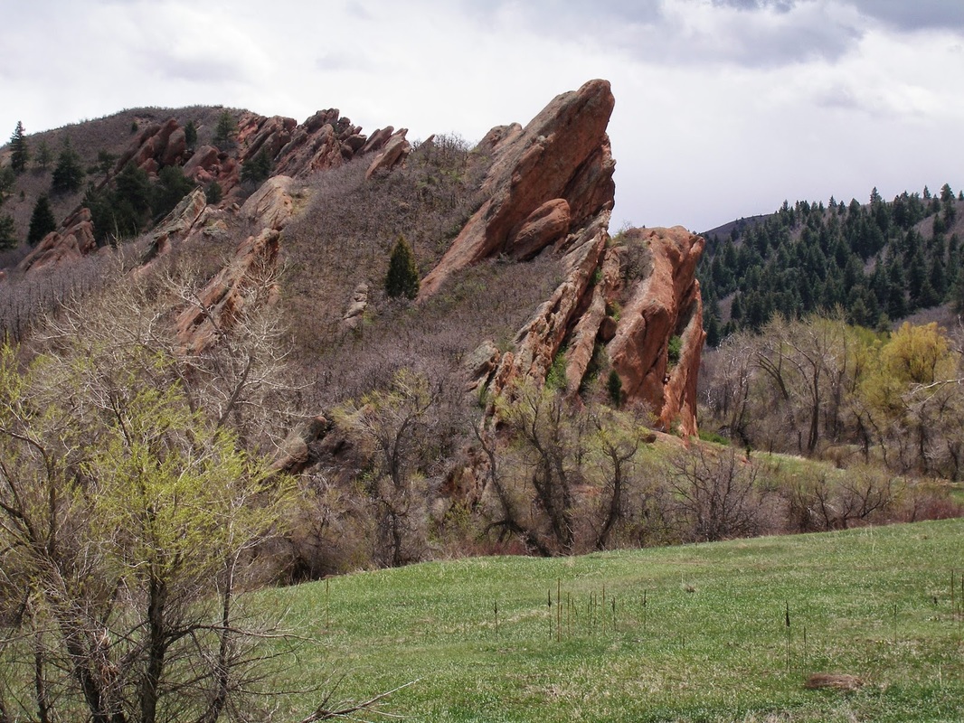
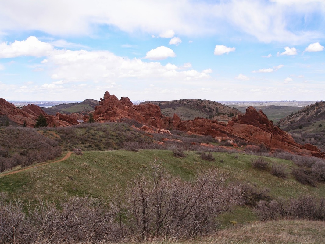
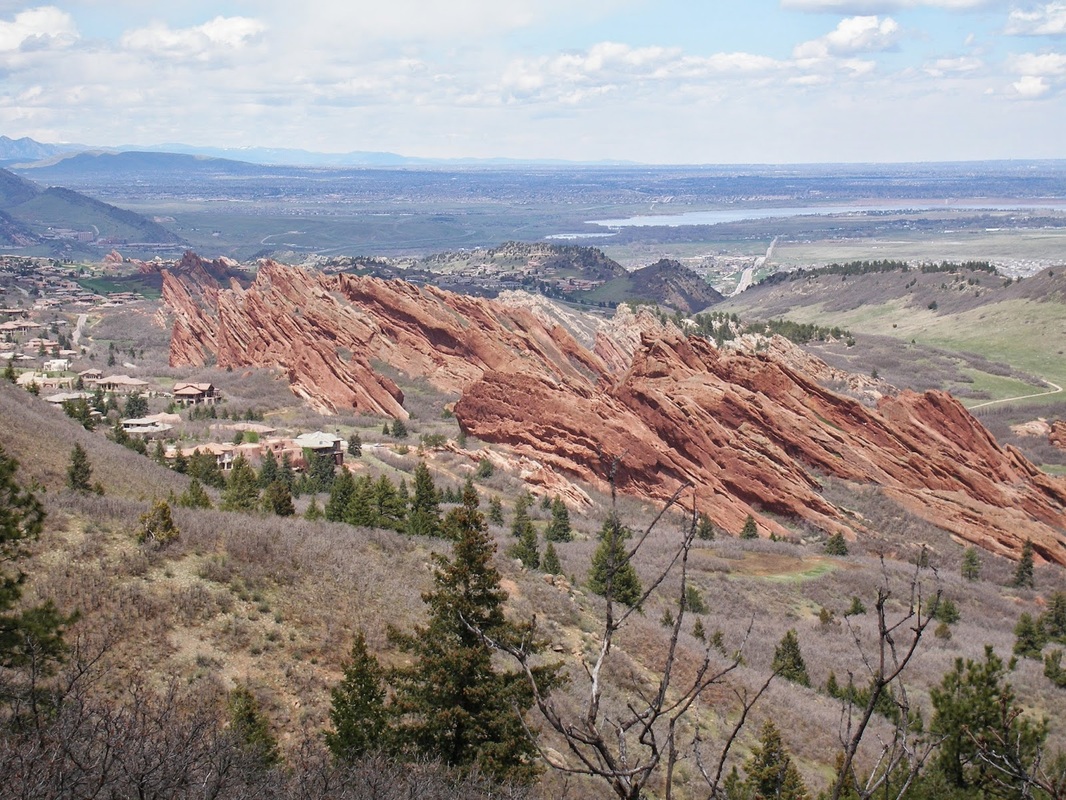
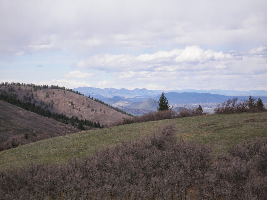
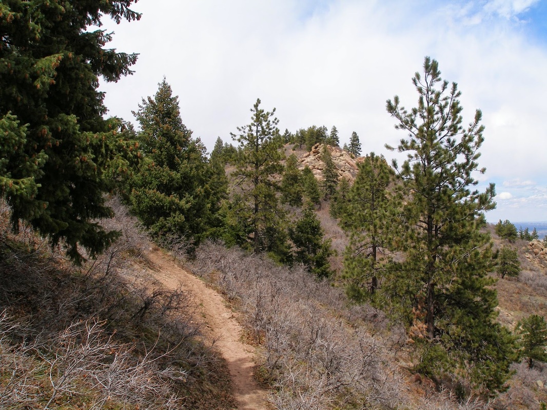
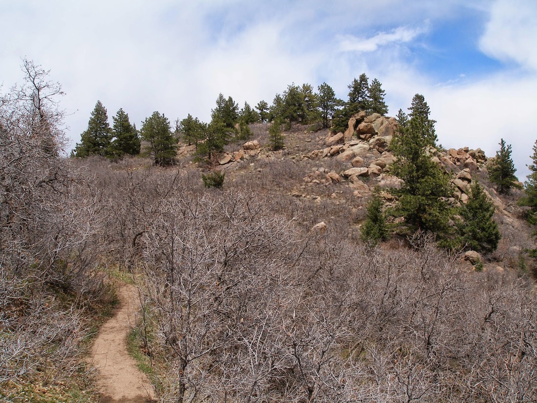
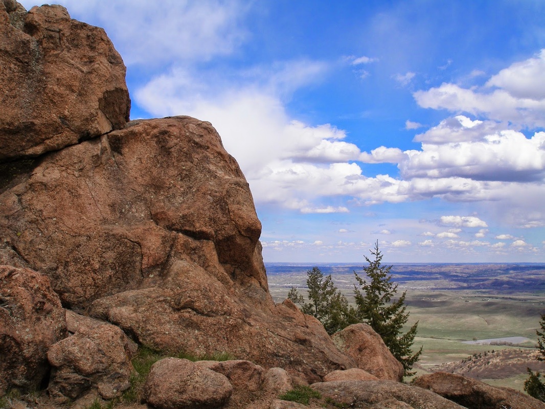
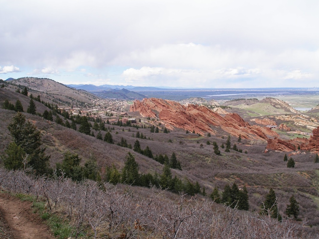
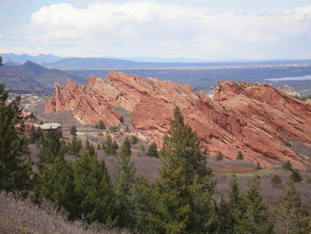
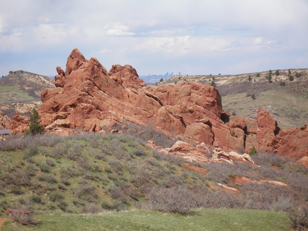
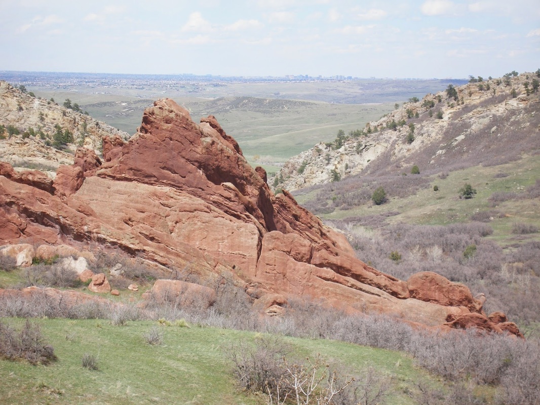
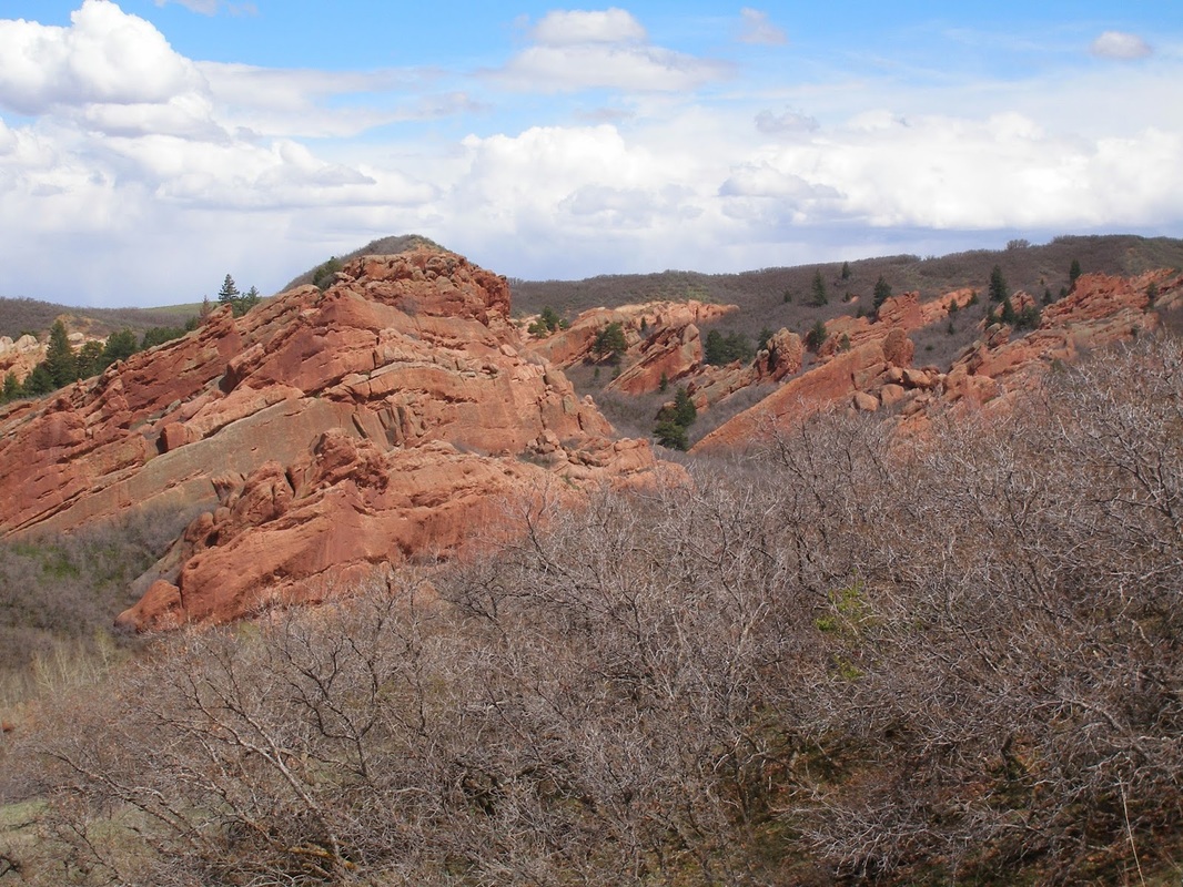
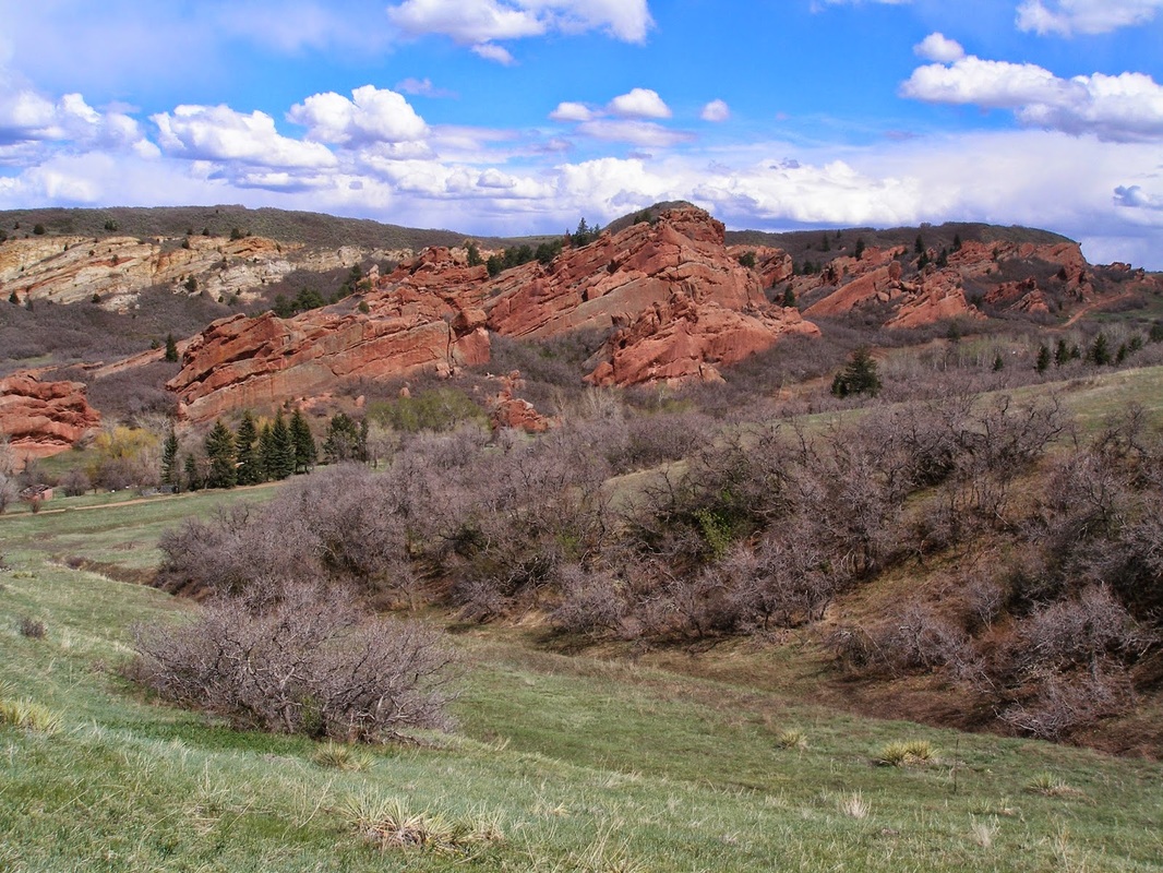
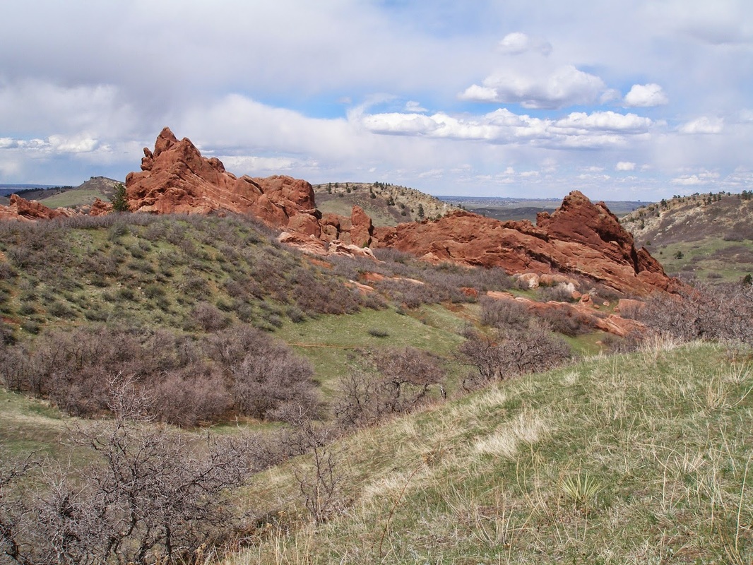
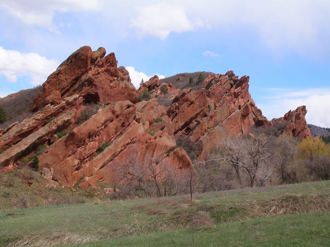
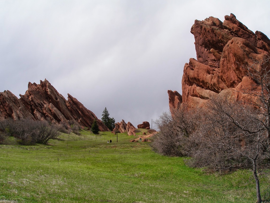
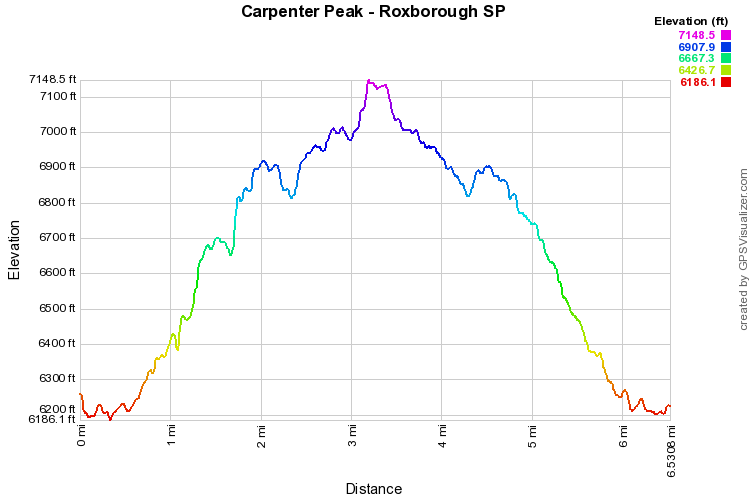
This is my favorite hike in the park.  It is a steady, moderate climb to a wonderful foothills peak.  You get a birds eye view of the park and when the weather is right you can see the snowy ridges of the Mount Evans Massif.  There are fewer people on this hike, since you gain about 1,000ft of elevation. 

Start at the Visitor's Center and just follow the signs.  There is not much thought involved in this hike, which allows you to take in the red rocks and the foothills in a relaxing way.  The trail crosses County Road 5 and switchbacks up the slopes of Carpenter Peak.  Just before the top you reach a trail junction pointing you to either the summit of the peak or Waterton Canyon.  It sure would be fun to reach this peak via Waterton Canyon...I'll put it on my to-do list...  The summit is rocky but ideal for a nice rest.  When satisfied with the view, head back the same way. 

An easy, quiet peak, in an otherwise busy state park just a stones throw from Denver. 
© Go Hike Colorado, 2020.  All Rights Reserved. 
Use of photographs without prior authorization is
​strictly prohibited.


Contact us at:
[email protected]
Legal Disclaimer - Information provided on this site is based upon our own observations, always double check information with the appropriate land management agency before heading into the backcountry.  Backcountry travel is inherently dangerous, please take all proper precautions.  Go Hike Colorado is not responsible for injury or incident.