|
Directions (from NPS website): Visitors traveling north/south on I-25: Exit at US 24 West, travel 35 miles to town of Florissant, then follow signs two miles south to the visitor center on Teller County 1. Visitors traveling east/west on US 24: Exit to the town of Florissant, then follow signs two miles south on Teller County 1 to the visitor center. Visitors traveling from the town of Cripple Creek: Follow Teller County Road 1 north for 16 miles.
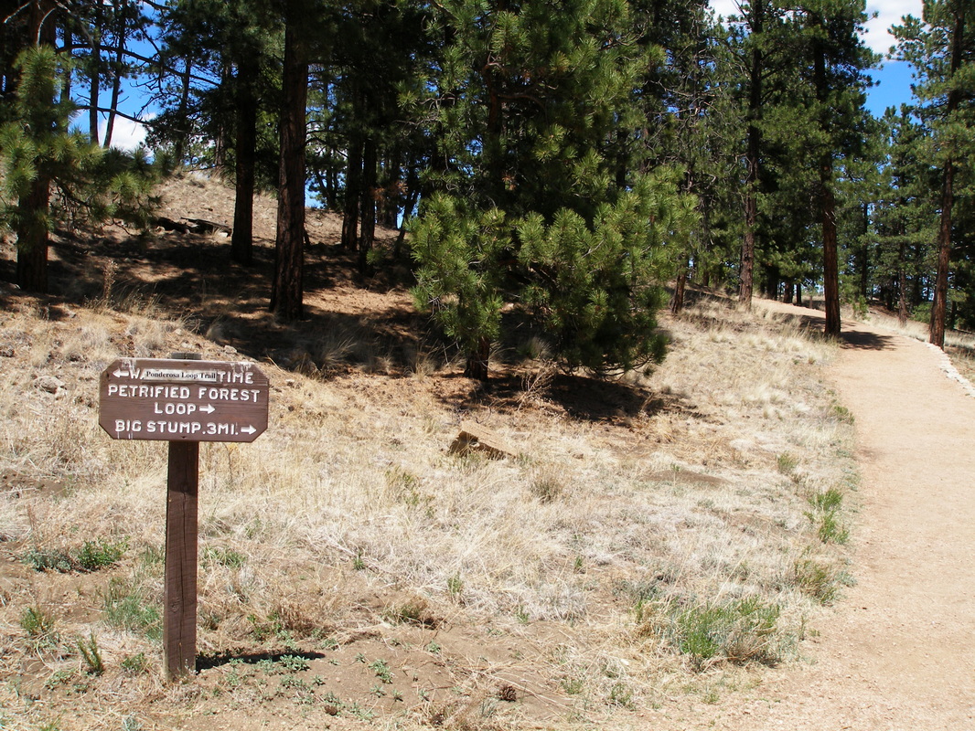
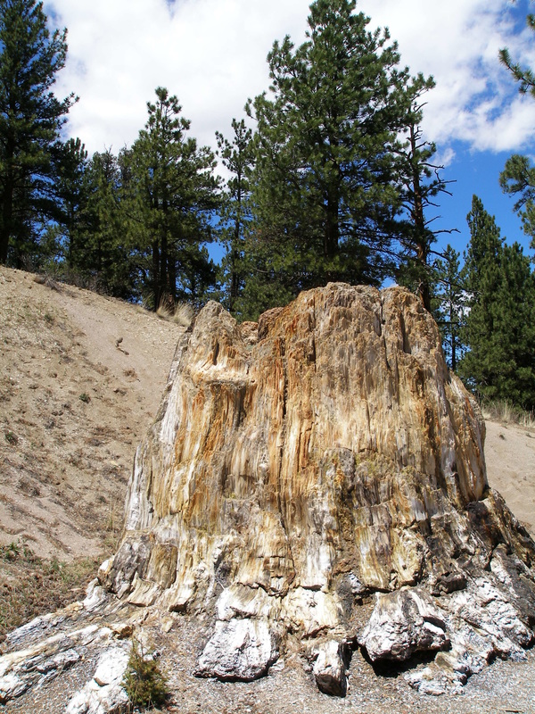
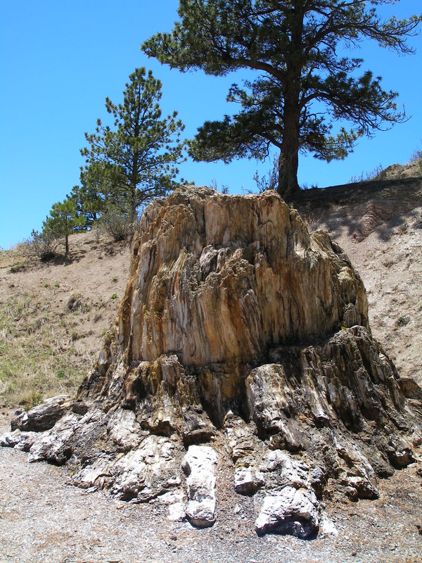
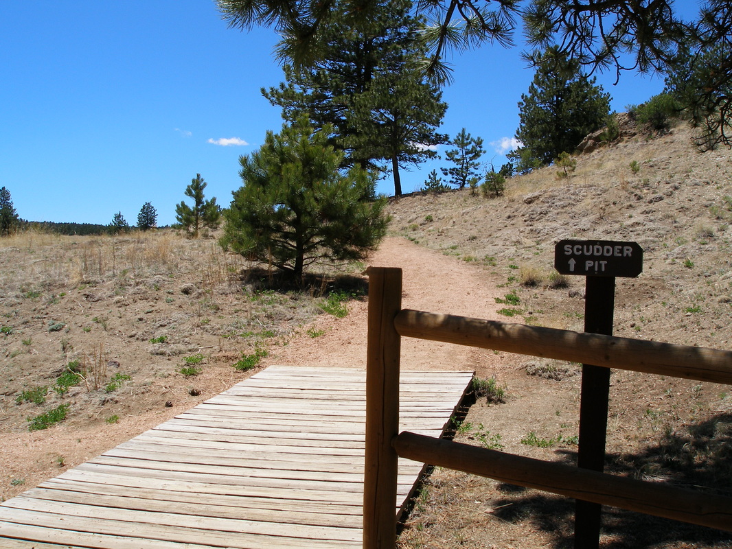
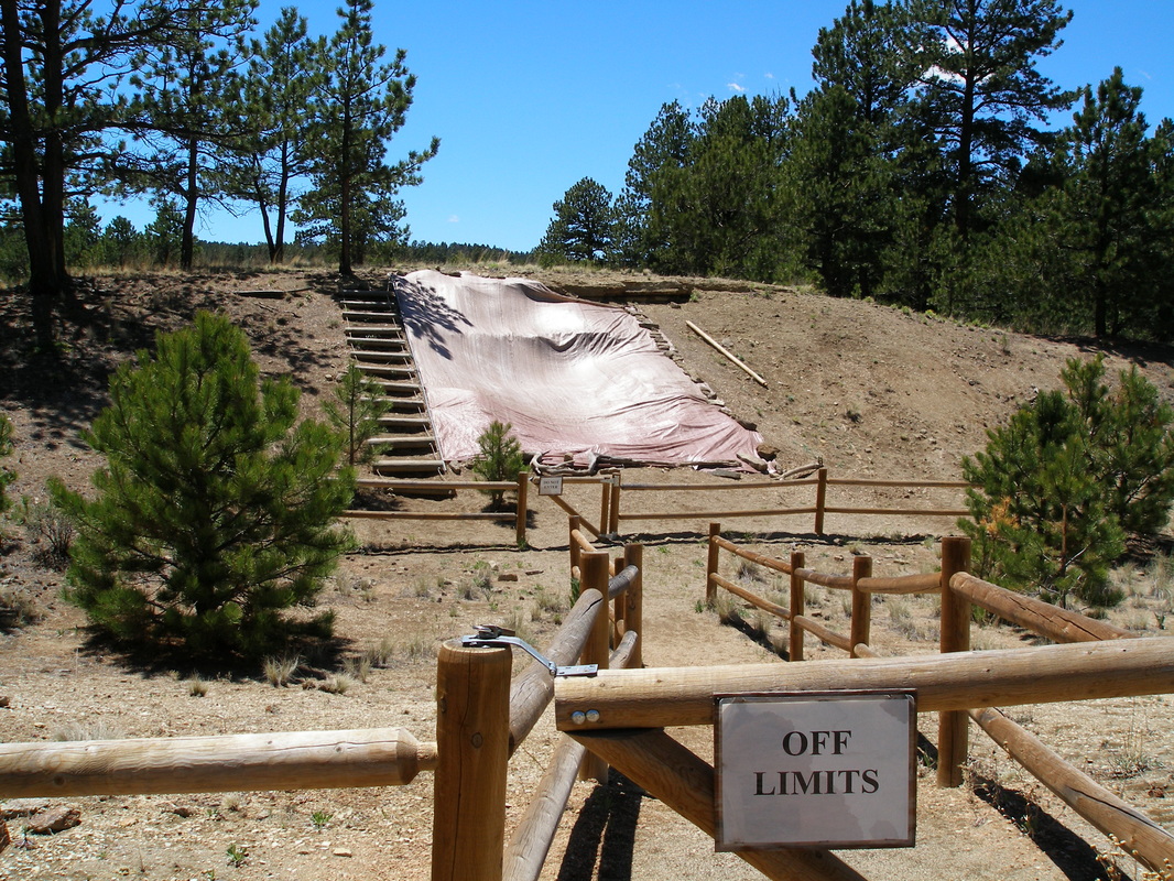
The Petrified Forest Loop is a short, easy hike that gives you a good taste of what the park has to offer. The trail starts from the Visitor Center, weaves through a Ponderosa Pine forest and showcases the fossilized Sequoia tree stumps that make this park so important. A self-guidance nature walk brochure is available to help interpret the resources featured. If you only have a few minutes to spend visiting the park, this hike provides a good introduction. |
|
- HOME
- ABOUT
-
HIKES BY REGION
-
NATIONAL PARK HIKES
- BENT'S OLD FORT NATIONAL HISTORIC SITE
- BLACK CANYON OF THE GUNNISON NATIONAL PARK
- COLORADO NATIONAL MONUMENT
- CURECANTI NATIONAL RECREATION AREA
- DINOSAUR NATIONAL MONUMENT
- FLORISSANT FOSSIL BEDS NATIONAL MONUMENT
- MESA VERDE NATIONAL PARK
- ROCKY MOUNTAIN NATIONAL PARK
- GREAT SAND DUNES NATIONAL PARK
- HOVENWEEP NATIONAL MONUMENT
- SAND CREEK MASSACRE NATIONAL HISTORIC SITE
- YUCCA HOUSE NATIONAL MONUMENT
- HIKES BY CATEGORY
- NEWS
- WEBCAMS
- $UPPORT GHC
- INTERACTIVE MAP
Petrified Forest Loop
Florissant Fossil Beds National Monument
Date Hiked: June 5, 2008
Distance: 1 mi (RT)
Elevation: 8,400ft
Elevation Gain: 100ft
Trailhead Lat/Long: 38 54' 49.75'' N; 105 17' 11.23'' W
Managing Agency: National Park Service
Fee: Yes