GO HIKE COLORADO
Get in Touch:
  • HOME
  • ABOUT
  • HIKES BY REGION
    • DENVER AREA >
      • Denver Mountain Parks
      • Jefferson County Open Space
      • Lakewood Parks
      • Denver Area Greenways
    • BOULDER AREA
    • DOUGLAS COUNTY
    • FORT COLLINS AREA
    • COLORADO SPRINGS AREA
    • FRONT RANGE
    • TENMILE & MOSQUITO RANGES
    • GORE RANGE
    • SANGRE DE CRISTO MOUNTAINS
    • PARK RANGE
    • SAWATCH RANGE
    • ELK MOUNTAINS
    • SAN JUAN MOUNTAINS
    • THE FLAT TOPS
    • GRAND MESA
    • COLORADO PLATEAU
    • EASTERN PLAINS
  • NATIONAL PARK HIKES
    • BENT'S OLD FORT NATIONAL HISTORIC SITE
    • BLACK CANYON OF THE GUNNISON NATIONAL PARK
    • COLORADO NATIONAL MONUMENT
    • CURECANTI NATIONAL RECREATION AREA
    • DINOSAUR NATIONAL MONUMENT
    • FLORISSANT FOSSIL BEDS NATIONAL MONUMENT
    • MESA VERDE NATIONAL PARK
    • ROCKY MOUNTAIN NATIONAL PARK
    • GREAT SAND DUNES NATIONAL PARK
    • HOVENWEEP NATIONAL MONUMENT
    • SAND CREEK MASSACRE NATIONAL HISTORIC SITE
    • YUCCA HOUSE NATIONAL MONUMENT
  • HIKES BY CATEGORY
    • HIKES TO ALPINE LAKES
    • HIKES TO PEAKS & PASSES
    • HIKES THROUGH CANYONS
    • HIKES WITH FALL COLORS
    • HIKES ALONG THE I-70 CORRIDOR
    • HIKES ON PAVED TRAILS
    • HIKES FOR KIDS
    • HIKES TO WATERFALLS
    • HIKES ALONG RIVERS
    • HIKES WITH ROCK FORMATIONS
    • HIKES WITH WILDFLOWERS
    • WINTER HIKES
  • NEWS
  • WEBCAMS
  • $UPPORT GHC
  • INTERACTIVE MAP

Old Kiln Trail
City of Boulder OSMP

Date Hiked: March 15, 2014

Distance: 2 mi (RT)
Elevation Gain: 419 ft
Managing Agency: City of Boulder Open Space & Mt. Parks
Fee: None

Four Mile Creek Trailhead Map
Picture

Directions:  The Four Mile Creek Trailhead is located on Lee Hill Rd.  Coming from Boulder/Denver take either Hwy 36 or Highway 93 north, turn west on Lee Hill Road and the trailhead is a few blocks west on the left. 

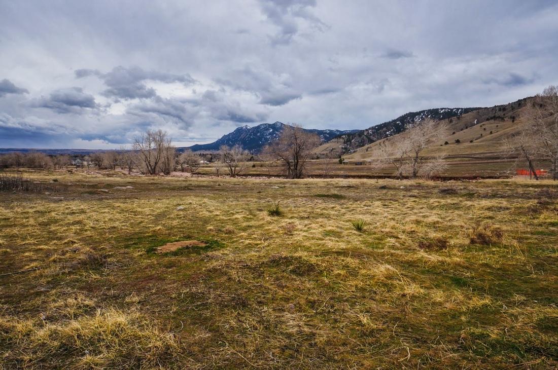
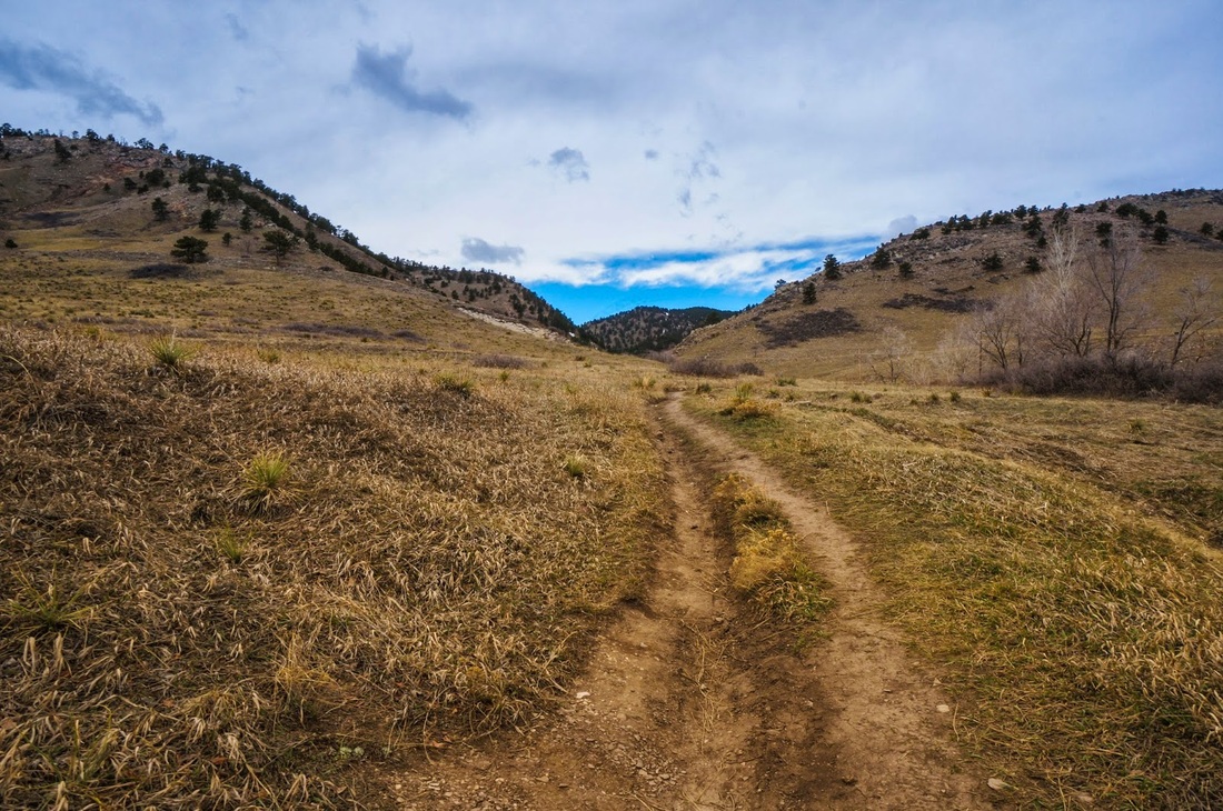
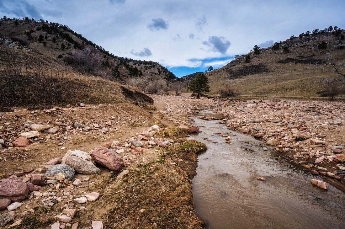
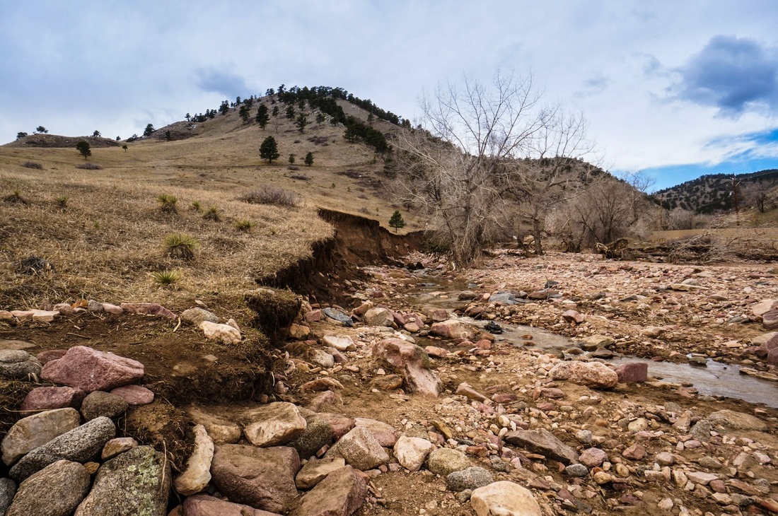
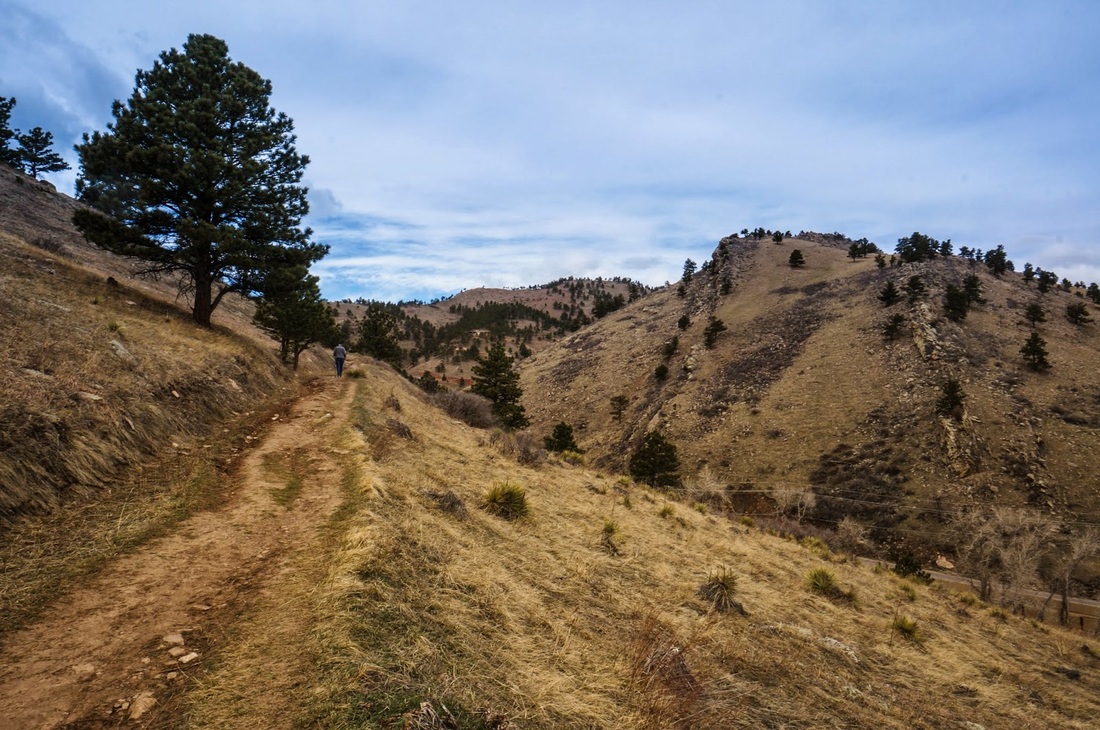
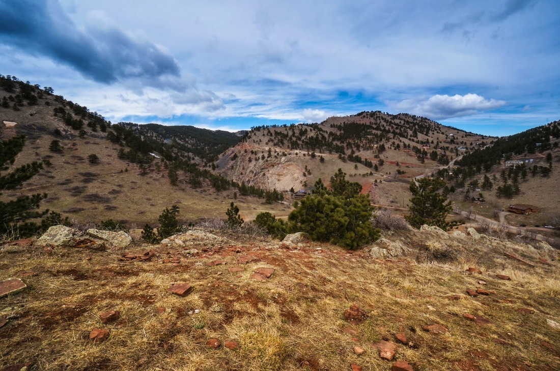
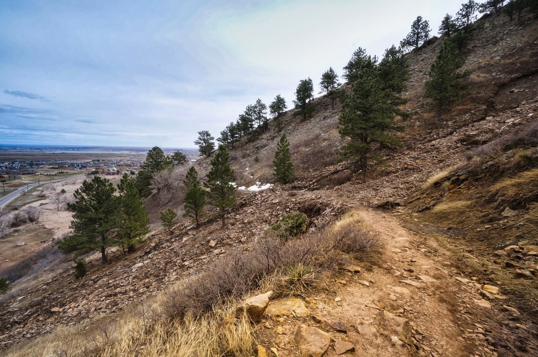
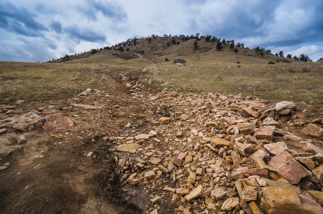
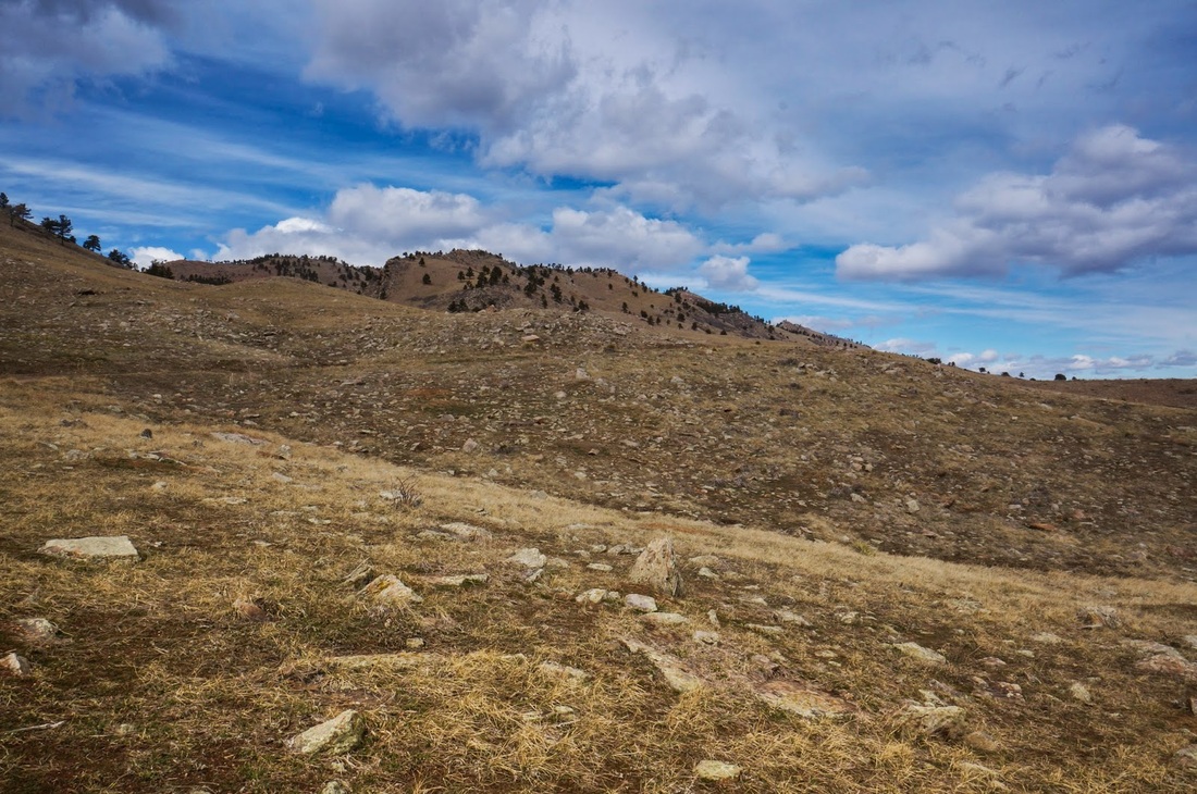
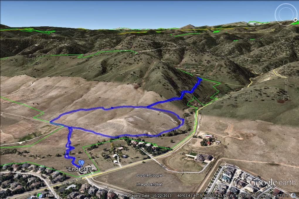
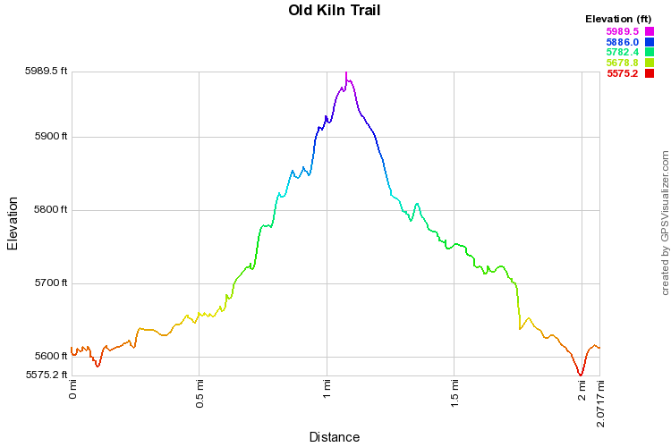
From the parking lot you start on the Foothills Trail, cross a creek, and make a right at the trail junction with the Old Kiln Trail.  This area was hit heavily by last years massive flooding.  The trail was washed out and has been rebuilt along the creek.  Follow cairns when the trail gets difficult to spot.  After following the creek for a little, the trail starts switchbacking and ascending onto the north slope of the hill.  Follow this slope till you reach a nice view of the Lee Hill Road Canyon area and a gate marking the end of City of Boulder OSMP property.  From here turn around but this time make a right and complete the lower loop.  There are nice views here looking north to Green Mountain.  Overall a very pleasant, short hike, with decent elevation gain, for the distance.
Powered by Create your own unique website with customizable templates.