GO HIKE COLORADO
Get in Touch:
  • HOME
  • ABOUT
  • HIKES BY REGION
    • DENVER AREA >
      • Denver Mountain Parks
      • Jefferson County Open Space
      • Lakewood Parks
      • Denver Area Greenways
    • BOULDER AREA
    • DOUGLAS COUNTY
    • FORT COLLINS AREA
    • COLORADO SPRINGS AREA
    • FRONT RANGE
    • TENMILE & MOSQUITO RANGES
    • GORE RANGE
    • SANGRE DE CRISTO MOUNTAINS
    • PARK RANGE
    • SAWATCH RANGE
    • ELK MOUNTAINS
    • SAN JUAN MOUNTAINS
    • THE FLAT TOPS
    • GRAND MESA
    • COLORADO PLATEAU
    • EASTERN PLAINS
  • NATIONAL PARK HIKES
    • BENT'S OLD FORT NATIONAL HISTORIC SITE
    • BLACK CANYON OF THE GUNNISON NATIONAL PARK
    • COLORADO NATIONAL MONUMENT
    • CURECANTI NATIONAL RECREATION AREA
    • DINOSAUR NATIONAL MONUMENT
    • FLORISSANT FOSSIL BEDS NATIONAL MONUMENT
    • MESA VERDE NATIONAL PARK
    • ROCKY MOUNTAIN NATIONAL PARK
    • GREAT SAND DUNES NATIONAL PARK
    • HOVENWEEP NATIONAL MONUMENT
    • SAND CREEK MASSACRE NATIONAL HISTORIC SITE
    • YUCCA HOUSE NATIONAL MONUMENT
  • HIKES BY CATEGORY
    • HIKES TO ALPINE LAKES
    • HIKES TO PEAKS & PASSES
    • HIKES THROUGH CANYONS
    • HIKES WITH FALL COLORS
    • HIKES ALONG THE I-70 CORRIDOR
    • HIKES ON PAVED TRAILS
    • HIKES FOR KIDS
    • HIKES TO WATERFALLS
    • HIKES ALONG RIVERS
    • HIKES WITH ROCK FORMATIONS
    • HIKES WITH WILDFLOWERS
    • WINTER HIKES
  • NEWS
  • WEBCAMS
  • $UPPORT GHC
  • INTERACTIVE MAP

Needle Rock Natural Area
BLM Public Lands

Date Hiked: June 20, 2020

​Distance: 1 mi (RT)
Elevation Gain: 450 ft
Elevation Min/Max: 7,011 to 7,454 ft
Trailhead Lat/Long: 38.72471, -107.54445
Managing Agency: Bureau of Land Management
​Fee: None

Needle Rock Webpage (BLM)
Picture

DIRECTIONS: From Crawford, CO head east out of town on Dogwood Ave.  Dogwood turns into Needlerock Road. Head east towards the Needle to the parking area and trailhead. 

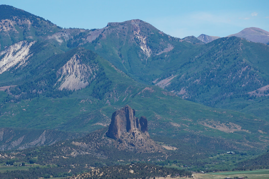
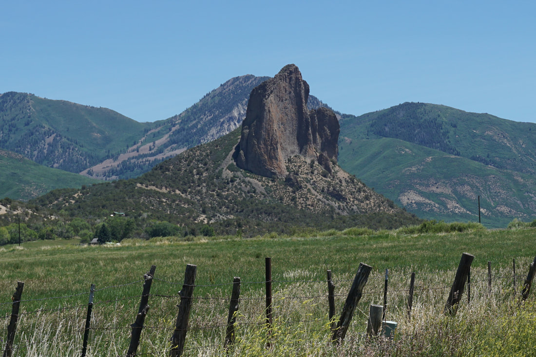
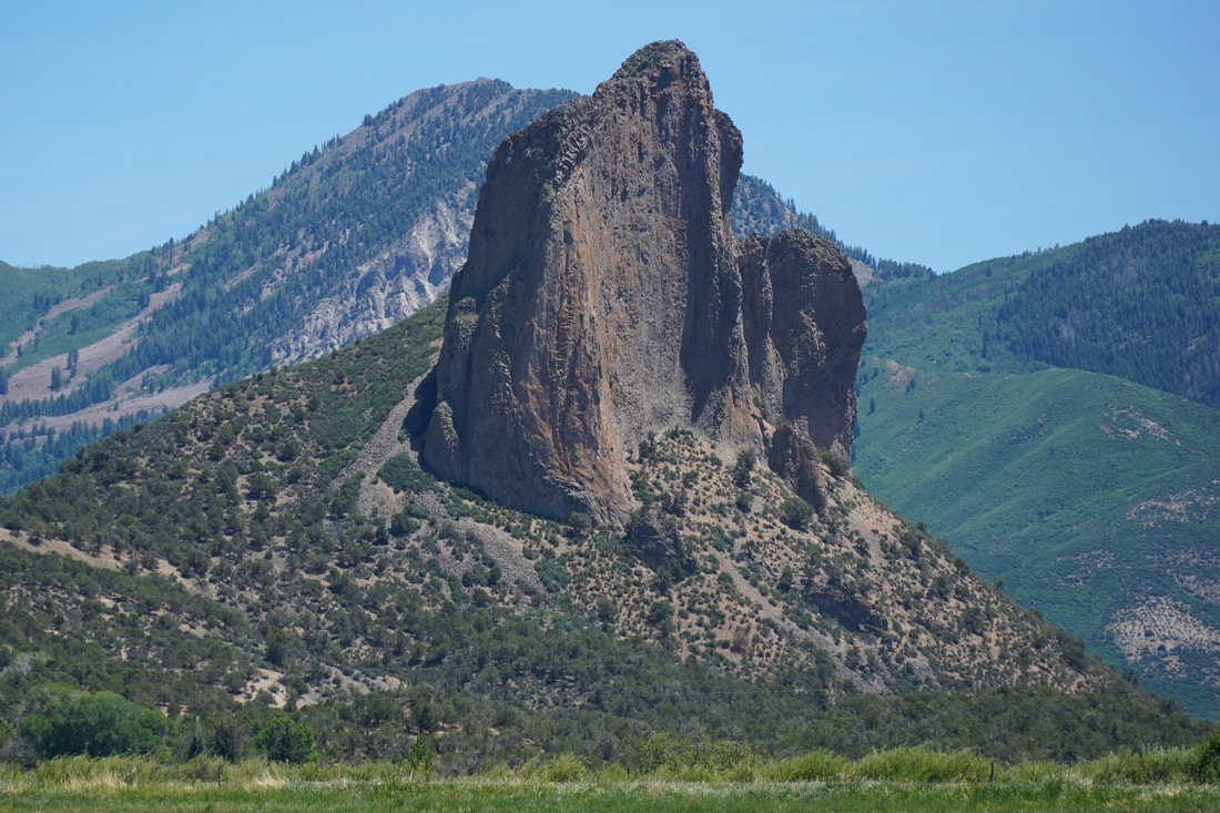
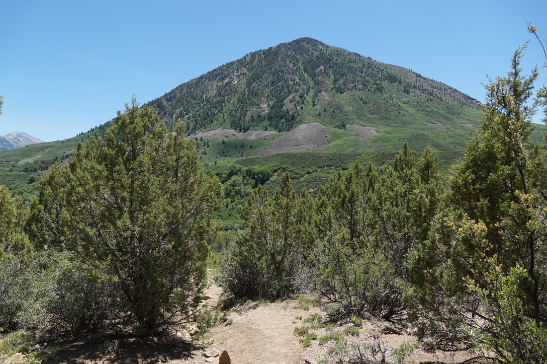
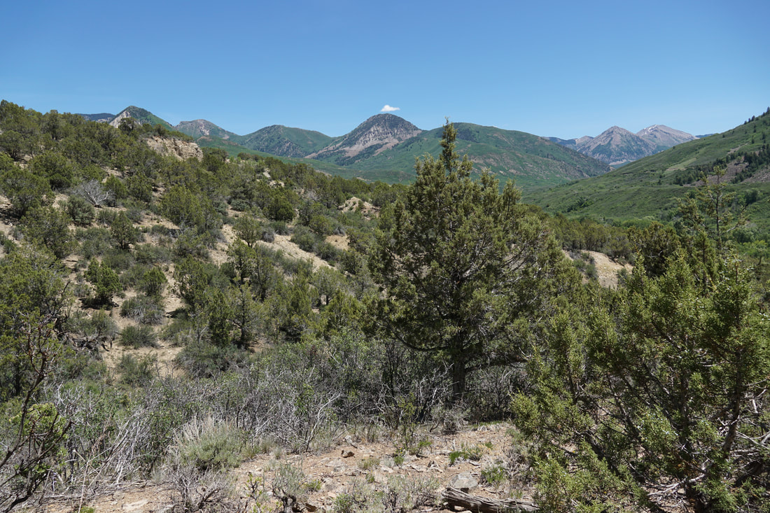
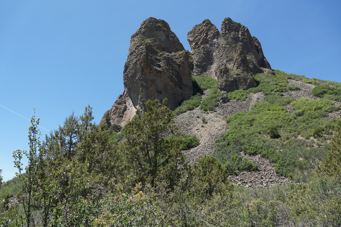
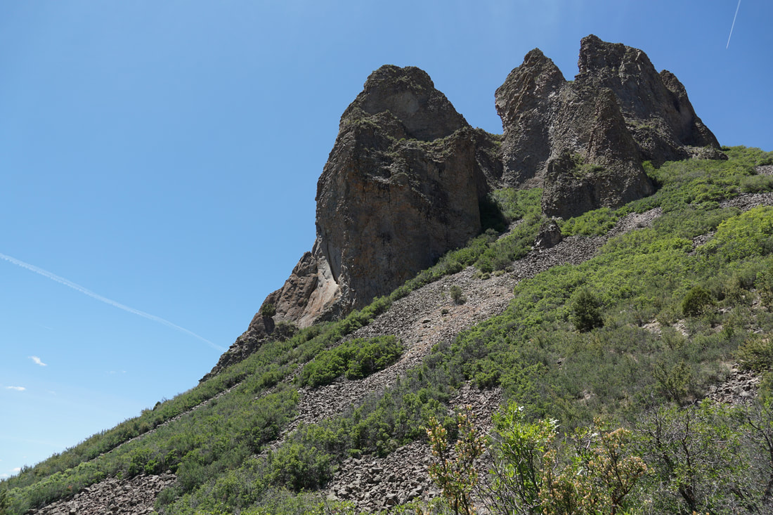
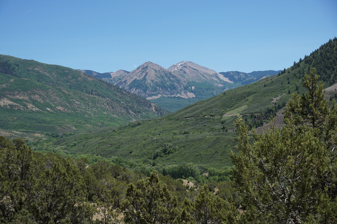
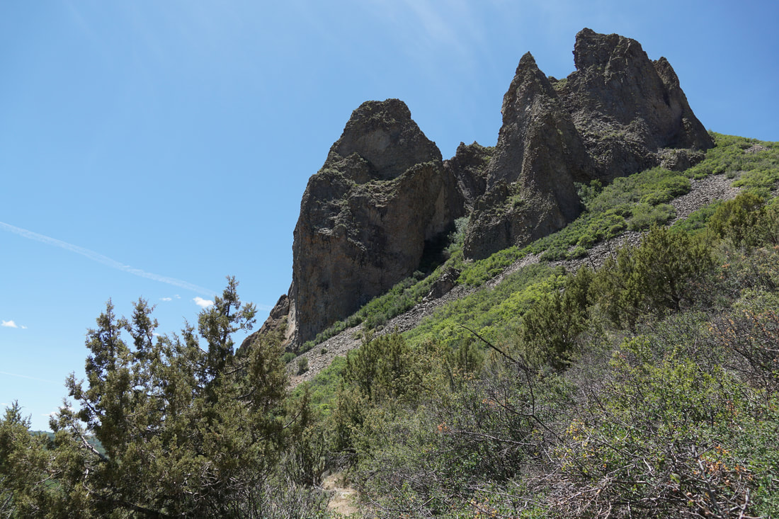
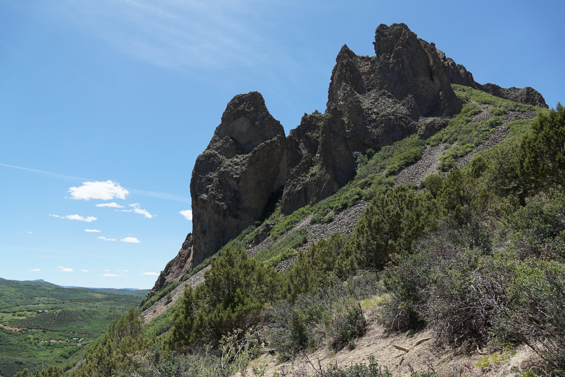
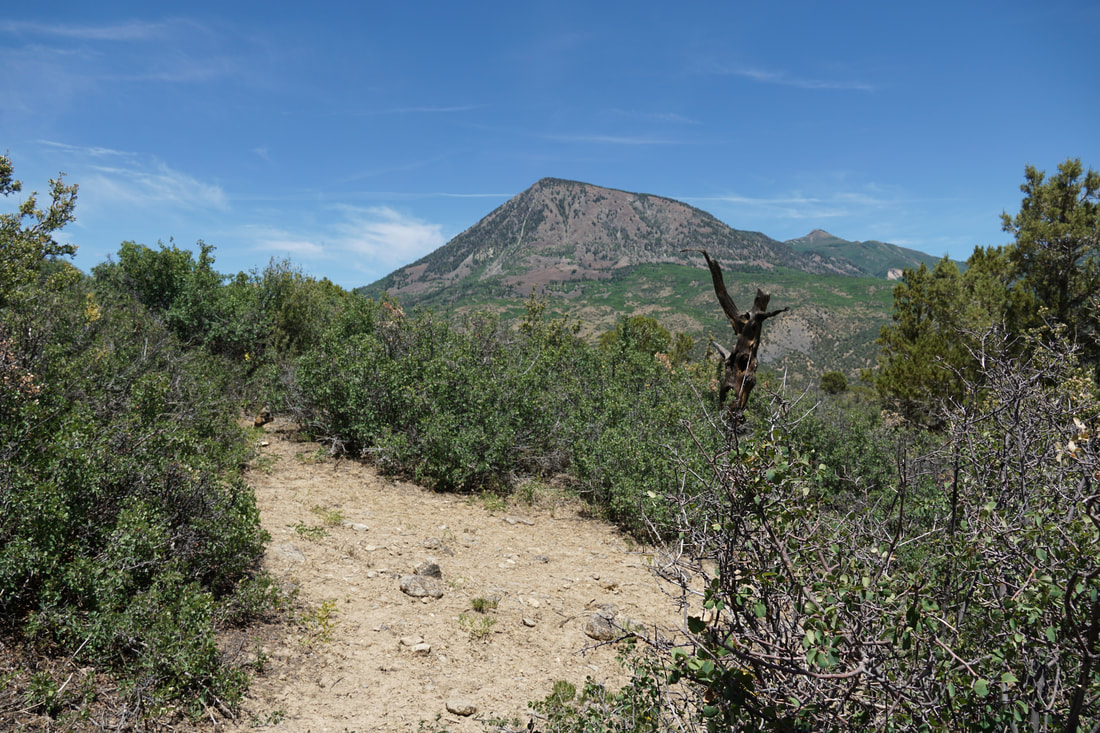
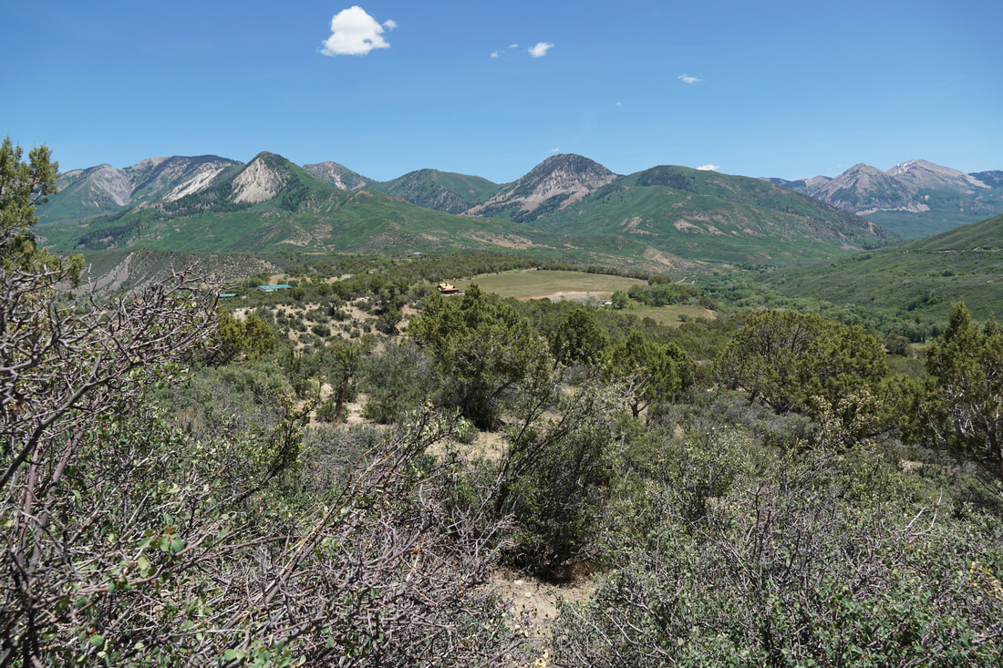
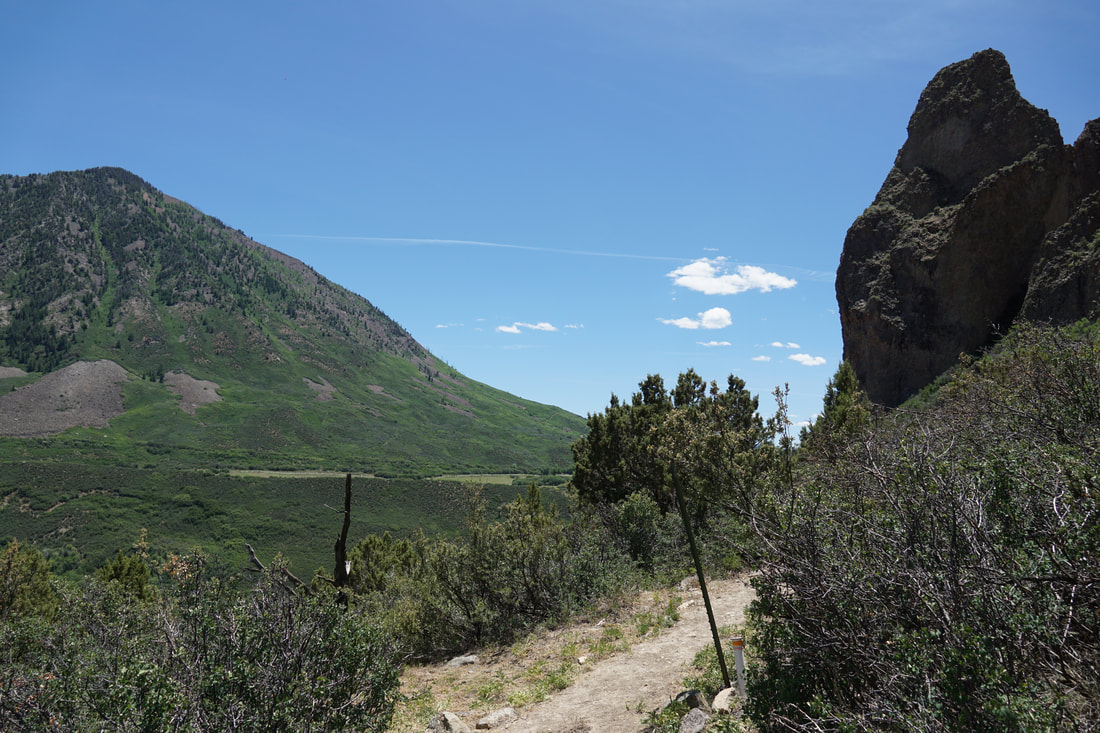
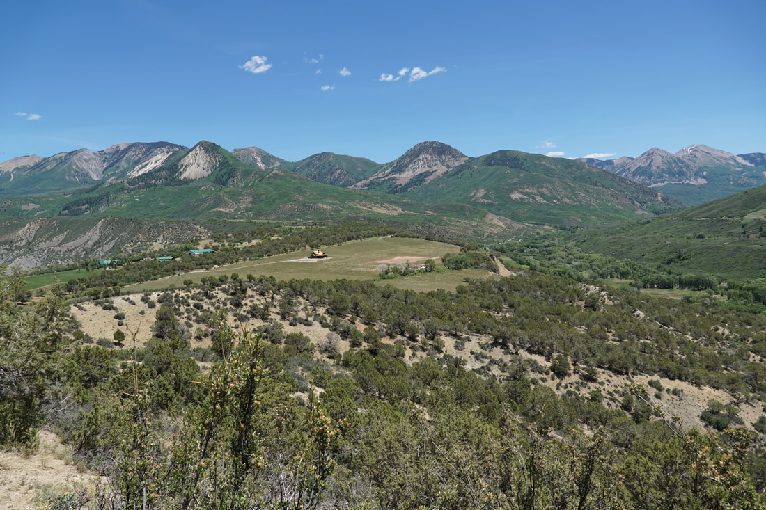
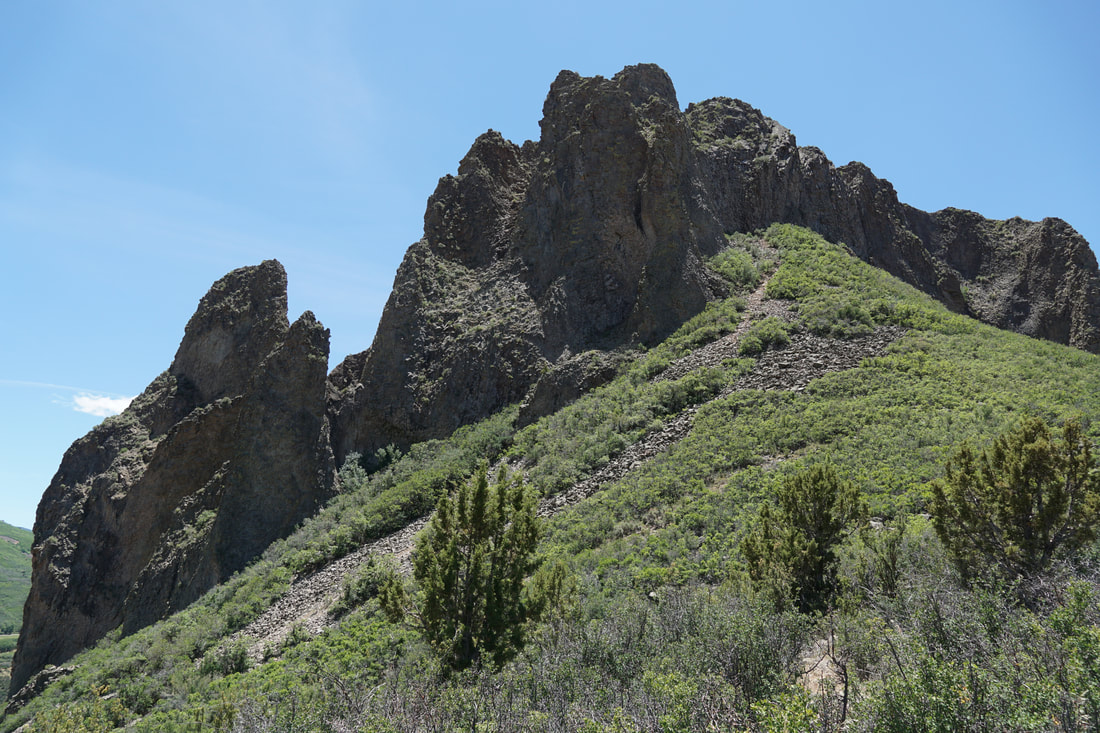
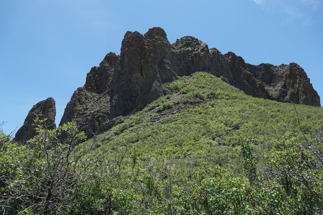
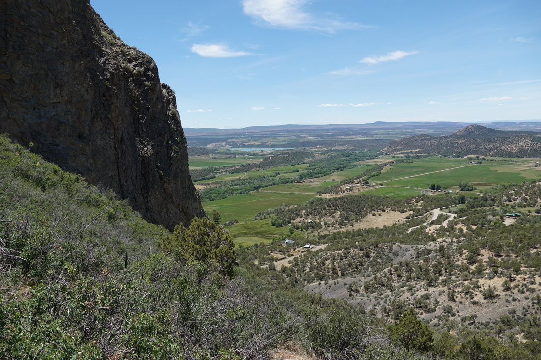
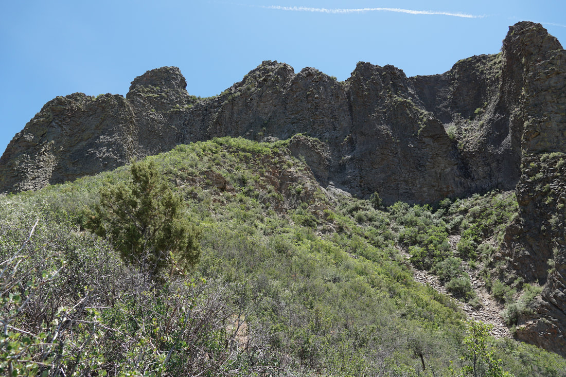
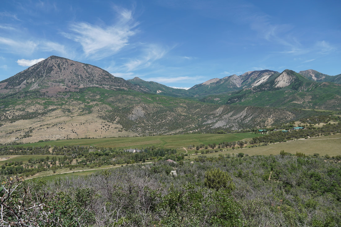
Needle Rock is an iconic landmark visible from Highway 92 near the town of Crawford.  The volcanic plug stands at the western edge of the West Elk Mountains rising 800 ft from the Gunnison River Valley.  A short but steep hiking trail gets you up close and personal with the geologic wonder. 

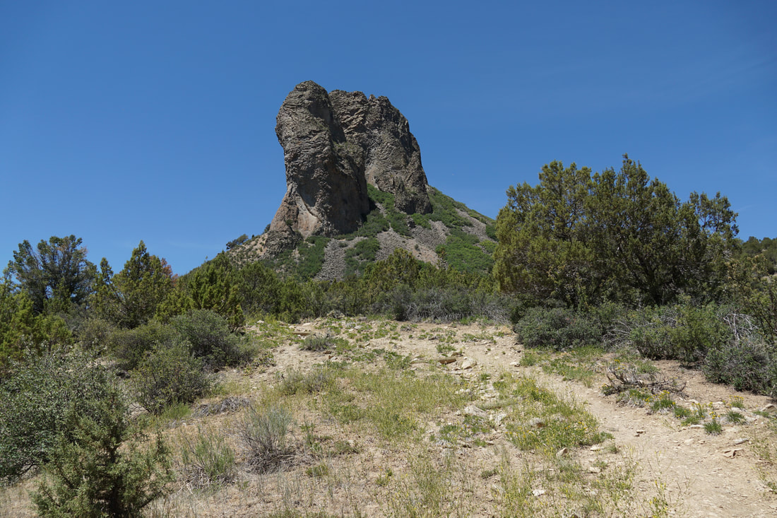
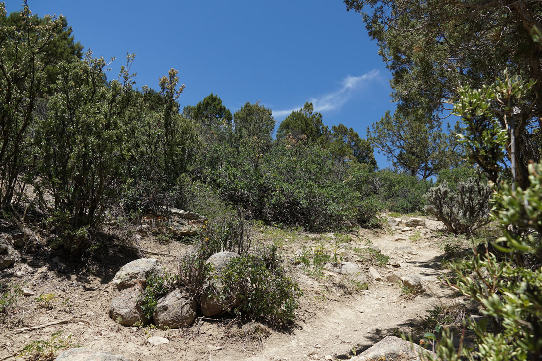
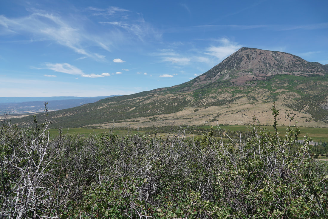
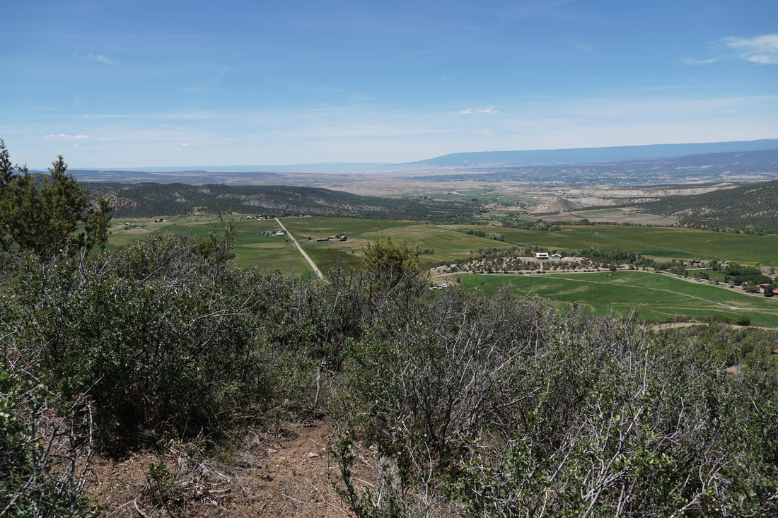
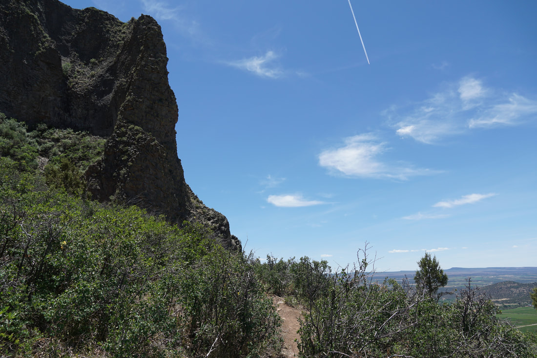
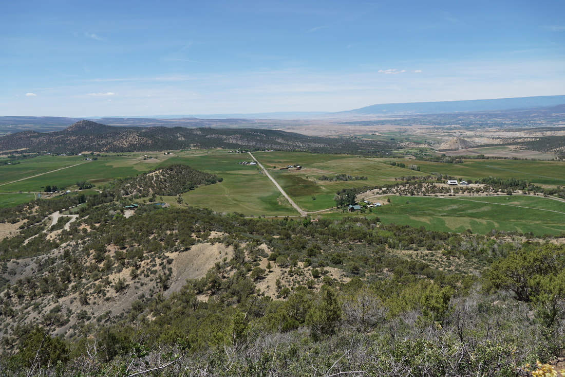
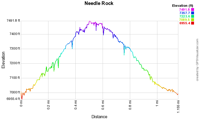
The trail climbs through juniper and sage brush along the eastern side of the monolith.  As you climb, the views of the West Elk Mountains stretch out before you.  The trail is steep and rocky and gets you close to the base of the rock but not all the way to the summit.  As impressive as Needle Rock looks from a distance, it is equally as impressive from up close.  

This is great hike to experience the icon as you drive through the Gunnison River Valley.  Rather than just drive by and look out the car window, get out and hike it.  You'll never look at it the same way again.  
Powered by Create your own unique website with customizable templates.