GO HIKE COLORADO
Get in Touch:
  • HOME
  • ABOUT
  • HIKES BY REGION
    • DENVER AREA >
      • Denver Mountain Parks
      • Jefferson County Open Space
      • Lakewood Parks
      • Denver Area Greenways
    • BOULDER AREA
    • DOUGLAS COUNTY
    • FORT COLLINS AREA
    • COLORADO SPRINGS AREA
    • FRONT RANGE
    • TENMILE & MOSQUITO RANGES
    • GORE RANGE
    • SANGRE DE CRISTO MOUNTAINS
    • PARK RANGE
    • SAWATCH RANGE
    • ELK MOUNTAINS
    • SAN JUAN MOUNTAINS
    • THE FLAT TOPS
    • GRAND MESA
    • COLORADO PLATEAU
    • EASTERN PLAINS
  • NATIONAL PARK HIKES
    • BENT'S OLD FORT NATIONAL HISTORIC SITE
    • BLACK CANYON OF THE GUNNISON NATIONAL PARK
    • COLORADO NATIONAL MONUMENT
    • CURECANTI NATIONAL RECREATION AREA
    • DINOSAUR NATIONAL MONUMENT
    • FLORISSANT FOSSIL BEDS NATIONAL MONUMENT
    • MESA VERDE NATIONAL PARK
    • ROCKY MOUNTAIN NATIONAL PARK
    • GREAT SAND DUNES NATIONAL PARK
    • HOVENWEEP NATIONAL MONUMENT
    • SAND CREEK MASSACRE NATIONAL HISTORIC SITE
    • YUCCA HOUSE NATIONAL MONUMENT
  • HIKES BY CATEGORY
    • HIKES TO ALPINE LAKES
    • HIKES TO PEAKS & PASSES
    • HIKES THROUGH CANYONS
    • HIKES WITH FALL COLORS
    • HIKES ALONG THE I-70 CORRIDOR
    • HIKES ON PAVED TRAILS
    • HIKES FOR KIDS
    • HIKES TO WATERFALLS
    • HIKES ALONG RIVERS
    • HIKES WITH ROCK FORMATIONS
    • HIKES WITH WILDFLOWERS
    • WINTER HIKES
  • NEWS
  • WEBCAMS
  • $UPPORT GHC
  • INTERACTIVE MAP

Mt. Cutler Trail
N. Cheyenne Canon Park

  • Date Hiked: October 13, 2014

  • Distance: 2 mi (RT)
  • Elevation Gain: 538ft
  • Elevation Min/Max: 6,746 to 7,211ft
  • Managing Agency: City of Colorado Springs Parks, Recreation & Cultural Services
  • Fee: None

N. Cheyenne Canon Park Map
Picture

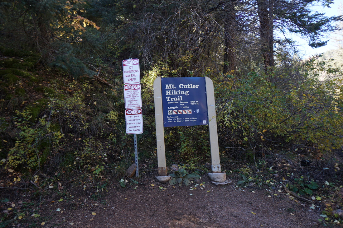
Directions:  From I-25, take Exit 140B and follow the signs to N. Cheyenne Canon Park.  Make a right onto W. Cheyenne Road and follow it to the large sign for the park.  Turn right into North Cheyenne Canon and drive up the road for 1.5 mi.  The trailhead is on the left. 

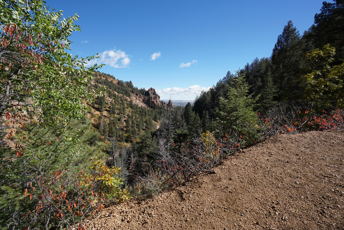
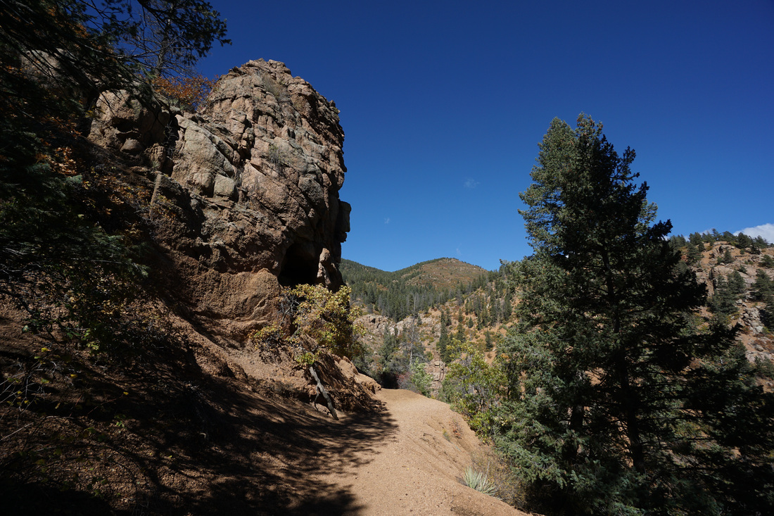
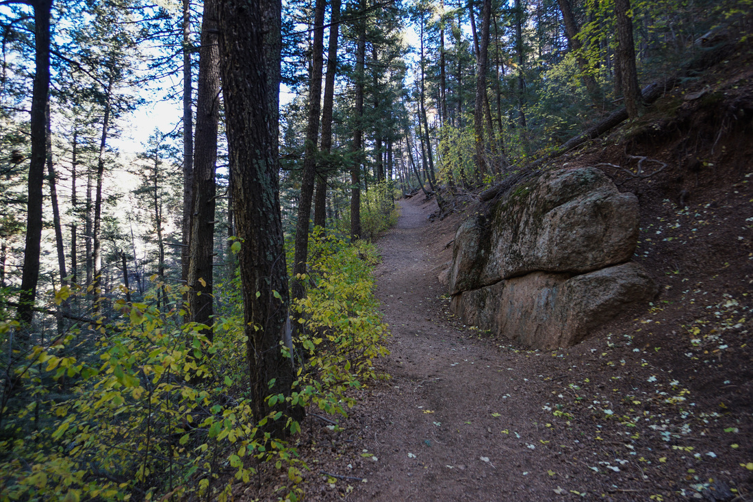
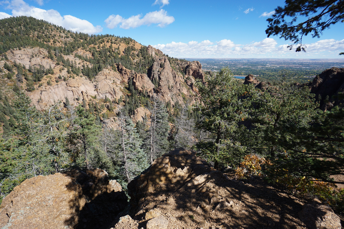
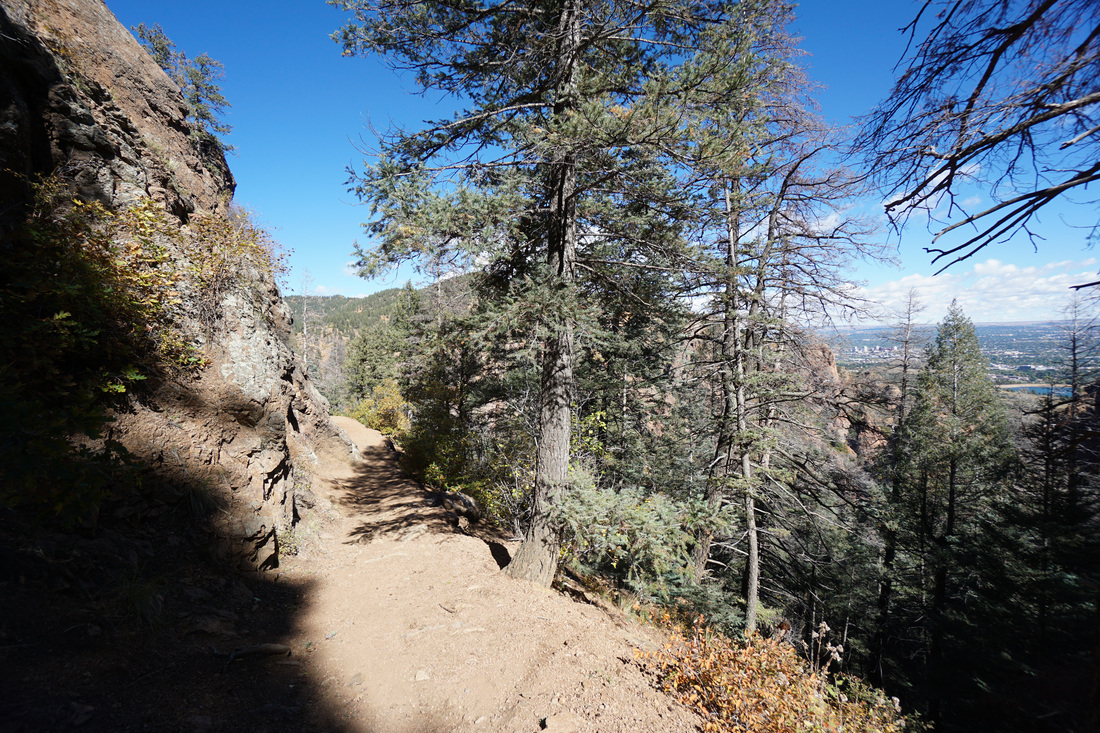
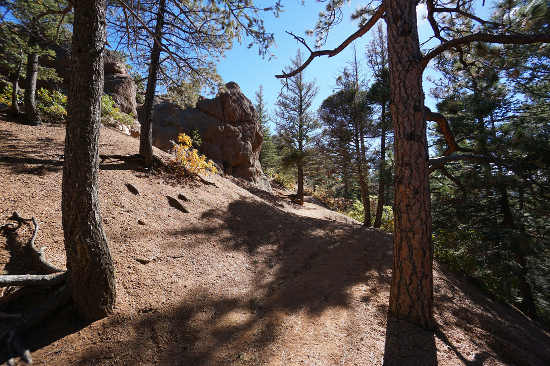
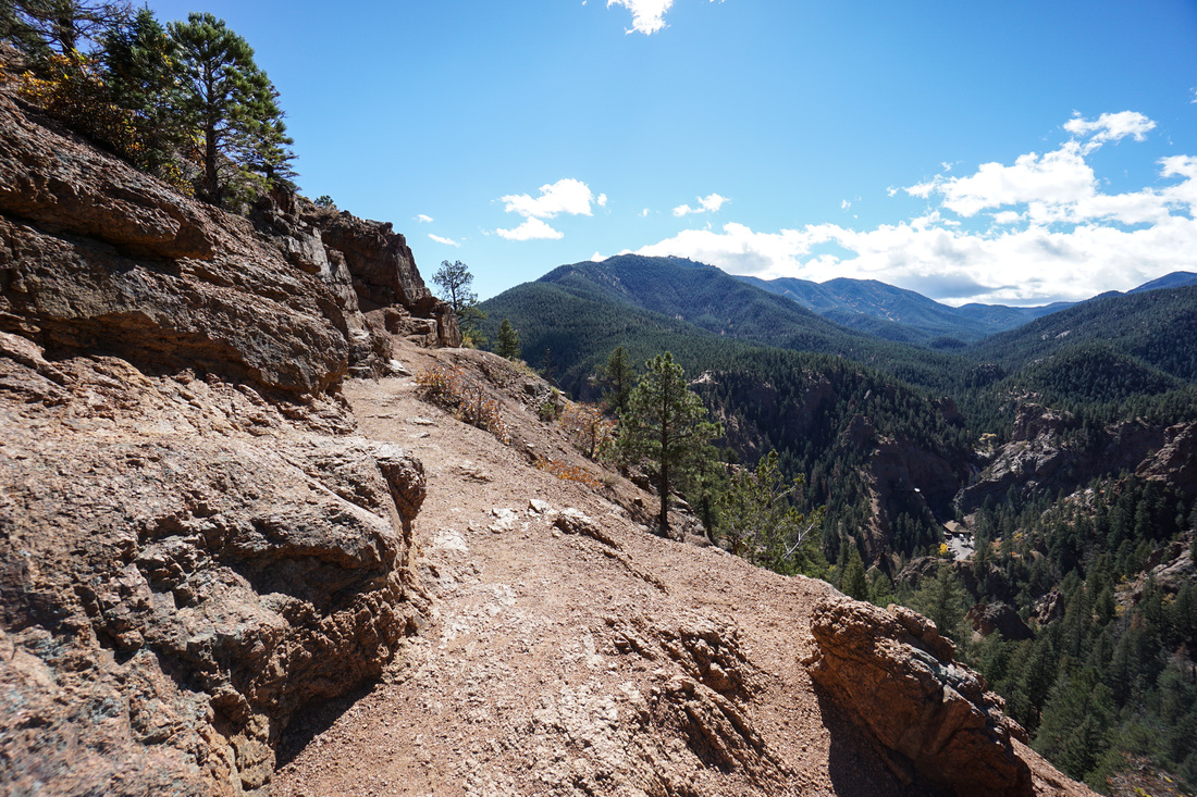
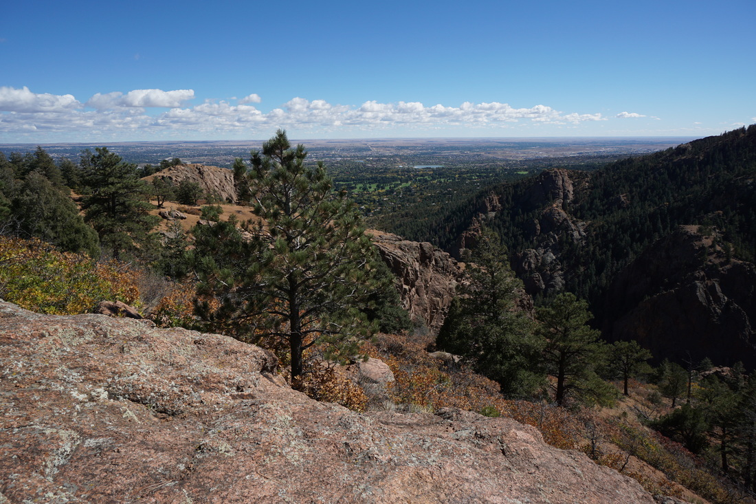
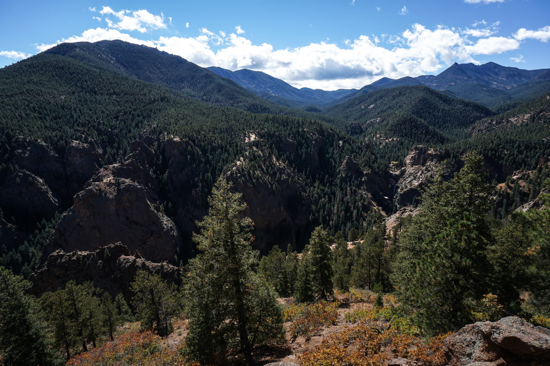
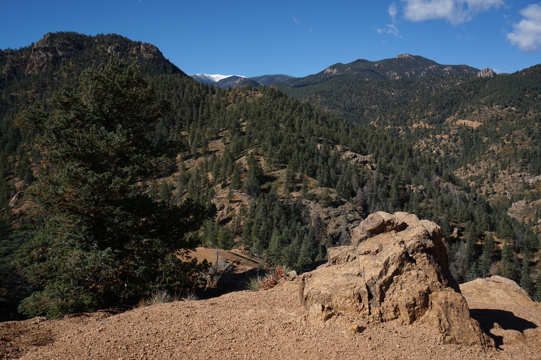
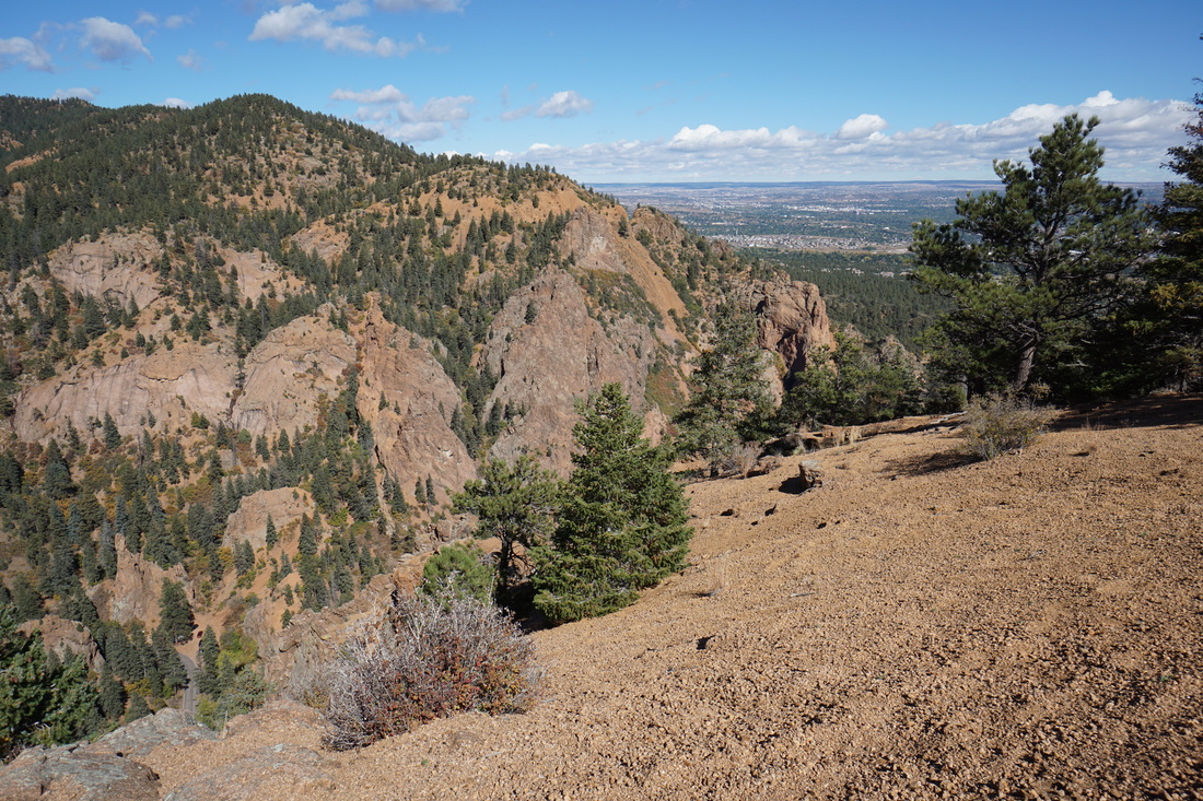
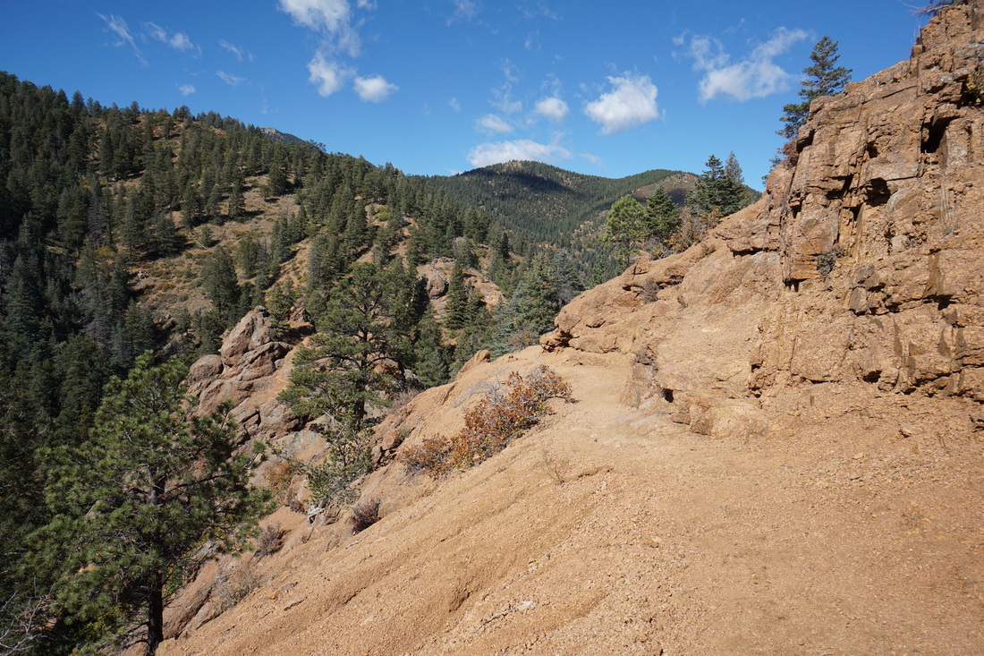
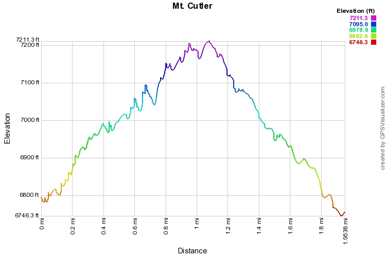
The Mt. Cutler Trail is a great way to experience North Cheyenne Canon.  The trail is easy going and snakes its way up the south slopes of the canyon.  The trail is mostly shaded by evergreen and aspen trees with various viewpoints towards the impressive mouth of the canyon.  The trail climbs up to a saddle on the ridge that separates North Cheyenne Canon from South Cheyenne Canyon.  As you follow the ridge the views down into South Cheyenne Canon's famous Seven Falls and up canyon towards some of the higher peaks that lead up to Pike's Peak. The high point of the trail (about .9 mi from the trailhead) is just about the summit (if not the official summit) of Mt. Cutler and it has a shaded bench for relaxing and taking in the views to the north.  I recommend following the ridge line downhill for a few minutes to get better views of the eastern terminus of N. Cheyenne Canyon, but be careful here, the slope is steep and the rock is loose.
Powered by Create your own unique website with customizable templates.