|
Directions: From Frisco/Dillon/Silverthorn take I-70 W to 91 S. towards Leadville. Pass Copper Mountain Ski Resort and when you are driving along side the active mining area, look for the trailhead and parking area off to the left.
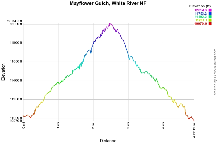
The Mayflower Gulch Trail is a direct and relatively easy trail into a basin surrounded by sawtooth peaks. Start hiking up the dirt road through the forest and along a creek and riparian area. After about 1 mi, you break out of the trees, cross the creek, and will be situated at an old abandoned mining town. There are various ruins that you can explore and this makes a great destination if you are hiking with kids. If you're like me, the call of the sawtooth ridge will be impossible to ignore and you'll want to follow the trail as far as you can. The trail continues for another 1.5 miles and steadily ascends towards the cirque. There are great views back down the basin of Jacque Peak and the ridge ahead is actually made up of Atlantic Peak and Fletcher Mountain. You can't see it, but directly behind Fletcher Mountain is Quandary Peak (14,265ft). The road takes you up but soon you'll reach a gated area with conflicting signs. This is an old mine and you should be careful about where you explore. At the gate signs say No Trespassing, but there is also a Summit County Open Space sign. I believe that this land was bought by Summit County, but that it has not yet been developed into an open space area open to the public. This makes for a good stopping point on this trail but you can further explore this area as there are trails that lead up to the ridge on the west side of the basin. |
- HOME
- ABOUT
-
HIKES BY REGION
-
NATIONAL PARK HIKES
- BENT'S OLD FORT NATIONAL HISTORIC SITE
- BLACK CANYON OF THE GUNNISON NATIONAL PARK
- COLORADO NATIONAL MONUMENT
- CURECANTI NATIONAL RECREATION AREA
- DINOSAUR NATIONAL MONUMENT
- FLORISSANT FOSSIL BEDS NATIONAL MONUMENT
- MESA VERDE NATIONAL PARK
- ROCKY MOUNTAIN NATIONAL PARK
- GREAT SAND DUNES NATIONAL PARK
- HOVENWEEP NATIONAL MONUMENT
- SAND CREEK MASSACRE NATIONAL HISTORIC SITE
- YUCCA HOUSE NATIONAL MONUMENT
- HIKES BY CATEGORY
- NEWS
- WEBCAMS
- $UPPORT GHC
- INTERACTIVE MAP
Mayflower Gulch
White River National Forest
Date Hiked: June 15, 2013
Distance: 5 mi (RT)
Elevation Gain: 1,200ft
Elevation Min/Max: 10,955 to 12,018ft
Trailhead Lat/Long: 39.430578º N; 106.165553º W
Managing Agency: U.S. Forest Service
Fee: None


