GO HIKE COLORADO
Get in Touch:
  • HOME
  • ABOUT
  • HIKES BY REGION
    • DENVER AREA >
      • Denver Mountain Parks
      • Jefferson County Open Space
      • Lakewood Parks
      • Denver Area Greenways
    • BOULDER AREA
    • DOUGLAS COUNTY
    • FORT COLLINS AREA
    • COLORADO SPRINGS AREA
    • FRONT RANGE
    • TENMILE & MOSQUITO RANGES
    • GORE RANGE
    • SANGRE DE CRISTO MOUNTAINS
    • PARK RANGE
    • SAWATCH RANGE
    • ELK MOUNTAINS
    • SAN JUAN MOUNTAINS
    • THE FLAT TOPS
    • GRAND MESA
    • COLORADO PLATEAU
    • EASTERN PLAINS
  • NATIONAL PARK HIKES
    • BENT'S OLD FORT NATIONAL HISTORIC SITE
    • BLACK CANYON OF THE GUNNISON NATIONAL PARK
    • COLORADO NATIONAL MONUMENT
    • CURECANTI NATIONAL RECREATION AREA
    • DINOSAUR NATIONAL MONUMENT
    • FLORISSANT FOSSIL BEDS NATIONAL MONUMENT
    • MESA VERDE NATIONAL PARK
    • ROCKY MOUNTAIN NATIONAL PARK
    • GREAT SAND DUNES NATIONAL PARK
    • HOVENWEEP NATIONAL MONUMENT
    • SAND CREEK MASSACRE NATIONAL HISTORIC SITE
    • YUCCA HOUSE NATIONAL MONUMENT
  • HIKES BY CATEGORY
    • HIKES TO ALPINE LAKES
    • HIKES TO PEAKS & PASSES
    • HIKES THROUGH CANYONS
    • HIKES WITH FALL COLORS
    • HIKES ALONG THE I-70 CORRIDOR
    • HIKES ON PAVED TRAILS
    • HIKES FOR KIDS
    • HIKES TO WATERFALLS
    • HIKES ALONG RIVERS
    • HIKES WITH ROCK FORMATIONS
    • HIKES WITH WILDFLOWERS
    • WINTER HIKES
  • NEWS
  • WEBCAMS
  • $UPPORT GHC
  • INTERACTIVE MAP

Zorro Trail to Dakota Ridge Summit
Matthews-Winters Park

Date Hiked: March 20, 2014

​Distance: 2.4 mi (RT)

Elevation Gain: 580 ft
Elevation Min/Max: 6,032 to 6,603ft
Managing Agence: Jefferson County Open Space
Fee: None

Matthews-Winters Park Website
Picture

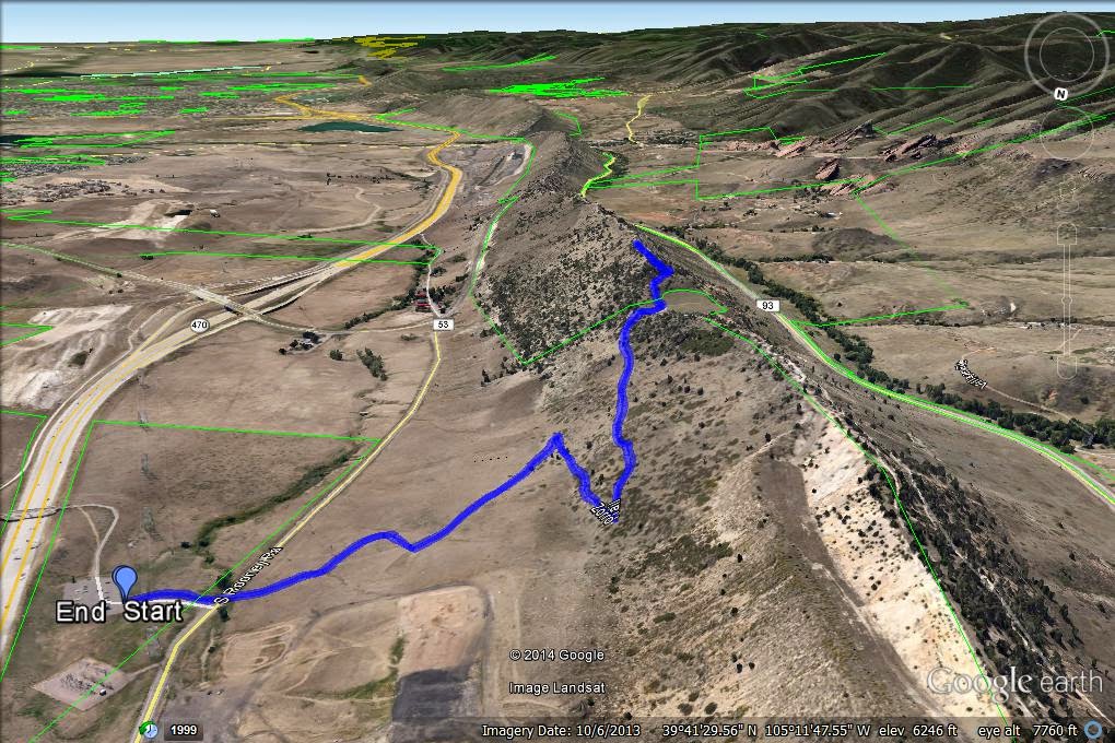
Directions:  The Zorro Trail starts across the road from the large parking area for William F. Hayden Park at Green Mountain (aka Green Mountain).  From Denver, take I-70 W to C470 South.  Then take the W. Alameda Pkwy exit towards Dinosaur Ridge.  Go West on Alameda Parkway to the end of the road and turn North onto S. Rooney Rd.  The parking area is off to the right and the trail to the left.

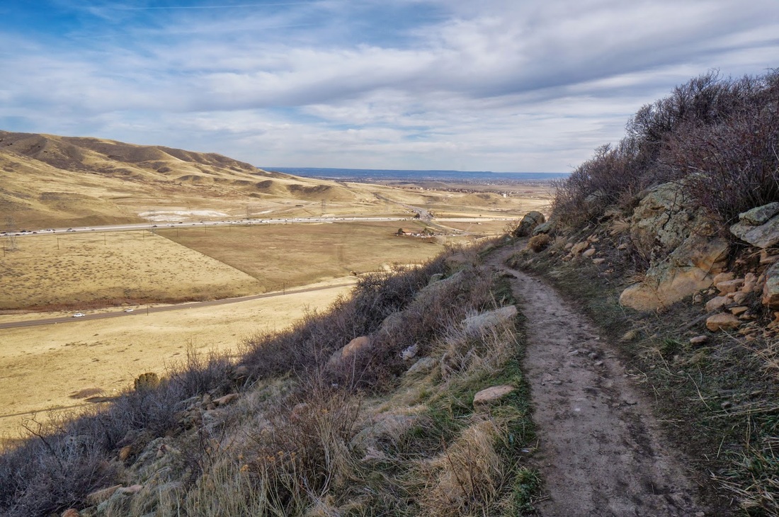
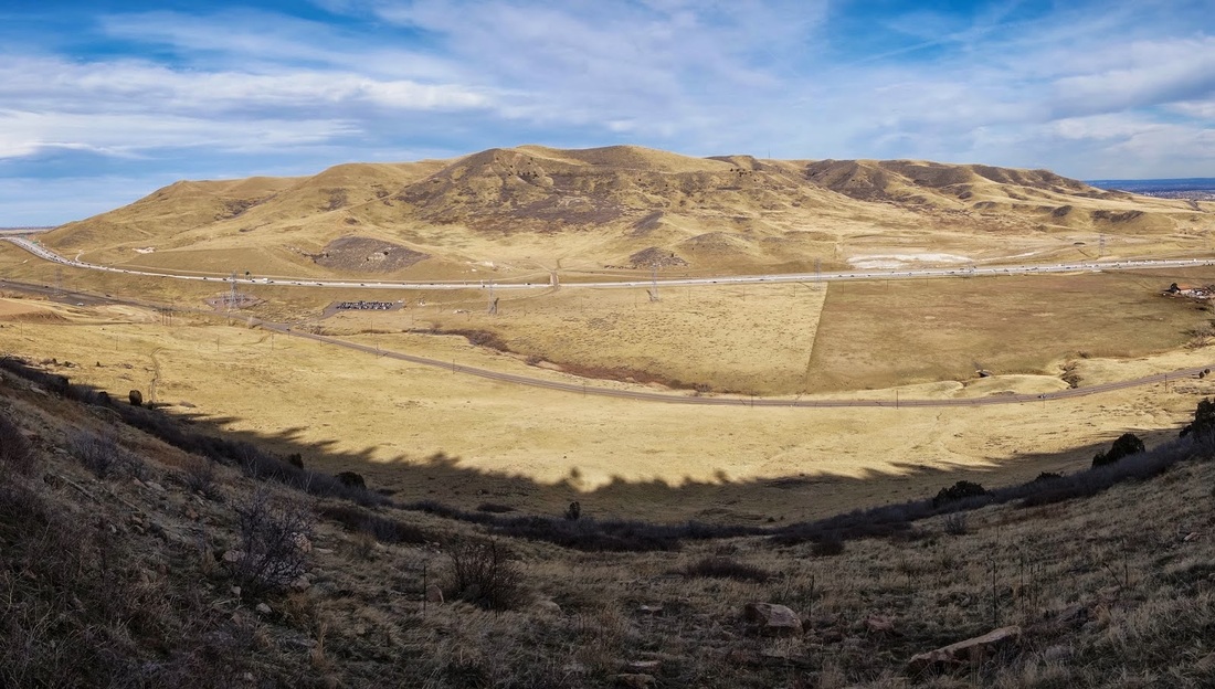
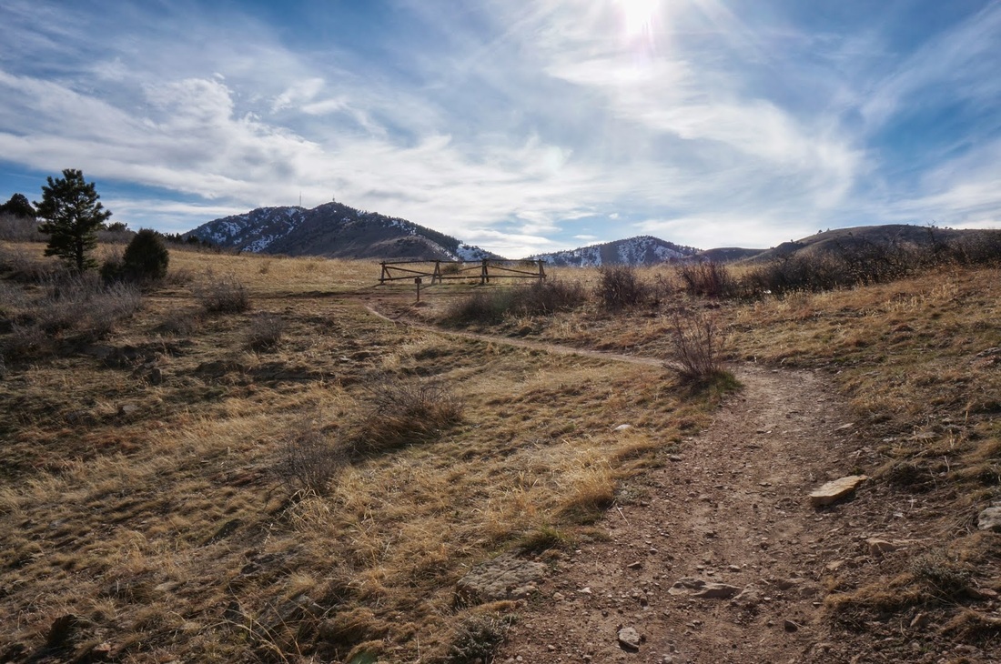
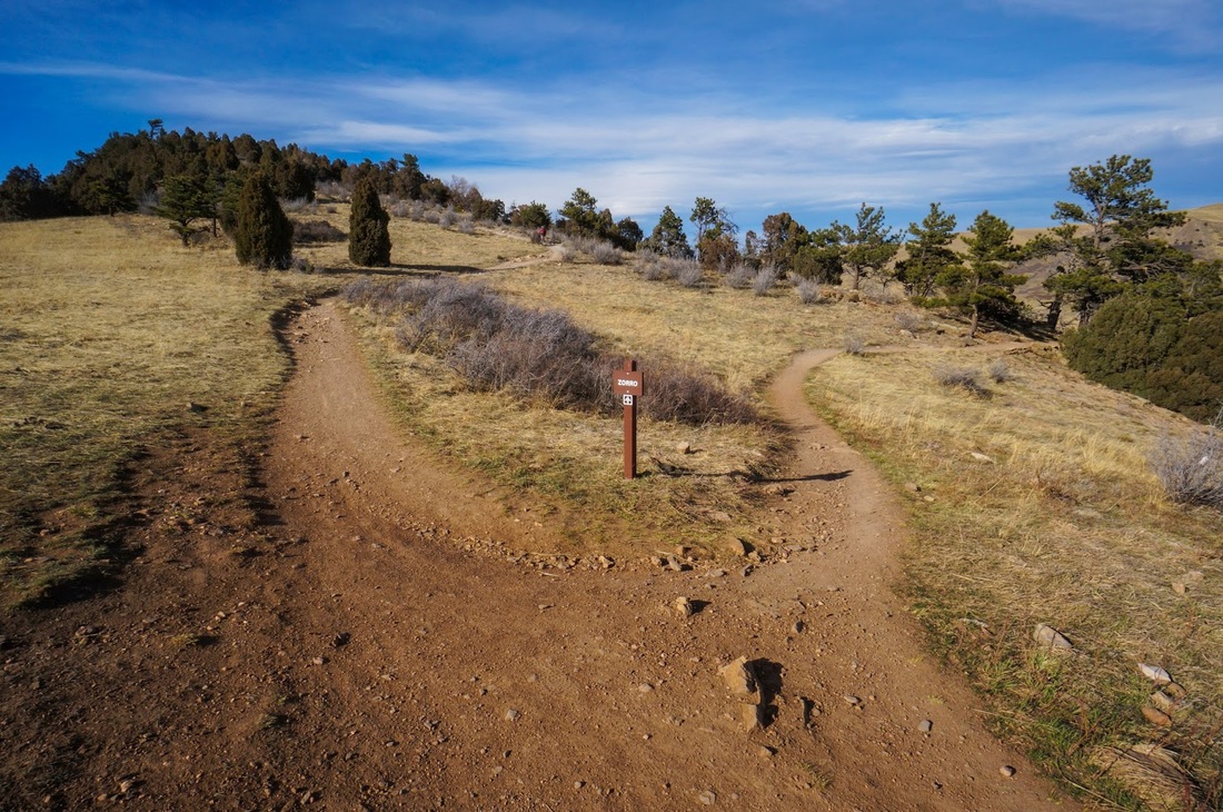
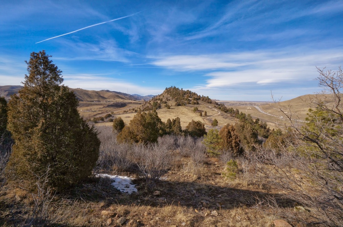
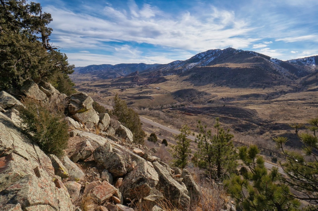
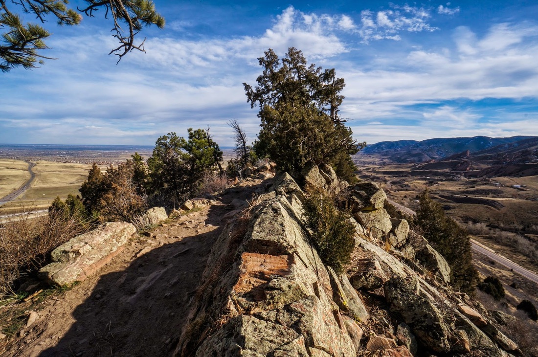
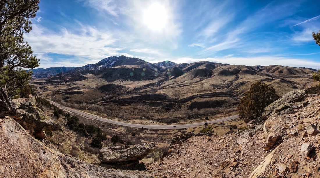
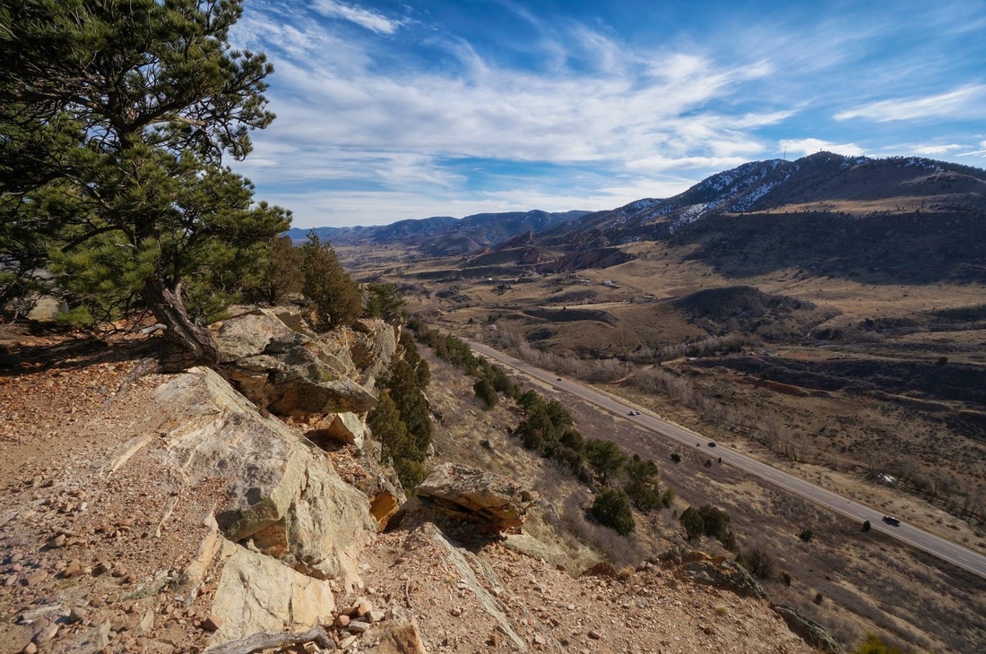
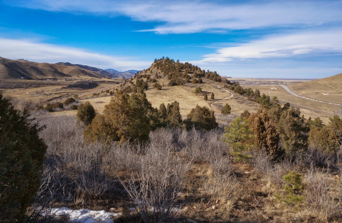
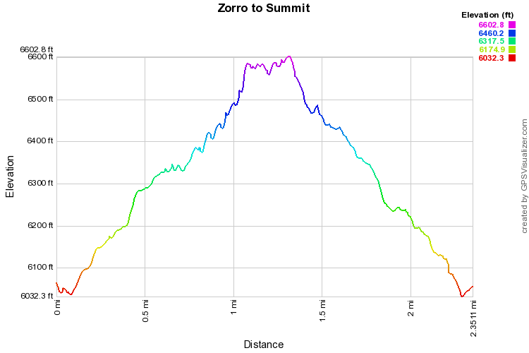
The Zorro Trail is basically a spur trail that accesses Dakota Ridge, aka Dinosaur Ridge, aka the Hogback.  The Dakota Ridge Trail itself is almost 2 mi long and is an extremely fun trail to hike.  Be warned however, there are lots of Mountain Bikers along this trail.  Once on the ridge the trail is mostly flat with a few steep areas and very rocky, you hike along slickrock and slabs with great views of Red Rocks, Green Mountain, Mount Morrison and up and down the various valleys.  I like this hike as a quick after-work workout,it is short and sweet and it takes you to the high point of Dakota Ridge. 
Powered by Create your own unique website with customizable templates.