|
DIRECTIONS: From Mesa, CO go 19 miles S on Hwy 65, turn left on Lands End Road. (Forest Rt. 100). Go 10 miles , the buildings are at the farthest most point of Lands End off to the right before the road starts down the hill. The road to Lands End is a mix of pavement and good dirt road. Most cars should have no problems in good weather.
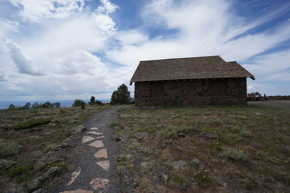
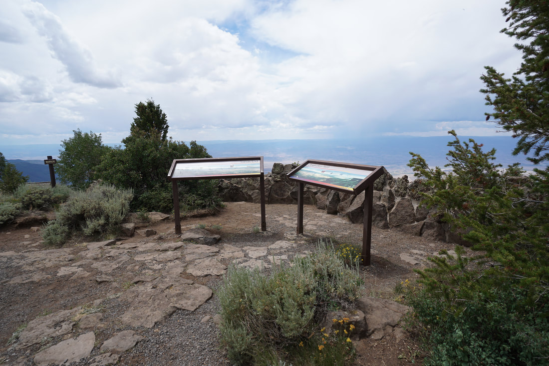
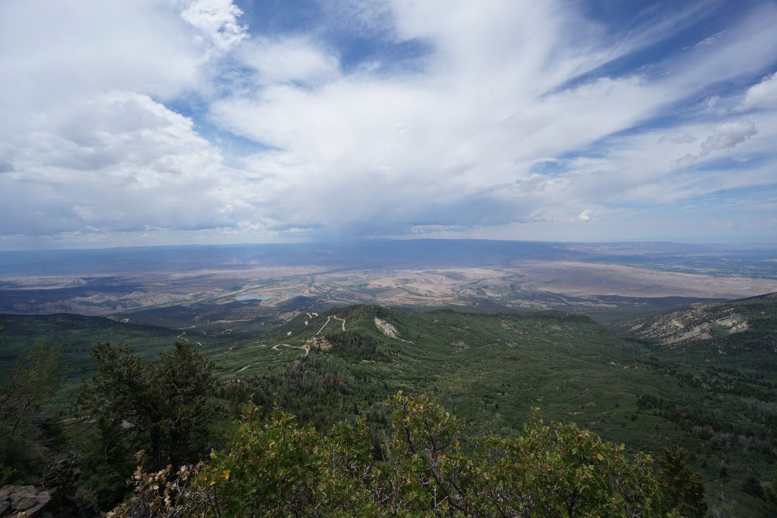
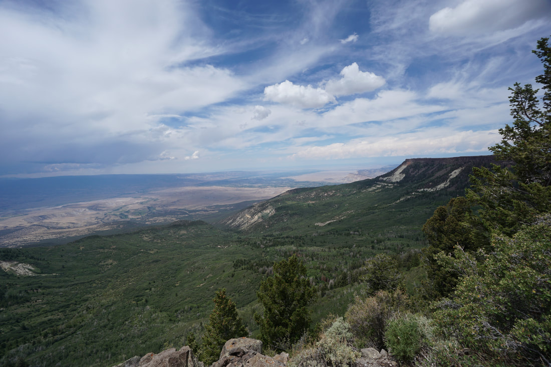
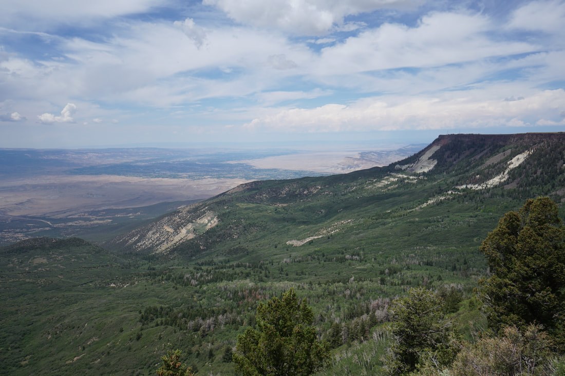
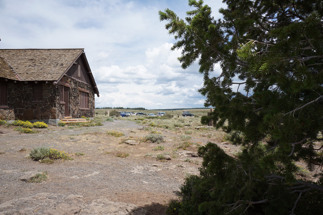
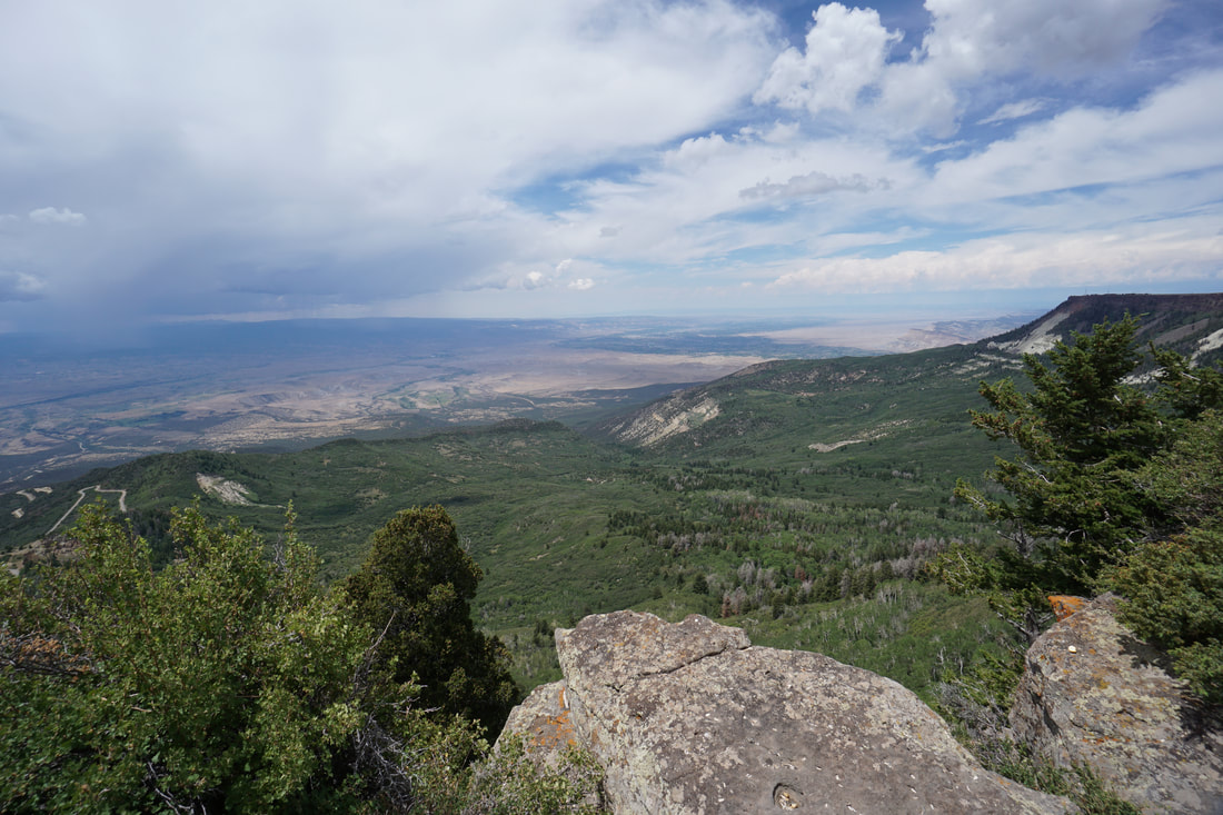
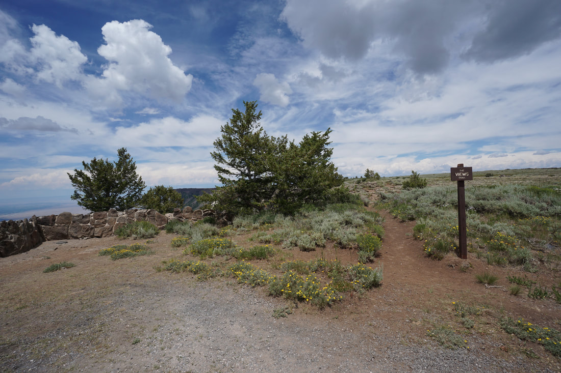
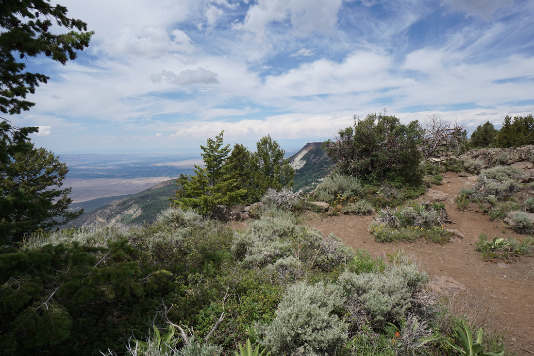
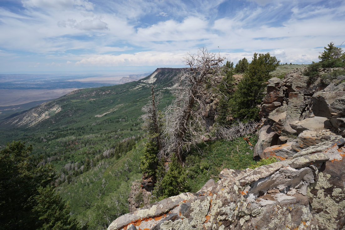
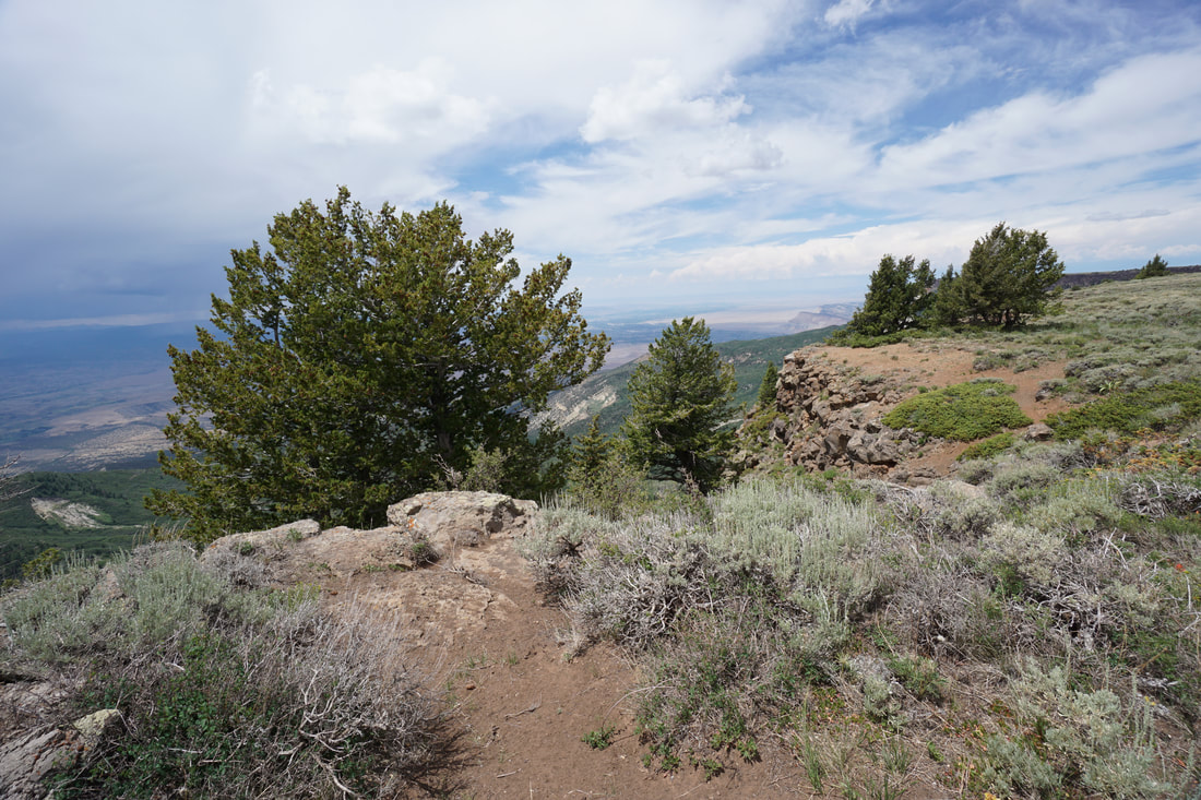
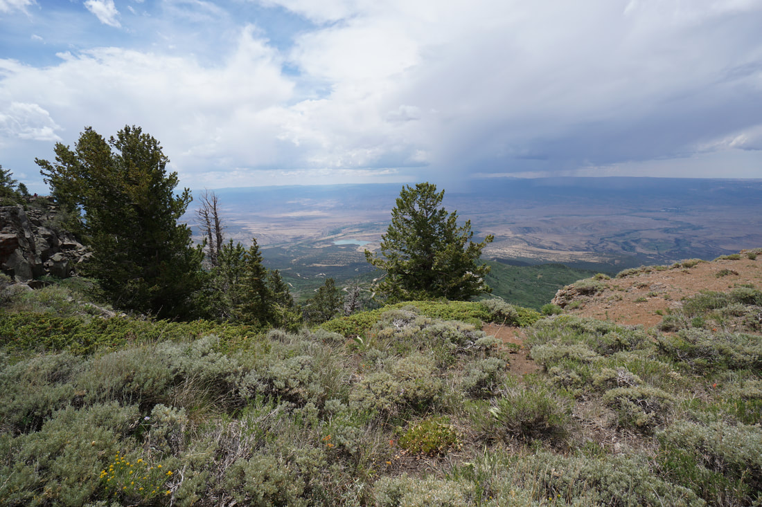
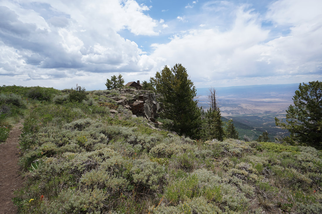
The Lands End Observatory is a must visit spot for all Grand Mesa visitors. The historic site sits at the western edge of the mesa and towers over the Grand Valley, thousands of feet below. The view is nothing short of incredible. The observatory sees a lot of visitors but if you want to get away from the crowds, a short trail called the "Views Trail" can be found at the northern end of the observatory. This trail is not on any of the maps of the area that I have seen...a nice surprise...
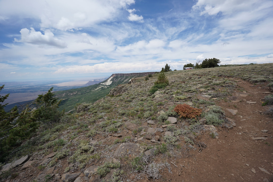
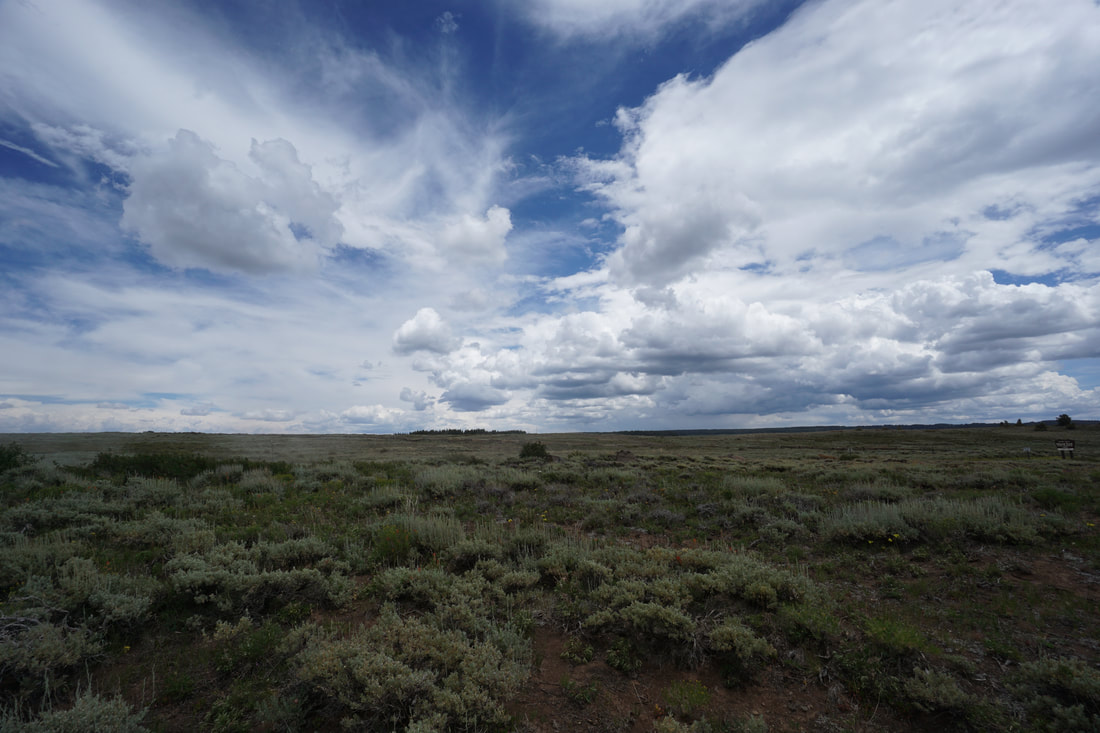
The trail is short but beautiful as it runs along the edge of the mesa through a scrubby landscape. As you hike along the mesa rim you'll get one-of-a-kind views across the Grand Valley. Colorado National Monument, the Uncompahgre Plateau, and the Manti La Sal Mountains are just a few examples of the sights to see. No visit to Grand Mesa is complete without a stop at Lands End and the Views Trail makes it even more appealing. |
|
- HOME
- ABOUT
-
HIKES BY REGION
-
NATIONAL PARK HIKES
- BENT'S OLD FORT NATIONAL HISTORIC SITE
- BLACK CANYON OF THE GUNNISON NATIONAL PARK
- COLORADO NATIONAL MONUMENT
- CURECANTI NATIONAL RECREATION AREA
- DINOSAUR NATIONAL MONUMENT
- FLORISSANT FOSSIL BEDS NATIONAL MONUMENT
- MESA VERDE NATIONAL PARK
- ROCKY MOUNTAIN NATIONAL PARK
- GREAT SAND DUNES NATIONAL PARK
- HOVENWEEP NATIONAL MONUMENT
- SAND CREEK MASSACRE NATIONAL HISTORIC SITE
- YUCCA HOUSE NATIONAL MONUMENT
- HIKES BY CATEGORY
- NEWS
- WEBCAMS
- $UPPORT GHC
- INTERACTIVE MAP
Lands End / Views Trail
Grand Mesa National Forest
Date Hiked: July 17, 2020
Distance: .4 mi (RT)
Elevation Gain: Minimal
Elevation: 9,930 ft
Trailhead Lat/Long: 39.02535, -108.22353
Managing Agency: U.S. Forest Service
Fee: None