GO HIKE COLORADO
Get in Touch:
  • HOME
  • ABOUT
  • HIKES BY REGION
    • DENVER AREA >
      • Denver Mountain Parks
      • Jefferson County Open Space
      • Lakewood Parks
      • Denver Area Greenways
    • BOULDER AREA
    • DOUGLAS COUNTY
    • FORT COLLINS AREA
    • COLORADO SPRINGS AREA
    • FRONT RANGE
    • TENMILE & MOSQUITO RANGES
    • GORE RANGE
    • SANGRE DE CRISTO MOUNTAINS
    • PARK RANGE
    • SAWATCH RANGE
    • ELK MOUNTAINS
    • SAN JUAN MOUNTAINS
    • THE FLAT TOPS
    • GRAND MESA
    • COLORADO PLATEAU
    • EASTERN PLAINS
  • NATIONAL PARK HIKES
    • BENT'S OLD FORT NATIONAL HISTORIC SITE
    • BLACK CANYON OF THE GUNNISON NATIONAL PARK
    • COLORADO NATIONAL MONUMENT
    • CURECANTI NATIONAL RECREATION AREA
    • DINOSAUR NATIONAL MONUMENT
    • FLORISSANT FOSSIL BEDS NATIONAL MONUMENT
    • MESA VERDE NATIONAL PARK
    • ROCKY MOUNTAIN NATIONAL PARK
    • GREAT SAND DUNES NATIONAL PARK
    • HOVENWEEP NATIONAL MONUMENT
    • SAND CREEK MASSACRE NATIONAL HISTORIC SITE
    • YUCCA HOUSE NATIONAL MONUMENT
  • HIKES BY CATEGORY
    • HIKES TO ALPINE LAKES
    • HIKES TO PEAKS & PASSES
    • HIKES THROUGH CANYONS
    • HIKES WITH FALL COLORS
    • HIKES ALONG THE I-70 CORRIDOR
    • HIKES ON PAVED TRAILS
    • HIKES FOR KIDS
    • HIKES TO WATERFALLS
    • HIKES ALONG RIVERS
    • HIKES WITH ROCK FORMATIONS
    • HIKES WITH WILDFLOWERS
    • WINTER HIKES
  • NEWS
  • WEBCAMS
  • $UPPORT GHC
  • INTERACTIVE MAP

Lake Agnes
State Forest State Park

Date Hiked: July 13, 2014 ​

Distance: 1.6 mi (RT)

  • Elevation Gain: 480 ft
  • Elevation Min/Max: 10,232 to 10,656 ft
  • Trailhead Lat/Long: 40º 29' 03" N; 105º 54' 10" W
  • Managing Agency: Colorado Division of Parks and Wildlife
  • Fee: Yes

State Forest State Park Map
Picture

Directions:  From Fort Collins journey west through Poudre Canyon for about 60 miles on Hwy 14 to Cameron Pass.  2.5 miles west of Cameron Pass, you'll see the turn off for Lake Agnes.  Make a left into the park (fee required) onto a good dirt road.  Follow the road down to a sign pointing to the right for Lake Agnes.  This road is closed in the winter but when open it will take you up to the Lake Agnes Trailhead.  The road is bout 1 mile long and it is a rough but passable narrow/steep dirt road.  There were some passenger cars in the lot but having an SUV or truck is highly recommended.

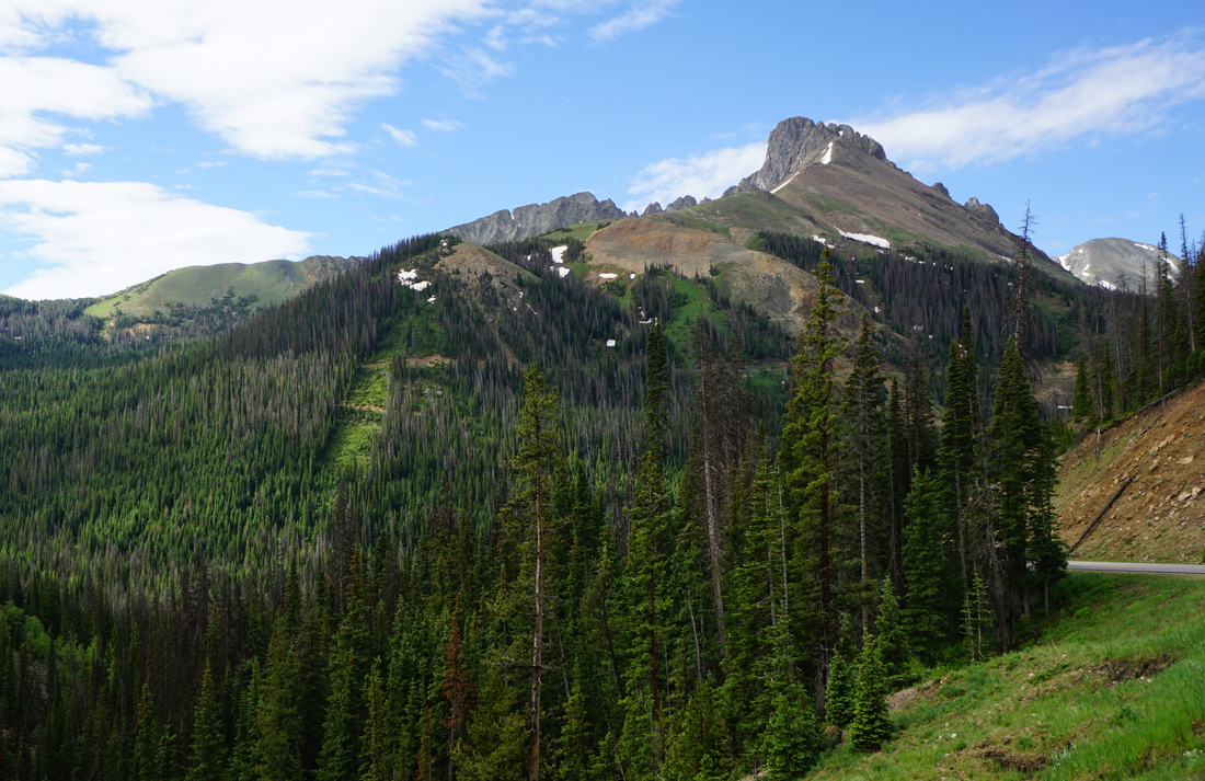
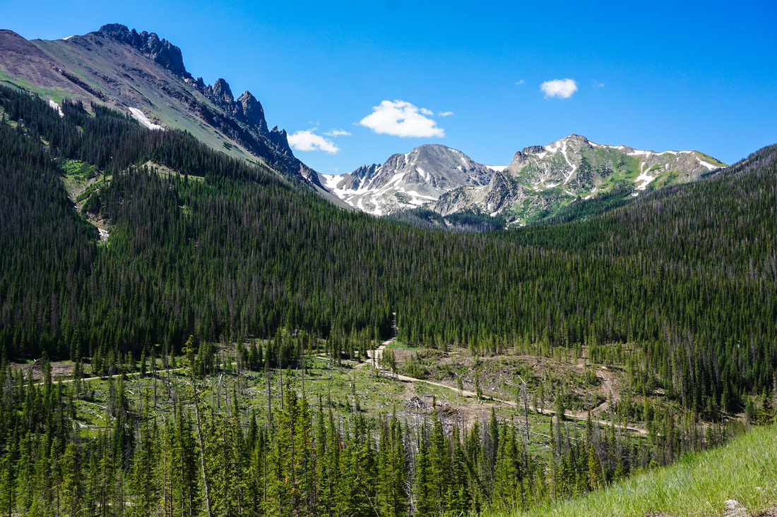
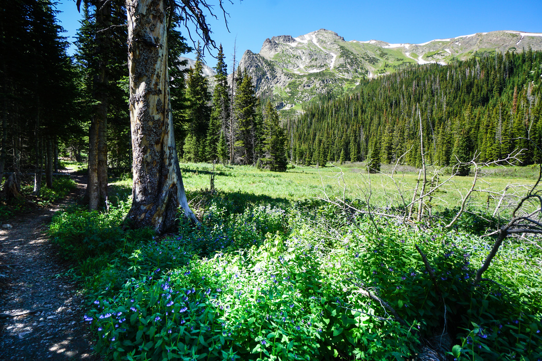
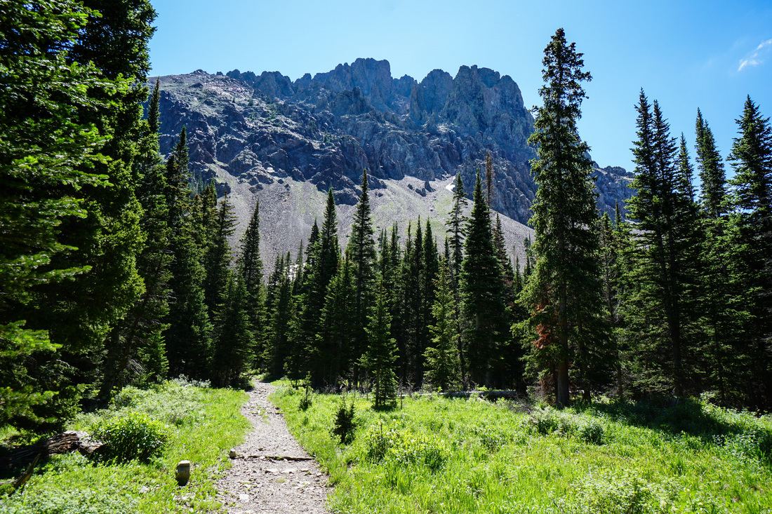
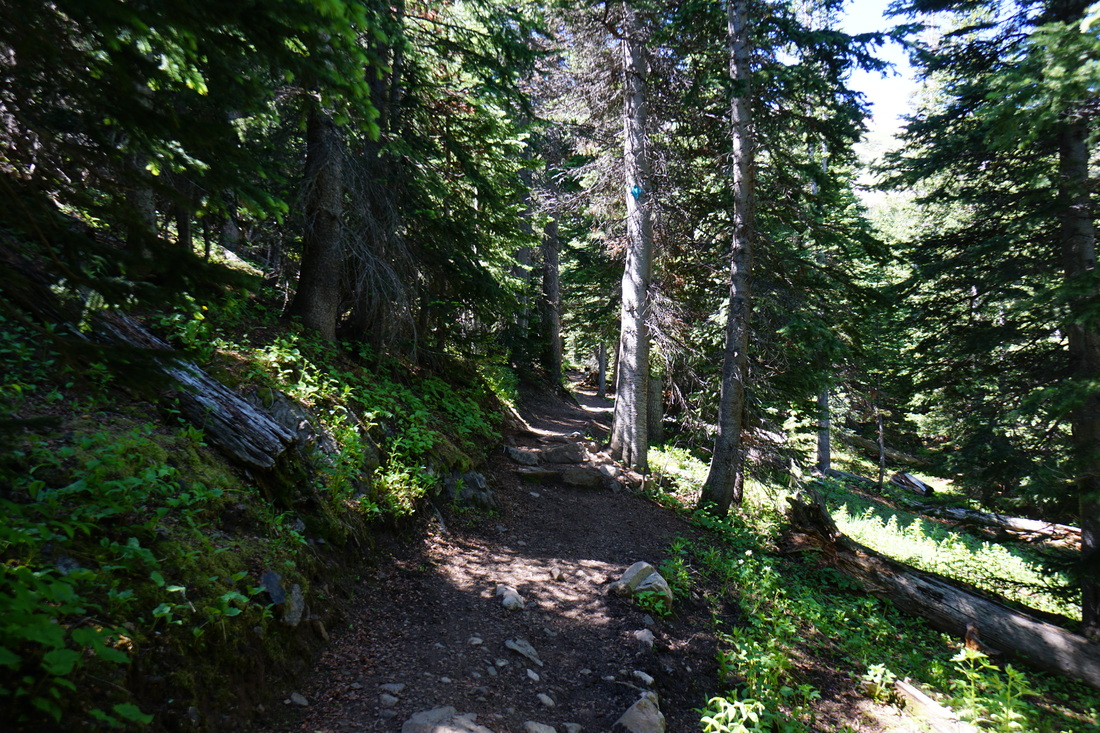
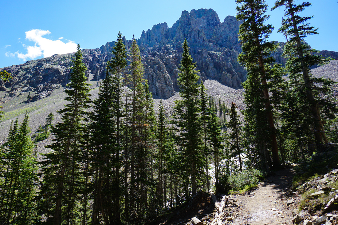
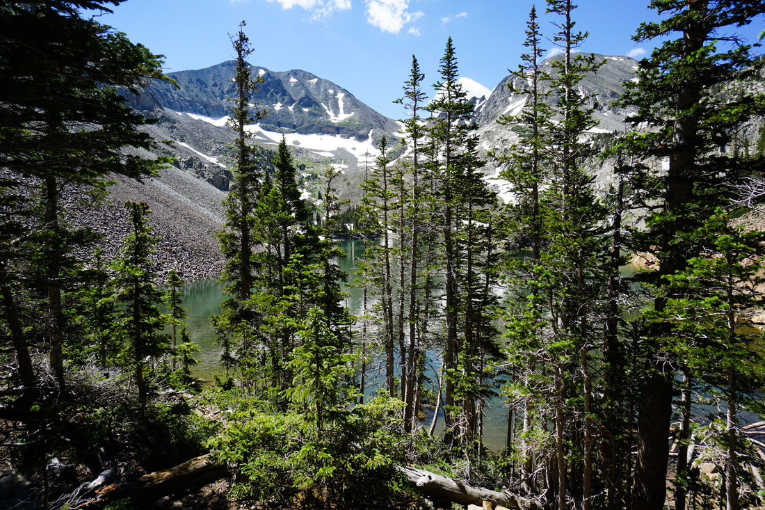
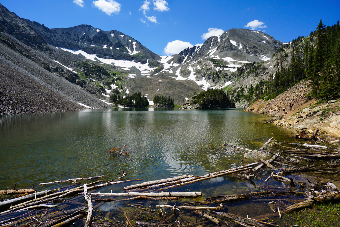
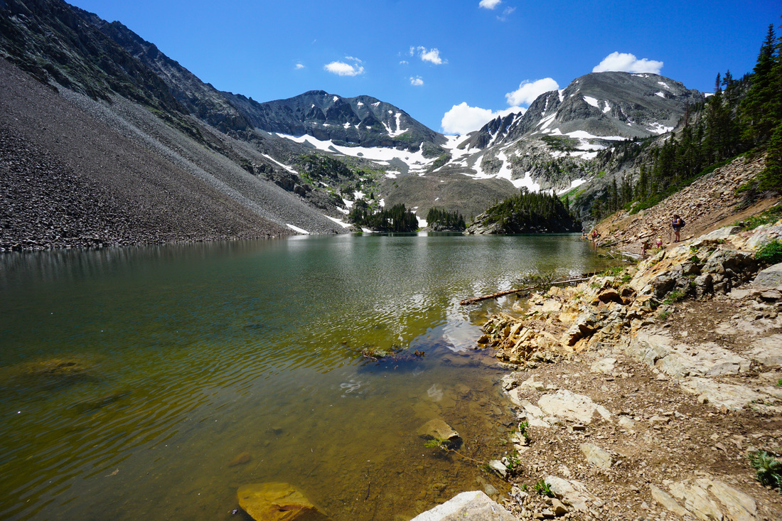
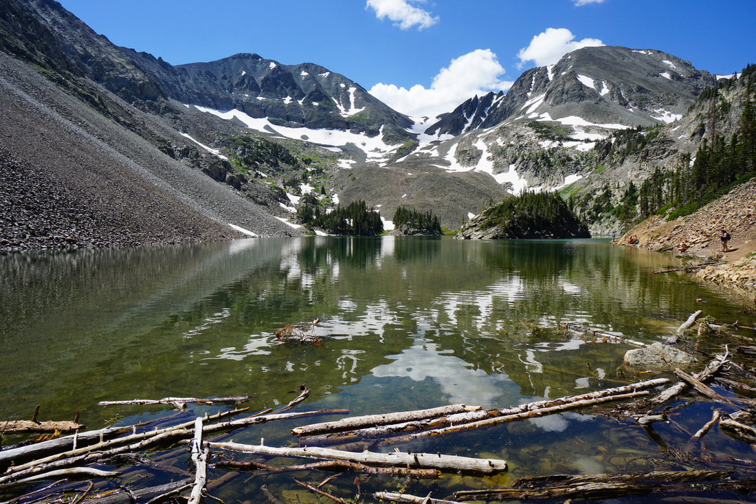
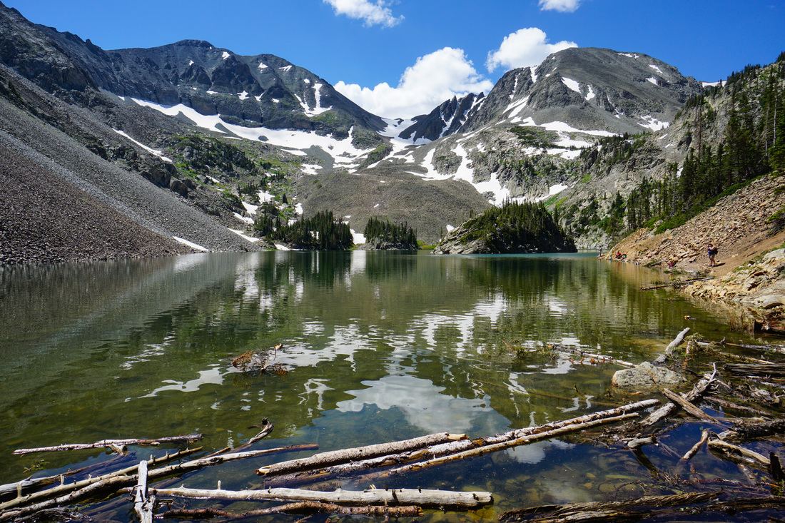
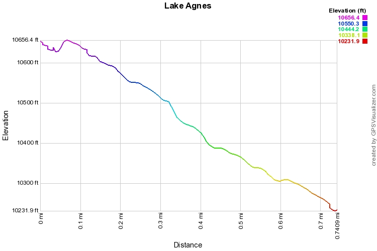
Lake Agnes falls into the "why wouldn't you" category of Colorado hikes.  The trail is short (.8 miles one way) and relatively easy.  You gain a good amount of altitude in a short while, but the switchbacks are well graded.  The hike is very popular and you'll understand why when you are hiking it, extraordinary bang for your buck.  As you march up the switchbacks, you'll be gawking at the Nokhu Crags towering above you, these are truly spectacular and will make you want to take up rock climbing.  When you reach the lake you'll be surrounded by high peaks and wonder at just how easy it is to get to a place so beautiful.  You can pick your way around the lake or just find a rock and relax, hopefully there won't be too many other people around, but you should expect it.

There are longer hikes to be done in this group of peaks and I can't wait to come back and explore further.  The hike to Snow Lake and Thunder Pass from the Crags Campground is now high on my priority list.

Powered by Create your own unique website with customizable templates.