GO HIKE COLORADO
Get in Touch:
  • HOME
  • ABOUT
  • HIKES BY REGION
    • DENVER AREA >
      • Denver Mountain Parks
      • Jefferson County Open Space
      • Lakewood Parks
      • Denver Area Greenways
    • BOULDER AREA
    • DOUGLAS COUNTY
    • FORT COLLINS AREA
    • COLORADO SPRINGS AREA
    • FRONT RANGE
    • TENMILE & MOSQUITO RANGES
    • GORE RANGE
    • SANGRE DE CRISTO MOUNTAINS
    • PARK RANGE
    • SAWATCH RANGE
    • ELK MOUNTAINS
    • SAN JUAN MOUNTAINS
    • THE FLAT TOPS
    • GRAND MESA
    • COLORADO PLATEAU
    • EASTERN PLAINS
  • NATIONAL PARK HIKES
    • BENT'S OLD FORT NATIONAL HISTORIC SITE
    • BLACK CANYON OF THE GUNNISON NATIONAL PARK
    • COLORADO NATIONAL MONUMENT
    • CURECANTI NATIONAL RECREATION AREA
    • DINOSAUR NATIONAL MONUMENT
    • FLORISSANT FOSSIL BEDS NATIONAL MONUMENT
    • MESA VERDE NATIONAL PARK
    • ROCKY MOUNTAIN NATIONAL PARK
    • GREAT SAND DUNES NATIONAL PARK
    • HOVENWEEP NATIONAL MONUMENT
    • SAND CREEK MASSACRE NATIONAL HISTORIC SITE
    • YUCCA HOUSE NATIONAL MONUMENT
  • HIKES BY CATEGORY
    • HIKES TO ALPINE LAKES
    • HIKES TO PEAKS & PASSES
    • HIKES THROUGH CANYONS
    • HIKES WITH FALL COLORS
    • HIKES ALONG THE I-70 CORRIDOR
    • HIKES ON PAVED TRAILS
    • HIKES FOR KIDS
    • HIKES TO WATERFALLS
    • HIKES ALONG RIVERS
    • HIKES WITH ROCK FORMATIONS
    • HIKES WITH WILDFLOWERS
    • WINTER HIKES
  • NEWS
  • WEBCAMS
  • $UPPORT GHC
  • INTERACTIVE MAP

Kenosha Pass South
CO Trail Segment 5, Pike National Forest

Date Hiked: September 19, 2014

  • Distance: 2.75 mi (RT)
  • Elevation Gain: 500 ft
  • Elevation Min/Max: 9,991 to 10,173ft
  • Trailhead Lat/Long: 39º 24' 49" N; 105º 45' 16" W
  • Managing Agency: U.S. Forest Service
  • Fee: None

Kenosha Pass Webpage (USFS)
Picture

Directions:  From Denver take I-70 W to C-470 E to 285 South.  Stay on 285 South all the way to Kenosha Pass.  Turn left when you reach the CO Trail and follow the dirt road to the Kenosha Pass Campground.  The Colorado Trail starts across from the restrooms at the entrance to the parking area.

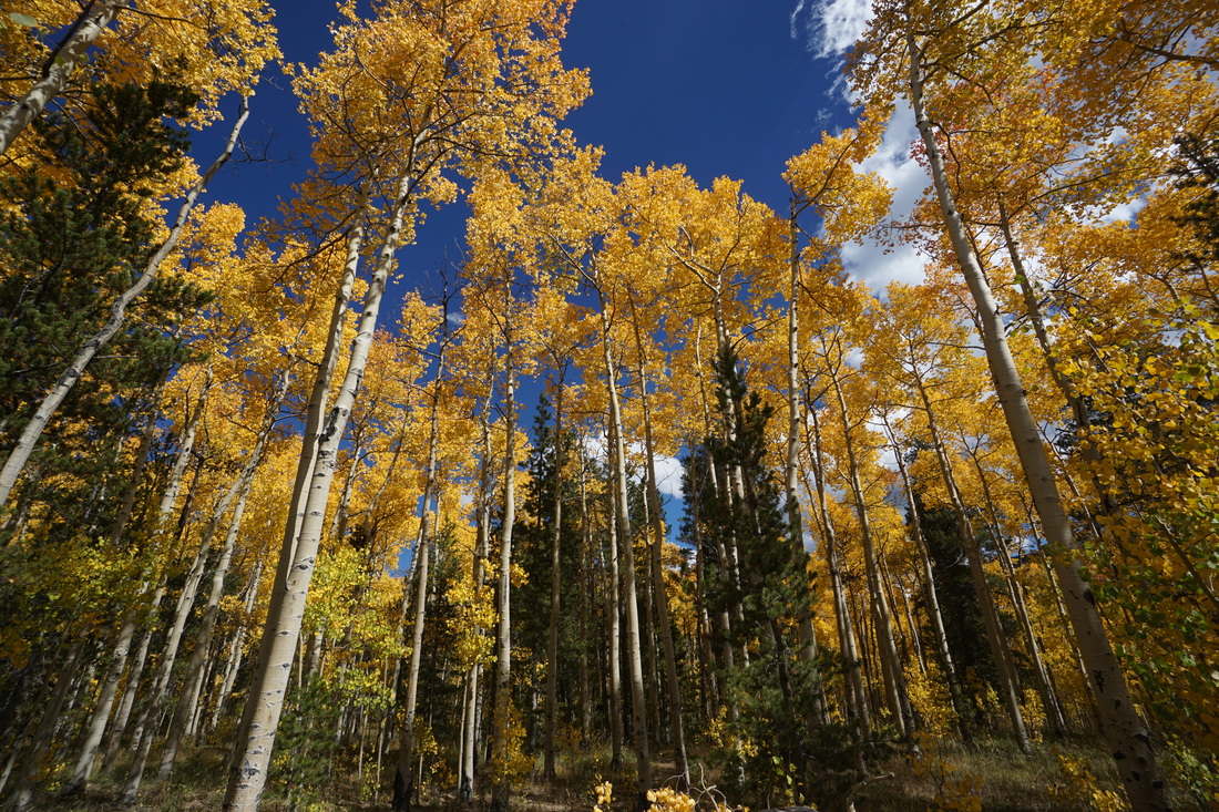
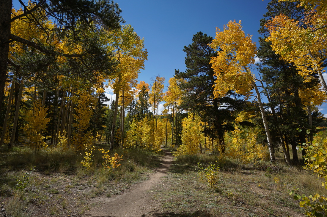
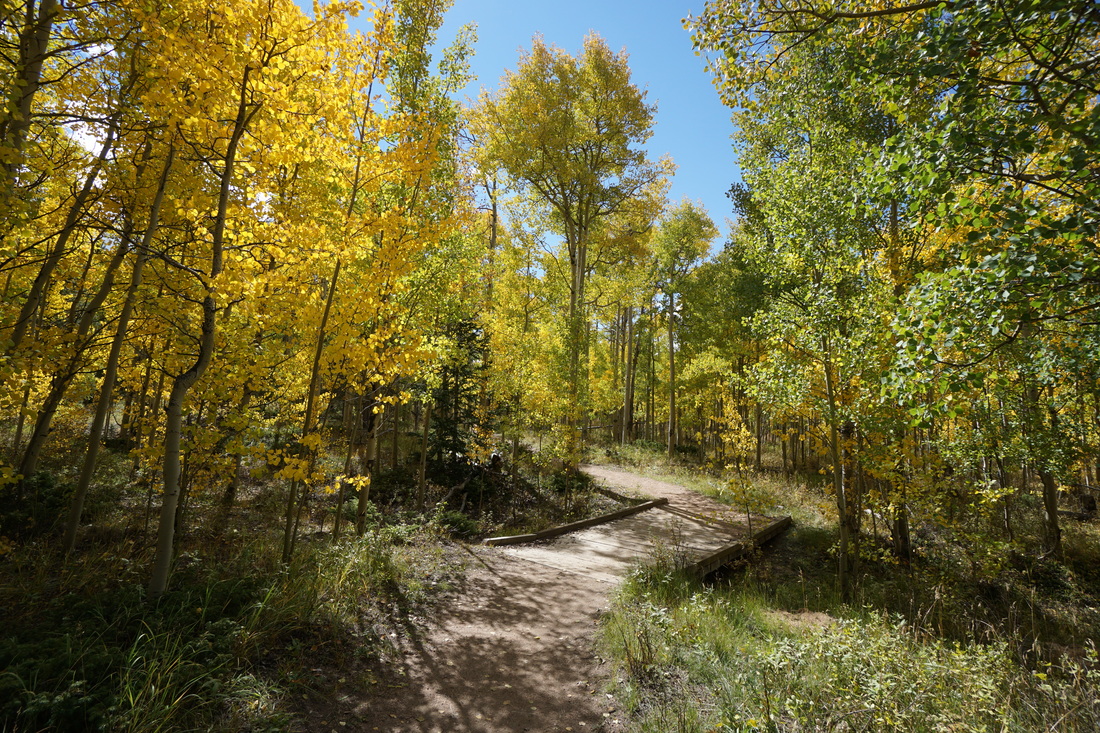
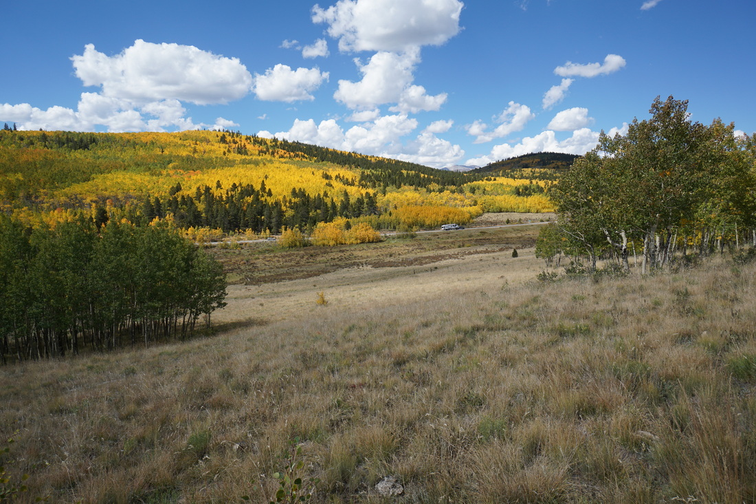
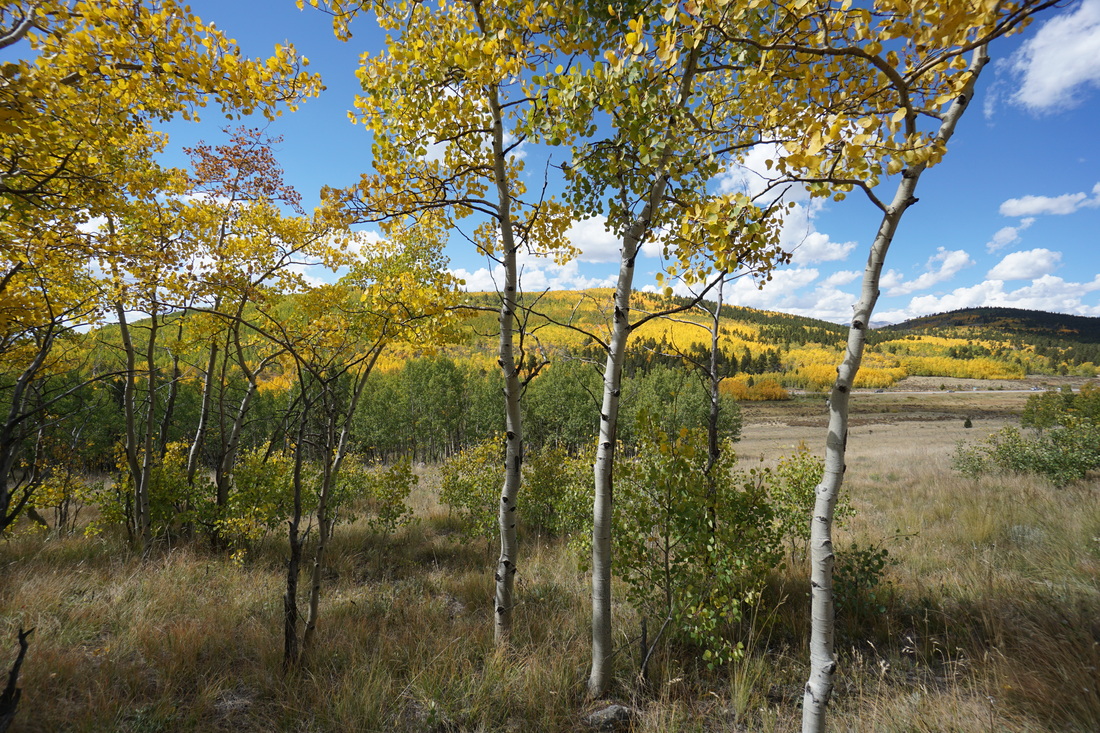
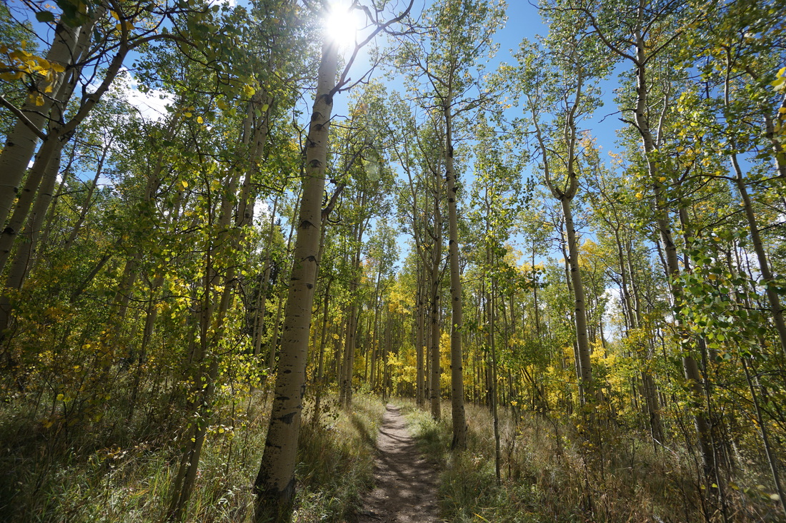
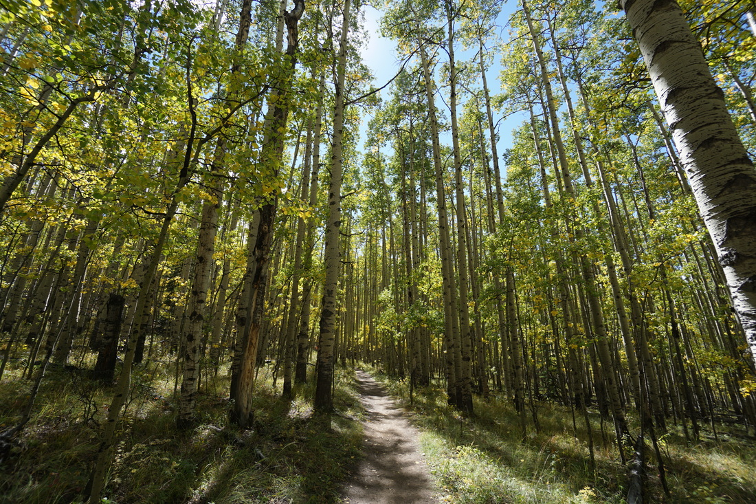
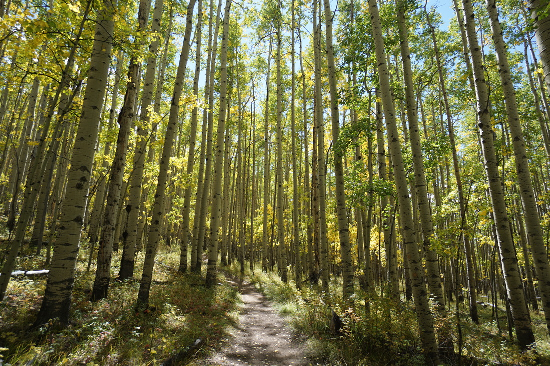
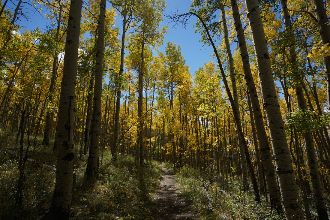
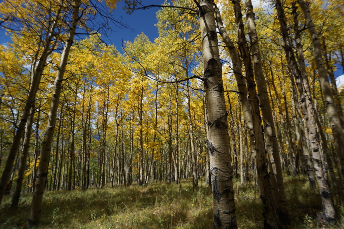
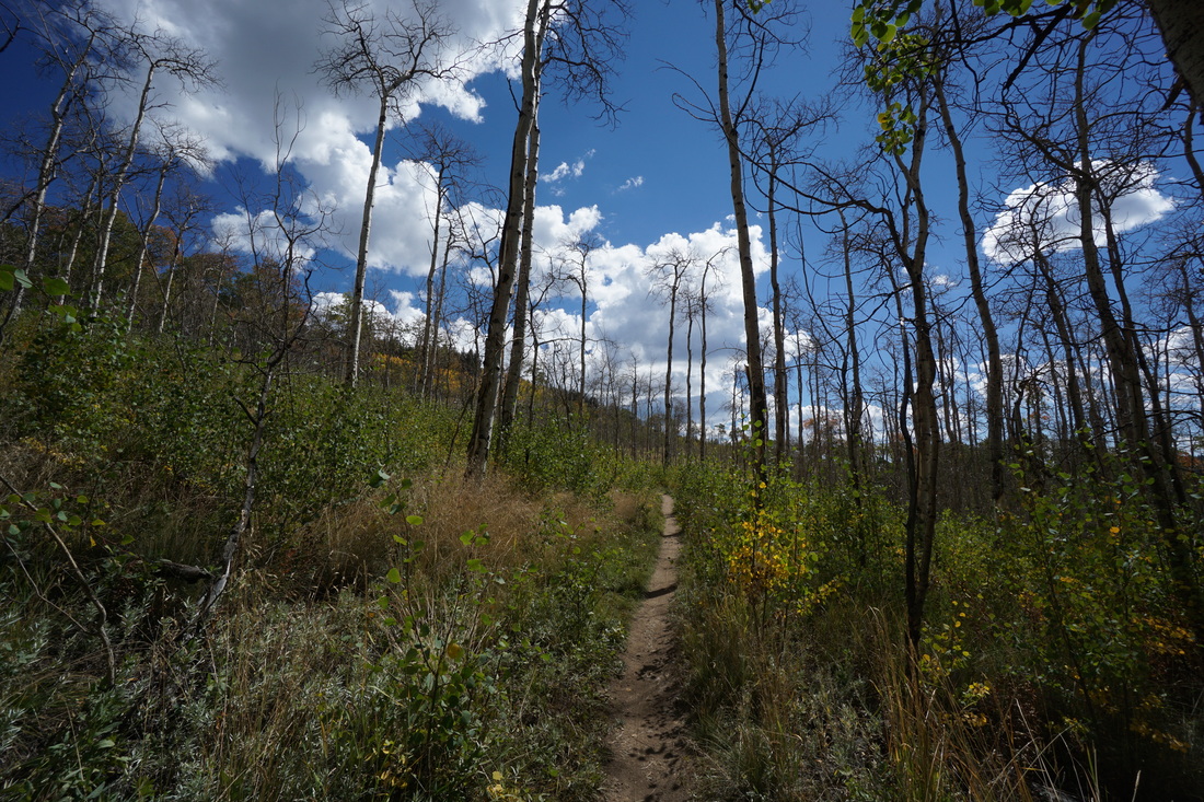
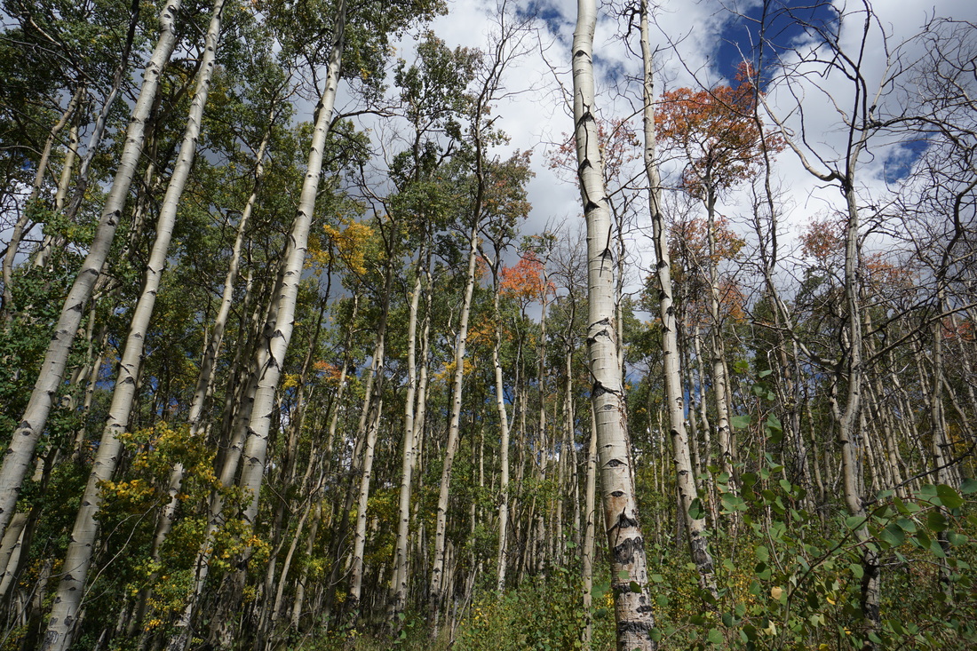
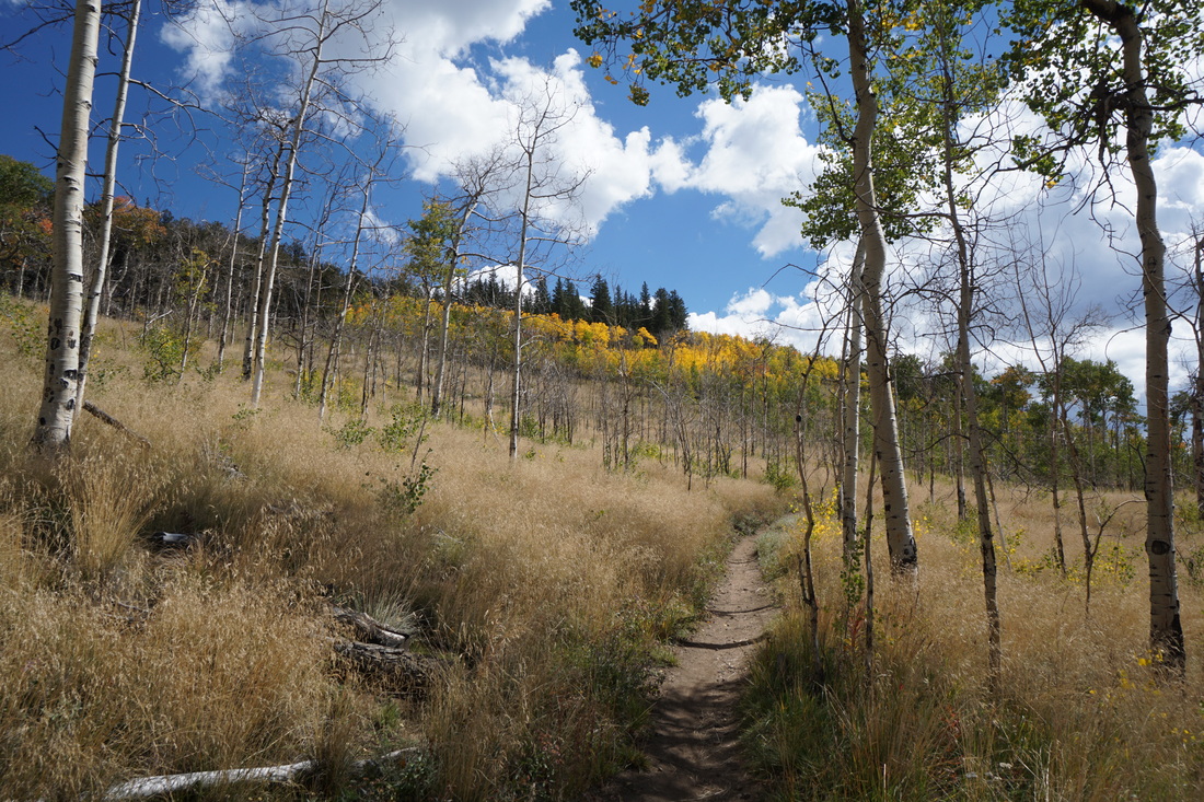
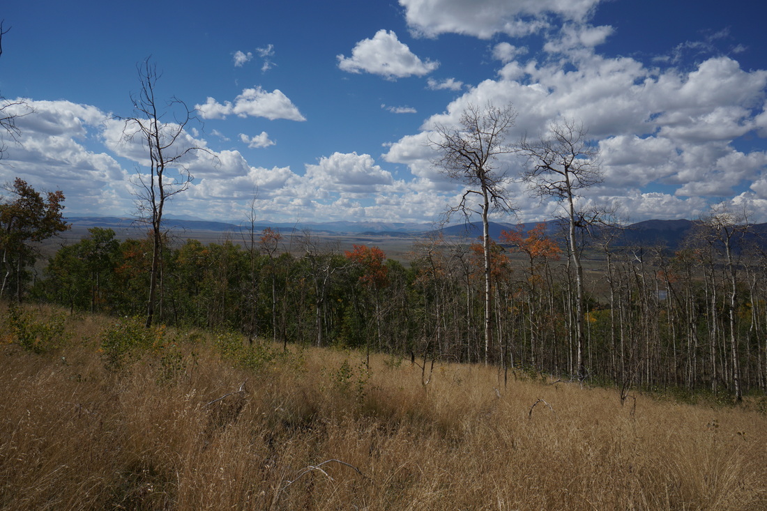
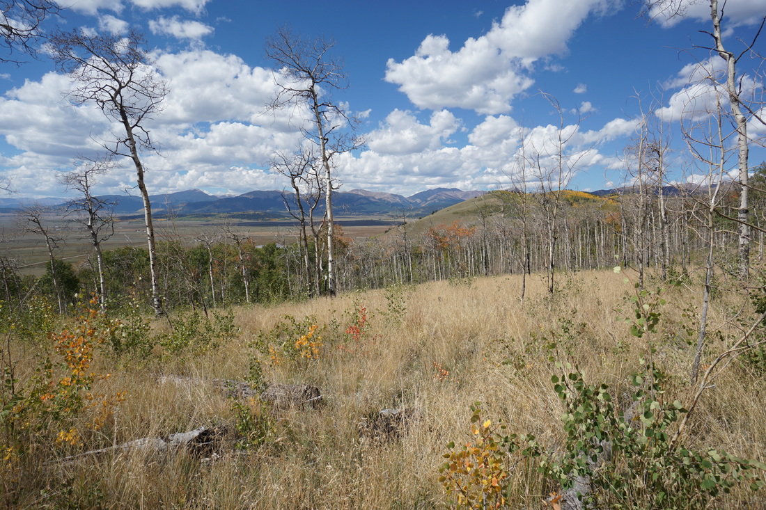
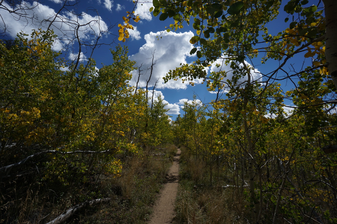
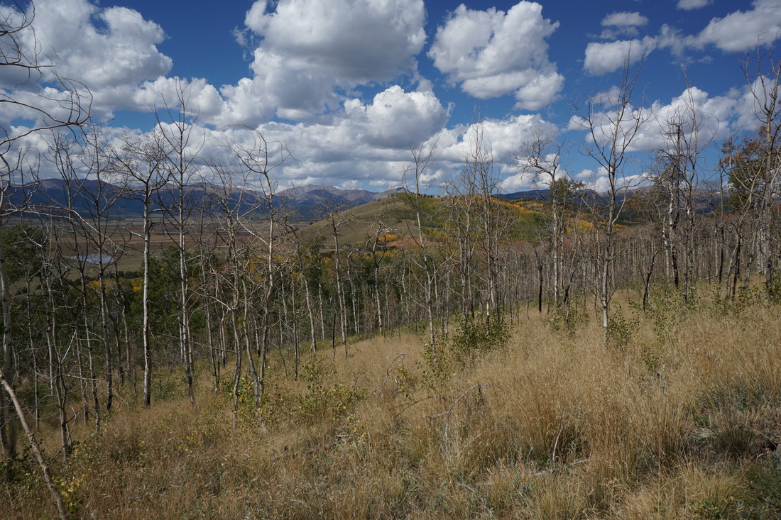
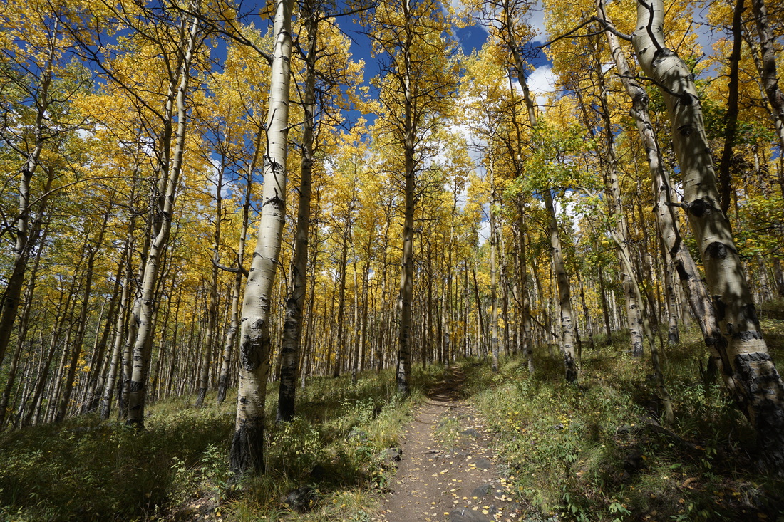
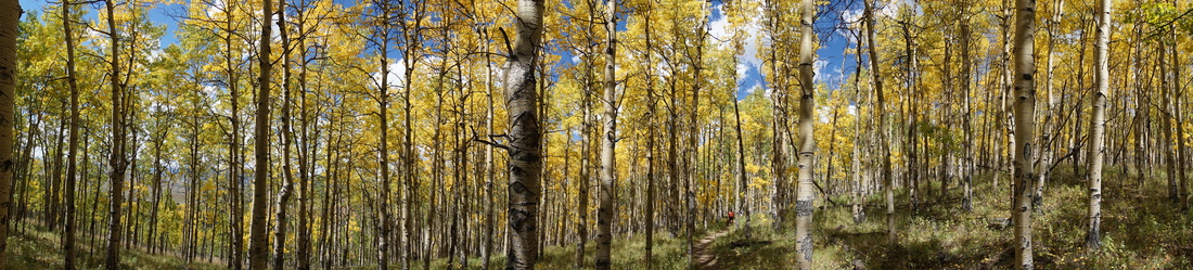
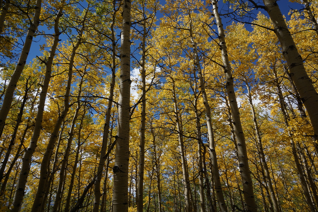
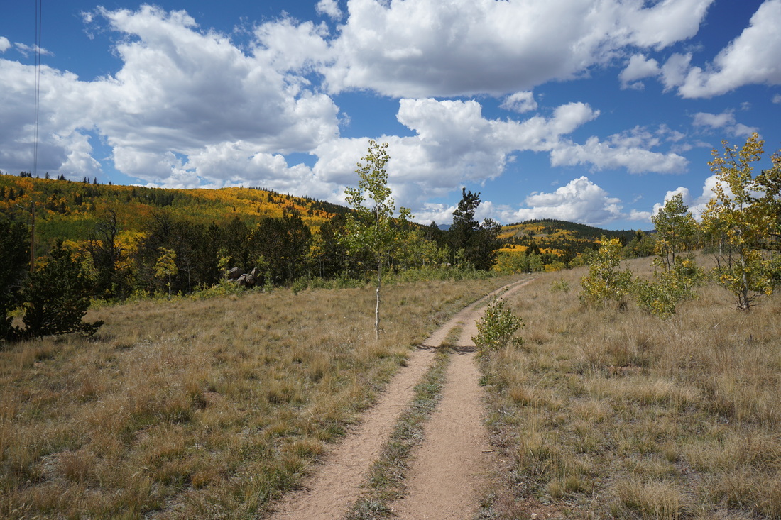
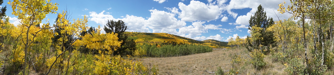
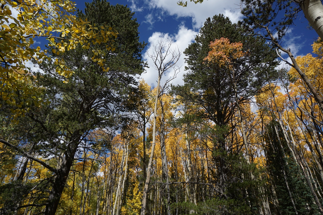
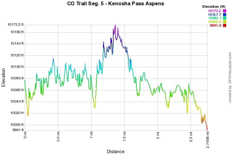
This is one of the best, easy, Colorado Fall colors hikes.  About .5 mile in on the CO Trail you enter what I like to call, the Great Aspen Grove.  This may be one of the finest and largest Aspen groves on the Front Range.  It is also one of the easiest to access.  The trail is easy to follow, mostly level, and you don't have to travel far to be surrounded by golden Aspen forest.  Because of this easy access there are many, many, people here enjoying the colors.  However, just like at a busy National Park, start hiking down the trail and the number of people drastically diminishes.  Even with the crowds of leaf peepers, it is worth hiking here around the peak of fall colors, you won't be disappointed.

I suggest hiking at least all the way through the Great Aspen Grove and keep on going for just a short distance.  After the Great Grove, you enter a recovering burn area.  The Aspens here are sparser and younger.  There is also a wonderful view of South Park and the Mosquito and Ten Mile Mountain Ranges beyond.  This view is worth exploring.  The CO trail keeps on going and so can you, but anywhere in this burn area or the recovering forest makes for a good turn around spot.

This weekend is not quite peak, but it is beautiful.  Mid-week or next weekend (9/26) may be the best time to come here.  There are still plenty of green aspen in the forest and the forest north of 285 is amazing as well.  Try to get an early start...


Powered by Create your own unique website with customizable templates.