|
|
|
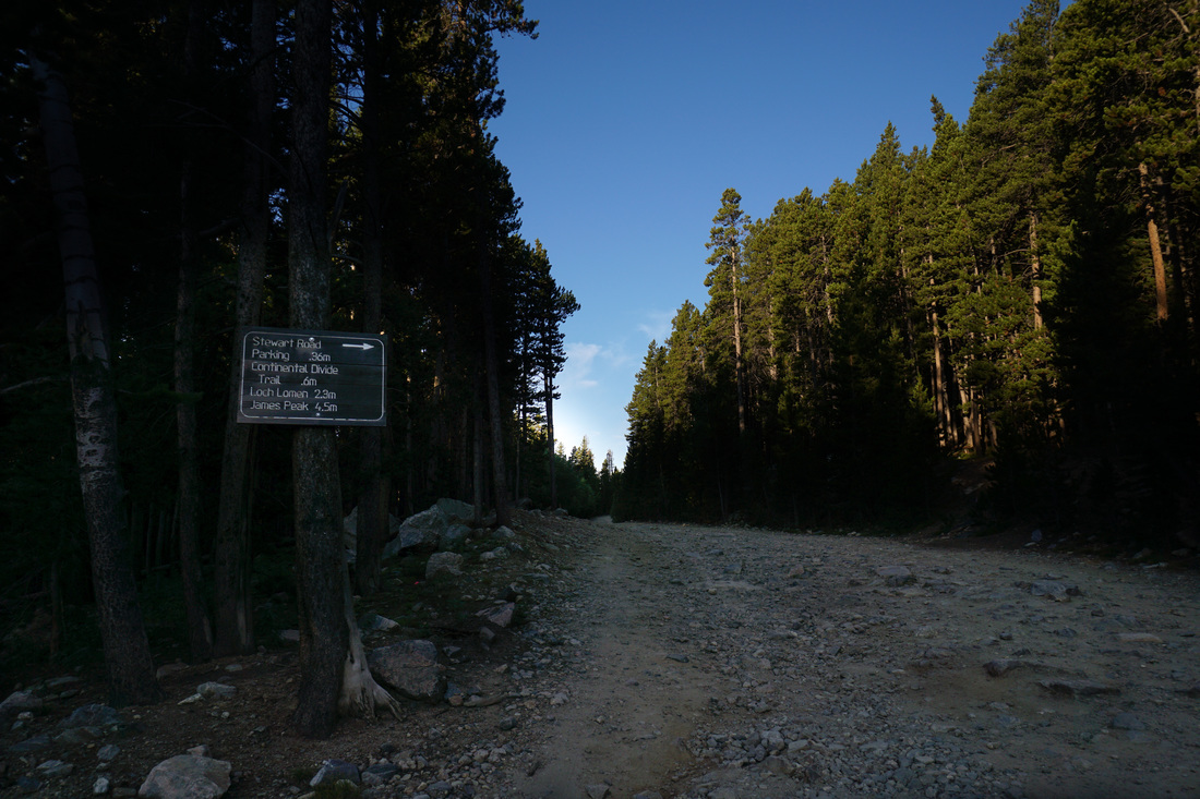
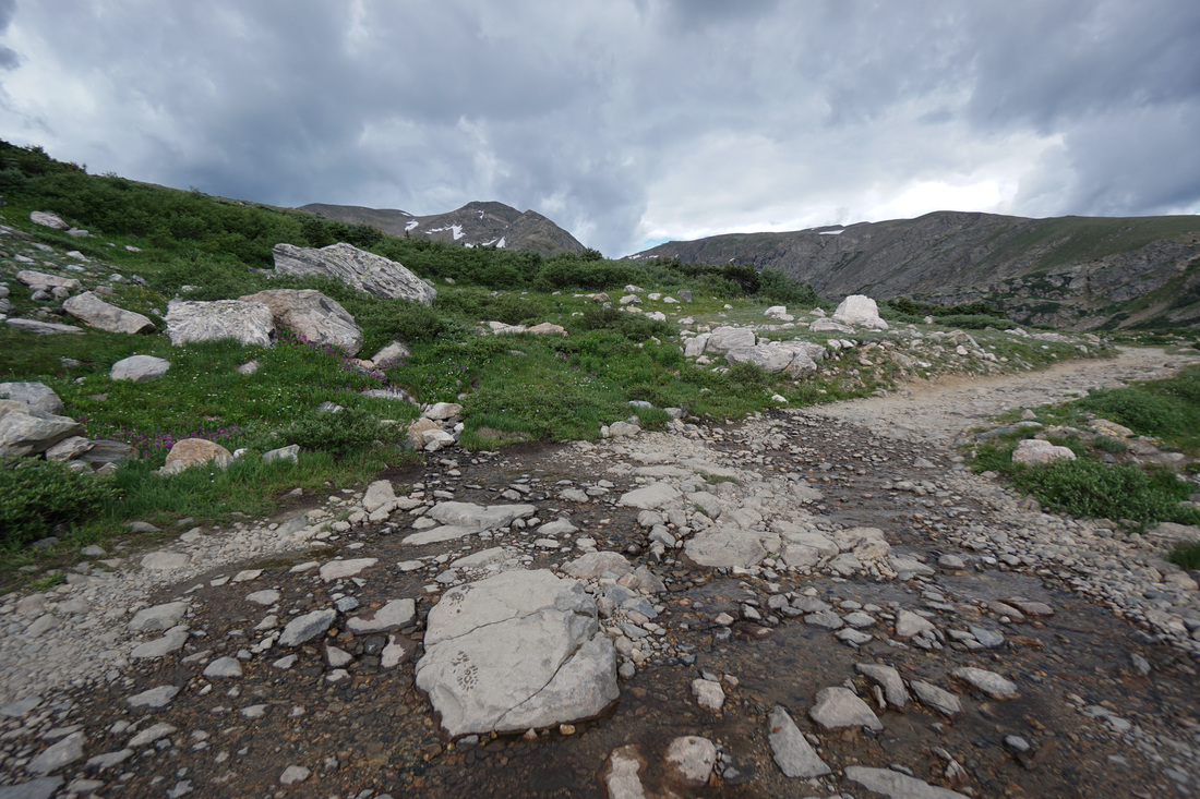
Directions: From I-70, take the Fall River Road exit towards St. Mary's/Alice. Follow Fall River Road for about 8.4 miles and turn left onto Alice Road. Stay on Alice road, past a few intersections, and at 1.1 miles, look to the right for the rocky Forest Service Road 7011. There will be a wooden sign on a tree pointing to Loch Lomen (wrong spelling) and James Peak. Park here off the side of the road. You can continue up the Forest Service Road to the Continental Divide Trail at .6 miles or continue all the way to the Loch, but the road is in pretty bad shape these days. If you have a Jeep or a good clearance 4WD you'll be fine, but SUVs and Subarus may have a hard time. Either way, the hike along the road is very nice and a quick walk to the CDT.
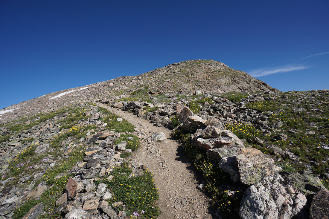
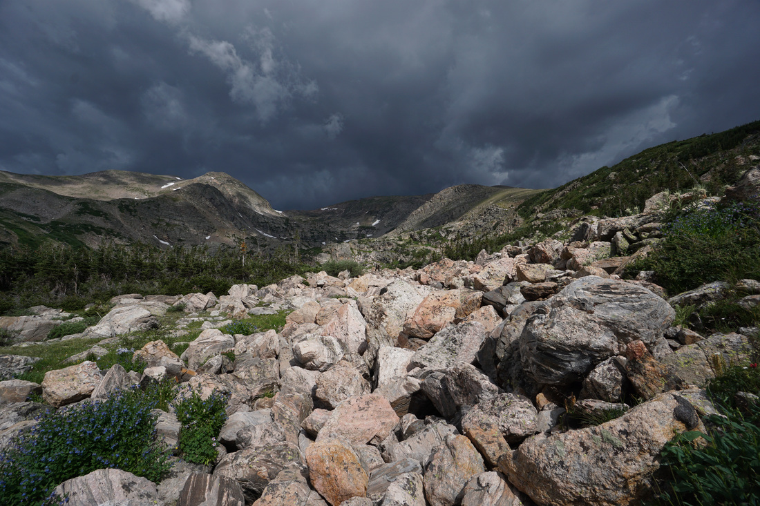
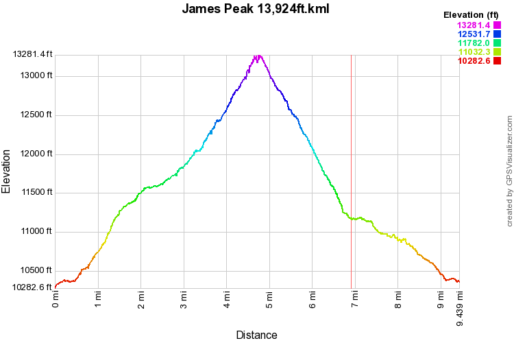
The climb up the east face of James Peak is a classic Colorado high altitude hike. It is relatively easy, requires no technical climbing, and access is quick and easy from the Front Range communities. That being said, this is a 13er and the altitude and exposure to weather makes this climb more strenuous then most. I strongly suggest that you get a very early start and plan to be off the summit by 10:00AM. The weather can move in quickly and the hike back down to tree line is not short.
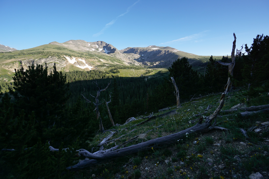
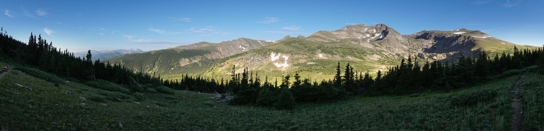
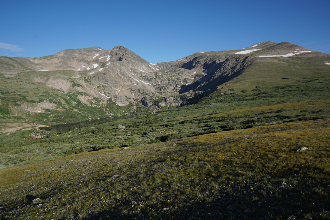
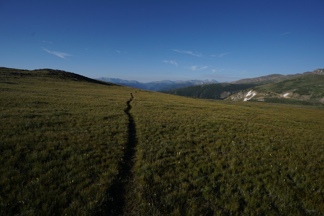
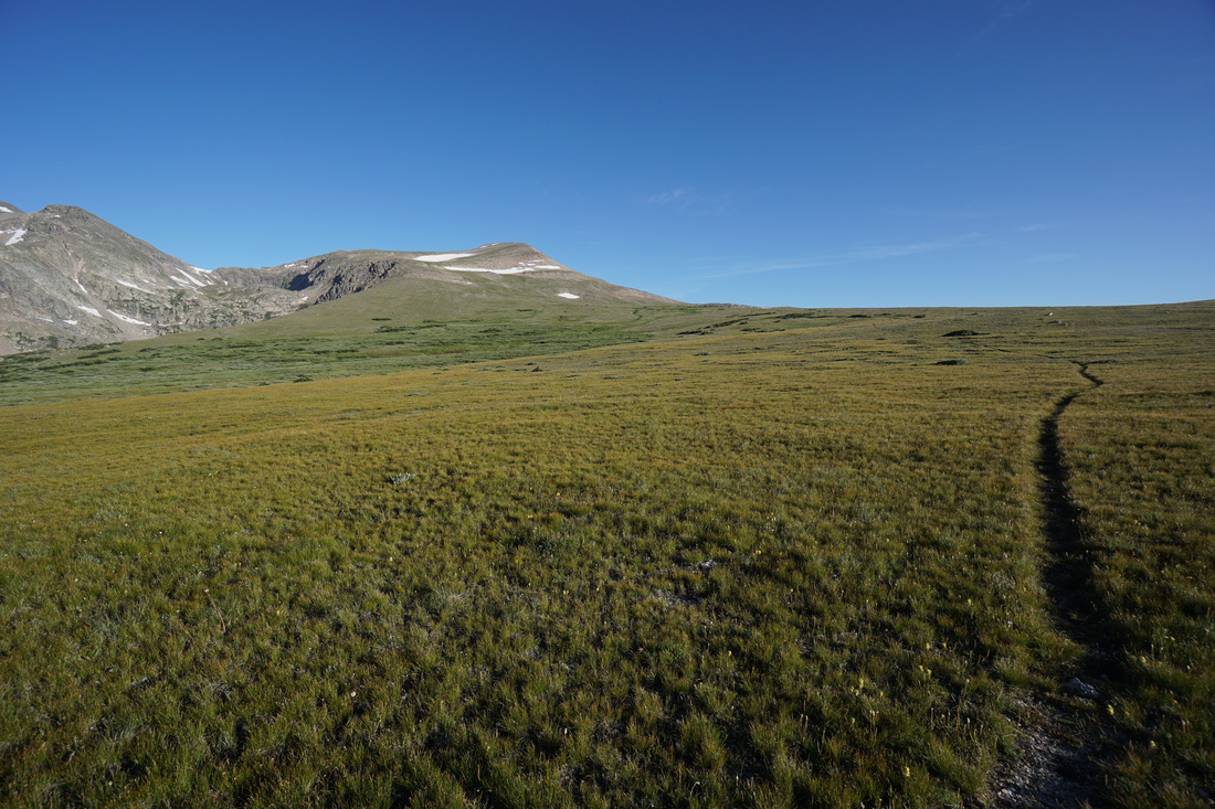
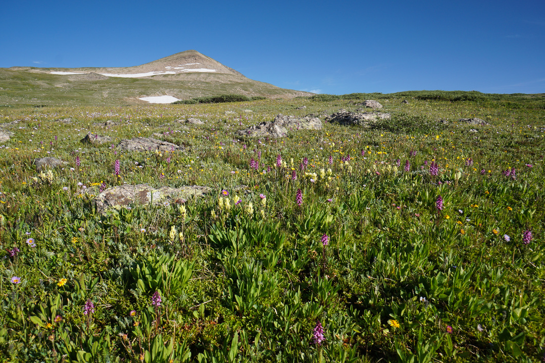
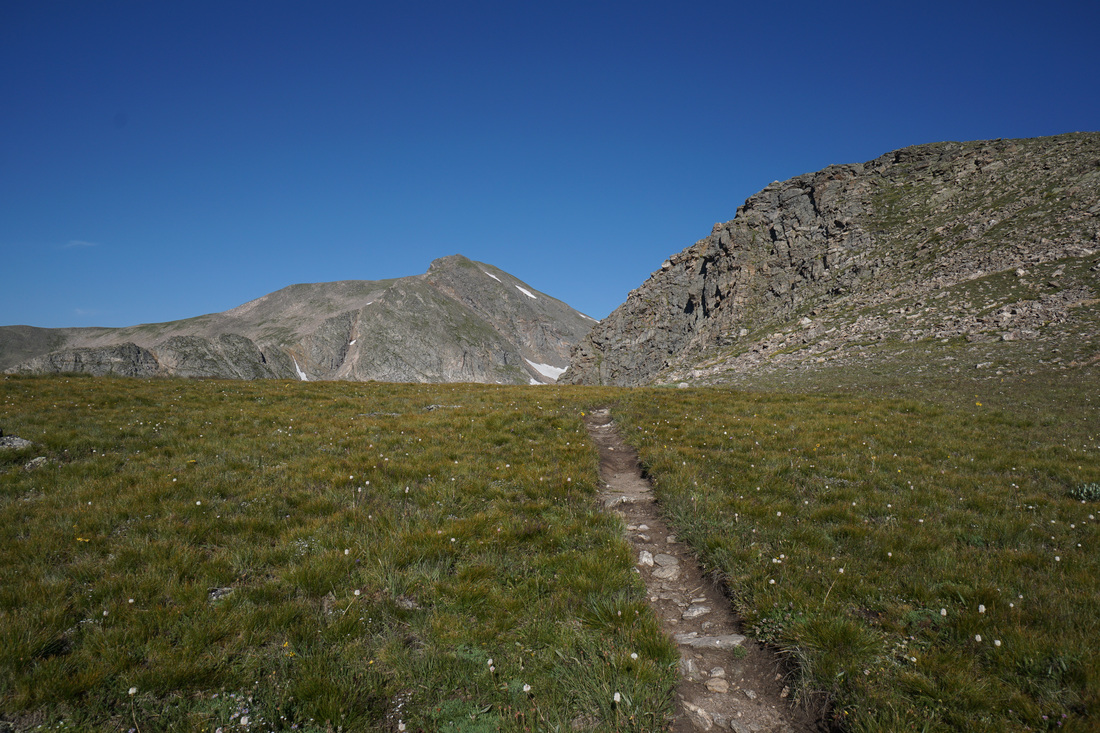
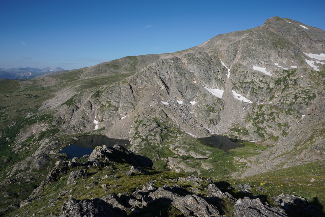
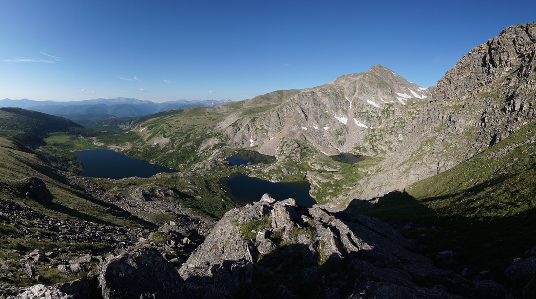
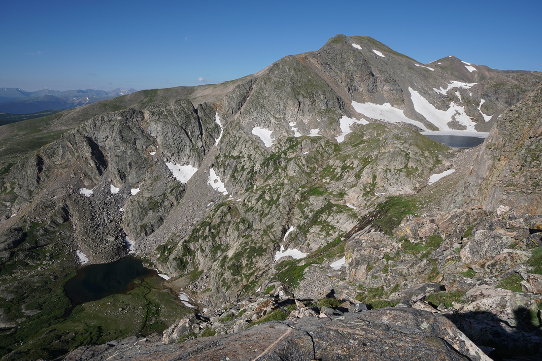
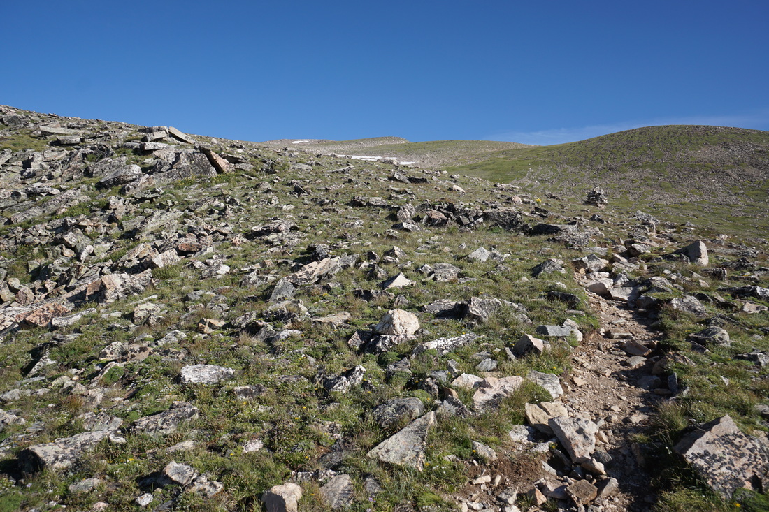
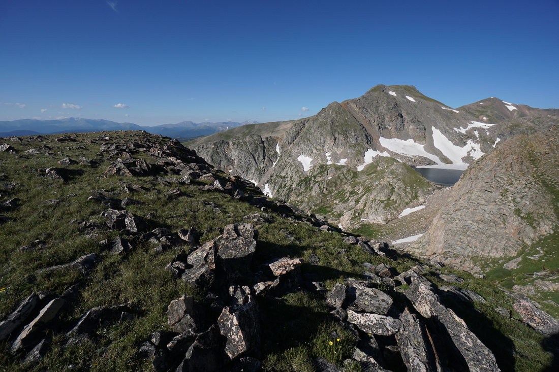
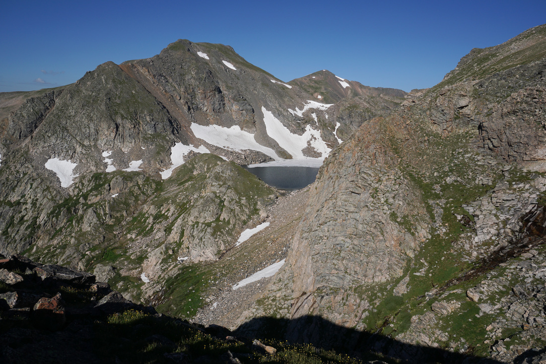
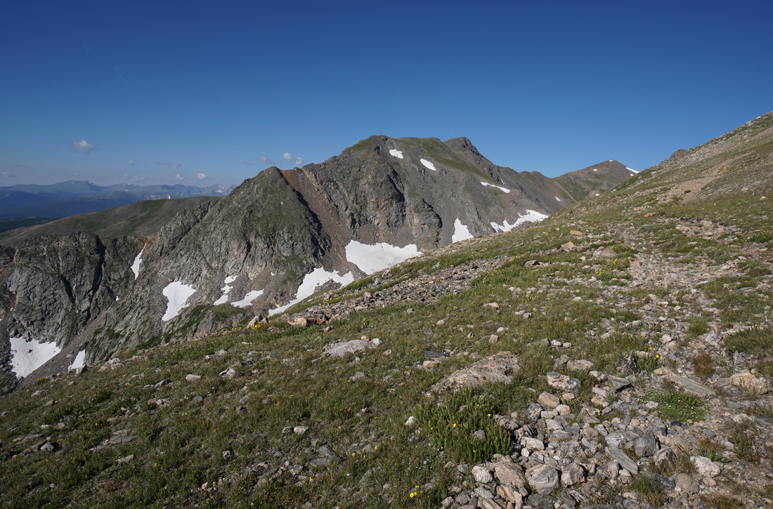
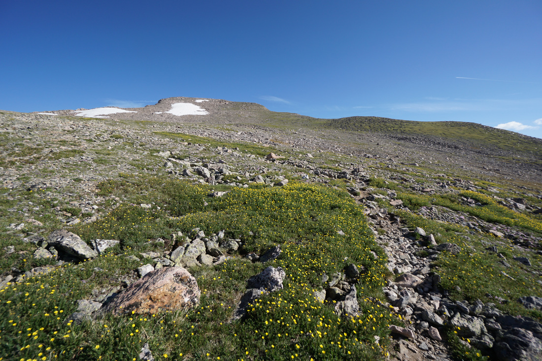
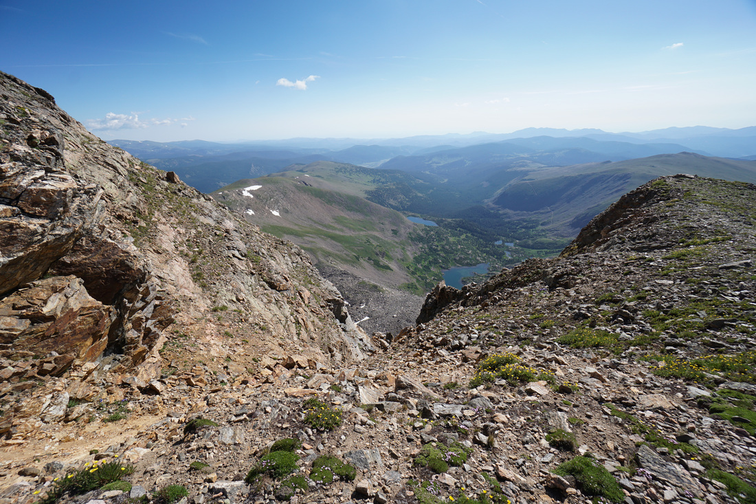
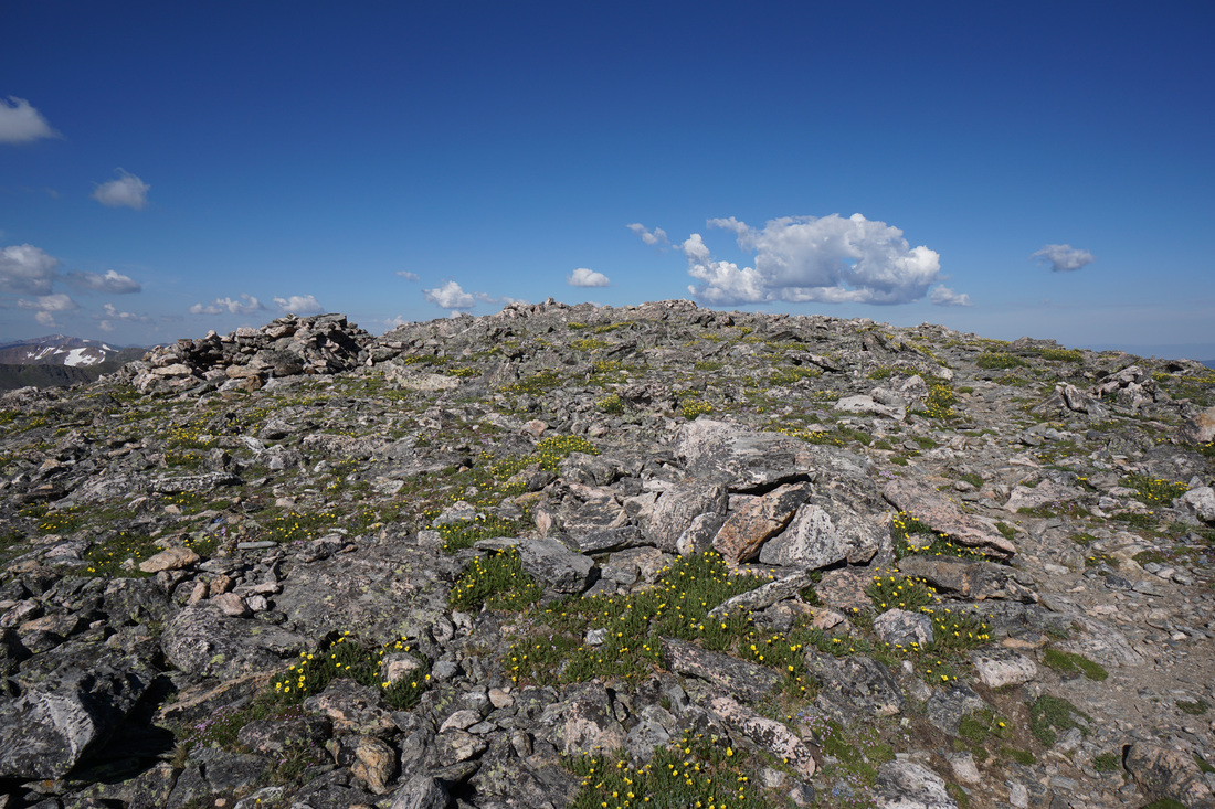
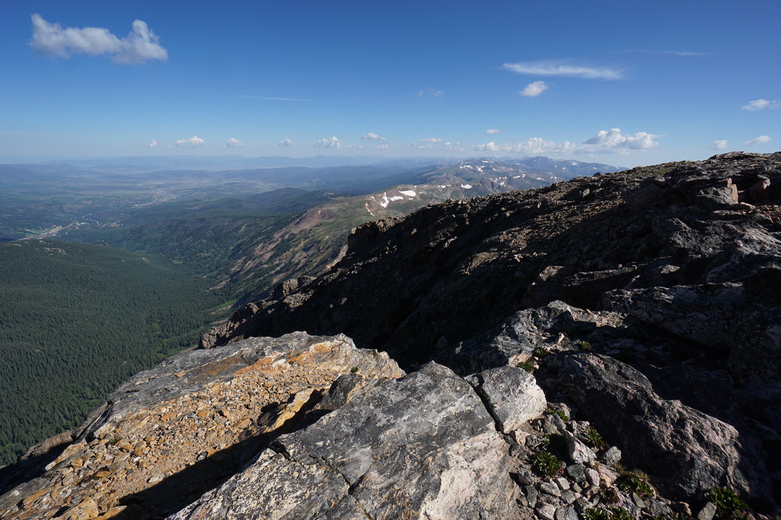
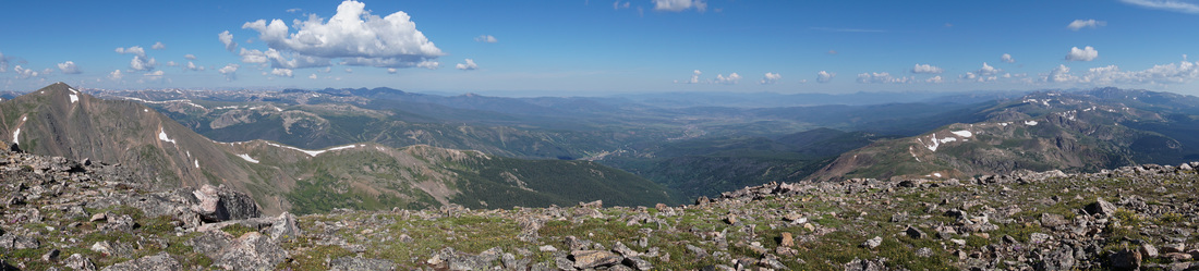
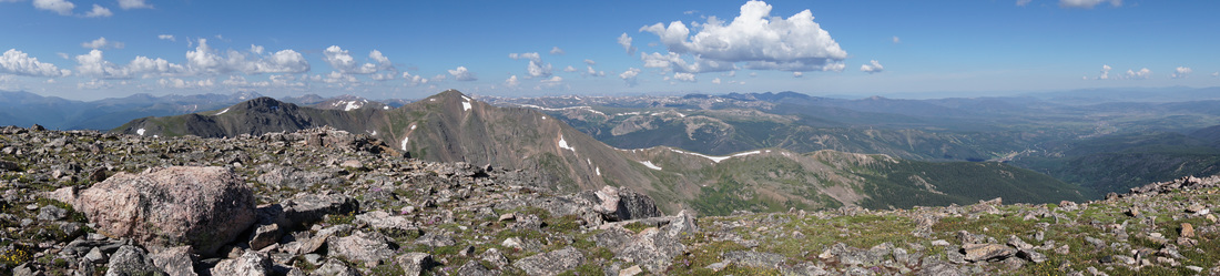
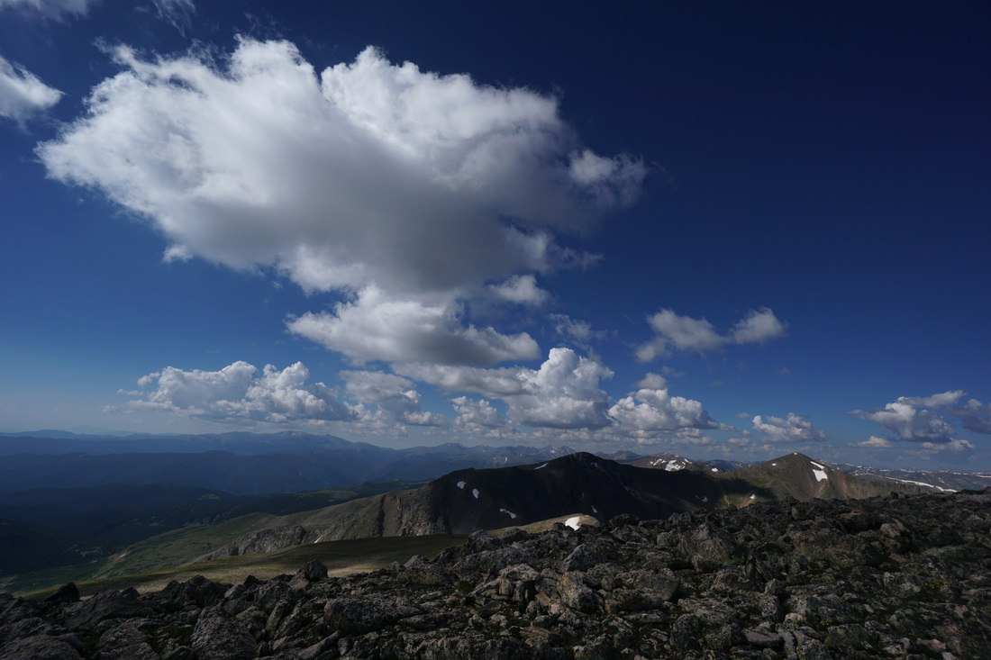
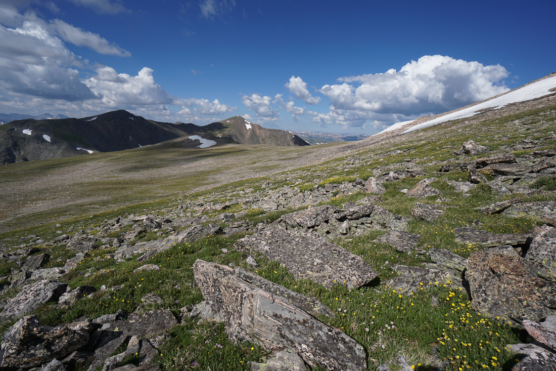
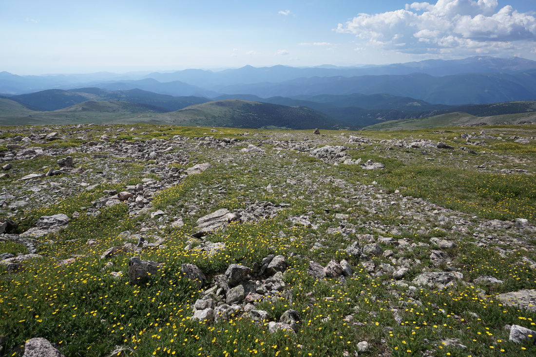
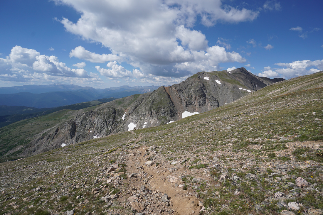
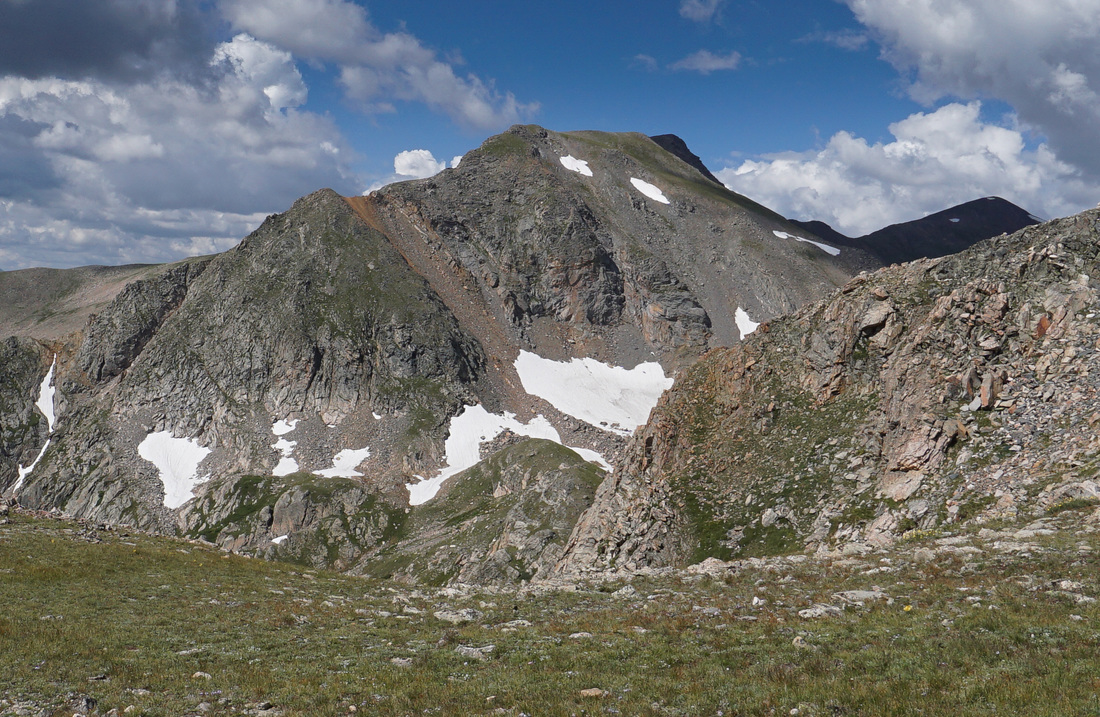
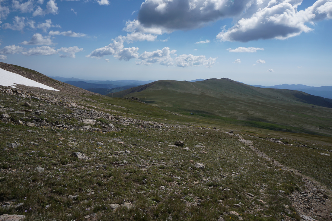
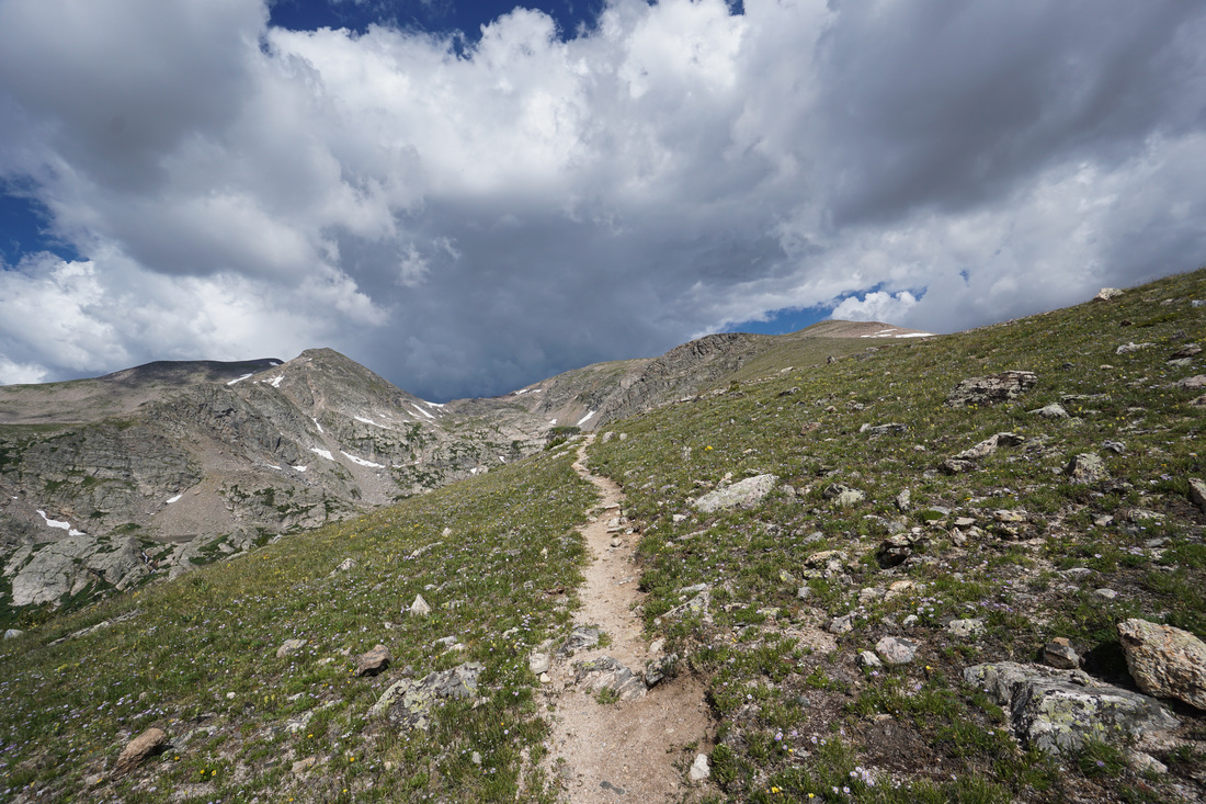
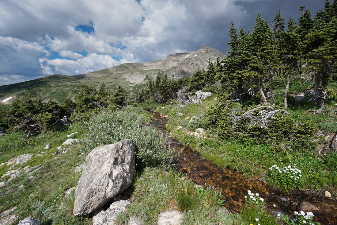
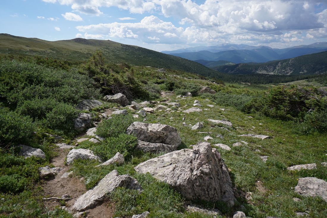
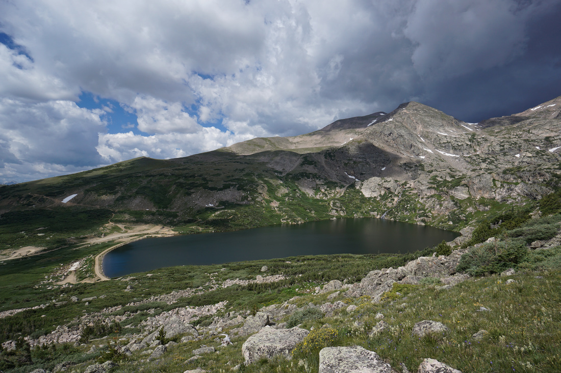
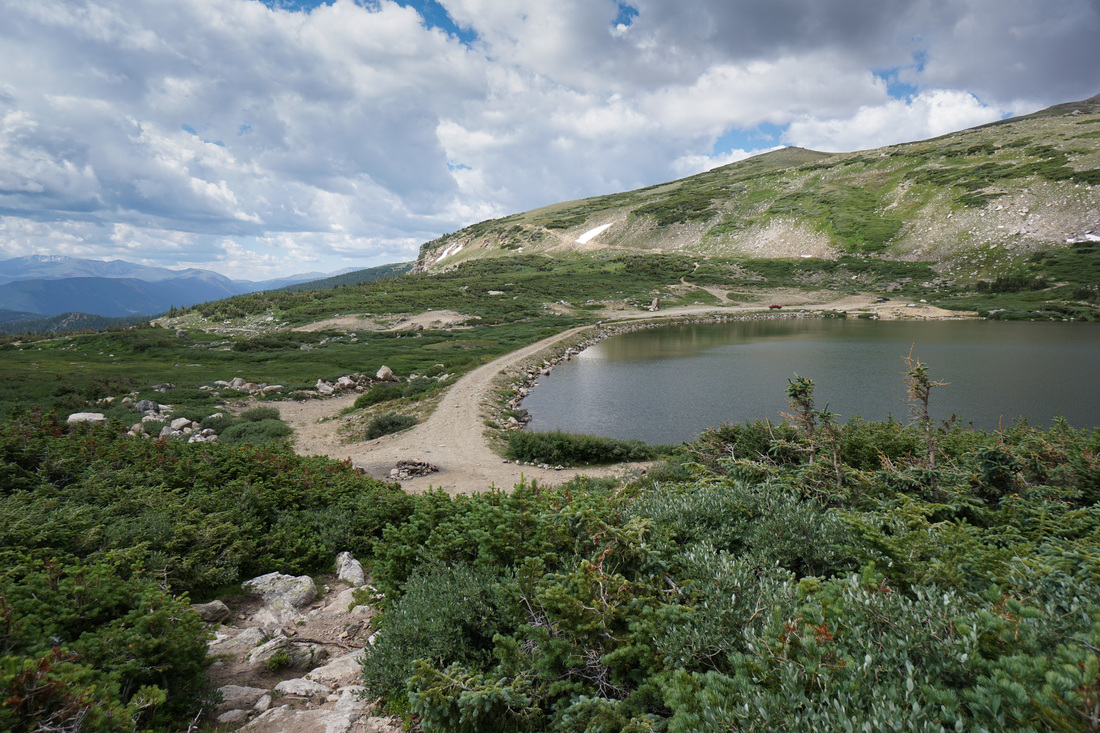
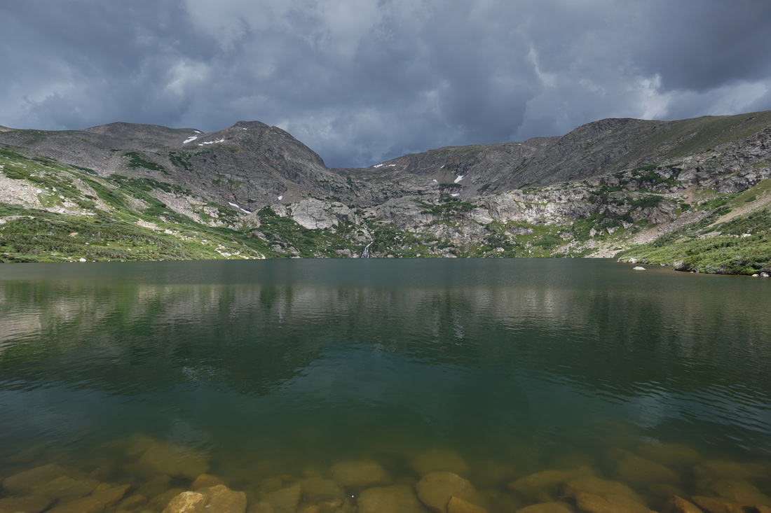
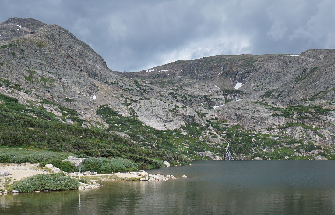
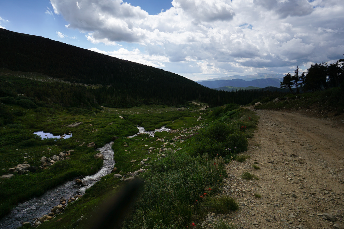
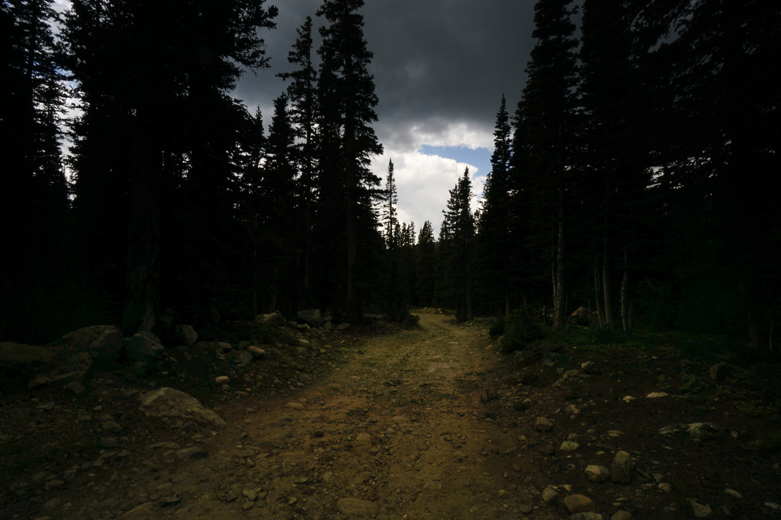
The views from the summit are phenomenal in all directions, but in my opinion, the view looking down into the Loch Lomond/Ice Lake basin is the real spectacle of this hike. The craggy, steep, waterfall filled basin looks like absolute paradise, if only it were easier to get down into it. At the top between James and Bancroft Peaks lies Ice Lake, partially frozen most of the year. Ice Lake spills down via a steep waterfall into Ohman Lake, which spills down via another steep waterfall into Stewart and Reynolds Lake, which again spills down via a steep waterfall into Loch Lomond. The middle portion of this hike skirts the edge of the basin and is a lot of fun. From the the intersection of Alice Road and Forest Road 1711, head west on the forest road. After .6 miles of rocky road walking, you'll come to the Continental Divide Trail, turn right at a small wooden sign and head up into the woods. The trail starts off on the steep side through dense forest but soon evens out as the tress get smaller and smaller. The views of James/Bancroft/Parry Peaks are immediate. When you leave treeline you have to cross a wide open, somewhat flat, high elevation grassland. This is a beautiful area with great views in every direction and plentiful wildflowers. Cross the creek and the wilderness boundary and you'll soon start the ascent to James Peak. As you climb the gentle trail, be sure to veer off to the left every now and then for the views down into the aforementioned Loch Lomond/Ice Lake Basin. The open tundra just below James Peak is astonishingly beautiful as the boulders, grasses, and wildflowers create a rock garden. Gain the saddle just below James Peak with terrific views down into the James Peak Lake Basin, an area not easily accessed. Its just a short climb up to the large summit of James Peak. The views from the summit are phenomenal in every direction, especially to the north where you can see the entirety of the Indian Peaks and Rocky Mountain National Park. To the south the shard ridge between James, Bancroft, and Parry is impressive with all the Front Range 14ers in the distance beyond. To the southwest you can see the Gore Range and on a clear day, Mt. of the Holy Cross. Truly an impressive vista. Keep your eyes on the building clouds and head down before the summer storms roll in. On the way down you can go back the way you came or take a side trail down to Loch Lomond. The trail to Loch Lomond is wonderful as is the view from the Loch. You'll have to do some easy boulder hoping and cross a few creeks but nothing too difficult. Once at the Loch you can head back to the trailhead via Steuart Road to make a loop. The views from the road are wonderful but watch out for the 4WD around corners. At the end of the day, the almost 10 mile, 3,000+ ft adventure will leave you tired but inspired. Considering how close you are to Denver, there are few hikes and few peaks that compare to James. |
|