GO HIKE COLORADO
Get in Touch:
  • HOME
  • ABOUT
  • HIKES BY REGION
    • DENVER AREA >
      • Denver Mountain Parks
      • Jefferson County Open Space
      • Lakewood Parks
      • Denver Area Greenways
    • BOULDER AREA
    • DOUGLAS COUNTY
    • FORT COLLINS AREA
    • COLORADO SPRINGS AREA
    • FRONT RANGE
    • TENMILE & MOSQUITO RANGES
    • GORE RANGE
    • SANGRE DE CRISTO MOUNTAINS
    • PARK RANGE
    • SAWATCH RANGE
    • ELK MOUNTAINS
    • SAN JUAN MOUNTAINS
    • THE FLAT TOPS
    • GRAND MESA
    • COLORADO PLATEAU
    • EASTERN PLAINS
  • NATIONAL PARK HIKES
    • BENT'S OLD FORT NATIONAL HISTORIC SITE
    • BLACK CANYON OF THE GUNNISON NATIONAL PARK
    • COLORADO NATIONAL MONUMENT
    • CURECANTI NATIONAL RECREATION AREA
    • DINOSAUR NATIONAL MONUMENT
    • FLORISSANT FOSSIL BEDS NATIONAL MONUMENT
    • MESA VERDE NATIONAL PARK
    • ROCKY MOUNTAIN NATIONAL PARK
    • GREAT SAND DUNES NATIONAL PARK
    • HOVENWEEP NATIONAL MONUMENT
    • SAND CREEK MASSACRE NATIONAL HISTORIC SITE
    • YUCCA HOUSE NATIONAL MONUMENT
  • HIKES BY CATEGORY
    • HIKES TO ALPINE LAKES
    • HIKES TO PEAKS & PASSES
    • HIKES THROUGH CANYONS
    • HIKES WITH FALL COLORS
    • HIKES ALONG THE I-70 CORRIDOR
    • HIKES ON PAVED TRAILS
    • HIKES FOR KIDS
    • HIKES TO WATERFALLS
    • HIKES ALONG RIVERS
    • HIKES WITH ROCK FORMATIONS
    • HIKES WITH WILDFLOWERS
    • WINTER HIKES
  • NEWS
  • WEBCAMS
  • $UPPORT GHC
  • INTERACTIVE MAP

S. Boulder Creek Inlet Trail
Gross Reservoir

Date Hiked: August 22, 2012

Distance: 3.1 mi (RT)
Elevation Gain:  300ft
Elevation Min/Max: 7,262 to 7,509ft
Trailhead Lat/Long:   39.936620º N; 105.372801º W
Managing Agency: Denver Water
Fee: None

Gross Reservoir Website
Picture

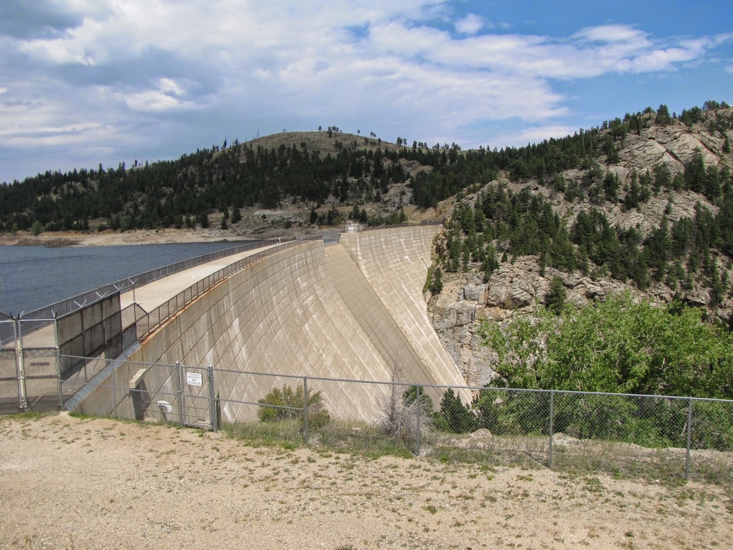
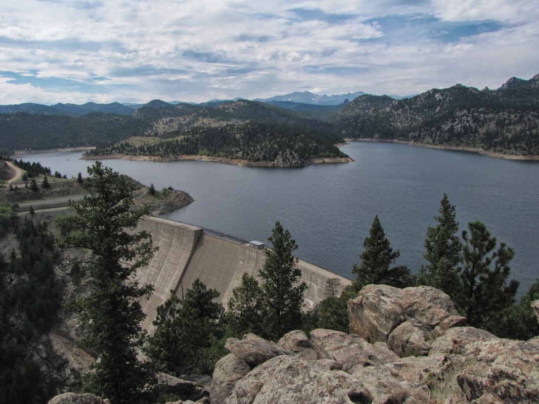
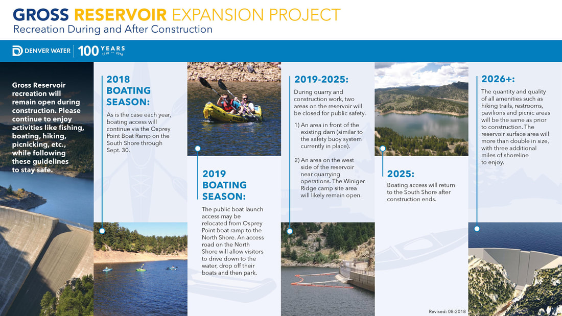
Please note that Gross Reservoir will be under going an expansion project that will impact recreational activities at Gross Reservoir this season and beyond. While the reservoir will remain open throughout construction, there will be some changes and areas that are temporarily closed. Please see the Gross Reservoir website, linked above, or the info graphic below for the anticipated schedule and impacts.
Picture

Directions:  From Boulder, take Flagstaff Road west until it turns into Gross Dam Road.  Follow Gross Dam Road to the South Access Area, park and follow signs to Osprey Point.  From Denver, take I-70 W to 93 North.  Turn West on Hwy 72 to Gross Dam Road.  Follow Gross Dam Road down towards the reservoir, when you see the park sign and map, turn left and follow the road to the south access point.

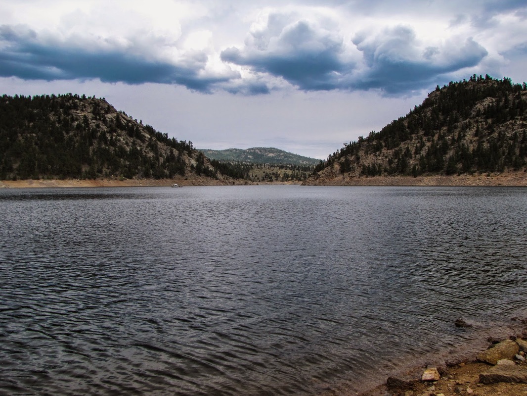
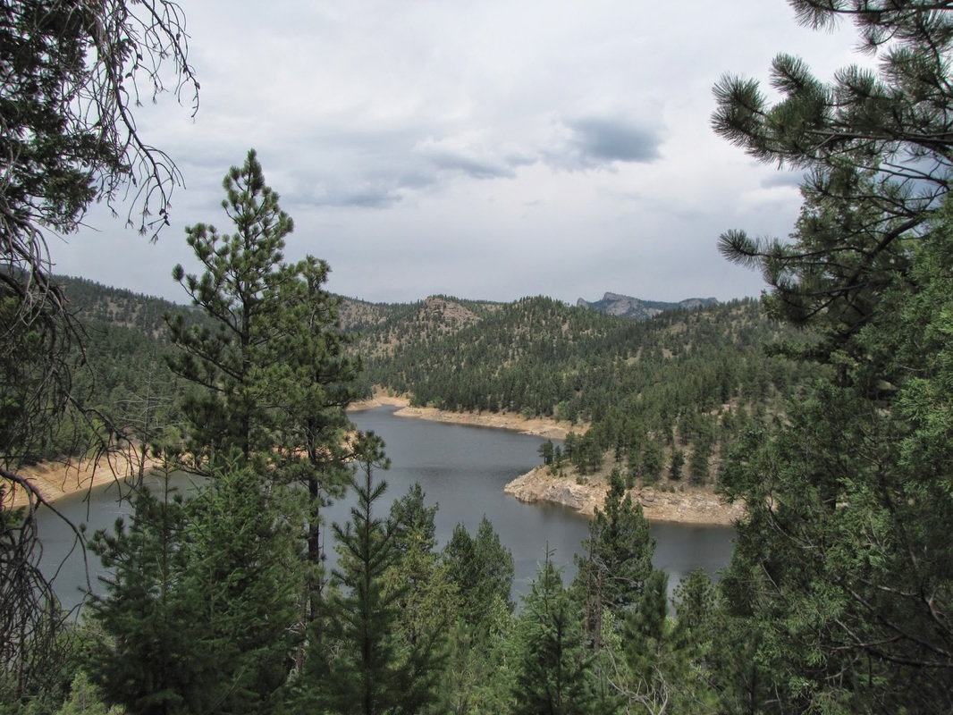
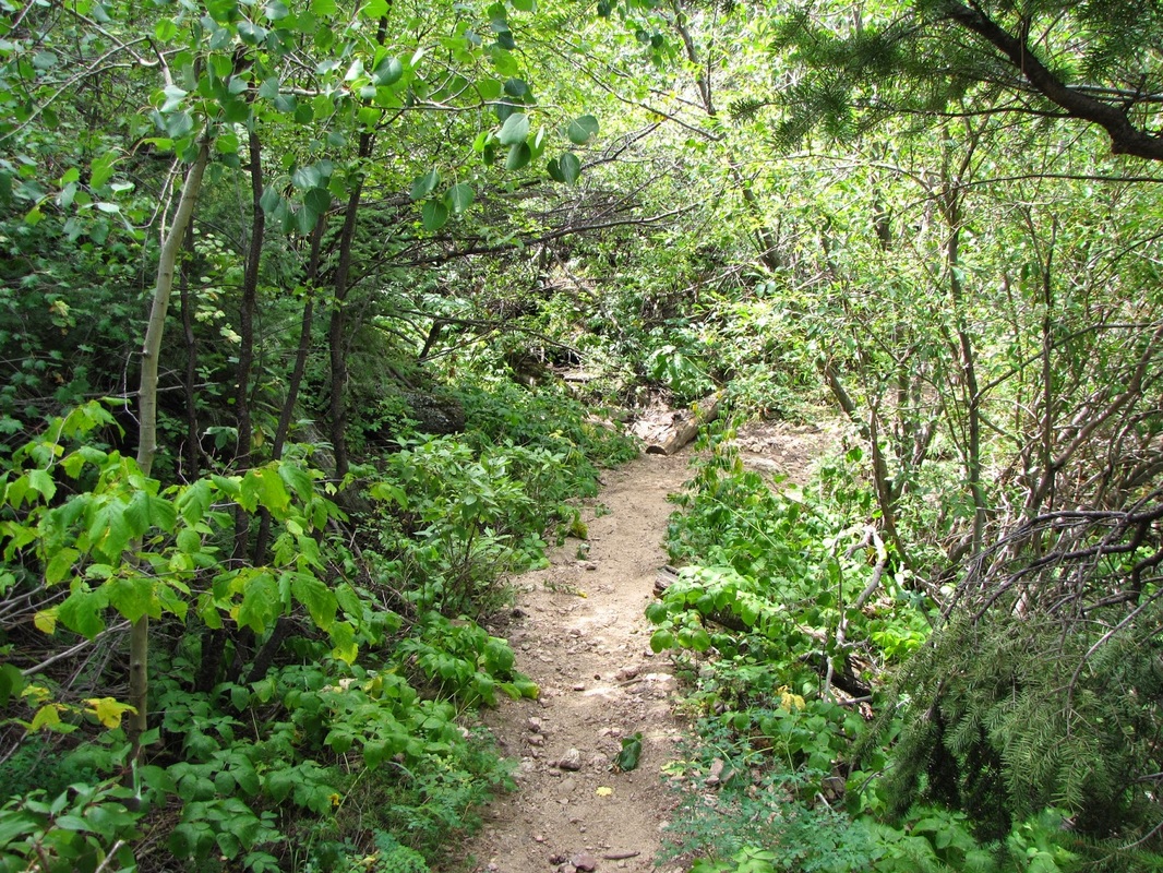
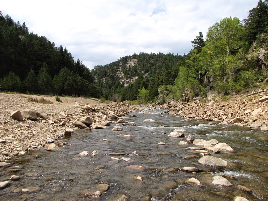
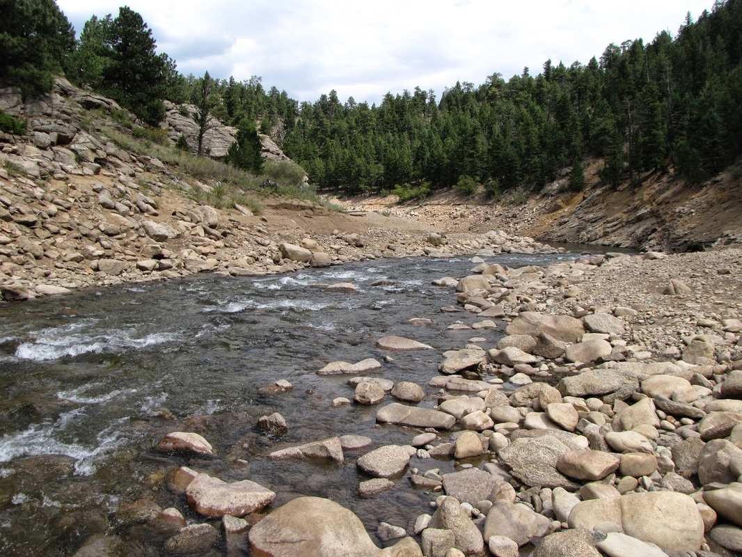
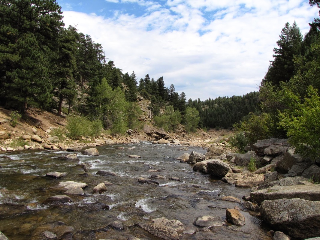
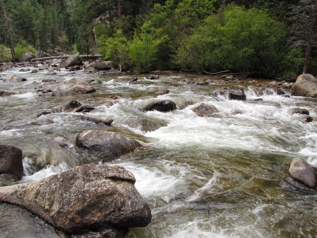
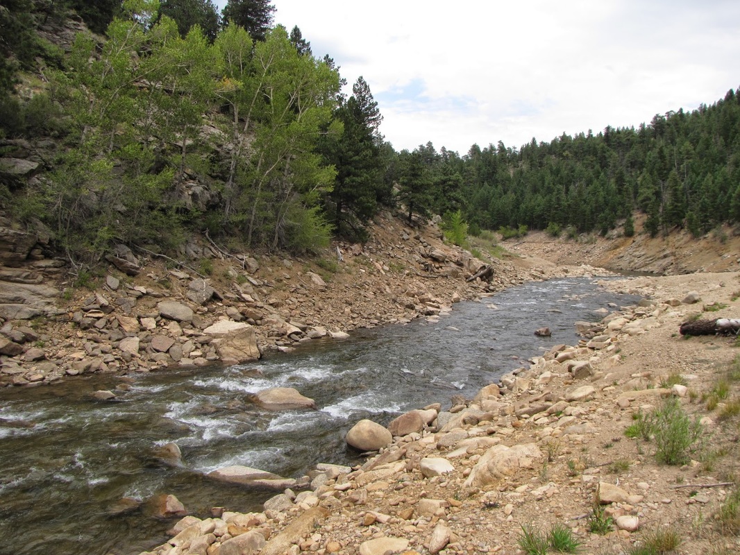
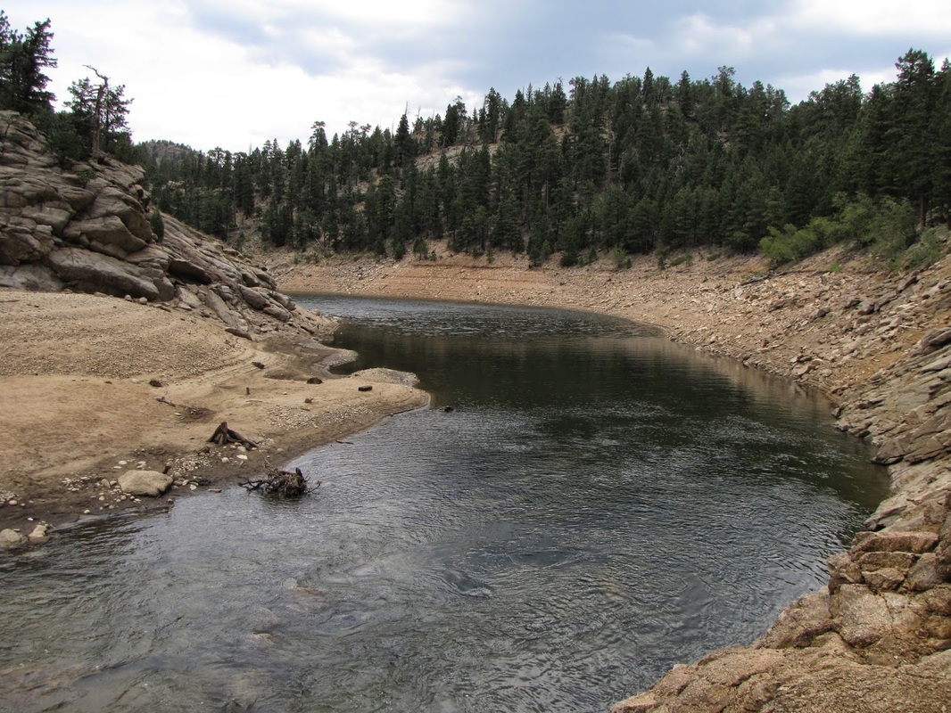
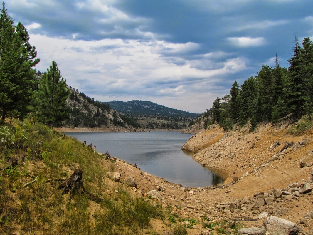
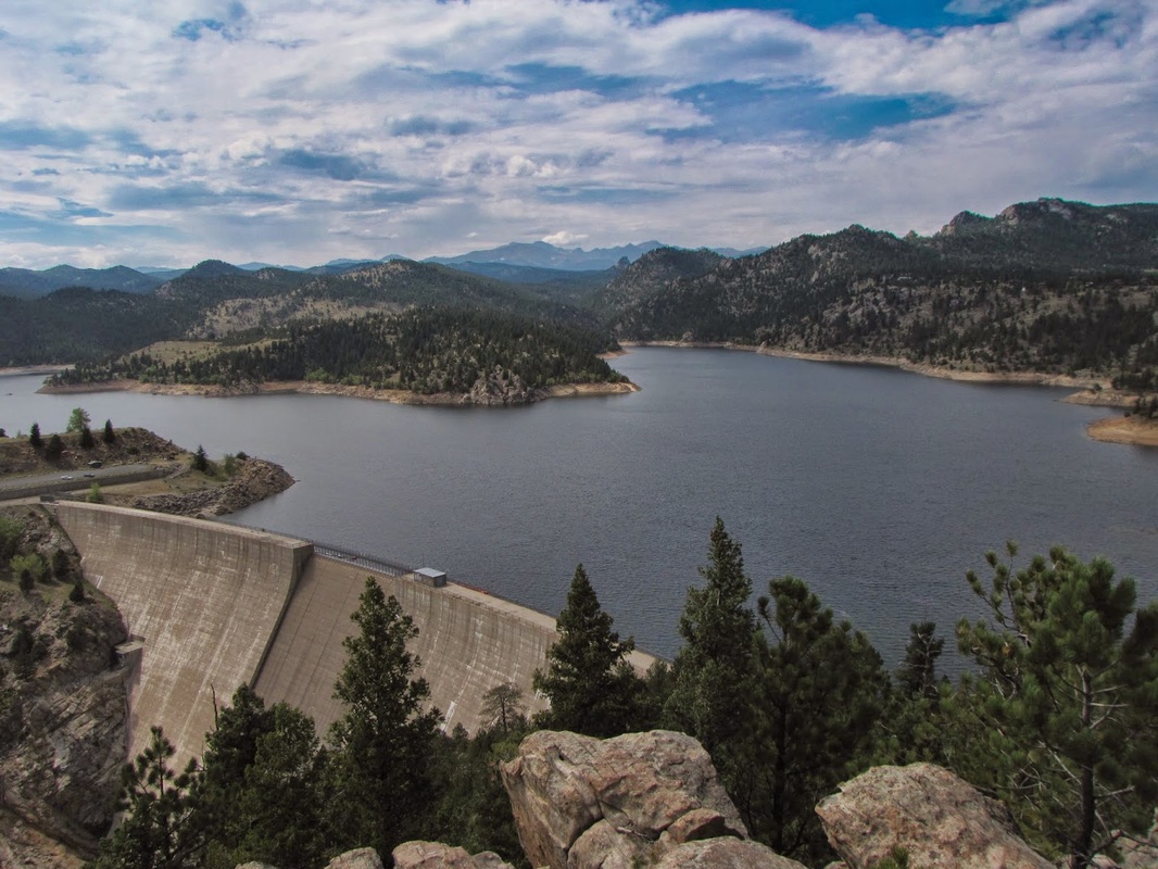
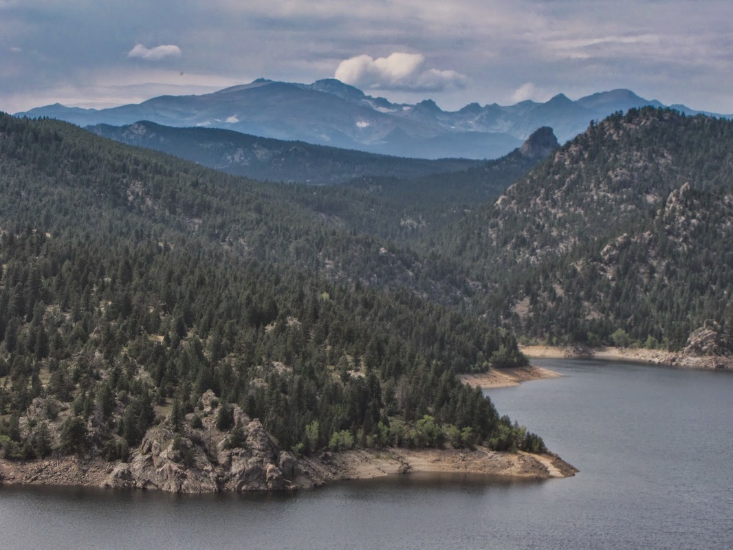
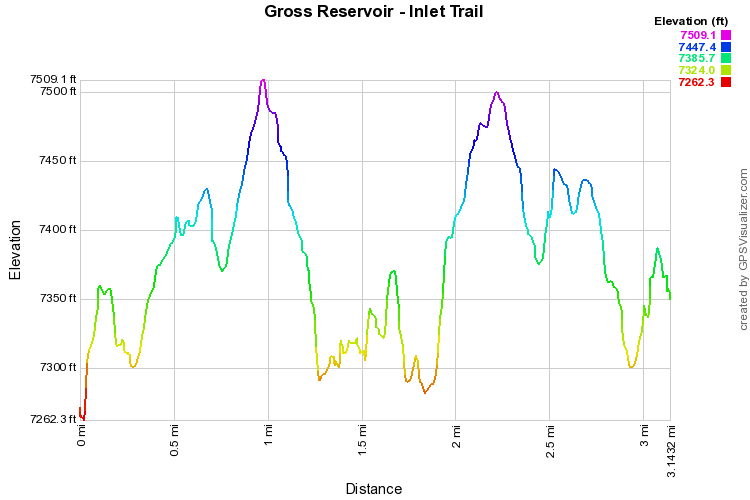
This is a pleasant, short trail, with very few people, along the south shore of Gross Reservoir.  Your destination is the inlet where South Boulder Creek enters the Reservoir.  From the picnic tables at the trailhead, head into the woods, gain a little elevation and travel through the woods looking out on the Reservoir.  Before too long, you'll descend down to S. Boulder Creek.  The trail continues along S. Boulder Creek and you can boulder hop for a long time.  There are a number of social trails in this area allowing you to explore further back along S. Boulder Creek.  If you follow the creek for long enough, you would eventually reach Pinecliff.  Following the Creek for just a mile or so, provides for a very private, relaxing hike.

Be sure to check out the various viewpoints before leaving Gross Reservoir the views of the reservoir with the Indian Peaks in the distance are spectacular. 
© Go Hike Colorado, 2020.  All Rights Reserved. 
Use of photographs without prior authorization is
​strictly prohibited.


Contact us at:
[email protected]
Legal Disclaimer - Information provided on this site is based upon our own observations, always double check information with the appropriate land management agency before heading into the backcountry.  Backcountry travel is inherently dangerous, please take all proper precautions.  Go Hike Colorado is not responsible for injury or incident.