GO HIKE COLORADO
Get in Touch:
  • HOME
  • ABOUT
  • HIKES BY REGION
    • DENVER AREA >
      • Denver Mountain Parks
      • Jefferson County Open Space
      • Lakewood Parks
      • Denver Area Greenways
    • BOULDER AREA
    • DOUGLAS COUNTY
    • FORT COLLINS AREA
    • COLORADO SPRINGS AREA
    • FRONT RANGE
    • TENMILE & MOSQUITO RANGES
    • GORE RANGE
    • SANGRE DE CRISTO MOUNTAINS
    • PARK RANGE
    • SAWATCH RANGE
    • ELK MOUNTAINS
    • SAN JUAN MOUNTAINS
    • THE FLAT TOPS
    • GRAND MESA
    • COLORADO PLATEAU
    • EASTERN PLAINS
  • NATIONAL PARK HIKES
    • BENT'S OLD FORT NATIONAL HISTORIC SITE
    • BLACK CANYON OF THE GUNNISON NATIONAL PARK
    • COLORADO NATIONAL MONUMENT
    • CURECANTI NATIONAL RECREATION AREA
    • DINOSAUR NATIONAL MONUMENT
    • FLORISSANT FOSSIL BEDS NATIONAL MONUMENT
    • MESA VERDE NATIONAL PARK
    • ROCKY MOUNTAIN NATIONAL PARK
    • GREAT SAND DUNES NATIONAL PARK
    • HOVENWEEP NATIONAL MONUMENT
    • SAND CREEK MASSACRE NATIONAL HISTORIC SITE
    • YUCCA HOUSE NATIONAL MONUMENT
  • HIKES BY CATEGORY
    • HIKES TO ALPINE LAKES
    • HIKES TO PEAKS & PASSES
    • HIKES THROUGH CANYONS
    • HIKES WITH FALL COLORS
    • HIKES ALONG THE I-70 CORRIDOR
    • HIKES ON PAVED TRAILS
    • HIKES FOR KIDS
    • HIKES TO WATERFALLS
    • HIKES ALONG RIVERS
    • HIKES WITH ROCK FORMATIONS
    • HIKES WITH WILDFLOWERS
    • WINTER HIKES
  • NEWS
  • WEBCAMS
  • $UPPORT GHC
  • INTERACTIVE MAP

Indian Creek Trail
Pike National Forest

Date Hiked: October 12, 2013

​Distance: 2.5 mi (RT) can be longer
Elevation Gain: 586ft
Elevation Min/Max: 7,081 to 7,473ft
Managing Agency: U.S. Forest Service
Fee: Yes

Indian Creek Trail Webpage (USFS)
Picture

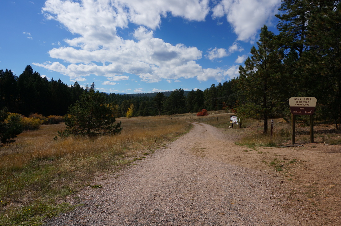
Directions:  From Sedalia, follow Jarre Canyon Road (67) west.  Pass the turnoff for Rampart Range Road and not much further turn right into the Bear Creek Campground.  There is a fee to park here.  From the west end of the parking lot take the dirt road next to the bathroom until the road ends and the trail begins.  There is a sign at the start of the single track trail.

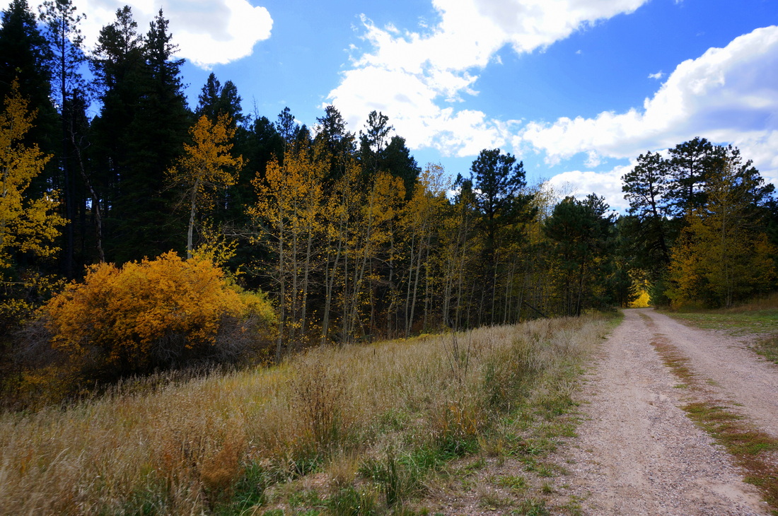
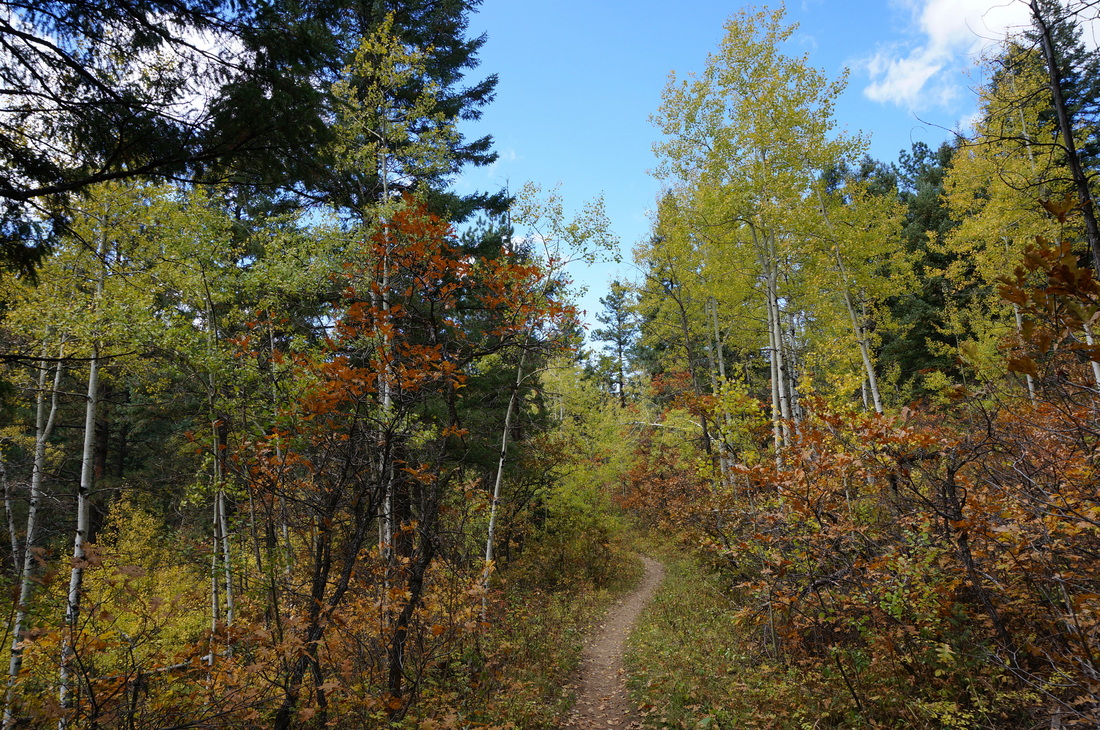
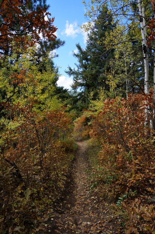
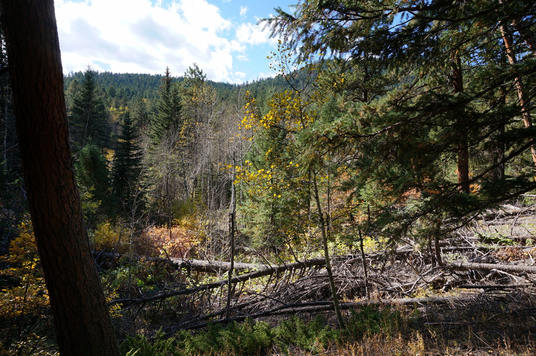
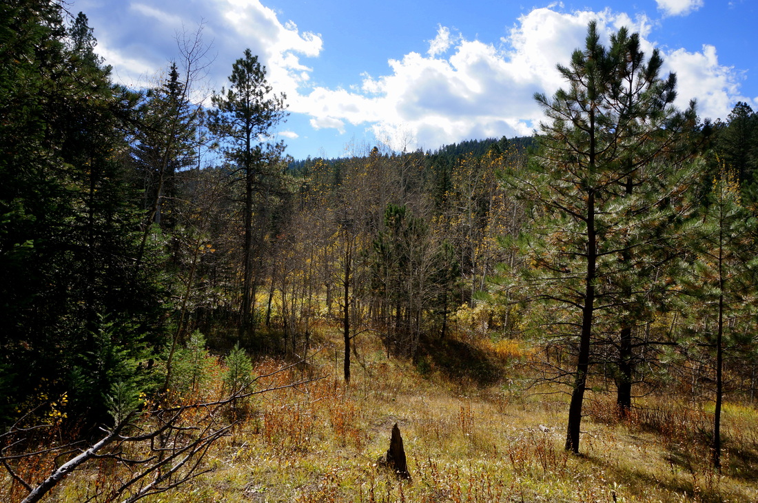
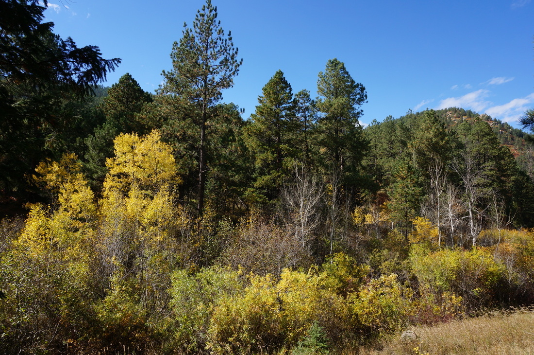
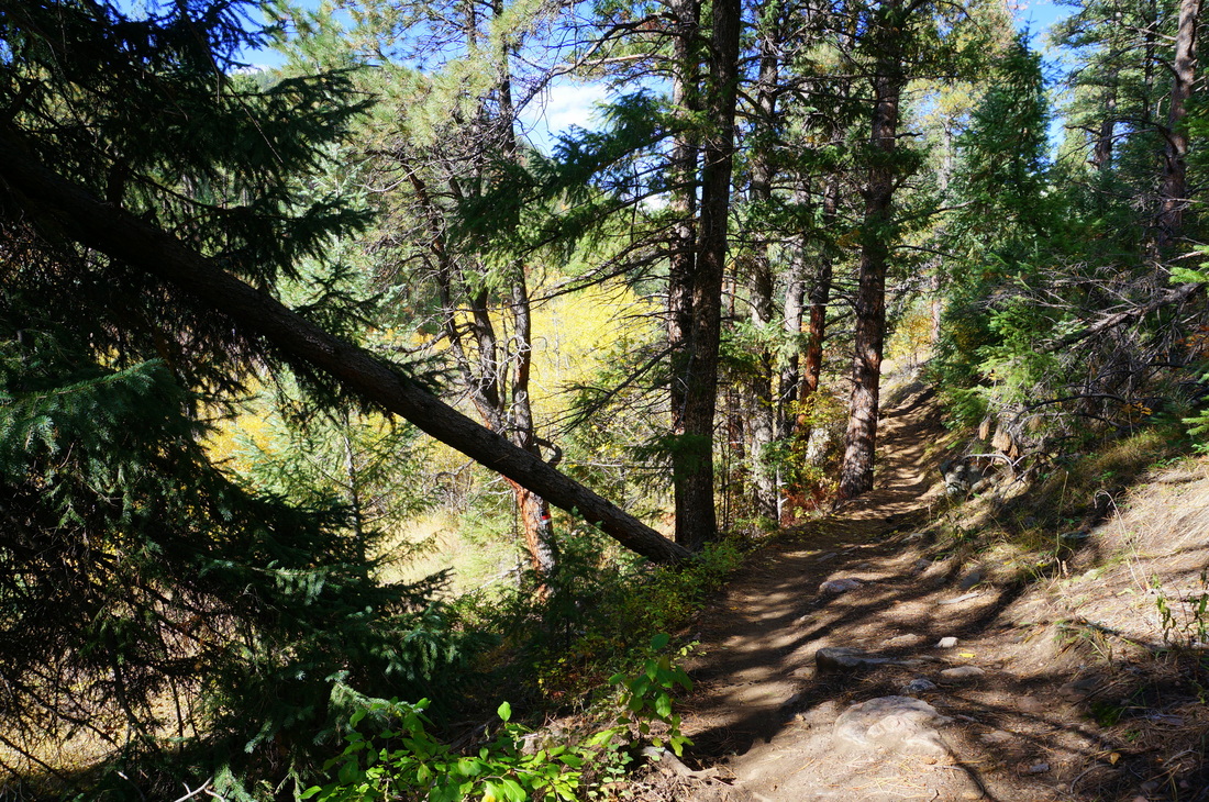
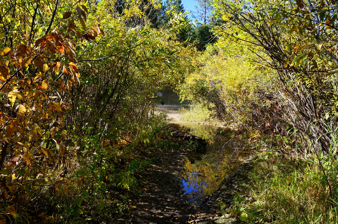
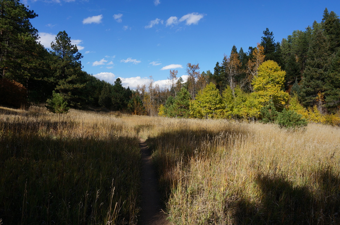
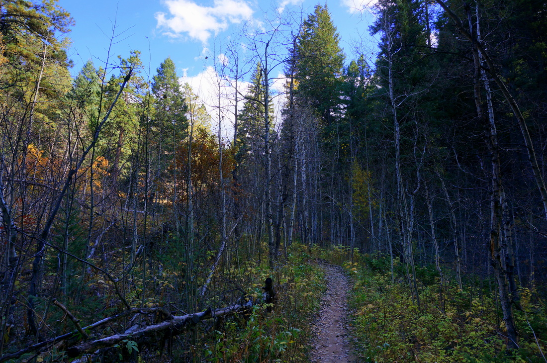
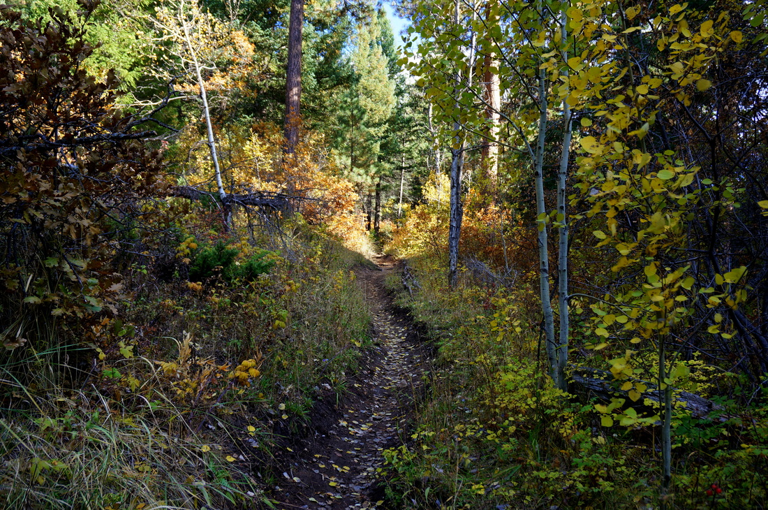
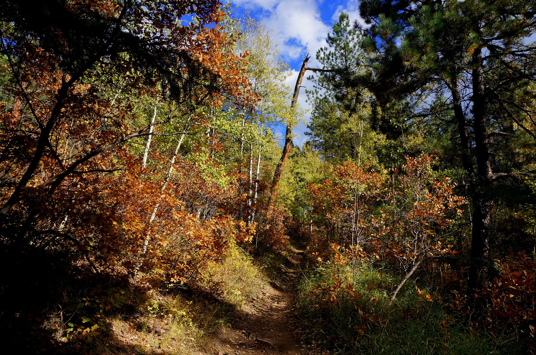
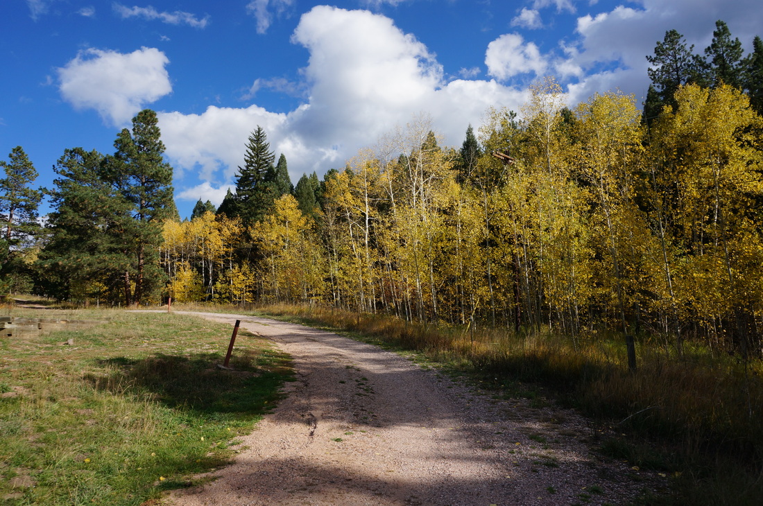
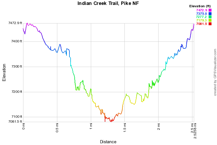
This trail is beautiful in the fall.  It descends steadily through aspen and evergreen forest until it reached Bear Creek at about the 1.25 mile mark.  Cross bear creek and you enter an open meadow.  This is a good spot to stop if you just want a quick fall hike (or if your wife is 8 months pregnant, as was the case when we hiked here).  The trail continues on and eventually reaches the Colorado Trail at the end of Waterton Canyon or can connect to Roxborough State Park (remember, I said eventually...).  Even if the meadow is your destination this is a perfect short hike through beautiful forest with abundant fall foliage.  
Powered by Create your own unique website with customizable templates.