GO HIKE COLORADO
Get in Touch:
  • HOME
  • ABOUT
  • HIKES BY REGION
    • DENVER AREA >
      • Denver Mountain Parks
      • Jefferson County Open Space
      • Lakewood Parks
      • Denver Area Greenways
    • BOULDER AREA
    • DOUGLAS COUNTY
    • FORT COLLINS AREA
    • COLORADO SPRINGS AREA
    • FRONT RANGE
    • TENMILE & MOSQUITO RANGES
    • GORE RANGE
    • SANGRE DE CRISTO MOUNTAINS
    • PARK RANGE
    • SAWATCH RANGE
    • ELK MOUNTAINS
    • SAN JUAN MOUNTAINS
    • THE FLAT TOPS
    • GRAND MESA
    • COLORADO PLATEAU
    • EASTERN PLAINS
  • NATIONAL PARK HIKES
    • BENT'S OLD FORT NATIONAL HISTORIC SITE
    • BLACK CANYON OF THE GUNNISON NATIONAL PARK
    • COLORADO NATIONAL MONUMENT
    • CURECANTI NATIONAL RECREATION AREA
    • DINOSAUR NATIONAL MONUMENT
    • FLORISSANT FOSSIL BEDS NATIONAL MONUMENT
    • MESA VERDE NATIONAL PARK
    • ROCKY MOUNTAIN NATIONAL PARK
    • GREAT SAND DUNES NATIONAL PARK
    • HOVENWEEP NATIONAL MONUMENT
    • SAND CREEK MASSACRE NATIONAL HISTORIC SITE
    • YUCCA HOUSE NATIONAL MONUMENT
  • HIKES BY CATEGORY
    • HIKES TO ALPINE LAKES
    • HIKES TO PEAKS & PASSES
    • HIKES THROUGH CANYONS
    • HIKES WITH FALL COLORS
    • HIKES ALONG THE I-70 CORRIDOR
    • HIKES ON PAVED TRAILS
    • HIKES FOR KIDS
    • HIKES TO WATERFALLS
    • HIKES ALONG RIVERS
    • HIKES WITH ROCK FORMATIONS
    • HIKES WITH WILDFLOWERS
    • WINTER HIKES
  • NEWS
  • WEBCAMS
  • $UPPORT GHC
  • INTERACTIVE MAP

Square Tower Group
Hovenweep National Monument

Distance: 1.8 mi (RT)
Elevation Gain: 1,000ft
Elevation Min/Max: 4,856 to 5,634ft
Managing Agency: National Park Service
Fee: $6

Square Tower Group Website
Picture

Directions (From NPS Website): From Cortez, Colorado.  Travel 2 miles south of Cortez on Highway 491 to County Road G / McElmo Canyon Road for 30 miles, turn right on County Road 401 for 4 miles, turn right on County Road 413/213 for 6 miles, turn right to enter park.  The hike starts at the Visitor Center.

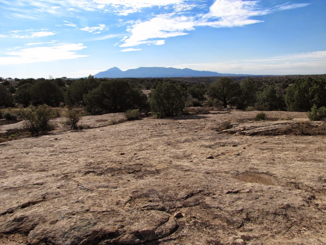
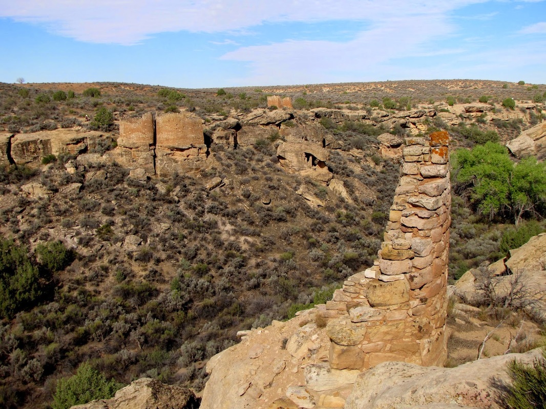
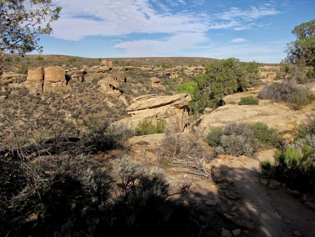
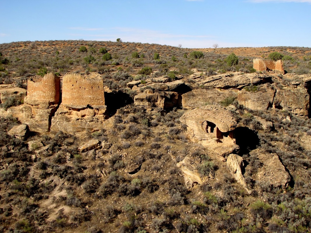
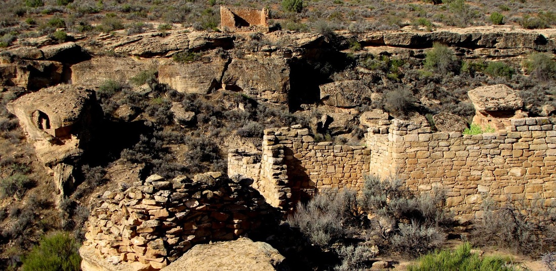
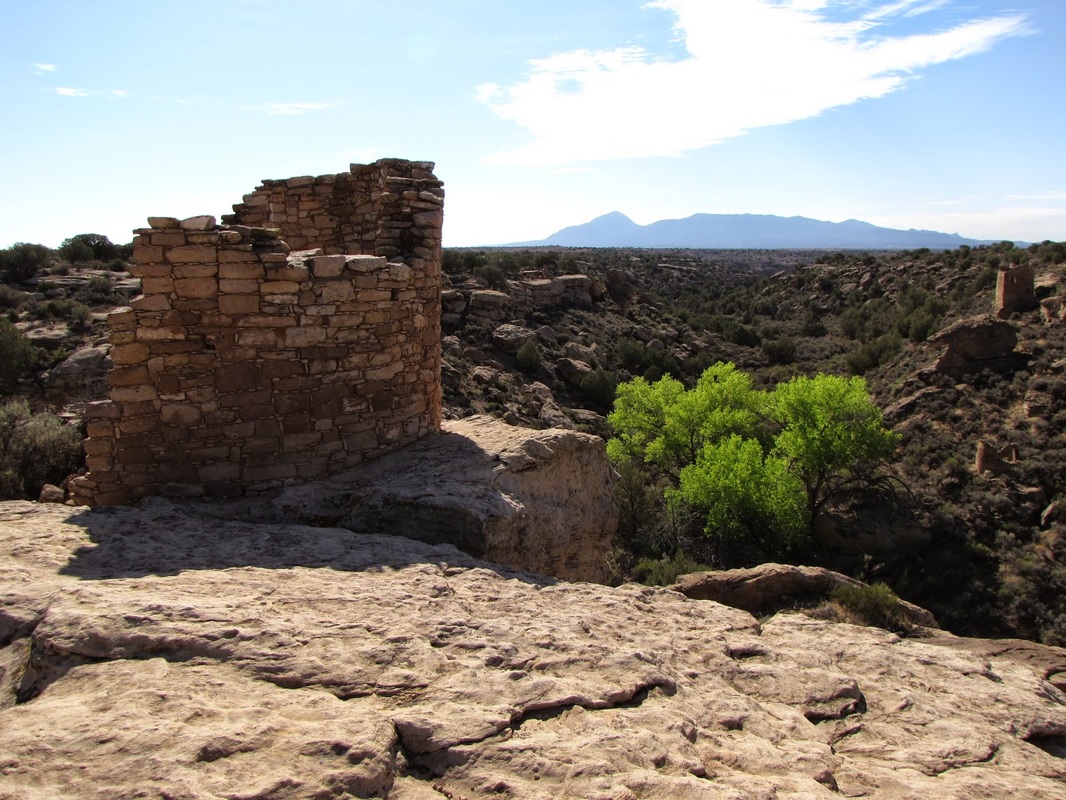
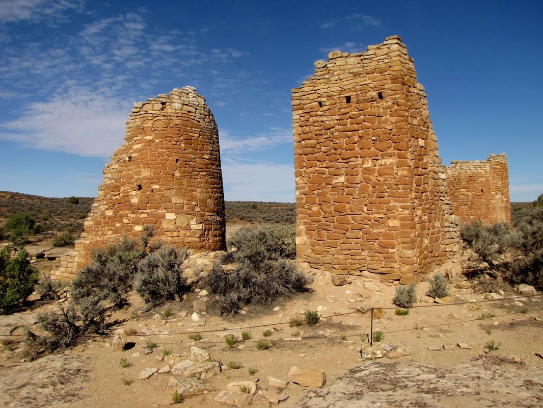
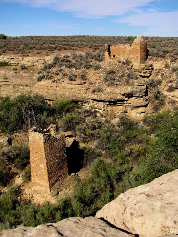
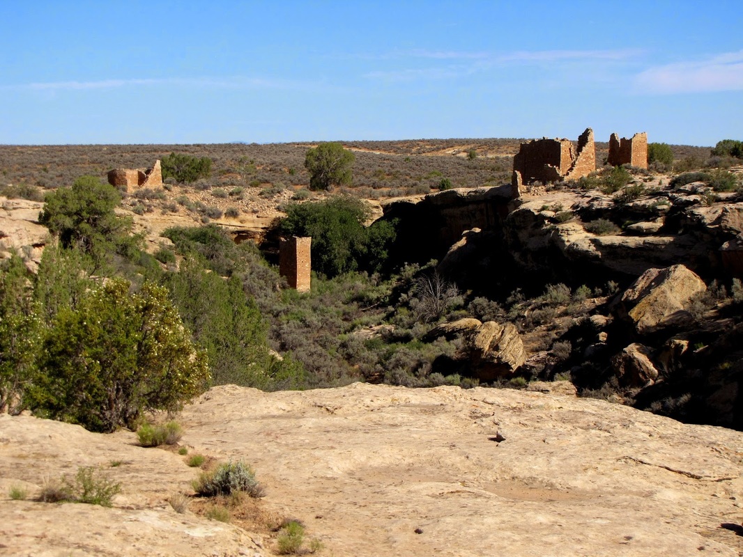
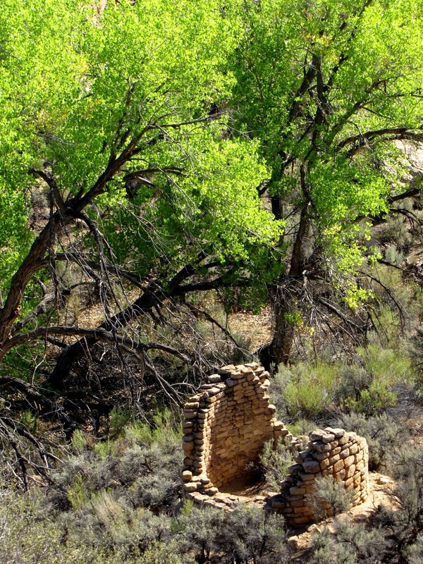
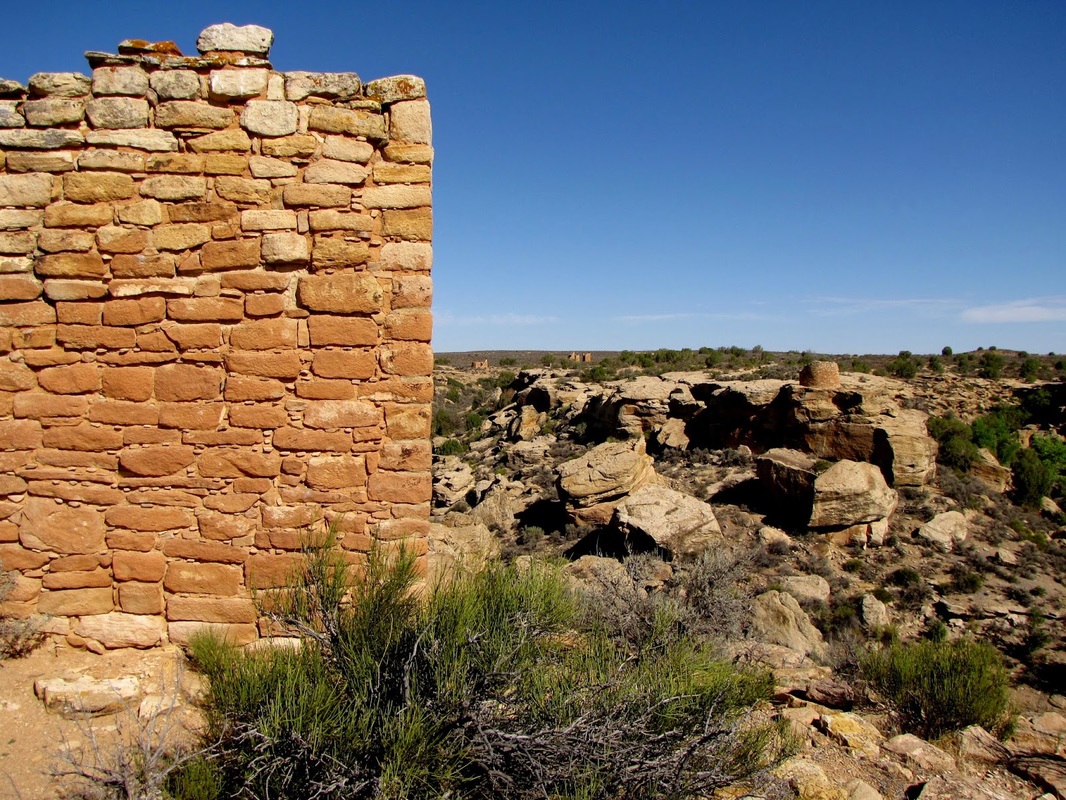
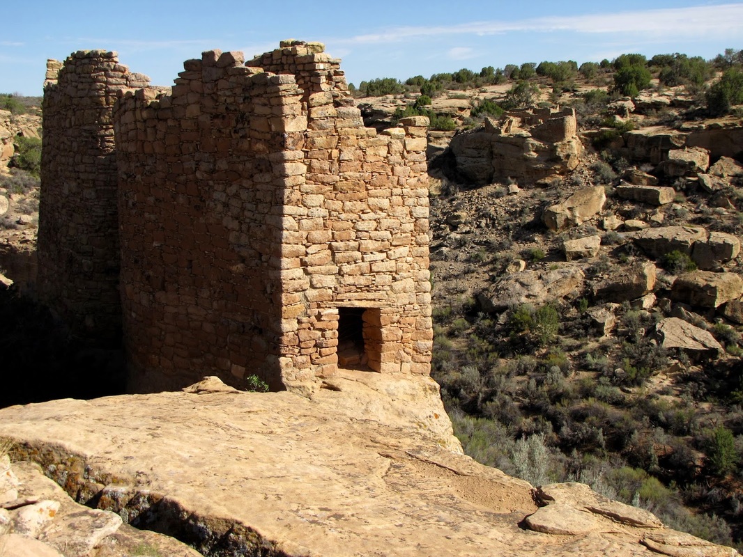
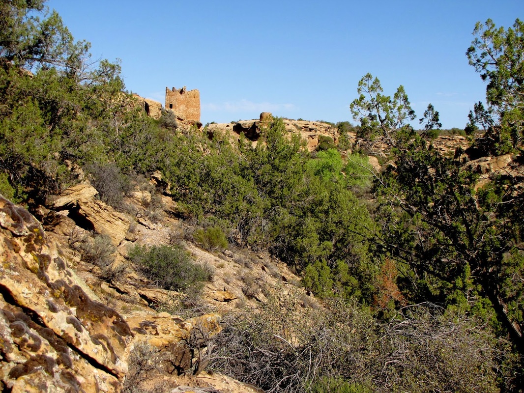
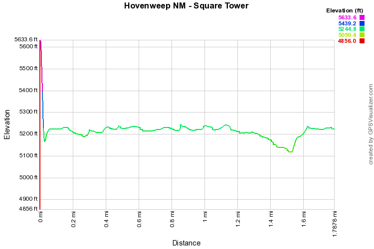
The Square Towers Group hike is actually in Utah as Hovenweep National Monument spans both Utah and Colorado.  However, since this hike is the main attraction of the park, I thought it fitting to include it here.  This hike is wonderful and well worth the drive to get here.  From the visitor center the trail loops around the rim of Little Ruin Canyon past various ancestral Puebloan structures and ruins.   The landscape consists of wonderfully sparse desert with big sky and small vegetation.   As you walk around the canyon stop at the various interpretive signs and keep looking down into the canyon for all the hidden kivas.  Once you round the south end of the trail you’ll dip down into the canyon to the creek bed and climb back up the other side.     

Square Towers Group is the easiest group of structures to access in Hovenweep and the only hike that does not require you to drive on dirt roads.  That being said, this park does not get the same high level of visitation as nearby Mesa Verde making for a quiet and isolated National Park experience at any time of year.
© Go Hike Colorado, 2020.  All Rights Reserved. 
Use of photographs without prior authorization is
​strictly prohibited.


Contact us at:
[email protected]
Legal Disclaimer - Information provided on this site is based upon our own observations, always double check information with the appropriate land management agency before heading into the backcountry.  Backcountry travel is inherently dangerous, please take all proper precautions.  Go Hike Colorado is not responsible for injury or incident.