GO HIKE COLORADO
Get in Touch:
  • HOME
  • ABOUT
  • HIKES BY REGION
    • DENVER AREA >
      • Denver Mountain Parks
      • Jefferson County Open Space
      • Lakewood Parks
      • Denver Area Greenways
    • BOULDER AREA
    • DOUGLAS COUNTY
    • FORT COLLINS AREA
    • COLORADO SPRINGS AREA
    • FRONT RANGE
    • TENMILE & MOSQUITO RANGES
    • GORE RANGE
    • SANGRE DE CRISTO MOUNTAINS
    • PARK RANGE
    • SAWATCH RANGE
    • ELK MOUNTAINS
    • SAN JUAN MOUNTAINS
    • THE FLAT TOPS
    • GRAND MESA
    • COLORADO PLATEAU
    • EASTERN PLAINS
  • NATIONAL PARK HIKES
    • BENT'S OLD FORT NATIONAL HISTORIC SITE
    • BLACK CANYON OF THE GUNNISON NATIONAL PARK
    • COLORADO NATIONAL MONUMENT
    • CURECANTI NATIONAL RECREATION AREA
    • DINOSAUR NATIONAL MONUMENT
    • FLORISSANT FOSSIL BEDS NATIONAL MONUMENT
    • MESA VERDE NATIONAL PARK
    • ROCKY MOUNTAIN NATIONAL PARK
    • GREAT SAND DUNES NATIONAL PARK
    • HOVENWEEP NATIONAL MONUMENT
    • SAND CREEK MASSACRE NATIONAL HISTORIC SITE
    • YUCCA HOUSE NATIONAL MONUMENT
  • HIKES BY CATEGORY
    • HIKES TO ALPINE LAKES
    • HIKES TO PEAKS & PASSES
    • HIKES THROUGH CANYONS
    • HIKES WITH FALL COLORS
    • HIKES ALONG THE I-70 CORRIDOR
    • HIKES ON PAVED TRAILS
    • HIKES FOR KIDS
    • HIKES TO WATERFALLS
    • HIKES ALONG RIVERS
    • HIKES WITH ROCK FORMATIONS
    • HIKES WITH WILDFLOWERS
    • WINTER HIKES
  • NEWS
  • WEBCAMS
  • $UPPORT GHC
  • INTERACTIVE MAP

Gross Reservoir Scenic View
​Gross Reservoir

Date Hiked: March 5, 2016

Distance: .15 mi (RT) 
Elevation Gain: 50 ft
Trailhead Lat/Long: 39º 56' 54" N; 105º 21' 13" W
Managing Agency: Denver Water
​Fee: None

Gross Reservoir Website
Picture

Please note that Gross Reservoir will be under going an expansion project that will impact recreational activities at Gross Reservoir this season and beyond. While the reservoir will remain open throughout construction, there will be some changes and areas that are temporarily closed. Please see the Gross Reservoir website, linked above, or the info graphic below for the anticipated schedule and impacts.
Picture

Directions:  From Boulder, take Flagstaff Road west until it turns into Gross Dam Road.  Follow Gross Dam Road to the North Shore parking area but instead of turning into the parking lot, turn left and follow the good dirt road for about .5 mile to the Scenic View parking lot.  From Denver, take I-70 W to 93 North.  Turn West on Hwy 72 to Gross Dam Road.  Follow Gross Dam Road down towards the reservoir, when you see the park sign and map, turn right and follow Gross Dam Road (good dirt road) for about 1.9 miles to the Scenic View parking area.

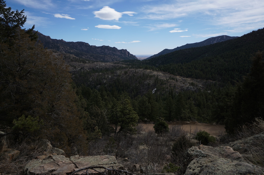
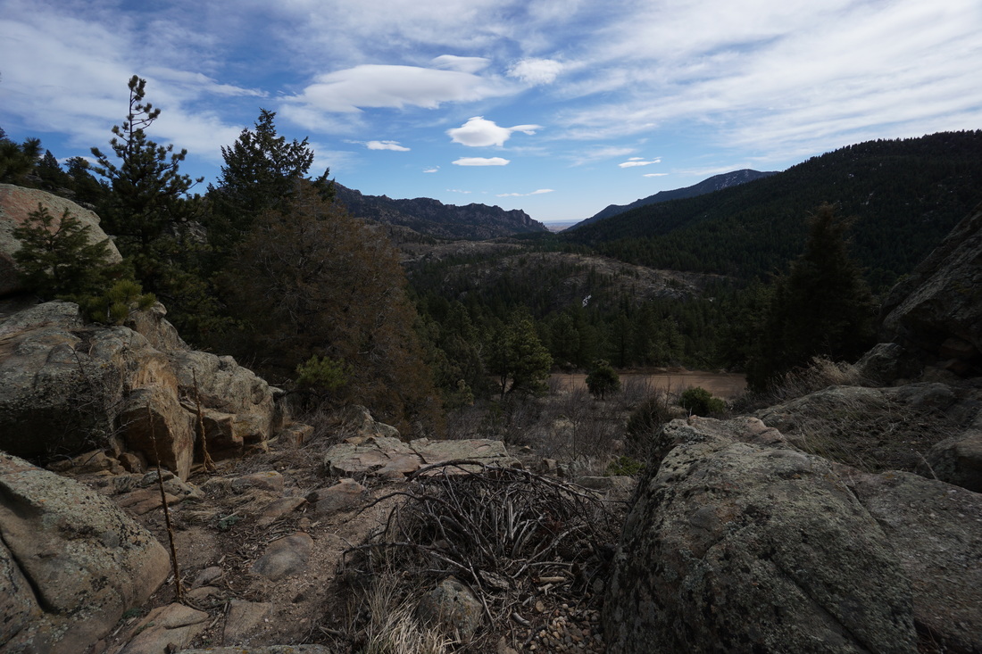
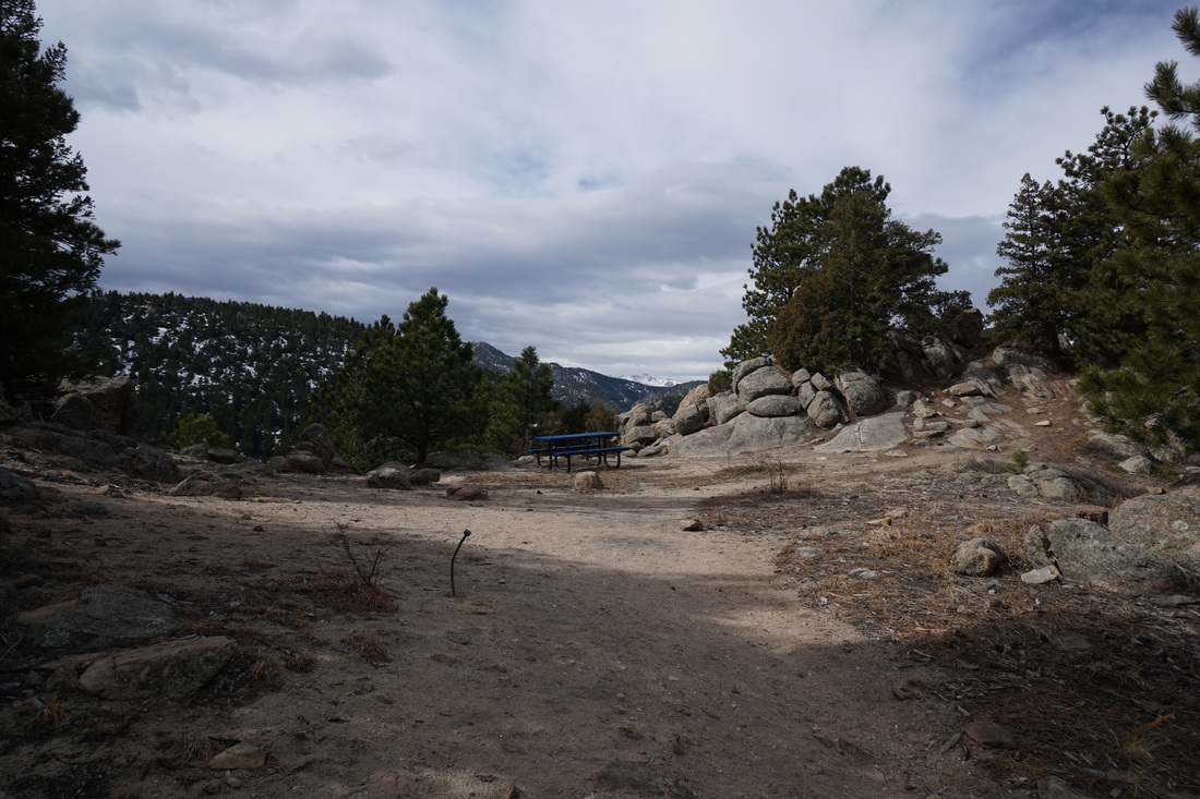
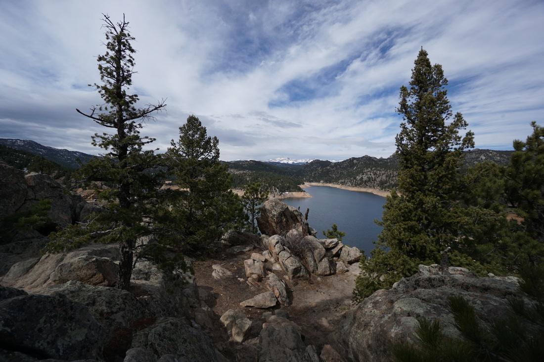
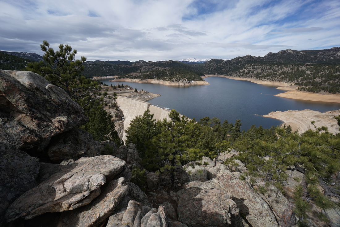
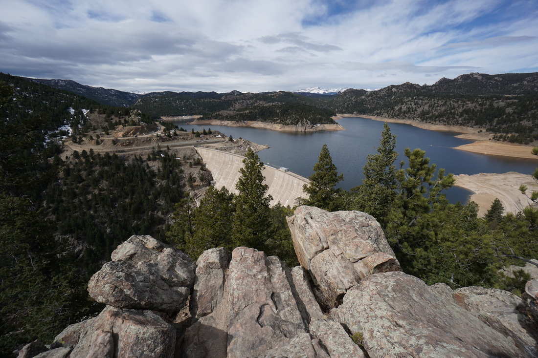
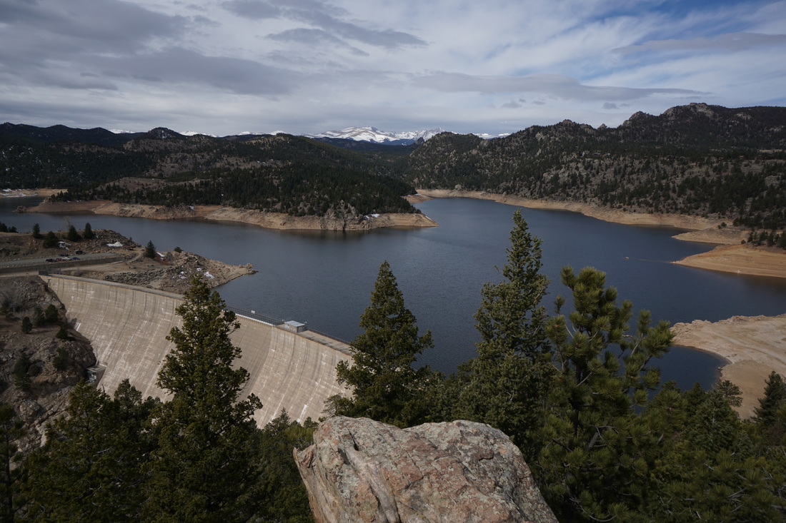
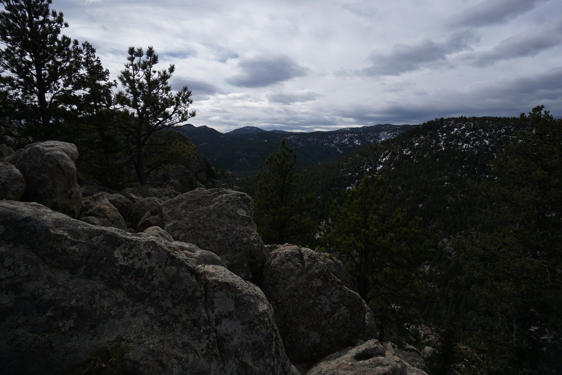
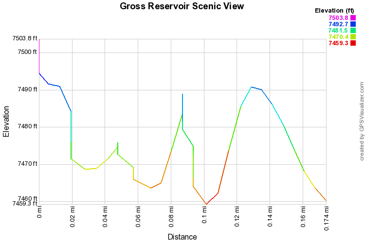
The Gross Reservoir Scenic View, is not much of a hike but I mention it here because the view is truly spectacular.  From the parking area, follow the obvious trail through the wooden fence and up to the picnic table about .1 mile from the parking area.  The view from the picnic table is good, but for the best view scramble up the rock outcropping to the right.  The view looks down on Gross Reservoir and out west to the Indian Peaks towering above the horizon.  We highly suggest adding this short outing to your visit to Gross Reservoir.
Powered by Create your own unique website with customizable templates.