GO HIKE COLORADO
Get in Touch:
  • HOME
  • ABOUT
  • HIKES BY REGION
    • DENVER AREA >
      • Denver Mountain Parks
      • Jefferson County Open Space
      • Lakewood Parks
      • Denver Area Greenways
    • BOULDER AREA
    • DOUGLAS COUNTY
    • FORT COLLINS AREA
    • COLORADO SPRINGS AREA
    • FRONT RANGE
    • TENMILE & MOSQUITO RANGES
    • GORE RANGE
    • SANGRE DE CRISTO MOUNTAINS
    • PARK RANGE
    • SAWATCH RANGE
    • ELK MOUNTAINS
    • SAN JUAN MOUNTAINS
    • THE FLAT TOPS
    • GRAND MESA
    • COLORADO PLATEAU
    • EASTERN PLAINS
  • NATIONAL PARK HIKES
    • BENT'S OLD FORT NATIONAL HISTORIC SITE
    • BLACK CANYON OF THE GUNNISON NATIONAL PARK
    • COLORADO NATIONAL MONUMENT
    • CURECANTI NATIONAL RECREATION AREA
    • DINOSAUR NATIONAL MONUMENT
    • FLORISSANT FOSSIL BEDS NATIONAL MONUMENT
    • MESA VERDE NATIONAL PARK
    • ROCKY MOUNTAIN NATIONAL PARK
    • GREAT SAND DUNES NATIONAL PARK
    • HOVENWEEP NATIONAL MONUMENT
    • SAND CREEK MASSACRE NATIONAL HISTORIC SITE
    • YUCCA HOUSE NATIONAL MONUMENT
  • HIKES BY CATEGORY
    • HIKES TO ALPINE LAKES
    • HIKES TO PEAKS & PASSES
    • HIKES THROUGH CANYONS
    • HIKES WITH FALL COLORS
    • HIKES ALONG THE I-70 CORRIDOR
    • HIKES ON PAVED TRAILS
    • HIKES FOR KIDS
    • HIKES TO WATERFALLS
    • HIKES ALONG RIVERS
    • HIKES WITH ROCK FORMATIONS
    • HIKES WITH WILDFLOWERS
    • WINTER HIKES
  • NEWS
  • WEBCAMS
  • $UPPORT GHC
  • INTERACTIVE MAP

Goshawk Ridge
Boulder Mountain Park

Date Hiked: November 7, 2013

​Distance: 4.11 mi (Round Trip)
Elevation Gain: 775 ft
Elevation Min/Max: 5,782 to 6,557ft
Managing Agency: City of Boulder Open Space & Mt. Parks
Fee: None

Doudy Draw Trailhead Map
Picture

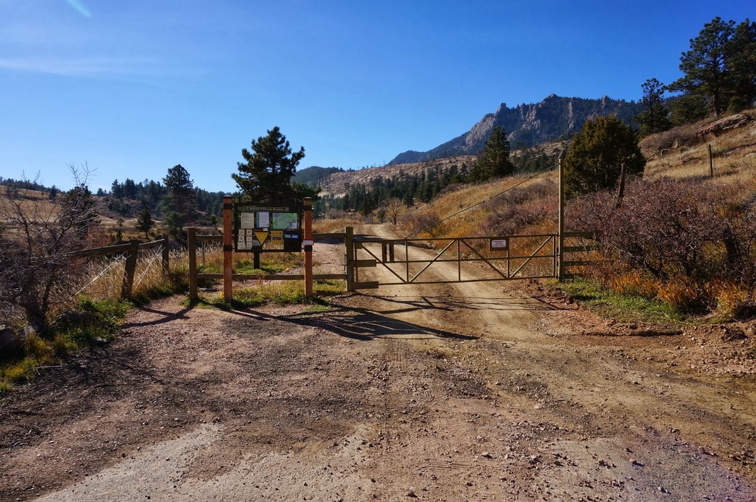
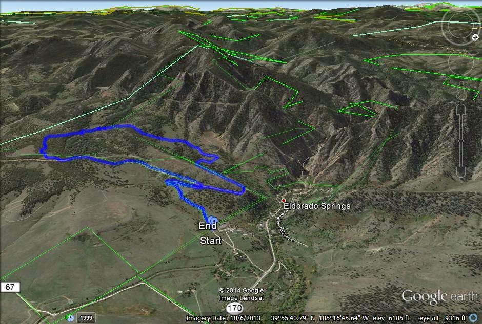
Directions:  This trail description begins at the Eldorado Mountain Trailhead.  From Denver/Boulder take Hwy 93 and head west on Eldorado Springs Drive.  Pass the Doudy Draw Trailhead and make the next left (look for the Ashram sign).  Drive up the paved/dirt road to the gate closure.  There is very limited parking on the east side of the road. 

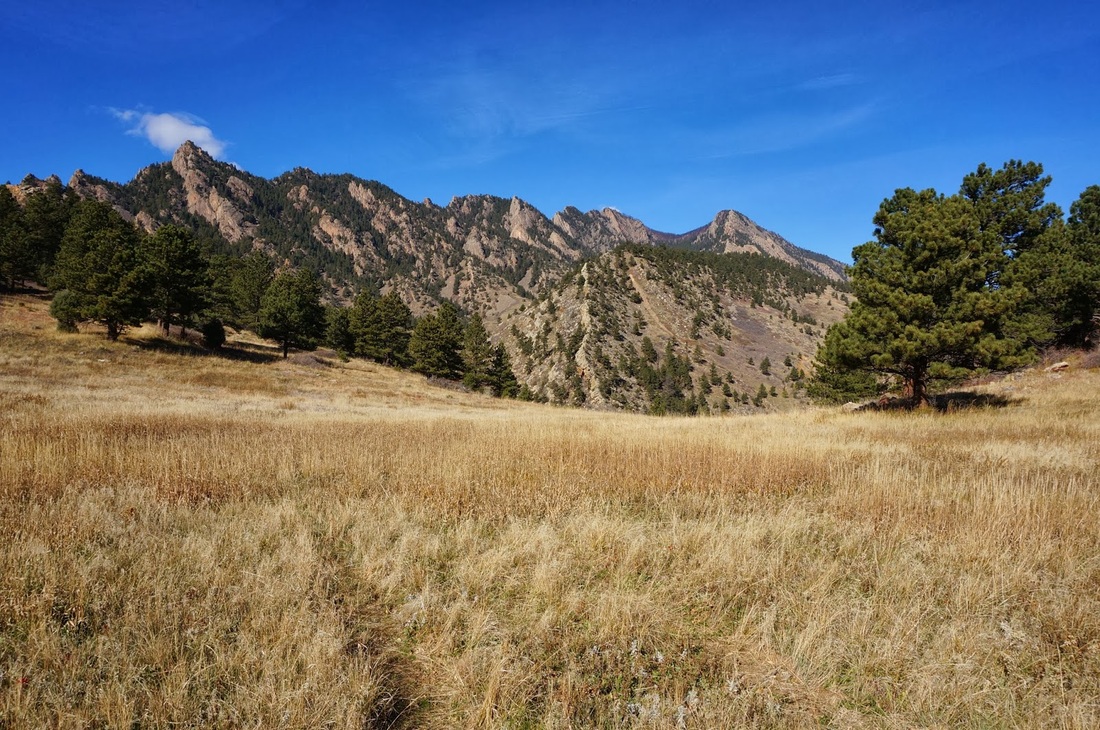
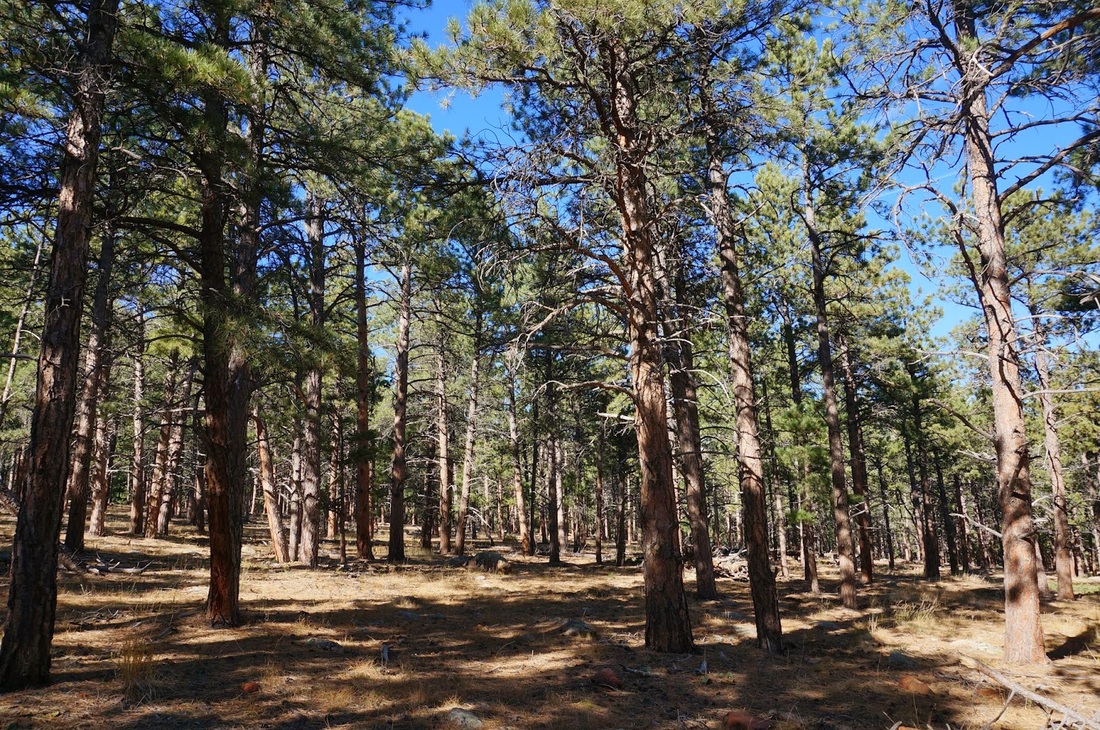
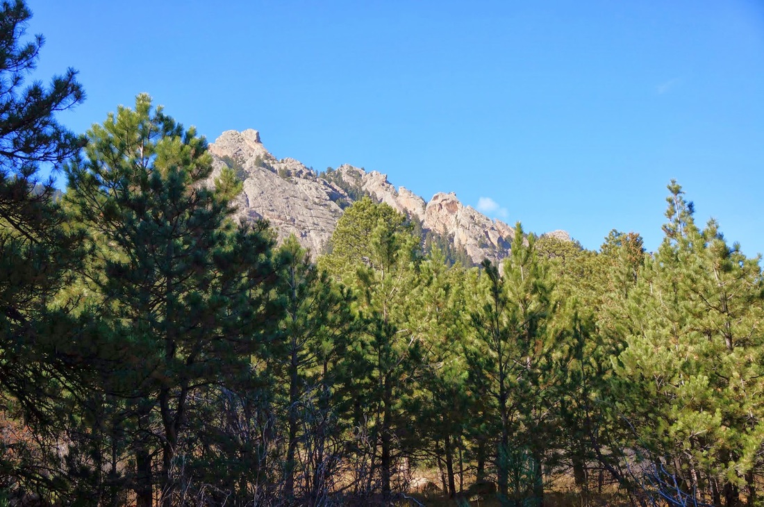
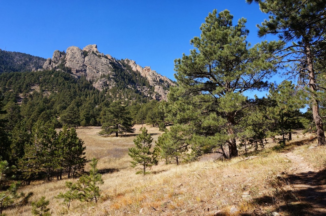
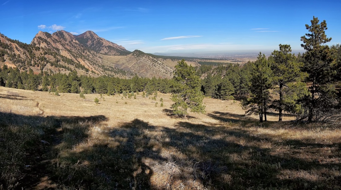
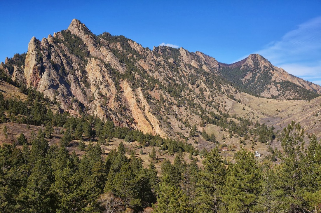
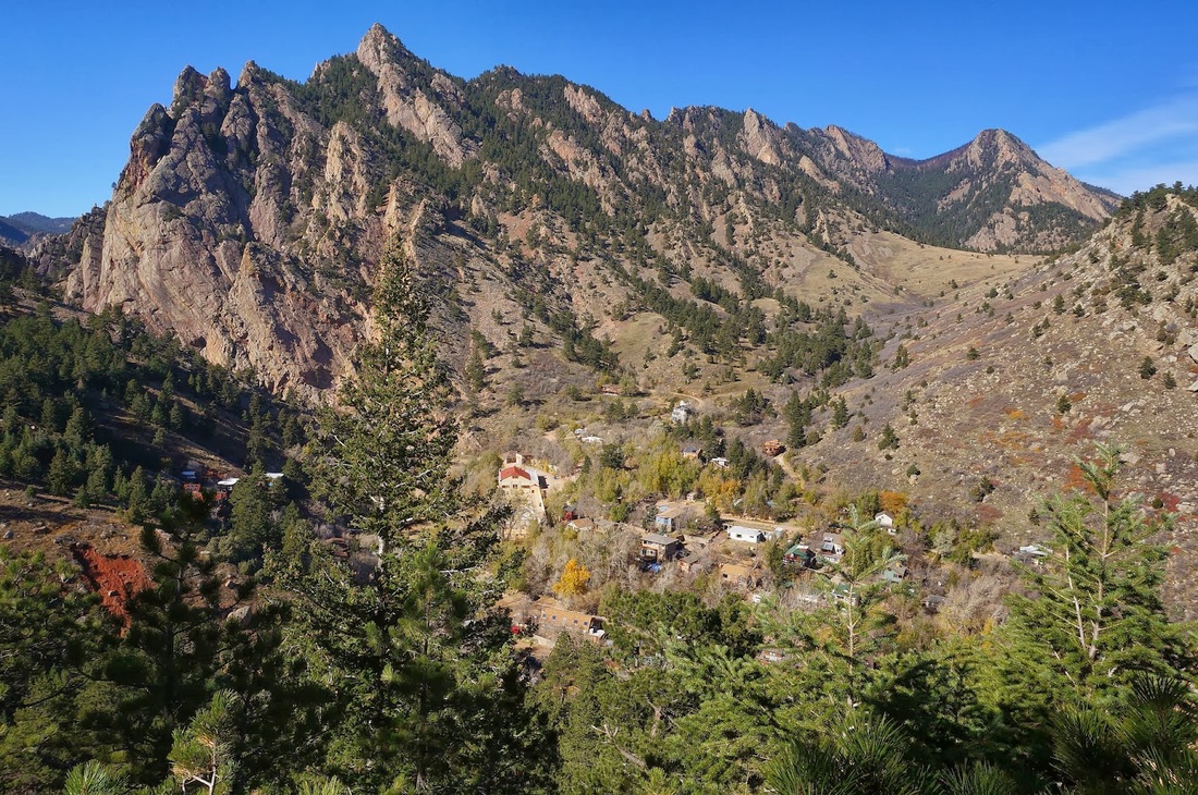
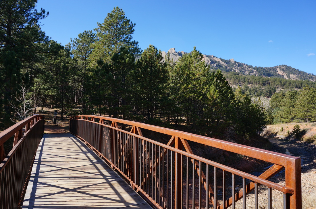
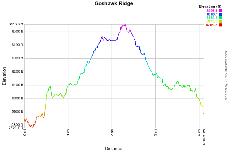
Hike up the dirt road to the junction with the Spring Brook trail.  Go left on the Spring Brook trail until you hit the irrigation ditch, look for a bridge crossing and the start of Goshawk Ridge Trail.  The trail enters a pine forest and soon offers fantastic views of Eldorado Mountain, Eldorado Canyon, and Shirttail Peak.  This one of the best views in the Boulder mountains and a great view down into Eldorado Springs and the start to Eldorado Canyon.  Follow the trail to the Fowler trail and stay straight.  You can make a left and take the Fowler trail into Eldorado Canyon State Park.  Going just past the state park boundary gives you an amazing view of the cliffs of Eldorado Canyon, truly spectacular.  Follow the Fowler trail through a rock cut and hook up again with the Spring Brook Trail back to the Trailhead.

This is one of my favorite south-of-Boulder trails and makes for a wonderful quick hike with great views and few crowds.
© Go Hike Colorado, 2020.  All Rights Reserved. 
Use of photographs without prior authorization is
​strictly prohibited.


Contact us at:
[email protected]
Legal Disclaimer - Information provided on this site is based upon our own observations, always double check information with the appropriate land management agency before heading into the backcountry.  Backcountry travel is inherently dangerous, please take all proper precautions.  Go Hike Colorado is not responsible for injury or incident.