|
|
|
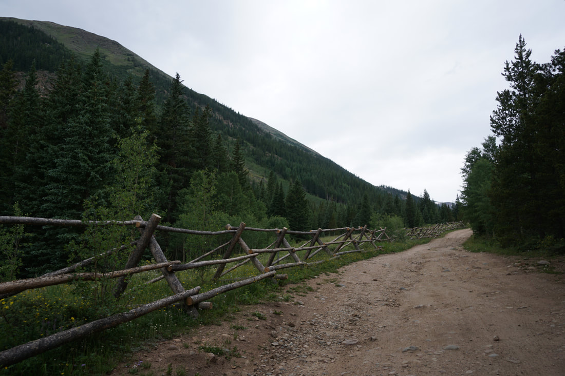
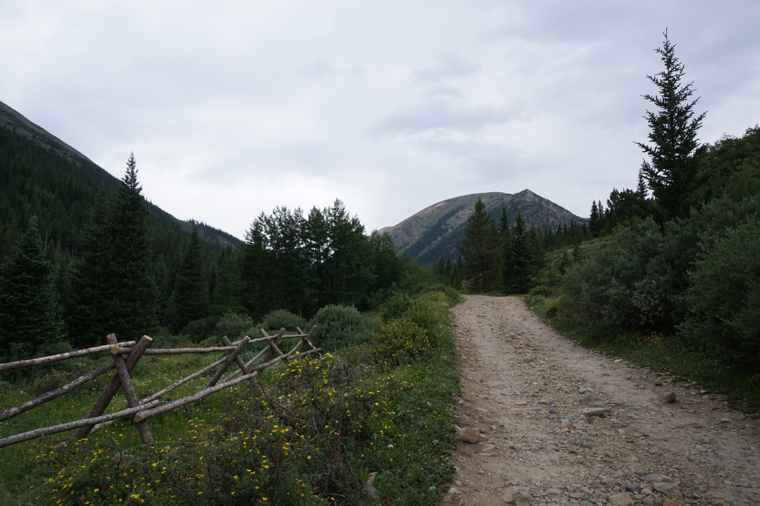
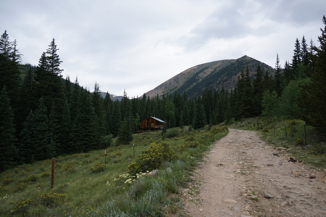
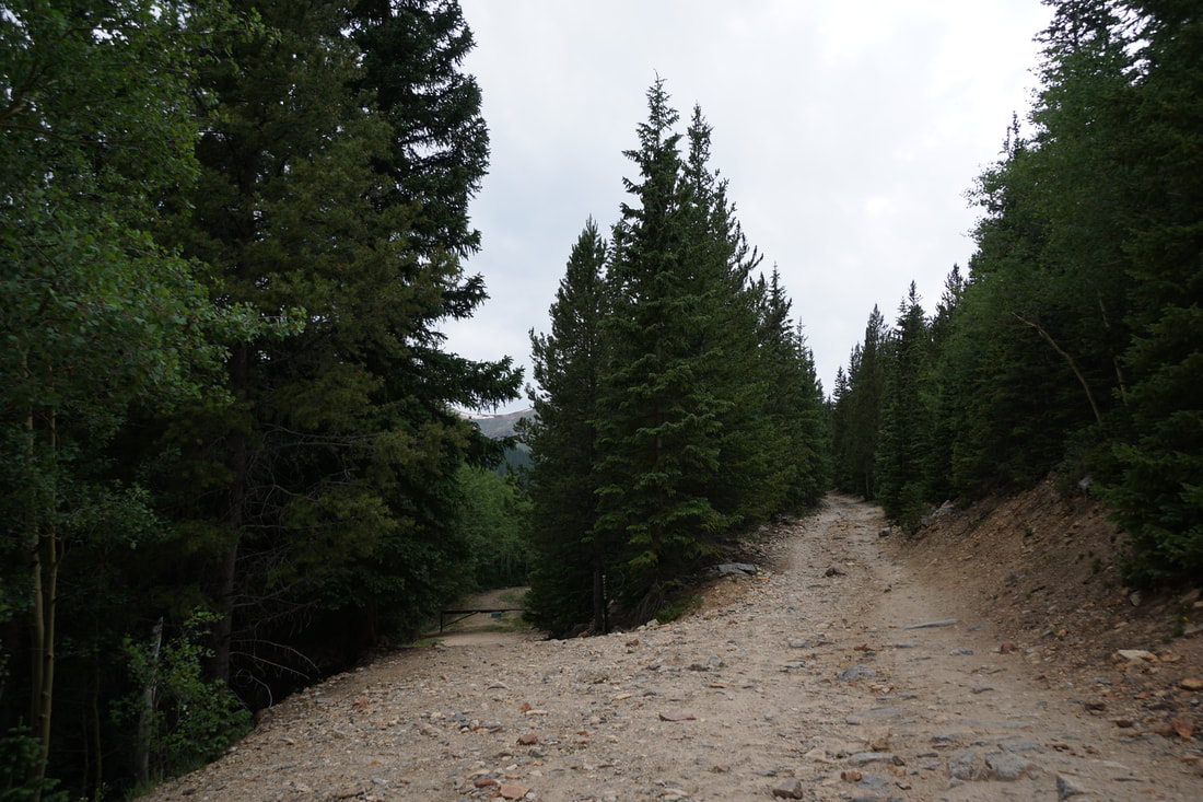
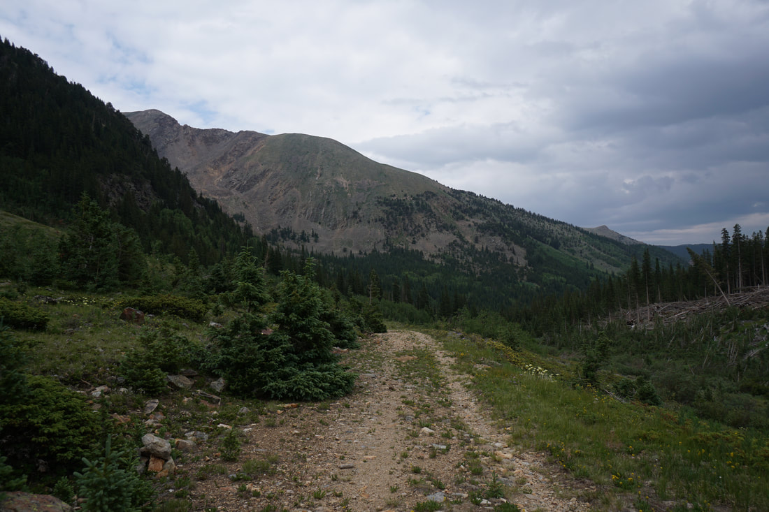
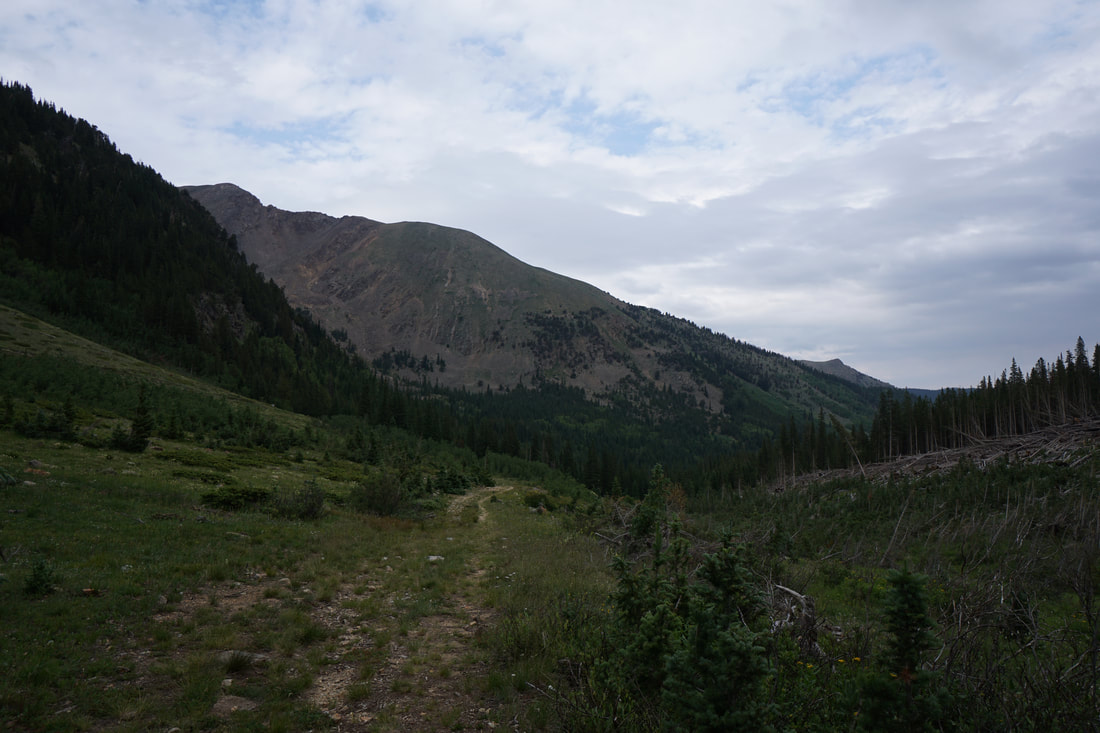
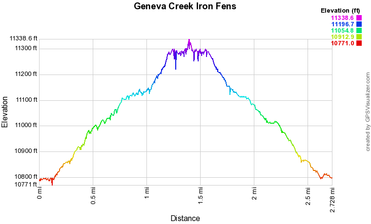
DIRECTIONS: From Bailey, CO drive 10.8 miles west on Highway 285 to Grant, CO. Turn right (north) on Guanella Pass Road. Drive 6.6 miles to the turnoff for Geneva Park campground and Duck Creek Picnic Ground. From the turnoff, the road gets rough. This road really requires 4WD or AWD and some decent clearance. It's 3.25 miles to the Shelf Lake Trailhead but the trailhead for the Iron Fens is another 2 miles up the road. Not all of this road is difficult but there are sections that may stop you in your tracks. In my 2010 Subaru Forester I made it about 3/4 of a mile past the Shelf Lake TH before I reached a fast flowing creek crossing that was too far outside my comfort zone. Even if you need to walk a mile or so up the road, it is a nice area and just adds a bit of distance to the hike.
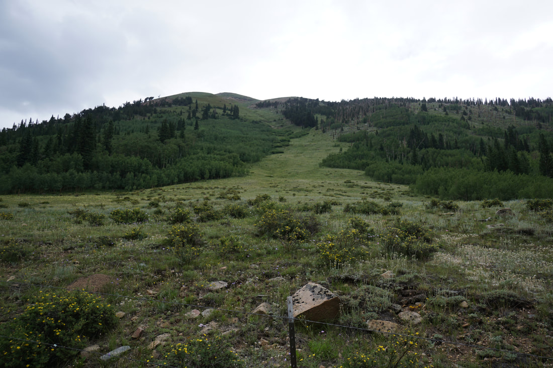
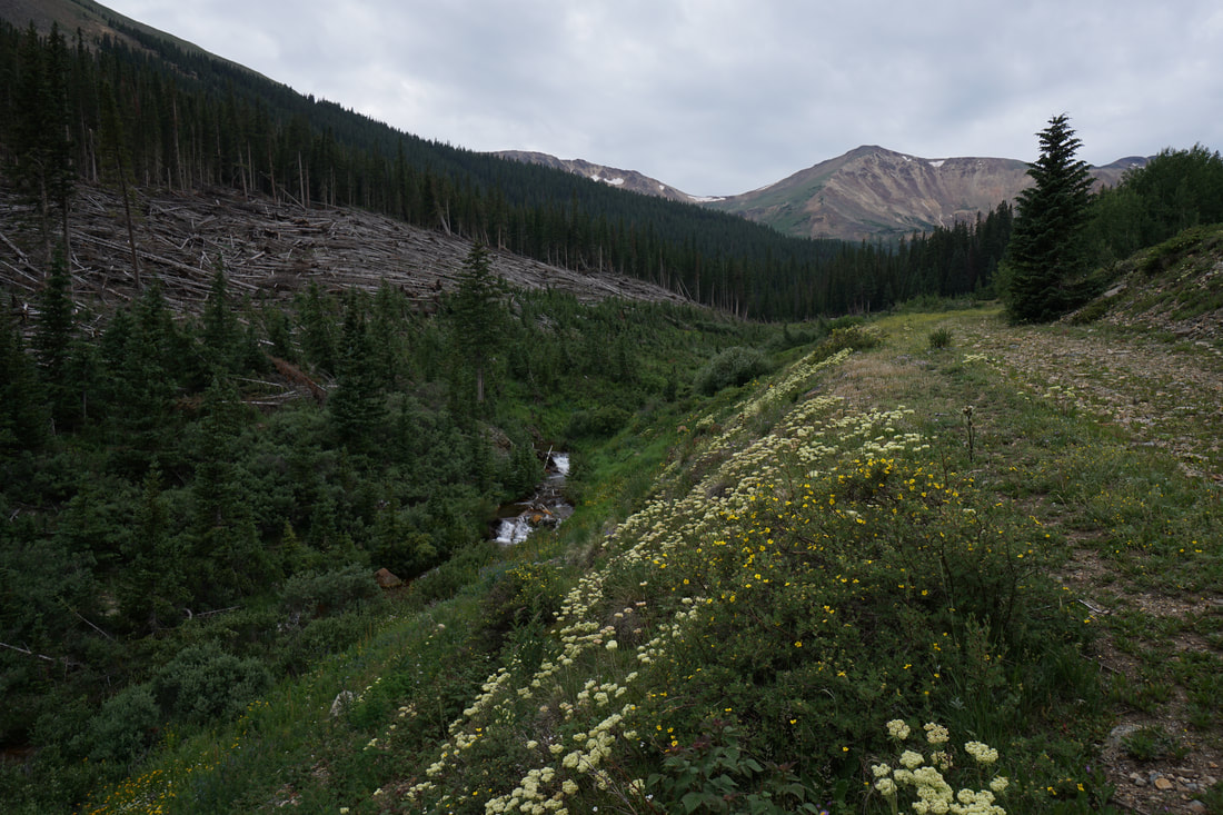
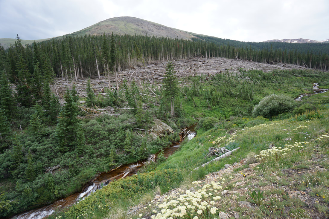
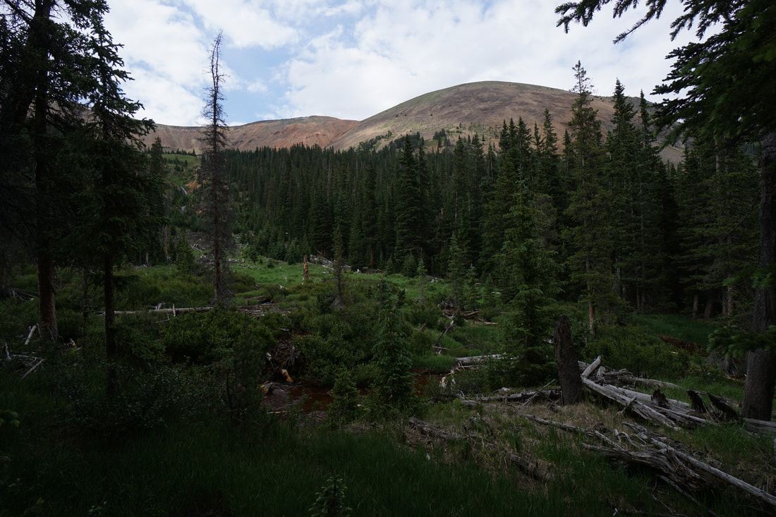
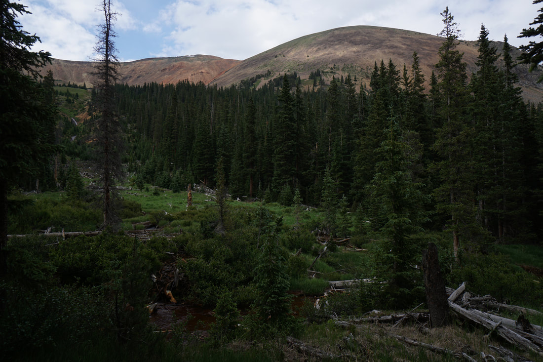
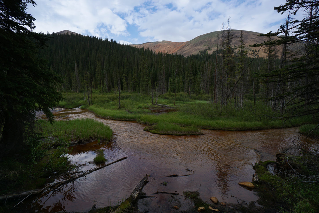
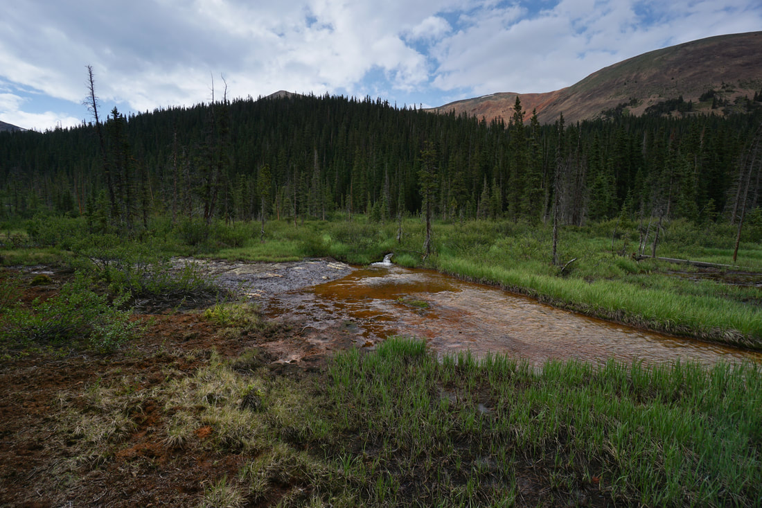
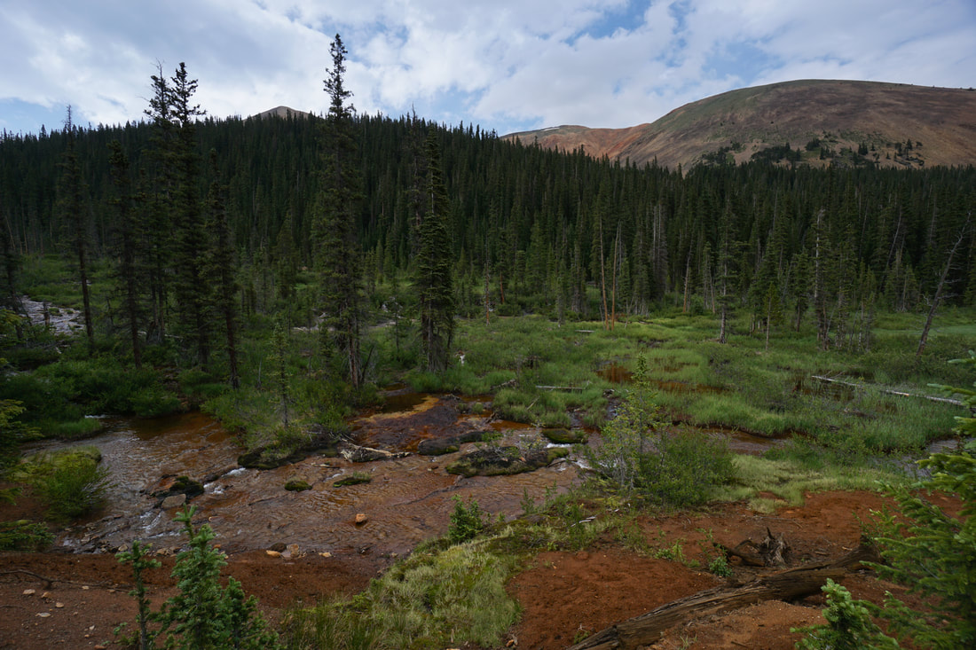
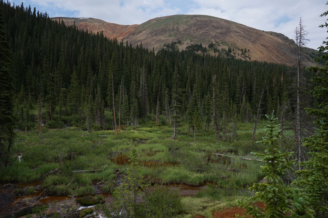
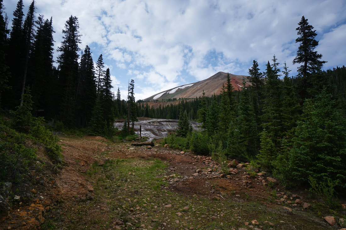
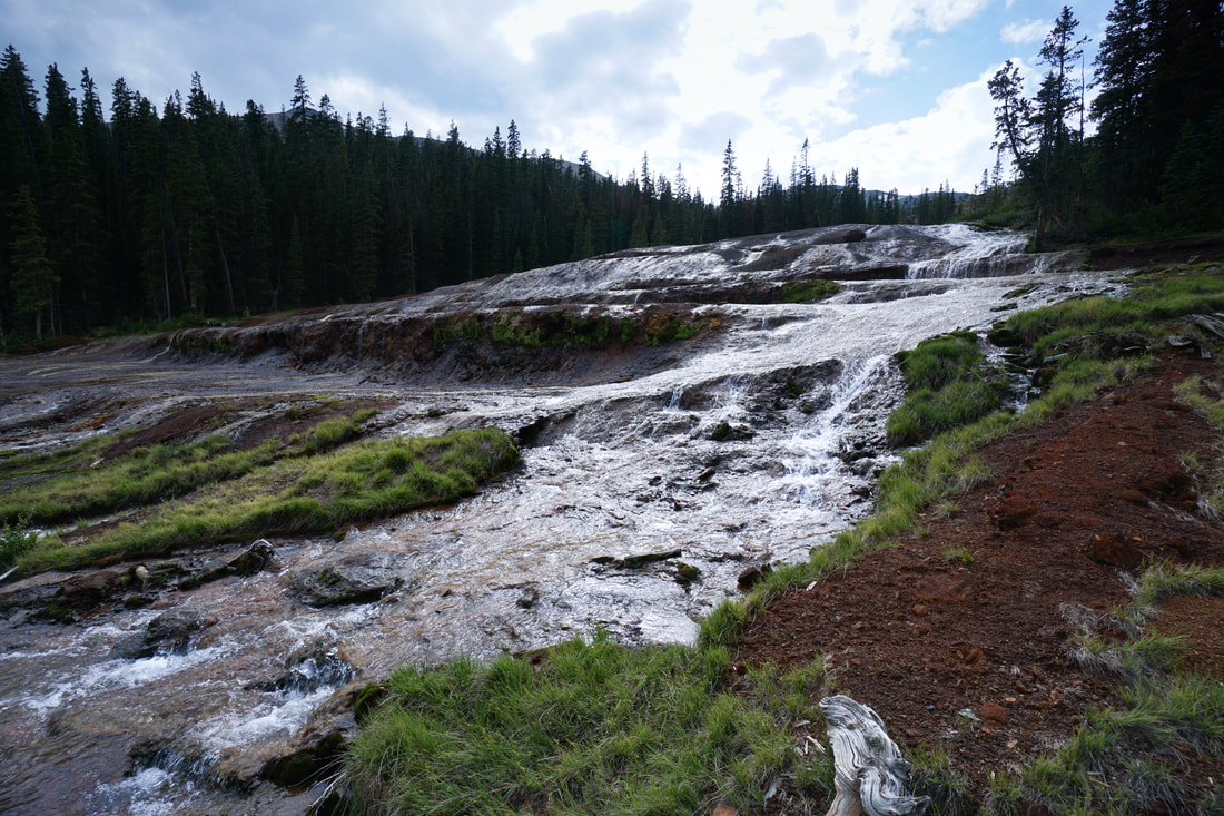
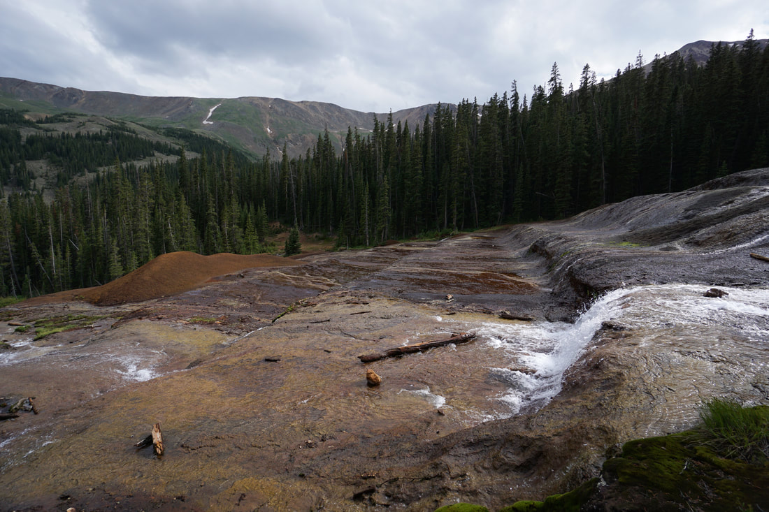
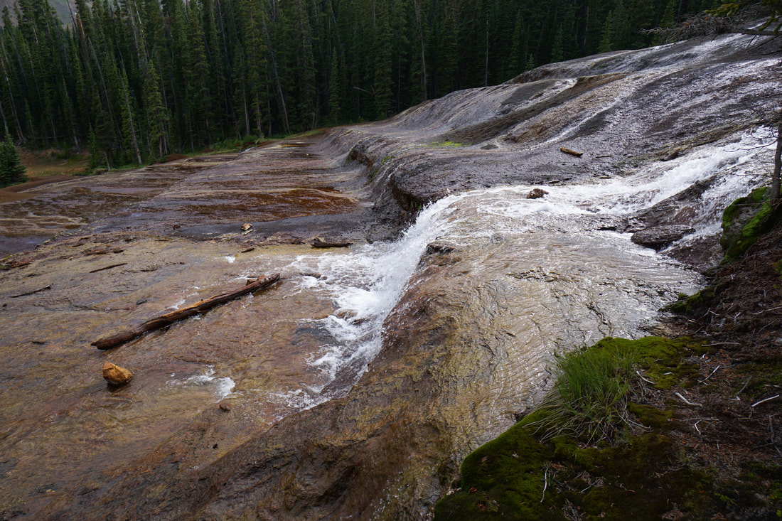
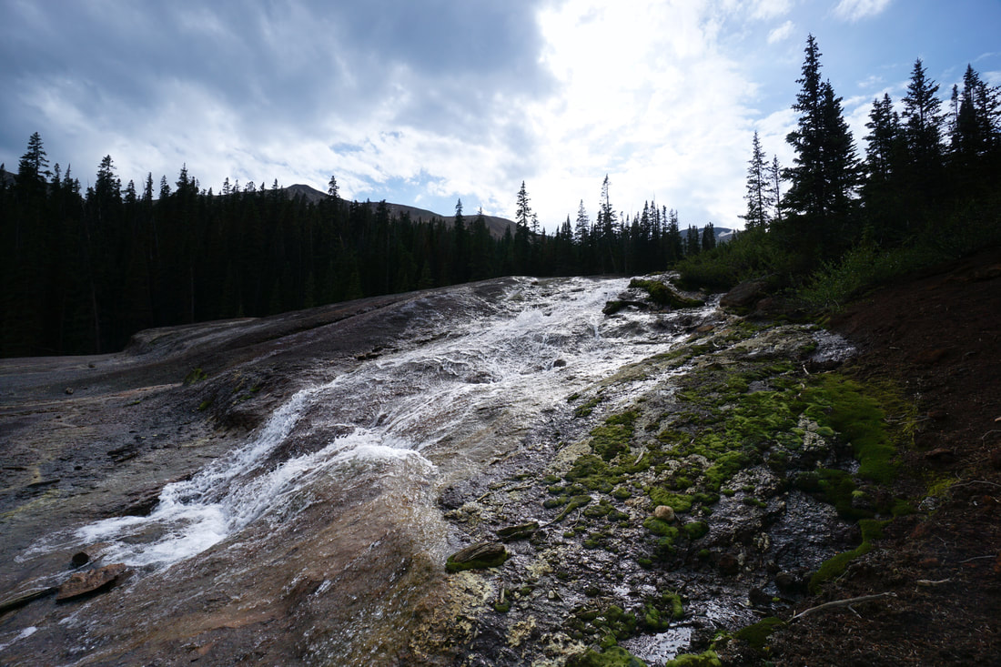
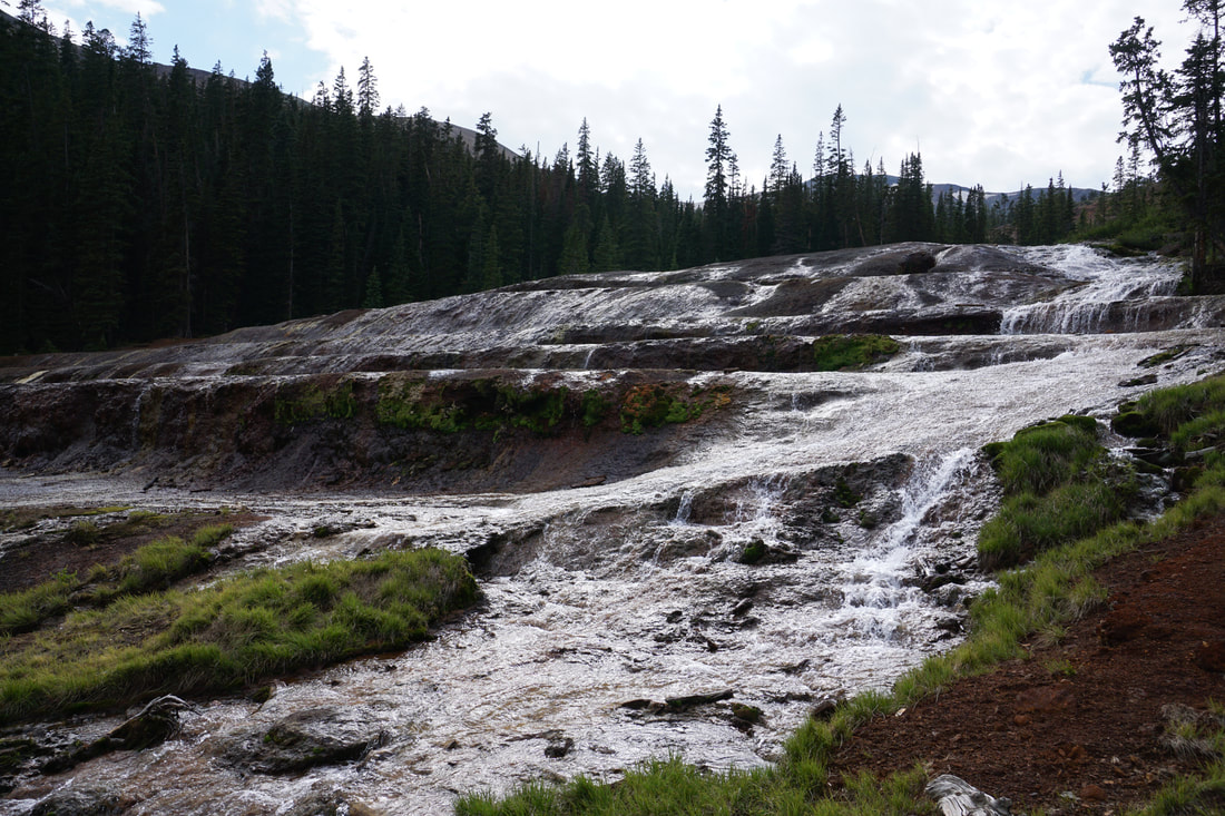
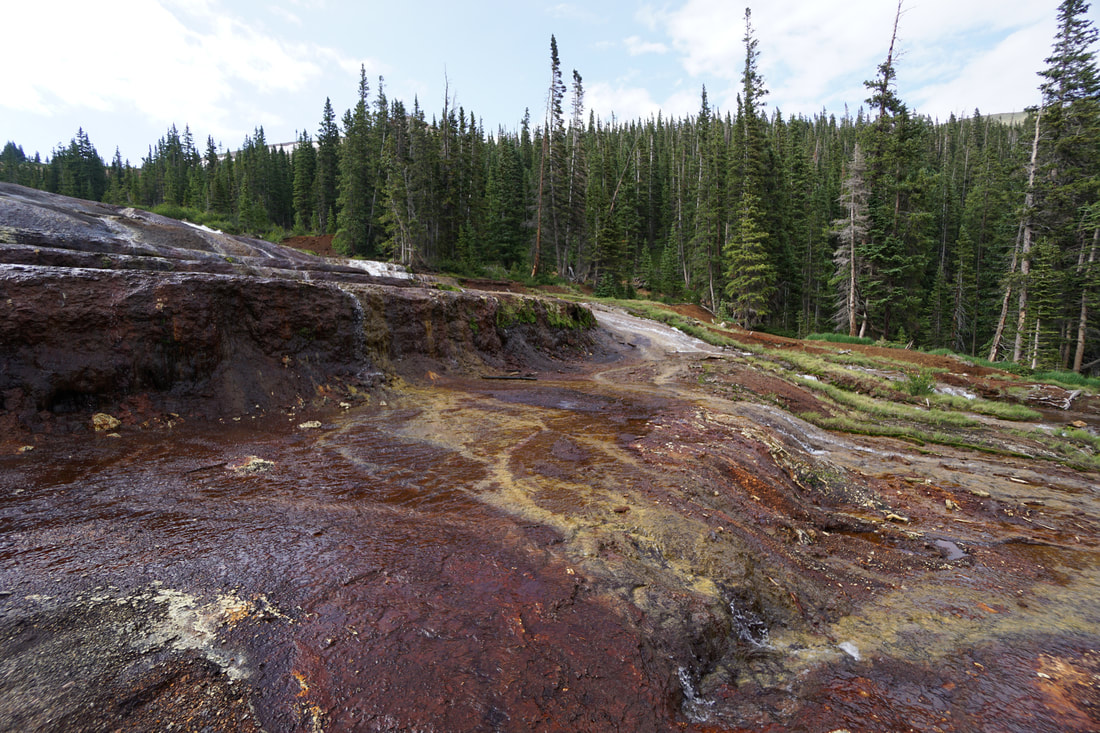
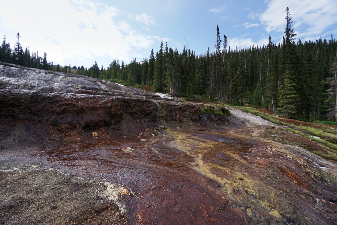
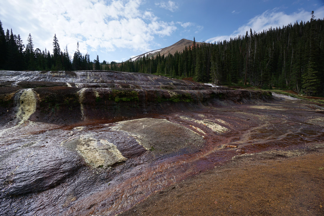
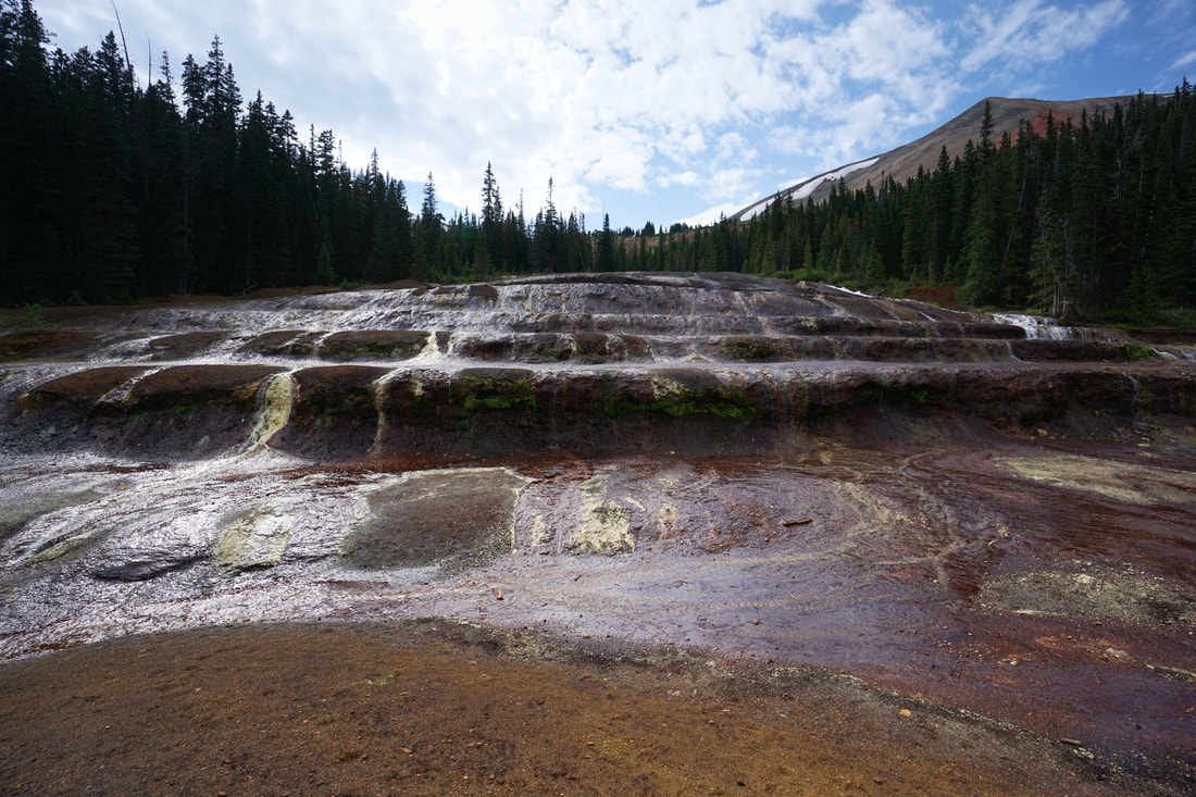
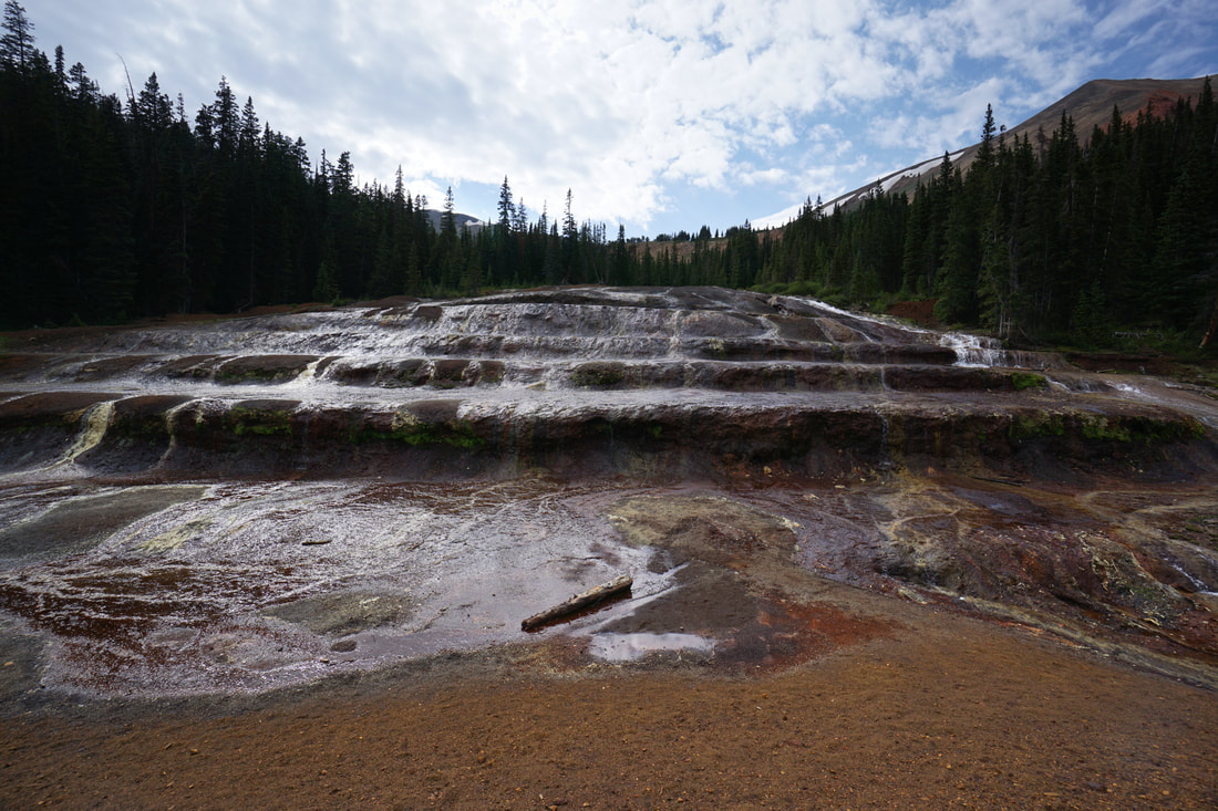
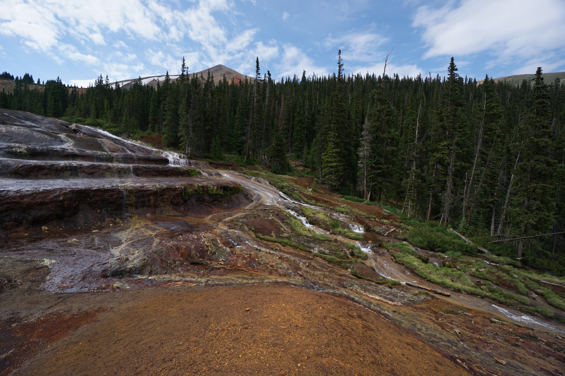
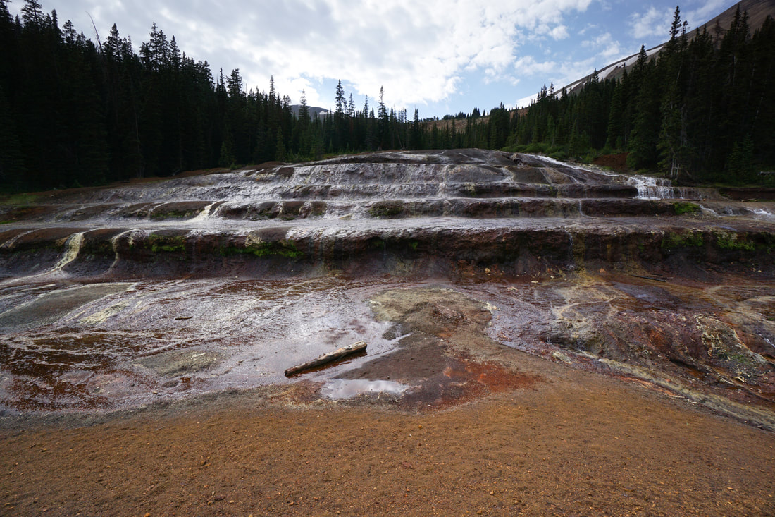
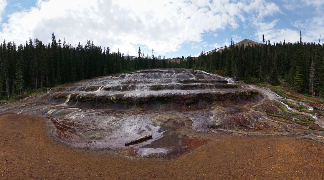
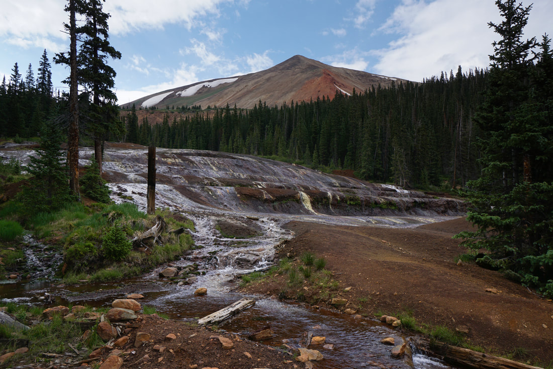
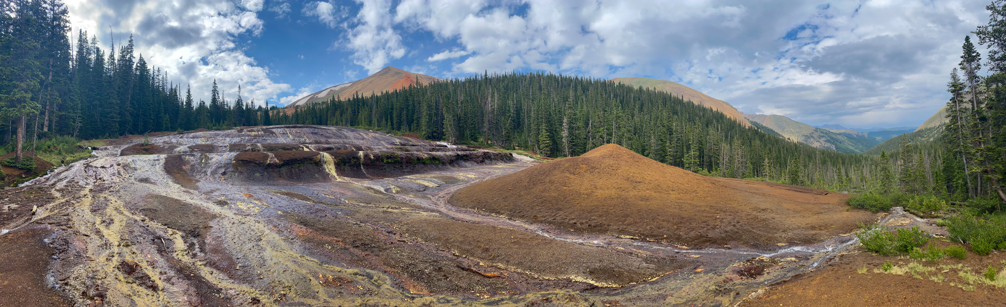
The Geneva Creek Iron Fens are an amazing natural wonder. The iron fens are an utterly unique feature only found in Colorado. It has an other-worldly feel and is relatively unknown to Front Range hikers. The fens are hidden away in Geneva Basin at the end of a long difficult dirt road. The hike to get to the fens is easy enough and the colorful peaks in the Geneva Basin add to the scenic quality of this hike. This hike should be high on everyone's to-do list.
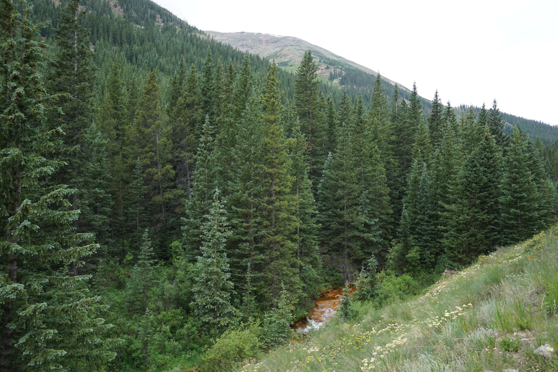
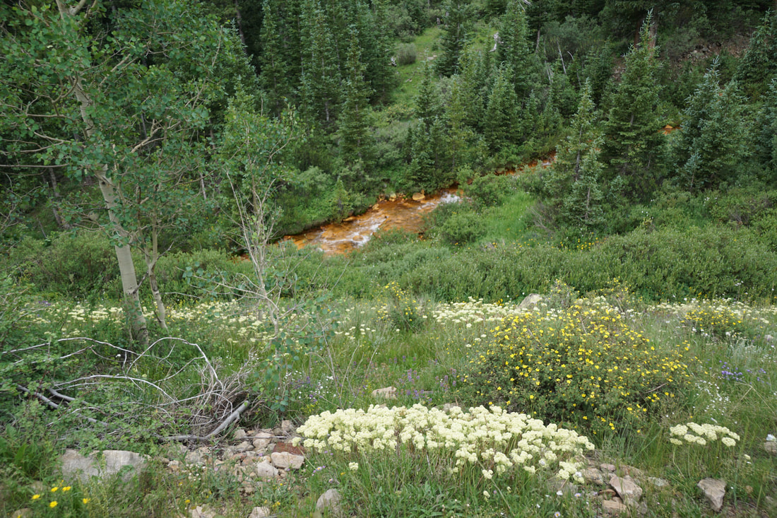
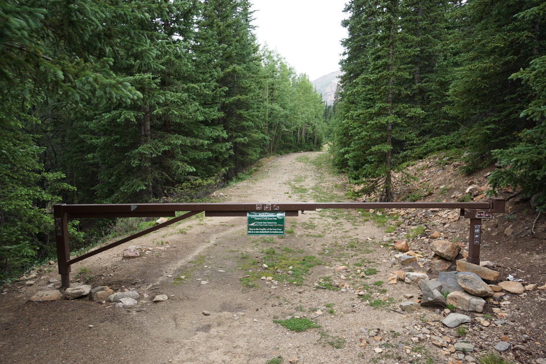
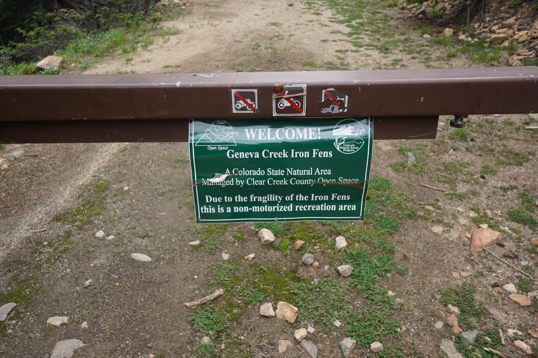
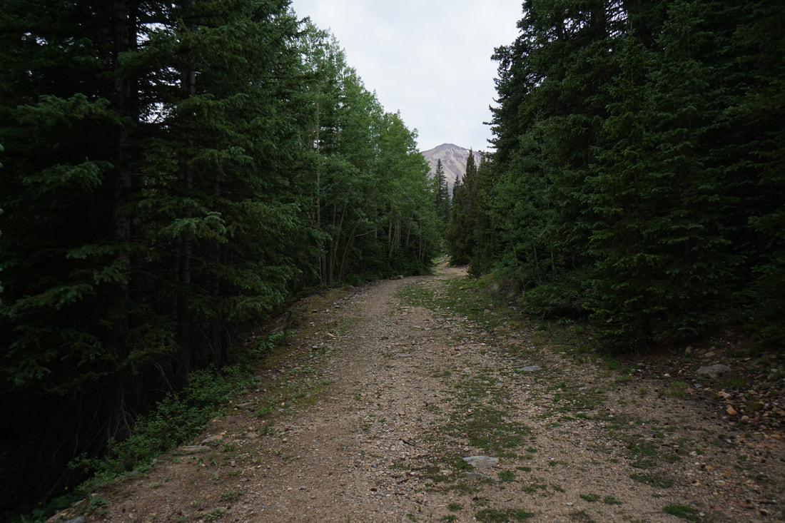
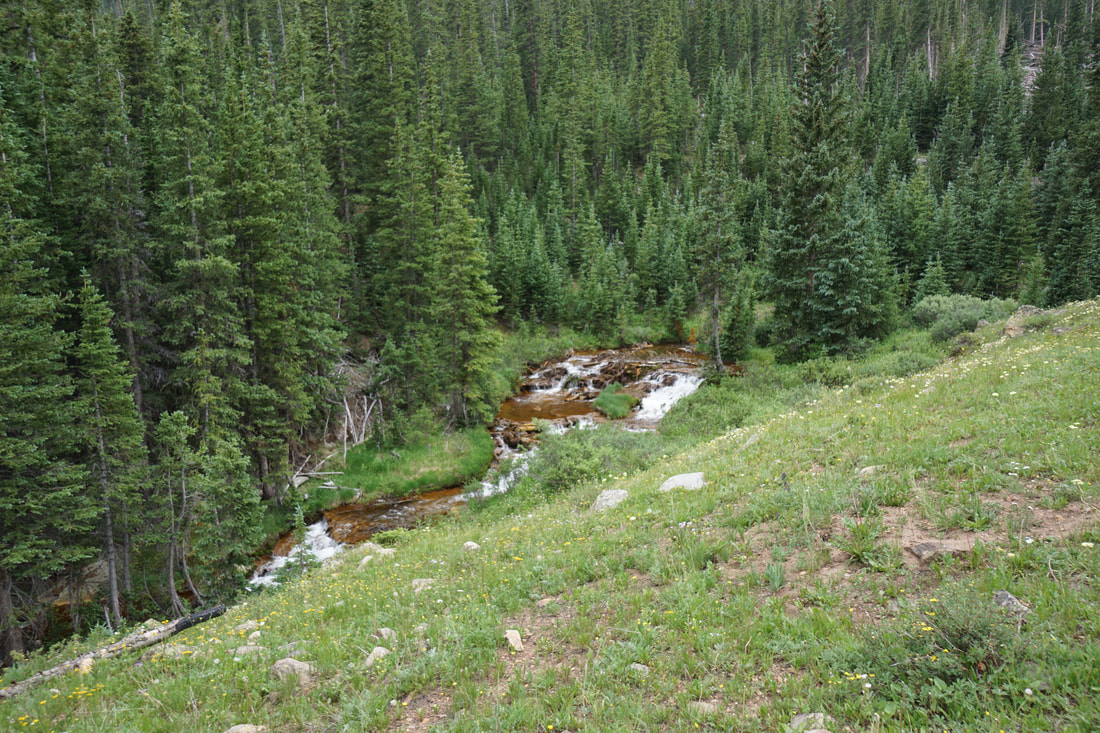
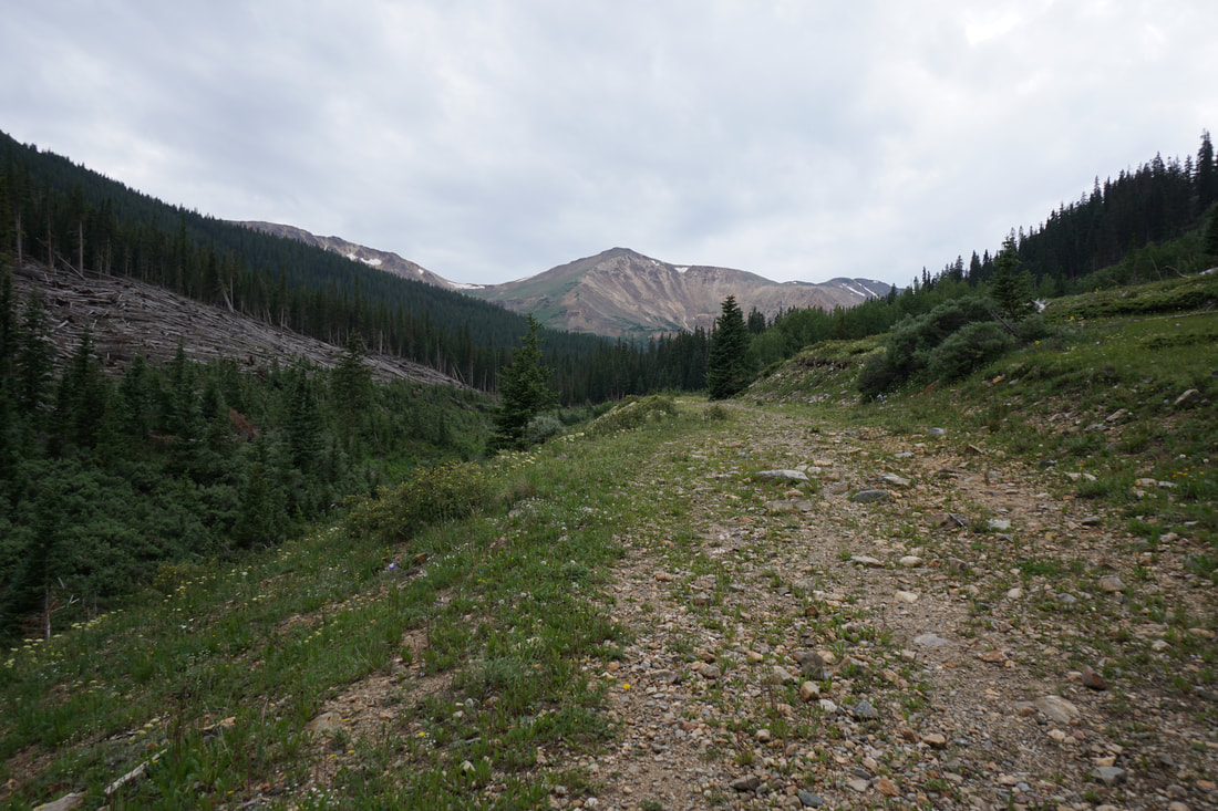
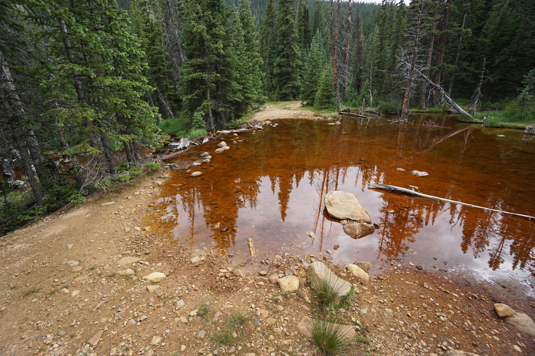
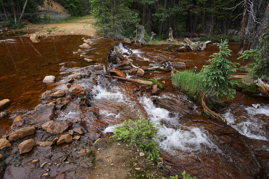
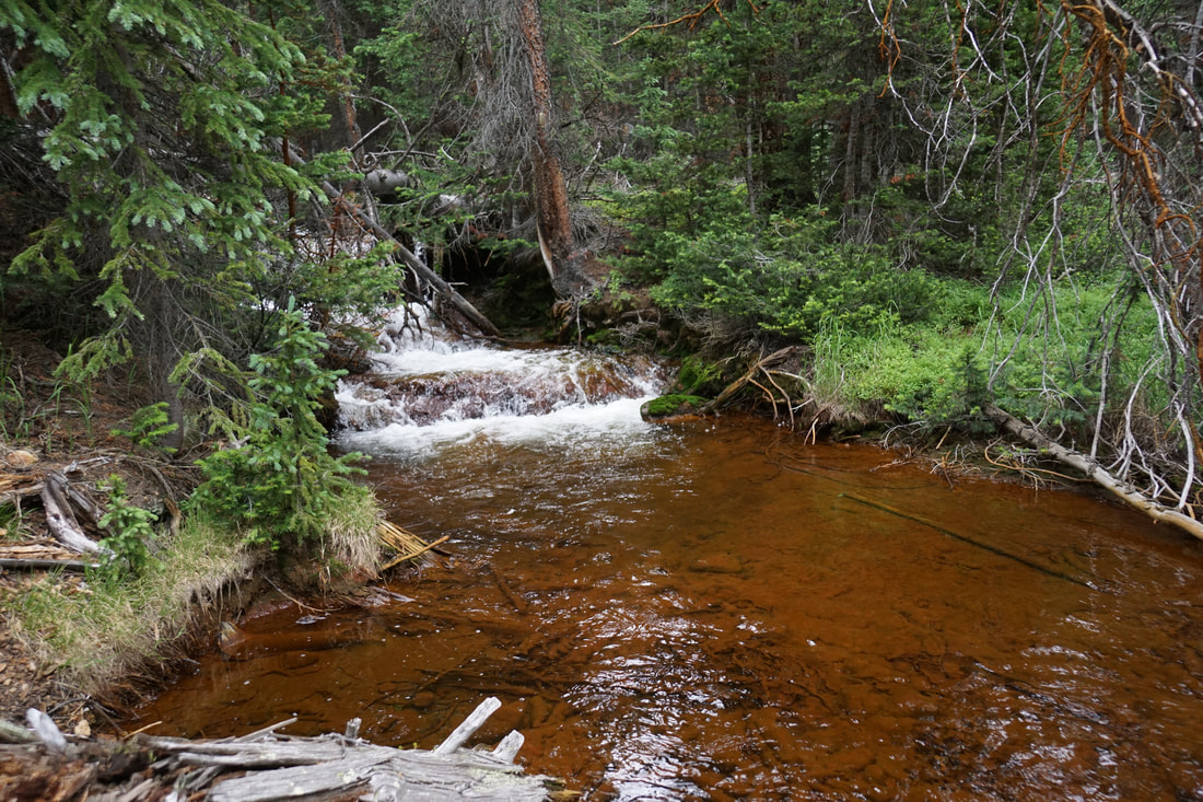
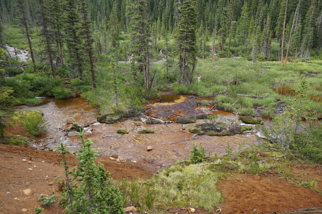
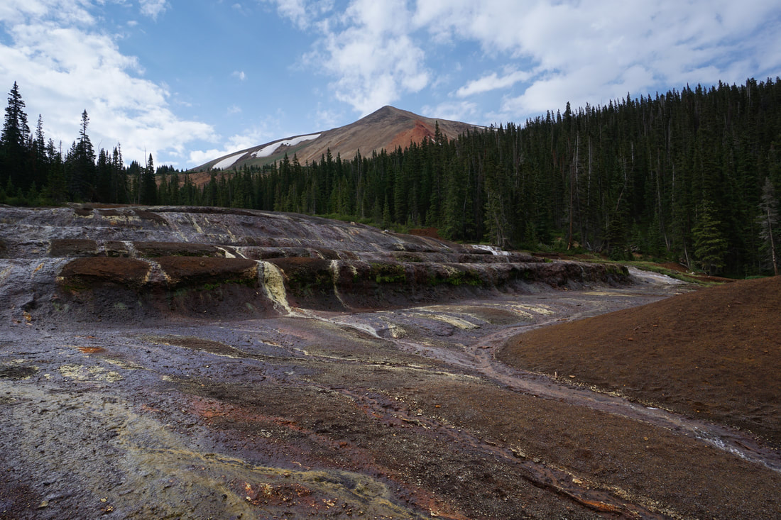
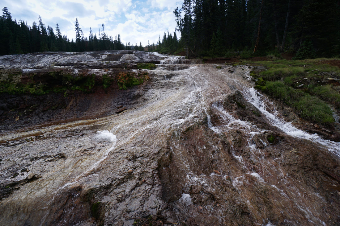
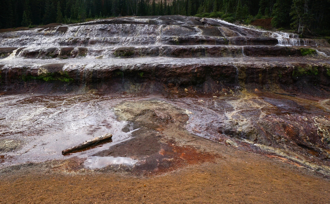
I am not a hydrologist nor a geologist so here is a description of the irons fens from Clear Creek County's webpage: "A fen is an area of peat-forming wetlands that receives nutrients usually from upslope mineral soils and groundwater movement. It is typically alkaline due to groundwater draining from surrounding calcareous rocks... The iron fens, due to the iron substrate, are very low in pH (acid) and are high in minerals. The geologic process forming the iron fen begins with a series of springs flowing over highly fractured, highly mineralized bedrock rich in pyrites producing extremely acidic (pH3), mineral-rich water. This process produces limonite (iron saturated peat) ledges and terraces." In layman's terms, the unique geologic processes and mineral content of Geneva Creek, create a colorful series of ledges cut into the creek bed. Colorful moss and plants and cascading waterfalls shape this unique feature. The iron fens are massive in size and when you first arrive, the fens will take your breath away. From the gate, the hike is simple. Follow the road through the woods and into an open alpine meadow. Geneva Creek is down a steep slope and already has a rich brown and red color. The road continues across the meadow with great views in all directions. Re-enter the woods and cross Geneva Creek. Depending on the season and water levels, this crossing may be difficult. After the crossing, the trail bends to the right and continues its moderate uphill slope. At this point, keep looking through the trees to the right for openings revealing the peat filled wetlands. You'll soon notice interesting features among the wetlands. You'll know when you reach the iron fens...you'll know it...no need to wonder if you are there yet. The road leads directly to the iron fens, just stay right at any forks in the road. ok, now here is the important part... This area is extremely fragile! Please, please be gentle and stay off the terraces. If you are careful you can step from dirt to dirt and get to the other side for even better views, but please stay off of anything that look out of the ordinary. Avoid the minerals and the peat moss and stay out of the water. Ok, lecture over... I can't say enough about this area and anything I say will still not live up to the experience of being at the iron fens...even the photos don't do it justice. Huge thanks to Clear Creek County Open Space for protecting and preserving the iron fens. Hopefully, we can all enjoy visiting this fantastical location for generations and generations. |
|