GO HIKE COLORADO
Get in Touch:
  • HOME
  • ABOUT
  • HIKES BY REGION
    • DENVER AREA >
      • Denver Mountain Parks
      • Jefferson County Open Space
      • Lakewood Parks
      • Denver Area Greenways
    • BOULDER AREA
    • DOUGLAS COUNTY
    • FORT COLLINS AREA
    • COLORADO SPRINGS AREA
    • FRONT RANGE
    • TENMILE & MOSQUITO RANGES
    • GORE RANGE
    • SANGRE DE CRISTO MOUNTAINS
    • PARK RANGE
    • SAWATCH RANGE
    • ELK MOUNTAINS
    • SAN JUAN MOUNTAINS
    • THE FLAT TOPS
    • GRAND MESA
    • COLORADO PLATEAU
    • EASTERN PLAINS
  • NATIONAL PARK HIKES
    • BENT'S OLD FORT NATIONAL HISTORIC SITE
    • BLACK CANYON OF THE GUNNISON NATIONAL PARK
    • COLORADO NATIONAL MONUMENT
    • CURECANTI NATIONAL RECREATION AREA
    • DINOSAUR NATIONAL MONUMENT
    • FLORISSANT FOSSIL BEDS NATIONAL MONUMENT
    • MESA VERDE NATIONAL PARK
    • ROCKY MOUNTAIN NATIONAL PARK
    • GREAT SAND DUNES NATIONAL PARK
    • HOVENWEEP NATIONAL MONUMENT
    • SAND CREEK MASSACRE NATIONAL HISTORIC SITE
    • YUCCA HOUSE NATIONAL MONUMENT
  • HIKES BY CATEGORY
    • HIKES TO ALPINE LAKES
    • HIKES TO PEAKS & PASSES
    • HIKES THROUGH CANYONS
    • HIKES WITH FALL COLORS
    • HIKES ALONG THE I-70 CORRIDOR
    • HIKES ON PAVED TRAILS
    • HIKES FOR KIDS
    • HIKES TO WATERFALLS
    • HIKES ALONG RIVERS
    • HIKES WITH ROCK FORMATIONS
    • HIKES WITH WILDFLOWERS
    • WINTER HIKES
  • NEWS
  • WEBCAMS
  • $UPPORT GHC
  • INTERACTIVE MAP

Fowler Trail via Eldorado Mt.
Eldorado Canyon State Park

Date Hiked: November 9, 2012

​Distance: 2.6 mi (RT)
Elevation Gain: 400ft
Elevation Start: 5,685ft
Managing Agency: City of Boulder OSMP/CO State Parks
Fee: None

Eldorado Mountain Trailhead  Map
Picture

Directions: The Eldorado Mountain Trailhead is off of a short dirt road extending south from Eldorado Springs Drive.  From Boulder/Denver take Hwy 93 to Eldorado Springs Drive and head west on Eldorado Springs Drive, just before you enter the town of Eldorado Springs, look for the dirt road on the left heading up-hill, the trailhead is at the end of the road.  On the map linked to above the trailhead is marked by an "A" just before Eldorado Springs.

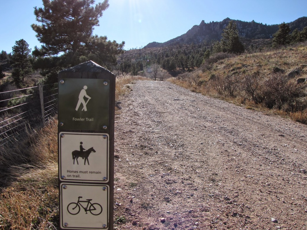
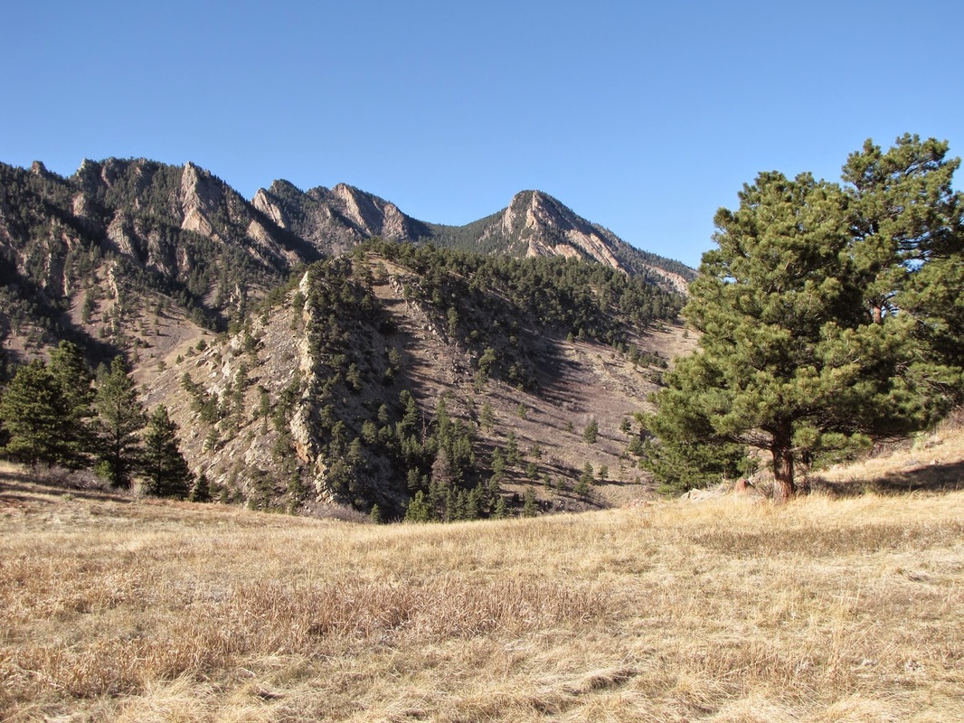
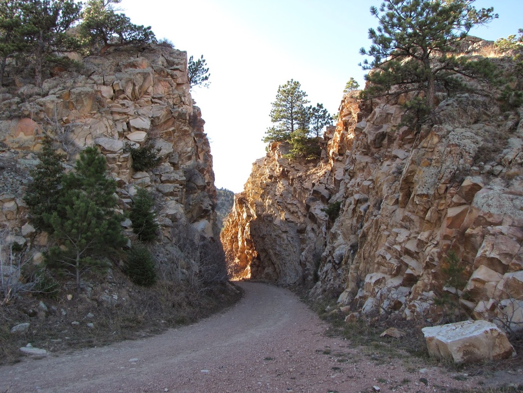
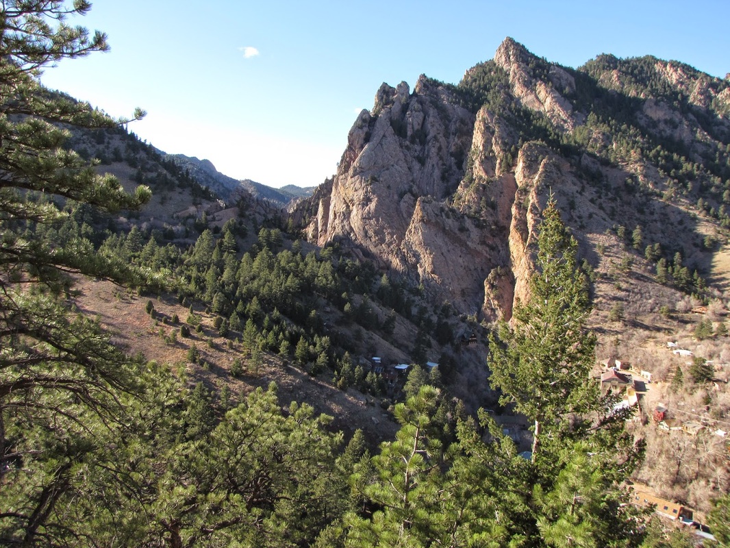
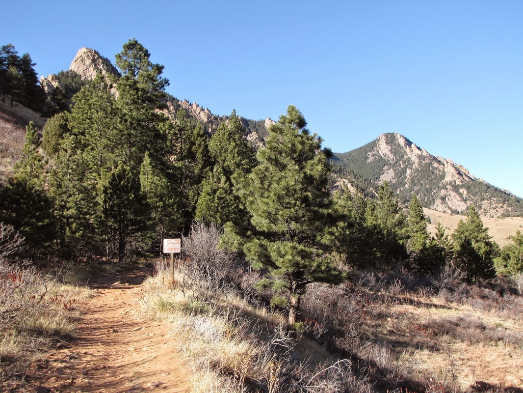
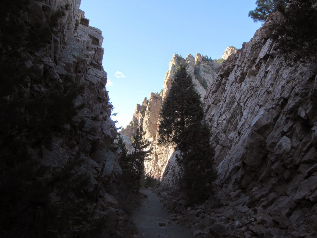
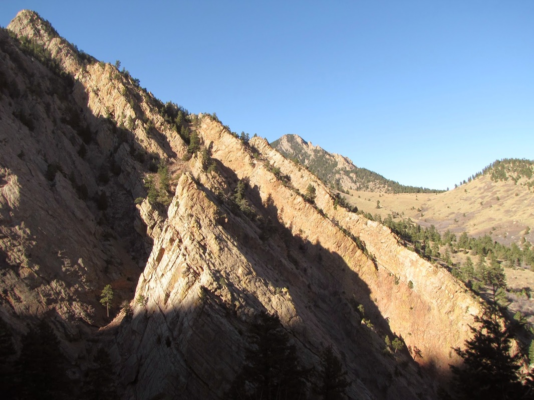
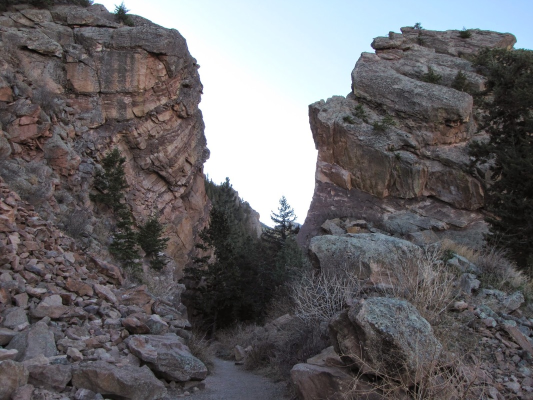
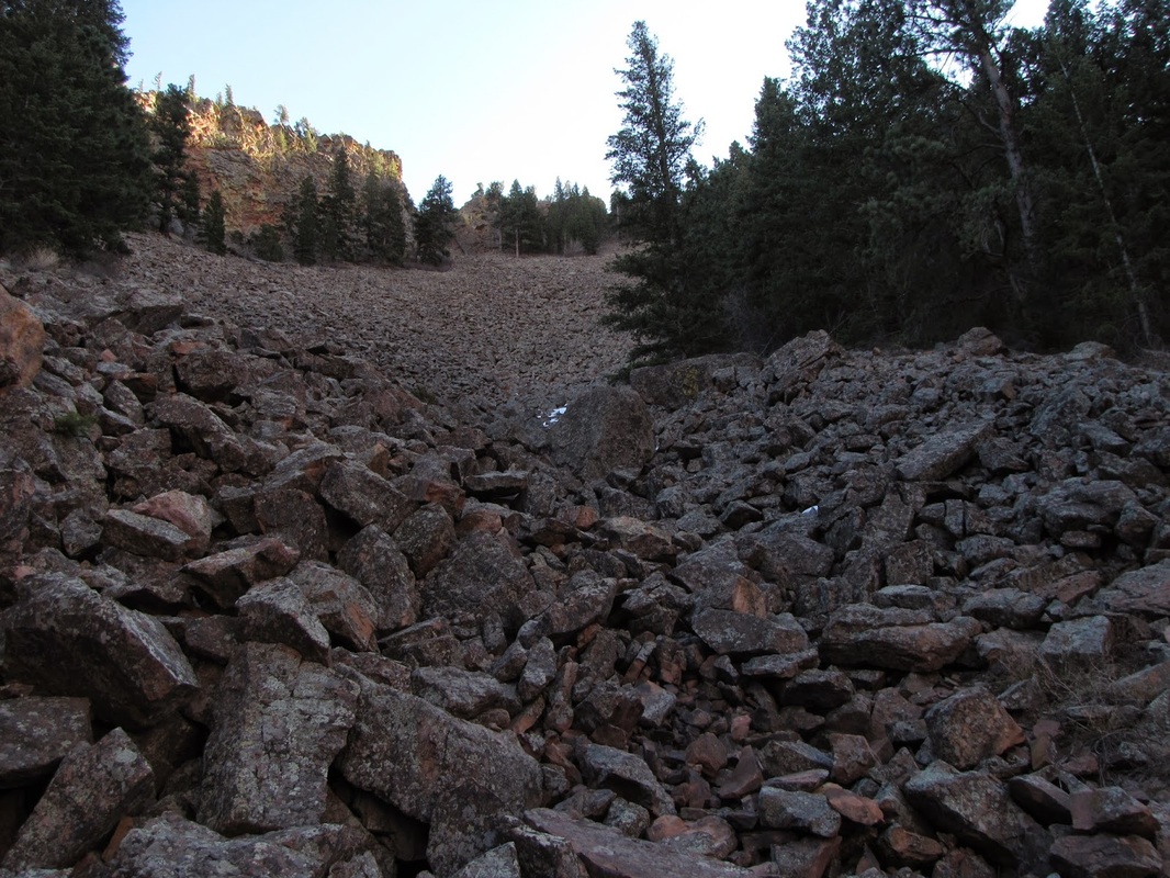
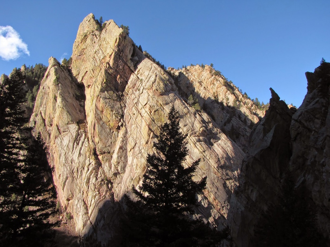
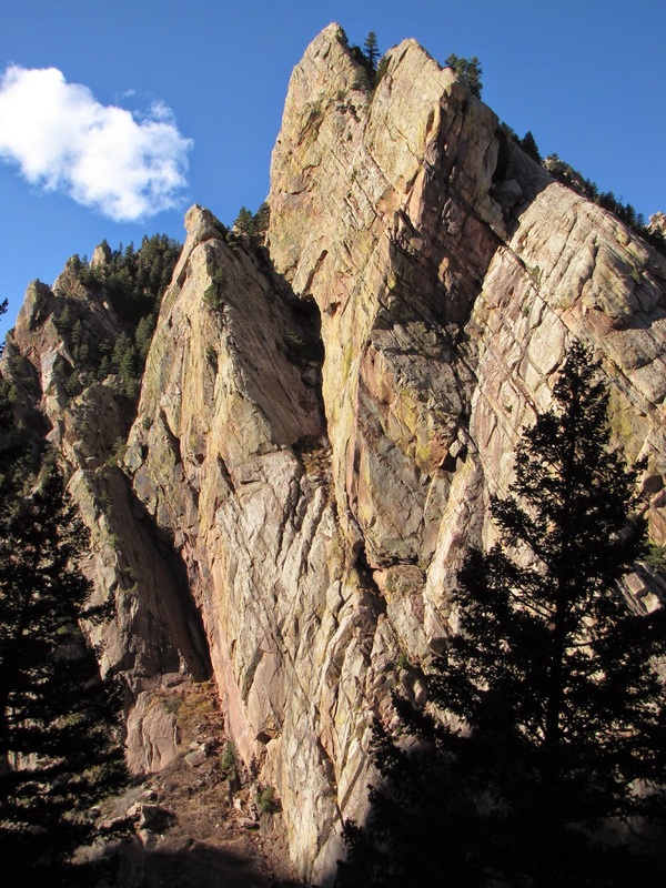
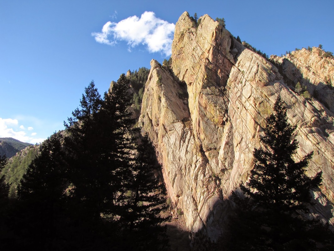
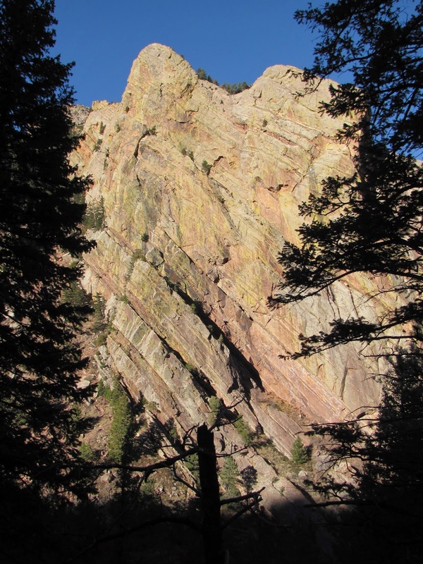
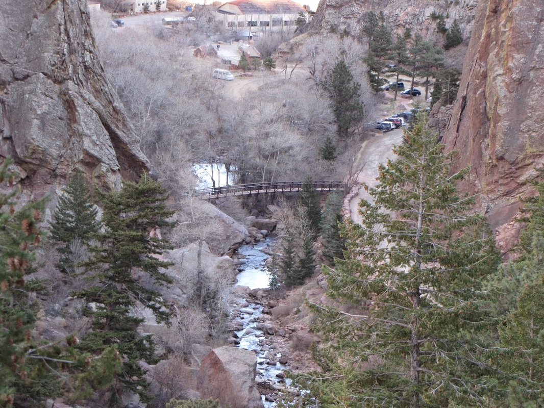
The Eldorado Mountain Trailhead is a great, lesser known way to access the Flatirons Vista/Doudy Draw Area as well as Eldorado Canyon State Park (no need to pay the park fee this way!).  From the Trailhead, Follow the Fowler Trail for .6 miles to a trail junction.  Turn right and continue uphill on the Fowler Trail around the north slope of the mountain and through a cut in the rock.  From here there are amazing views of Shirttail Peak and S. Boulder Peak towering above Eldorado Springs.  Continue on this trail for .5 miles and turn right towards Eldorado Canyon State Park.  After .2 miles you enter the park and cross through another cut in the rock.  At this point you are on the State Park's Fowler Trail and looking up at Shirttail Peak in all its glory.  This is an amazing spot so be sure you soak it all in before heading back.  You can also explore further into Eldorado Canyon State Park from this access point.
Powered by Create your own unique website with customizable templates.