GO HIKE COLORADO
Get in Touch:
  • HOME
  • ABOUT
  • HIKES BY REGION
    • DENVER AREA >
      • Denver Mountain Parks
      • Jefferson County Open Space
      • Lakewood Parks
      • Denver Area Greenways
    • BOULDER AREA
    • DOUGLAS COUNTY
    • FORT COLLINS AREA
    • COLORADO SPRINGS AREA
    • FRONT RANGE
    • TENMILE & MOSQUITO RANGES
    • GORE RANGE
    • SANGRE DE CRISTO MOUNTAINS
    • PARK RANGE
    • SAWATCH RANGE
    • ELK MOUNTAINS
    • SAN JUAN MOUNTAINS
    • THE FLAT TOPS
    • GRAND MESA
    • COLORADO PLATEAU
    • EASTERN PLAINS
  • NATIONAL PARK HIKES
    • BENT'S OLD FORT NATIONAL HISTORIC SITE
    • BLACK CANYON OF THE GUNNISON NATIONAL PARK
    • COLORADO NATIONAL MONUMENT
    • CURECANTI NATIONAL RECREATION AREA
    • DINOSAUR NATIONAL MONUMENT
    • FLORISSANT FOSSIL BEDS NATIONAL MONUMENT
    • MESA VERDE NATIONAL PARK
    • ROCKY MOUNTAIN NATIONAL PARK
    • GREAT SAND DUNES NATIONAL PARK
    • HOVENWEEP NATIONAL MONUMENT
    • SAND CREEK MASSACRE NATIONAL HISTORIC SITE
    • YUCCA HOUSE NATIONAL MONUMENT
  • HIKES BY CATEGORY
    • HIKES TO ALPINE LAKES
    • HIKES TO PEAKS & PASSES
    • HIKES THROUGH CANYONS
    • HIKES WITH FALL COLORS
    • HIKES ALONG THE I-70 CORRIDOR
    • HIKES ON PAVED TRAILS
    • HIKES FOR KIDS
    • HIKES TO WATERFALLS
    • HIKES ALONG RIVERS
    • HIKES WITH ROCK FORMATIONS
    • HIKES WITH WILDFLOWERS
    • WINTER HIKES
  • NEWS
  • WEBCAMS
  • $UPPORT GHC
  • INTERACTIVE MAP

Escarpment Path
​Ridgway / Loghill Village Parks & Rec. District

Date Hiked: December 27 & 30, 2018

Distance: 1.5 mi (RT) longer options
Elevation Gain: 115 ft 
Elevation Min/Max: 7,944 to 8,000 ft
Trailhead Lat/Long: 38º 11' 14" N; 107º 47' 19" W
Managing Agency: Loghill Village Parks & Rec. District
Fee: None

Loghill Village Trail System Map
Picture

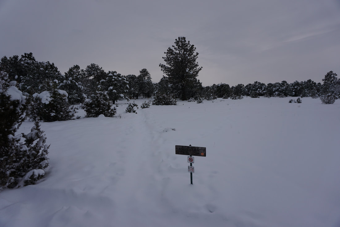
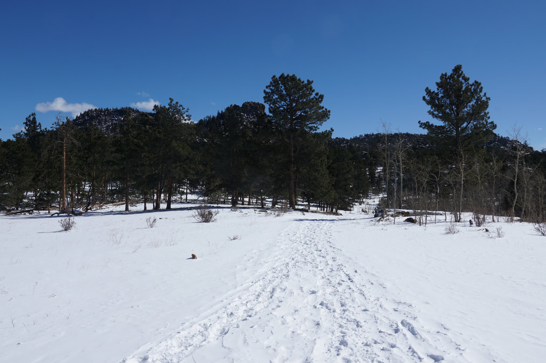
DIRECTIONS:  From the intersection of Hwys 550 and 62 in Ridgway, turn west on Hwy 62 towards Telluride.  Turn right (north) on County Road 24A and left (west) on County Road 24.  Follow 24 until it becomes County Road 1 and starts climbing up to the top of the Mesa.  At the top, turn right on Ponderosa Drive.  Follow Pondersa Drive past the fire station and look for a small parking area and trail sign on the right.  The trailhead is very difficult to spot after a big snow storm.  There is room for a few cars in the parking area.  

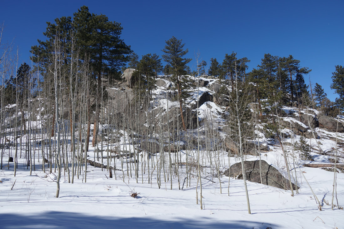
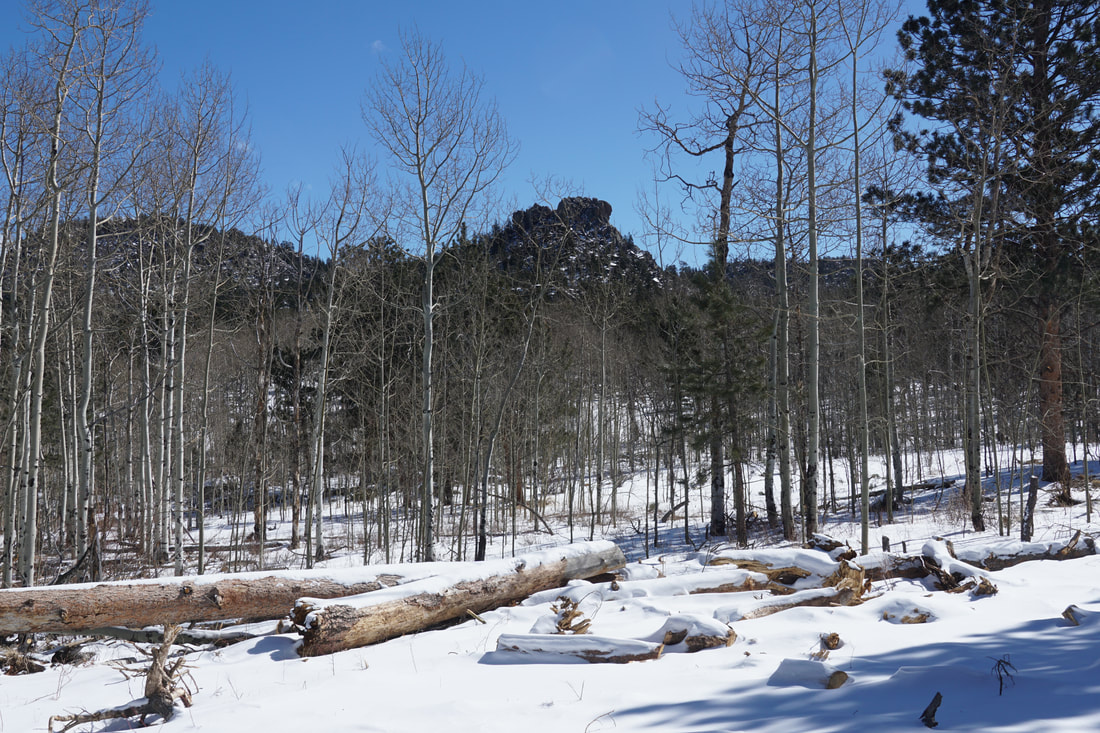
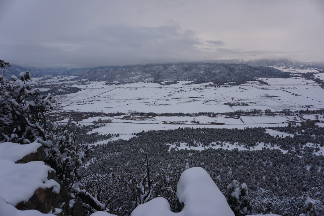
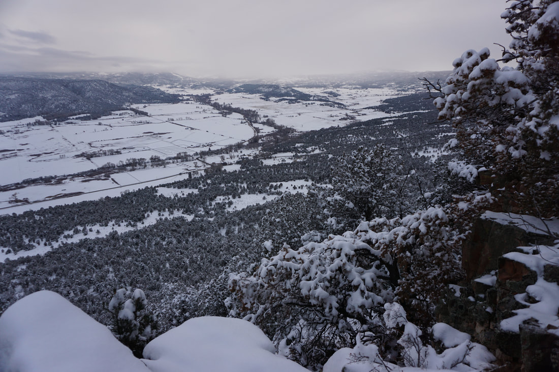
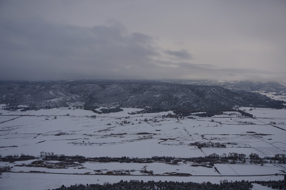
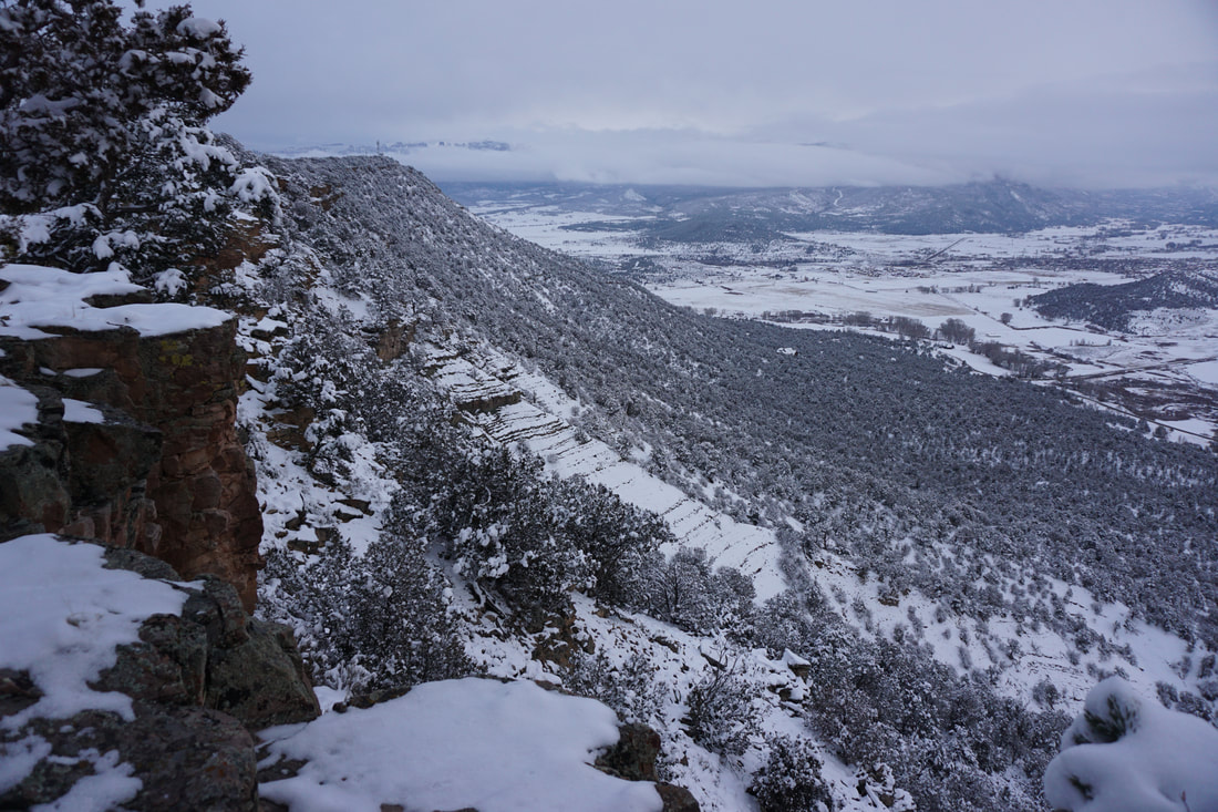
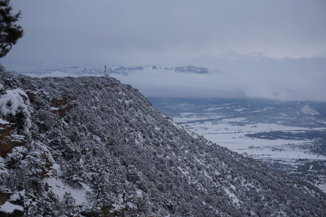
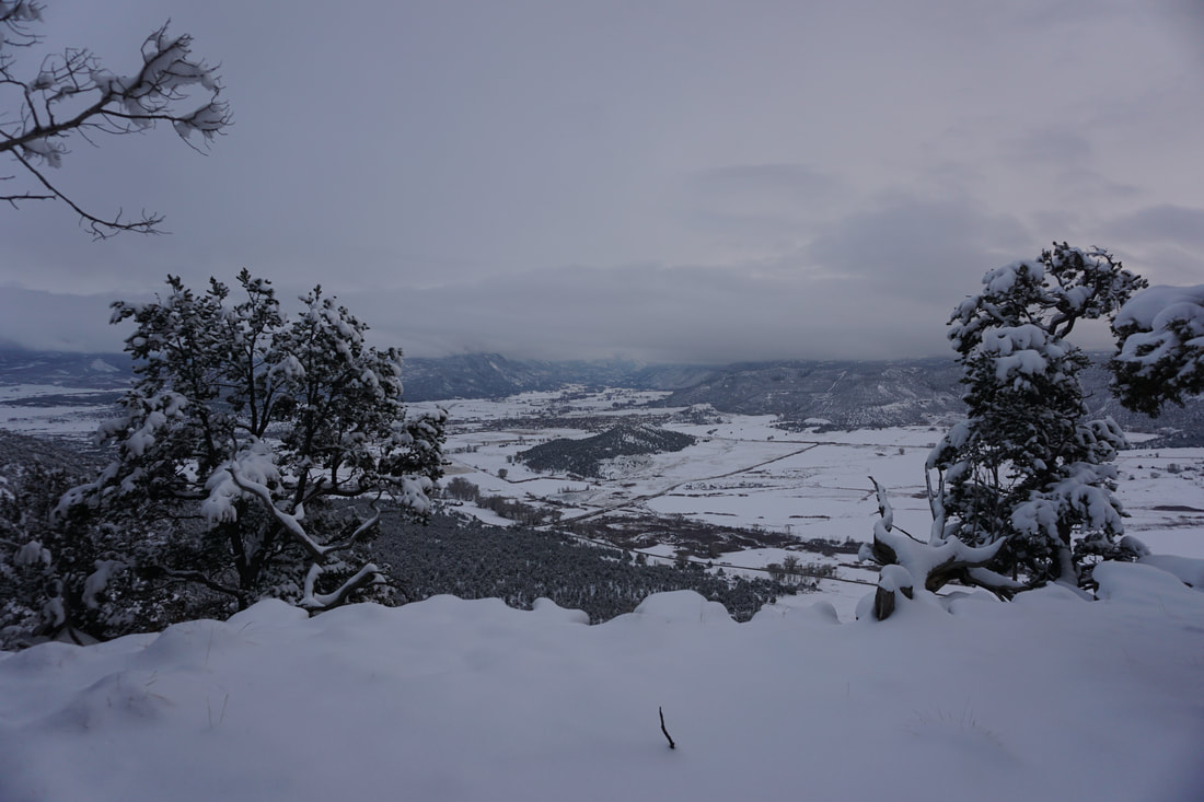
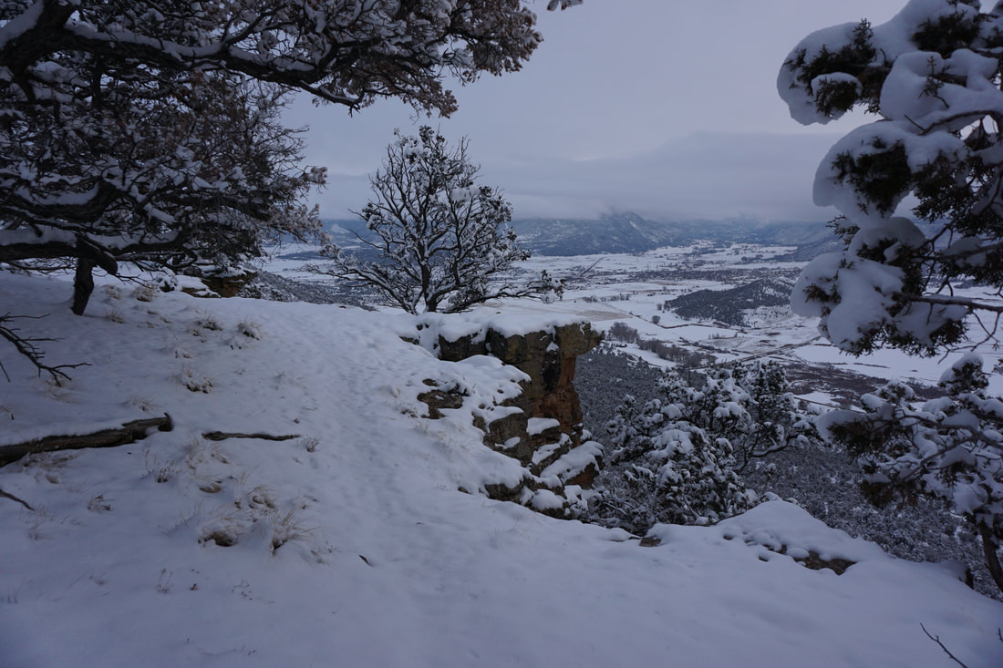
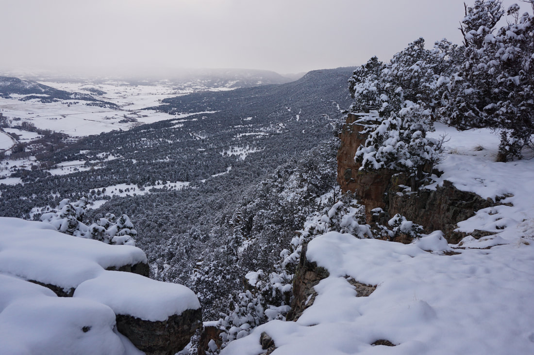
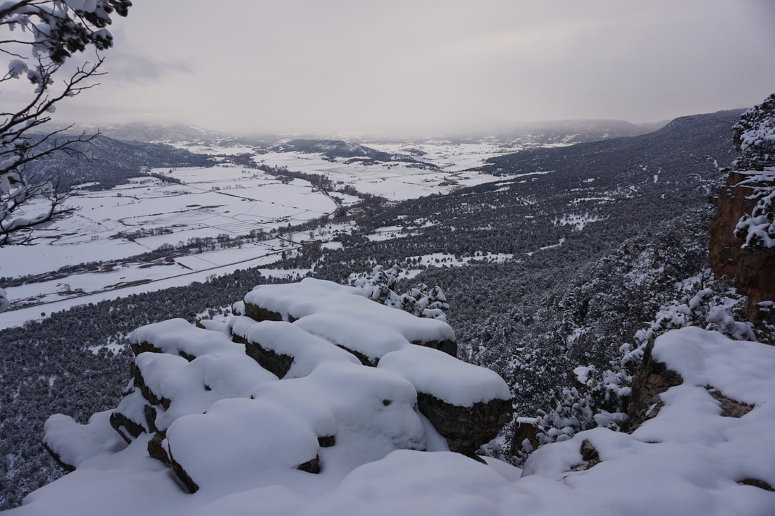
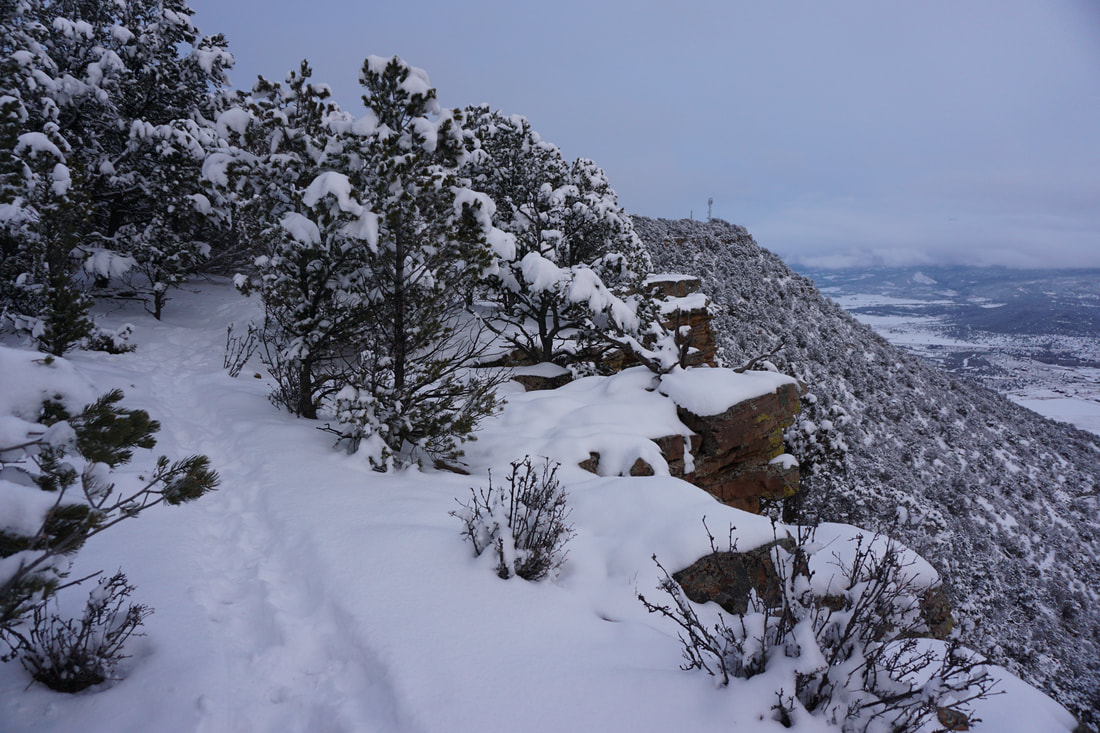
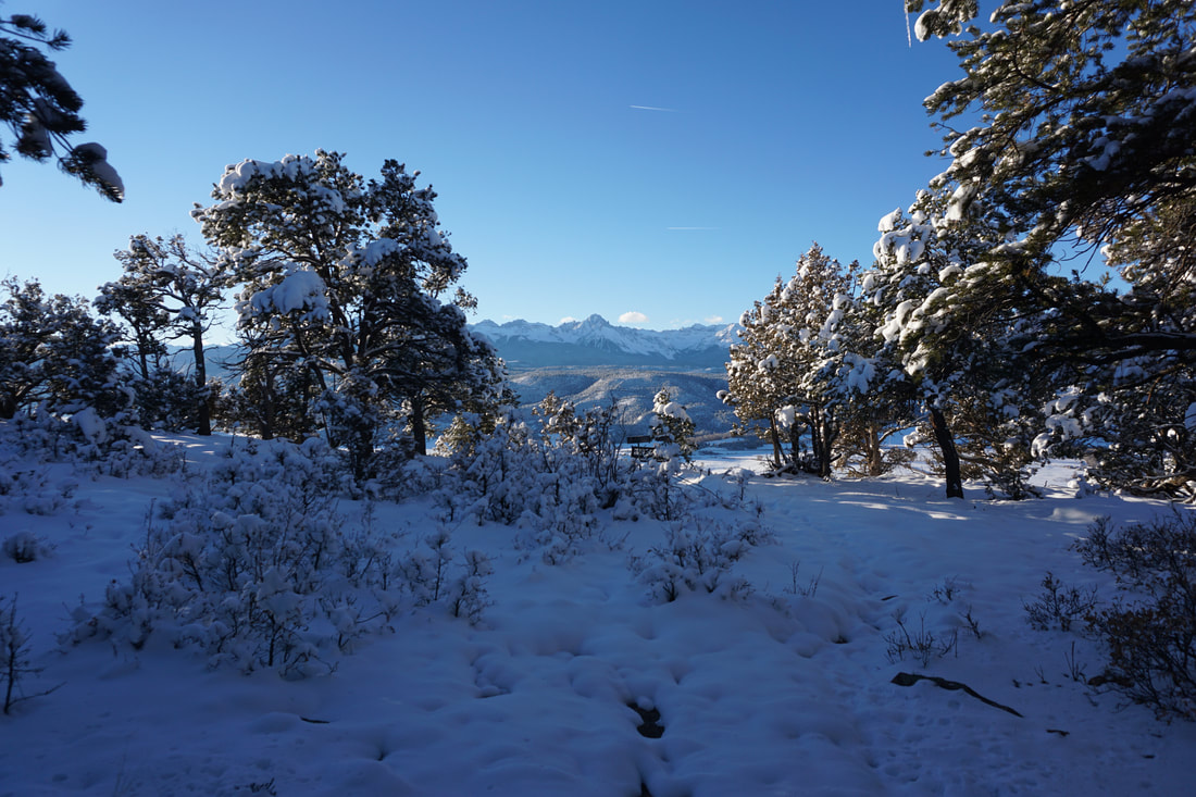
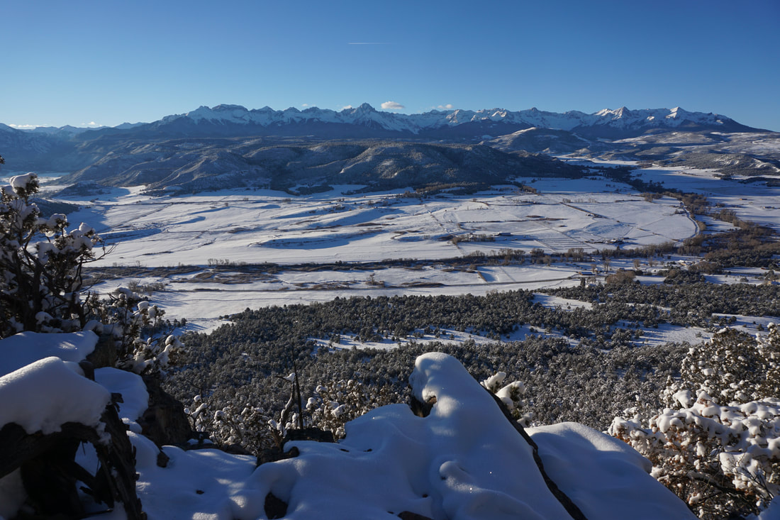
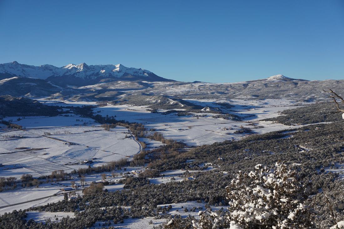
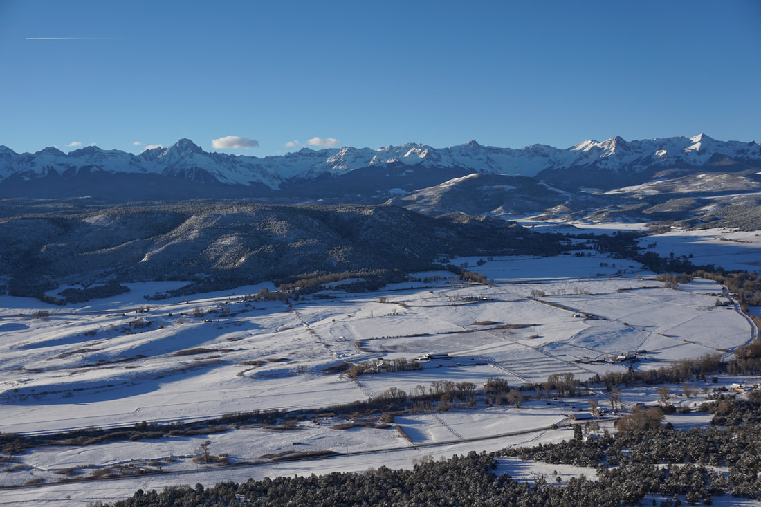
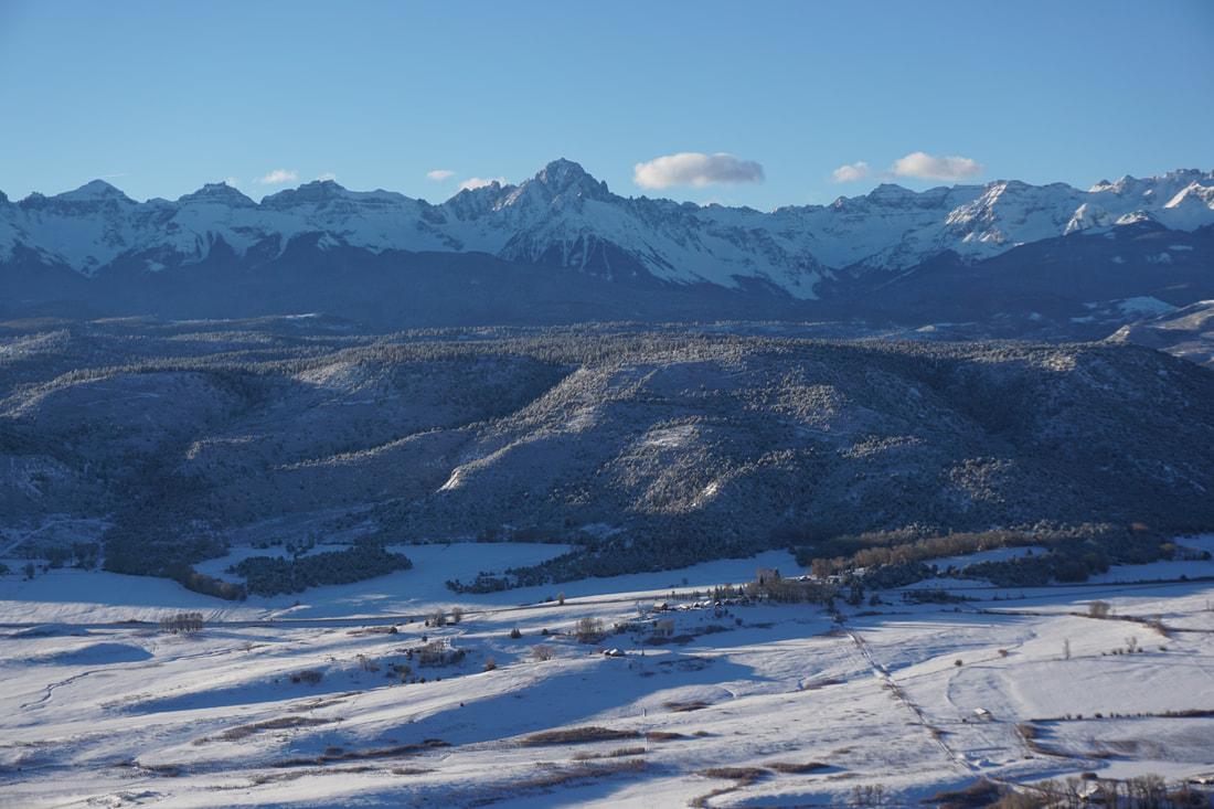
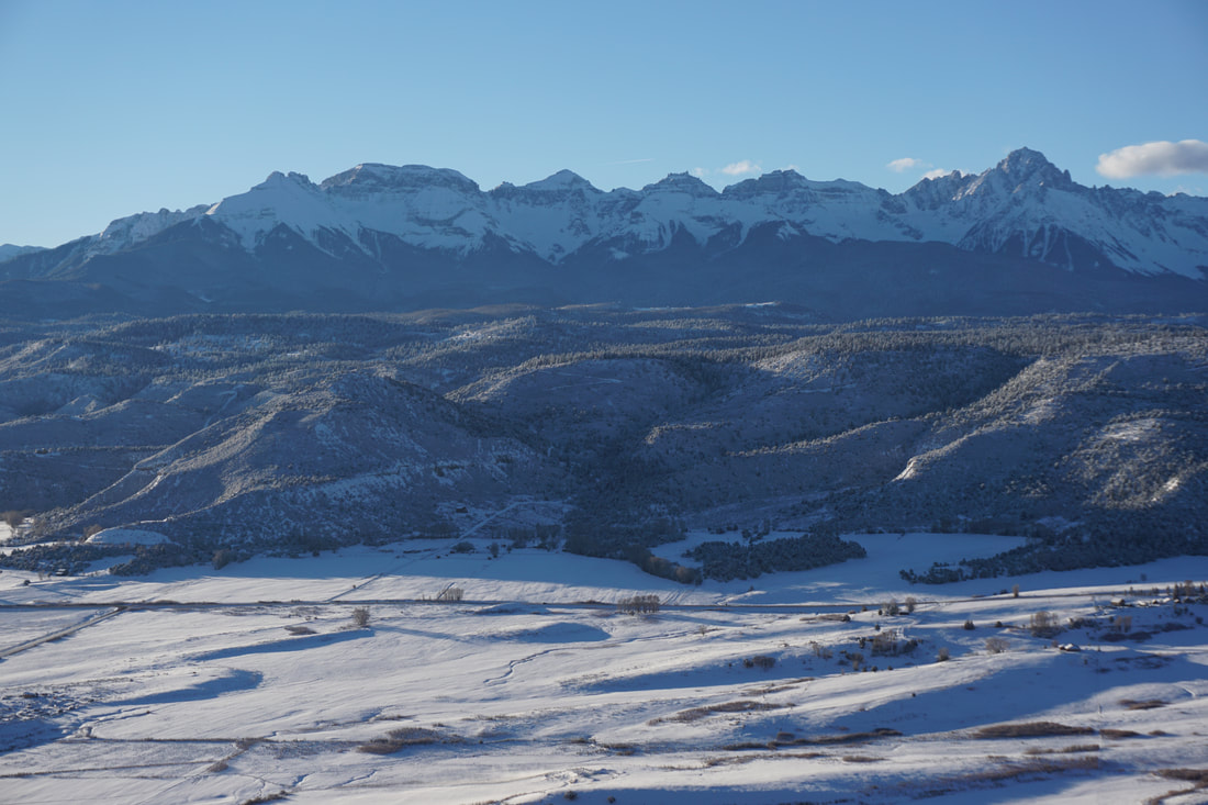
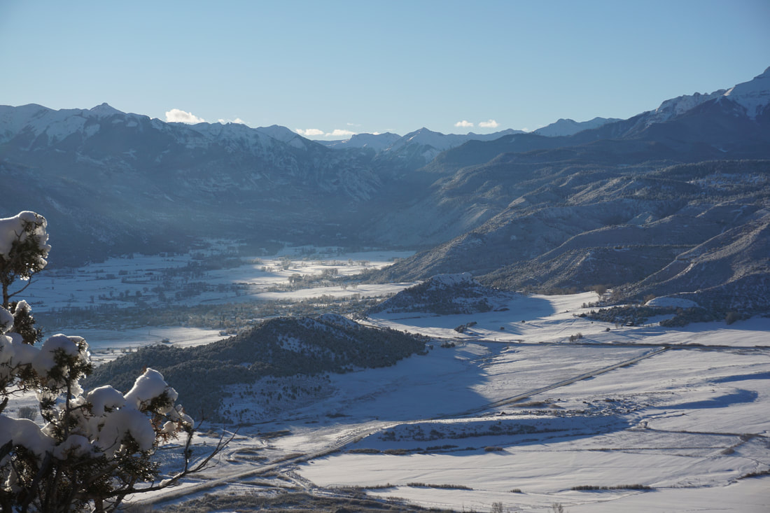
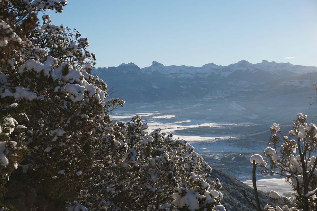
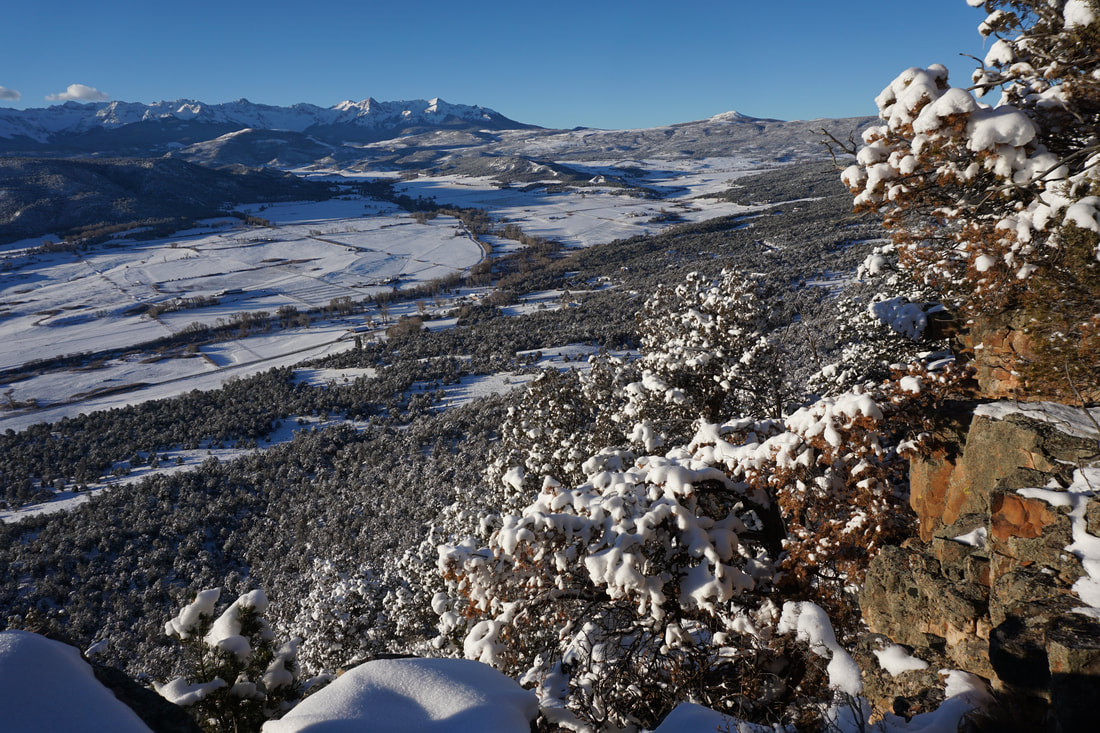
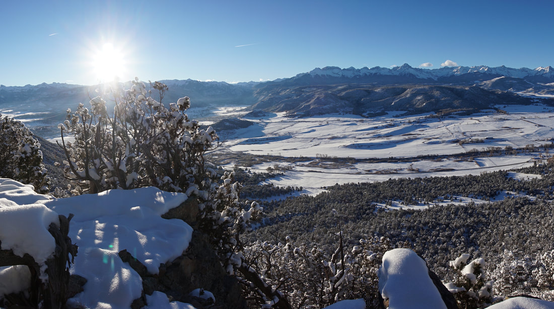
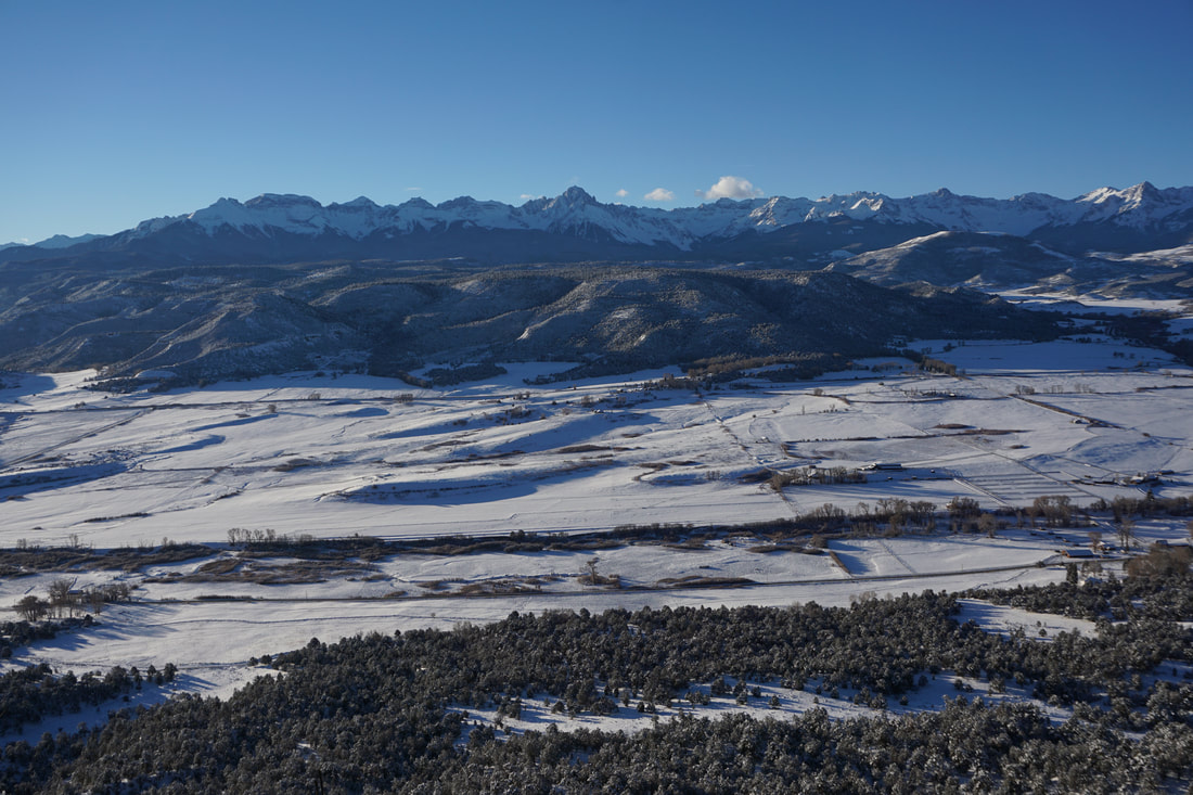
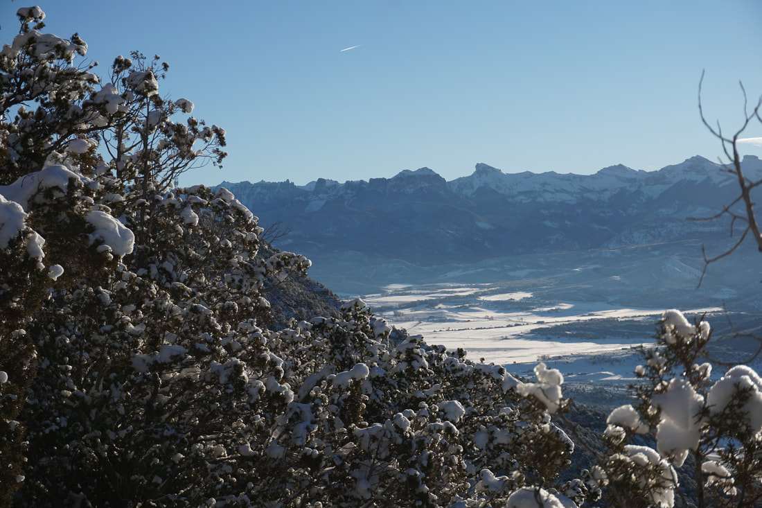
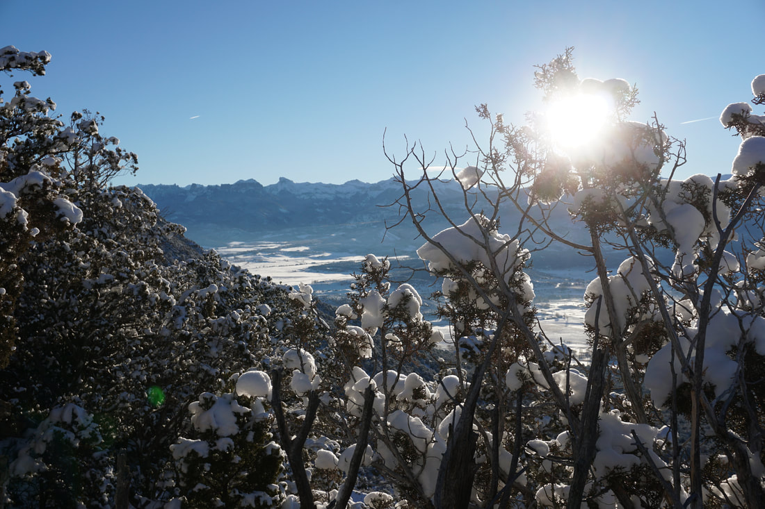
The Escarpment Path is one of many trails in the Loghill Village trail system located on the mesa top just to the west of downtown Ridgway.  While the trails are open to the public, they are surrounded by private land and residences so please be respectful.  The Escarpment Trail runs along the edge of the mesa and therefore has incredible views of both the Sneffels Range and the Cimarron Range to the east.  All the iconic peaks are visible with Mt. Sneffels (14,150 ft) being the most prominent.  

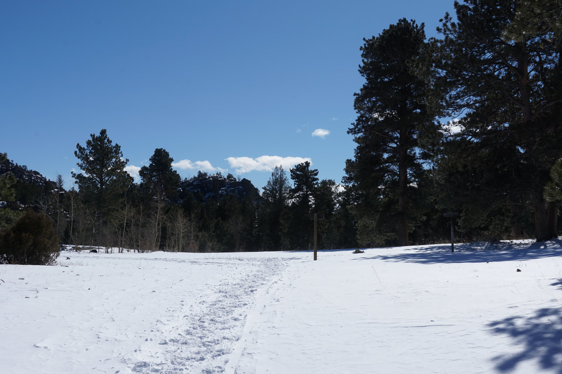
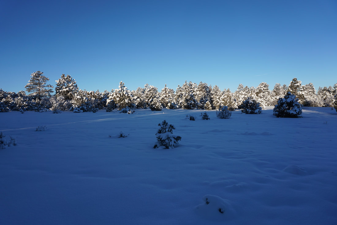
In the winter, this trail is a wonderful option as you can get amazing mountain views with easy access and short distances.  It's only about 3 tenths of a mile to the first overlook but when you are hiking through single digit temperatures you'll be happy to have the option of making this a short hike.  

On the day I visited the Escarpment Path, a snow storm had just rolled in and the epic mountain views were nonexistent.  It was also frigid cold so 1.5 miles roundtrip was all I could muster.  However, before I left the San Juans, I returned and hiked out to the main lookout on a blue bird day to experience to majesty of the Sneffels and Cimarron Ranges...simply stunning.  

With so much to offer, this hike is a great option for kids and adults alike looking to take in the views without an all-day commitment.  It's also thrilling to think that you are hiking along the edge of the Colorado Plateau gazing upon the start of the San Juan Mountains and imagining all the wonders that lie to the south.    

December 27, 2018

December 30, 2018

© Go Hike Colorado, 2020.  All Rights Reserved. 
Use of photographs without prior authorization is
​strictly prohibited.


Contact us at:
[email protected]
Legal Disclaimer - Information provided on this site is based upon our own observations, always double check information with the appropriate land management agency before heading into the backcountry.  Backcountry travel is inherently dangerous, please take all proper precautions.  Go Hike Colorado is not responsible for injury or incident.