|
| ||
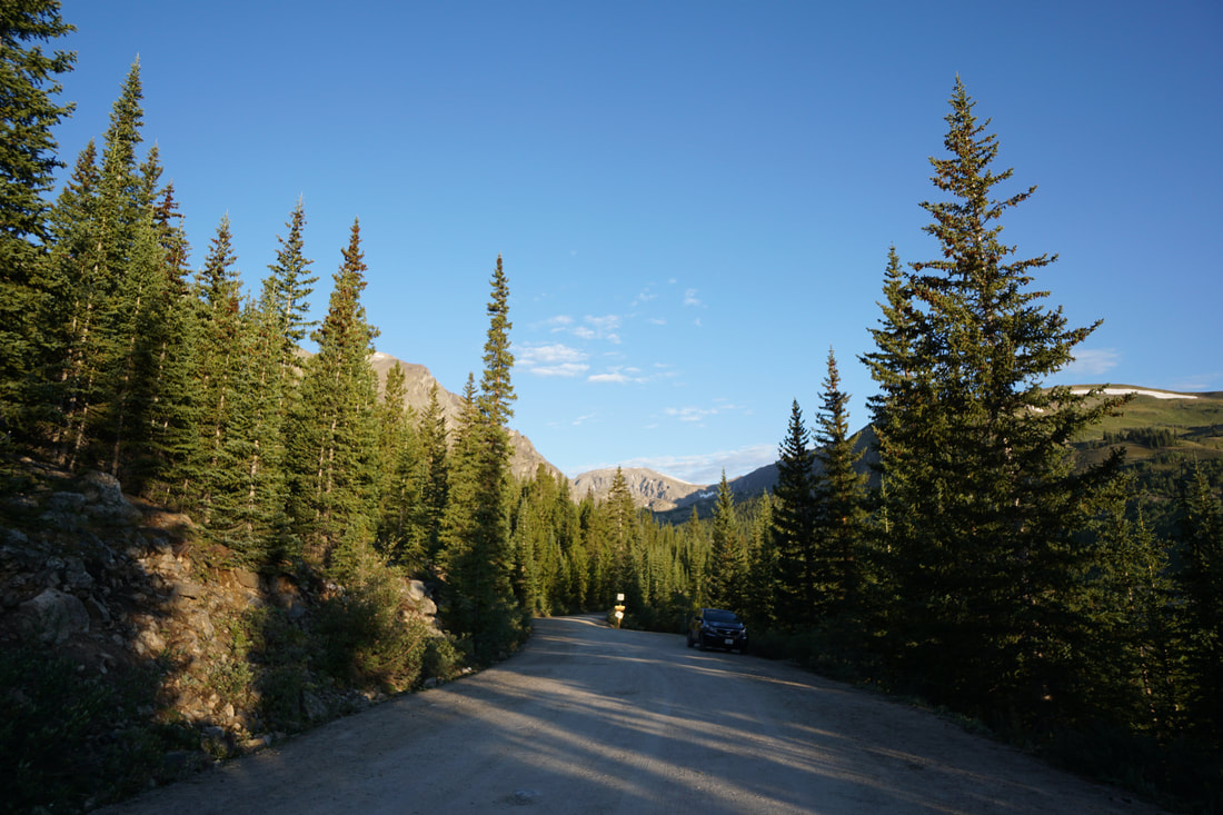
Directions: From Breckenridge head south on Hwy 9 through Blue River and past a set of switchbacks. Turn right at the signs for Quandary Trailhead, pass the lower Quandary parking lot and turn right on McCullough Gulch Road, a rough but good dirt road. To get to the Trailhead, you need to walk along the road or take the shuttle from the Quandary Peak Trailhead, which requires a reservation. For more info visit www.parkquandary.com
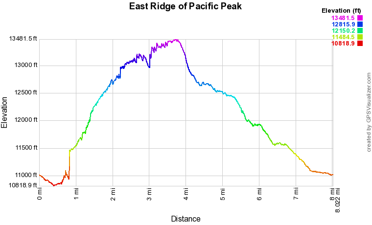
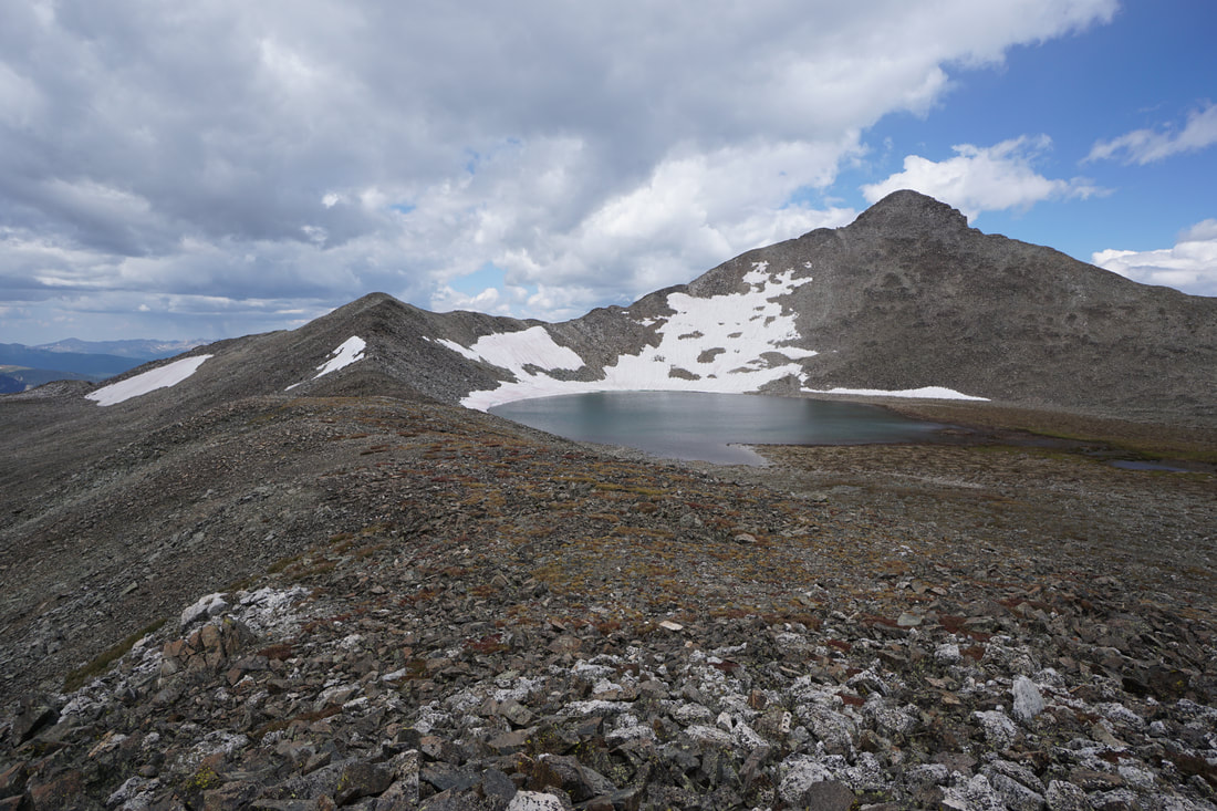
The East Ridge of Pacific Peak is a classic Colorado scramble. The ridge leads to Pacific Tarn, the highest lake in the United States (13,435 ft) and Pacific Peak standing tall at 13,950 ft. The ridge separates the McCullough Gulch basin and the Mohawk Lakes basin and runs parallel to the ridge leading to Quandary Peak. The entirety of the East Ridge is above 13,000 feet and the views from the ridge are simply incredible.
East Ridge has a long stretch of class 3 climbing. For a good summary of climbing classifications check out this page developed by the good people at 14ers.com. They define Class 3 as "Scrambling or un-roped climbing. You must use your hands most of the time to hold the terrain or find your route. This may be caused by a combination of steepness and extreme terrain (large rocks or steep snow). Some Class 3 routes are better done with rope." Class 3 climbing is difficult but yields incredible views and unforgettable experiences. I encourage you to give it a shot, but be safe, hike with a partner, and don't underestimate the exposure and energy needed to sustain this climbing, especially at high altitudes.
The first 6 miles or so of this hike are off trail, so I'll try to be specific as to the route that we took, however, part of the fun of this hike is forging your own route and choosing your own adventure. Due to the complexity of this off-trail route, I divided the hike description and photos into specific sections.
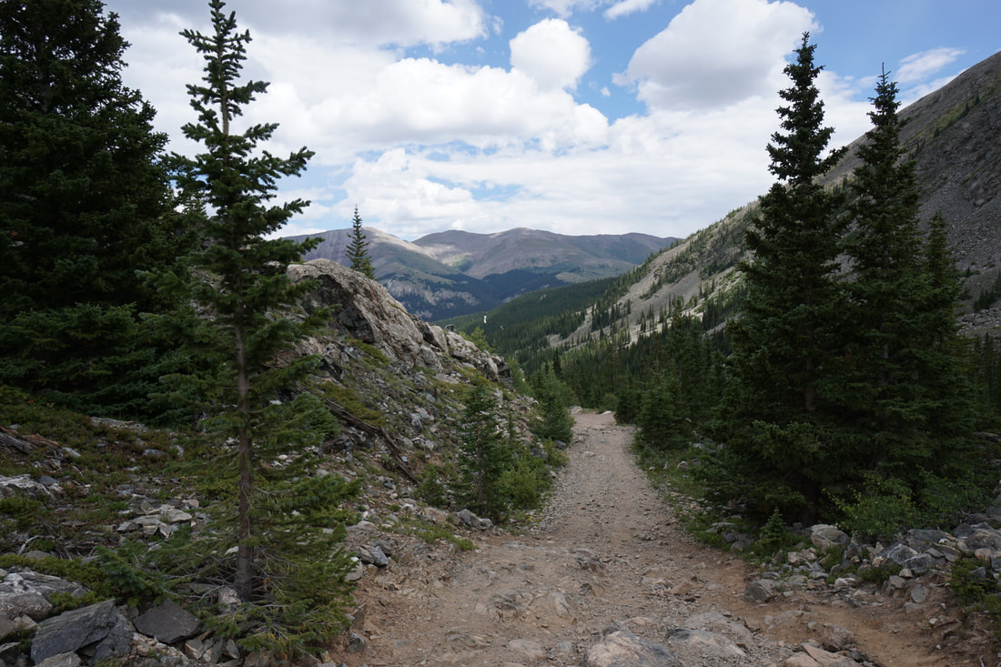
McCullough Gulch Trailhead to Base of East Ridge
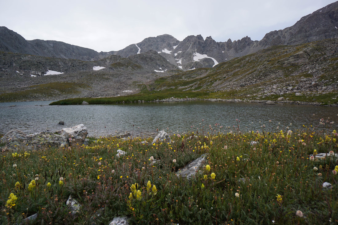
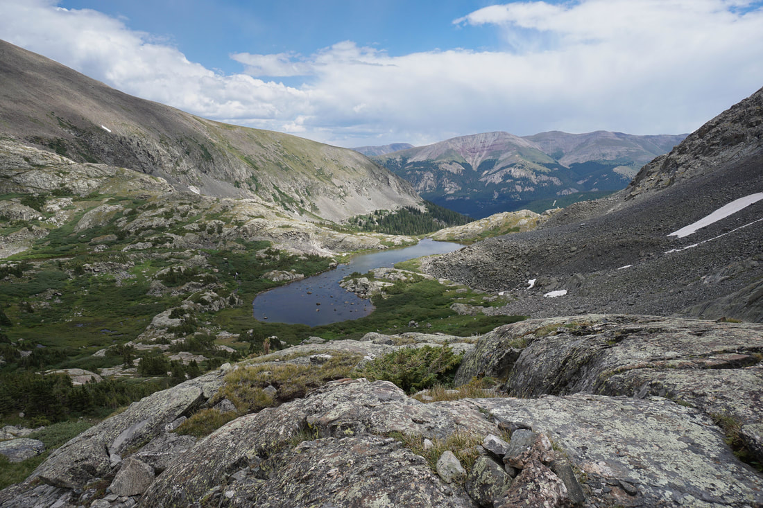
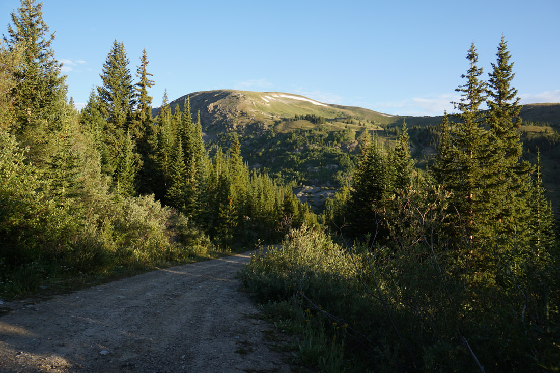
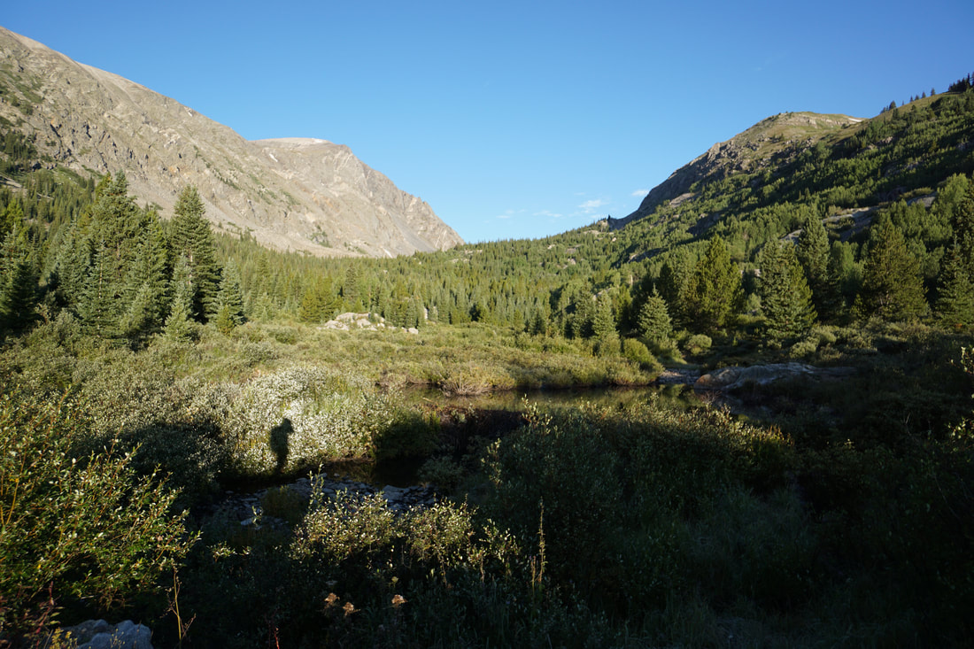
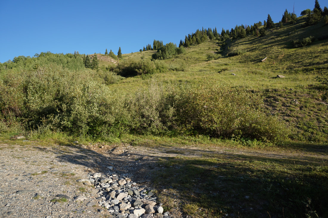
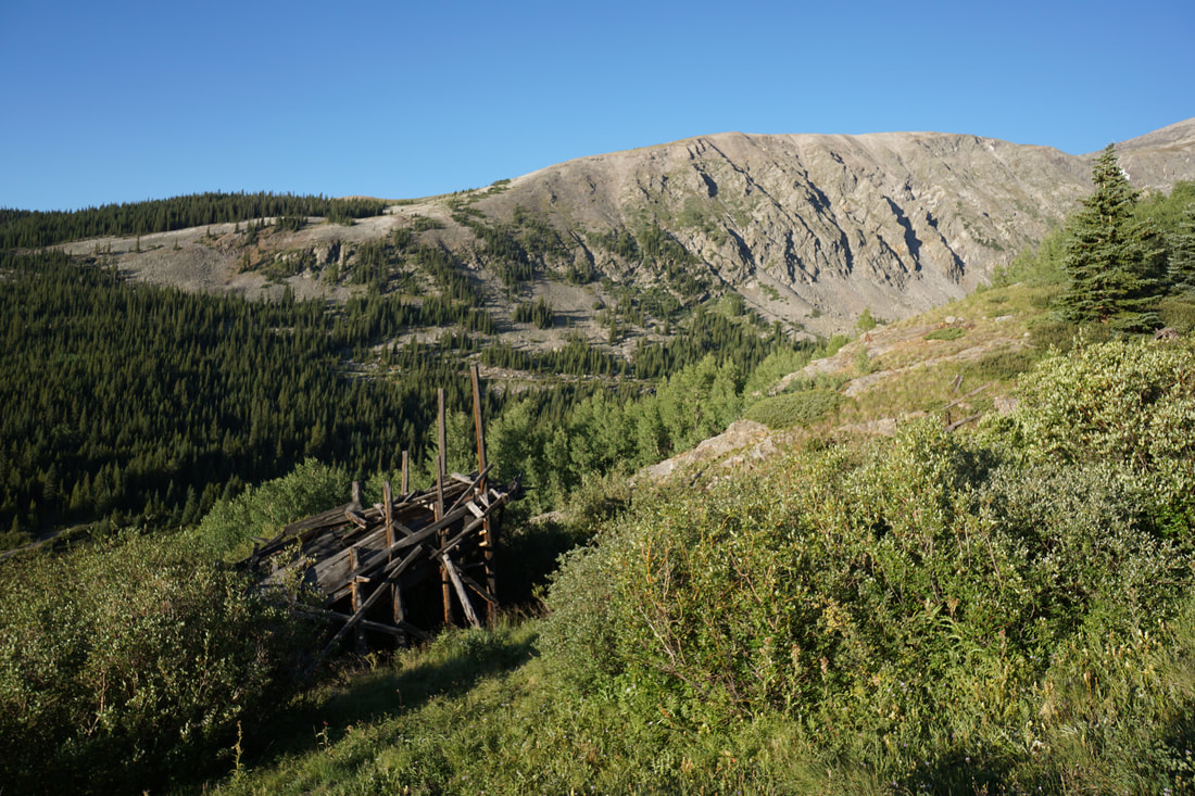
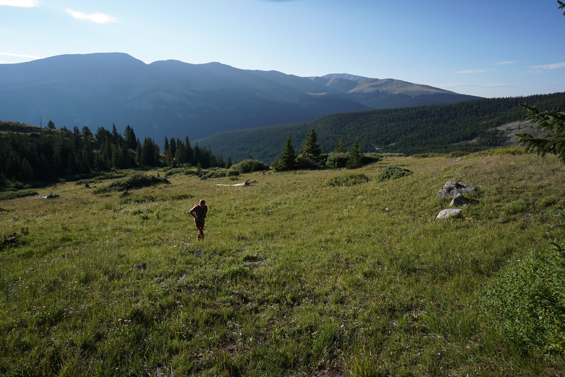
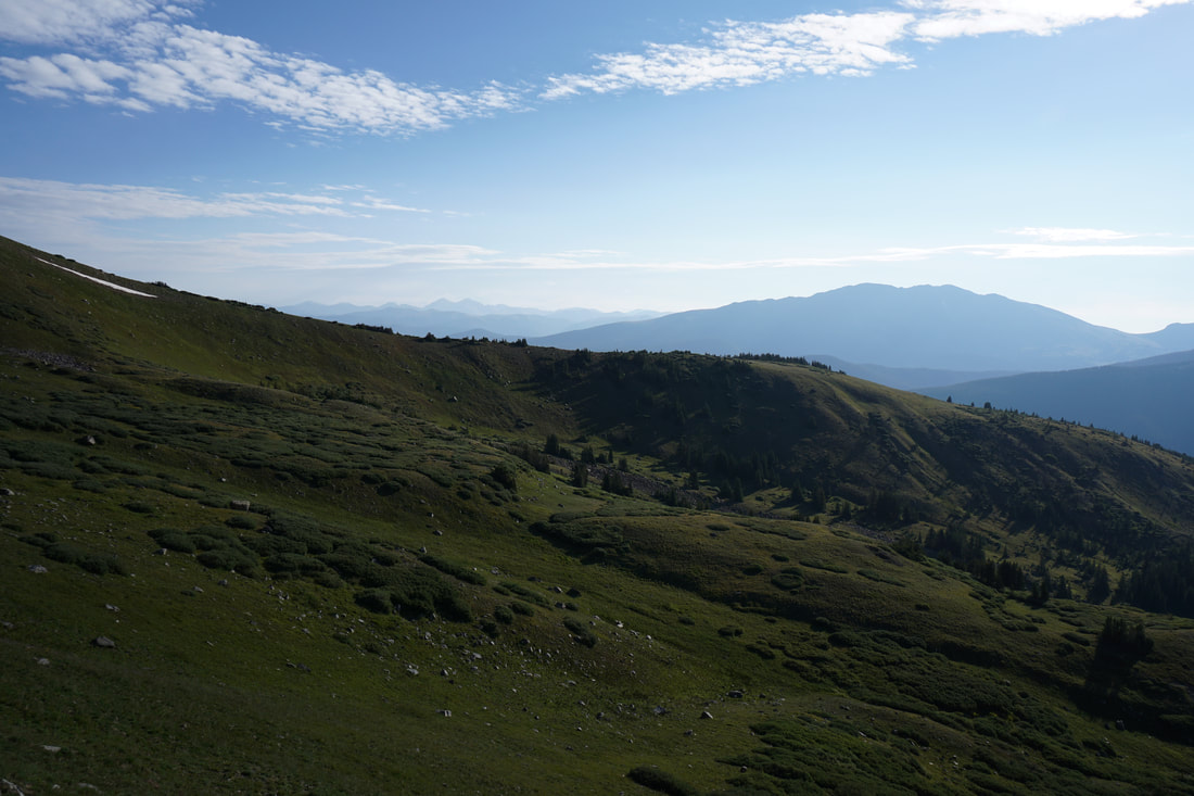
From the parking area at the fork in the McCullough Gulch road take the right fork heading downhill. At the bottom of the road are some dispersed campsites. Continue, uphill now, and follow the road as it curves west past the Wheeler Trailhead. Look for a mine warning sign on the right and a campsite just past the sign. At the far side of the campsite is a faint social trail leading towards an old mining structure, this is a good place to start bushwhacking.
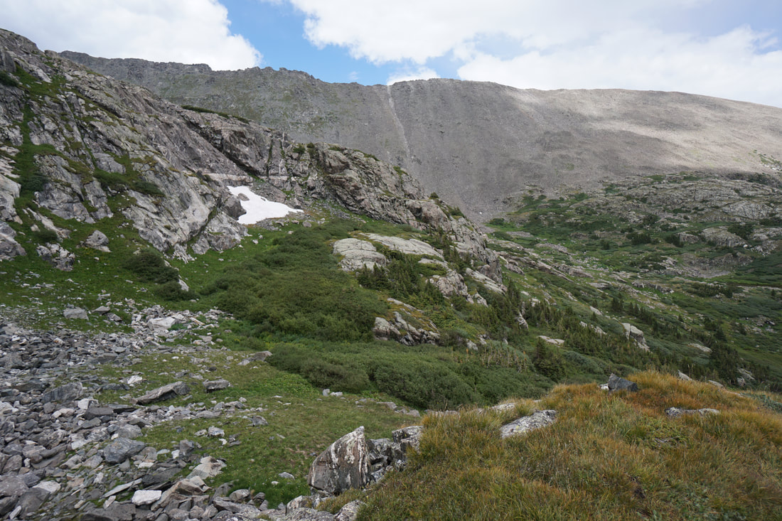
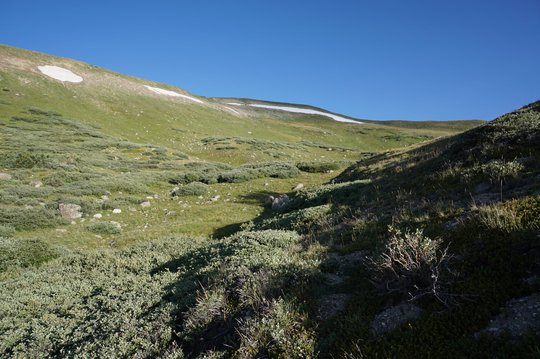
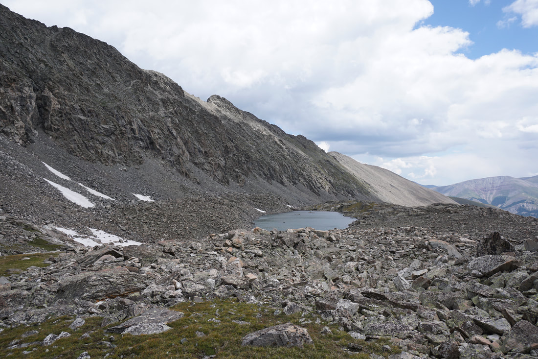
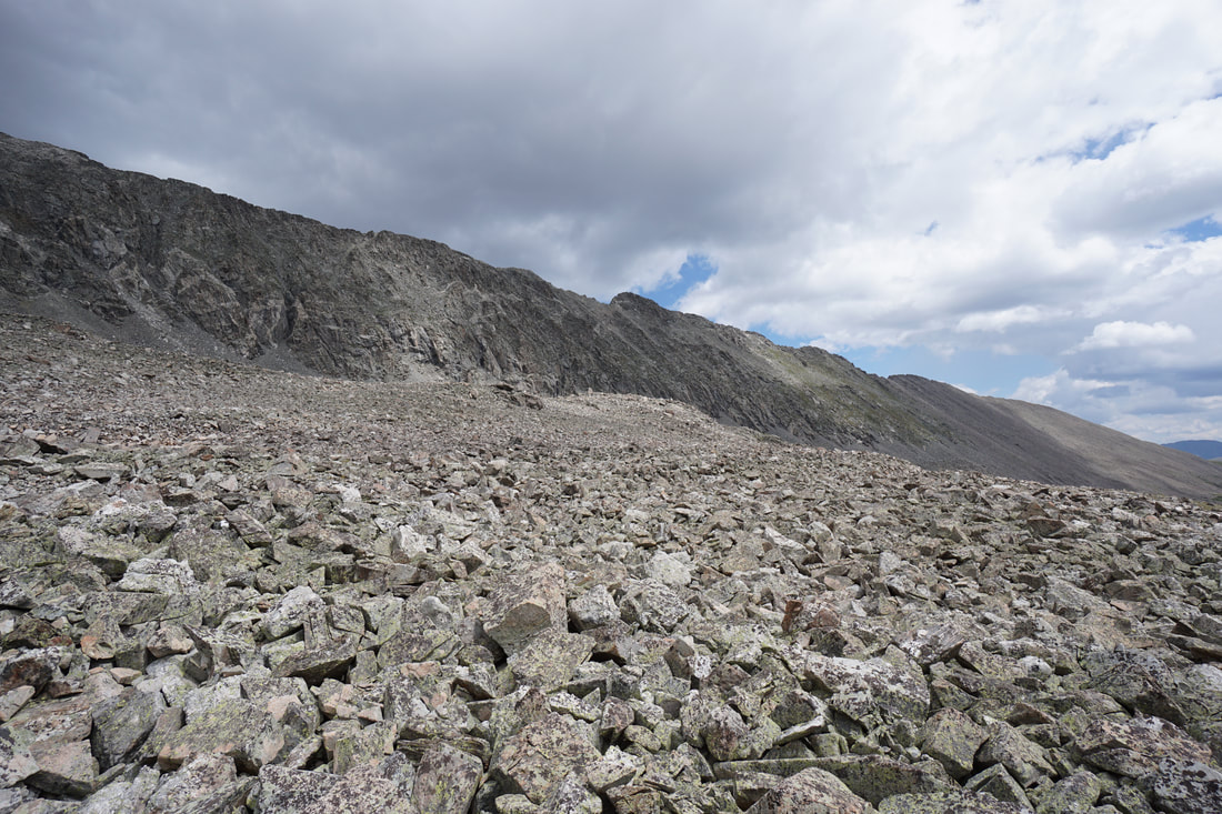
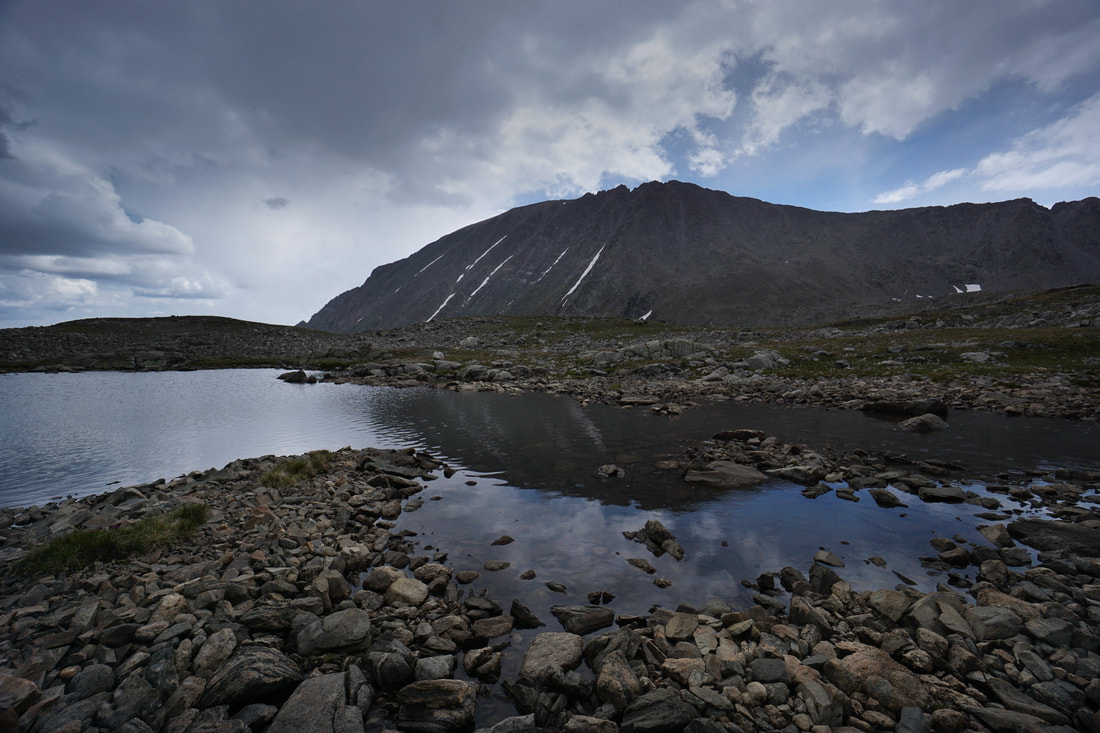
The trail ends quickly at a small gulch. Follow this gulch steeply uphill and when it levels off (after about 200 ft) turn west into some sparse trees. Cross over another gulch and wind your way through willows and sparse evergreens to reach the more open terrain. Stay to the left of a hill along the edge of the willows as you approach the steep basin wall. As you approach the wall look for a short and wide rock wall to the left of a series of small snowfields. Aim to the right of the rock wall for a good route out of the basin and up to the ridge.
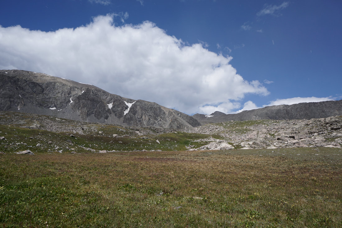
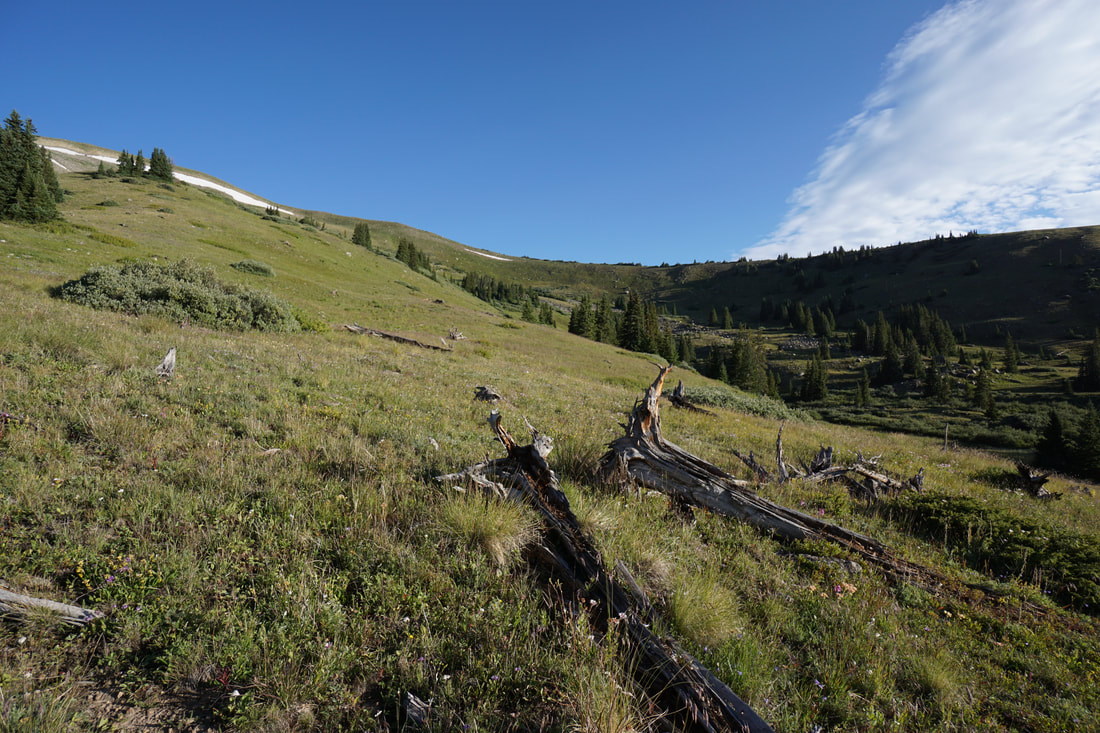
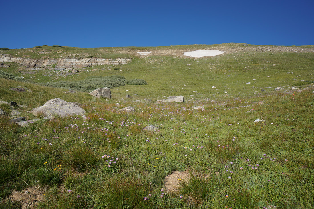
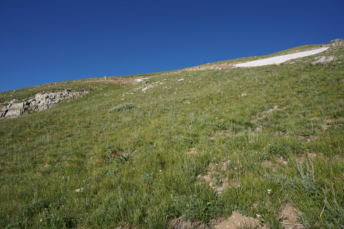
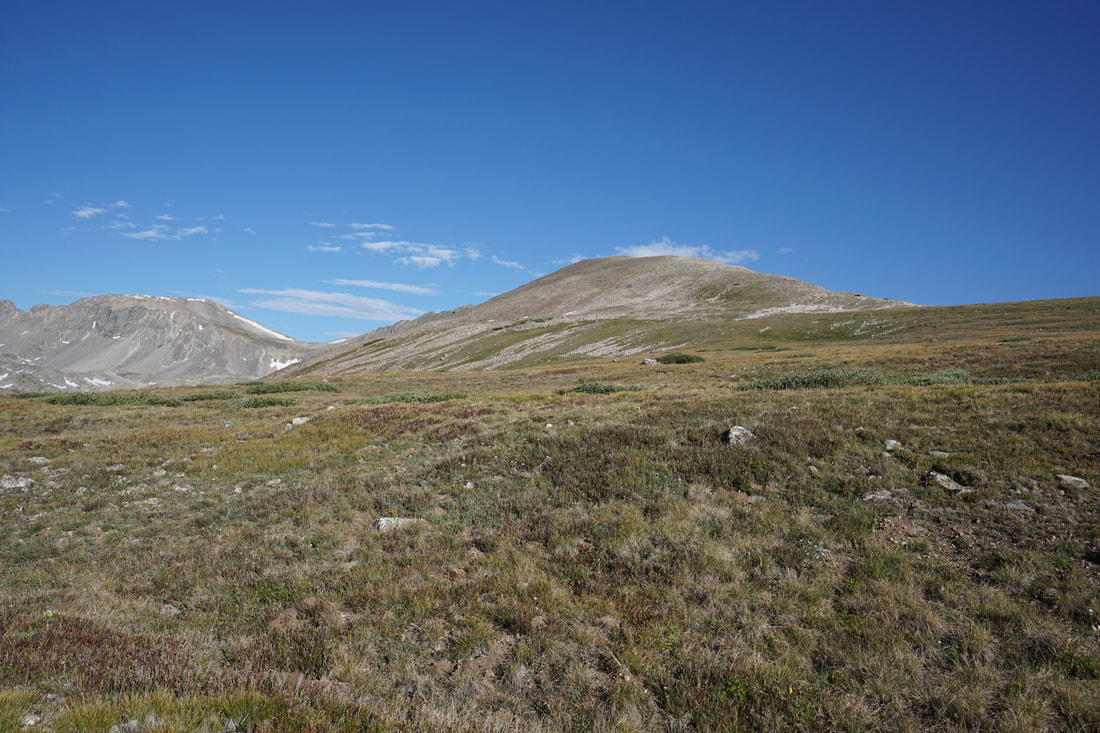
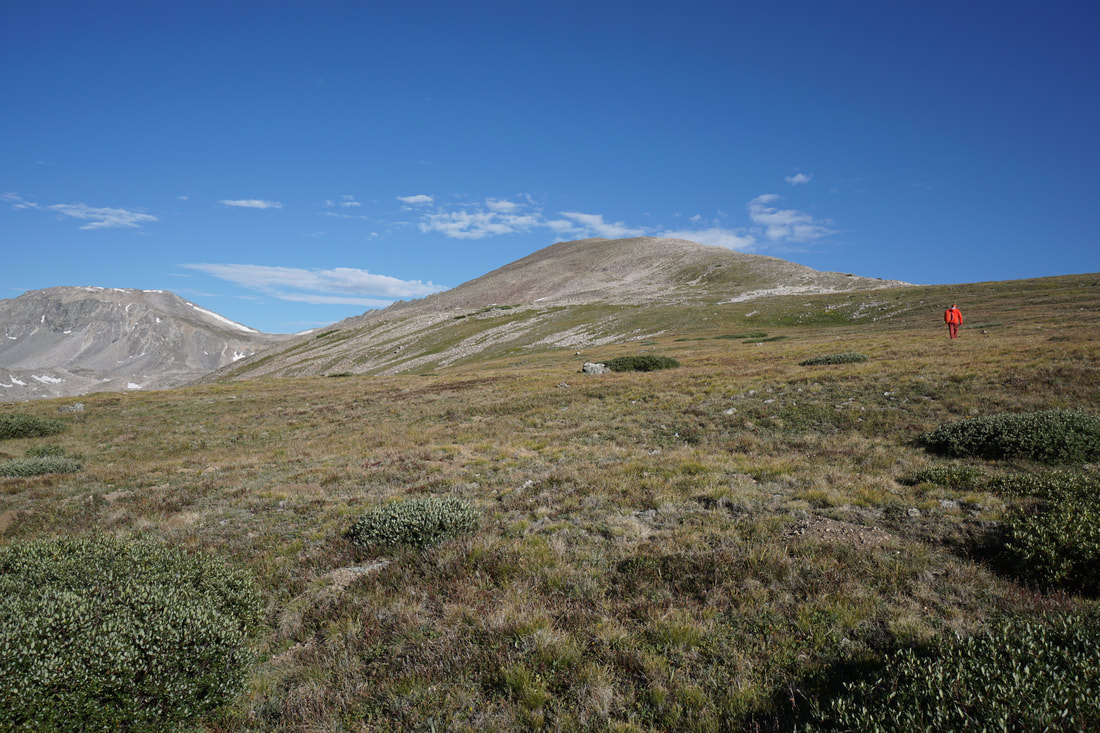
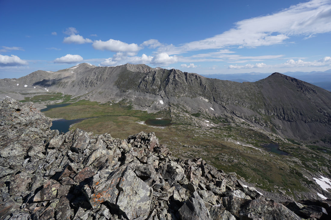
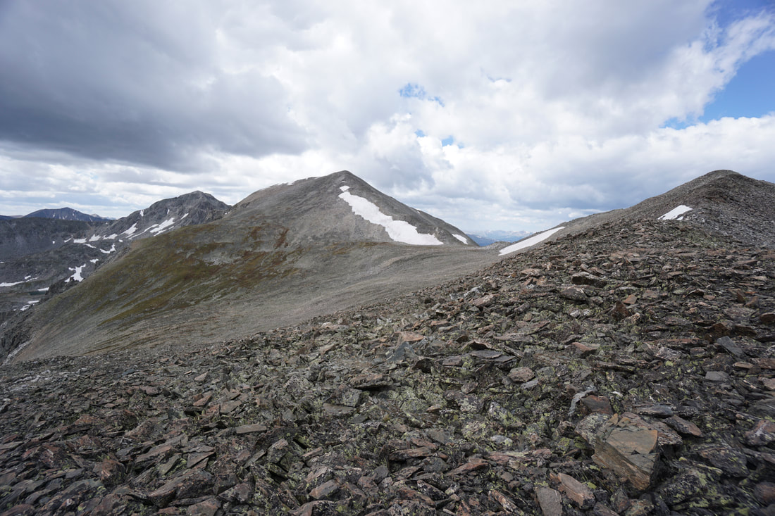
Once out of the basin, work your way up the gentler slopes with the entirety of Quandary Peak now visible to the south. Continue up the grassy slopes, staying generally to the left. Once the views open up to Mt. Fletcher and the jagged ridge leading to Atlantic Peak, you should be able to see the start of the rocky East Ridge up ahead. Aim for the base of the ridge and follow the rolling slopes.
The trail ends quickly at a small gulch. Follow this gulch steeply uphill and when it levels off (after about 200 ft) turn west into some sparse trees. Cross over another gulch and wind your way through willows and sparse evergreens to reach the more open terrain. Stay to the left of a hill along the edge of the willows as you approach the steep basin wall. As you approach the wall look for a short and wide rock wall to the left of a series of small snowfields. Aim to the right of the rock wall for a good route out of the basin and up to the ridge.
Once out of the basin, work your way up the gentler slopes with the entirety of Quandary Peak now visible to the south. Continue up the grassy slopes, staying generally to the left. Once the views open up to Mt. Fletcher and the jagged ridge leading to Atlantic Peak, you should be able to see the start of the rocky East Ridge up ahead. Aim for the base of the ridge and follow the rolling slopes.


East Ridge of Pacific Peak to Pacific Tarn
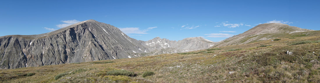
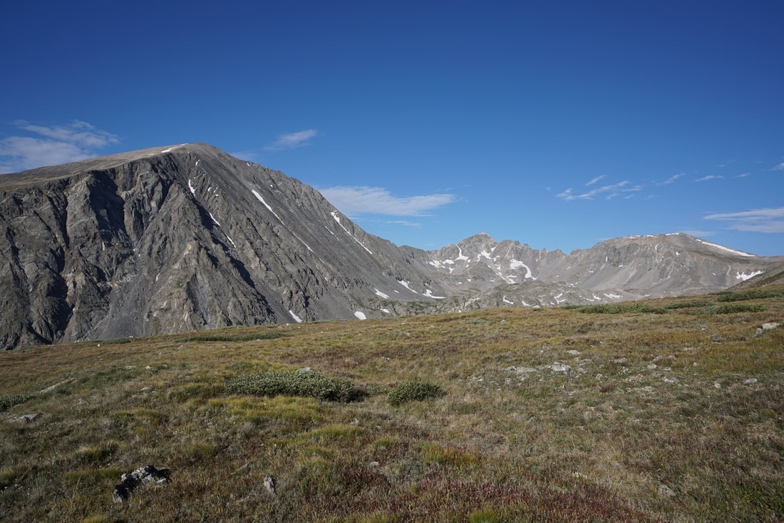
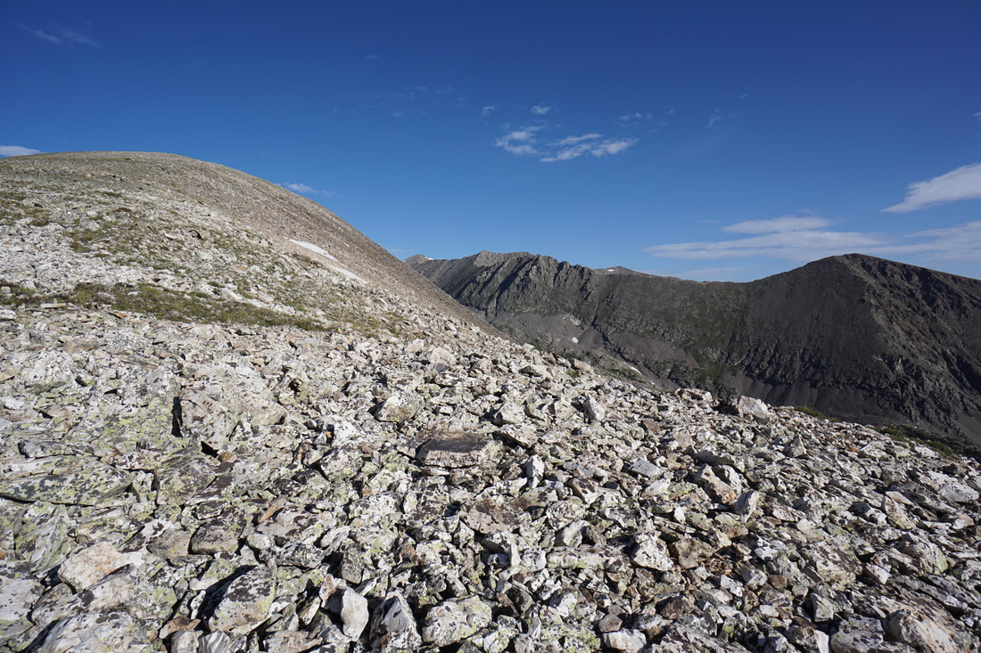
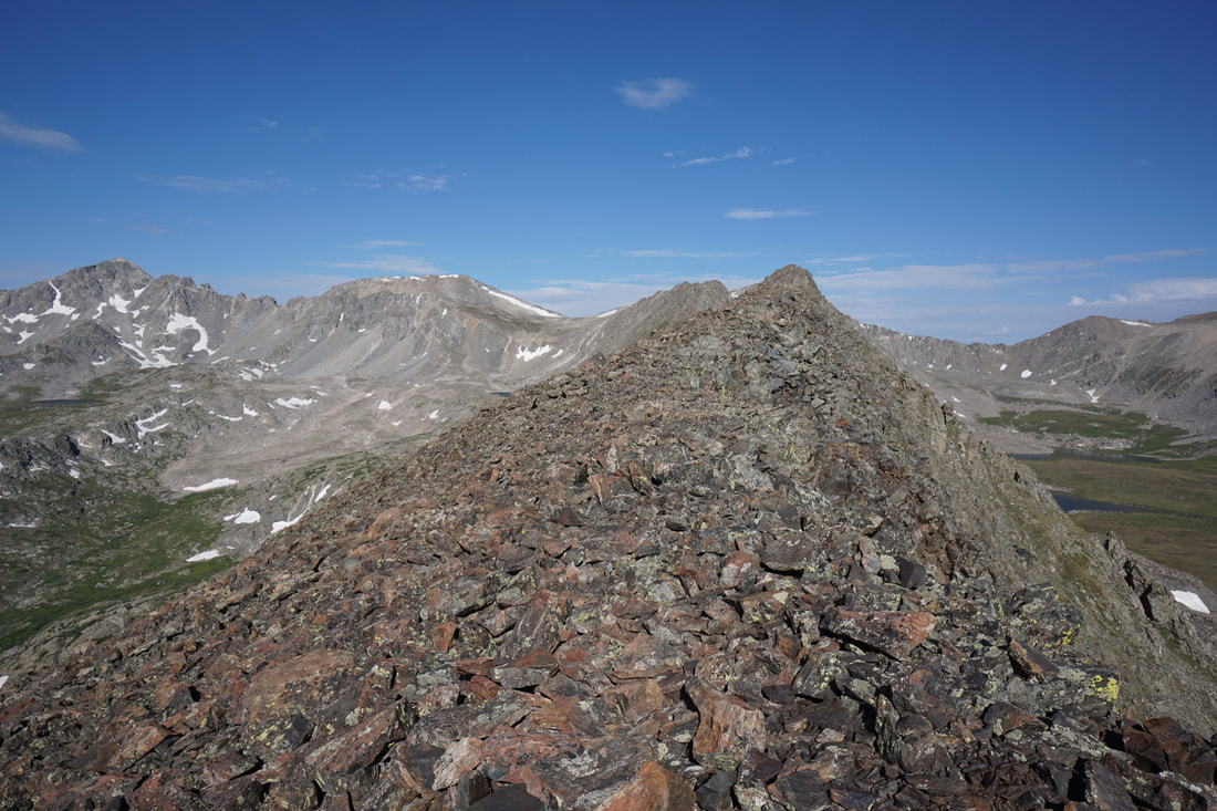
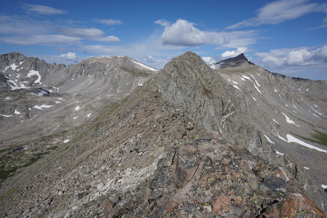
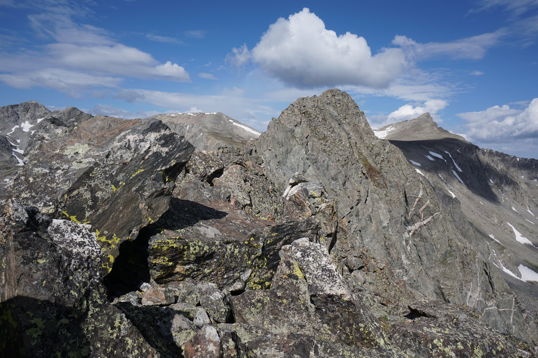
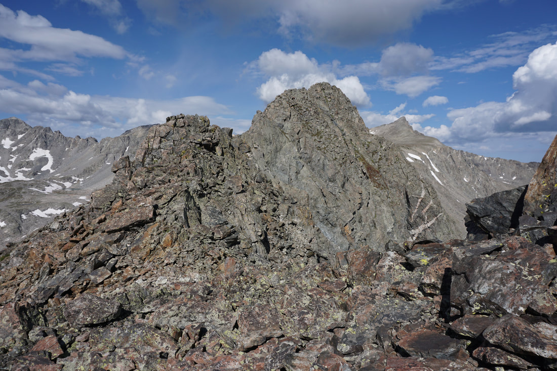
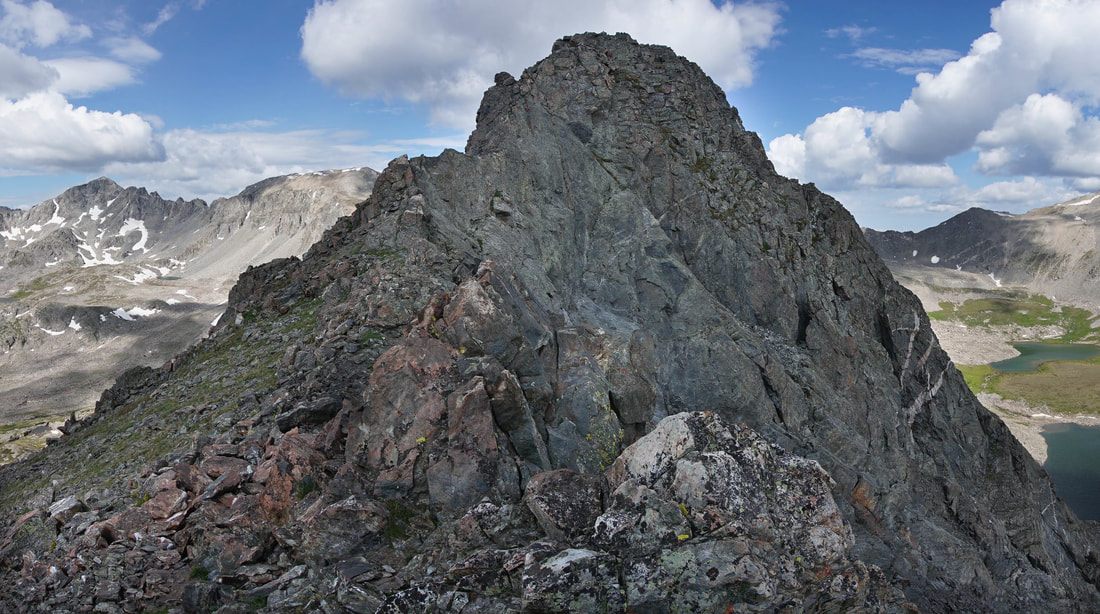
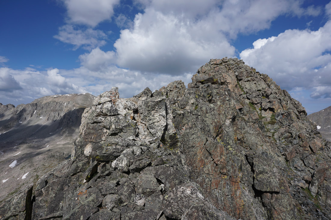
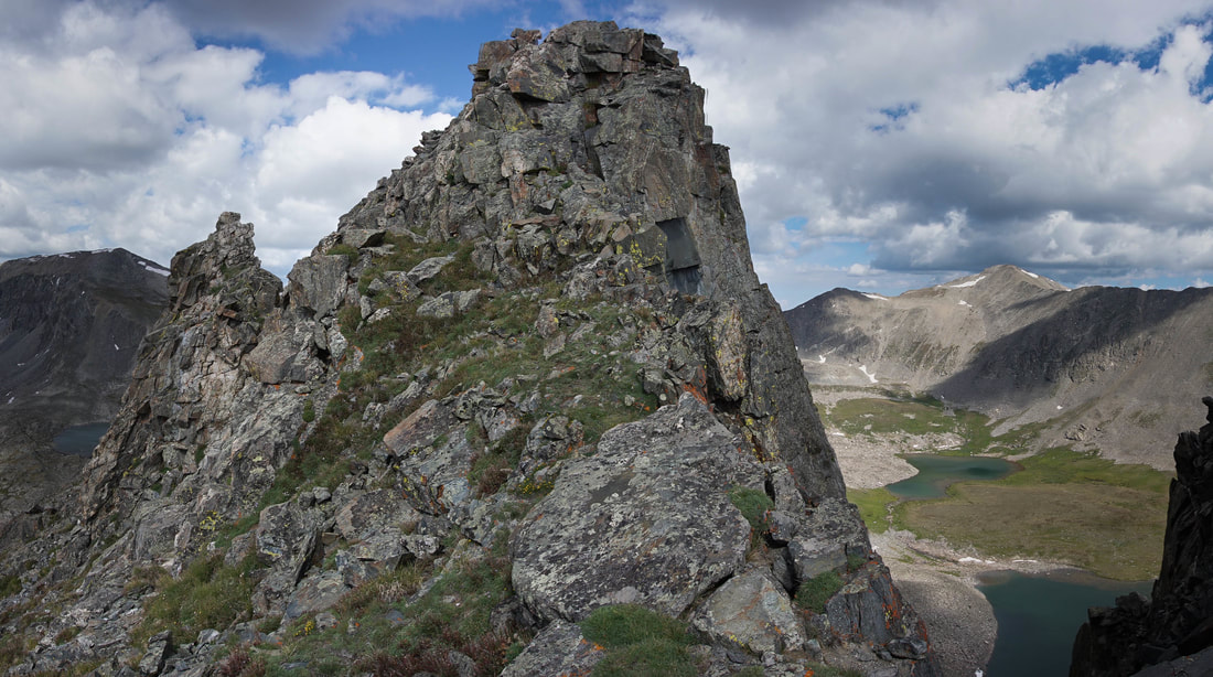
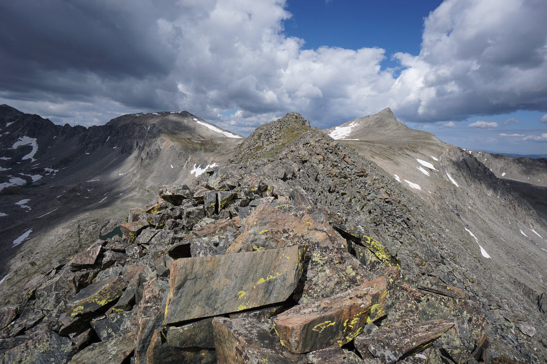
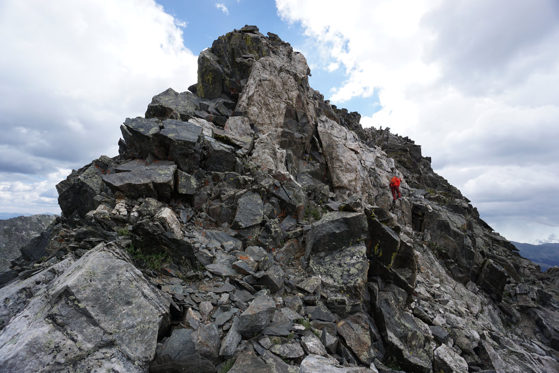
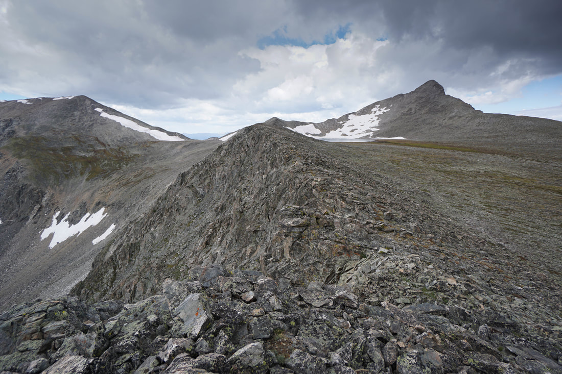
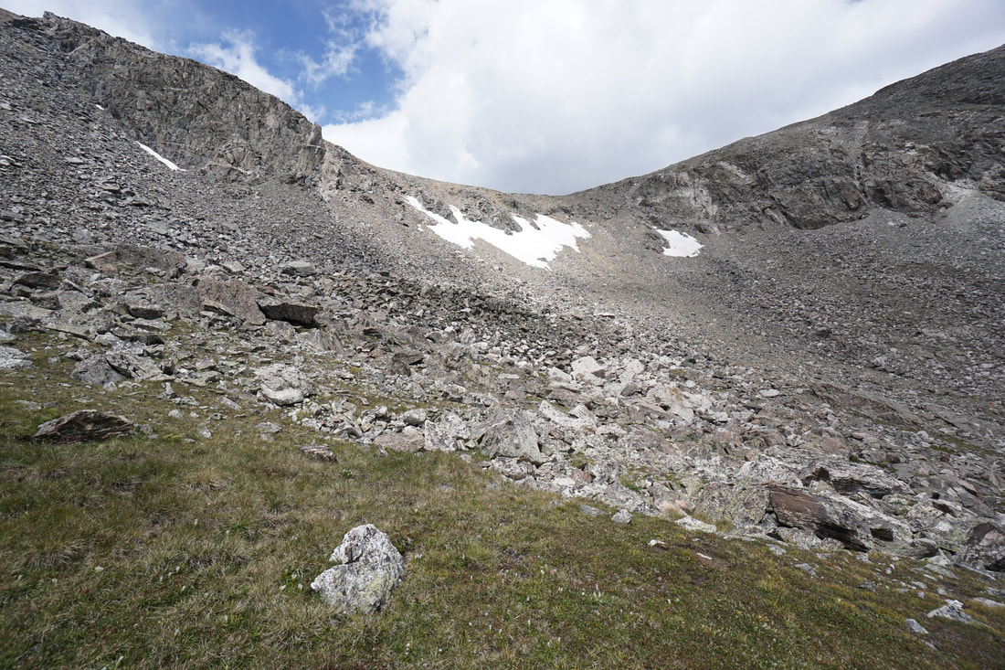
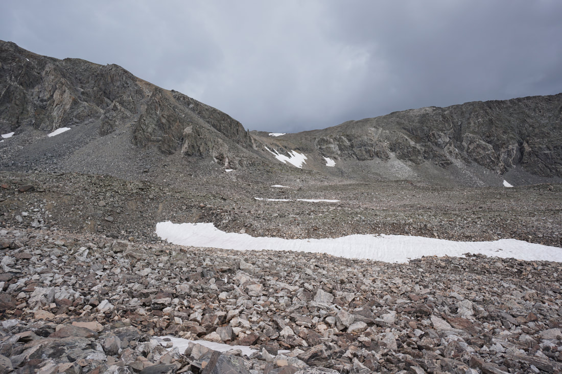
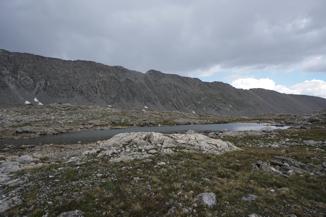
Once you reach the base of the ridge you get your first northern views over the Mohawk Lakes basin below and across to Mt. Helen and the impressive ridge leading to Crystal Peak. This marks the start of the boulder hopping climb up the ridge. As you near the top of the ridge, the ridge narrows and the exposure becomes extreme, you are now on the East Ridge and while it is still class 2 for the next 1/3 of a mile, the real fun begins here.
This is also a good spot to survey the weather and gauge your comfort level with this type of exposure. The drop offs on both sides are impressive and the ridge is very narrow. The views are incredible as you straddle two basins. Keep your focus on the ridge ahead and test every rock and you should be fine.
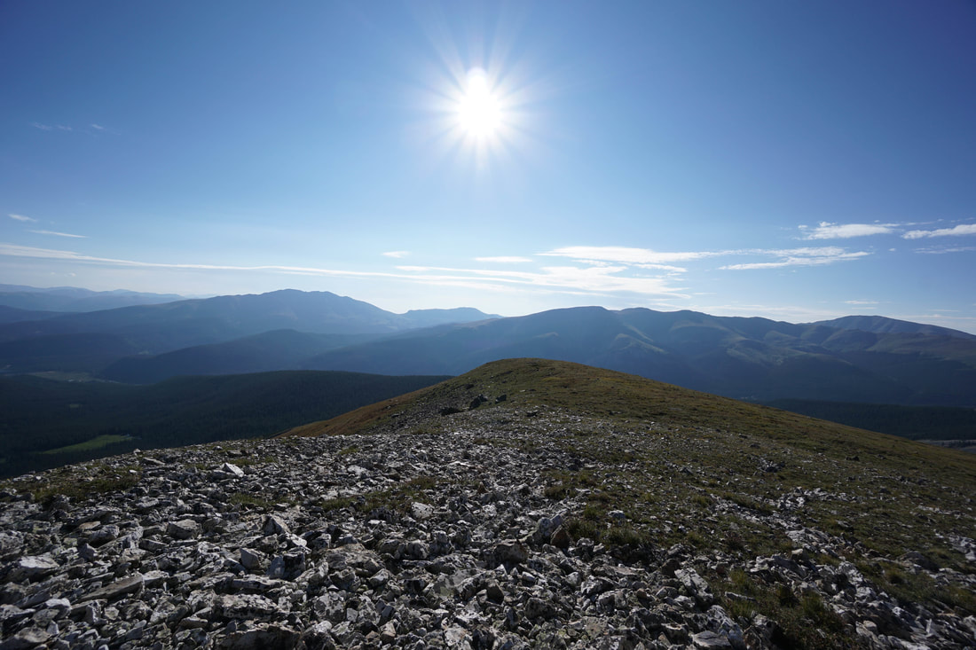
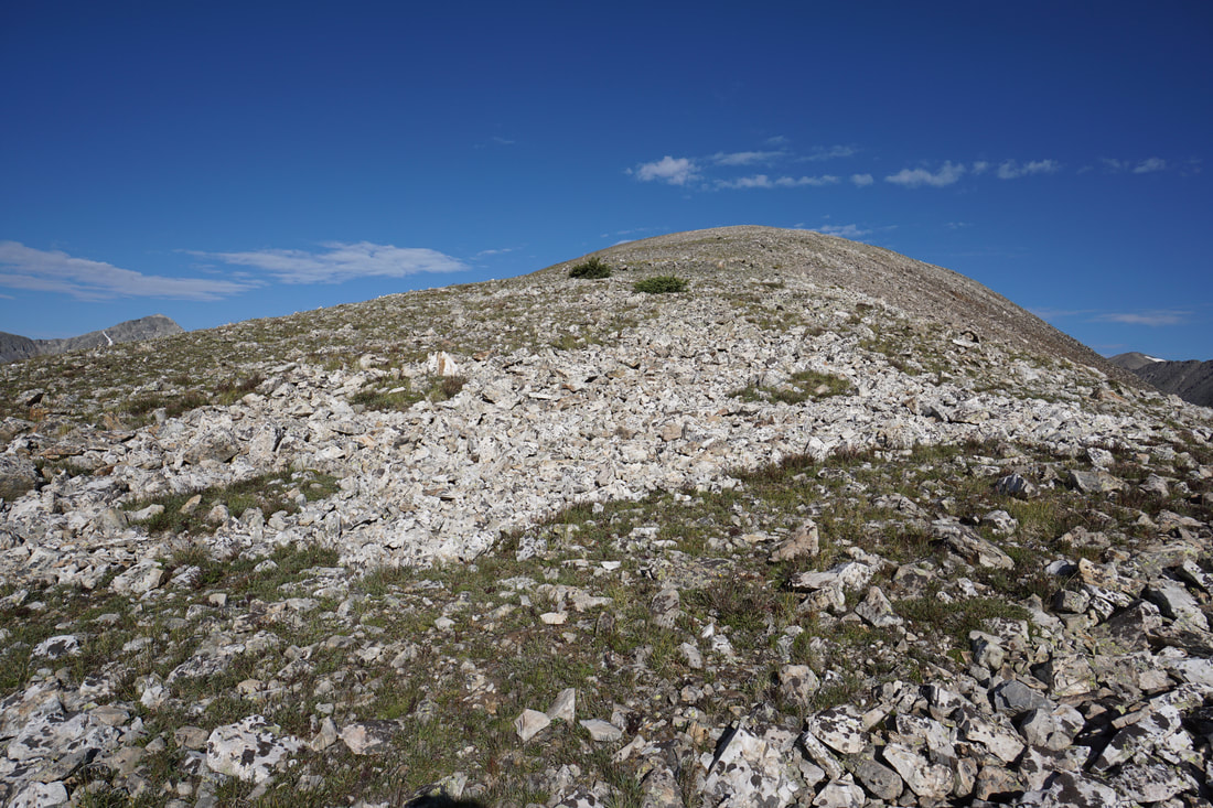
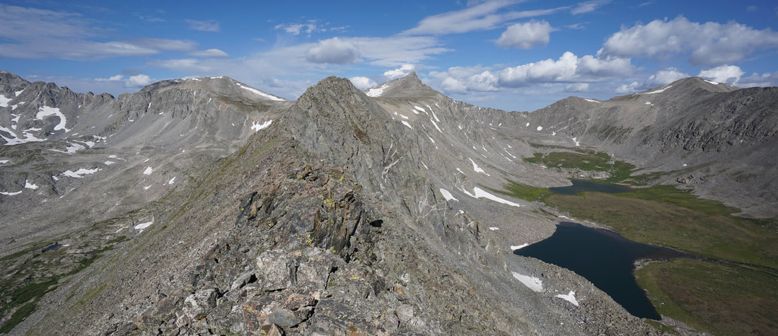
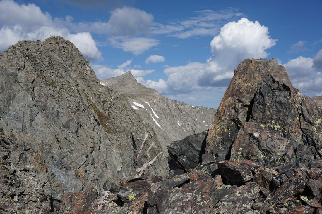
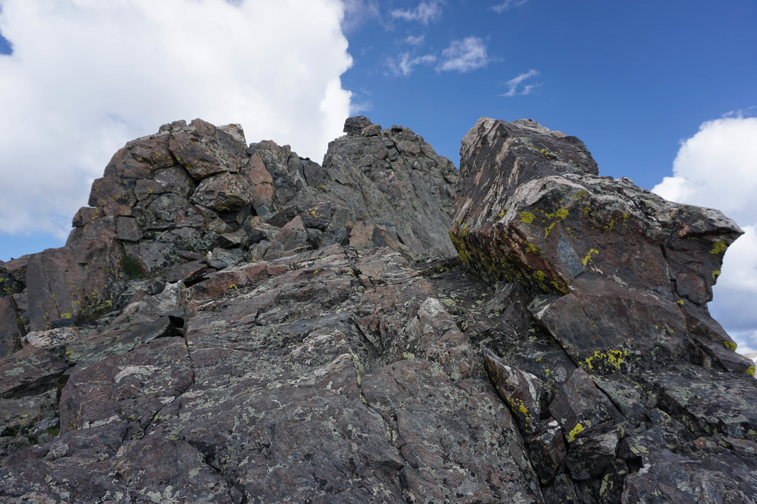
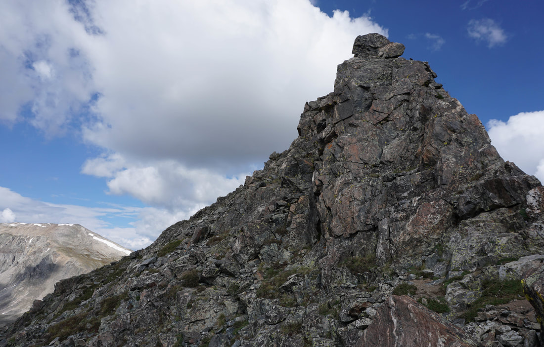
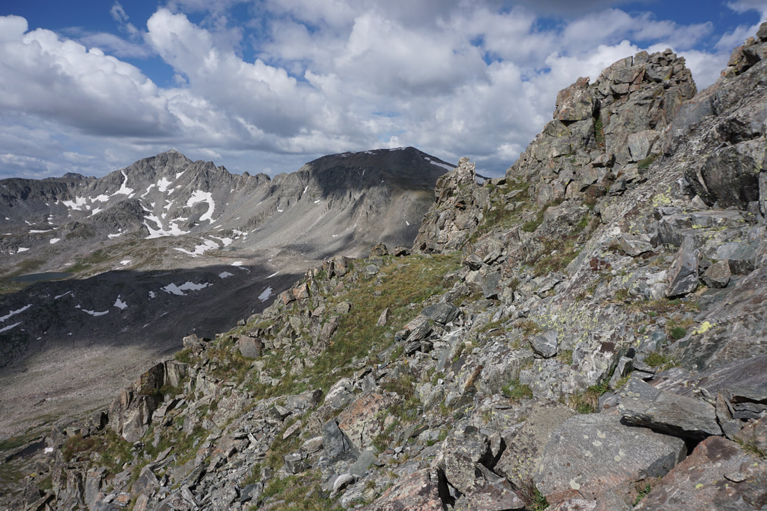
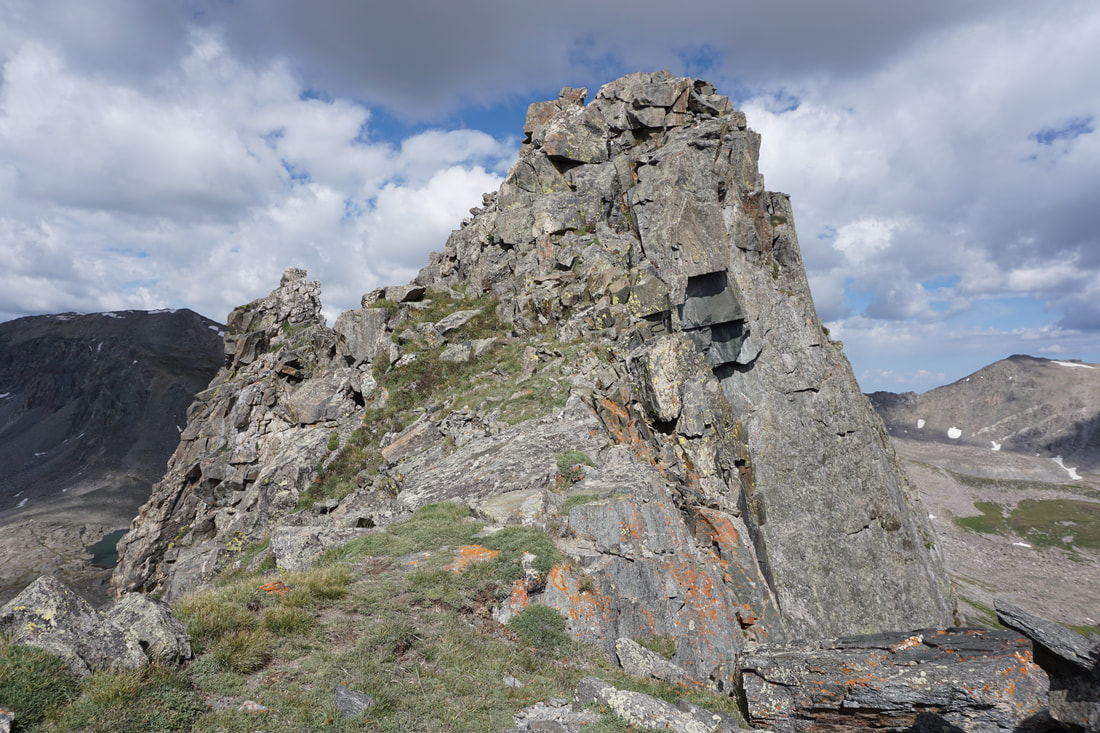
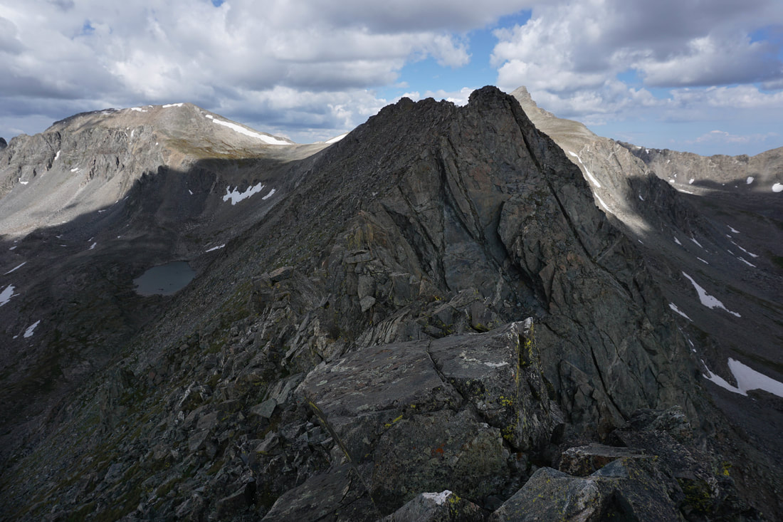
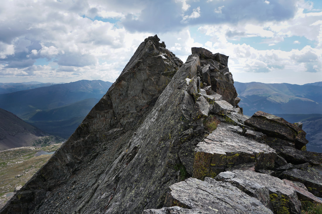
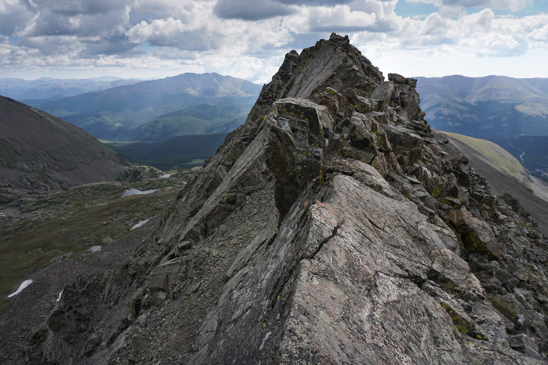
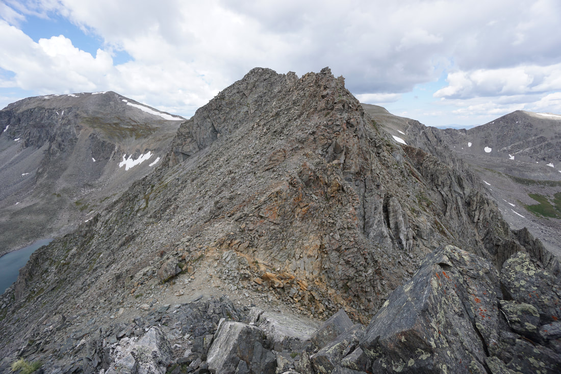
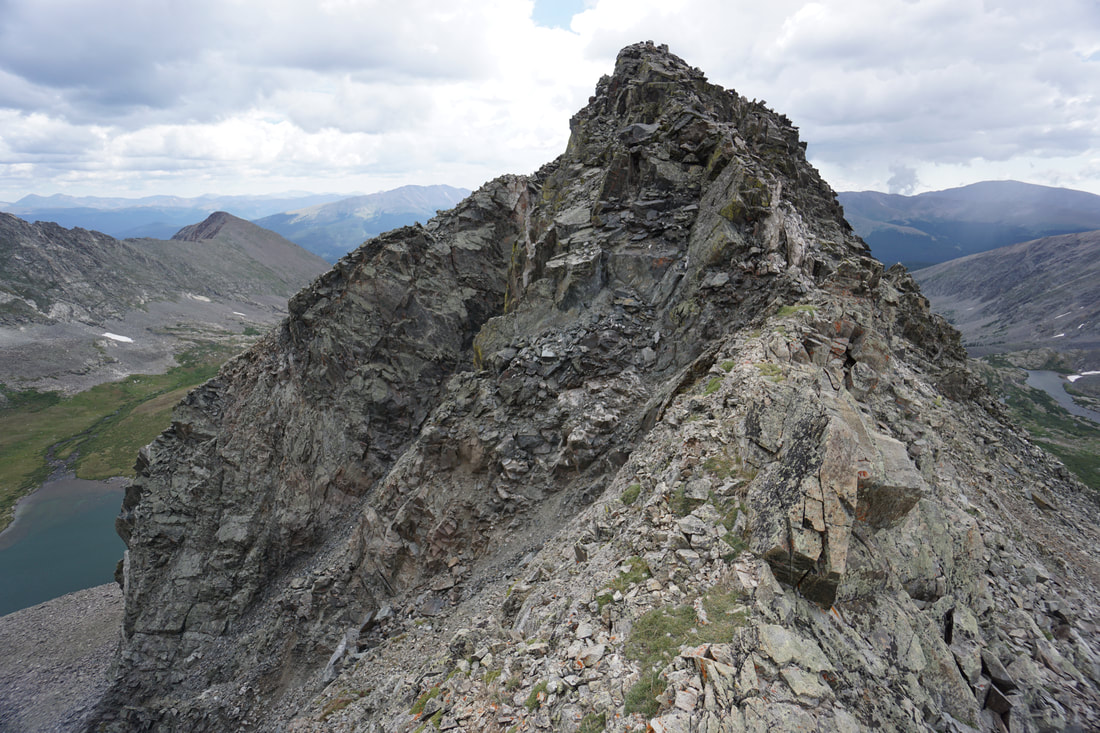
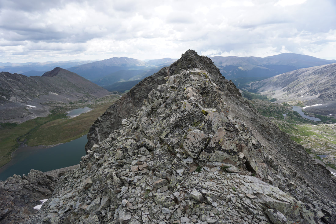
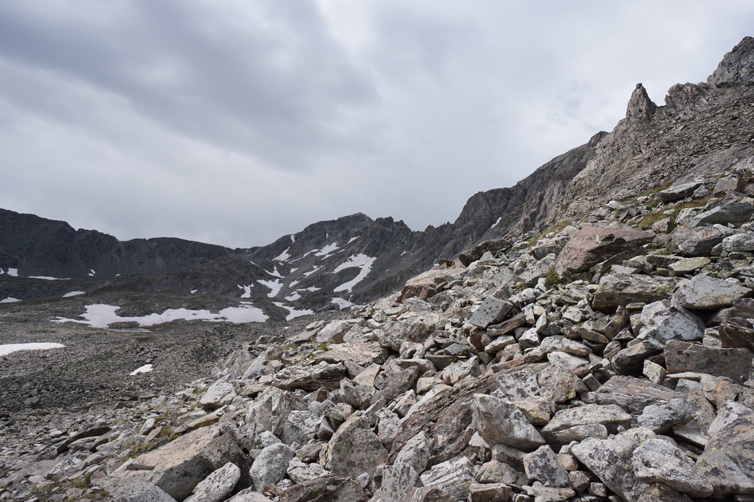
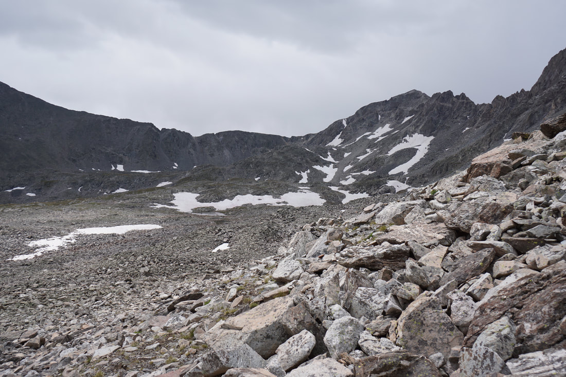
After about .3 of a mile, you'll encounter your first class 3 moves. The next .8 miles consists of mostly class 3 terrain. The great thing about this ridge is that if the ridge proper becomes too difficult you can usually stay to the left (south) of the ridge and bypass the more difficult moves. However, you should try to stay on the ridge itself as much as possible. While this ridge is not easy, it is also not considered difficult class 3 climbing. The ridge consists of a series of towers that you need to ascend and descend. Some of the descents off these towers can be difficult so it is important to scout ahead and down-climb or skirt around towers when necessary. Additionally, the ridge is long...very long... Just when you think you have climbed the last tower, there will be three more ahead.
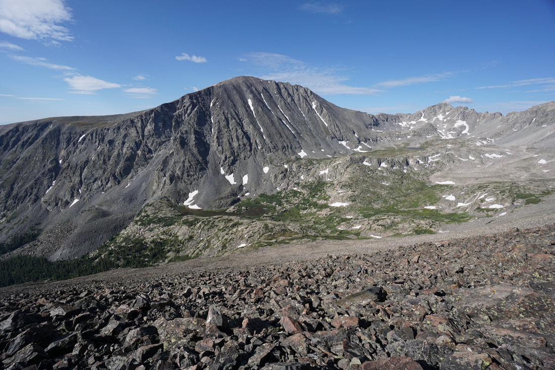
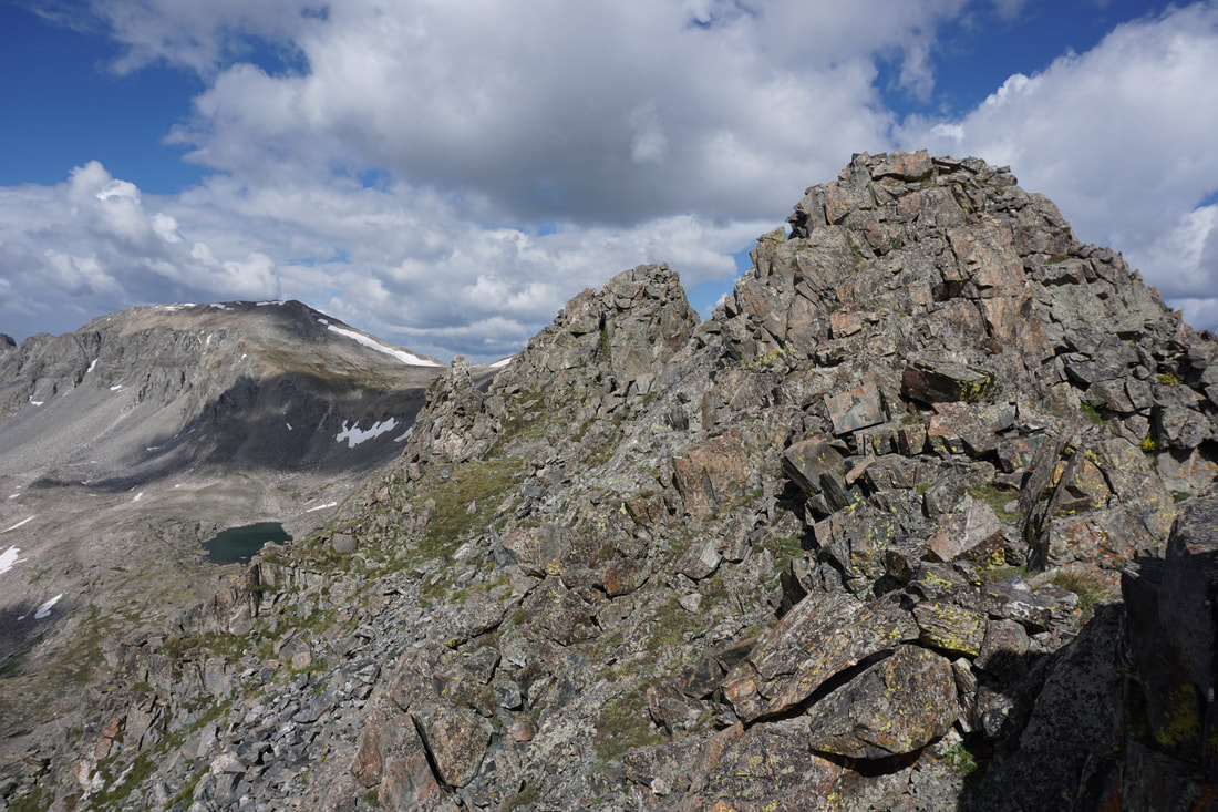
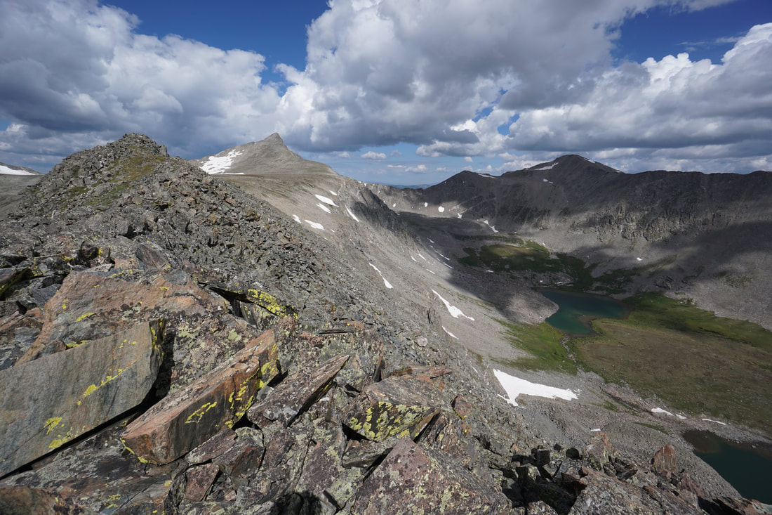
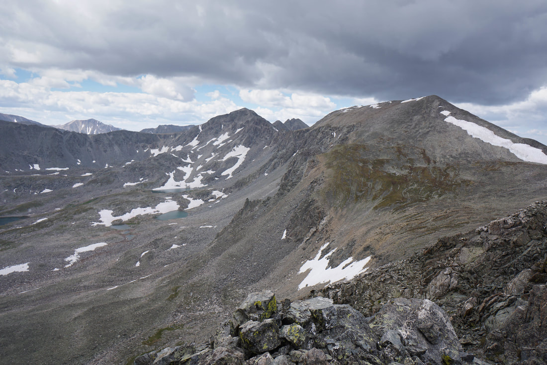
That being said, the East Ridge is spectacular and truly fun. The views are amazing, the scrambling is thrilling, and if you enjoy the puzzle of picking out the best line on a routes through rock mazes, then you'll have a blast along this ridge. This is also a great ridge to gain experience on since it is long and forces you to maintain your composure for a extended period of time. I won't go into detail on each tower but eventually the towers will end and the ridge will revert back to solid class 2 terrain. Looking back on the ridge you should feel a true sense of accomplishment, you just crossed terrain that few hikers get the opportunity to experience. The rest of the hike is technically much easier but there are still some experiences ahead...
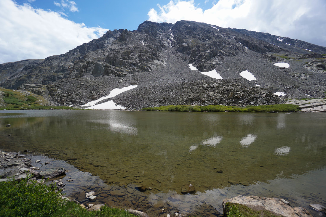
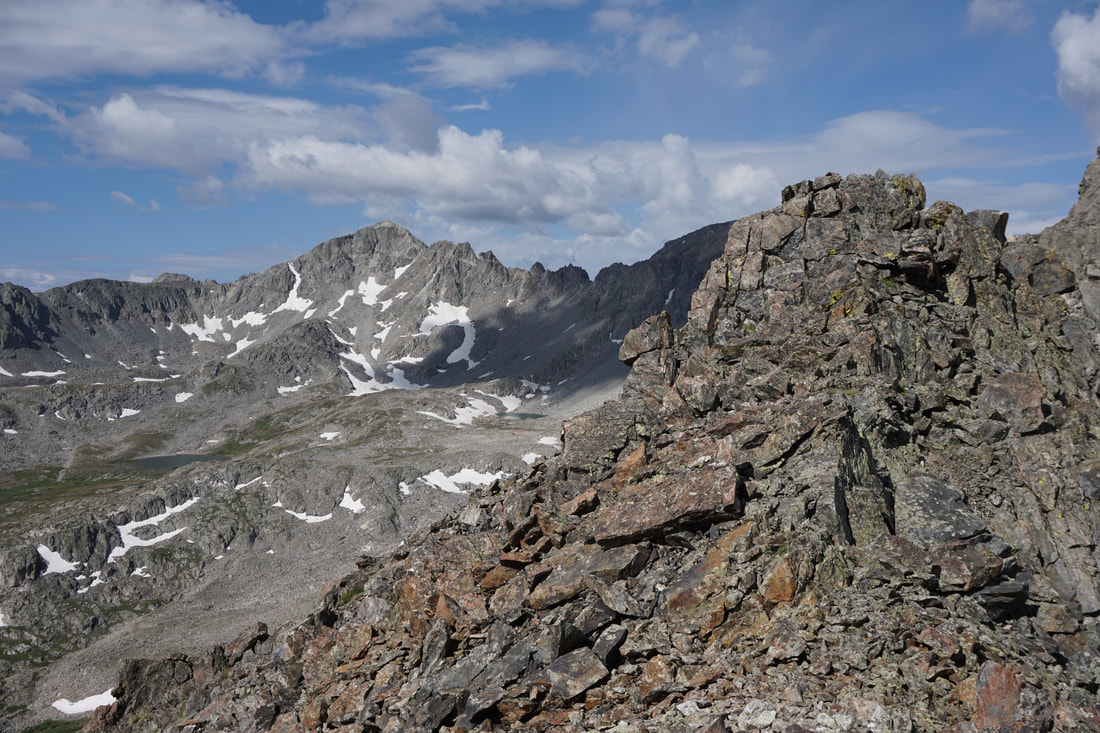
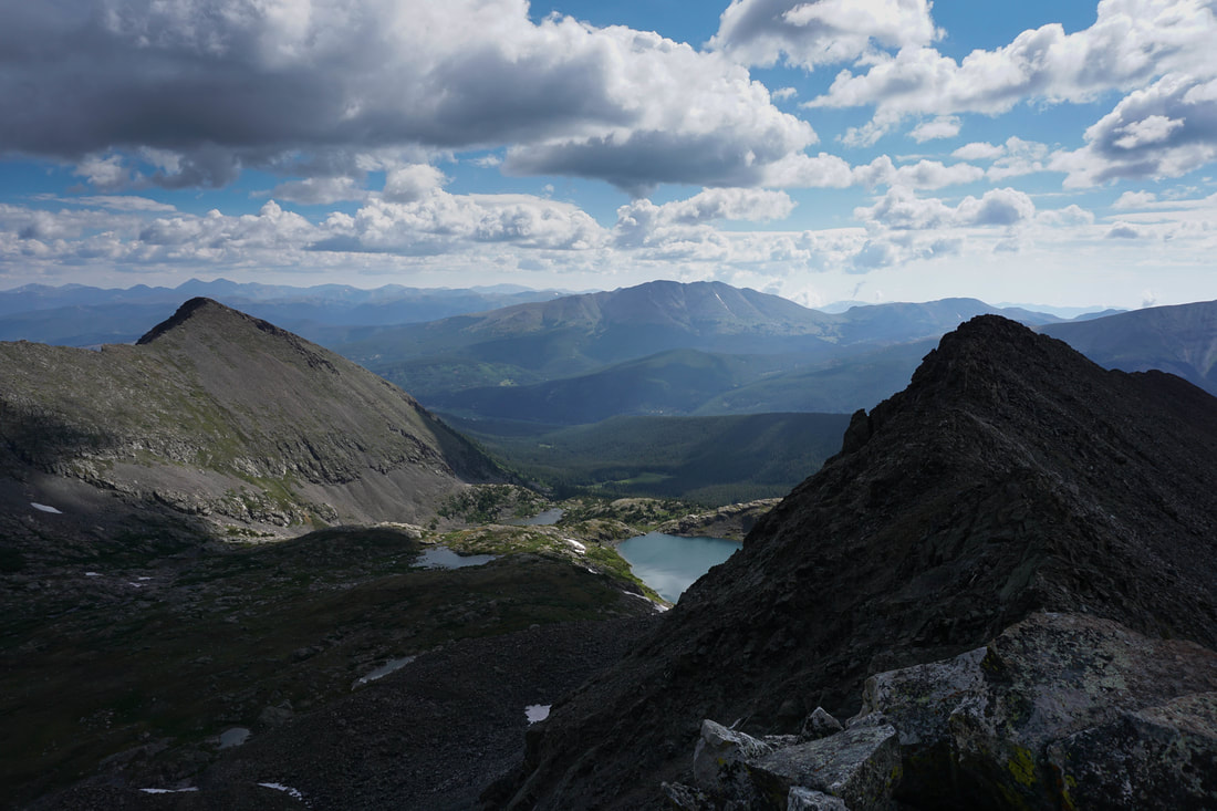
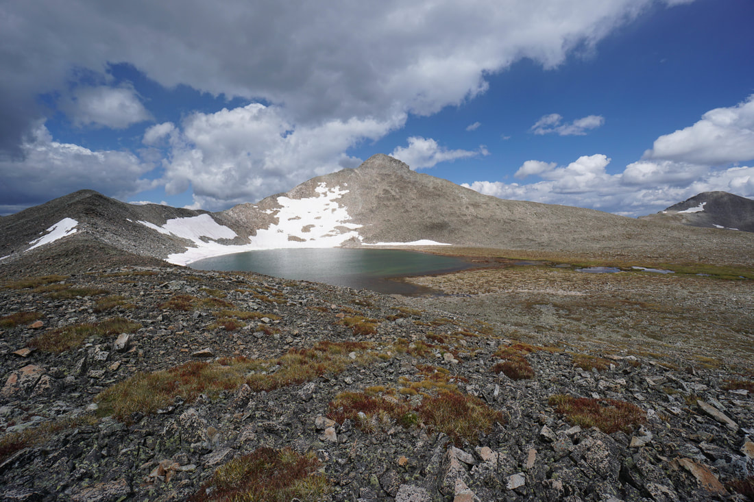
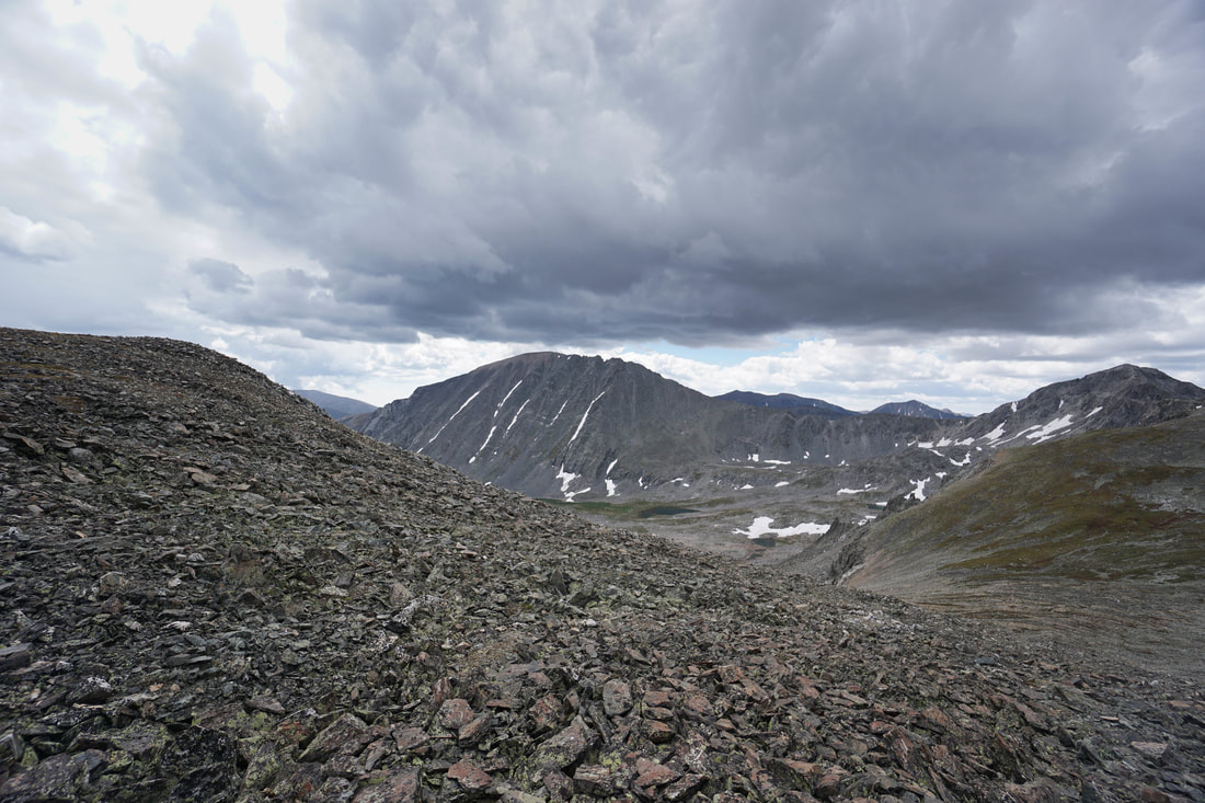
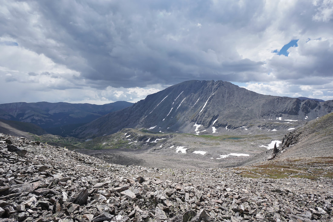
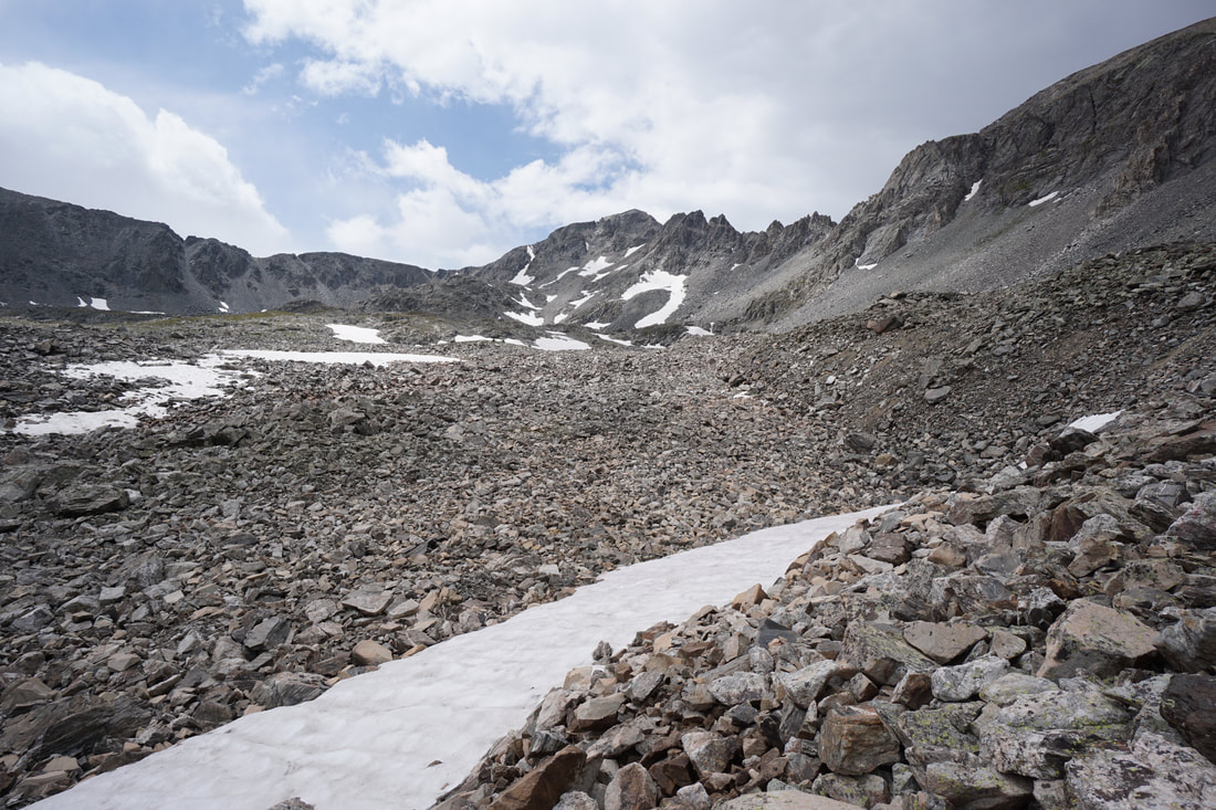
Once you have conquered the ridge, Pacific Peak and Pacific Tarn will be in full view. On our trip Pacific Peak was the goal but the weather was concerning with some snowfall and thunder to the south. We made the difficult decision to forego the final climb up Pacific Peak and instead "settled" for the wonderful shores of Pacific Tarn as our destination. This lake is really something special, barren, remote, and beautiful. At the far end of the Tarn is a glacier with bright blue ice slowly melting into the lake. Pacific Tarn is the highest officially named lake (officially recognized by the United States Board on Geographic Names) in the United States. For more detailed information, see the description for the standard route up Pacific Tarn (which is also the same descent described in this description).
This is also a good spot to survey the weather and gauge your comfort level with this type of exposure. The drop offs on both sides are impressive and the ridge is very narrow. The views are incredible as you straddle two basins. Keep your focus on the ridge ahead and test every rock and you should be fine.
After about .3 of a mile, you'll encounter your first class 3 moves. The next .8 miles consists of mostly class 3 terrain. The great thing about this ridge is that if the ridge proper becomes too difficult you can usually stay to the left (south) of the ridge and bypass the more difficult moves. However, you should try to stay on the ridge itself as much as possible. While this ridge is not easy, it is also not considered difficult class 3 climbing. The ridge consists of a series of towers that you need to ascend and descend. Some of the descents off these towers can be difficult so it is important to scout ahead and down-climb or skirt around towers when necessary. Additionally, the ridge is long...very long... Just when you think you have climbed the last tower, there will be three more ahead.
That being said, the East Ridge is spectacular and truly fun. The views are amazing, the scrambling is thrilling, and if you enjoy the puzzle of picking out the best line on a routes through rock mazes, then you'll have a blast along this ridge. This is also a great ridge to gain experience on since it is long and forces you to maintain your composure for a extended period of time. I won't go into detail on each tower but eventually the towers will end and the ridge will revert back to solid class 2 terrain. Looking back on the ridge you should feel a true sense of accomplishment, you just crossed terrain that few hikers get the opportunity to experience. The rest of the hike is technically much easier but there are still some experiences ahead...
Once you have conquered the ridge, Pacific Peak and Pacific Tarn will be in full view. On our trip Pacific Peak was the goal but the weather was concerning with some snowfall and thunder to the south. We made the difficult decision to forego the final climb up Pacific Peak and instead "settled" for the wonderful shores of Pacific Tarn as our destination. This lake is really something special, barren, remote, and beautiful. At the far end of the Tarn is a glacier with bright blue ice slowly melting into the lake. Pacific Tarn is the highest officially named lake (officially recognized by the United States Board on Geographic Names) in the United States. For more detailed information, see the description for the standard route up Pacific Tarn (which is also the same descent described in this description).


Pacific Tarn to McCullough Gulch
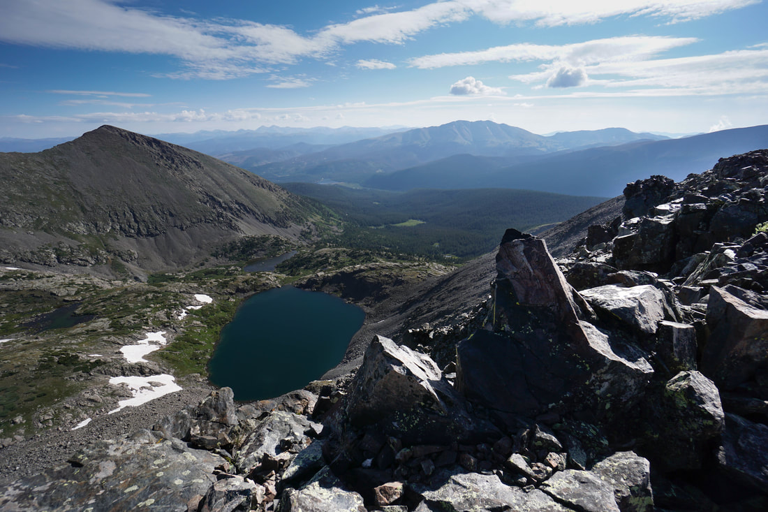
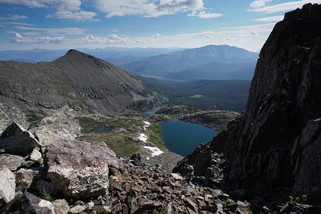
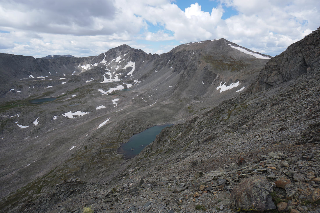
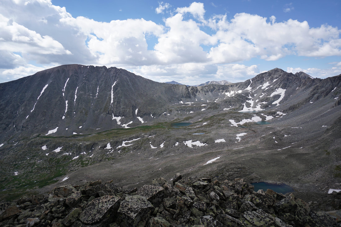
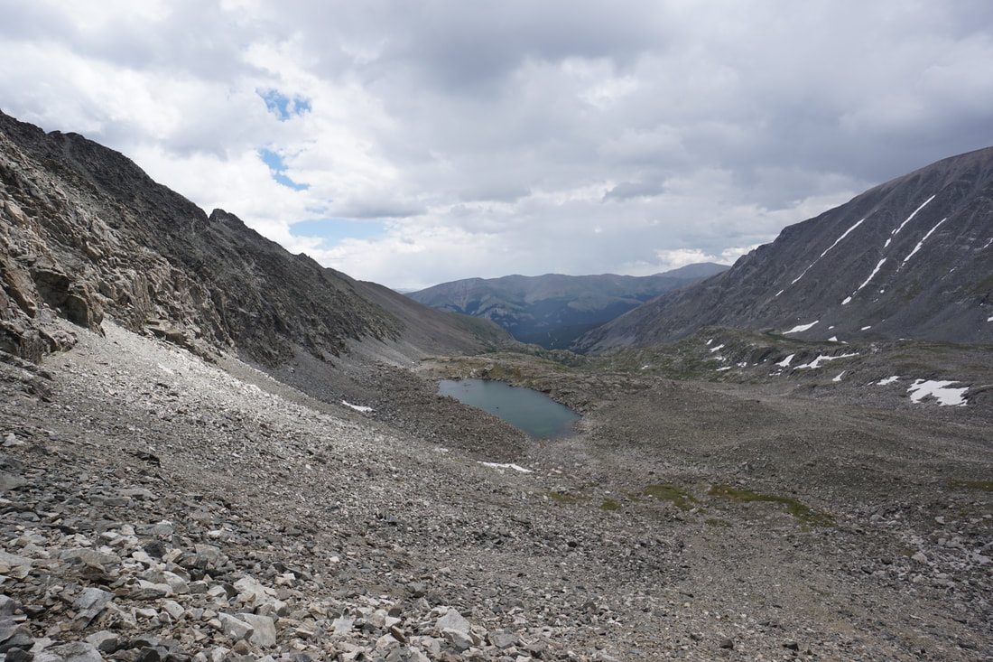
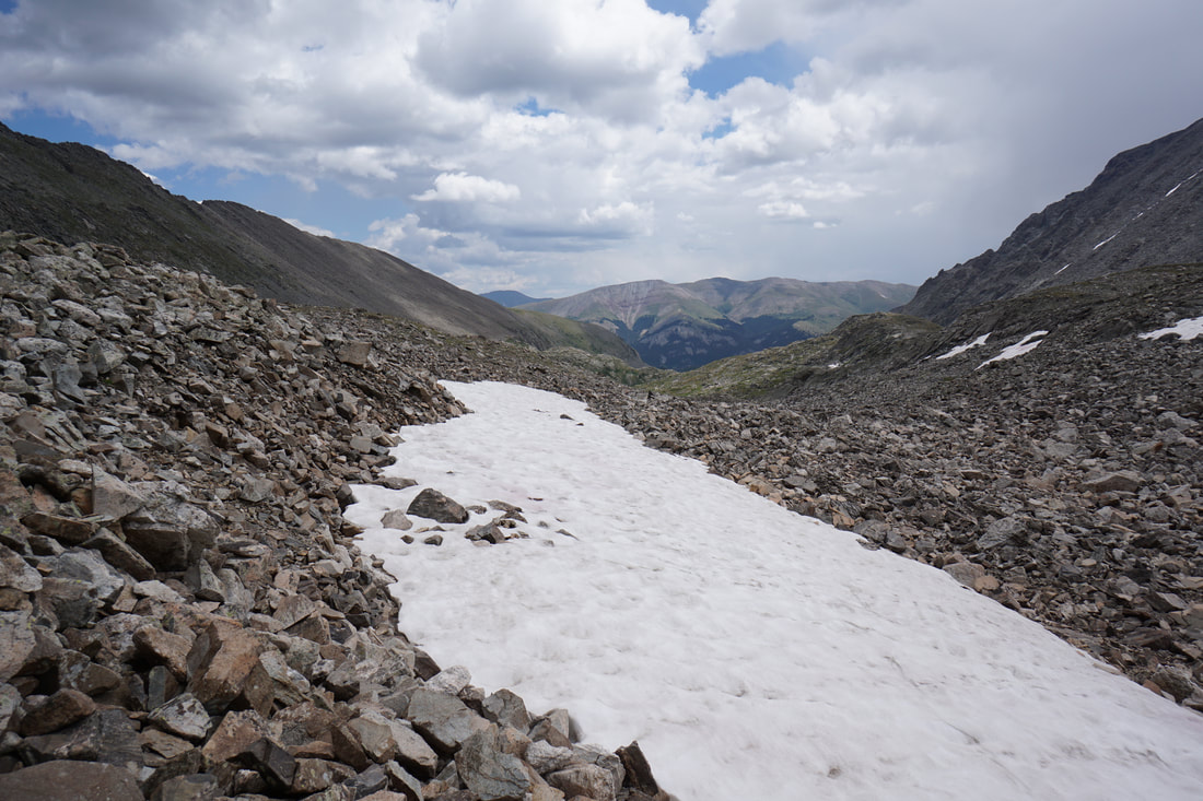
From the Tarn you now have to negotiate the steep decent from the saddle down to McCullough Gulch's upper basin. This section is steep, loose, and slightly miserable. Pick your way down the boulders and stay to the left, it is a good idea to start your route finding up on the ridge and aim for spaces in between snowfields. Whichever route you choose, the loose dirt and loose rock will be difficult. Take your time and exercise patience as you work your way down.
Once you get to the boulder field below the steep section, start heading due south towards Upper Lake #1. Directly below the steep section there is a beautiful unnamed lake, visit if you like, but otherwise, aim for the large lake to the south under the slopes of Quandary. The next half mile is boulder hoping across a few gullies and perhaps across a few snowfields. Before too long you'll arrive at a ridge above Upper Lake #1. Head for the outlet to find the faint trail heading down McCullough Gulch.
Once you get to the boulder field below the steep section, start heading due south towards Upper Lake #1. Directly below the steep section there is a beautiful unnamed lake, visit if you like, but otherwise, aim for the large lake to the south under the slopes of Quandary. The next half mile is boulder hoping across a few gullies and perhaps across a few snowfields. Before too long you'll arrive at a ridge above Upper Lake #1. Head for the outlet to find the faint trail heading down McCullough Gulch.

McCullough Gulch
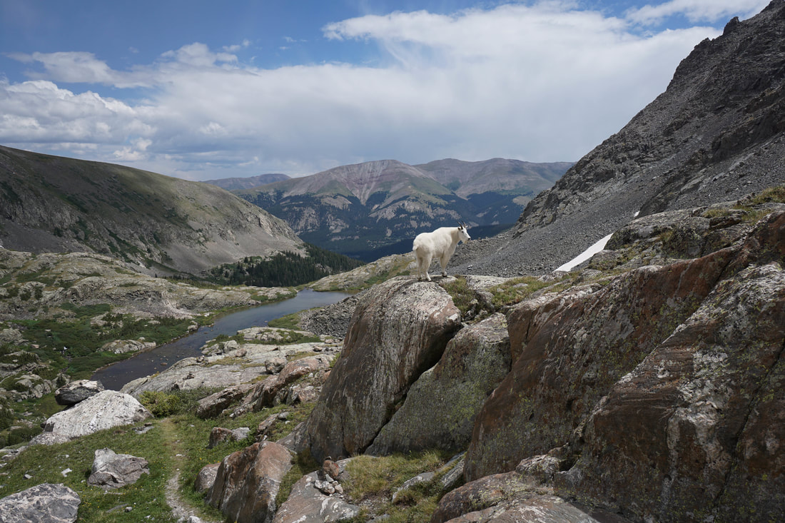
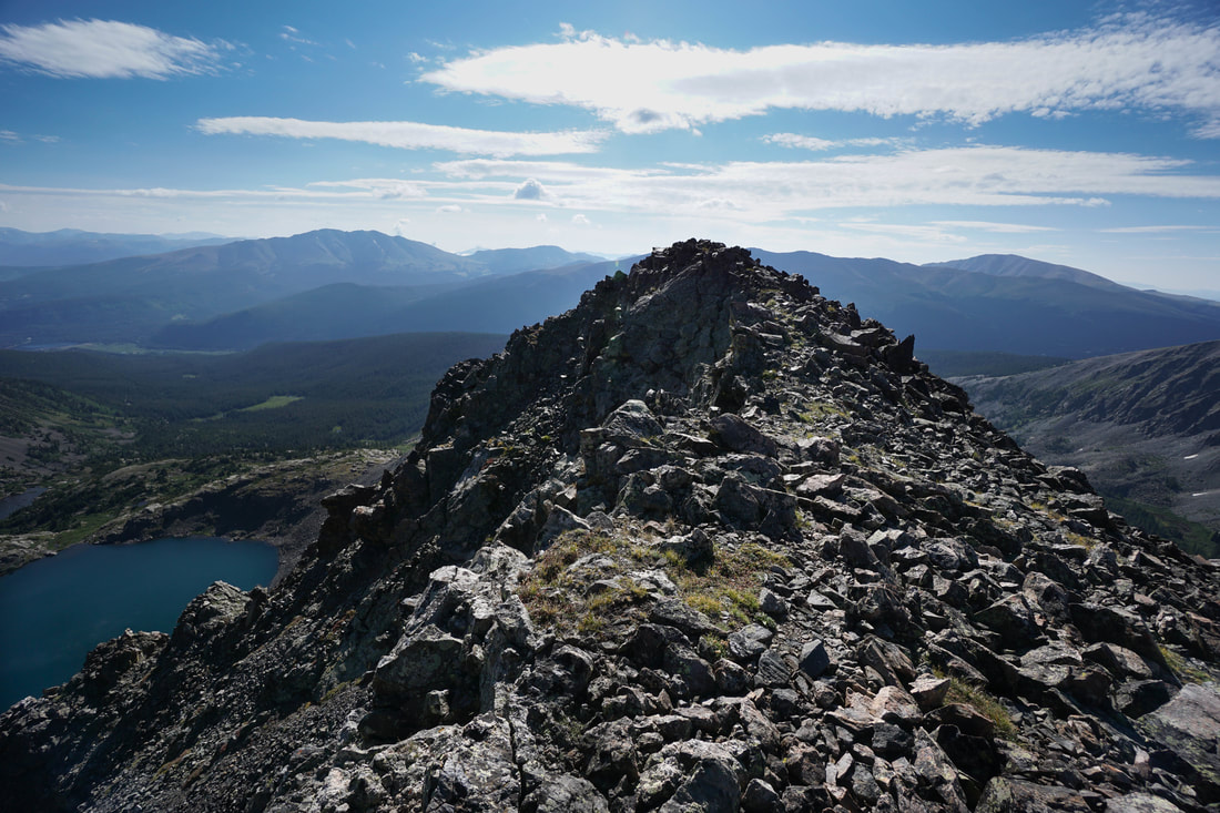
I'll only briefly describe the route back, for a more detailed account, see the description of McCullough Gulch. Upper Lake #1 is stunning as is the entirety of the upper basin. If you still have energy you can hike up-basin from Upper Lake #1 to Upper Lake #2 about .5 mile away on top of the next shelf. The trail between Upper Lake #1 and Upper Blue Reservoir is faint but you shouldn't have trouble finding it, there is no trail to Upper Lake #2. The trail slithers down the Gulch past waterfalls, wildflowers, rock formations, and the odd Mountain Goat. The entire time the ridge that you just climbed towers overhead. You get a great sense of scale by examining the ridge from below and your ego will inflate as you hike beneath the East Ridge.
The trail skirts the north shore of Upper Blue Reservoir and descends a steep and rocky trail past incredible waterfalls back to the dirt road, the trailhead, the road gate, the fork, and your car. Congratulations! Beer and food should be your next priorities, you've certainly earned it after this incredible journey.
The trail skirts the north shore of Upper Blue Reservoir and descends a steep and rocky trail past incredible waterfalls back to the dirt road, the trailhead, the road gate, the fork, and your car. Congratulations! Beer and food should be your next priorities, you've certainly earned it after this incredible journey.