GO HIKE COLORADO
Get in Touch:
  • HOME
  • ABOUT
  • HIKES BY REGION
    • DENVER AREA >
      • Denver Mountain Parks
      • Jefferson County Open Space
      • Lakewood Parks
      • Denver Area Greenways
    • BOULDER AREA
    • DOUGLAS COUNTY
    • FORT COLLINS AREA
    • COLORADO SPRINGS AREA
    • FRONT RANGE
    • TENMILE & MOSQUITO RANGES
    • GORE RANGE
    • SANGRE DE CRISTO MOUNTAINS
    • PARK RANGE
    • SAWATCH RANGE
    • ELK MOUNTAINS
    • SAN JUAN MOUNTAINS
    • THE FLAT TOPS
    • GRAND MESA
    • COLORADO PLATEAU
    • EASTERN PLAINS
  • NATIONAL PARK HIKES
    • BENT'S OLD FORT NATIONAL HISTORIC SITE
    • BLACK CANYON OF THE GUNNISON NATIONAL PARK
    • COLORADO NATIONAL MONUMENT
    • CURECANTI NATIONAL RECREATION AREA
    • DINOSAUR NATIONAL MONUMENT
    • FLORISSANT FOSSIL BEDS NATIONAL MONUMENT
    • MESA VERDE NATIONAL PARK
    • ROCKY MOUNTAIN NATIONAL PARK
    • GREAT SAND DUNES NATIONAL PARK
    • HOVENWEEP NATIONAL MONUMENT
    • SAND CREEK MASSACRE NATIONAL HISTORIC SITE
    • YUCCA HOUSE NATIONAL MONUMENT
  • HIKES BY CATEGORY
    • HIKES TO ALPINE LAKES
    • HIKES TO PEAKS & PASSES
    • HIKES THROUGH CANYONS
    • HIKES WITH FALL COLORS
    • HIKES ALONG THE I-70 CORRIDOR
    • HIKES ON PAVED TRAILS
    • HIKES FOR KIDS
    • HIKES TO WATERFALLS
    • HIKES ALONG RIVERS
    • HIKES WITH ROCK FORMATIONS
    • HIKES WITH WILDFLOWERS
    • WINTER HIKES
  • NEWS
  • WEBCAMS
  • $UPPORT GHC
  • INTERACTIVE MAP

Devil's Head
Rampart Range Recreation Area
Pike National Forest

Date Hiked: May 12, 2013

WINTER STATISTICS:

Distance: 4 miles (RT)
Elevation Gain: 940 ft
Elevation Min/Max: 8,793 to 9,762ft
Trailhead Lat/Long: 39.275580 N; 105.107669 W
Managing Agency: U.S. Forest Service
Fee: None

Devil's Head Webpage (USFS)
Picture

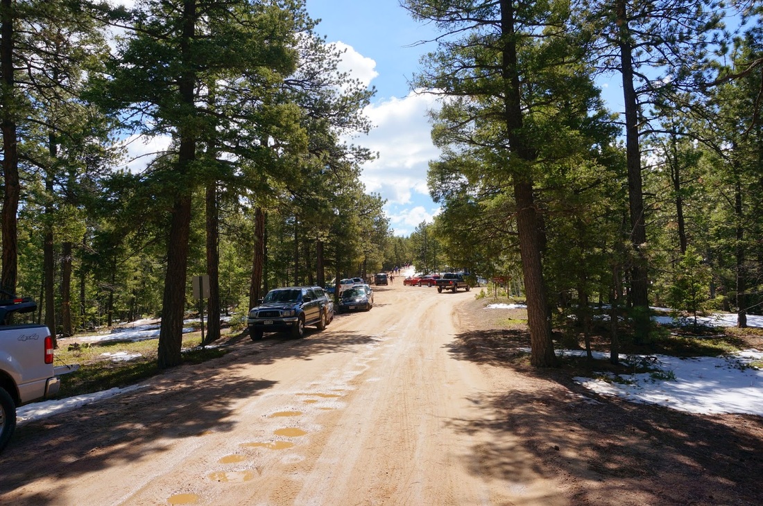
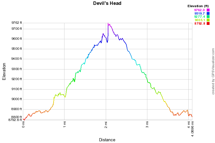
Directions:  The Devil's Head trailhead is at the end of Rampart Range Road.  From Sedalia head west on Jarre Canyon Rd (67) for 10 miles.  Make a left on S. Rampart Range Road and travel 8.5 miles to the parking area and trailhead.  S. Rampart Range Rd is a dirt road but passable by most passenger cars.  In the winter the road is closed approx. 1 mile from the trailhead.  This adds a mile of hiking each way but the trail is so short (2.5 mi RT) that it doesn't make much difference.

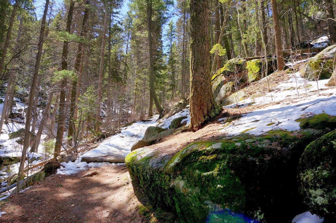
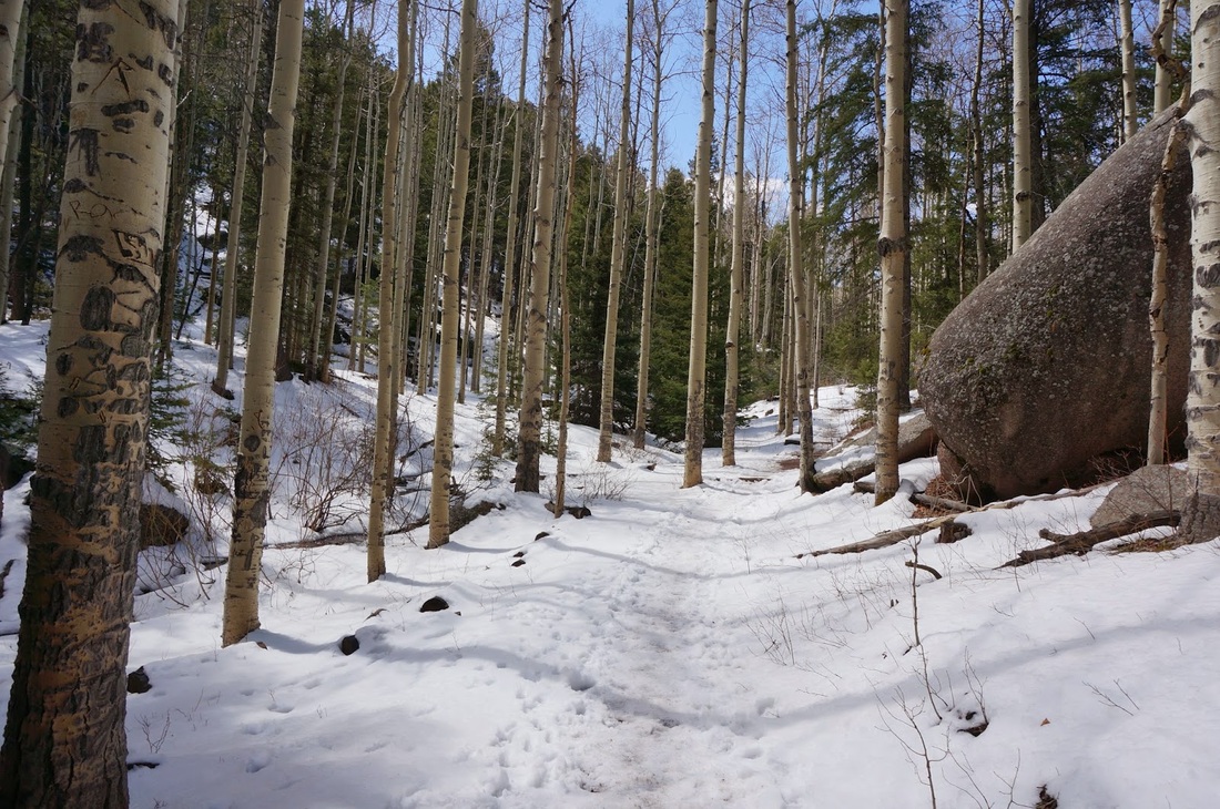
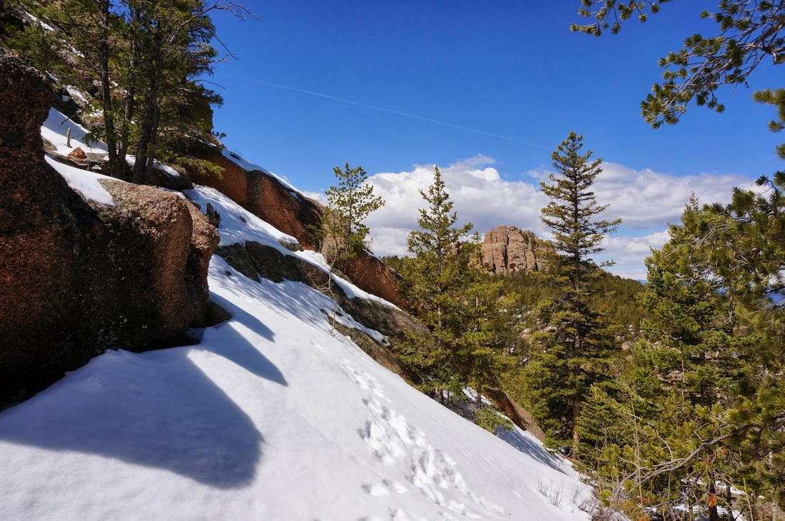
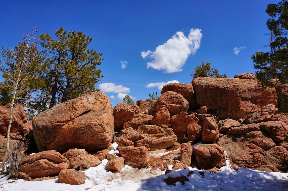
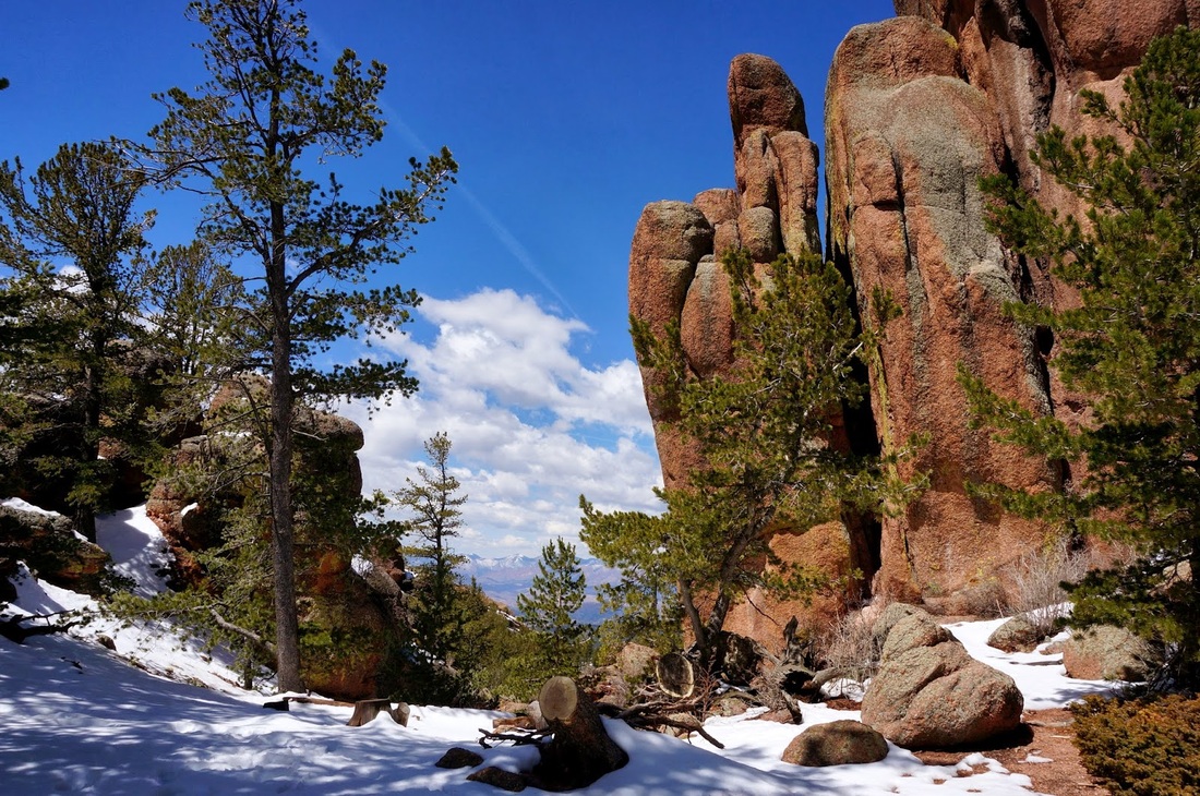
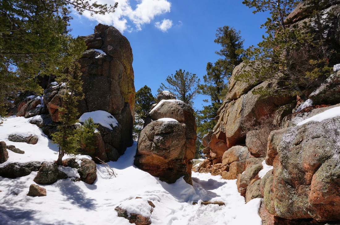
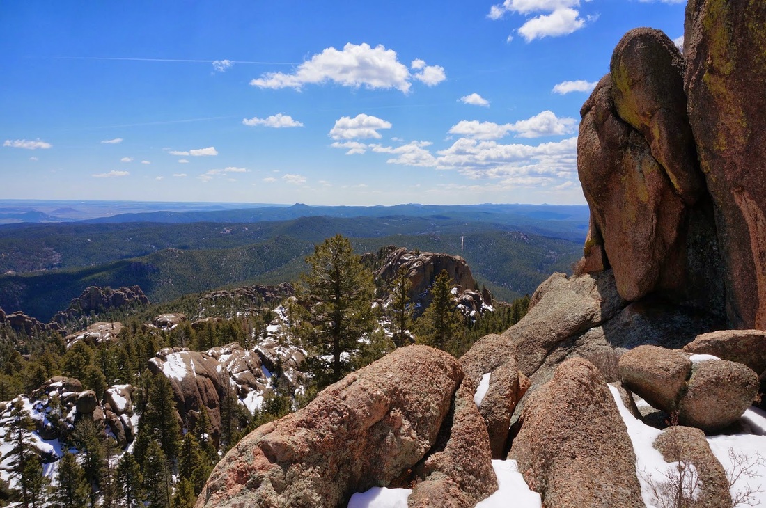
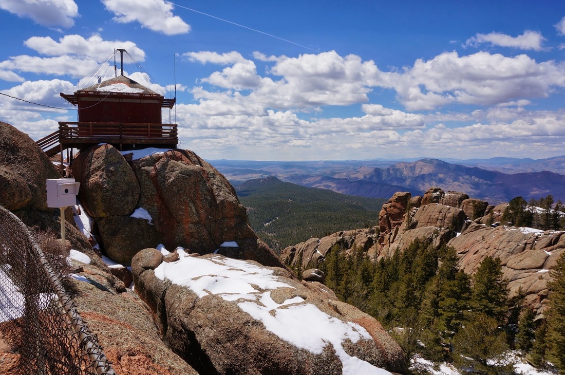
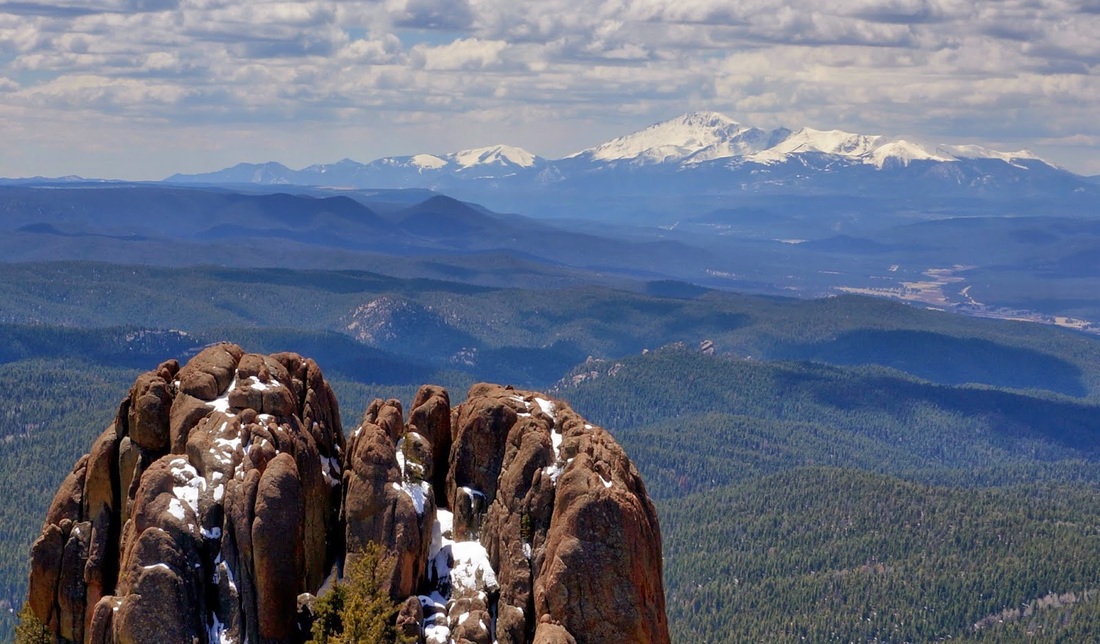
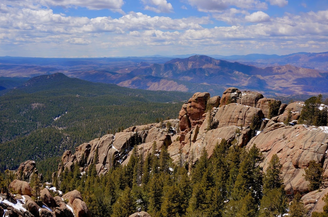
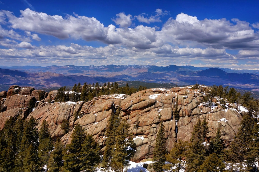
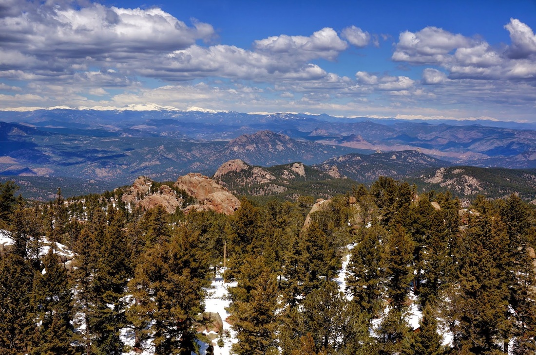
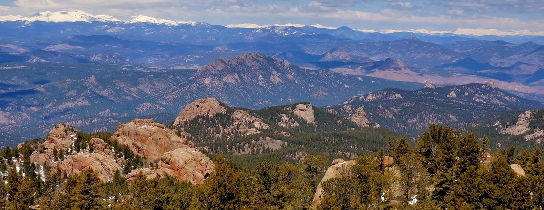
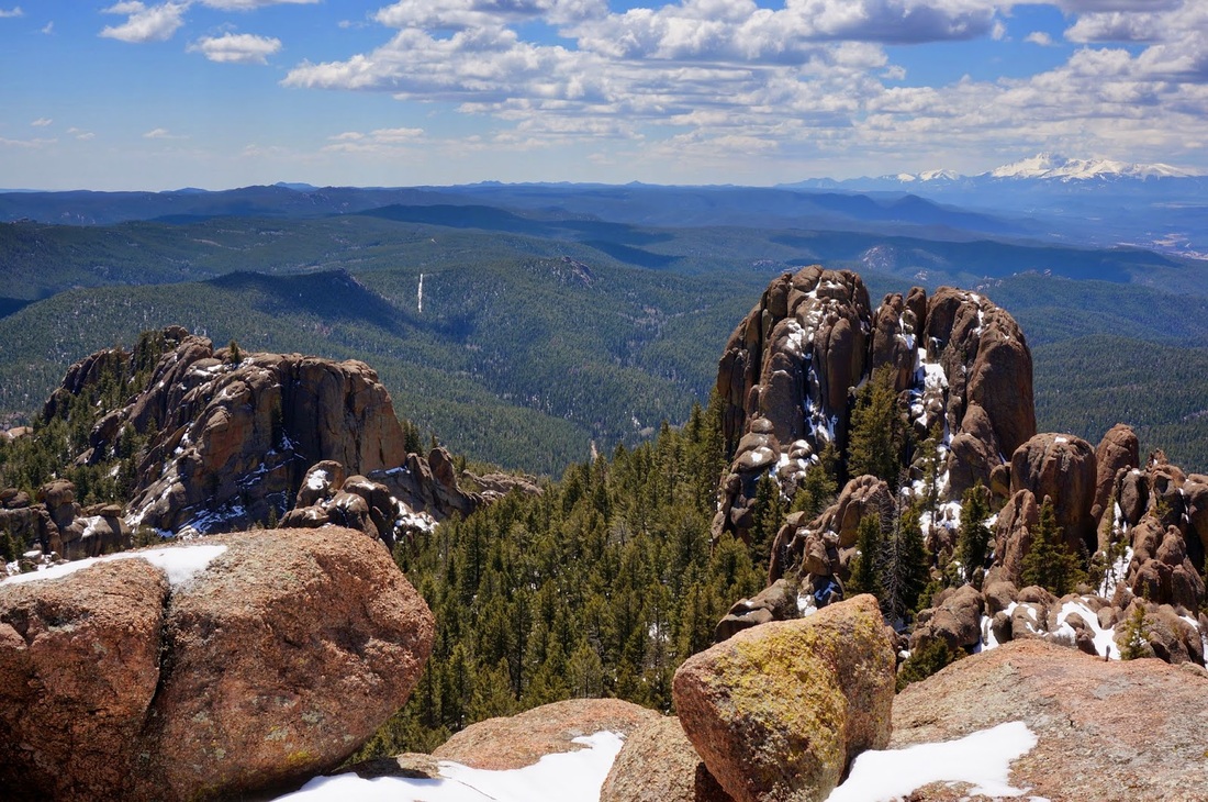
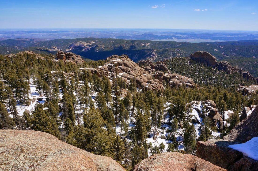
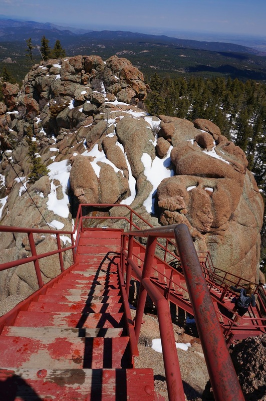
The Devil's Head trail is extremely popular and for good reason.  The trail is short but steep and weaves through beautiful aspen forest (great for fall colors) and large rock formations.  Views of the Rampart Range's rock outcroppings are abundant.  The real joy of this hike however, is the fire lookout tower.  The tower was built over 100 years ago and has a view that simply must be experienced.  Once you arrive at the base of the stairs you may have to wait for folks to come down before you head up, but patience is a virtue here.  Climb the many metal steep stairs, don't look down, and prepare to be amazed.  There is often a volunteer on hand to answer historical questions.  Be sure to look south for an incredible view of Pike's Peak.

This has to be one of the top ten front range hikes and IS the best view this close to Denver.

Powered by Create your own unique website with customizable templates.