GO HIKE COLORADO
Get in Touch:
  • HOME
  • ABOUT
  • HIKES BY REGION
    • DENVER AREA >
      • Denver Mountain Parks
      • Jefferson County Open Space
      • Lakewood Parks
      • Denver Area Greenways
    • BOULDER AREA
    • DOUGLAS COUNTY
    • FORT COLLINS AREA
    • COLORADO SPRINGS AREA
    • FRONT RANGE
    • TENMILE & MOSQUITO RANGES
    • GORE RANGE
    • SANGRE DE CRISTO MOUNTAINS
    • PARK RANGE
    • SAWATCH RANGE
    • ELK MOUNTAINS
    • SAN JUAN MOUNTAINS
    • THE FLAT TOPS
    • GRAND MESA
    • COLORADO PLATEAU
    • EASTERN PLAINS
  • NATIONAL PARK HIKES
    • BENT'S OLD FORT NATIONAL HISTORIC SITE
    • BLACK CANYON OF THE GUNNISON NATIONAL PARK
    • COLORADO NATIONAL MONUMENT
    • CURECANTI NATIONAL RECREATION AREA
    • DINOSAUR NATIONAL MONUMENT
    • FLORISSANT FOSSIL BEDS NATIONAL MONUMENT
    • MESA VERDE NATIONAL PARK
    • ROCKY MOUNTAIN NATIONAL PARK
    • GREAT SAND DUNES NATIONAL PARK
    • HOVENWEEP NATIONAL MONUMENT
    • SAND CREEK MASSACRE NATIONAL HISTORIC SITE
    • YUCCA HOUSE NATIONAL MONUMENT
  • HIKES BY CATEGORY
    • HIKES TO ALPINE LAKES
    • HIKES TO PEAKS & PASSES
    • HIKES THROUGH CANYONS
    • HIKES WITH FALL COLORS
    • HIKES ALONG THE I-70 CORRIDOR
    • HIKES ON PAVED TRAILS
    • HIKES FOR KIDS
    • HIKES TO WATERFALLS
    • HIKES ALONG RIVERS
    • HIKES WITH ROCK FORMATIONS
    • HIKES WITH WILDFLOWERS
    • WINTER HIKES
  • NEWS
  • WEBCAMS
  • $UPPORT GHC
  • INTERACTIVE MAP

Dakota Ridge Hogback
Matthews-Winters Park

Date Hiked: June 4, 2014

Distance: 2.8 mi (RT)

Elevation Gain: 677ft
Elevation Min/Max: 6,225 to 6,825ft
Managing Agency: Jefferson County Open Space
Fee: None

Matthews-Winters Park Website
Picture

Directions:  From Denver, head west on I-70 to the Morrison/Park and Ride Exit.  Make a left once you take the exit and a quick left into the dinosaur parking area.  You'll see the trail start from the southern part of the parking area.

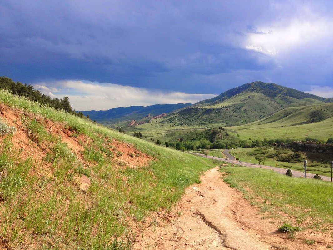
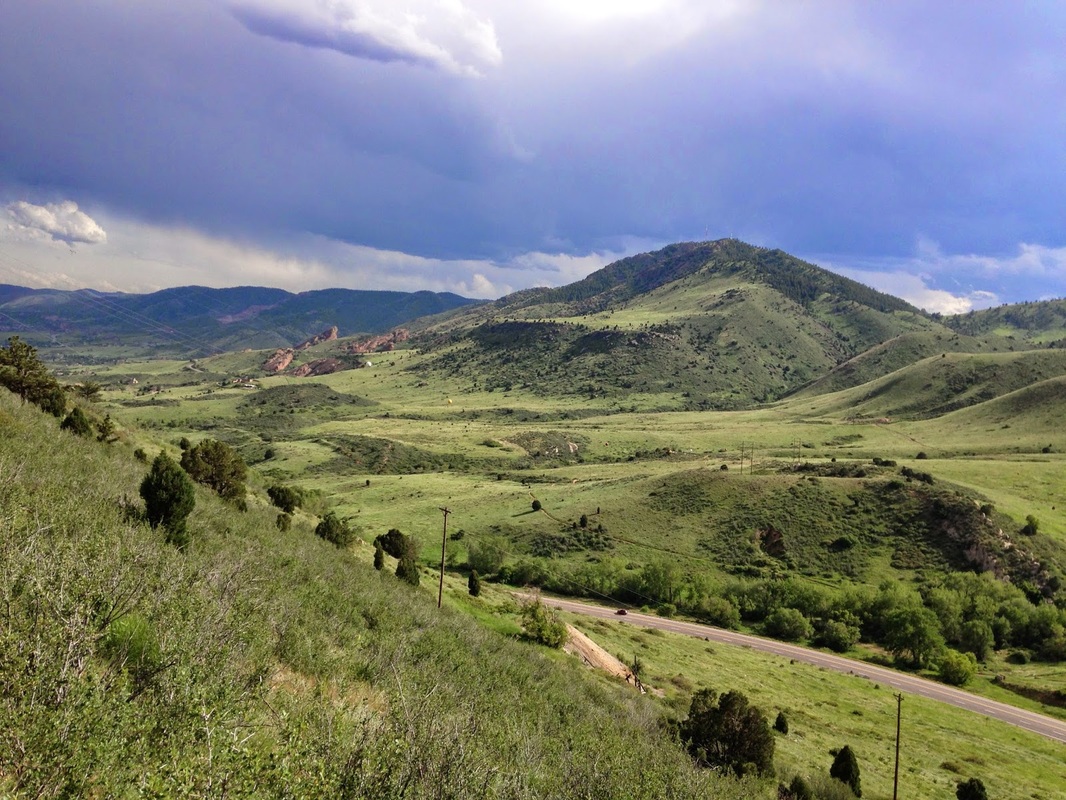
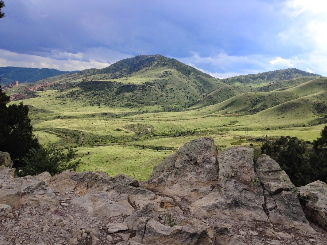
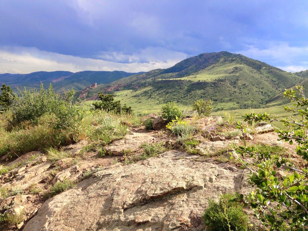
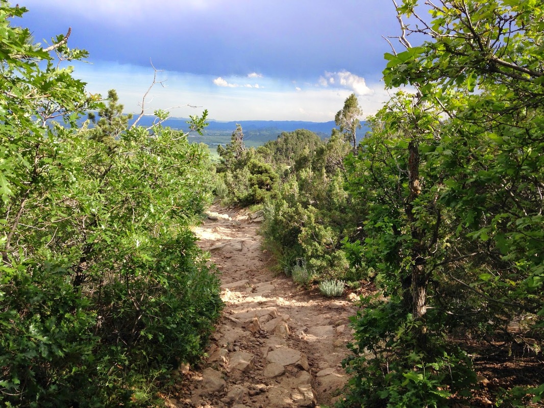
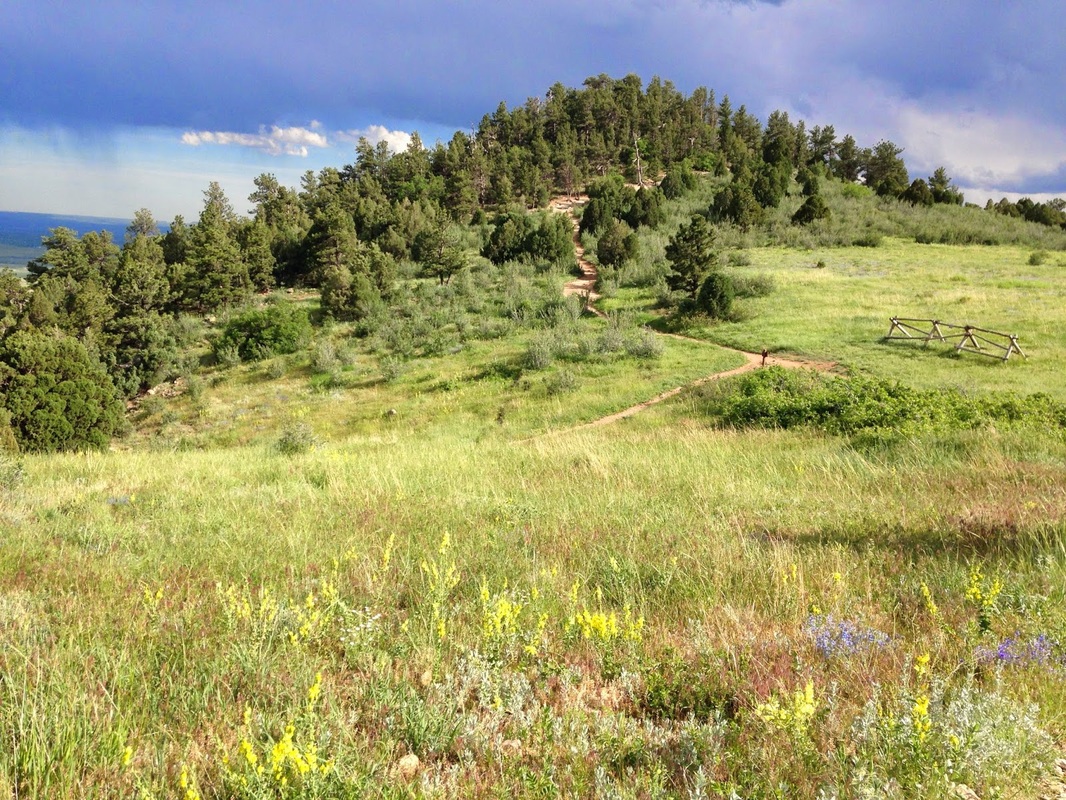
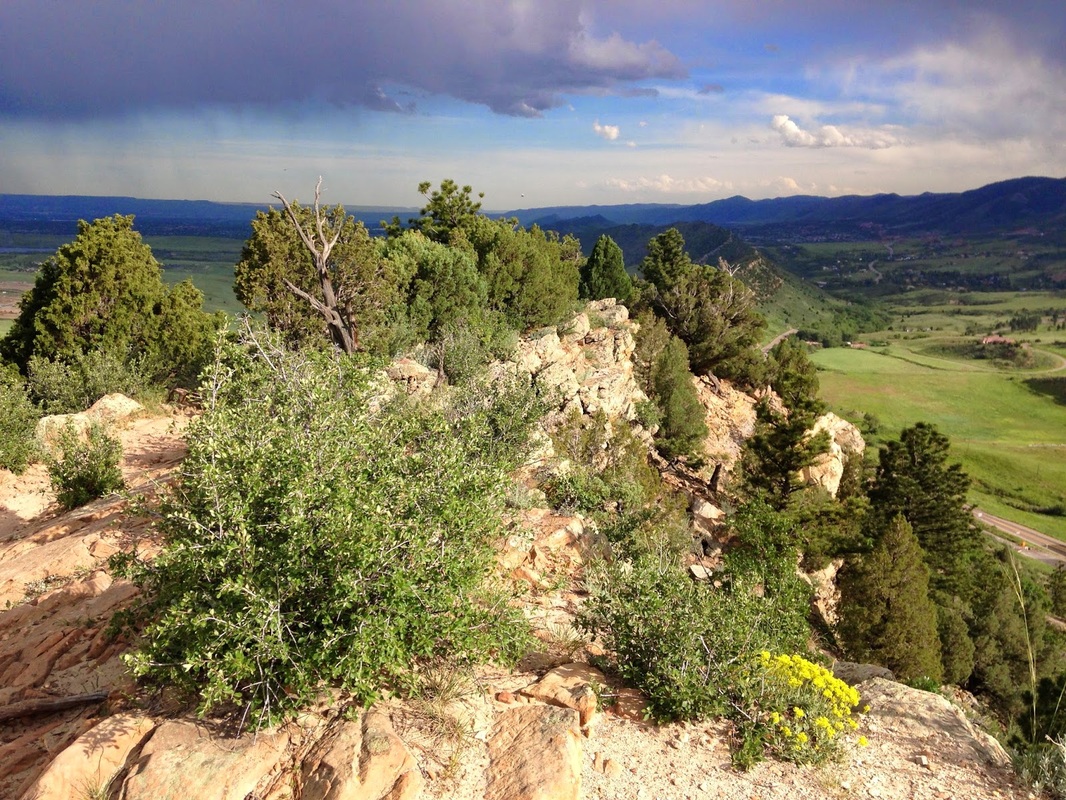
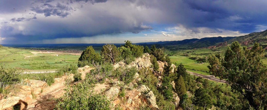
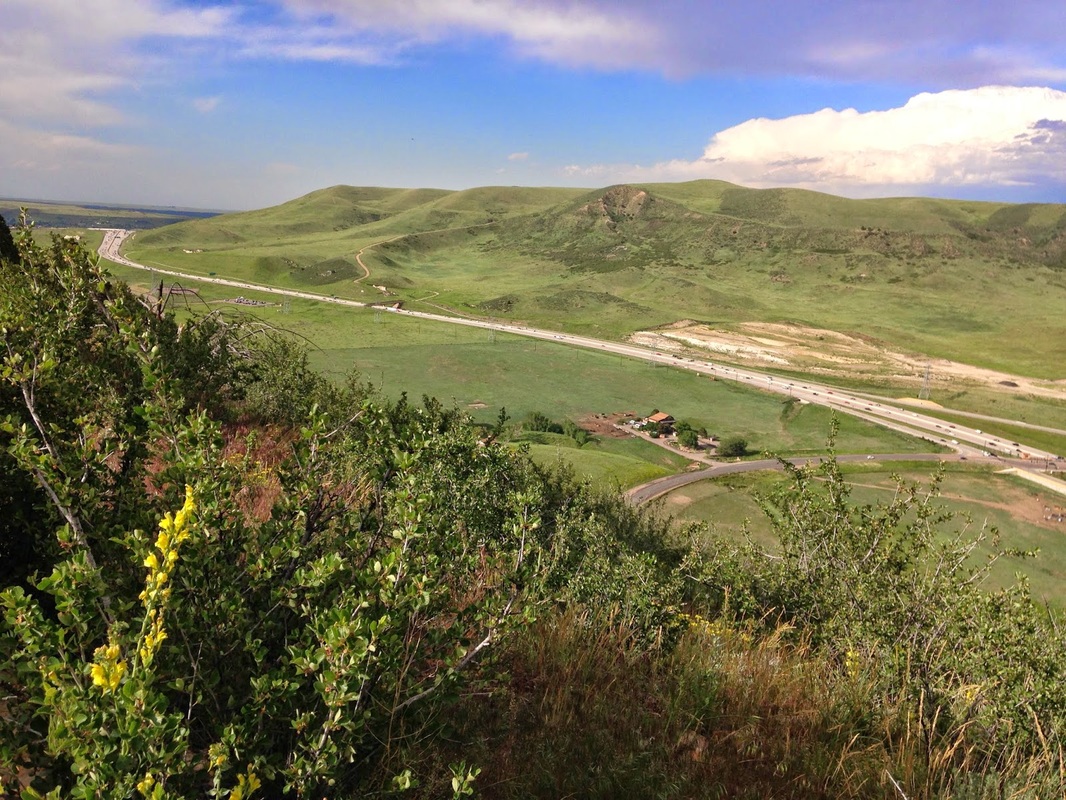
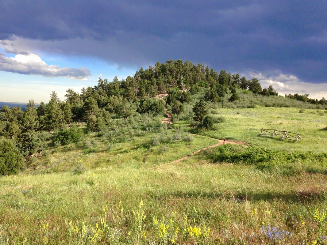
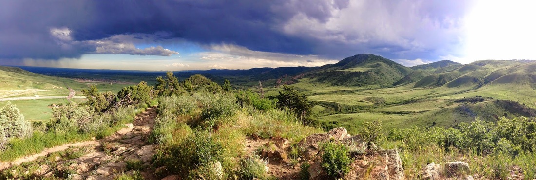
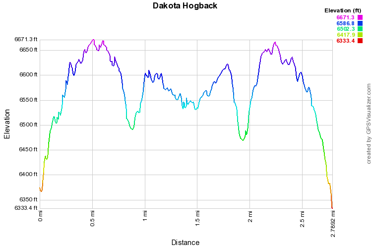
I love the Dakota Ridge Hogback, I can't say it enough, it may be favorite trail on the Denver outskirts.  The trail is not long (2.2mi each way in it's entirety) and the elevation gain is only about 600ft, but the trail is just fun to hike.  It is very rocky, there are huge slickrock slabs to cross, and the views of Red Rocks, Mt. Morrison, and Green Mountain are fantastic.  There are small groves of pine and spruce and huge drop offs on both sides.  It is exciting, relaxing, and just plain fun.  When i hike it one way (instead of part of a larger loop in the park) I like to go about 1.5 miles and turn back when it is clear that the ridge is descending down to the Dinosaur Ridge Saddle, you'll know the spot when you get there.  This hike has it all and is only about 20 minutes from Downtown Denver, have fun!
© Go Hike Colorado, 2020.  All Rights Reserved. 
Use of photographs without prior authorization is
​strictly prohibited.


Contact us at:
[email protected]
Legal Disclaimer - Information provided on this site is based upon our own observations, always double check information with the appropriate land management agency before heading into the backcountry.  Backcountry travel is inherently dangerous, please take all proper precautions.  Go Hike Colorado is not responsible for injury or incident.