GO HIKE COLORADO
Get in Touch:
  • HOME
  • ABOUT
  • HIKES BY REGION
    • DENVER AREA >
      • Denver Mountain Parks
      • Jefferson County Open Space
      • Lakewood Parks
      • Denver Area Greenways
    • BOULDER AREA
    • DOUGLAS COUNTY
    • FORT COLLINS AREA
    • COLORADO SPRINGS AREA
    • FRONT RANGE
    • TENMILE & MOSQUITO RANGES
    • GORE RANGE
    • SANGRE DE CRISTO MOUNTAINS
    • PARK RANGE
    • SAWATCH RANGE
    • ELK MOUNTAINS
    • SAN JUAN MOUNTAINS
    • THE FLAT TOPS
    • GRAND MESA
    • COLORADO PLATEAU
    • EASTERN PLAINS
  • NATIONAL PARK HIKES
    • BENT'S OLD FORT NATIONAL HISTORIC SITE
    • BLACK CANYON OF THE GUNNISON NATIONAL PARK
    • COLORADO NATIONAL MONUMENT
    • CURECANTI NATIONAL RECREATION AREA
    • DINOSAUR NATIONAL MONUMENT
    • FLORISSANT FOSSIL BEDS NATIONAL MONUMENT
    • MESA VERDE NATIONAL PARK
    • ROCKY MOUNTAIN NATIONAL PARK
    • GREAT SAND DUNES NATIONAL PARK
    • HOVENWEEP NATIONAL MONUMENT
    • SAND CREEK MASSACRE NATIONAL HISTORIC SITE
    • YUCCA HOUSE NATIONAL MONUMENT
  • HIKES BY CATEGORY
    • HIKES TO ALPINE LAKES
    • HIKES TO PEAKS & PASSES
    • HIKES THROUGH CANYONS
    • HIKES WITH FALL COLORS
    • HIKES ALONG THE I-70 CORRIDOR
    • HIKES ON PAVED TRAILS
    • HIKES FOR KIDS
    • HIKES TO WATERFALLS
    • HIKES ALONG RIVERS
    • HIKES WITH ROCK FORMATIONS
    • HIKES WITH WILDFLOWERS
    • WINTER HIKES
  • NEWS
  • WEBCAMS
  • $UPPORT GHC
  • INTERACTIVE MAP

Crown Hill Park

Date Hiked: August 23, 2012

​Distance: 2.7 mi (RT)

Elevation Gain: Negligible
Elevation: 5,511ft
Managing Agency: Jefferson County Open Space
Fee: None
Trailhead Latitude:  39.762057º N
Trailhead Longitude: 105.094576º W

Crown Hill Park Website
Picture

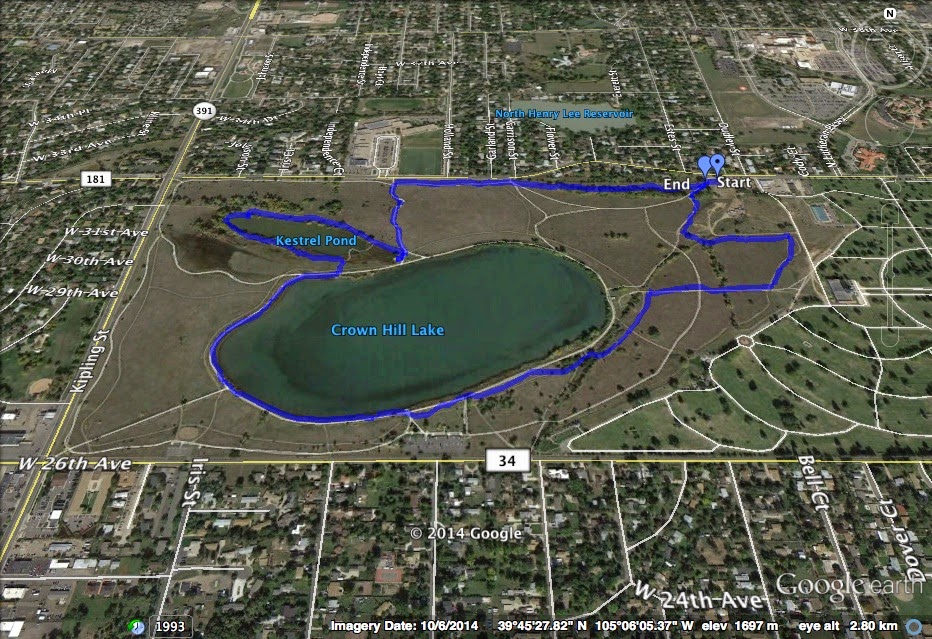
Directions:  The park is located off of Kipling Street in between 26th Ave and 32nd Ave in Lakewood.  The trailhead for this hike is located at 32nd and Estes Street.

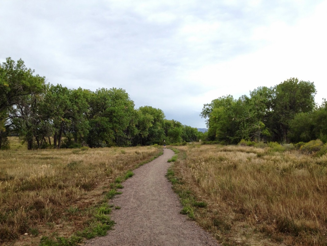
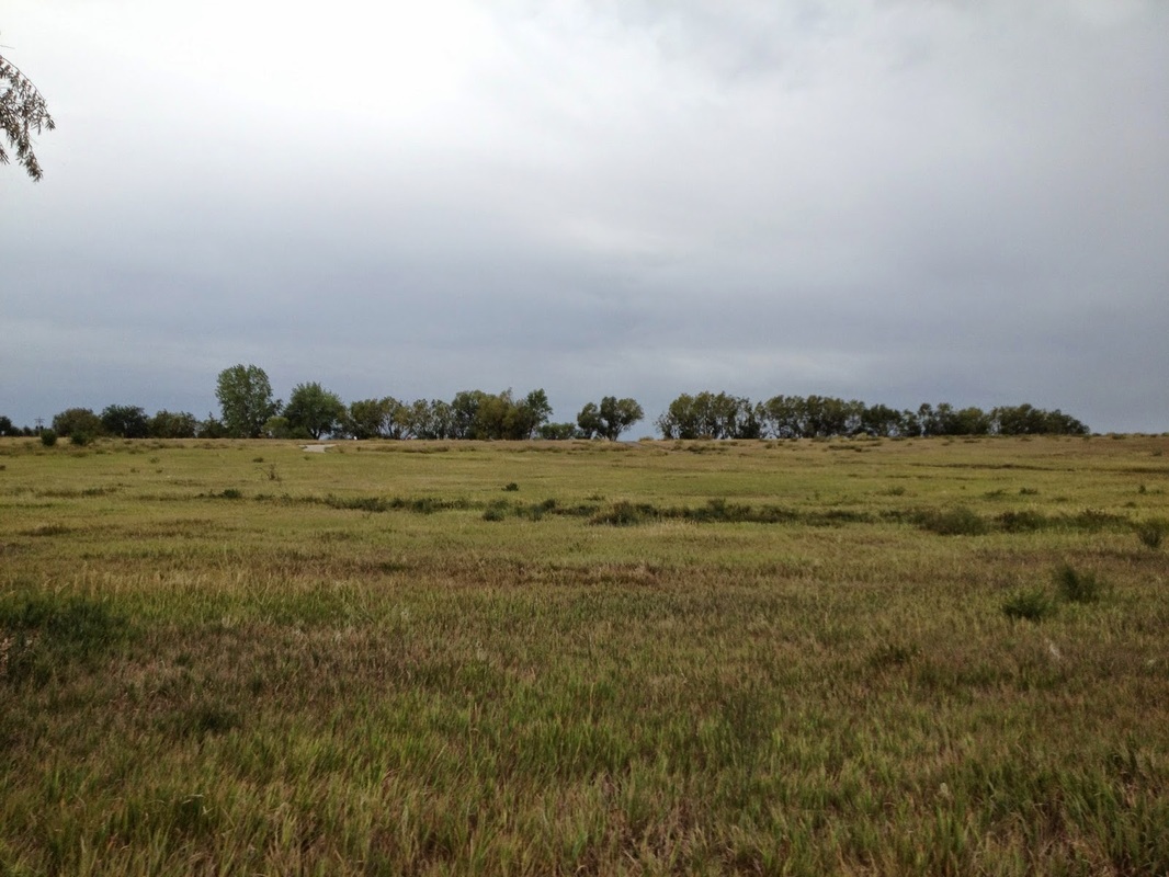
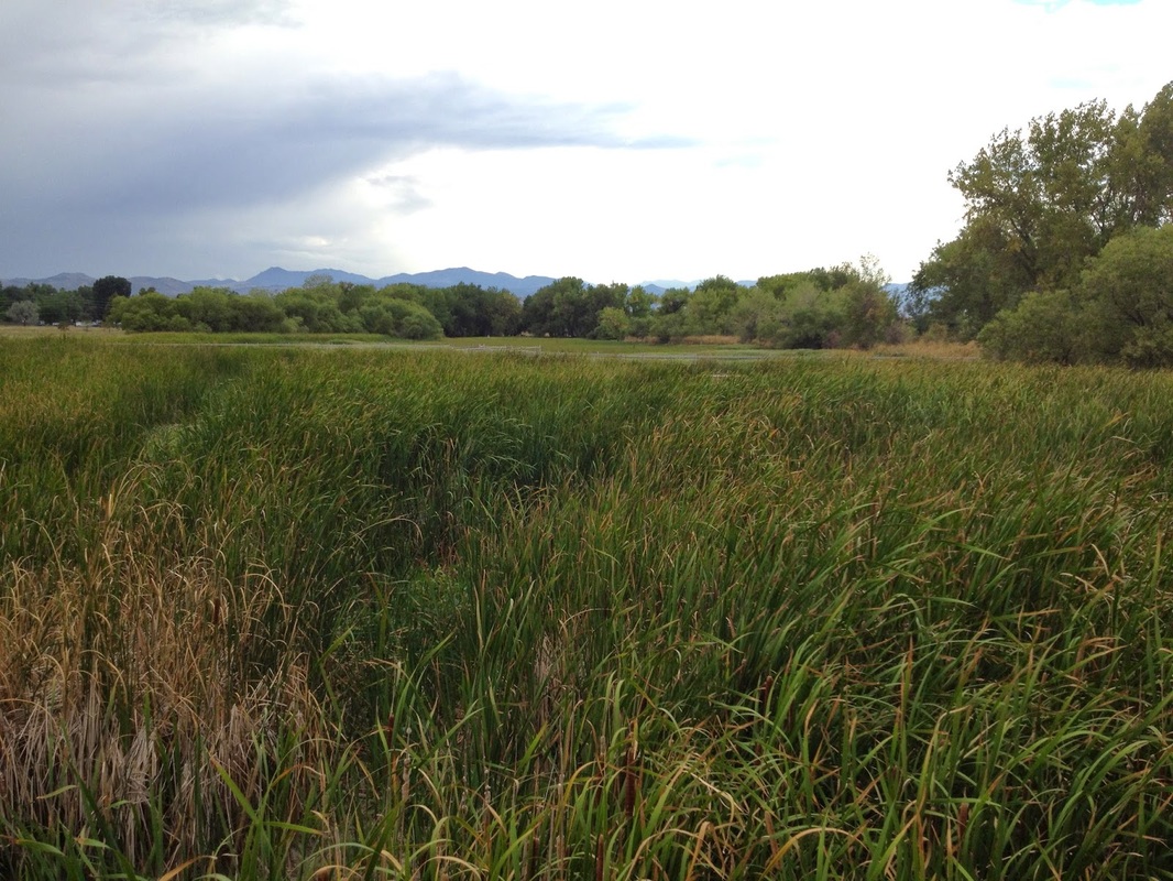
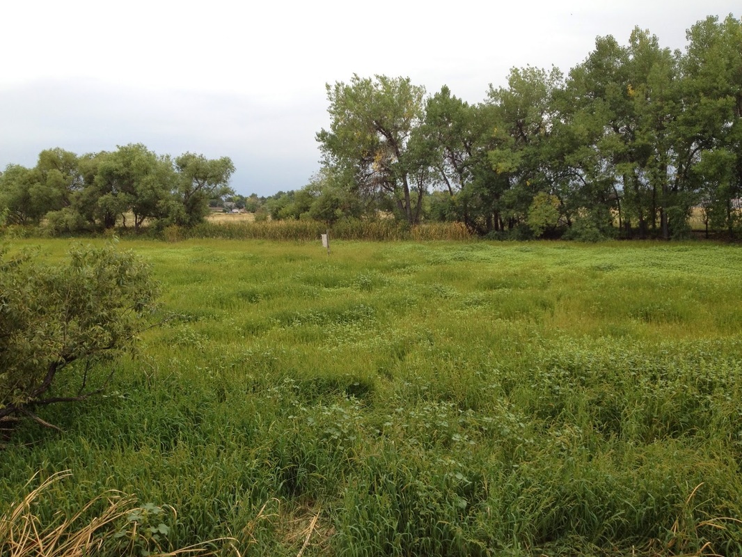
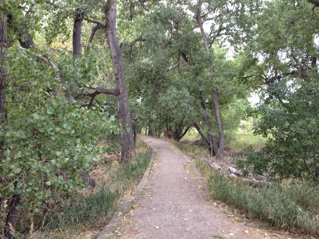
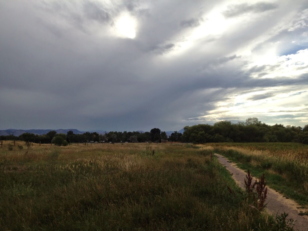
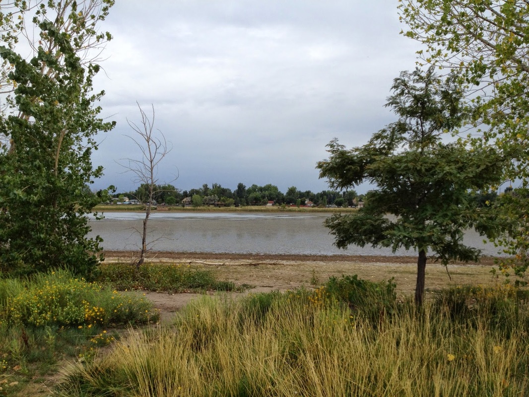
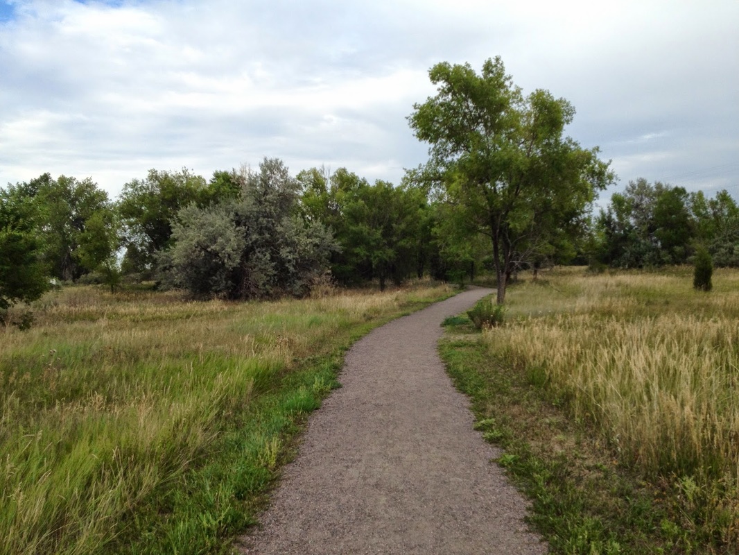
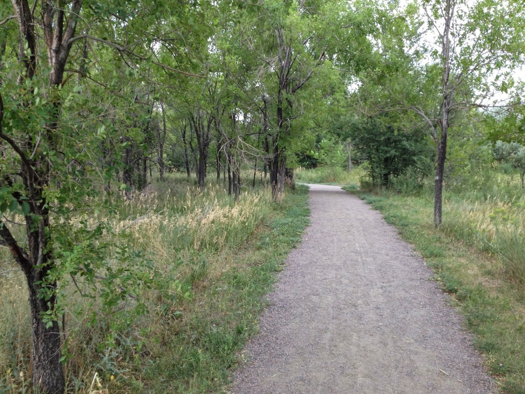
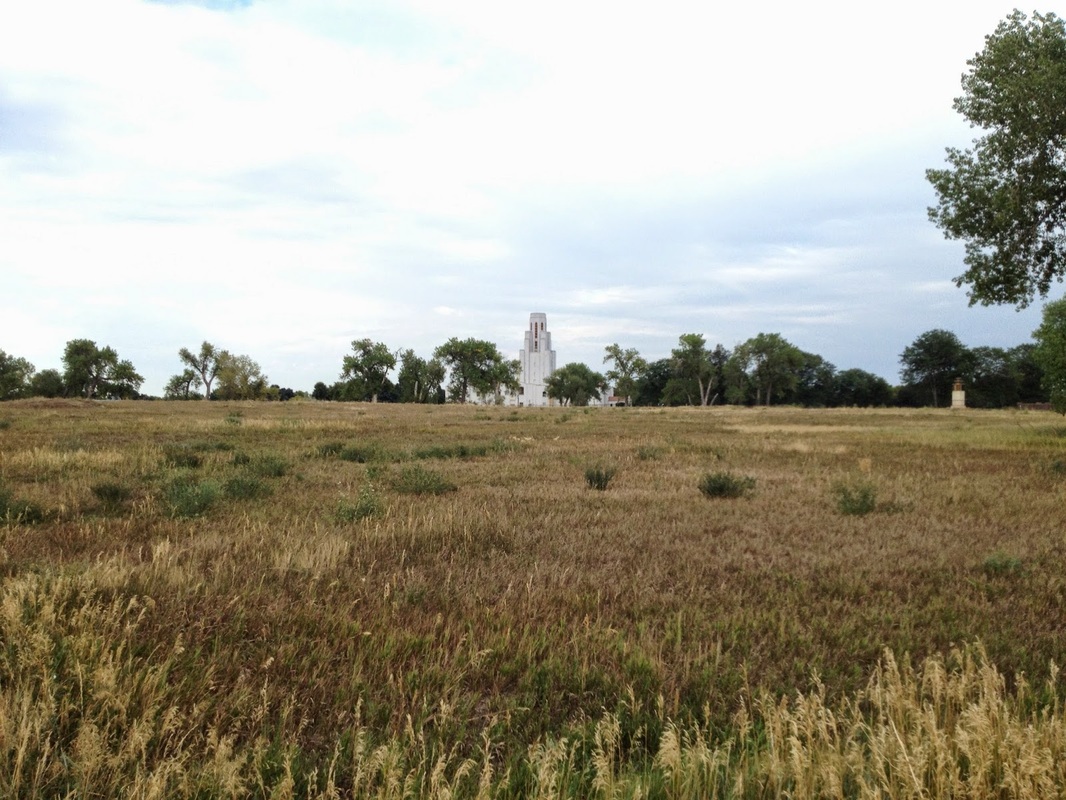
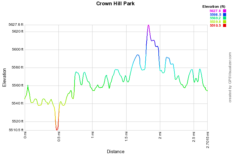
Crown Hill Park has much more to offer than you might think.  Aside from Crown Hill Lake, the main attraction with a 1.4 mile paved trail, there are various natural areas that each have nice trails to explore.  This hike description gives you a good tour of the park hitting all the major highlights. 

Instead of parking at the main lot off of Kipling Street, start at the Northside on 32nd.  The eastern portion of the park is wooded and has nice natural surface trails to explore.  From the trailhead head west on the wide path through Cottonwoods.  Once you exit the wooded area there will be various trails leading to the south turn left here and work your way towards the lake but bearing west.  Up ahead you’ll see a fenced in wooded area with is the Crown Hill Wildlife Sanctuary.  There is a gate on the eastern edge of the sanctuary.  The short loop within the fenced in section is peaceful and serene.  Enjoy the quiet stroll through this area over bridges and reading the interpretive signage along the way.  Exit the area through another gate and meet up with the main paved trail around the lake.  Follow the west and south shores but keep your eyes out for the natural surface trails leading away from the lake to the east.  Leave the lake and follow these trails through more wooded areas and back to the north.  You’ll find yourself in an open prairie area beneath the towering steeple of the Historic Olinger Mortuary.  Cross the plains and work your back north back to the trailhead.
© Go Hike Colorado, 2020.  All Rights Reserved. 
Use of photographs without prior authorization is
​strictly prohibited.


Contact us at:
[email protected]
Legal Disclaimer - Information provided on this site is based upon our own observations, always double check information with the appropriate land management agency before heading into the backcountry.  Backcountry travel is inherently dangerous, please take all proper precautions.  Go Hike Colorado is not responsible for injury or incident.