GO HIKE COLORADO
Get in Touch:
  • HOME
  • ABOUT
  • HIKES BY REGION
    • DENVER AREA >
      • Denver Mountain Parks
      • Jefferson County Open Space
      • Lakewood Parks
      • Denver Area Greenways
    • BOULDER AREA
    • DOUGLAS COUNTY
    • FORT COLLINS AREA
    • COLORADO SPRINGS AREA
    • FRONT RANGE
    • TENMILE & MOSQUITO RANGES
    • GORE RANGE
    • SANGRE DE CRISTO MOUNTAINS
    • PARK RANGE
    • SAWATCH RANGE
    • ELK MOUNTAINS
    • SAN JUAN MOUNTAINS
    • THE FLAT TOPS
    • GRAND MESA
    • COLORADO PLATEAU
    • EASTERN PLAINS
  • NATIONAL PARK HIKES
    • BENT'S OLD FORT NATIONAL HISTORIC SITE
    • BLACK CANYON OF THE GUNNISON NATIONAL PARK
    • COLORADO NATIONAL MONUMENT
    • CURECANTI NATIONAL RECREATION AREA
    • DINOSAUR NATIONAL MONUMENT
    • FLORISSANT FOSSIL BEDS NATIONAL MONUMENT
    • MESA VERDE NATIONAL PARK
    • ROCKY MOUNTAIN NATIONAL PARK
    • GREAT SAND DUNES NATIONAL PARK
    • HOVENWEEP NATIONAL MONUMENT
    • SAND CREEK MASSACRE NATIONAL HISTORIC SITE
    • YUCCA HOUSE NATIONAL MONUMENT
  • HIKES BY CATEGORY
    • HIKES TO ALPINE LAKES
    • HIKES TO PEAKS & PASSES
    • HIKES THROUGH CANYONS
    • HIKES WITH FALL COLORS
    • HIKES ALONG THE I-70 CORRIDOR
    • HIKES ON PAVED TRAILS
    • HIKES FOR KIDS
    • HIKES TO WATERFALLS
    • HIKES ALONG RIVERS
    • HIKES WITH ROCK FORMATIONS
    • HIKES WITH WILDFLOWERS
    • WINTER HIKES
  • NEWS
  • WEBCAMS
  • $UPPORT GHC
  • INTERACTIVE MAP

Travois > Evening Sun Loop
Centennial Cone Park

Date Hiked: September 23, 2012

​Distance: 2.67 miles (Round Trip)

Elevation Gain: 400ft
Elevation Min/Max: 7,430 to 7,807ft
Managing Agency: Jefferson County Open Space
Fee: None

Centennial Cone Park Website
Picture

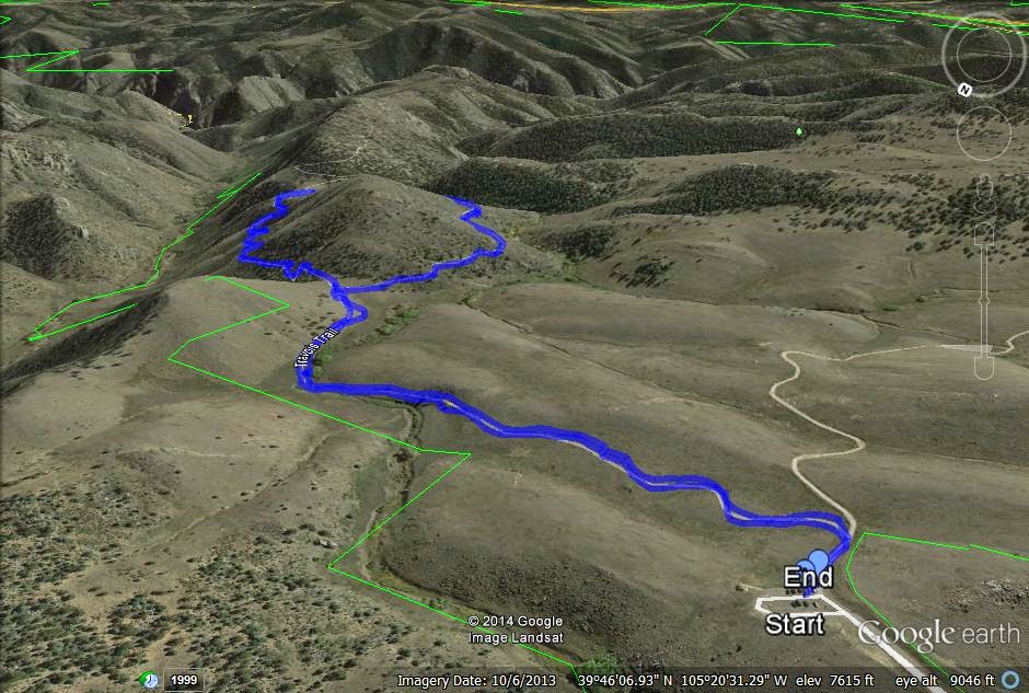
Directions:  The Travois trail starts from the Camino Perdido Trailhead, aka, the northern TH for Centennial Cone Park.  From  Denver/Boulder and Hwy 93 head west on Golden Gate Canyon Road toward Golden Gate Canyon State Park. Make a left on Robinson Hill Road and a left on Camino Perdido Road to the Park entrance. 

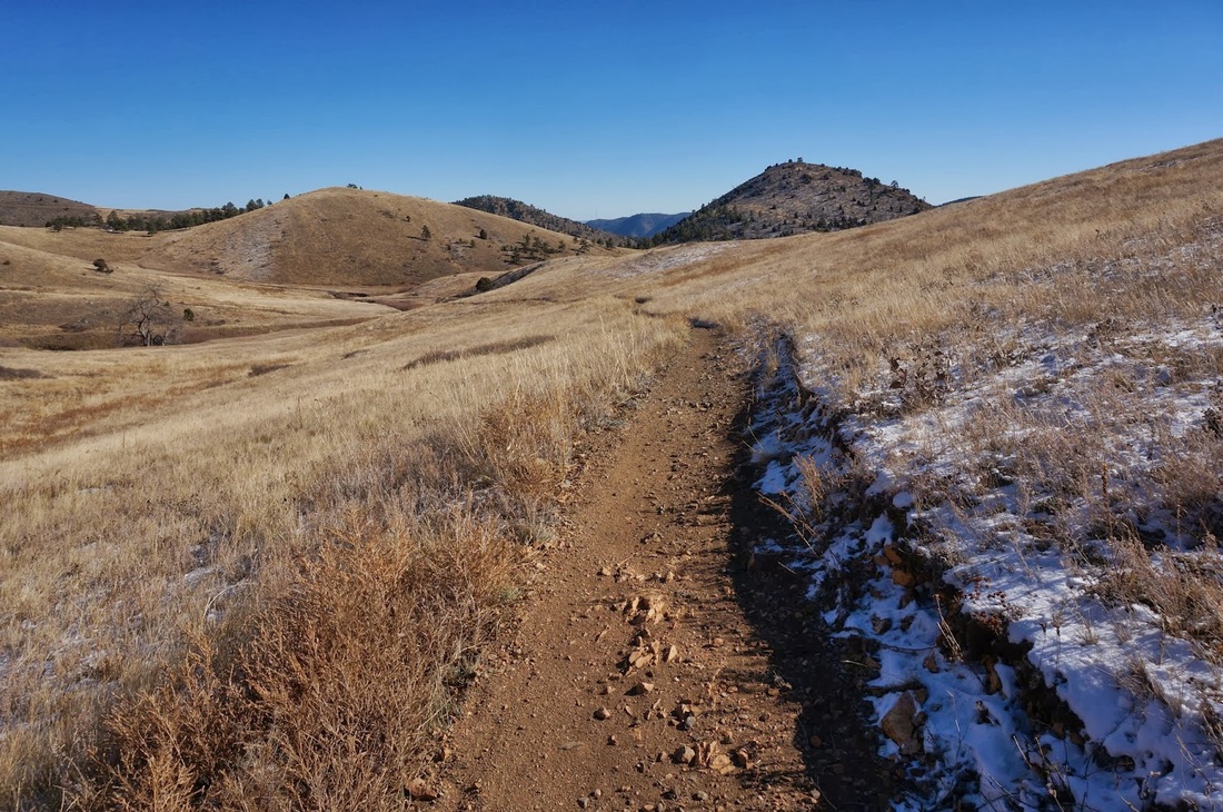
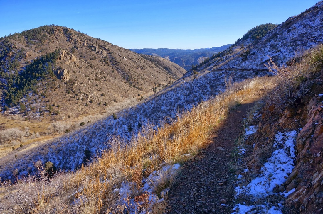
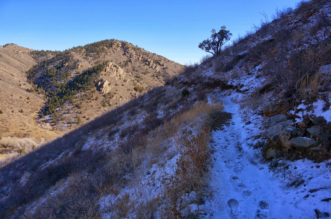
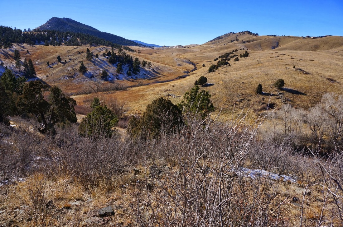
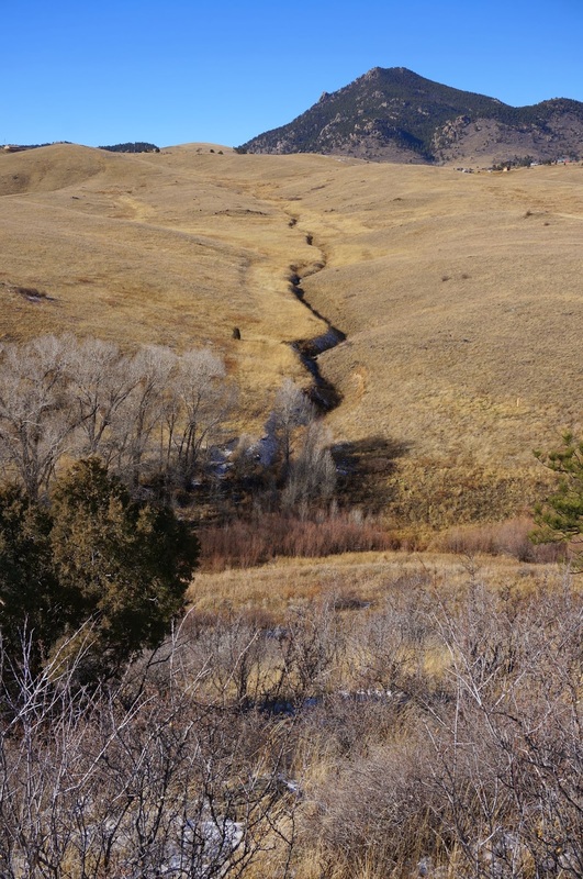
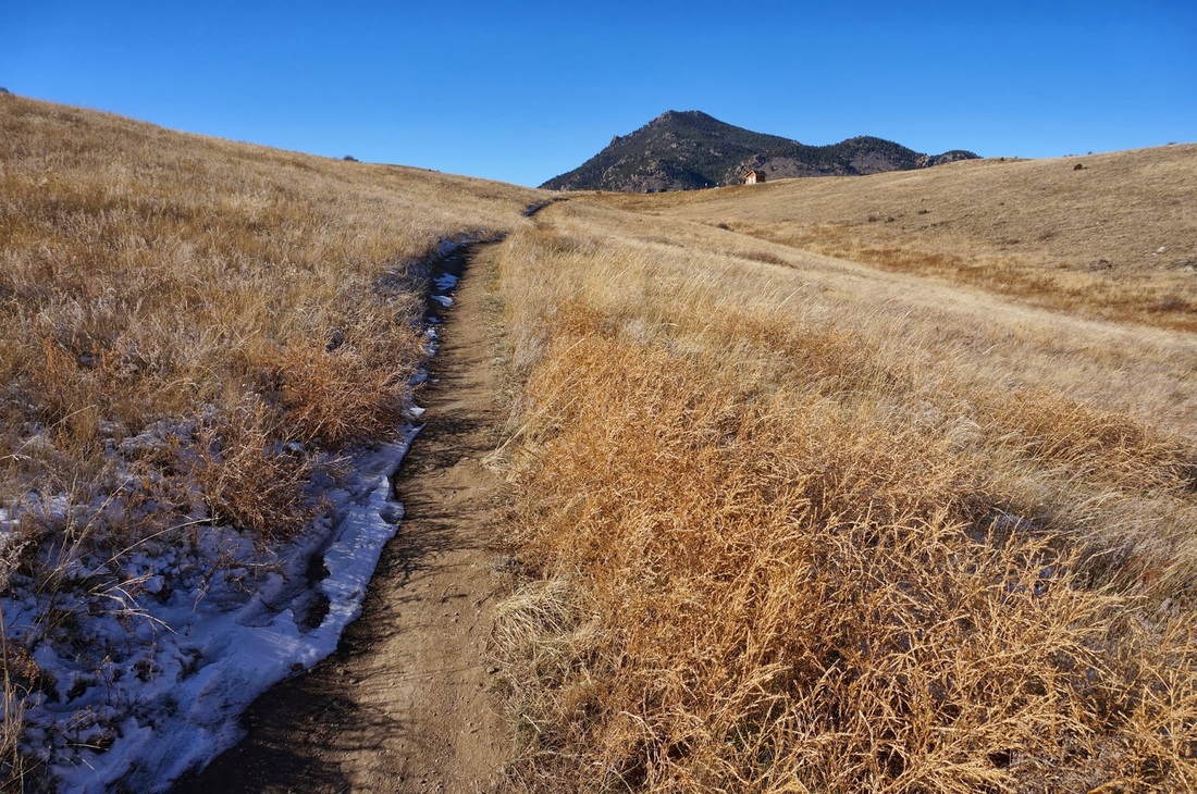
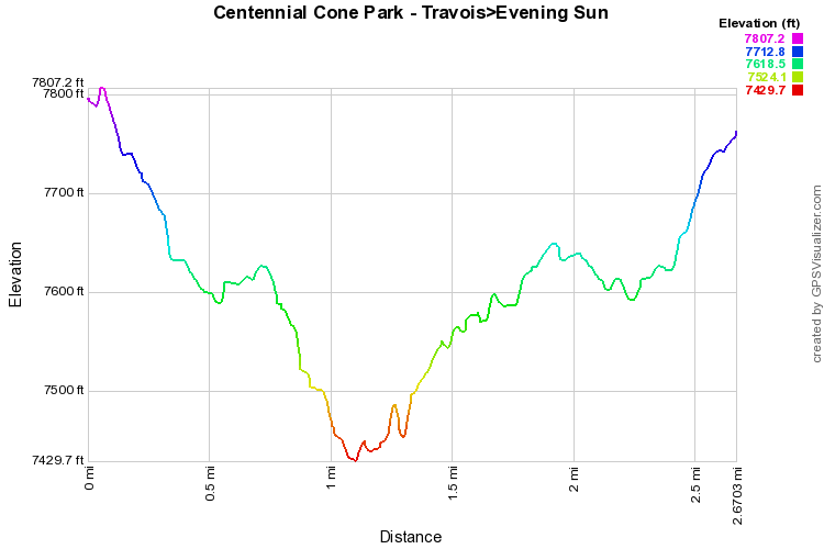
The park alternates between hiking use and biking use on weekends so check the park's website before heading out.

The Travois trail descends from the parking lot through rolling hills.  Keep left at the trail junction with the Evening Sun trail to stay on the Travois Trail.  The next part of the trail skirts the side of a deep canyon before it ascends to a pass and the 2nd junction with the Evening Sun trail.  From this point you can take the Evening Sun trail back up to the Travois trail or continue on the Travois trail for as long as you like. 
Powered by Create your own unique website with customizable templates.