
|
|
|
|
|
|
|
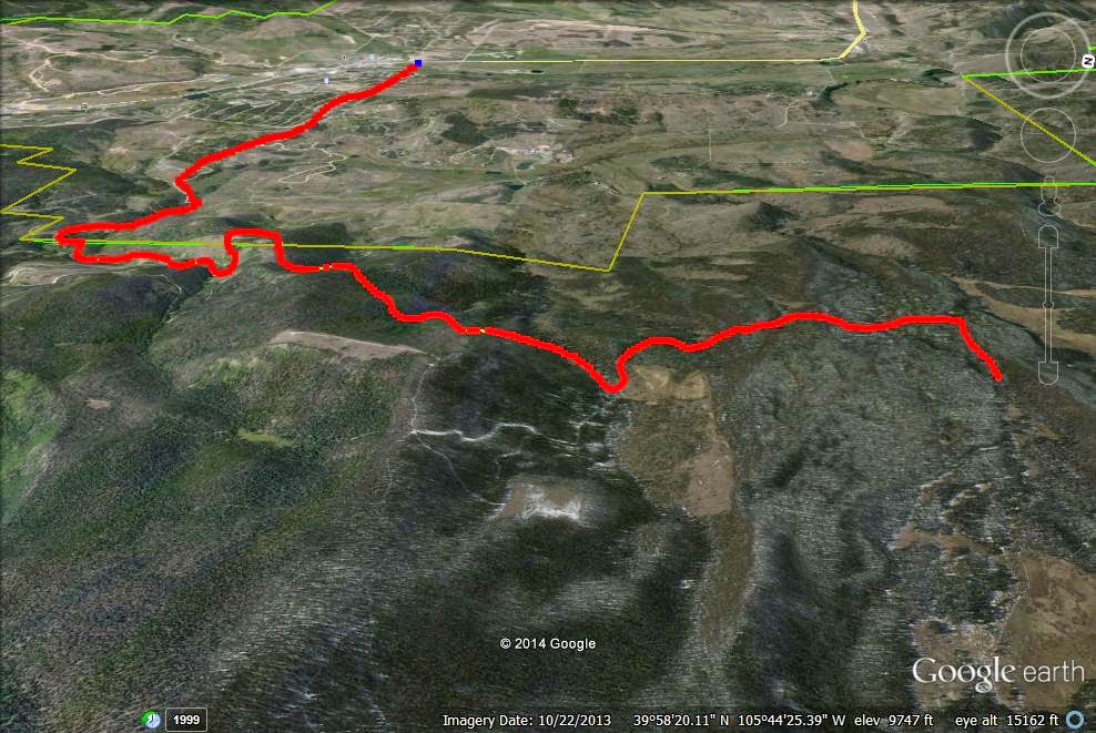
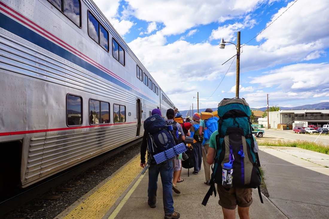
Here's a fun challenge for you, make it from Denver, across the Continental Divide to Fraser, hiking, taking the bus, and riding the Zephyr (Amtrak) back to Denver. This trip is epic and a great way to spend a long weekend hiking. Below I'll describe how to link together the trails and how to get to and from the trailheads using nothing but public transit or your own two feet.
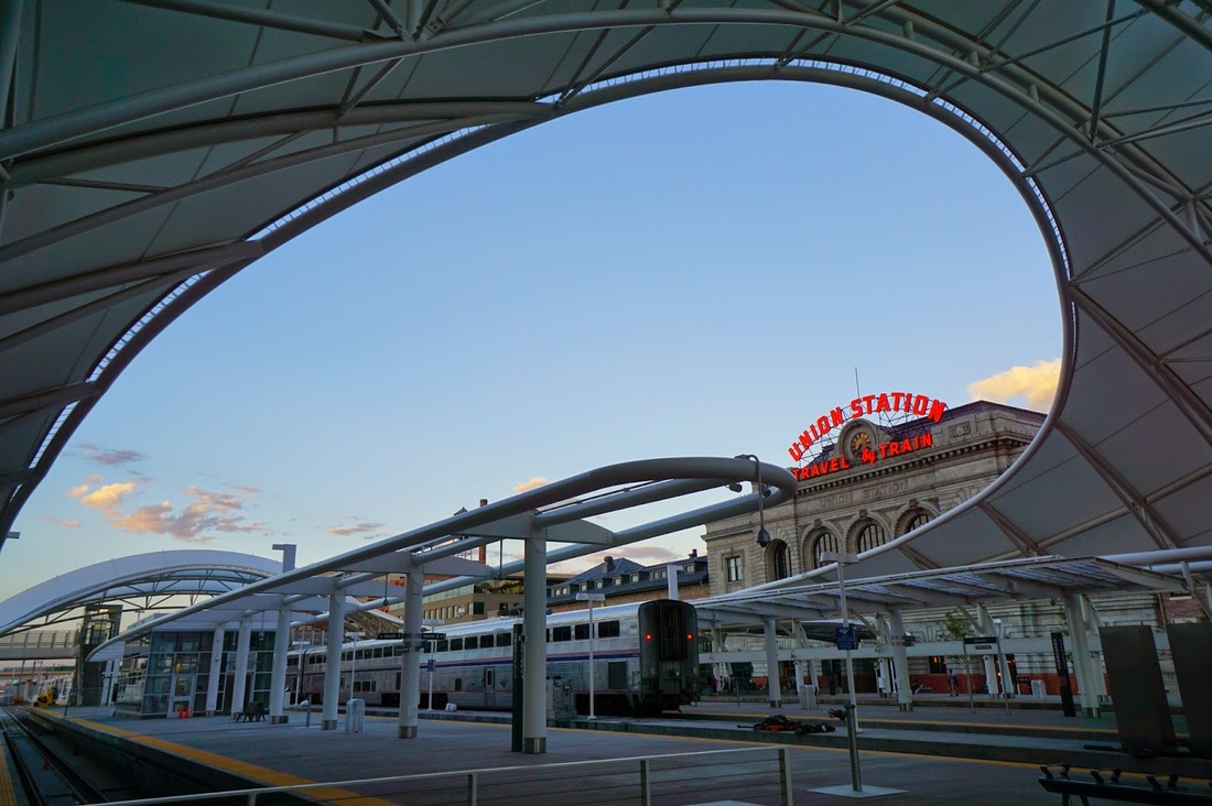
Step 1 - Bus from Union Station (Denver) to Boulder Transit Center
Not much explanation here, go to Union Station early and catch the 6:20AM bus to Boulder. Coffee at PigTrain is a must!
Step 2 - Bus from Boulder Transit Center to Nederland
Here is trick #1 for this trip. The bus to Nederland can take you to either the Nederland High School or the Eldora Ski Resort. You should take neither...convince the driver to drop you off at the junction of Eldora Ave and Shelf Road, just where the road up to Eldora Ski Resort begins. If your driver refuses (ask nicely) then you should get off at the High School. It is easier to walk the extra mile or so than to backtrack down the long road from the Ski Resort.
Step 3 - Walk along Eldora/Eldorado/Hessie Ave
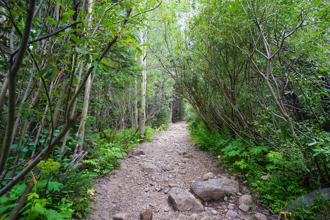
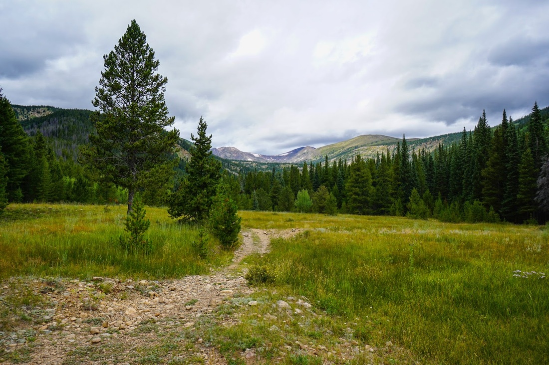
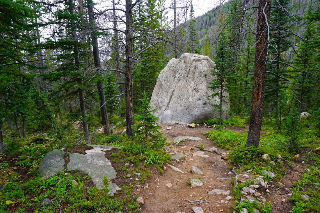
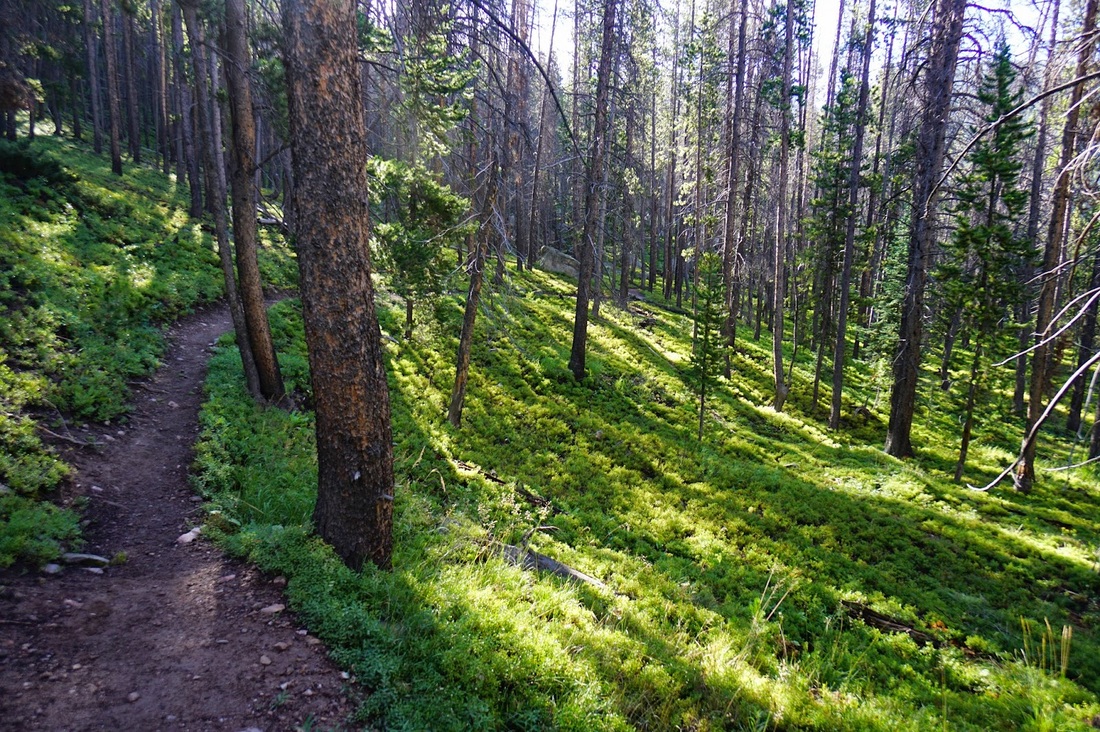
Distance: 4 mi (one way) - For this segment you want to walk along Eldora Ave for 4 miles. You walk through the town of Eldora and once the road becomes dirt, follow it to the Hessie Trailhead. This 4 mile stretch does not take all that long, it is mostly flat and surprisingly scenic.
Distance: 4 mi (one way) - For this segment you want to walk along Eldora Ave for 4 miles. You walk through the town of Eldora and once the road becomes dirt, follow it to the Hessie Trailhead. This 4 mile stretch does not take all that long, it is mostly flat and surprisingly scenic.
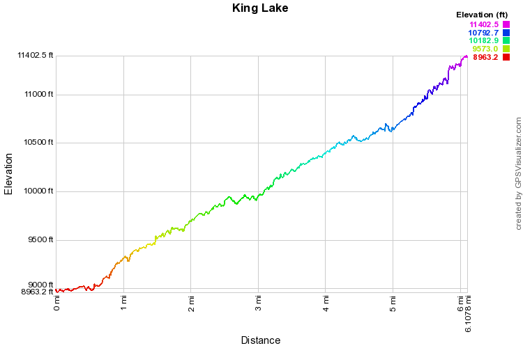
Step 4 - Hike from the Hessie Trailhead to King Lake
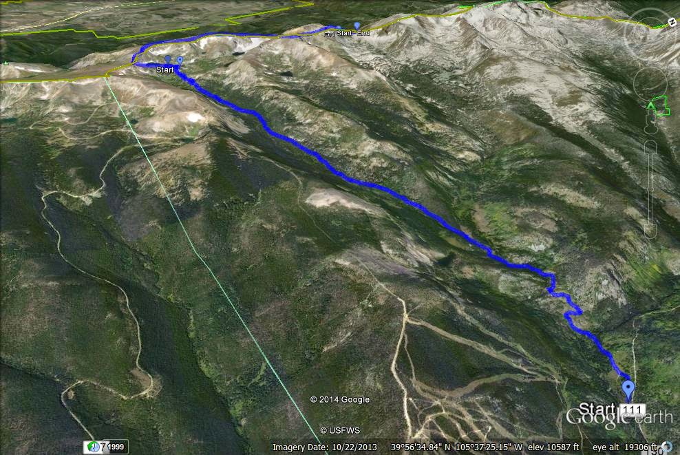
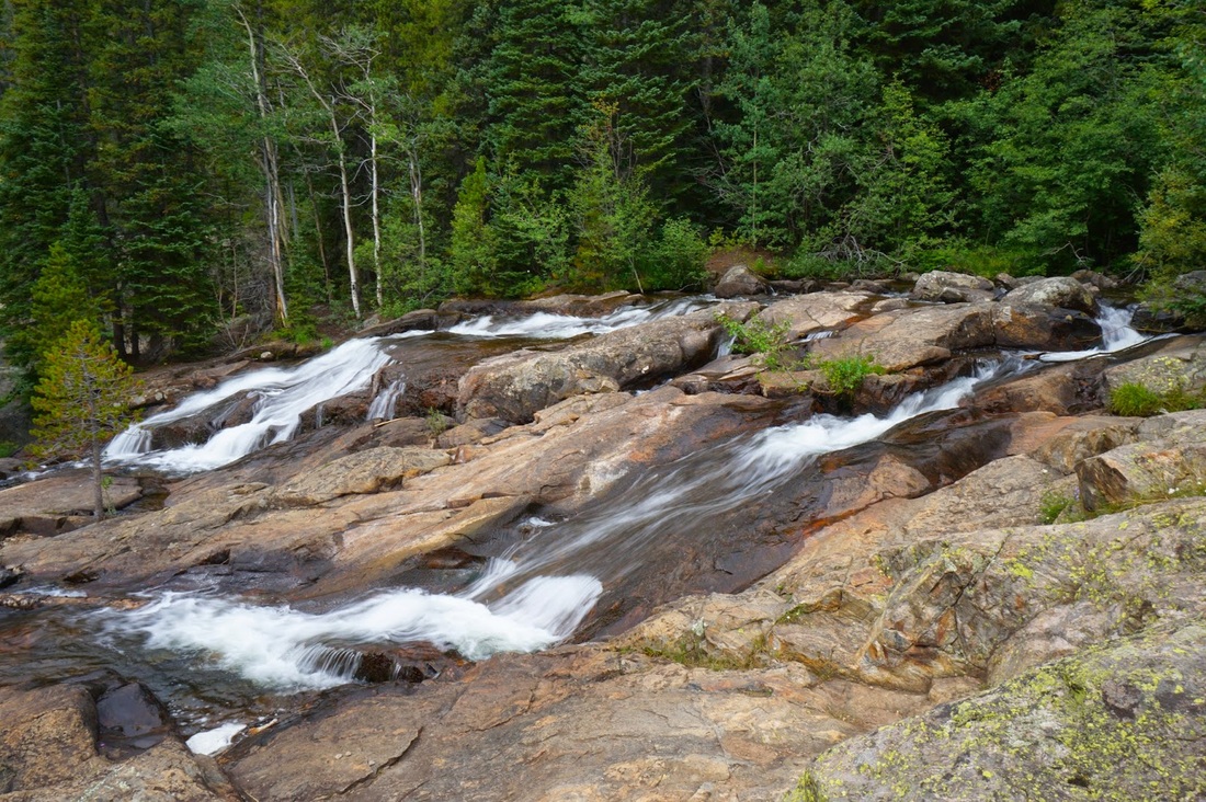
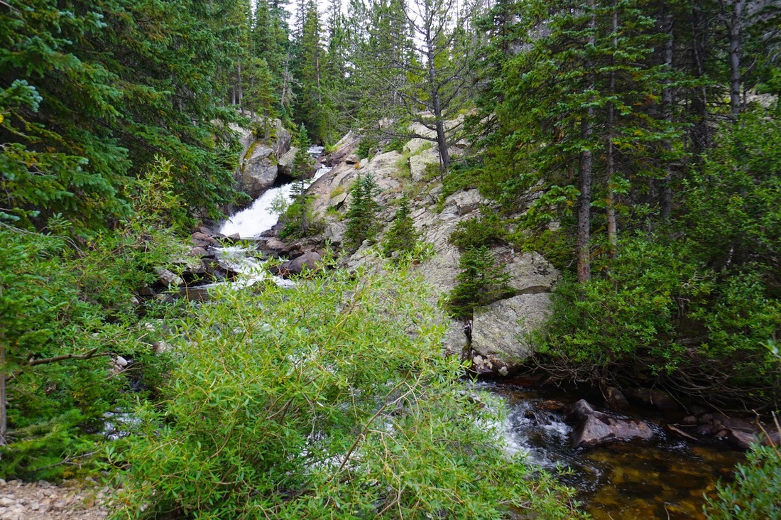
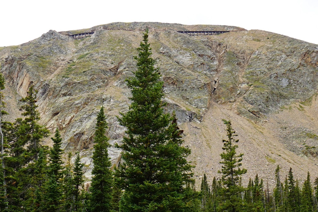
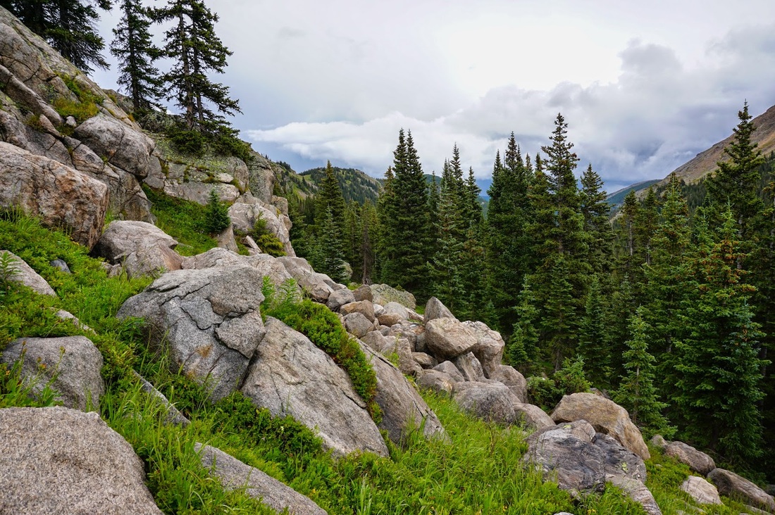
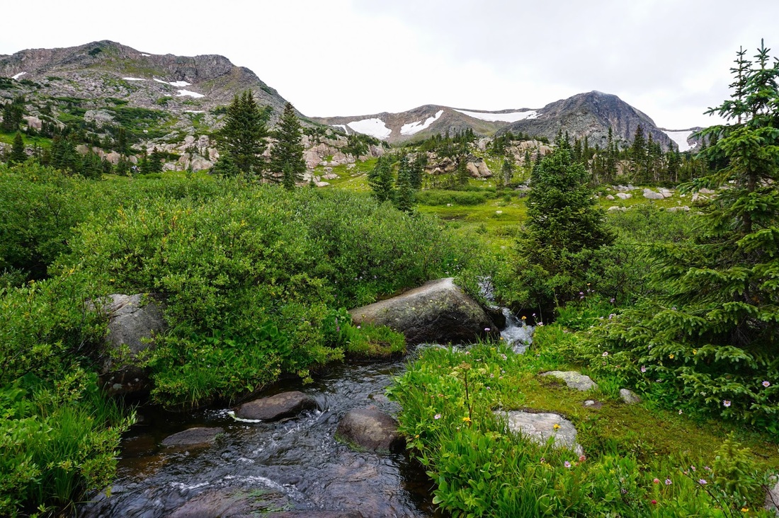
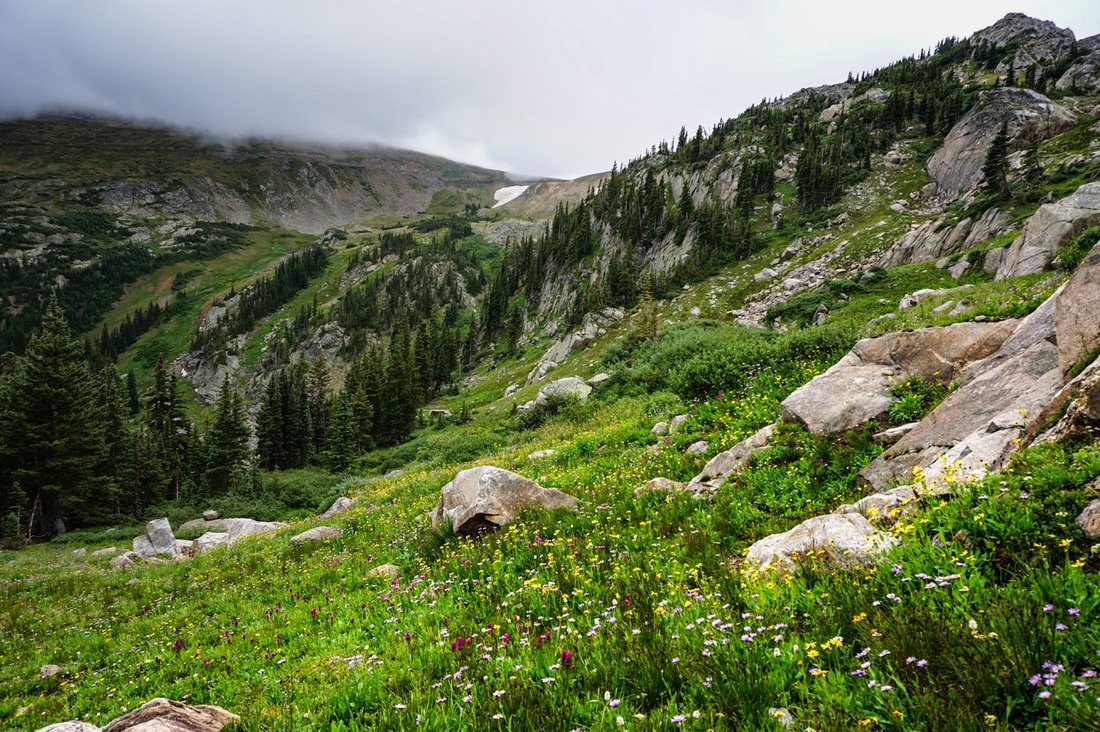
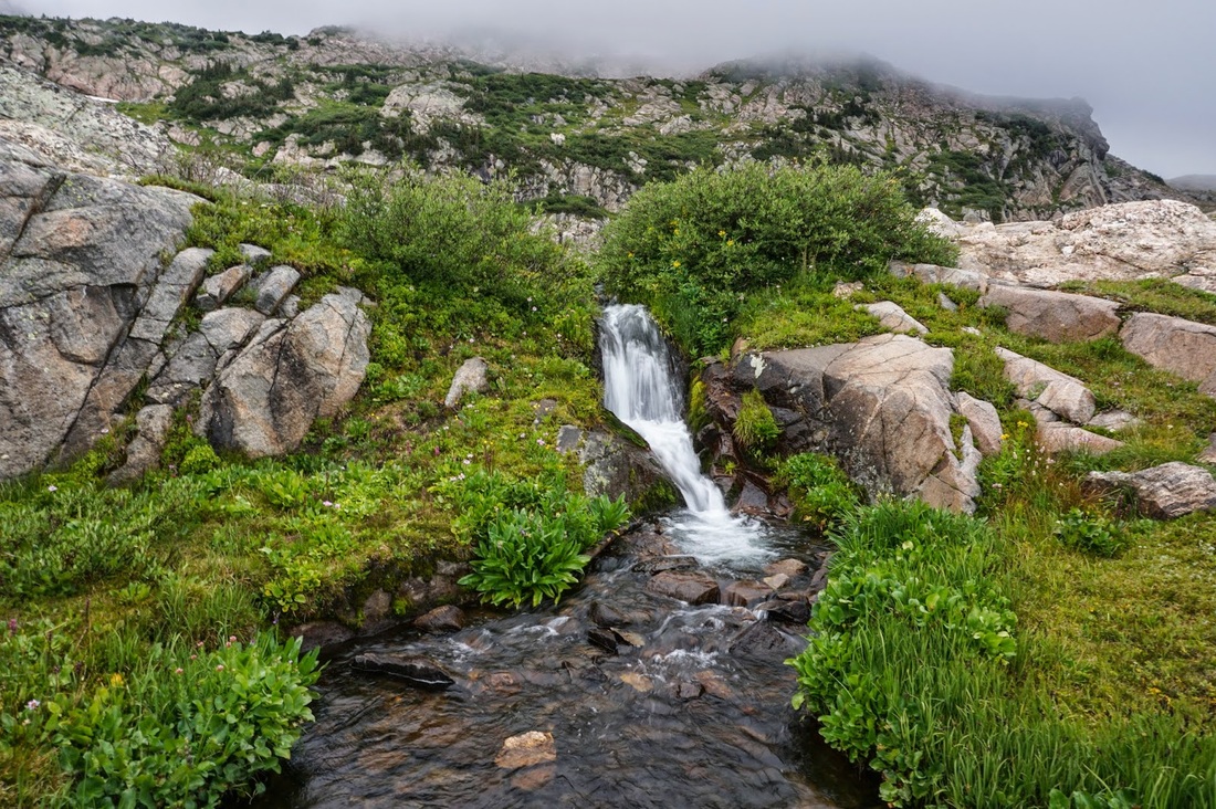
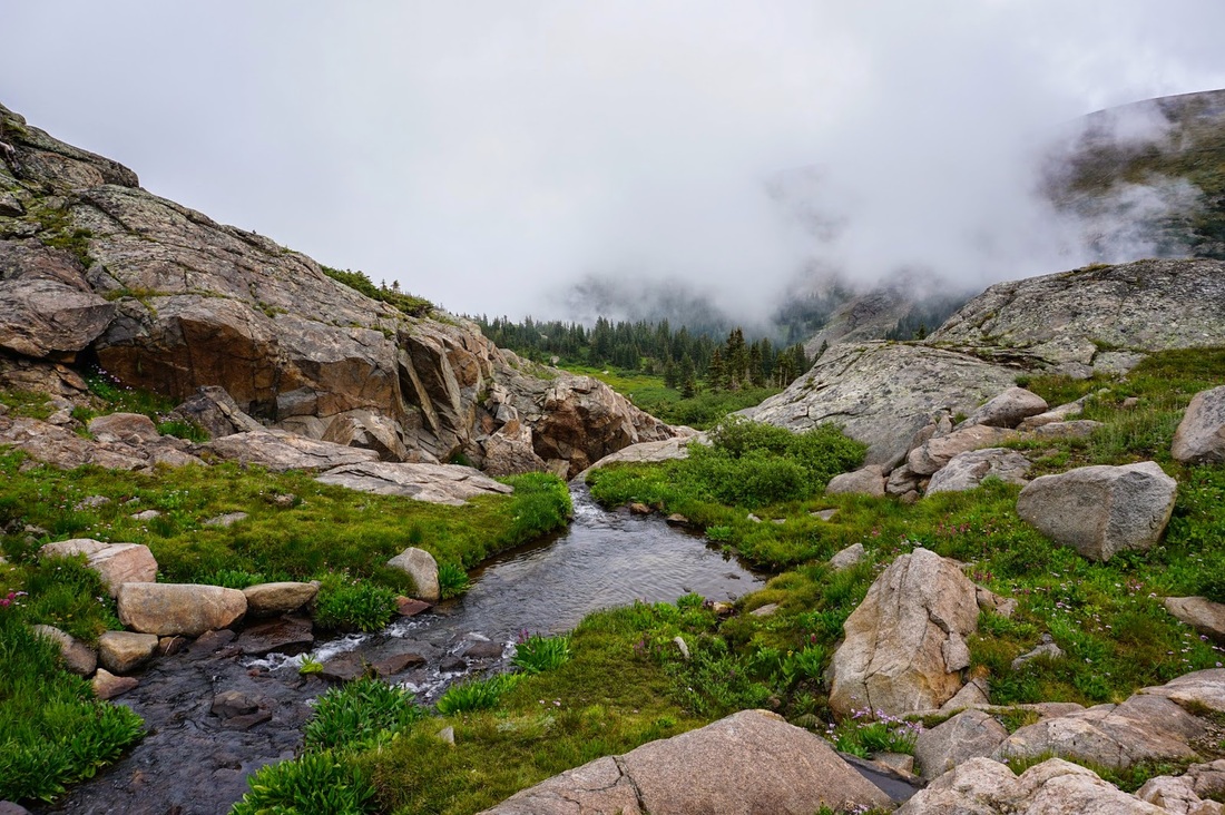
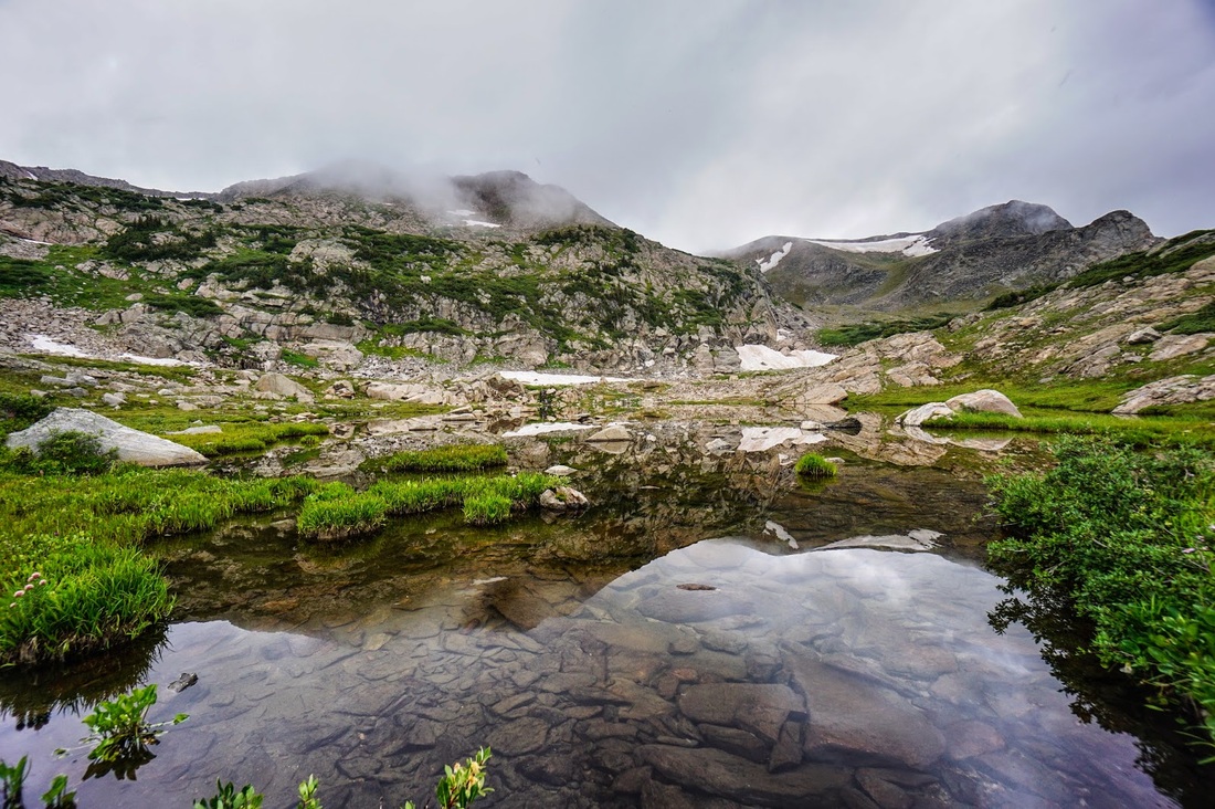
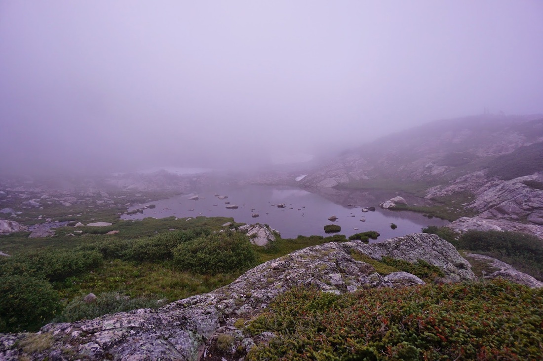
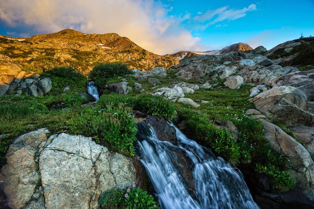
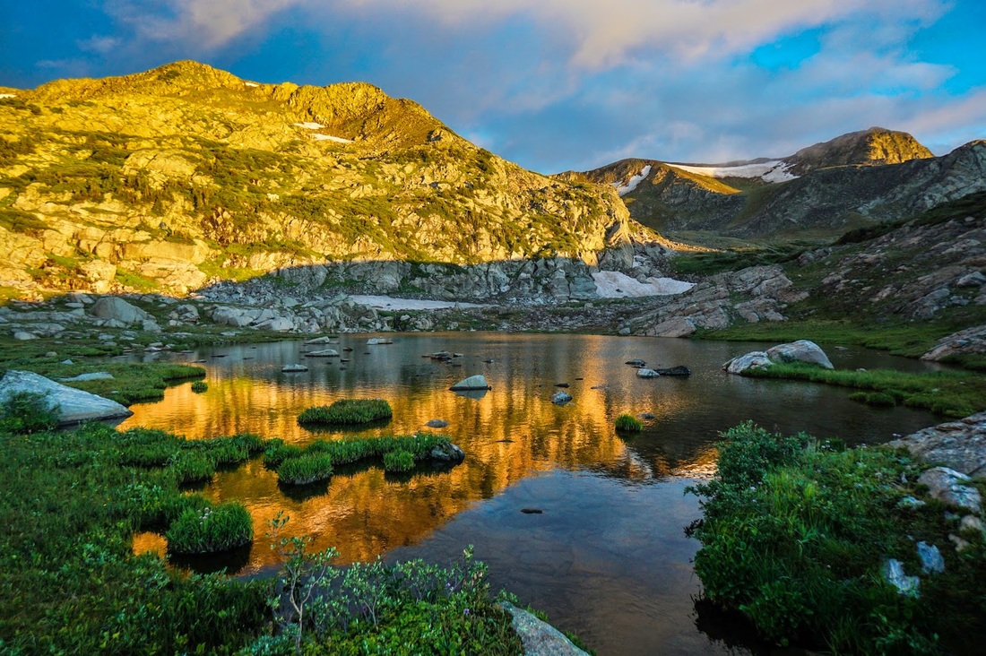
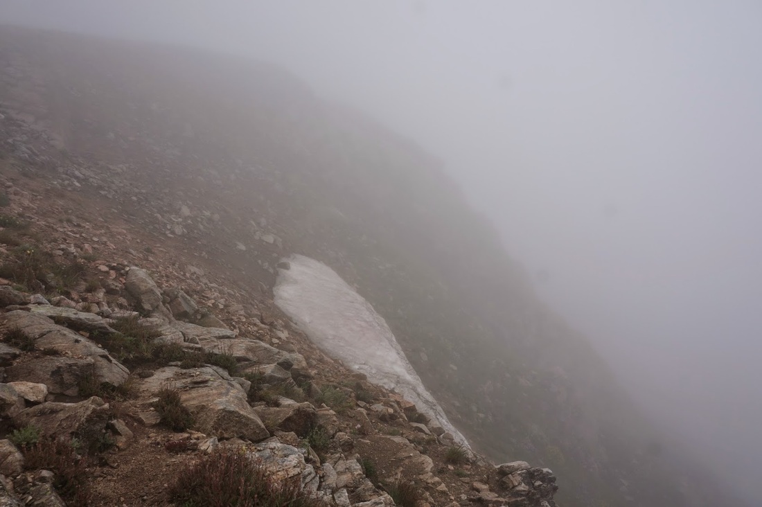
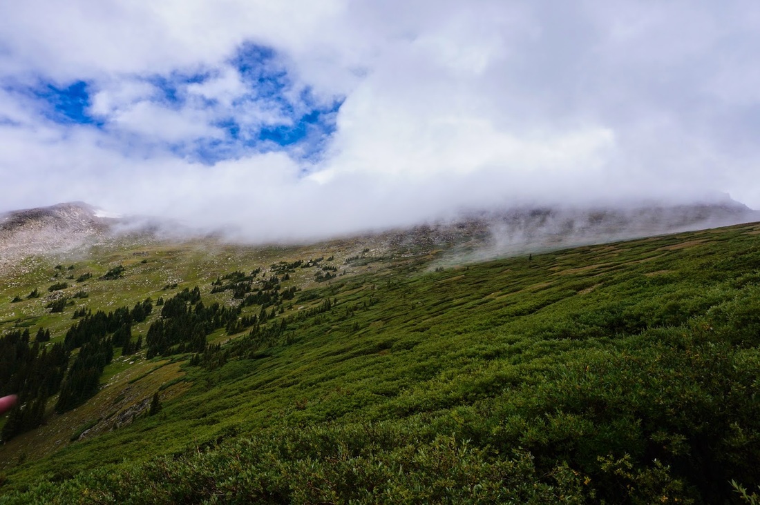
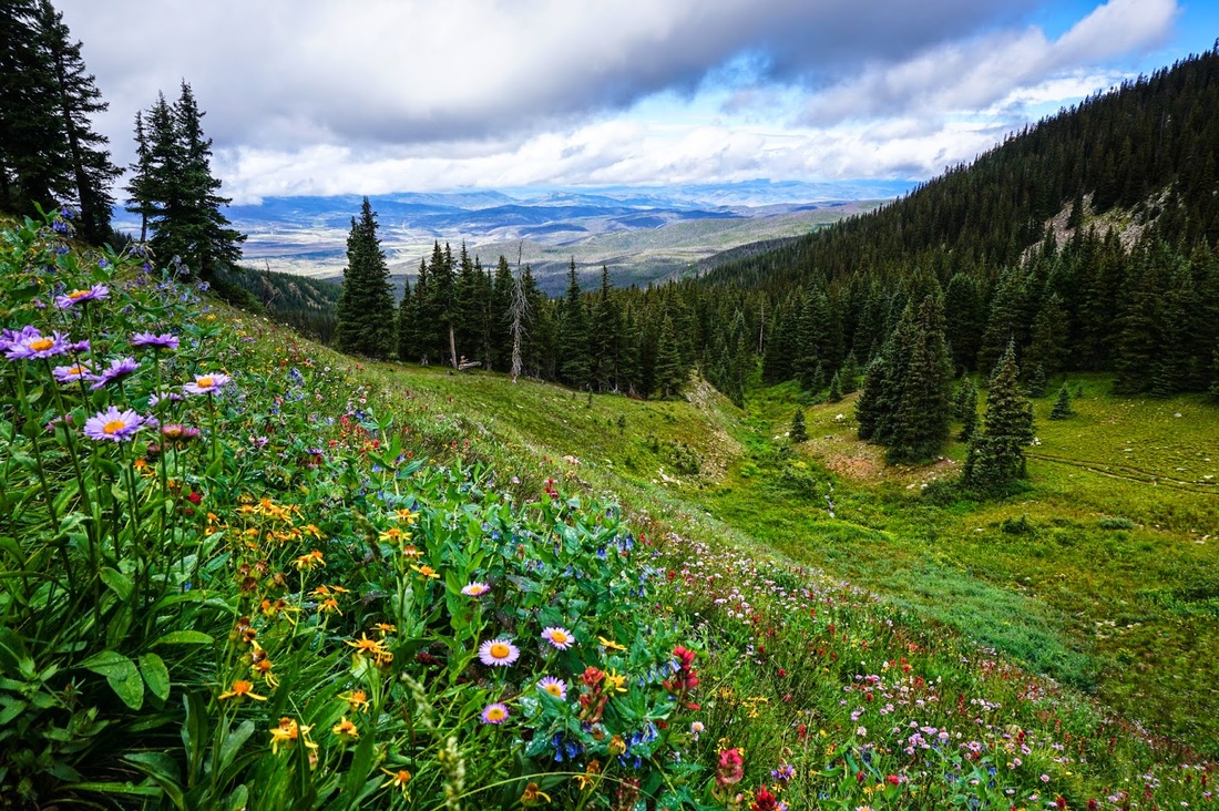
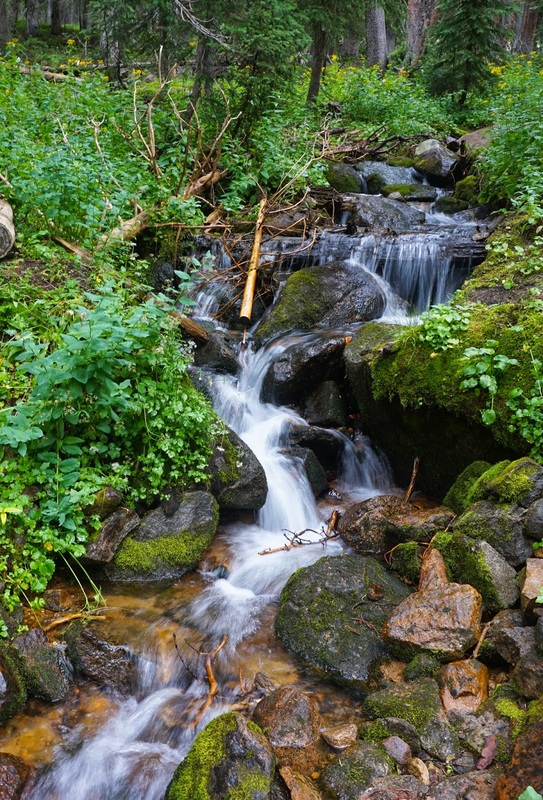
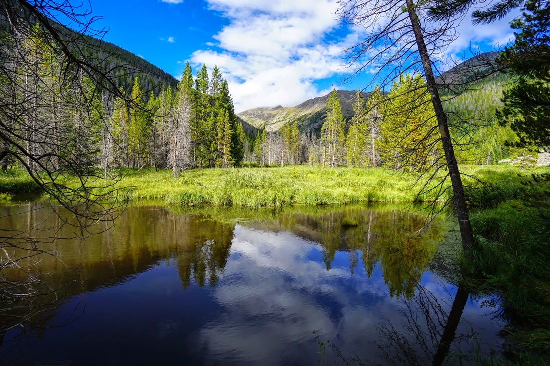
This is where the real fun begins. The hike up to King Lake is beautiful, even with the weather being grey, rainy, and brooding, the trail is pleasant and the destination provides top-notch alpine scenery. The signs say 5 miles to King Lake from the trailhead, but considering that you need to walk .5 miles from the turnoff to the trailhead (as the road is flooded and there is a large creek crossing) the actual hike is more like 6 miles. The trail roughly follows the South Fork of Middle Boulder Creek all the way up the drainage. You'll pass through pine and aspen forest on good trail with plenty of cascades, waterfalls, and wildflowers to keep the approach interesting. Once you begin to near treeline and the final push up to King Lake keep your eyes peeled to the slopes across the valley to the South. You just may catch a glimpse of a historic railroad trestle and an old car pinned down in the boulders. This is the historic railroad that once carried passengers across the divide at Rollins Pass (then known as Corona Pass) to the Winter Park area. The approach to King Lake will switchback up and up with great views back down valley until you are deposited onto a flat area with multiple creek crossings. If you are intent on camping in the trees, this is your spot. If you continue up the trail above treeline you'll find a number of terrific camping spots that are still sheltered from the wind by strands of shorter trees and large boulders. However, if thunder storms are in the forecast, stick below treeline. Following the trail past these spots will take you towards King Lake. Take an unofficial, but obvious, spur to the right to reach the open shore of King Lake...I think it is a pretty lake...without the clouds... Just before you reach King Lake there is a side trail that leads north to a unnamed but highly scenic pond with great camping options. King Lake is just a 5-10 minute walk up from this pond and I highly recommend camping here. There is a series of small waterfalls and cascades providing a true paradise as your water source. But remember, you're at 11,400ft so high altitude camping precautions are a must. 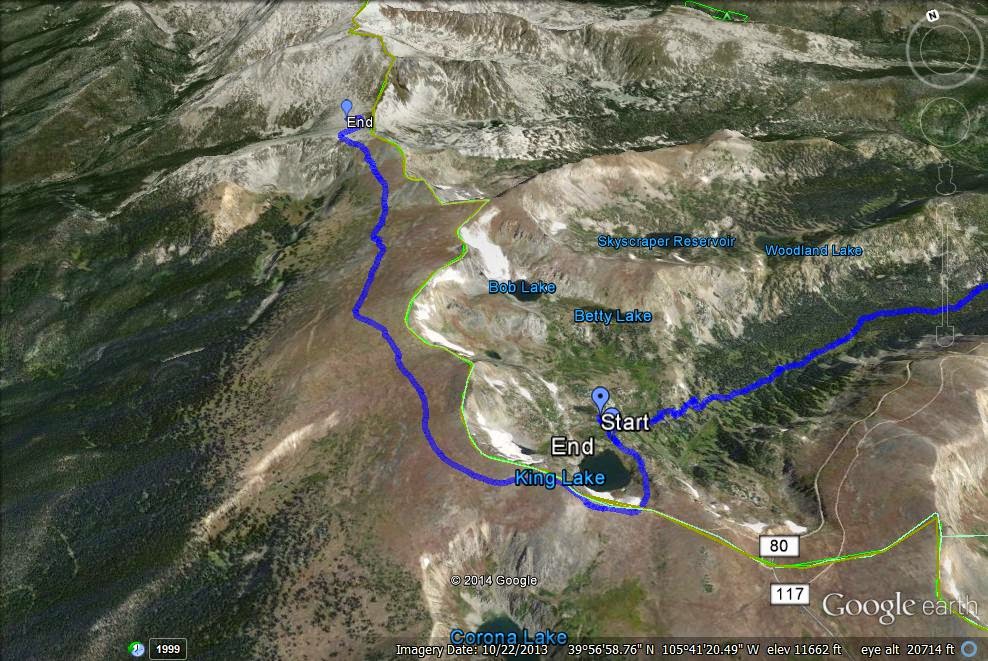
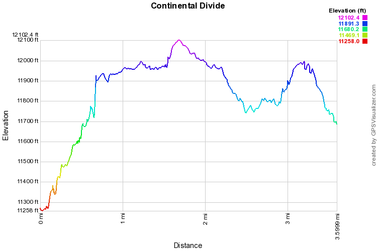
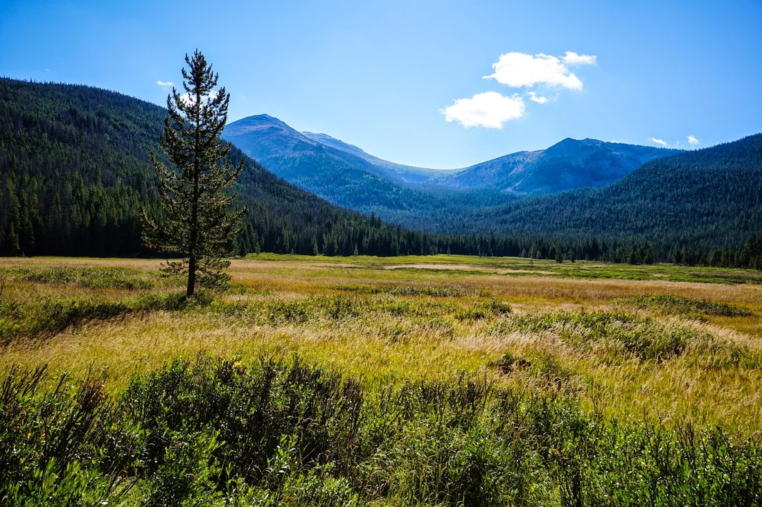
Step 5 - King Lake to Devil's Thumb Pass via the Continental Divide National Scenic Trail
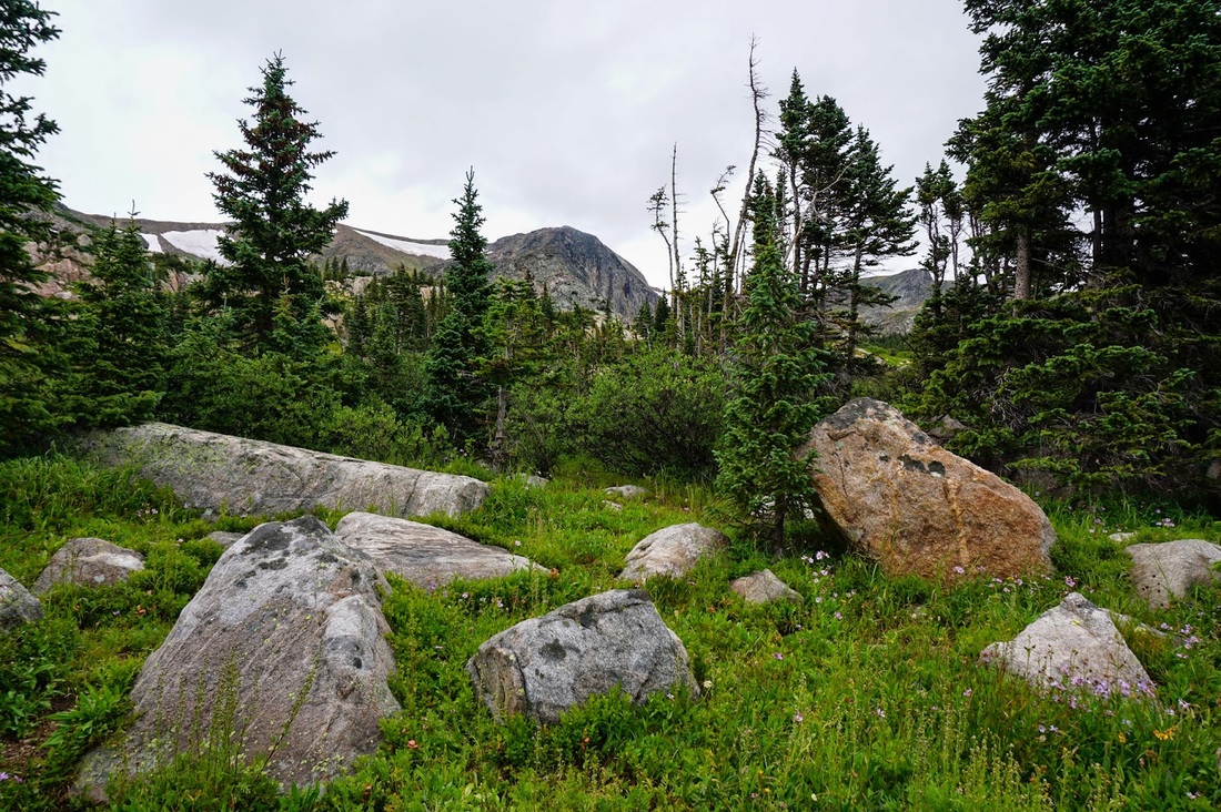
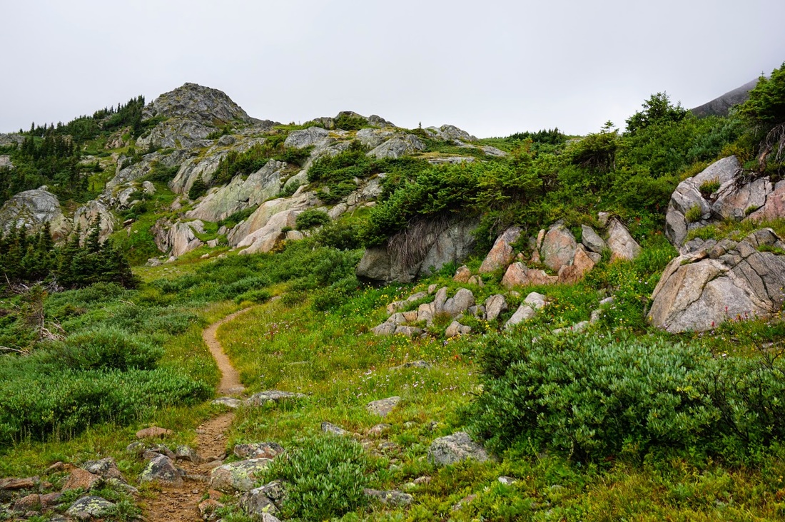
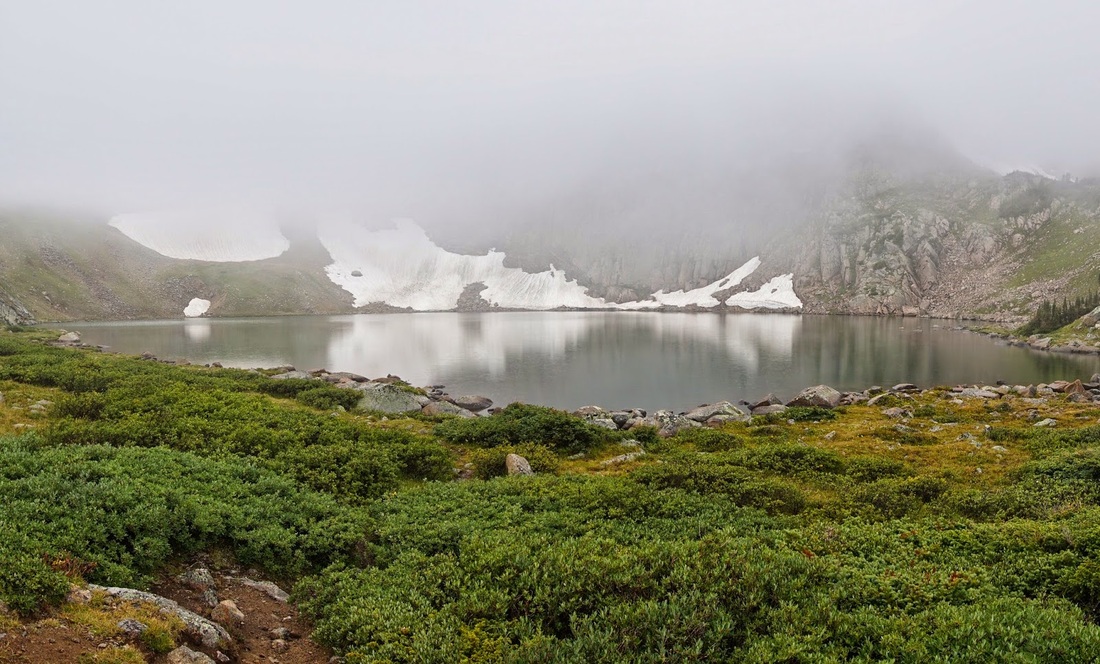
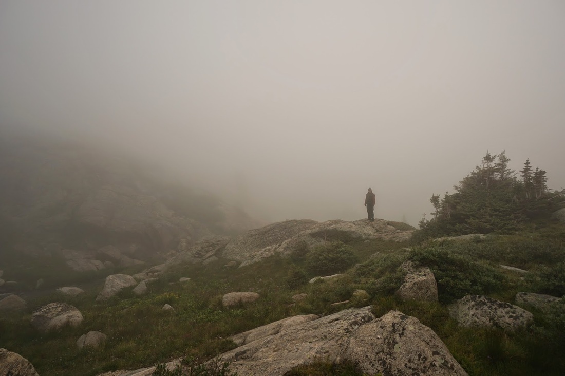
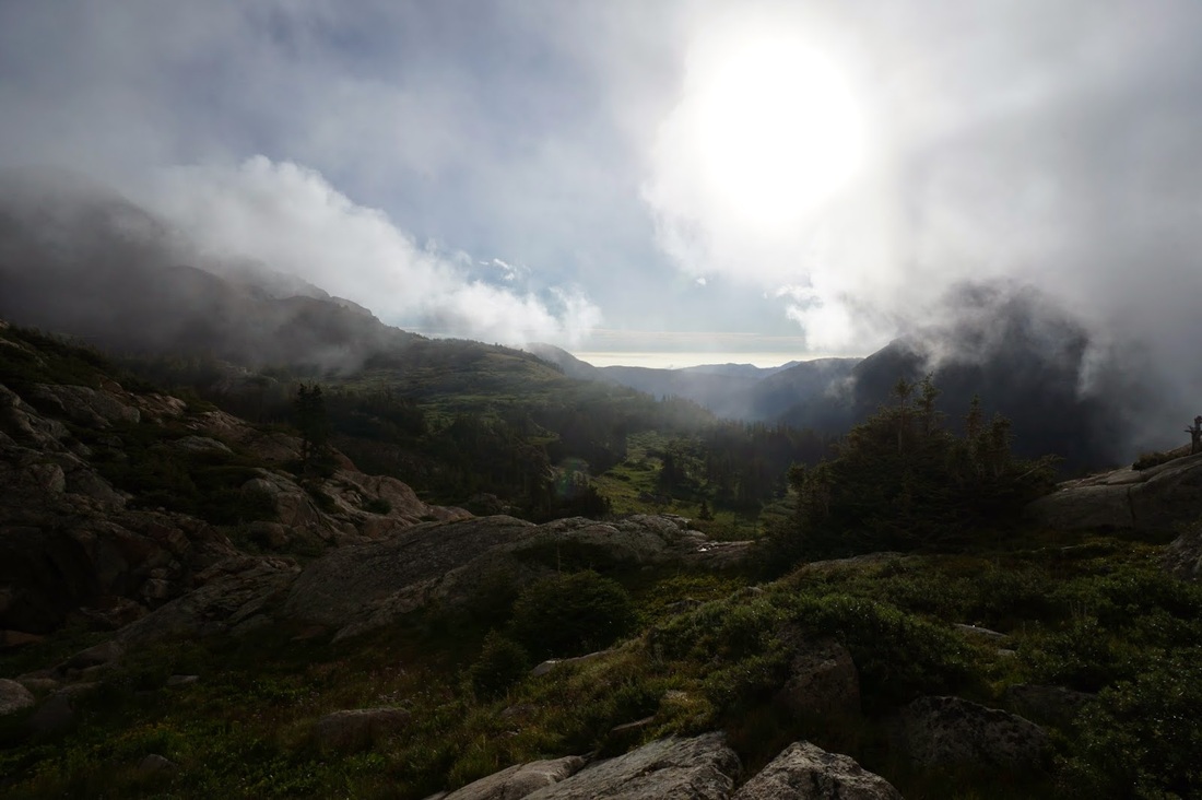
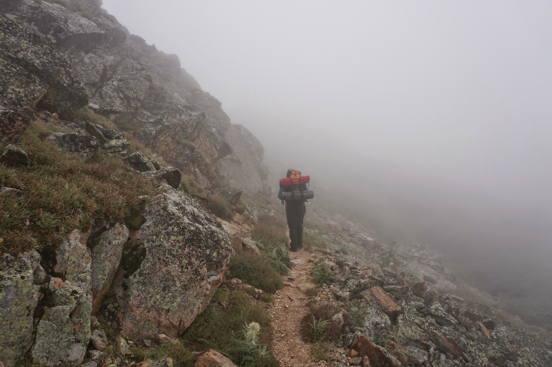
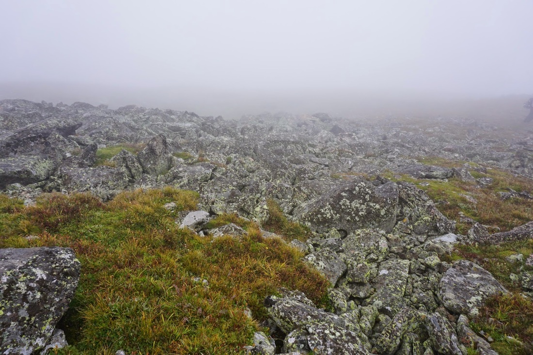
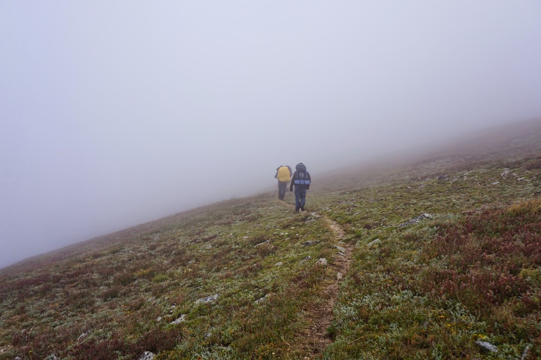
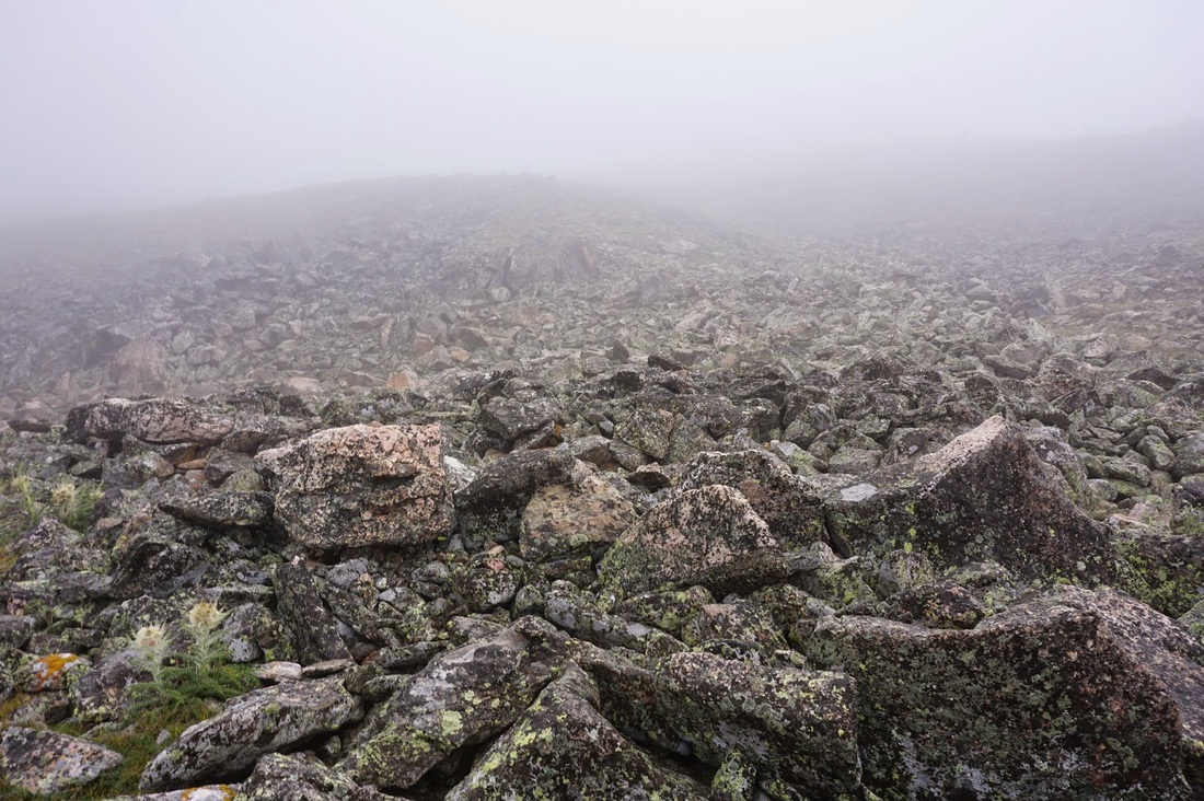
If you can pull yourself away from the alpine splendor of King Lake, continue your journey by climbing the well marked trail south of King Lake up to the Continental Divide Trail. When you gain the ridge you'll see the sign pointing south for Rollins Pass and north for High Lonesome Trail and Devil's Thumb Trail. Head north. The High Lonesome Trail is synonymous with the Continental Divide Trail for this section. The views along the ridge are...well, I don't know...I imagine that they are pretty amazing, but this is all we saw for 3.6 miles... Regardless the trail gains the ridge steeply at first and then begins a rolling path along the western slopes of the Divide. The trail is easy to follow. There are two trail junctions but keep on following the signs to Devil's Thumb. The trail will take you all the way to Devil's Thumb Pass where you'll see a large cairn, then...no trail... Stay to the left (west) and you will find your way to the Devil's Thumb Trail, I'd imagine it is easier when you can see more than 20 feet in front of you... |
|


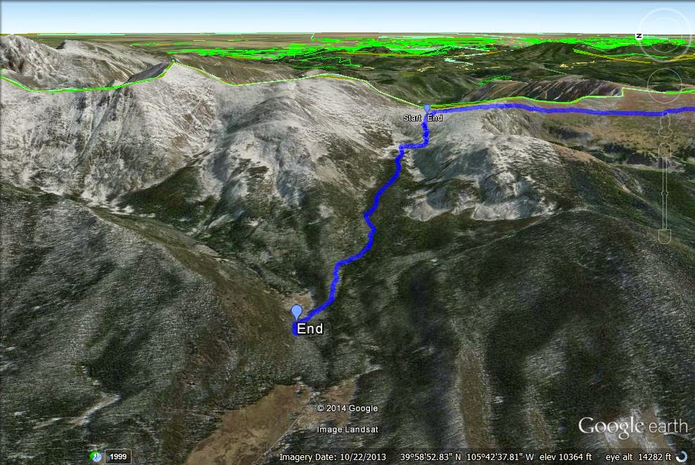
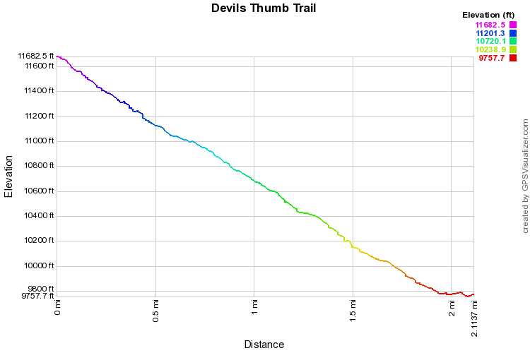
Step 6 - Devil's Thumb Pass Trail to 2nd Campsite or Trailhead
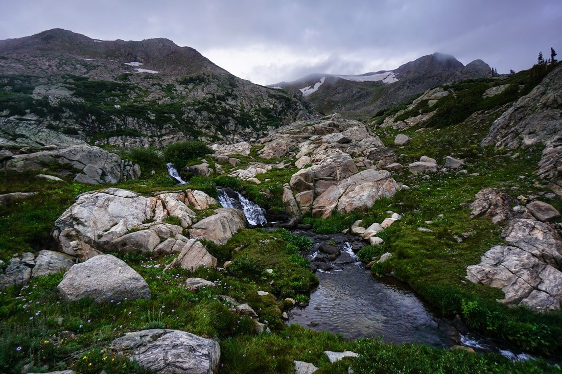
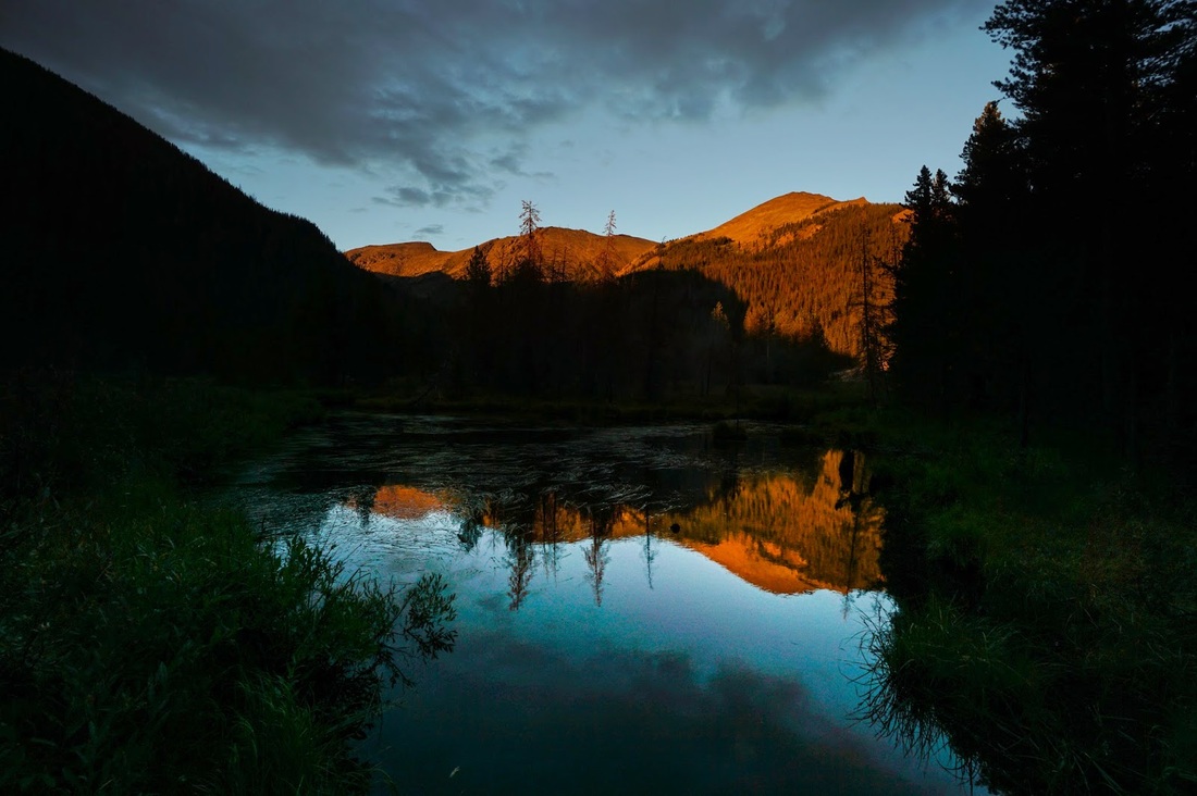
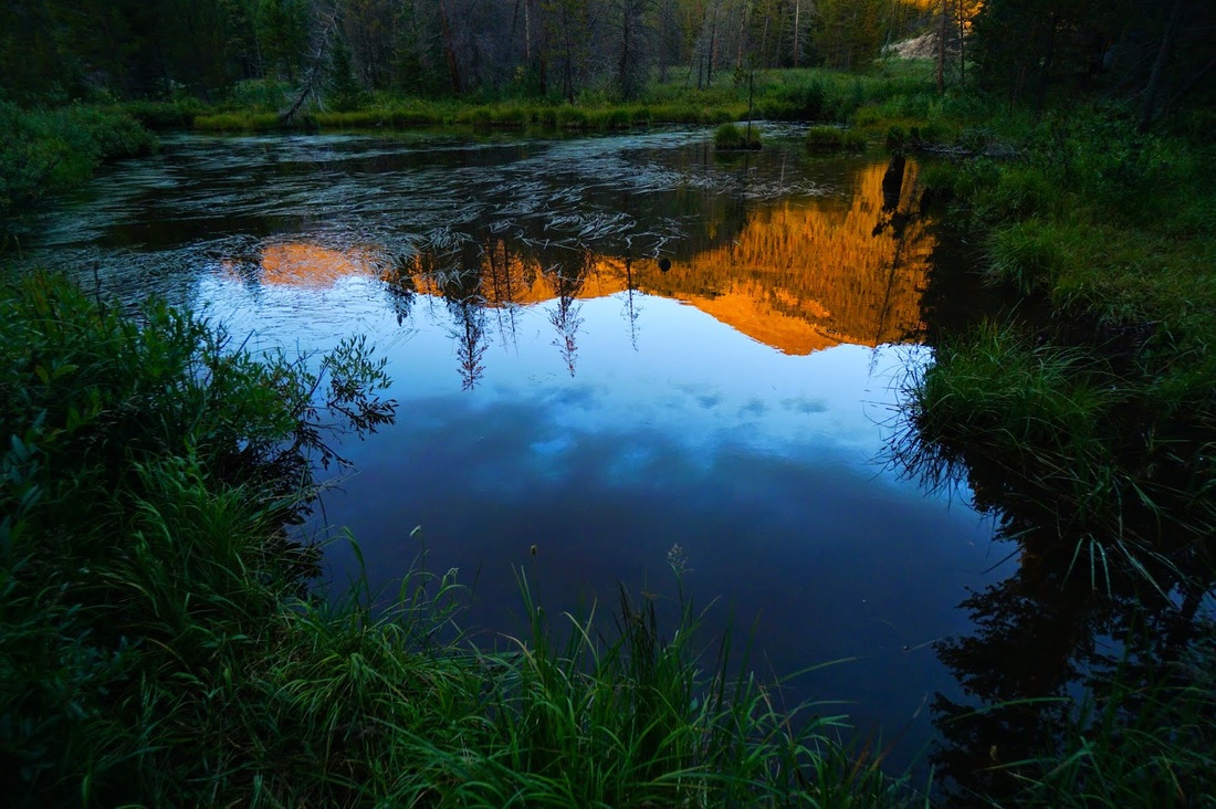
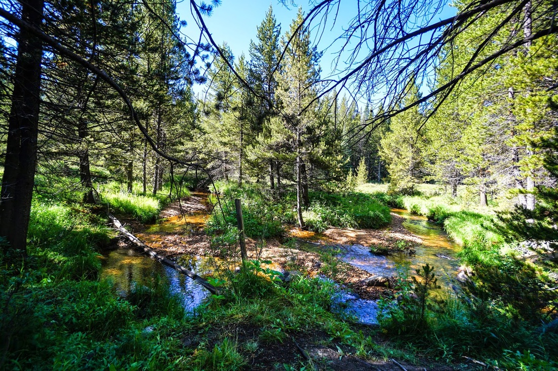
You'll be very happy once you start descending the Devil's Thumb Trail that you didn't decide to come up to the divide this way...this trail is steep...beautiful...but steep... From the pass, you head down through scrub with terrific views down into the valley below. Once you pass through the shoulder height scrub forest, you'll enter a steep V shaped valley with amazing wildflowers and nice little creek running down the middle. Before long you'll enter into dense pine forest, with a wonderful cascades and huge glacial boulders. After about 2 miles you'll enter the James Peak Protected Area and reach the suggested campsite, and you'll know it when you get there. The site is just off the trail and at the edge of a wonderful pond...keep your eyes peeled for moose... The views across the pond are phenomenal at sunset and include views of Mt. Neva, Mt. Jasper, and Devil's Thumb Pass. |
|


Step 7 - Hike along Dirt Roads to Fraser
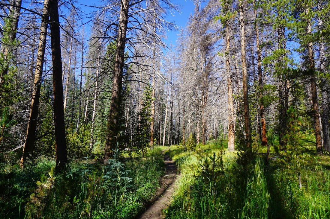
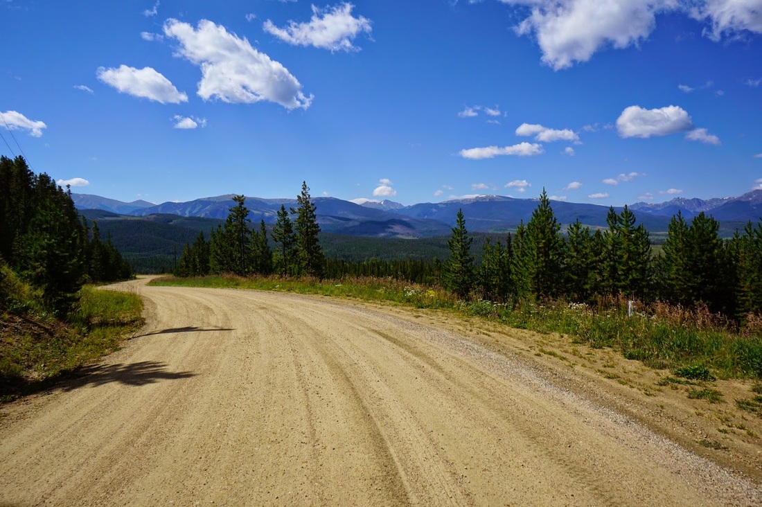
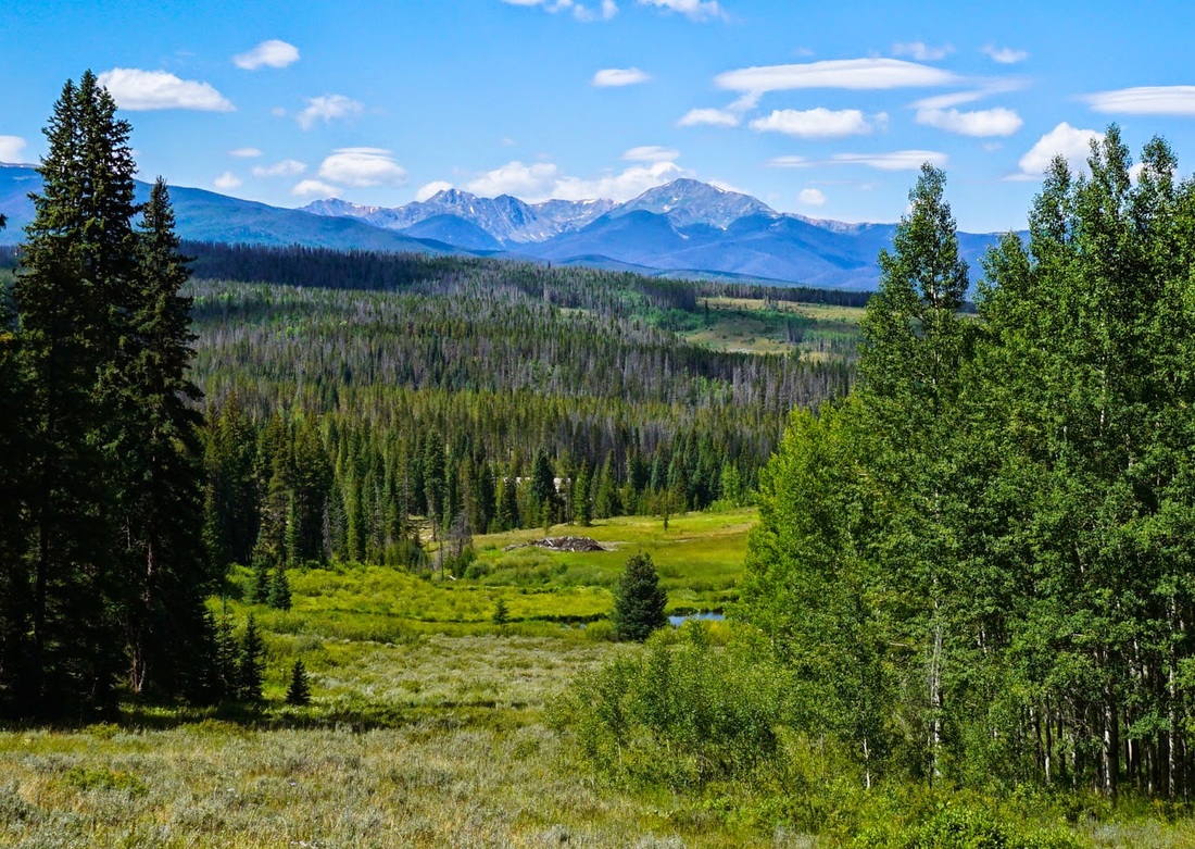
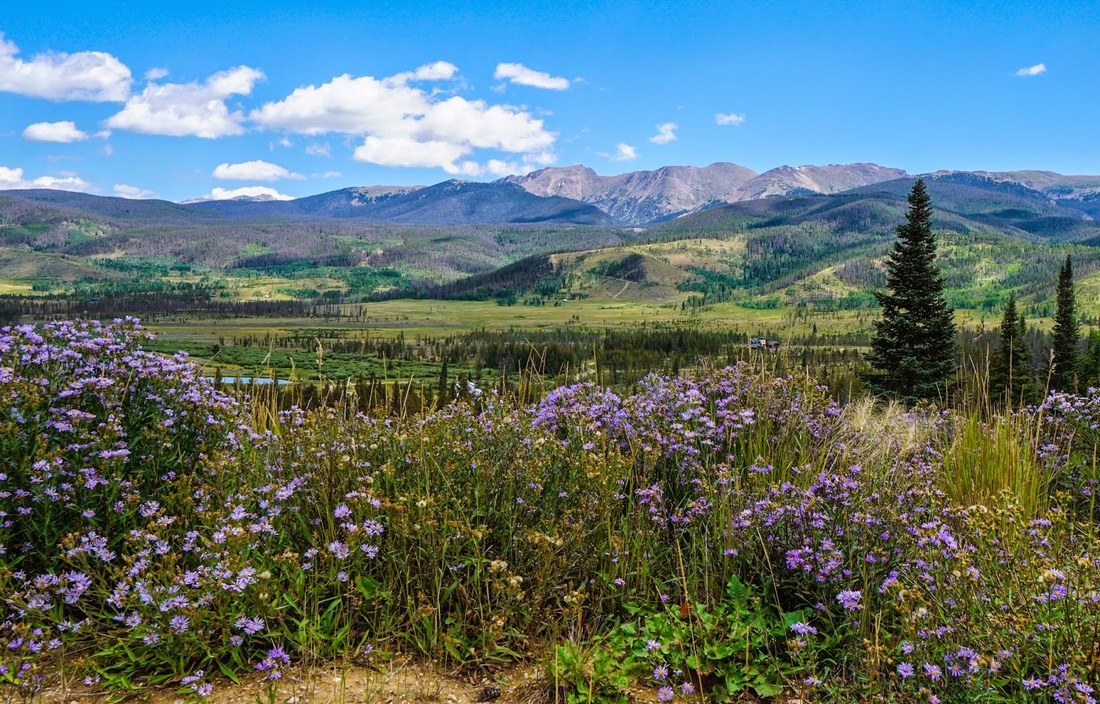
Distance: 7.7 mi (one way) Once you reach the Devil's Thumb Trailhead, your trail hiking is concluded and you are left with dirt roads to lead the way. Follow the dirt road west from the trailhead and when you come to the intersection head to the left (south). Follow this road out of the National Forest, through the backside of Devil's Thumb Ranch, and all the way down into Fraser. This part of the hike can be a slog, and a stressful one if you are running late. Figure about 2.5 hours of hiking time to get from the Devil's Thumb trailhead to Fraser. The views along the road are fantastic. Ptarmigan Peak, Byers Peak, Winter Park, and looking back to the Divide and the ridge line where you just came from is a real treat. This road can get hot in the summer and has some uphill sections but is mostly an easy downhill ramble. |
|


|
Step 8 - Beer, Burgers, and More Beer
You just walked across the Continental Divide, I think you deserve a beer. Crooked Creek Saloon has a great beer selection, fantastic post-hike food, and is 2 blocks from the Fraser Amtrak Station. Step 9 - Amtrak Back to Union Station Be sure to book your tickets ahead of time. The train back to Denver leaves at about 4:30PM but is prone to delays. If you get up early in the morning and don't take too many breaks, you should be able to get into Fraser with enough time to get some food before getting to the station. Ride triumphantly through the Moffat Tunnel and along the Front Range foothills back into Denver. The observation car makes for a great spot to take in the scenery and the comfy seats allow you to sleep until your legs cramp-up...and oh yeah, there's also a bar car... |
|


This hike is really something special. There are not many ways to hike from Denver across the divide and back without driving. Is it a novelty? Sure, but there are many Denver hikers out there who do not own cars and may be looking for an epic adventure in the Indian Peaks. Colorado's better than average public transportation makes this type of trip a reality. I've always thought of the Indian Peaks as Denver's premier backyard adventure spot, but this journey really puts it into perspective.
We are quite lucky to live in Denver, time to take advantage of it!
We are quite lucky to live in Denver, time to take advantage of it!
