GO HIKE COLORADO
Get in Touch:
  • HOME
  • ABOUT
  • HIKES BY REGION
    • DENVER AREA >
      • Denver Mountain Parks
      • Jefferson County Open Space
      • Lakewood Parks
      • Denver Area Greenways
    • BOULDER AREA
    • DOUGLAS COUNTY
    • FORT COLLINS AREA
    • COLORADO SPRINGS AREA
    • FRONT RANGE
    • TENMILE & MOSQUITO RANGES
    • GORE RANGE
    • SANGRE DE CRISTO MOUNTAINS
    • PARK RANGE
    • SAWATCH RANGE
    • ELK MOUNTAINS
    • SAN JUAN MOUNTAINS
    • THE FLAT TOPS
    • GRAND MESA
    • COLORADO PLATEAU
    • EASTERN PLAINS
  • NATIONAL PARK HIKES
    • BENT'S OLD FORT NATIONAL HISTORIC SITE
    • BLACK CANYON OF THE GUNNISON NATIONAL PARK
    • COLORADO NATIONAL MONUMENT
    • CURECANTI NATIONAL RECREATION AREA
    • DINOSAUR NATIONAL MONUMENT
    • FLORISSANT FOSSIL BEDS NATIONAL MONUMENT
    • MESA VERDE NATIONAL PARK
    • ROCKY MOUNTAIN NATIONAL PARK
    • GREAT SAND DUNES NATIONAL PARK
    • HOVENWEEP NATIONAL MONUMENT
    • SAND CREEK MASSACRE NATIONAL HISTORIC SITE
    • YUCCA HOUSE NATIONAL MONUMENT
  • HIKES BY CATEGORY
    • HIKES TO ALPINE LAKES
    • HIKES TO PEAKS & PASSES
    • HIKES THROUGH CANYONS
    • HIKES WITH FALL COLORS
    • HIKES ALONG THE I-70 CORRIDOR
    • HIKES ON PAVED TRAILS
    • HIKES FOR KIDS
    • HIKES TO WATERFALLS
    • HIKES ALONG RIVERS
    • HIKES WITH ROCK FORMATIONS
    • HIKES WITH WILDFLOWERS
    • WINTER HIKES
  • NEWS
  • WEBCAMS
  • $UPPORT GHC
  • INTERACTIVE MAP

Sage > Eagle > Cobalt Loop
Boulder Valley Ranch

Date Hiked: March 3, 2013

Distance: 4.4 mi (RT)
Elevation Gain: 400ft
Elevation Min/Max: 5,194 to 5,562ft
Managing Agency: City of Boulder Open Space & Mountain Parks
Fee: None

Boulder Valley Ranch Trail Map
Picture

Directions:  From Boulder take either Broadway Street or Hwy 36 north out of Boulder.  Just after you leave North Boulder, make a right onto Longhorn Road and follow this to the trailhead and parking area.]

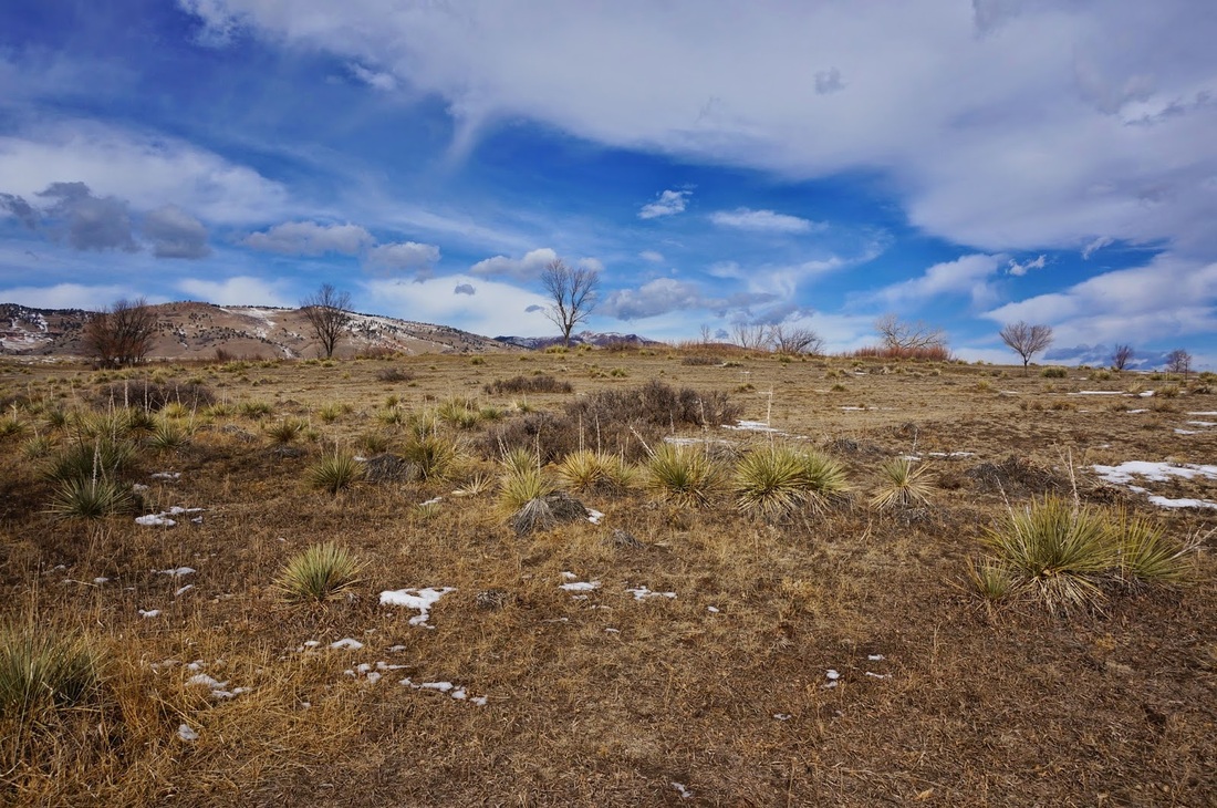
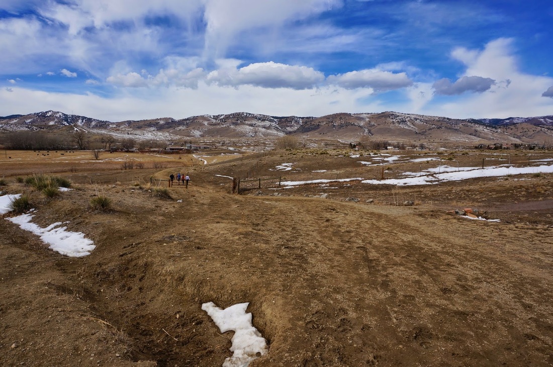
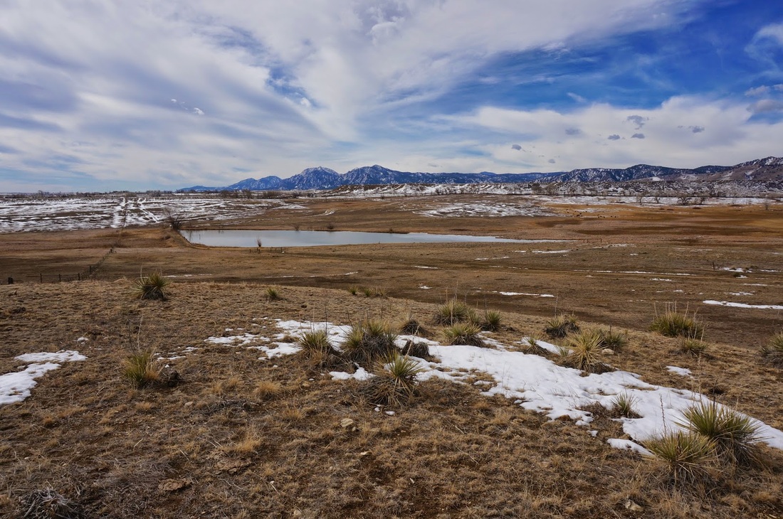
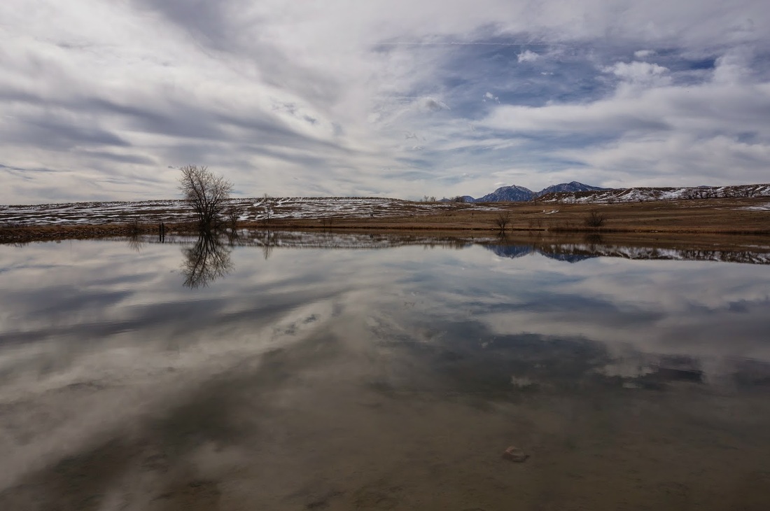
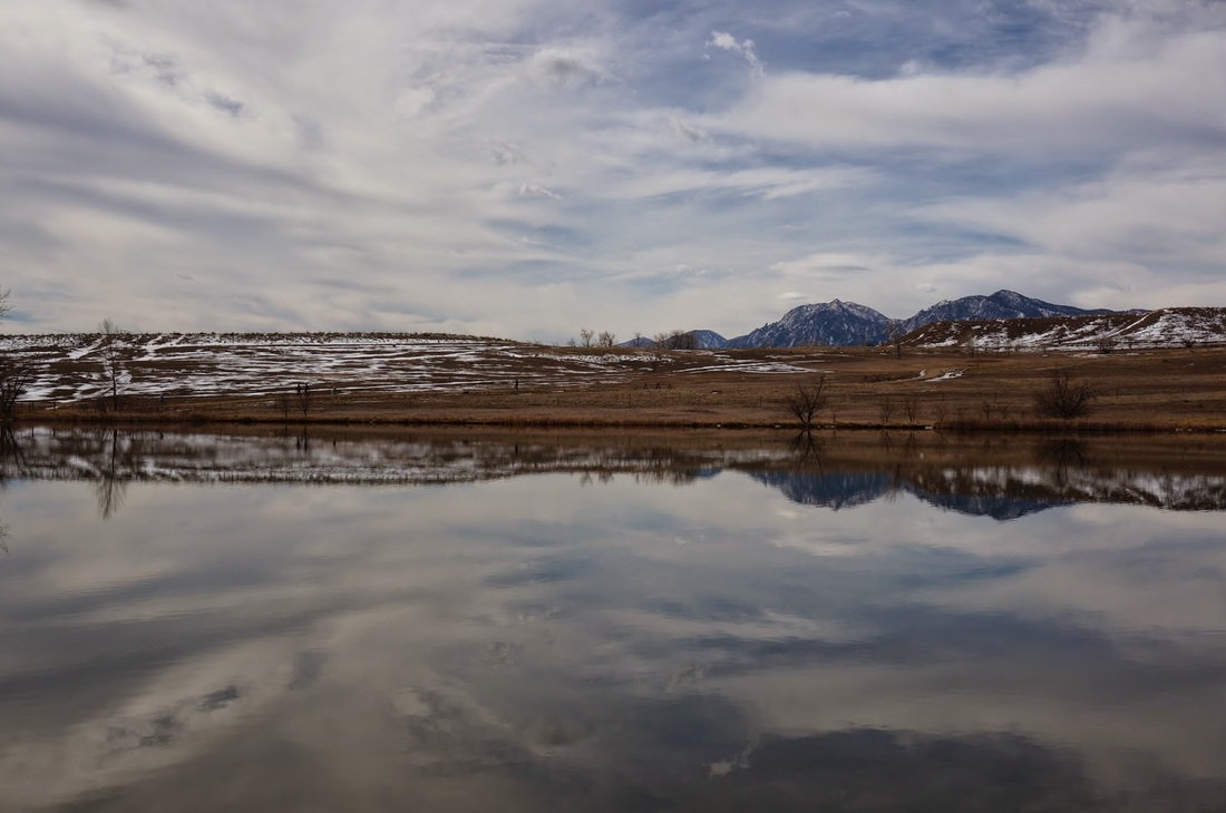
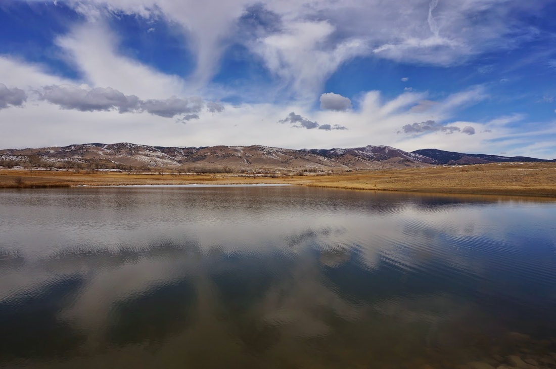
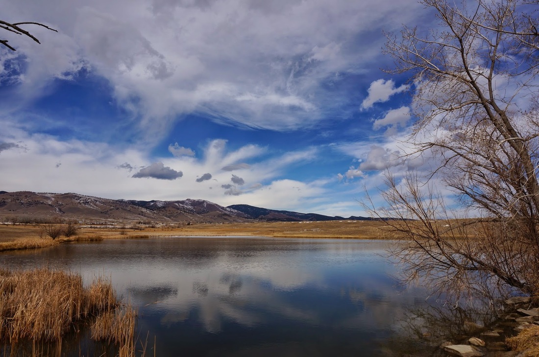
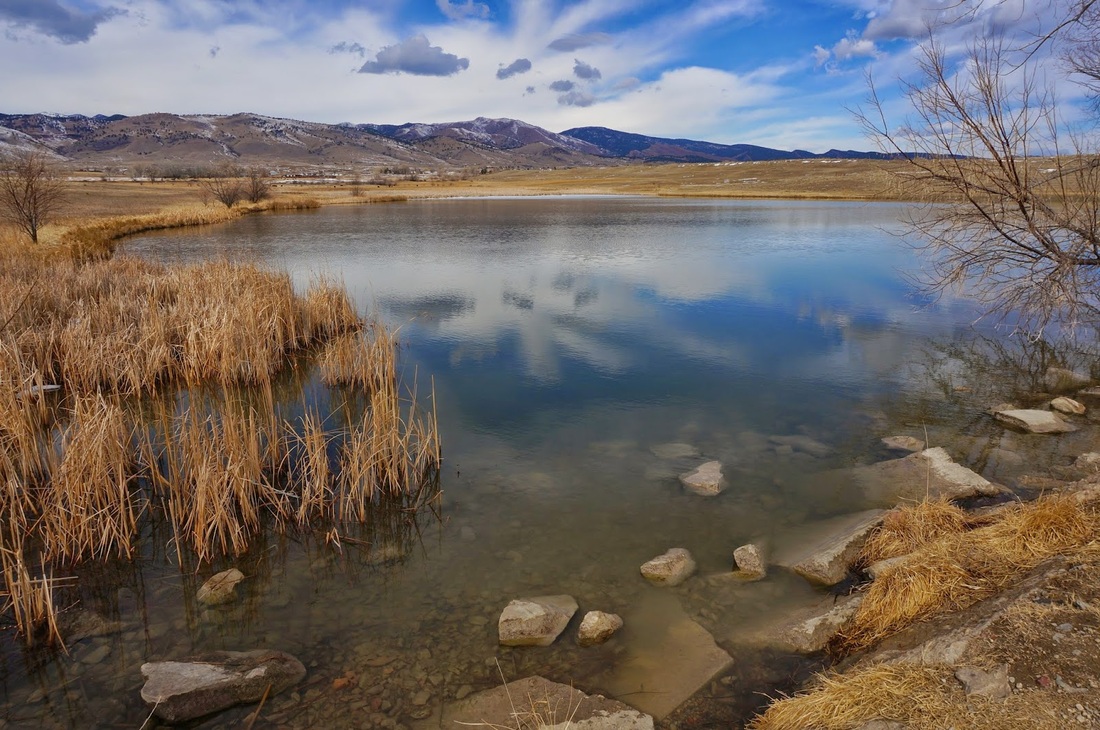
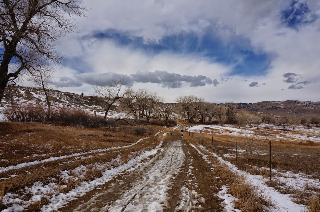
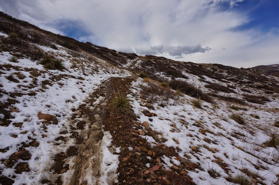
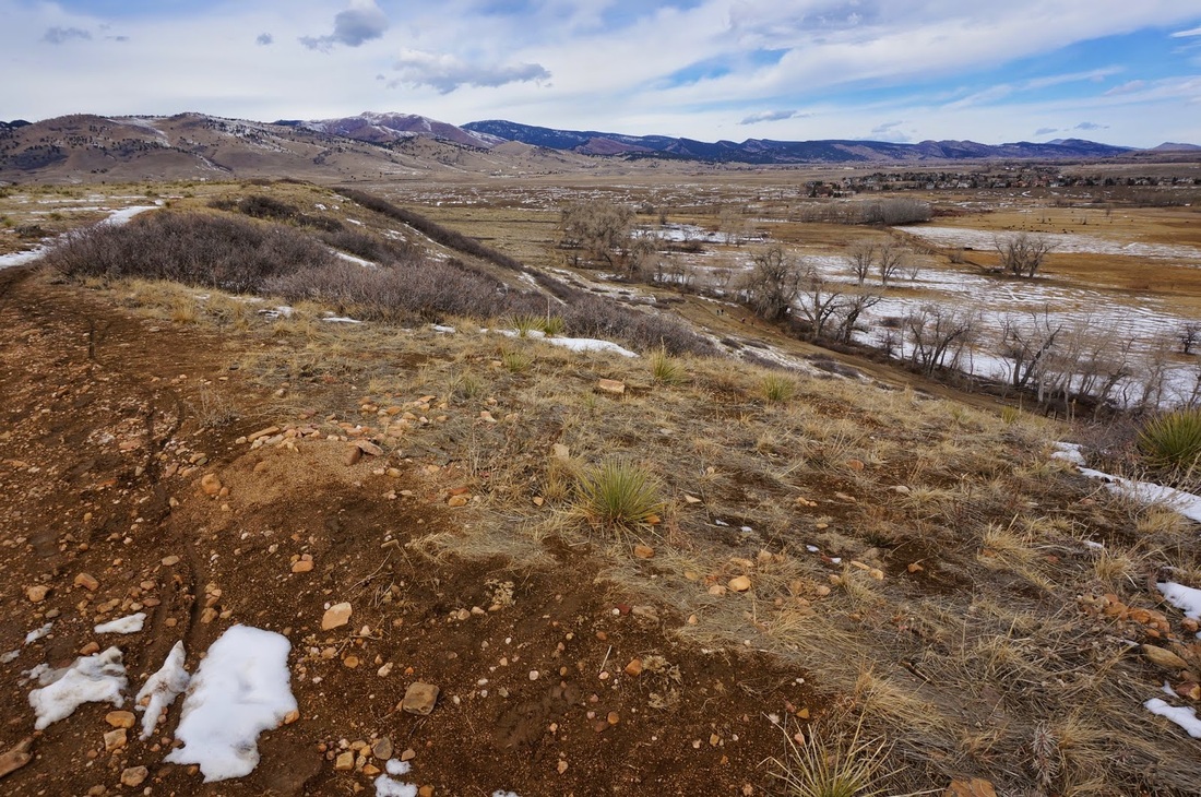
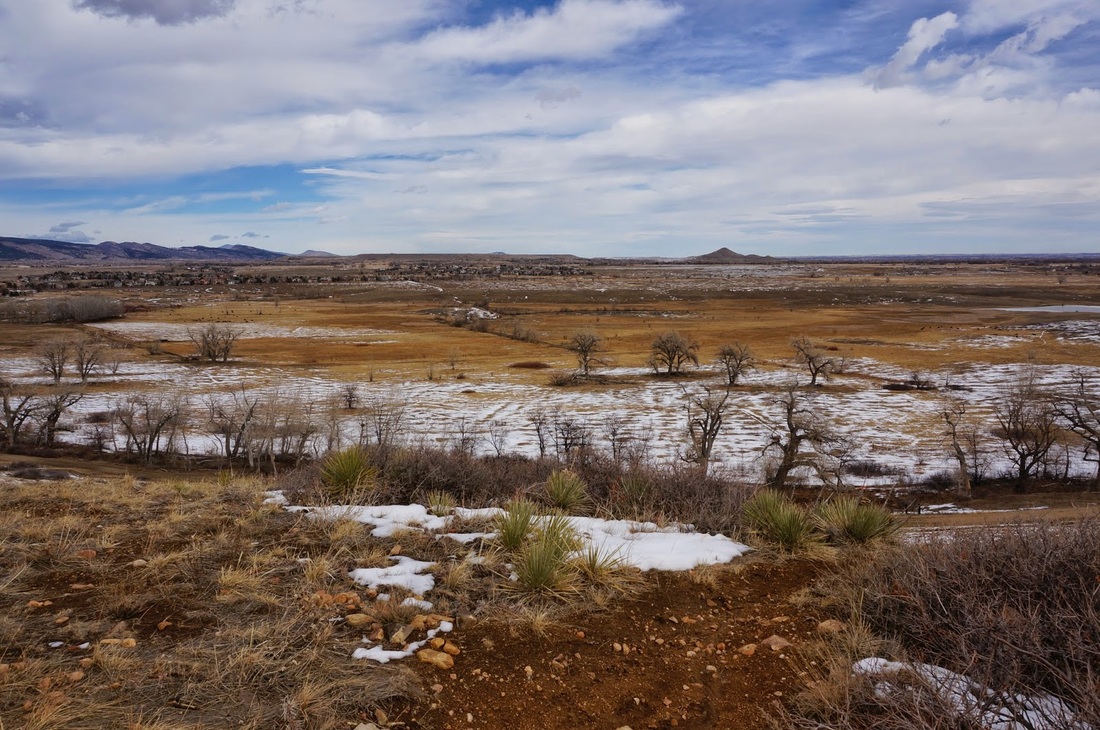
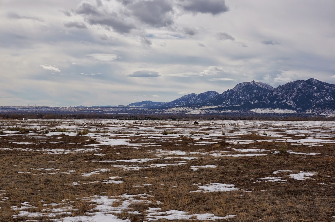
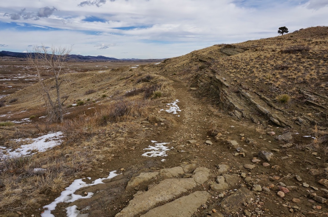
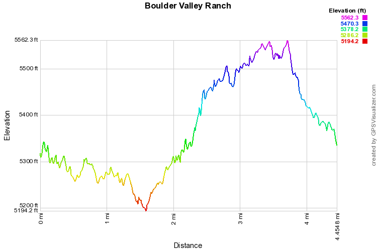
Boulder Valley Ranch is a popular open space park just east of Hwy 36.  The trails are mostly flat but climb some rolling hills.  There are great views of the Boulder Foothills and some scenic ponds along the way.  Avoid hiking here in March however as it becomes a mud pit.  The main loop starts by leaving the parking area, heading east, on the Sage Trail, when you reach the junction with the Eagle Trail, turn right and start heading back to the southwest.  You'll pass BVR Pond 1, which has some nice views looking back towards Boulder.  When you reach the junction with the Sage Trail, you can either turn right and head back to the trailhead, or continue on the Eagle Trail for another 1.2 miles along a ridge to the Cobalt Trail.  When you reach the Cobalt Trail, descend the ridge and cut back east for just under a mile back to the trailhead.

There are many options here to make a longer hike if you so wish, but this main loop makes for a very pleasant, if not crowded or muddy, hike along the plains northeast of Boulder. 
© Go Hike Colorado, 2020.  All Rights Reserved. 
Use of photographs without prior authorization is
​strictly prohibited.


Contact us at:
[email protected]
Legal Disclaimer - Information provided on this site is based upon our own observations, always double check information with the appropriate land management agency before heading into the backcountry.  Backcountry travel is inherently dangerous, please take all proper precautions.  Go Hike Colorado is not responsible for injury or incident.