|
Directions: The South Rim of Black Canyon of the Gunnison National Park is located north of Hwy 50 in between Gunnison and Montrose. From either direction, turn north on 347 at the sign for the park.
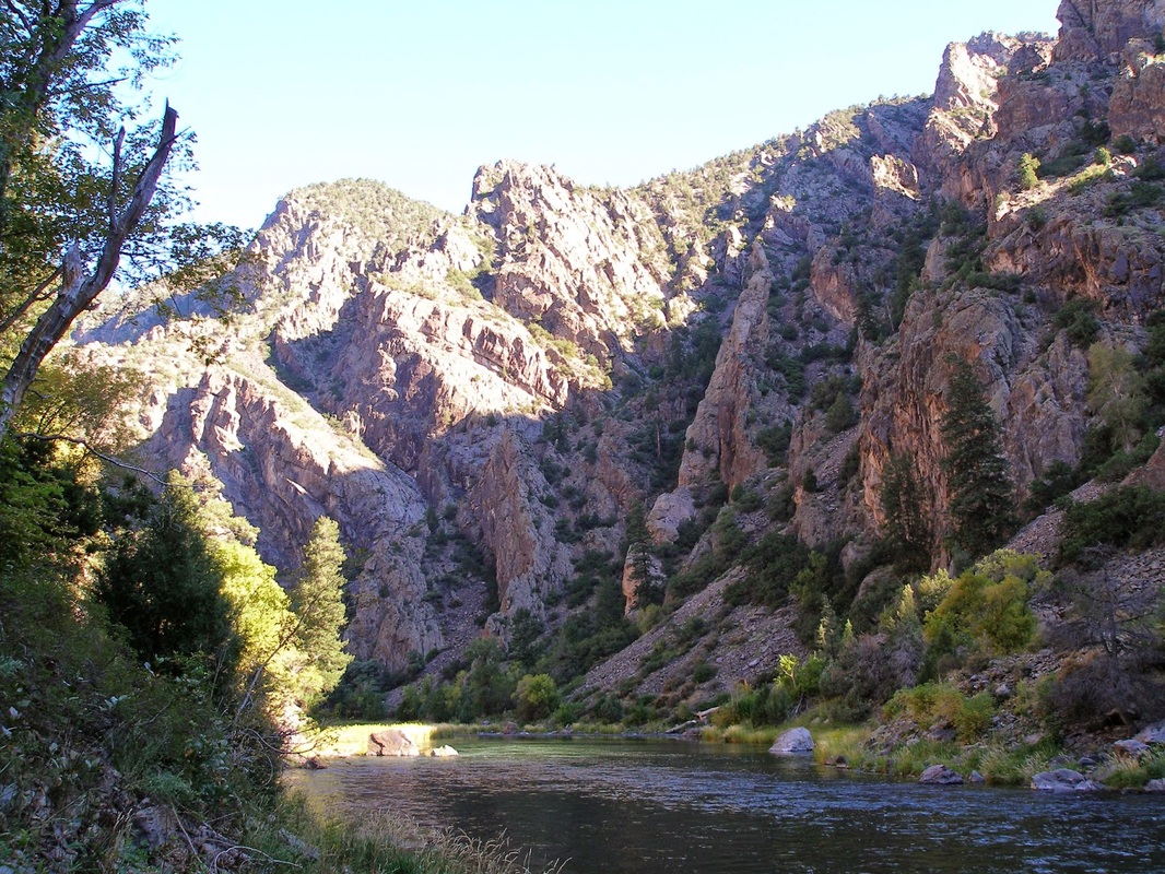
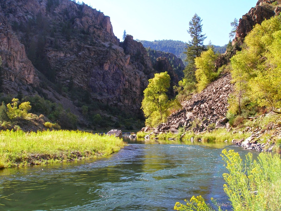
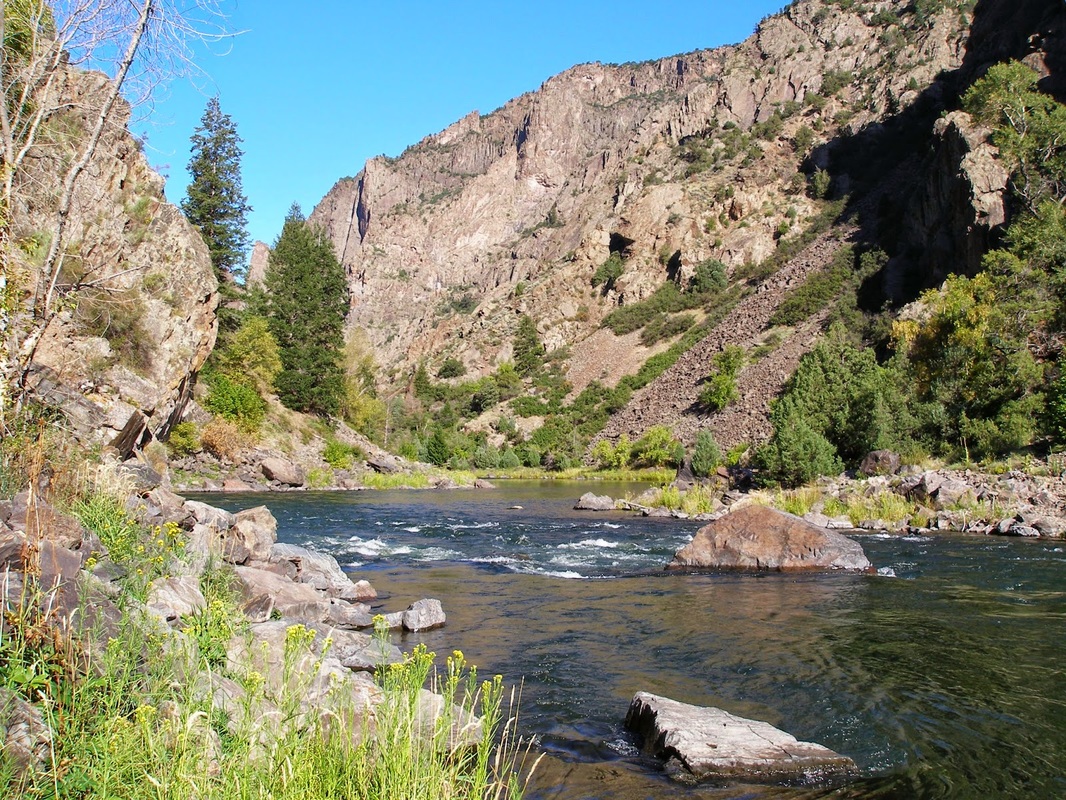
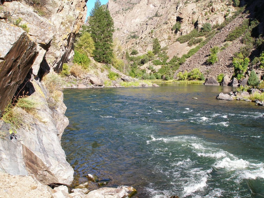
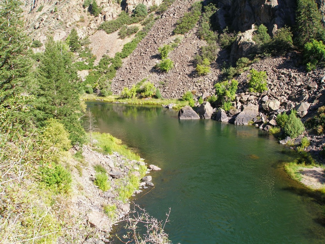
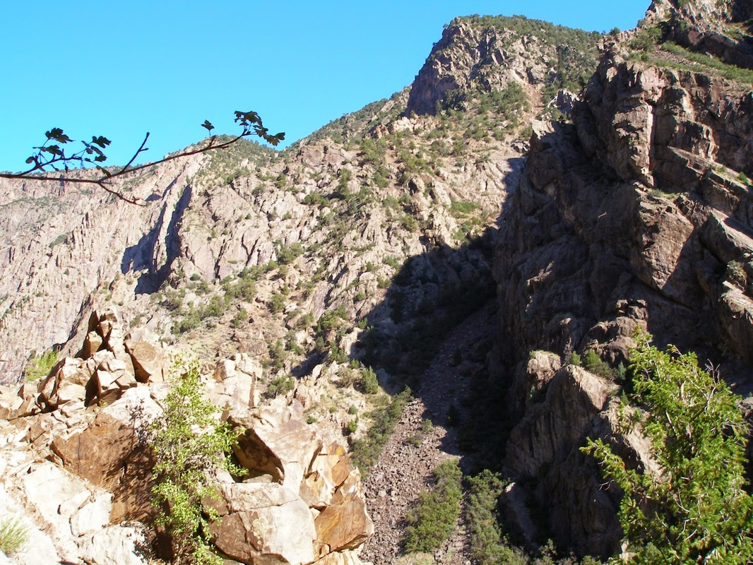
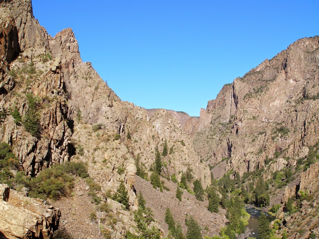
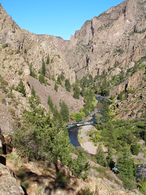
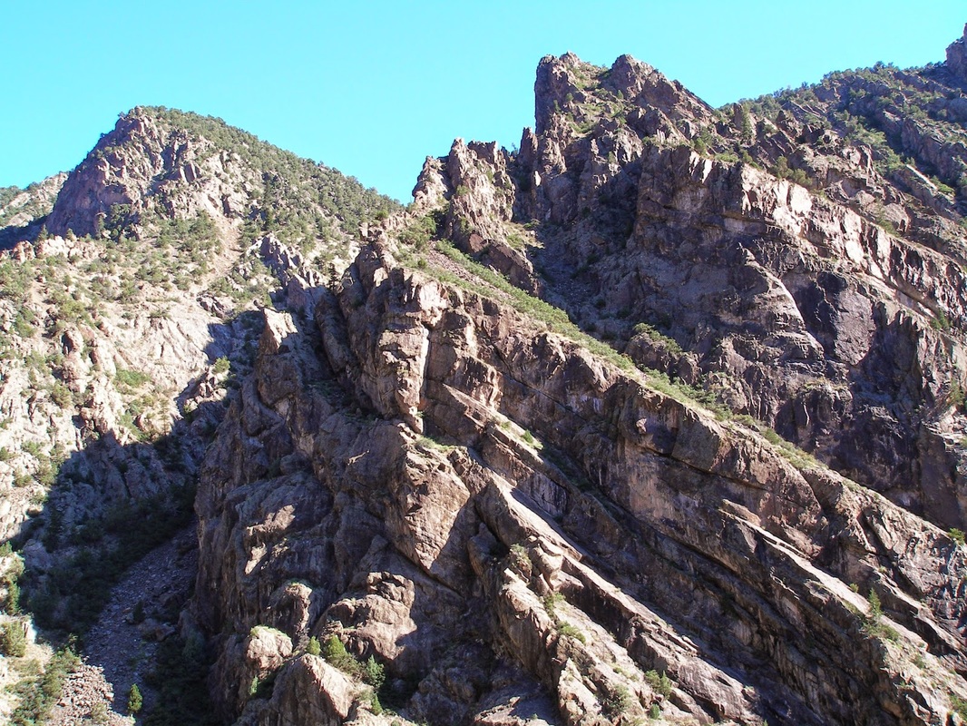
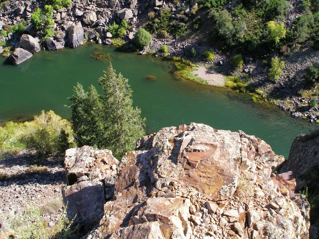
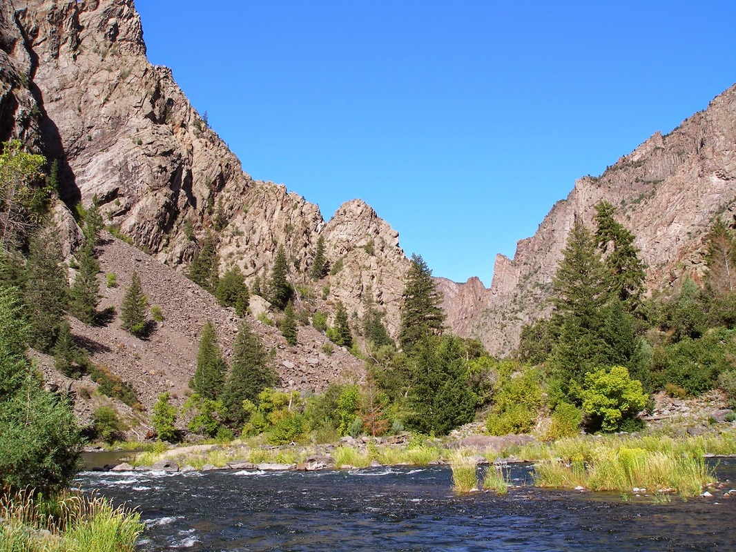
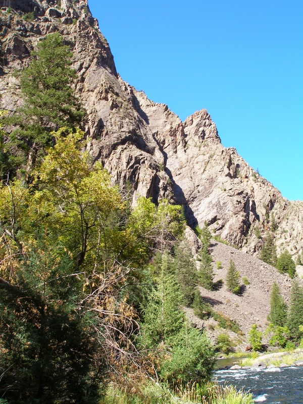
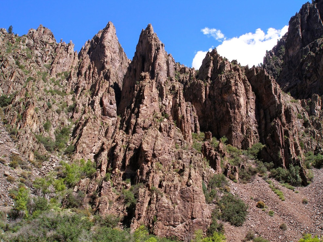
The Devil's Backbone Trail is the only trail along the Gunnison River that does not require you to take one of the steep, steep, steep inner canyon routes to reach. The trail starts from the East Portal Trailhead. The 1st .5 mi or so of the trail is easy enough. It is a pleasant river-side stroll with the ever narrowing canyon walls towering on either side. When the trail starts to head up the south wall of the canyon, things get fun... The route climbs up a diamond shaped ridge called the Devil's Backbone. The climb requires scrambling and route finding. It can be difficult to find your way as the route itself is not clearly defined. There are some wonderful viewpoints here, but be careful. If you find your way across the Devil's Backbone, you can pick your way into the canyon for another mile or two until it gets so steep and narrow that you need to stop. This is a terrific way to get a close up view of the Canyon and the Gunnison River but it is not easy and you should not attempt this trail alone. |
|
- HOME
- ABOUT
-
HIKES BY REGION
-
NATIONAL PARK HIKES
- BENT'S OLD FORT NATIONAL HISTORIC SITE
- BLACK CANYON OF THE GUNNISON NATIONAL PARK
- COLORADO NATIONAL MONUMENT
- CURECANTI NATIONAL RECREATION AREA
- DINOSAUR NATIONAL MONUMENT
- FLORISSANT FOSSIL BEDS NATIONAL MONUMENT
- MESA VERDE NATIONAL PARK
- ROCKY MOUNTAIN NATIONAL PARK
- GREAT SAND DUNES NATIONAL PARK
- HOVENWEEP NATIONAL MONUMENT
- SAND CREEK MASSACRE NATIONAL HISTORIC SITE
- YUCCA HOUSE NATIONAL MONUMENT
- HIKES BY CATEGORY
- NEWS
- WEBCAMS
- $UPPORT GHC
- INTERACTIVE MAP
Devil's Backbone
Black Canyon of the Gunnison National Park
Distance: 1 mi (RT) or more on backcountry routes
Elevation: 6,547ft
Managing Agency: National Park Service
Fee: Yes, $15