Spring Creek Canyon Overlook
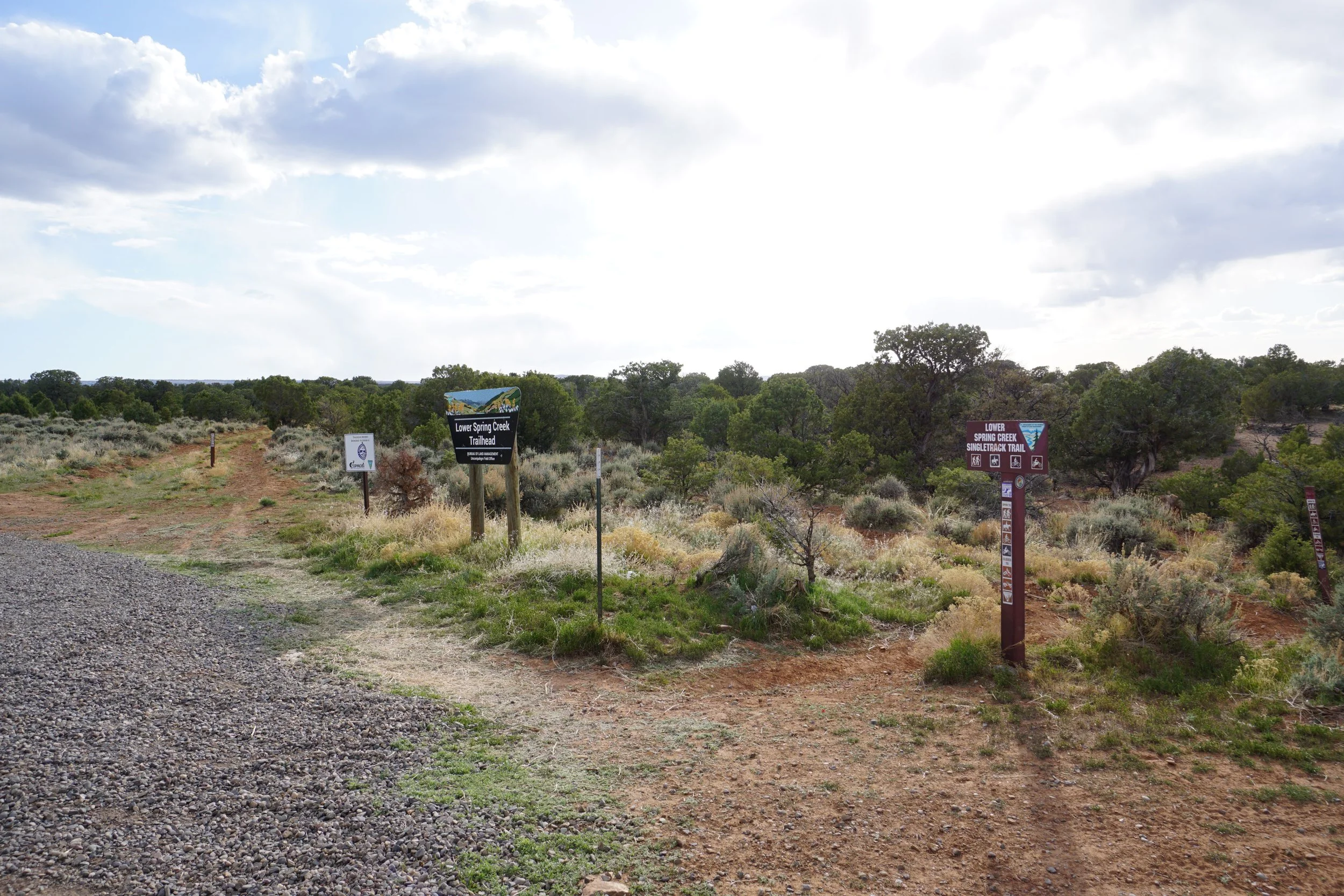
Lower Spring Creek Trailhead, BLM Public Lands
Date Hiked: May 4, 2024
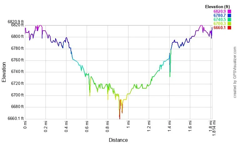
Distance: 1.8 mi (RT)
Elevation Gain: 115 ft
Elevation Min/Max: 6,697 to 6,810 ft
Trailhead Lat/Long: 38.38438, -107.94050
Managing Agency: Bureau of Land Management (BLM)
Fee: None
DIRECTIONS:
From the intersection of Hwys 550 and 90 in Montrose, head west out of town on Hwy 90. Follow 90 as it turns left, then right. Then turn left (south) onto Dave Wood Road. Dave Wood Road takes you south to the Spring Creek Canyon area. Pass the Mailbox trailhead and continue for about 3 miles to the Lower Spring Creek Trailhead on the right.
HIKE DESCRIPTION:
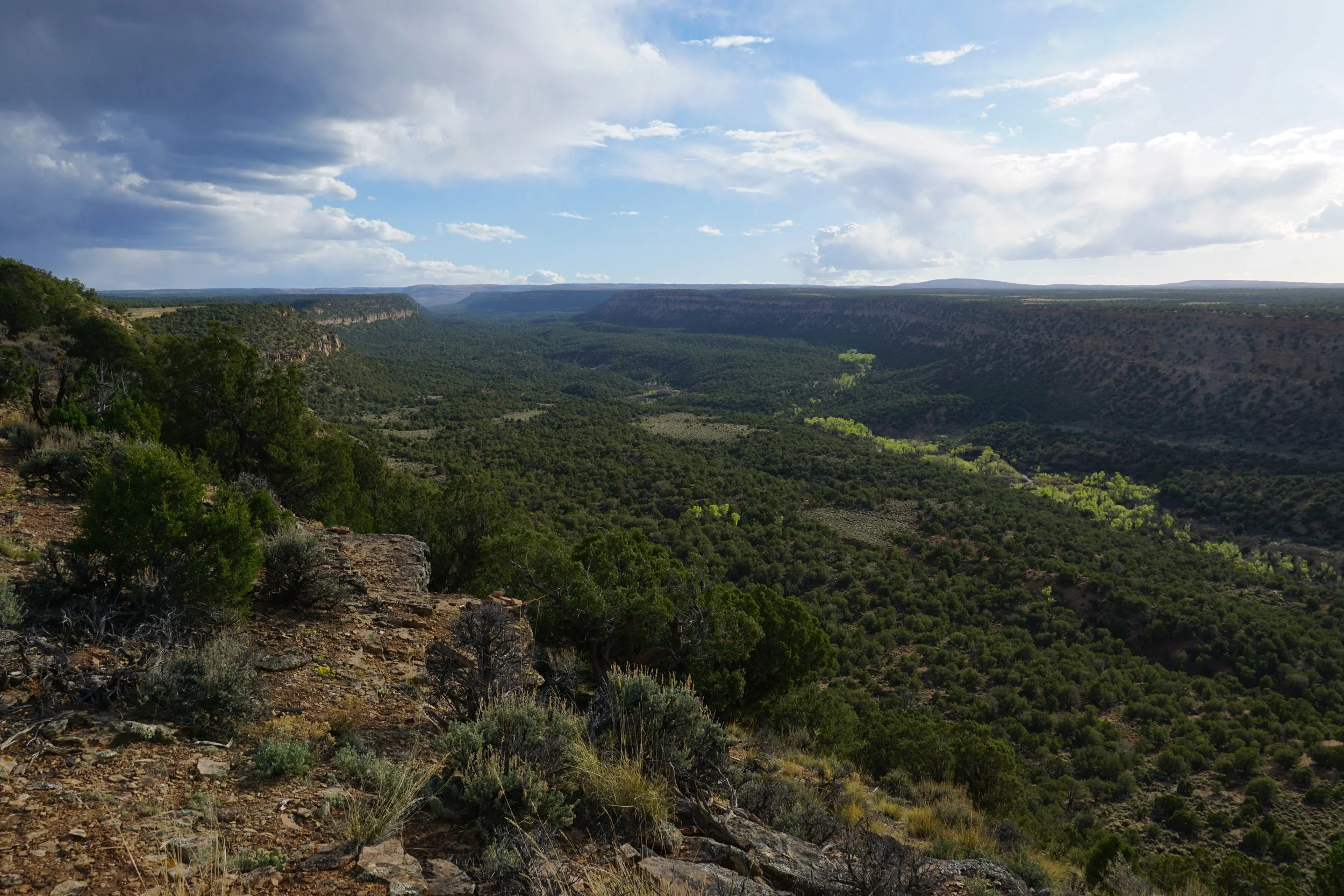
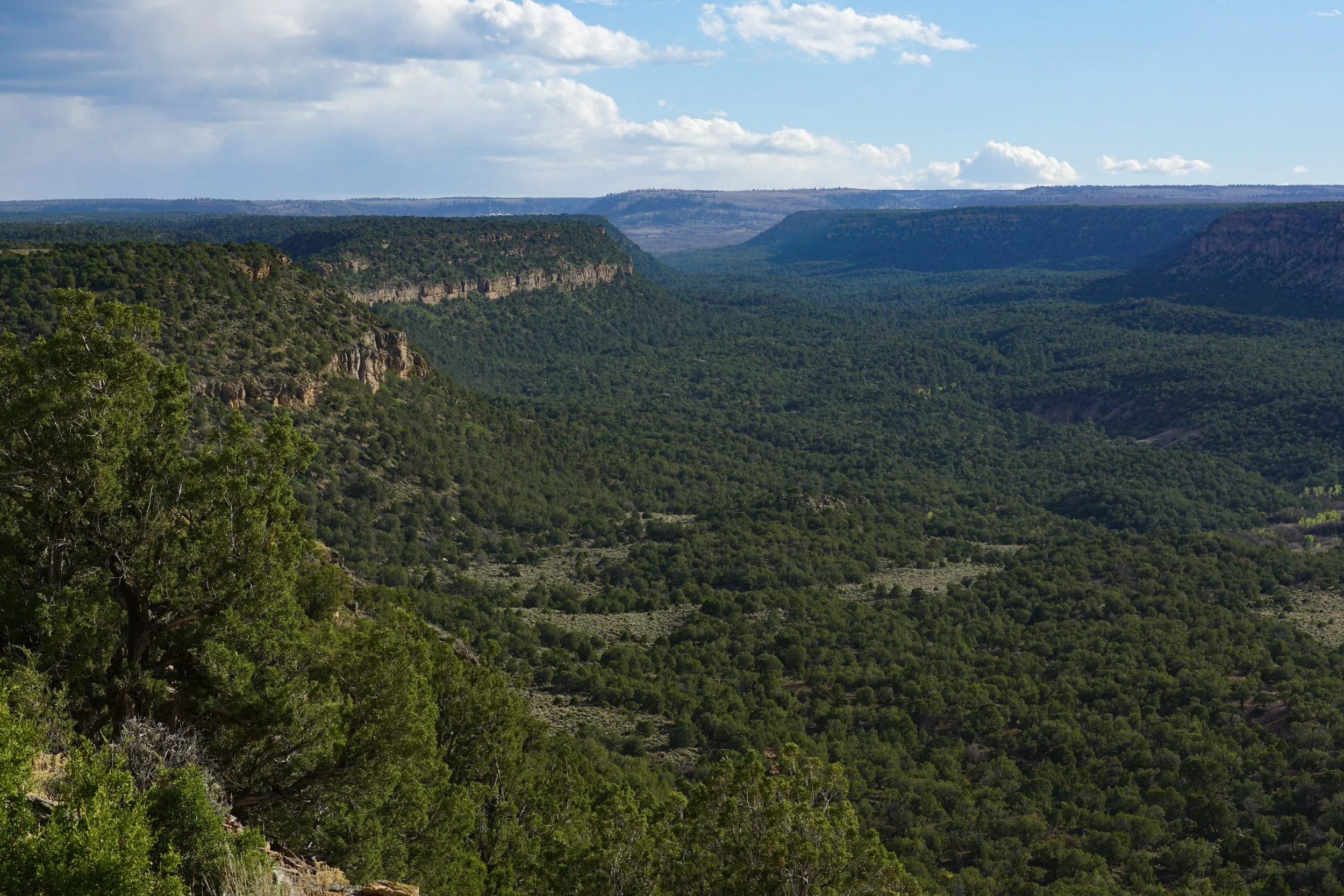
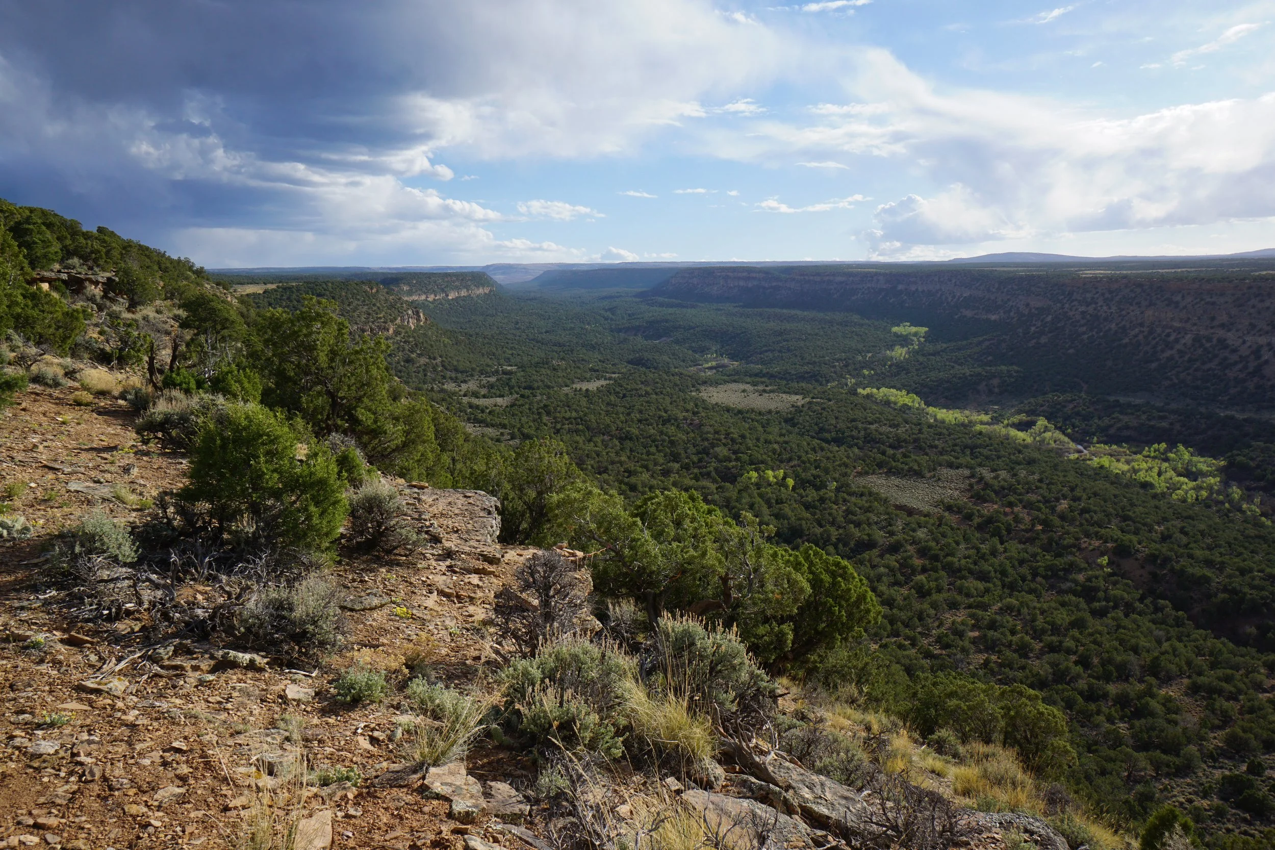
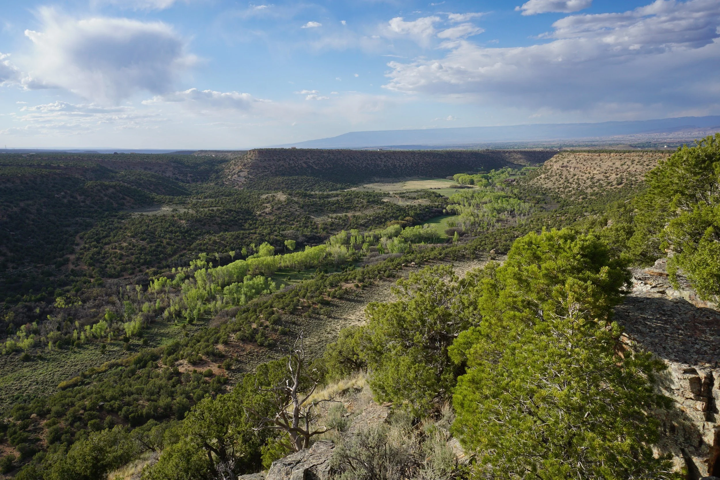
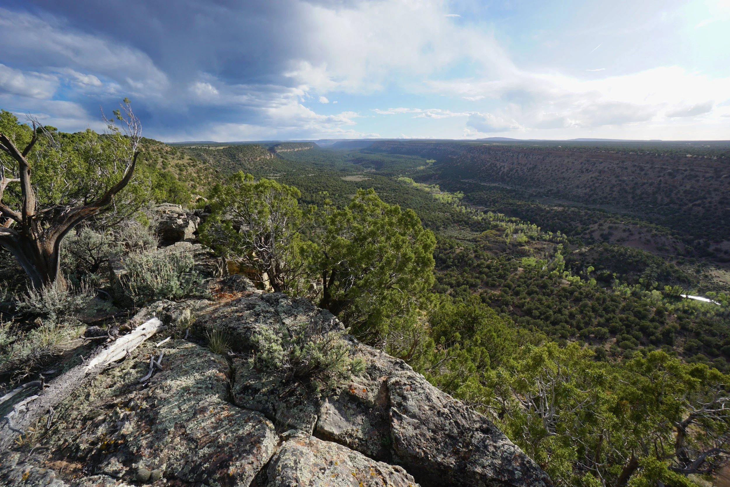
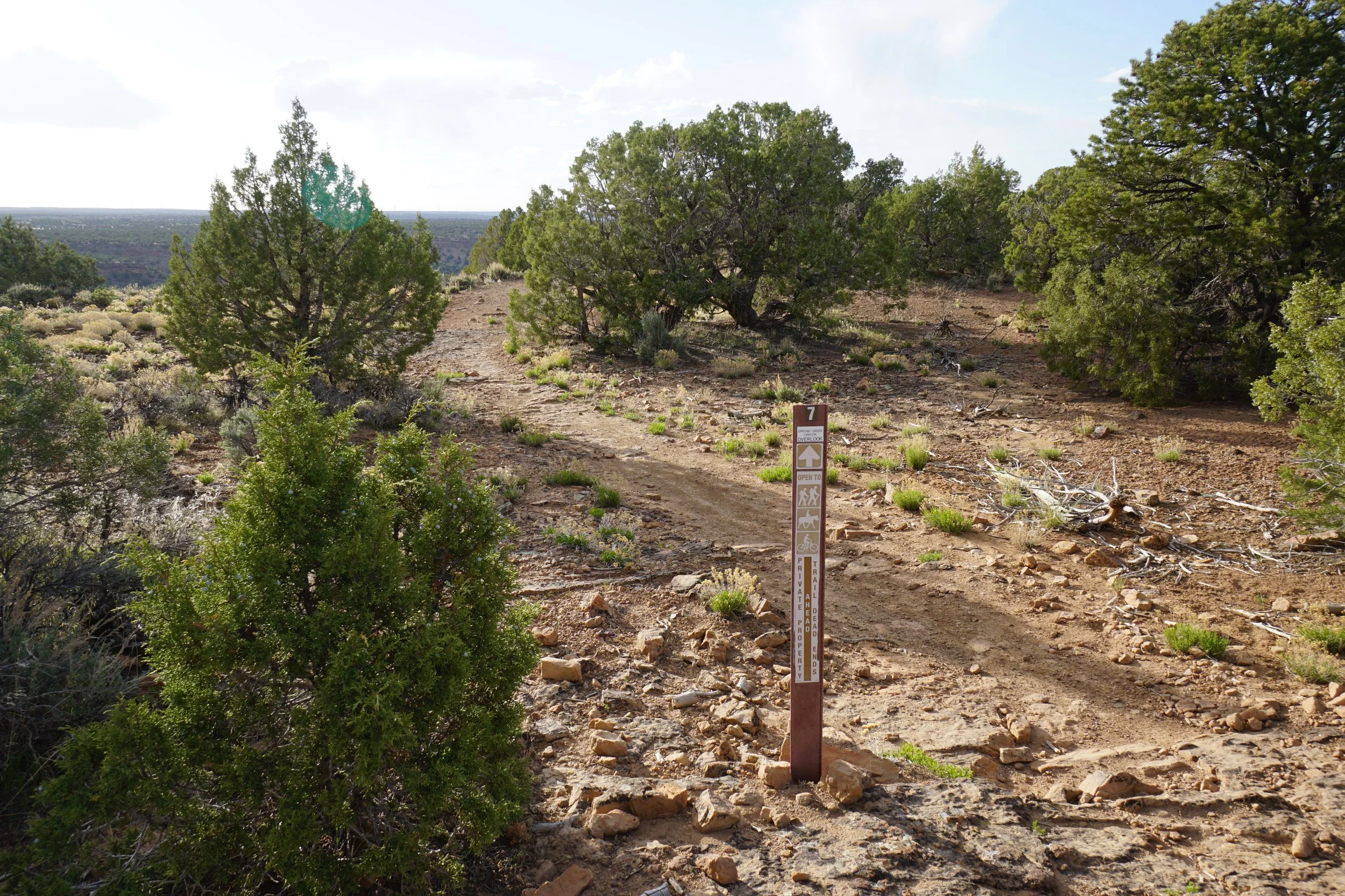
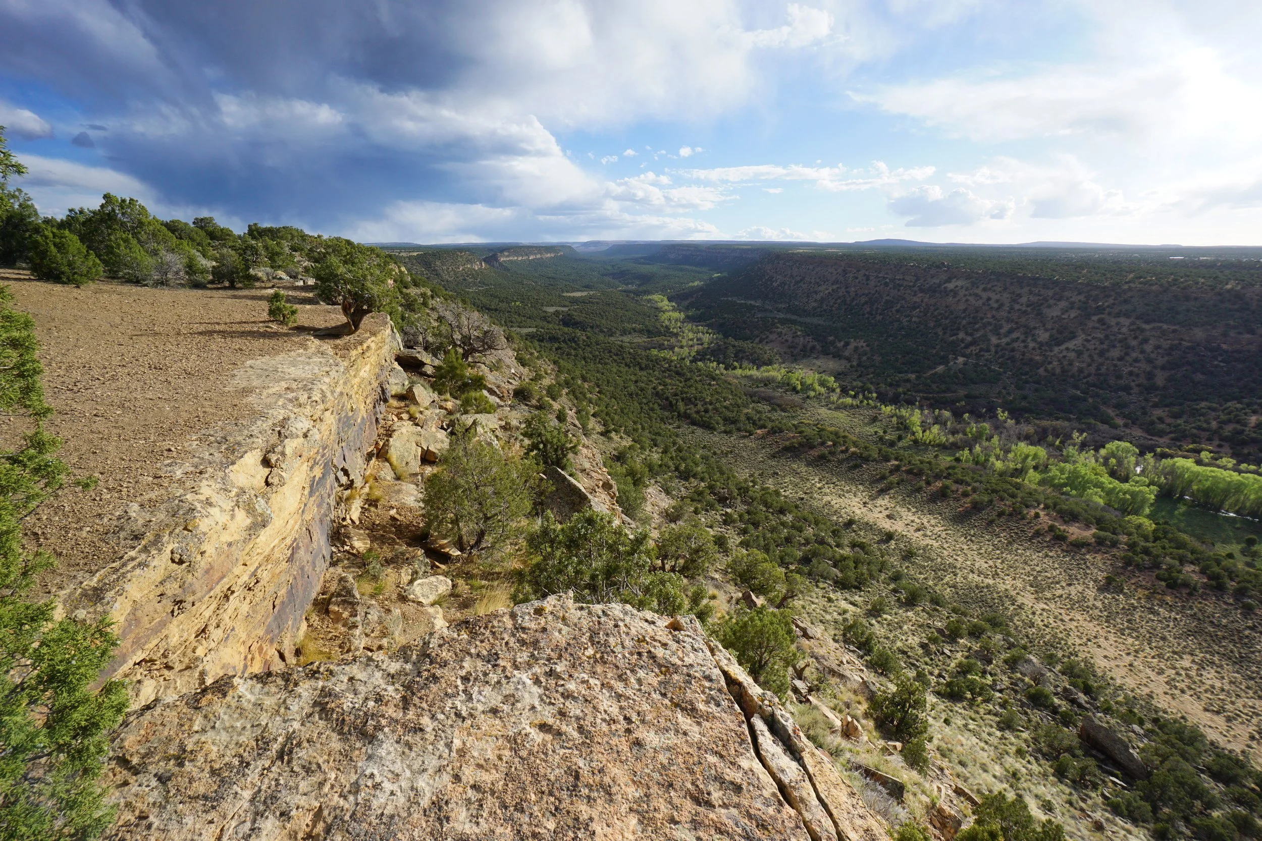
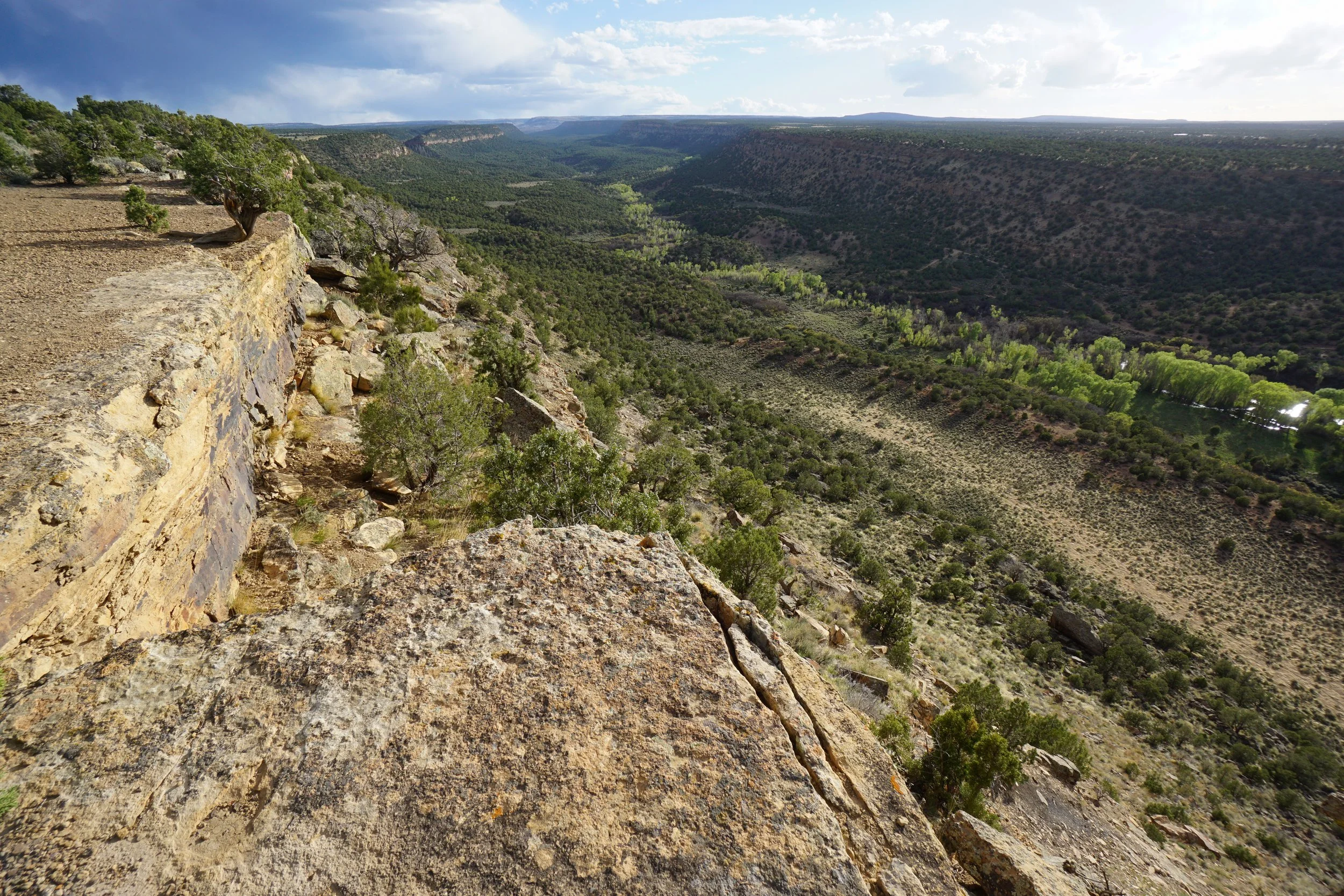
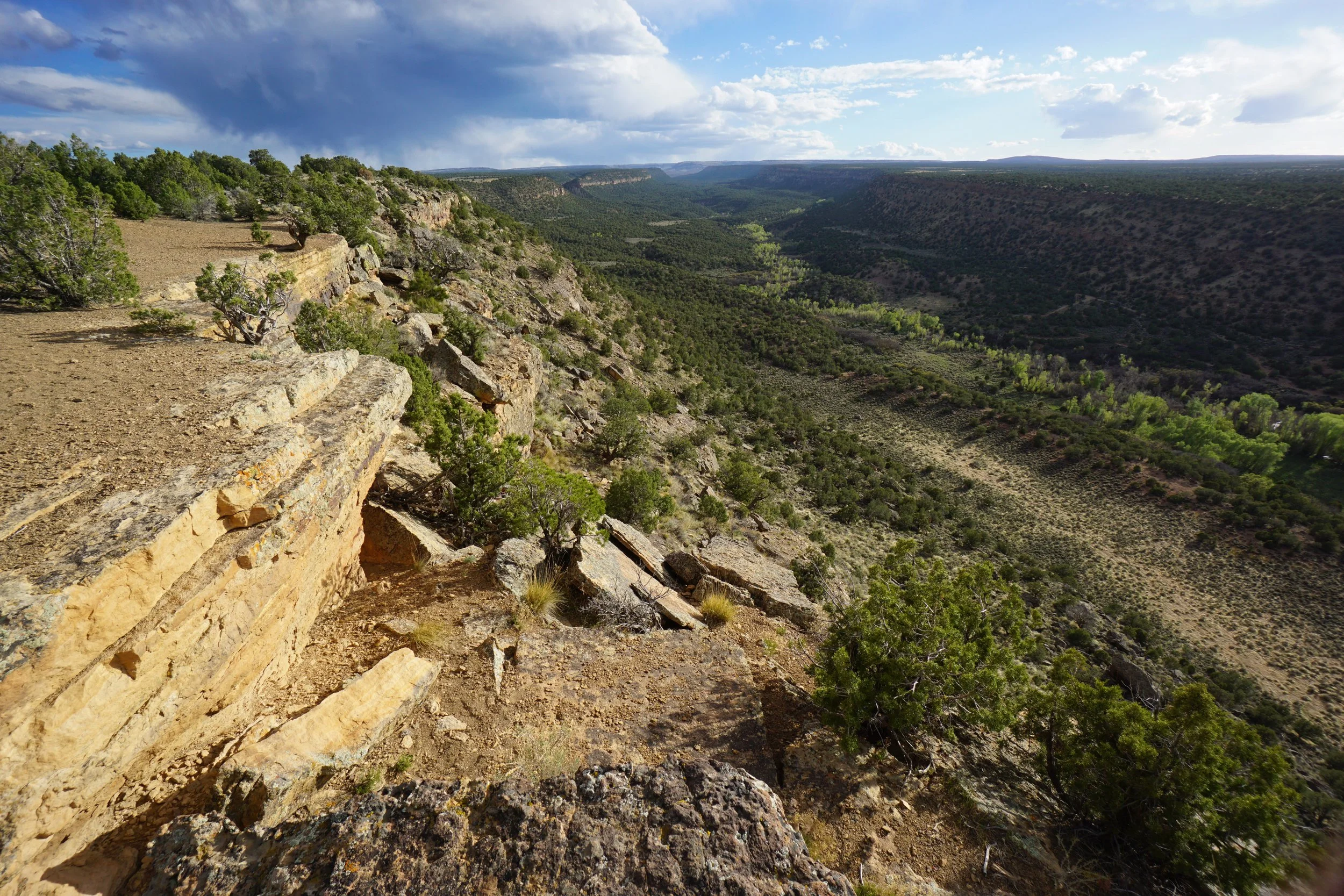
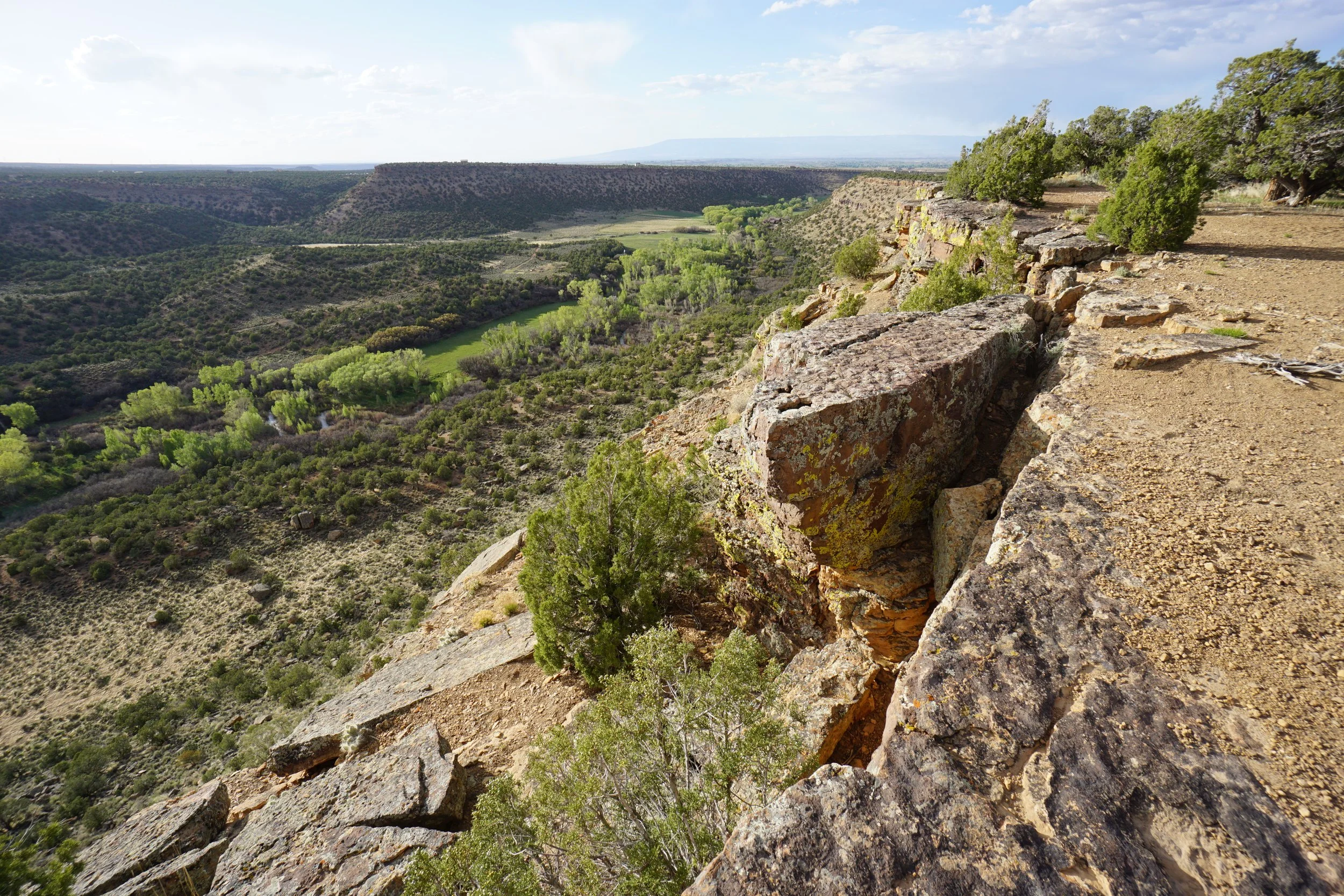
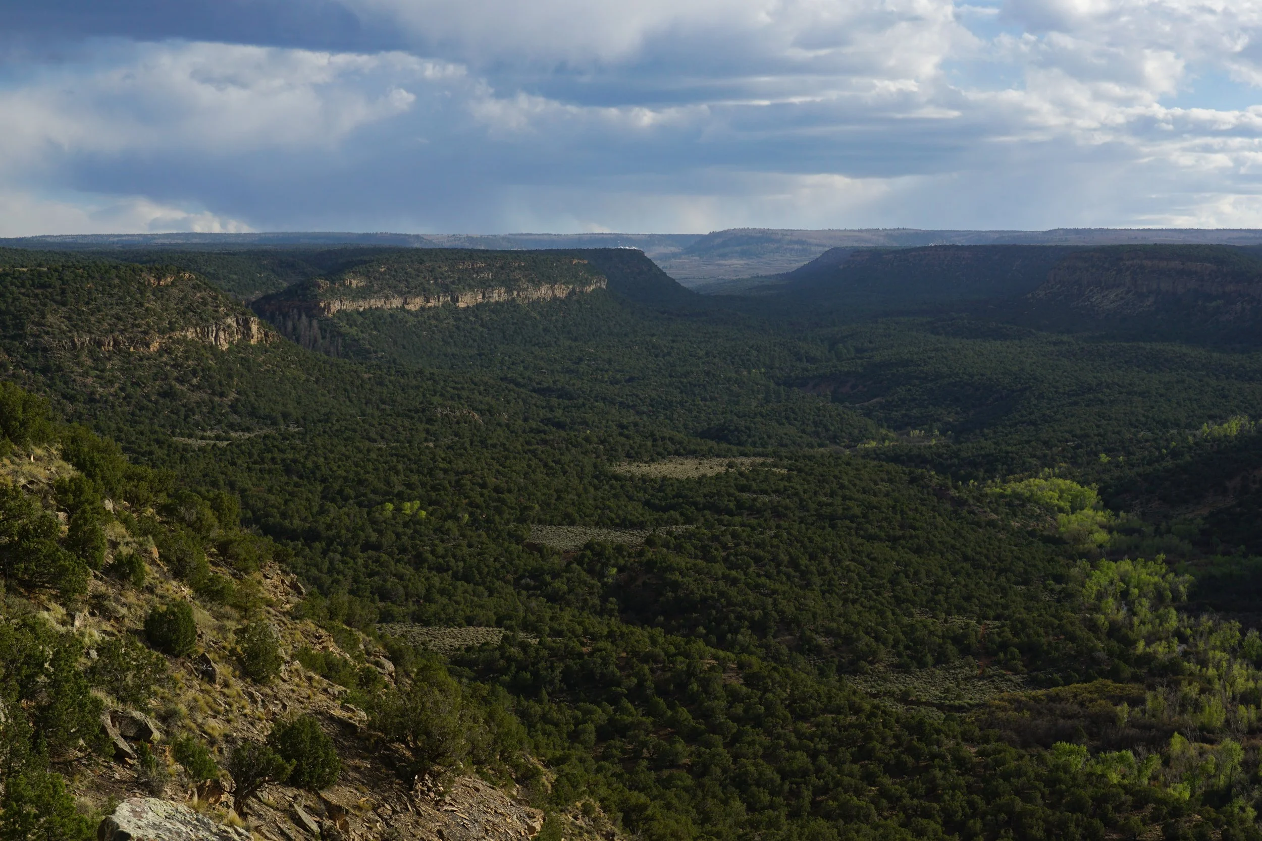
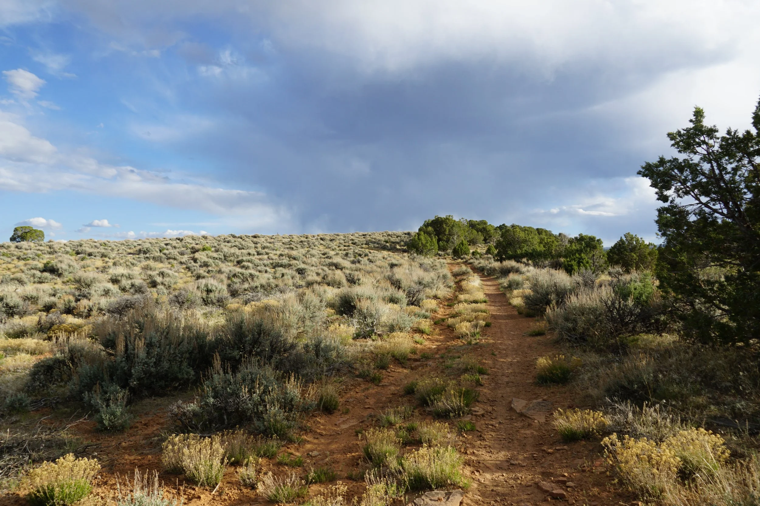
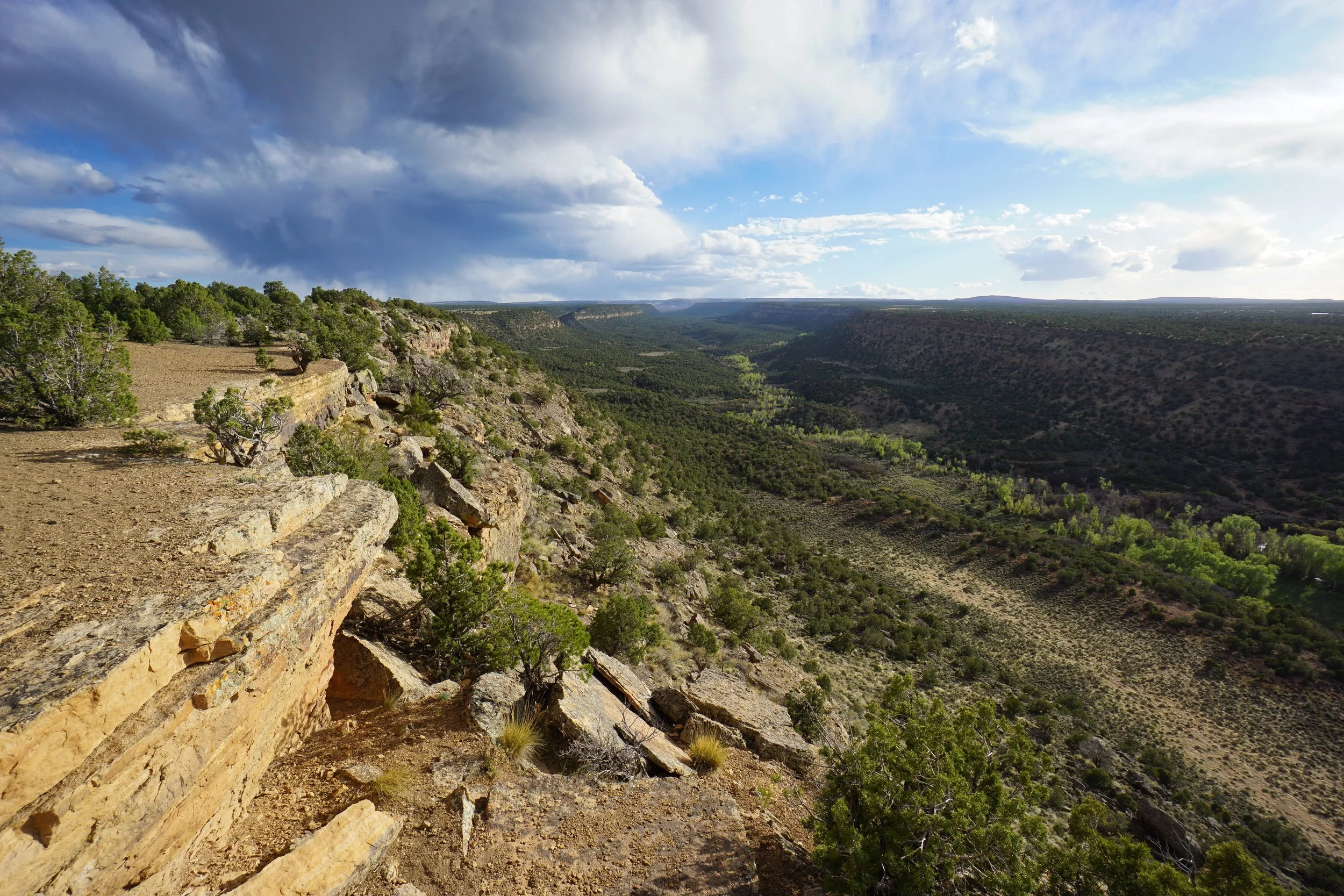
Spring Creek Canyon stretches out from the hills west of Montrose to the Uncompahgre Plateau. It is a beautiful canyon with miles of hiking trails both on the rim and down into the canyon below. The Dakota Rim Trail to the Spring Creek Canyon Overlook is a quick way to get some massive views of the canyon in what is known as the Buzzard Gulch Area. The hike begins at the Lower Spring Creek Trailhead.
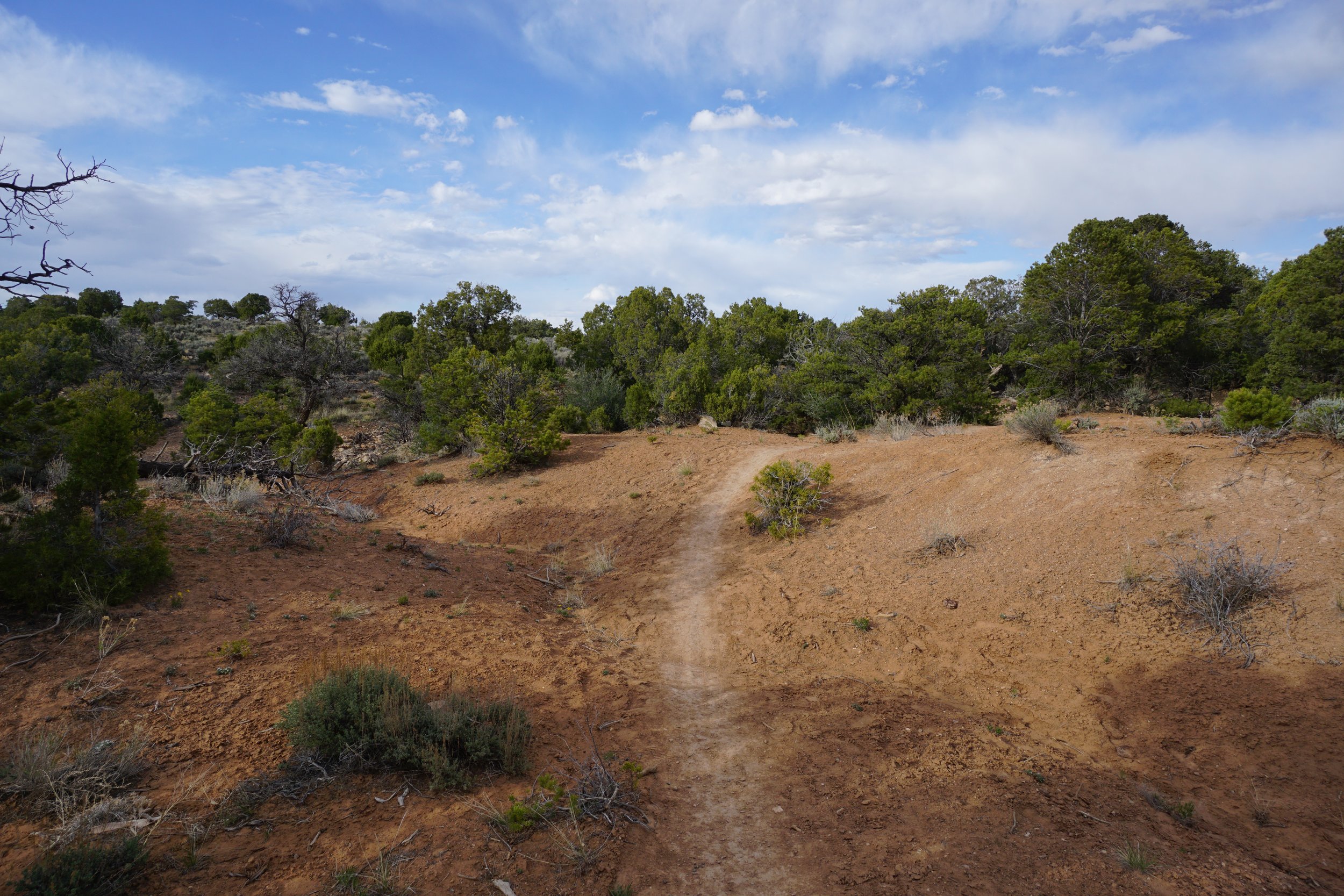
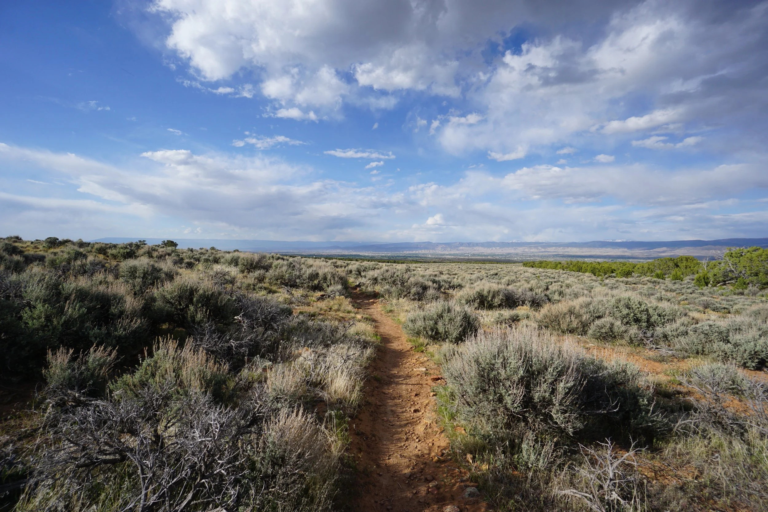
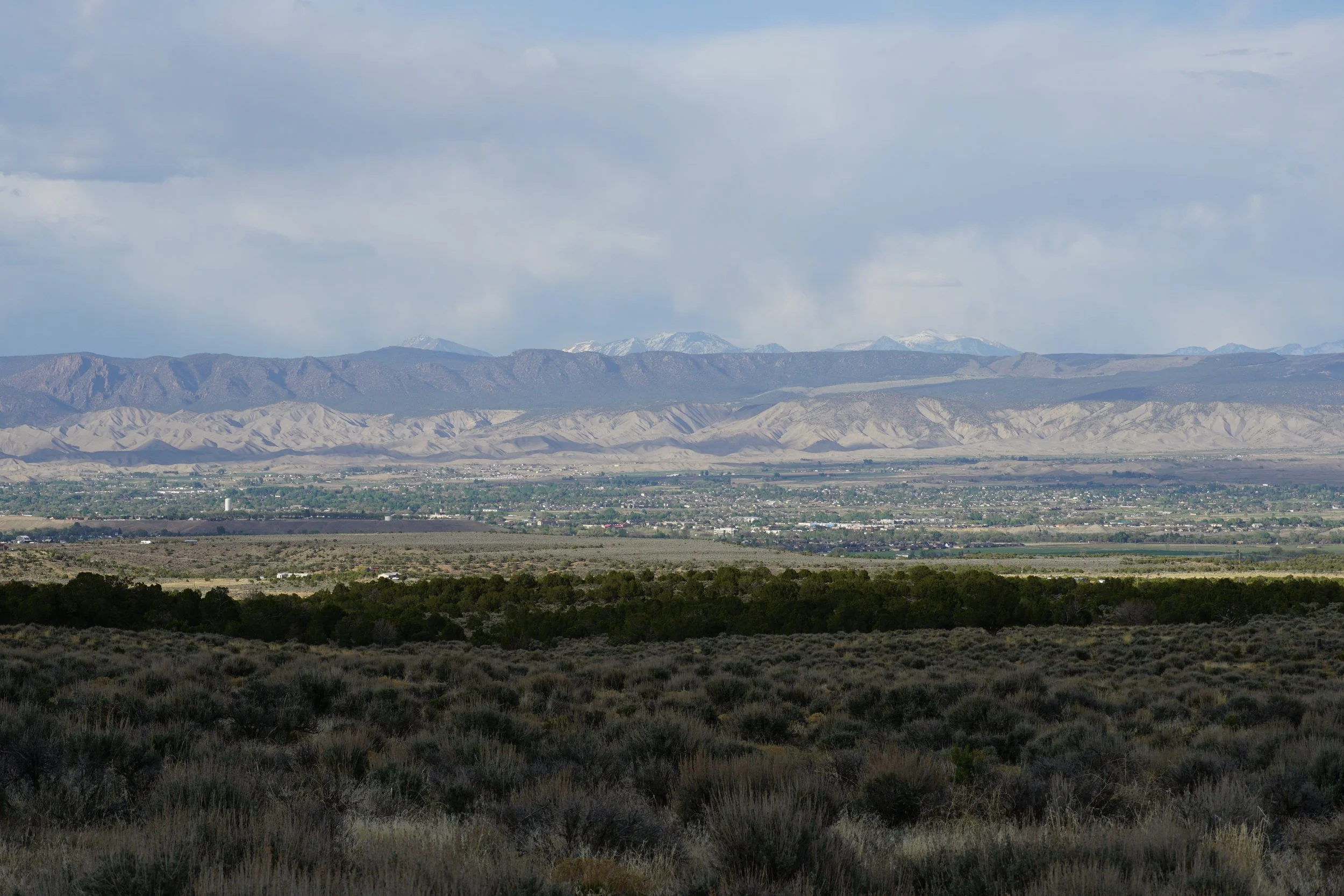
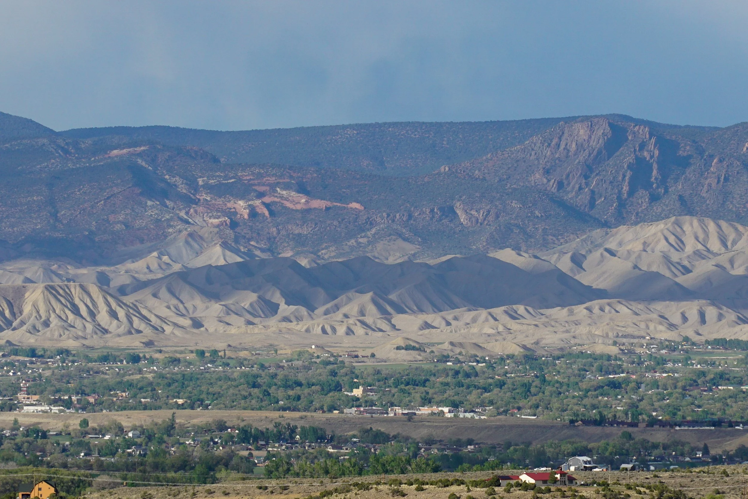
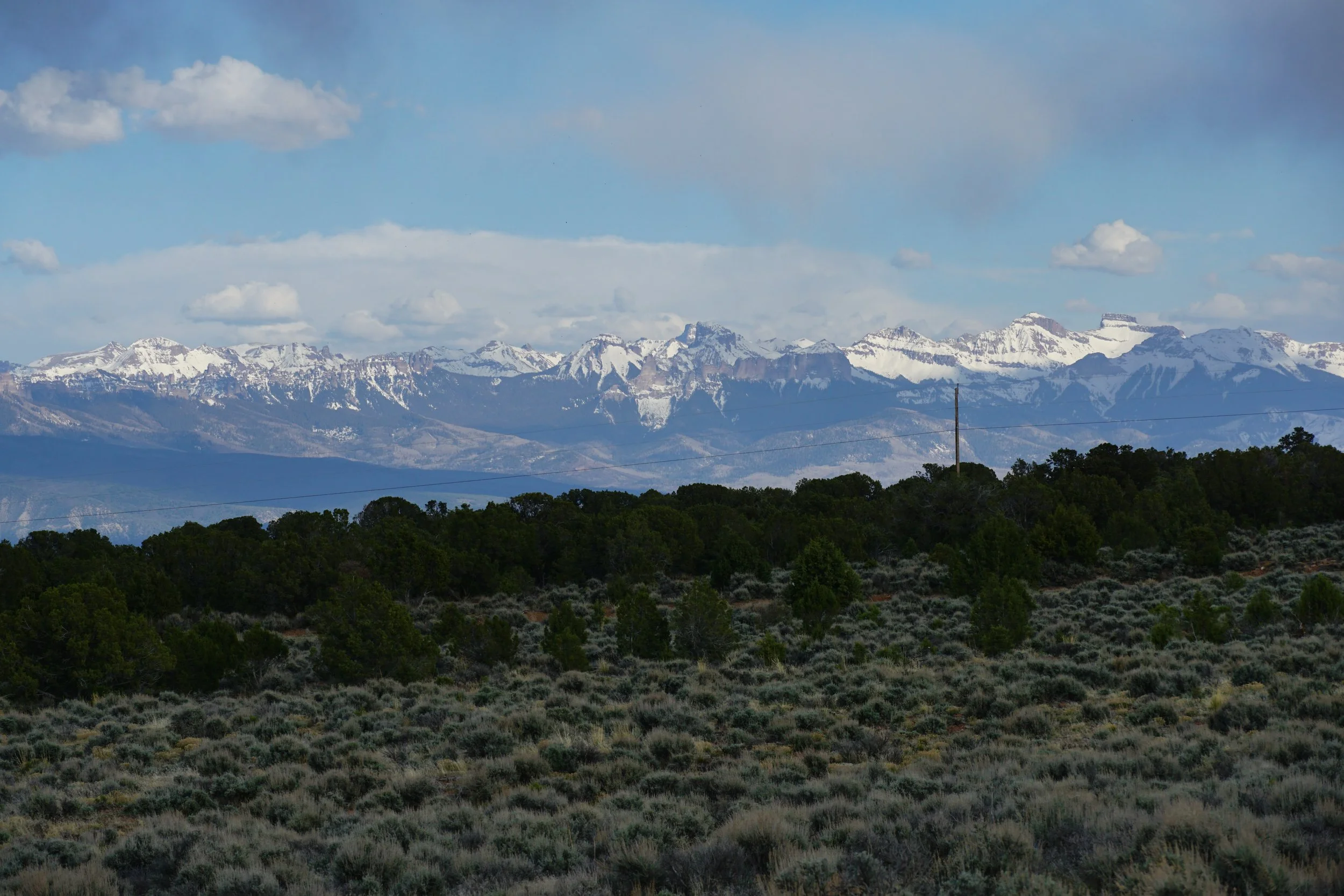
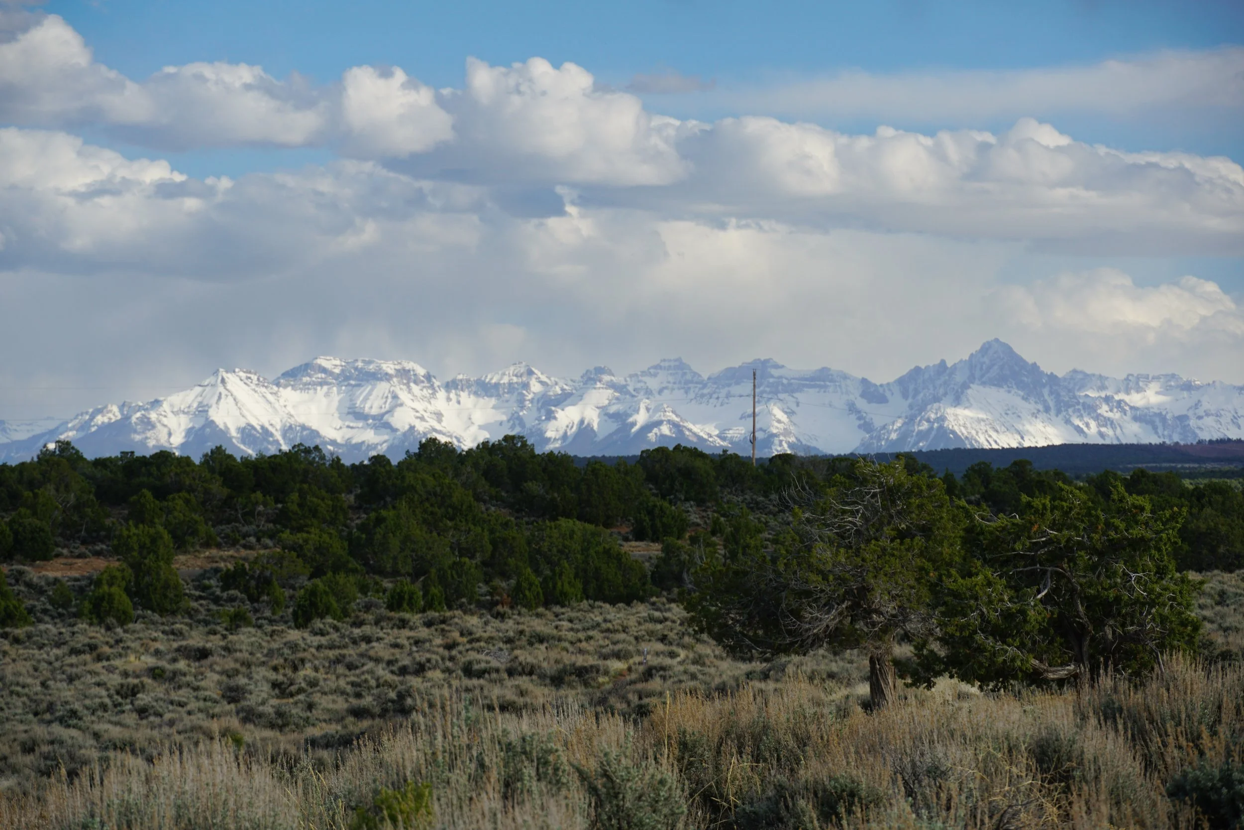
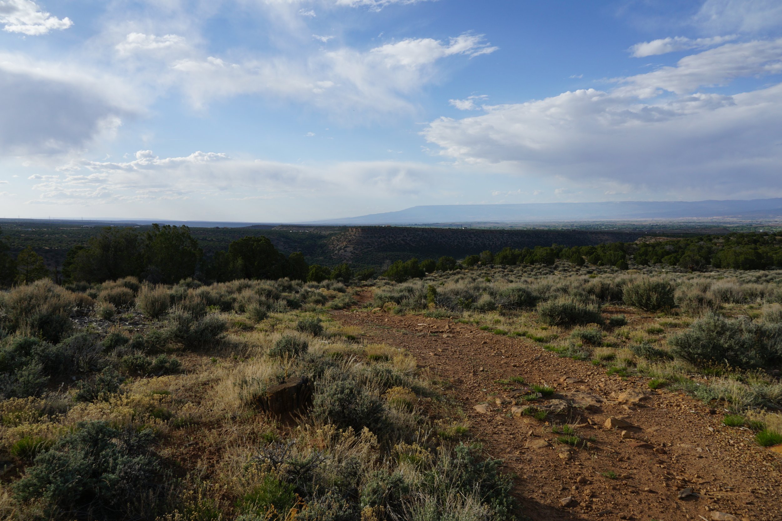
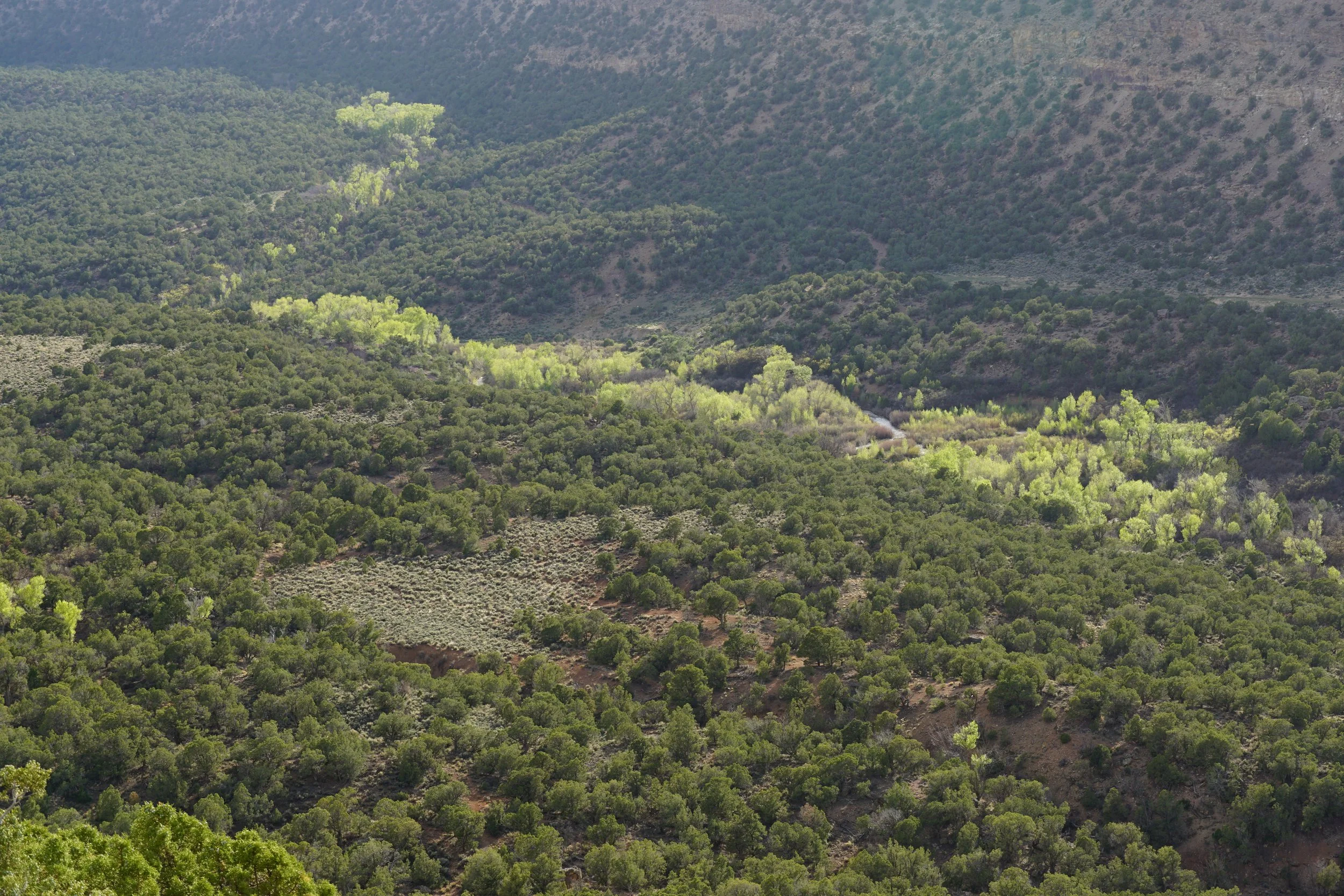
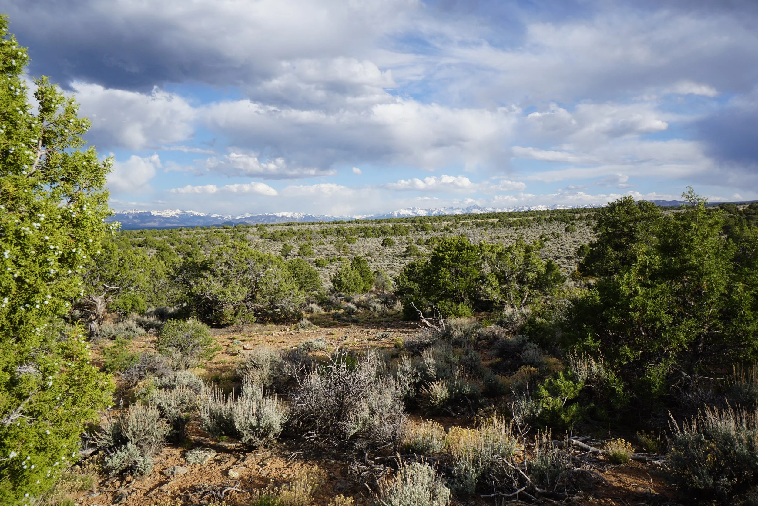
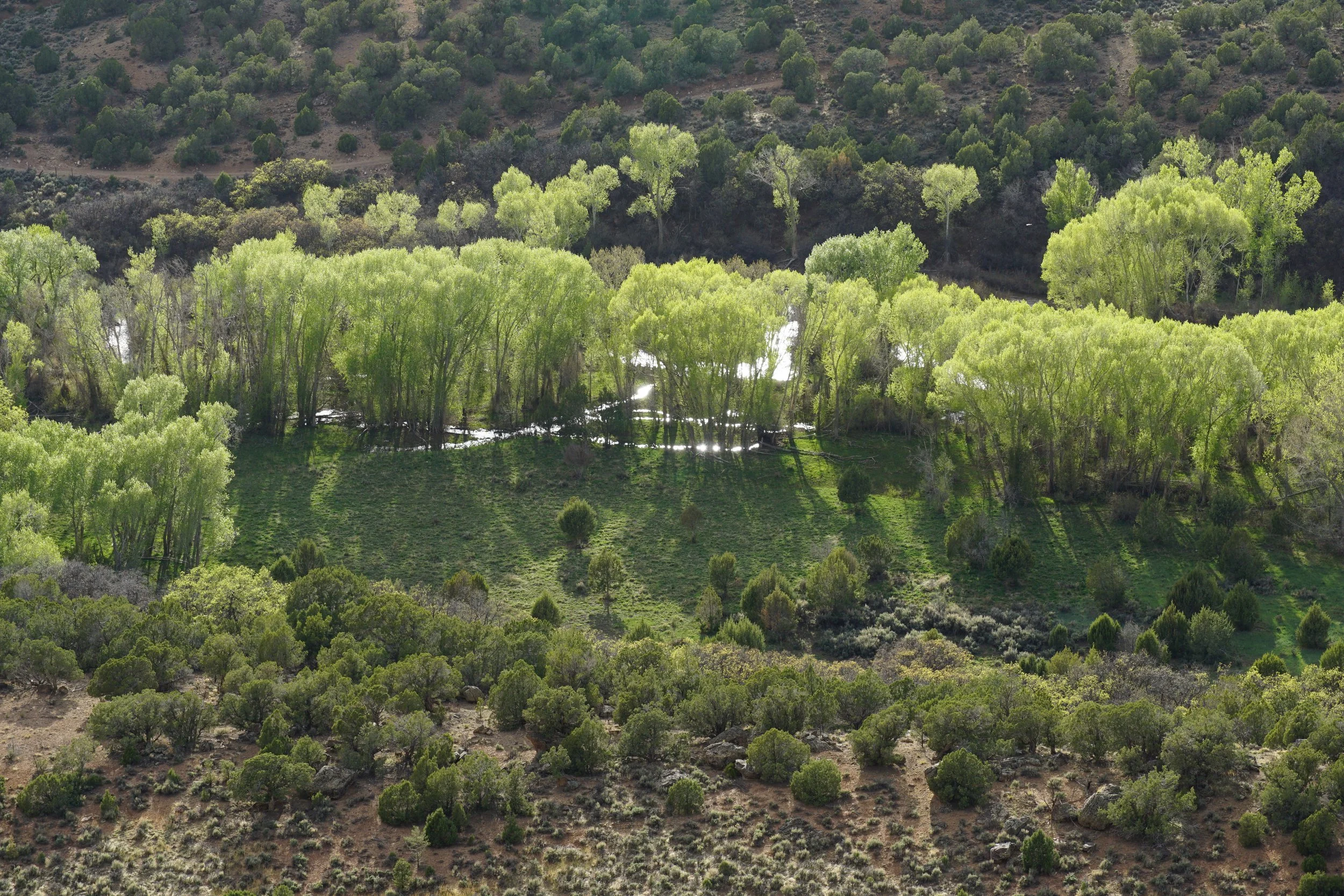
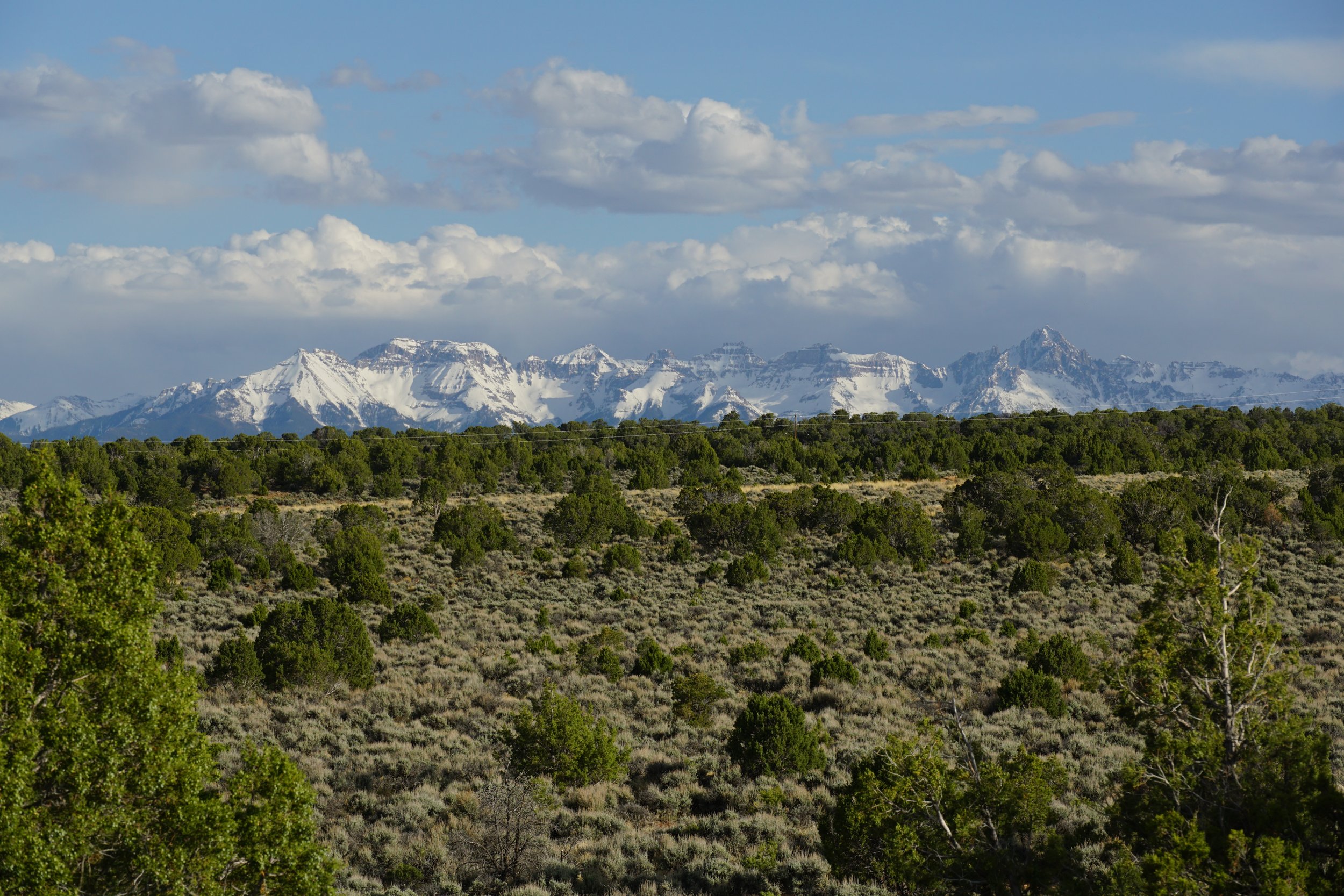
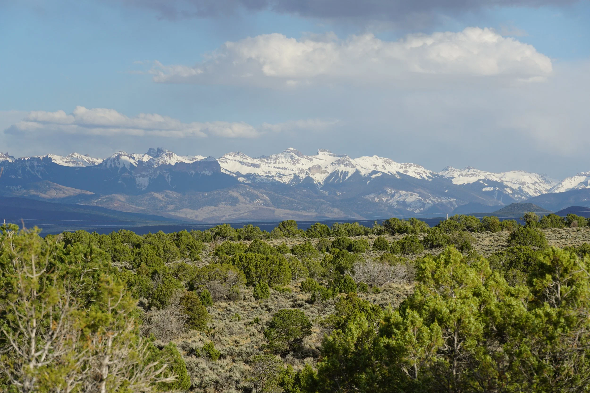
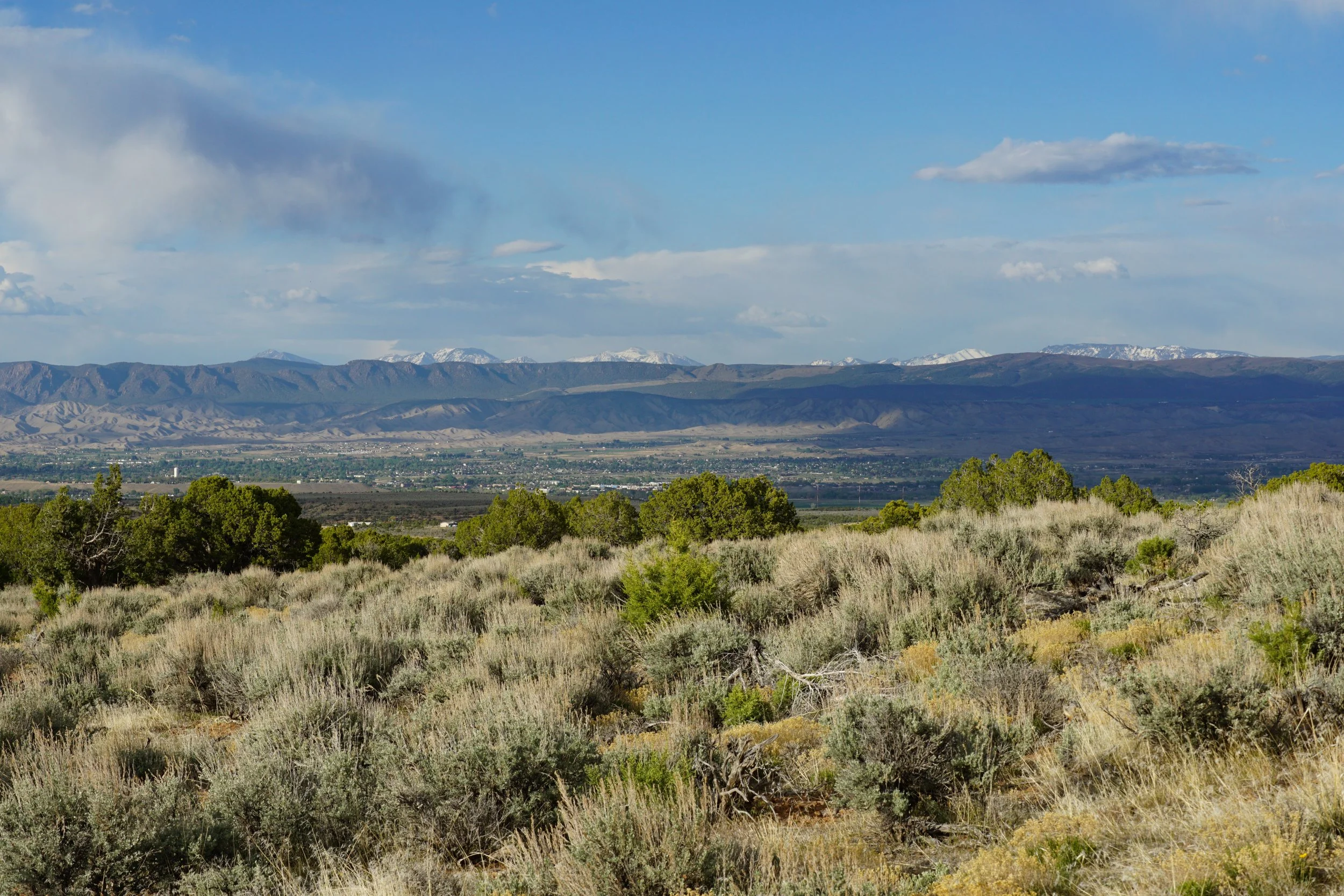
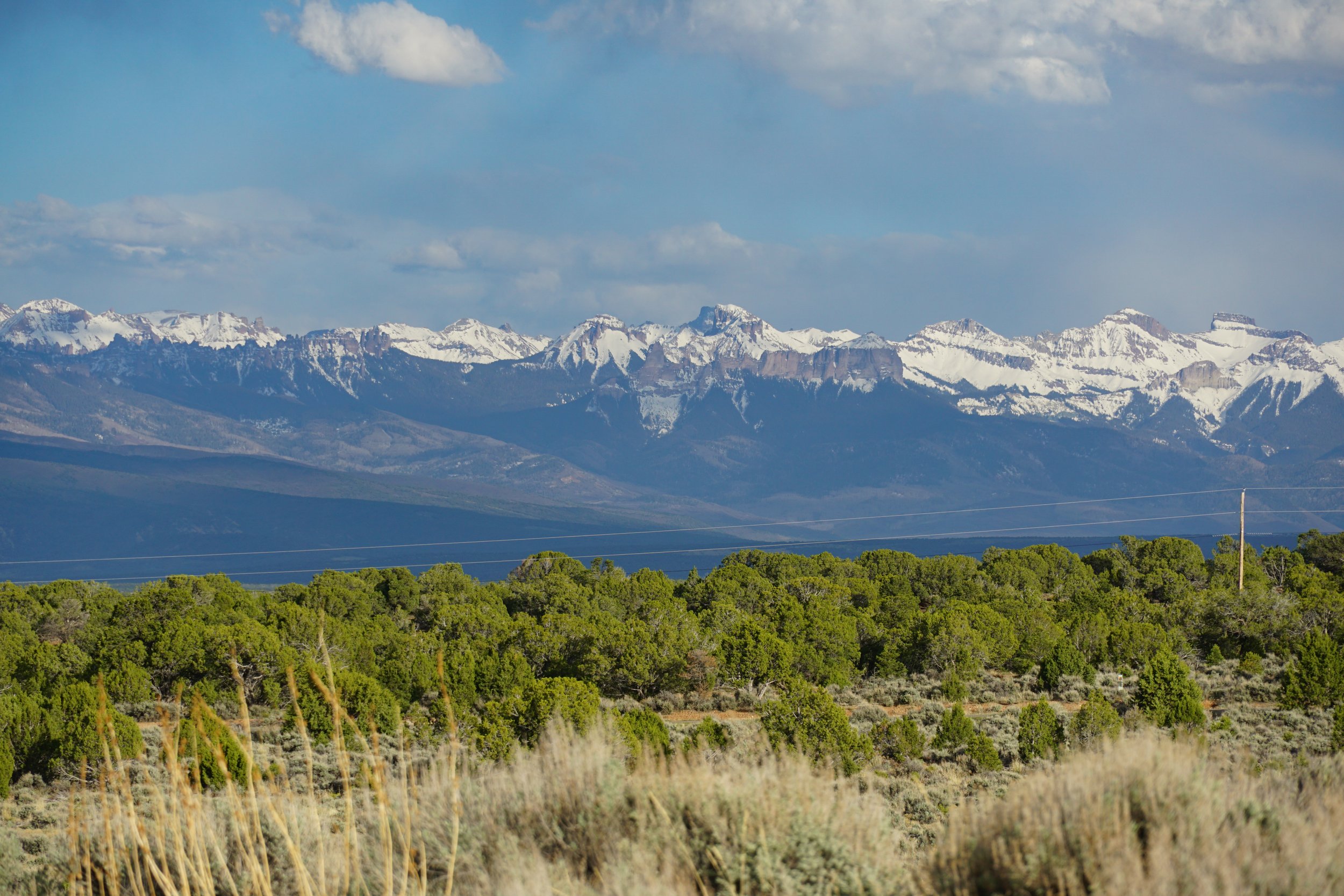
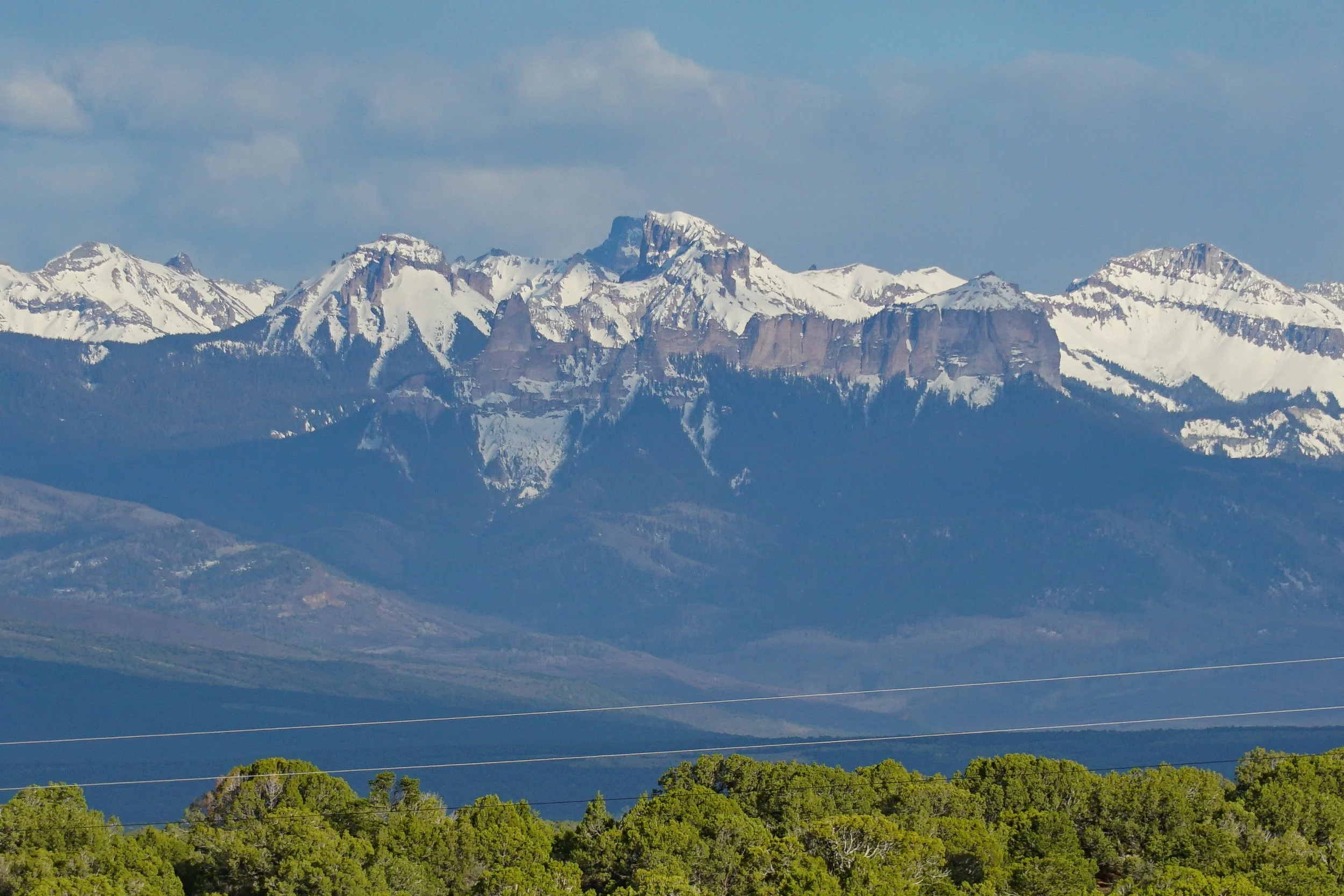
From the start, the hike offers wonderful views as you travel across an open sagebrush landscape. There are some terrific views down into Montrose and the Gunnison Gorge NCA to the Northeast. You are also treated to views of the Sneffels Range and the Cimarron Range to the south. As you hike you’ll get closer and closer to the rim of Spring Creek Canyon. The overlook at the destination is one of the best views, but if you just can’t wait, there are numerous small side trails to the canyon rim. After about 8/10ths of a mile, take the trail to the left for the Spring Creek Canyon Overlook. The views from the Overlook are tremendous. Spring Creek Canyon is massive and cuts across the terrain to the west as it rises to meet the Uncompahgre Plateau. Below, Spring Creek feeds lush vegetation beautiful when the the late day sun hits it at the right angle.
After you return to the main trail, you have some options. Returning to the traihead results in a bit less than a 2 mile hike (as described here) or you can further explore the Buzzard Gulch Trail System for longer hikes.