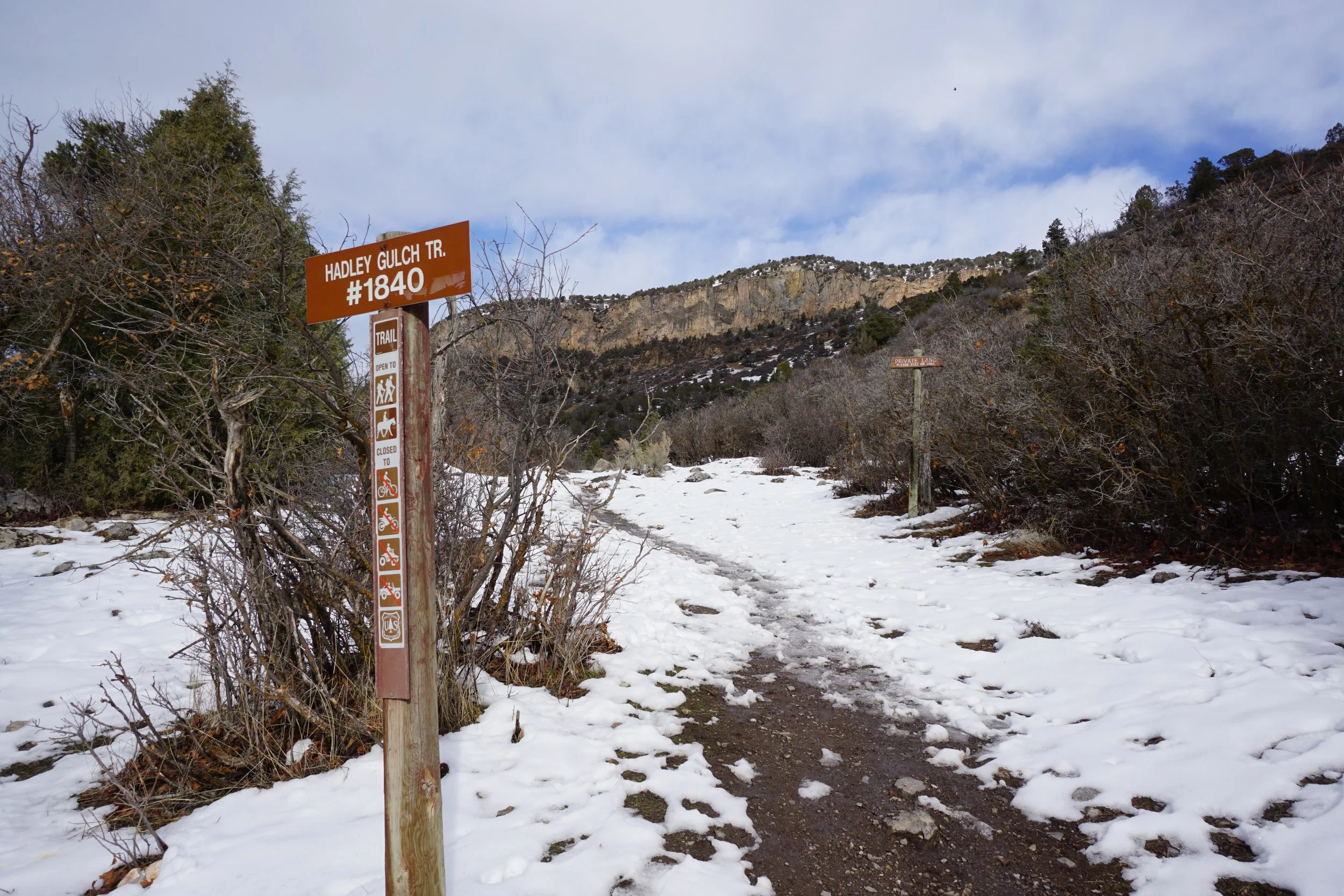
Hadley Gulch Trail
White River National Forest
Date Hiked: December 30, 2024
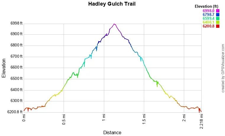
Distance: 2 mi (RT)
Elevation Gain: 711 ft
Elevation Min/Max: 6,245 to 6,962 ft
Trailhead Lat/Long: 39.67707, -107.56989
Managing Agency: U.S. Forest Service
Fee: None
Directions:
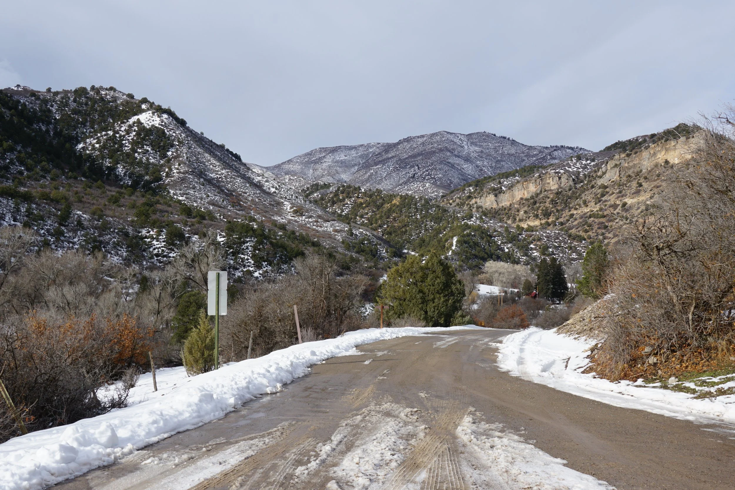
From New Castle, CO travel north on 7th street (which becomes Midland Ave), and take a slight left onto County Road 245 (Buford Road). Travel 3.1 miles and turn right onto County Road 243 (Main Elk Creek Road). Travel 5.8 miles to the beginning of Clinetop Road (Forest Service Road 603) to Clinetop Trailhead.
Hike Description:
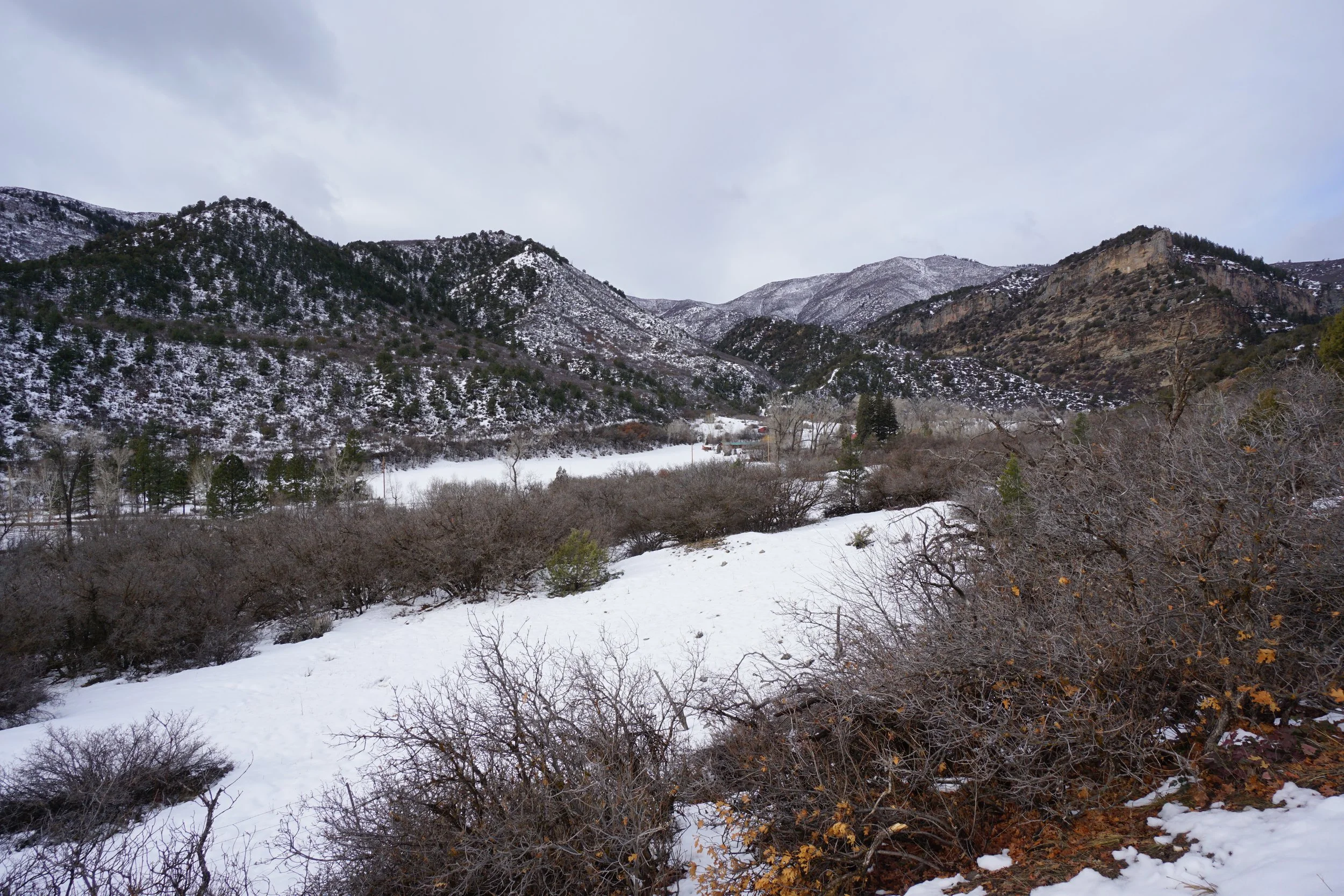
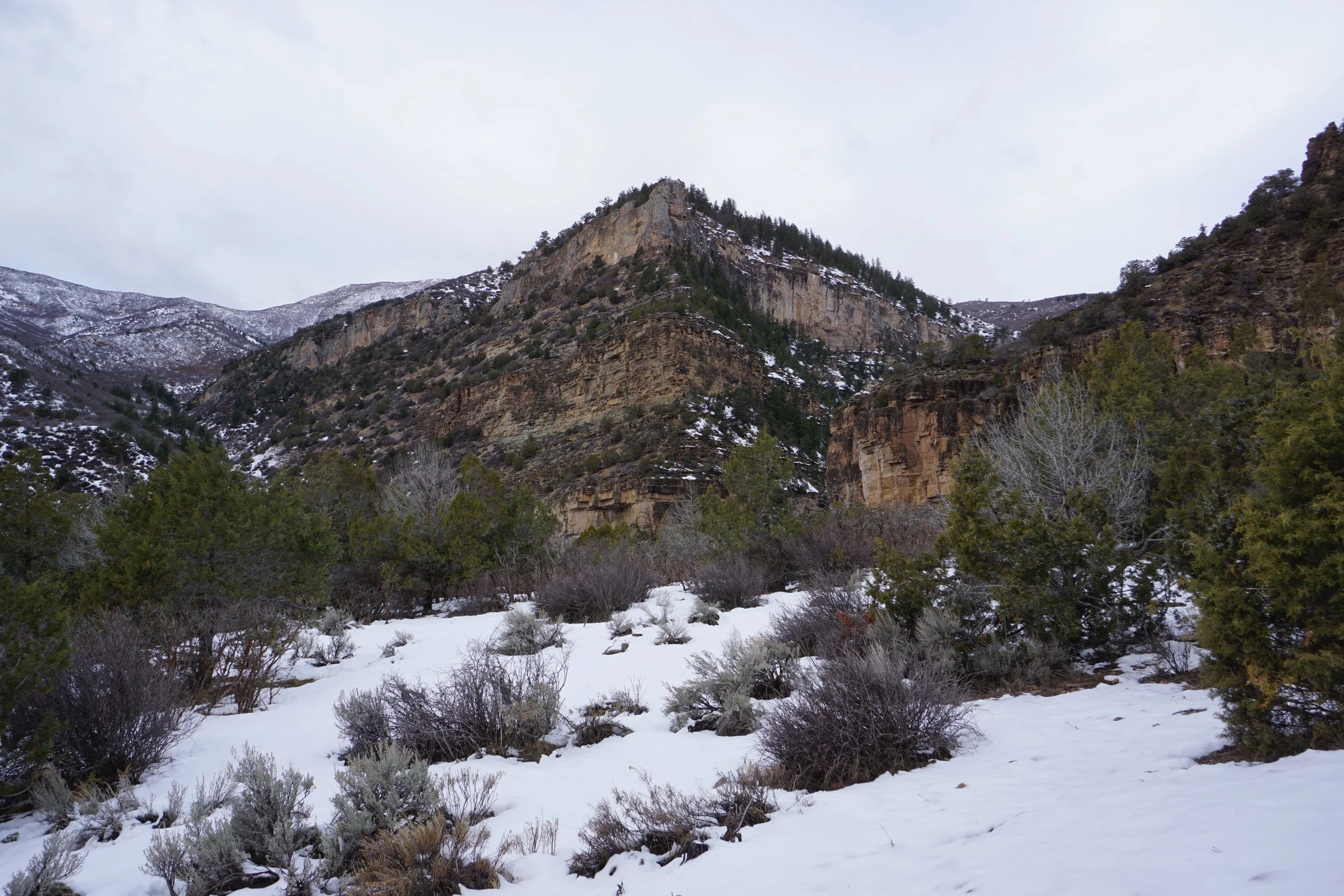
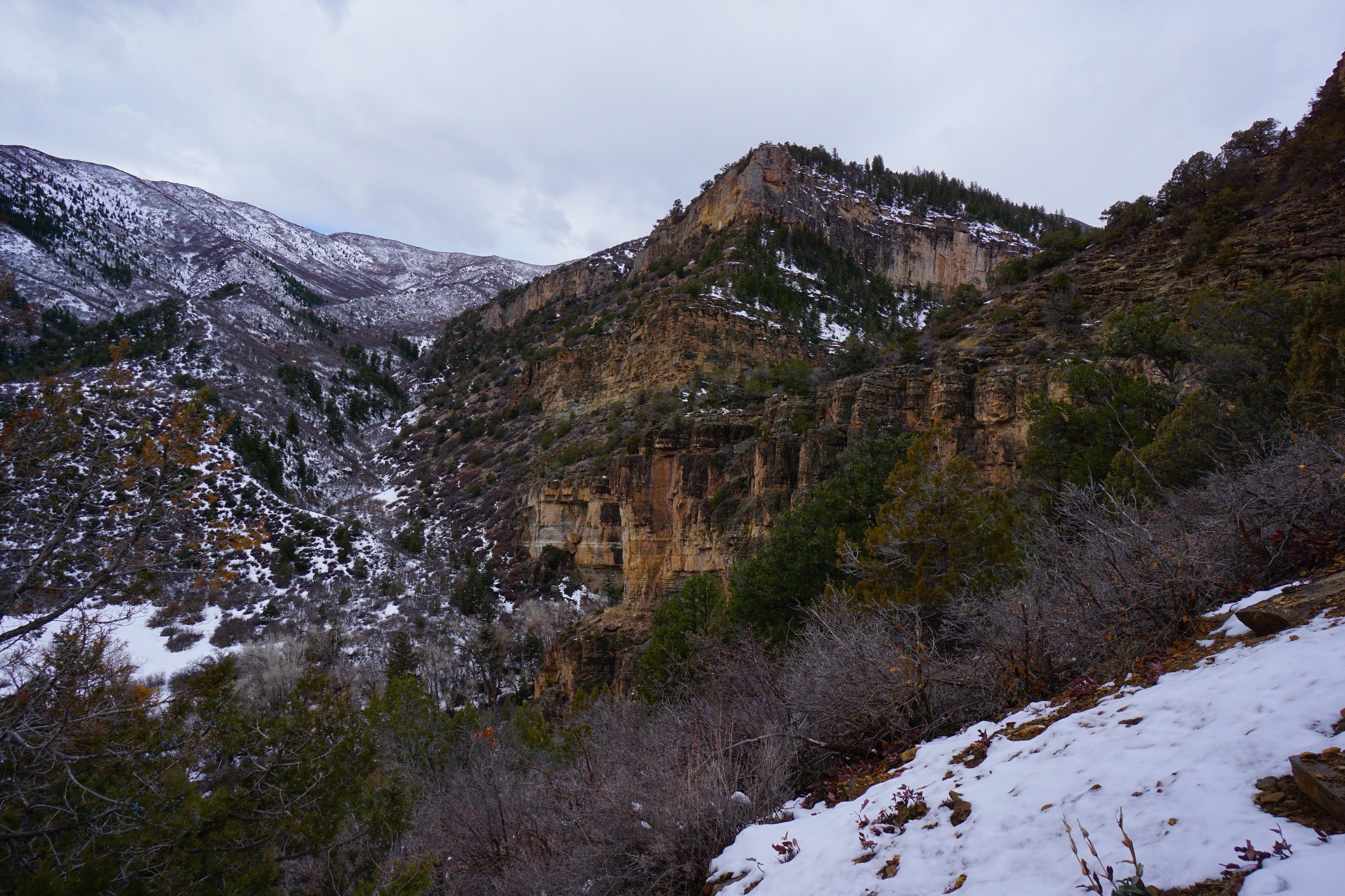
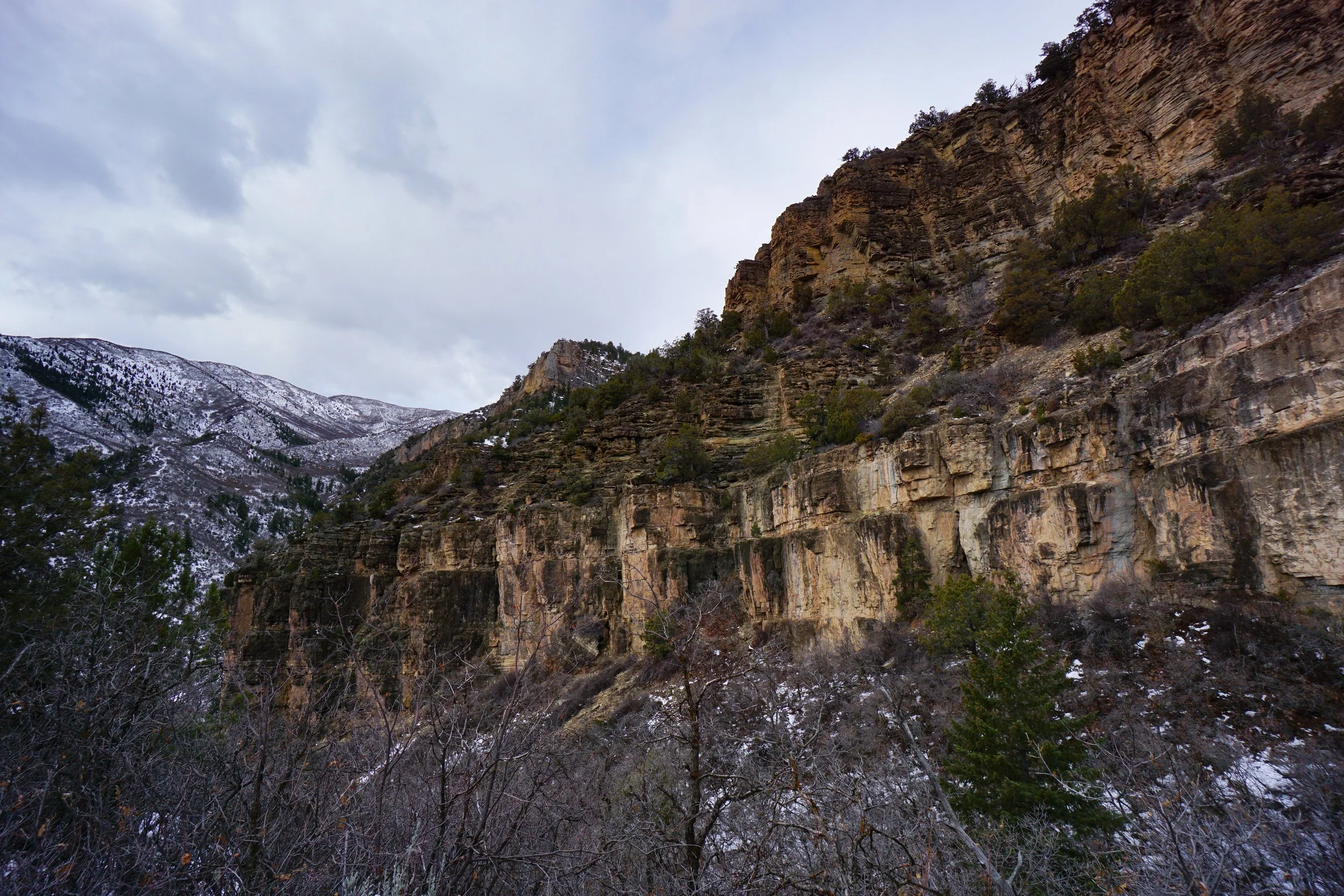
The southern edge of the White River Plateau is an interesting area to explore and hike through. The area is full of mesas, cliffs, and rock formations with dramatic exciting scenery and lower elevations. The lower elevations make it a great area to hit during the winter or the shoulder seasons when snow is possible but probably not all that deep.
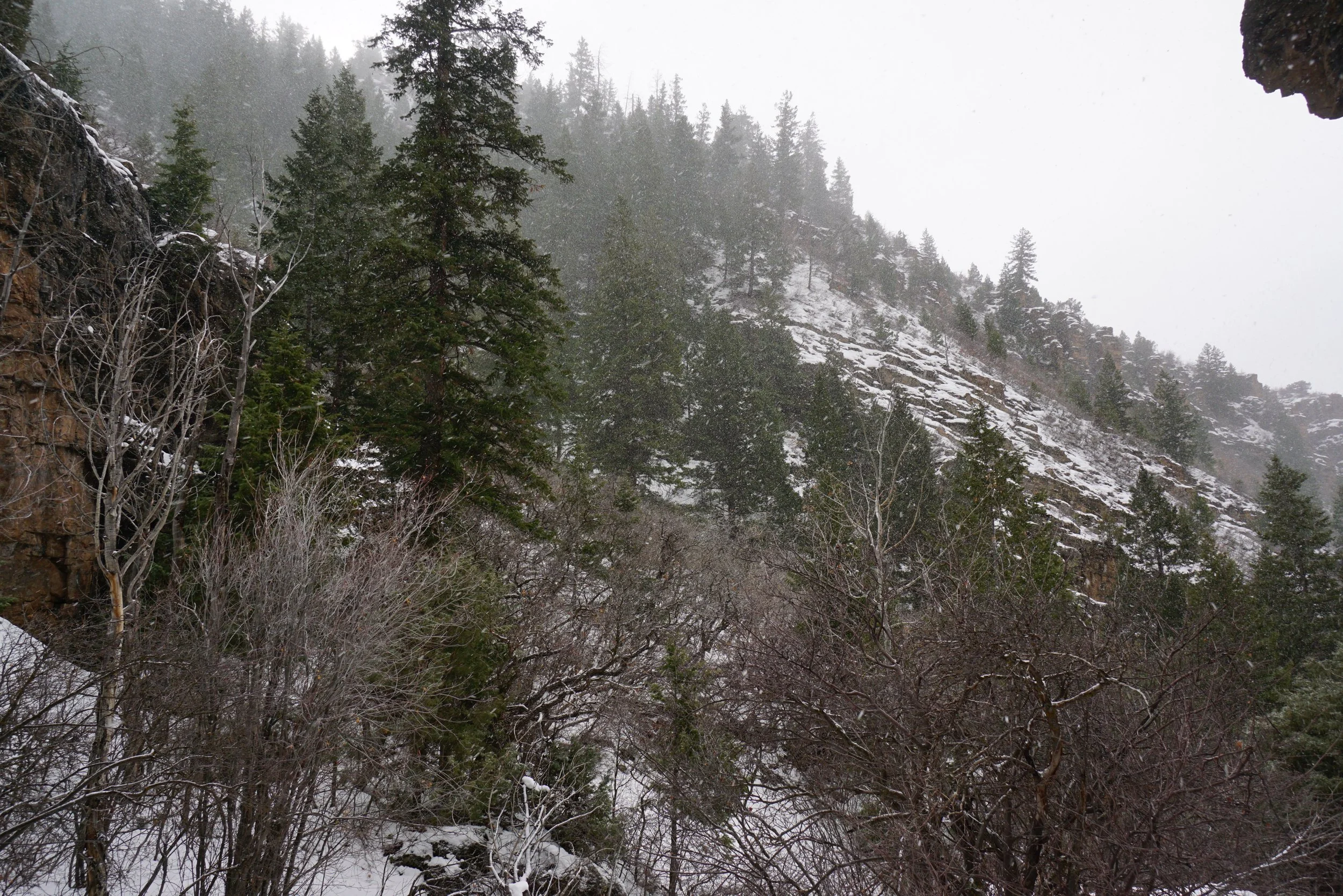
The Hadley Gulch Trail follows Hadley Gulch for about 5 miles, one way. Hadley Gulch is situated between Joes Hill and Hadley Point to the north, which sits at about 9,000 ft. To reach Hadley Point, you need to climb out of Hadley Gulch along the Zig Zag trail and hook up to the Clinetop Cow Camp trail for a 7 mile roundtrip hike. With all that in mind, this area would be a wonderful place to explore. This hike, however, just gets a taste of this area. My hike got cut short due to a snow storm moving into the area, though I was really just exploring and didn’t have a destination in mind.
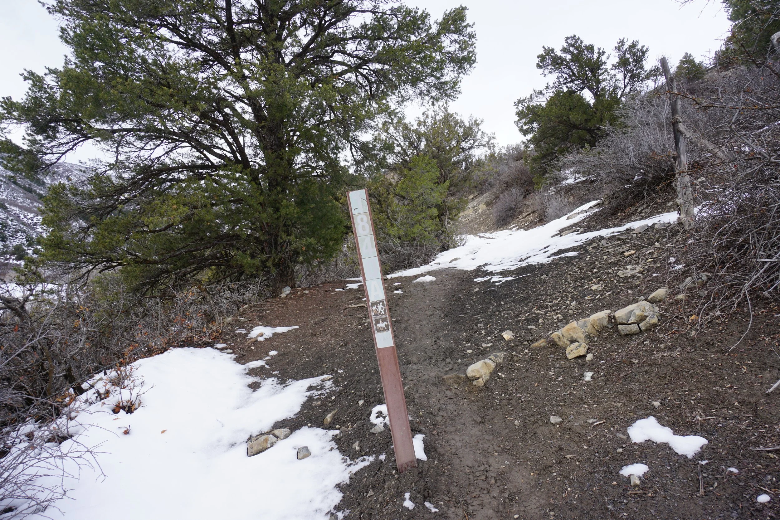
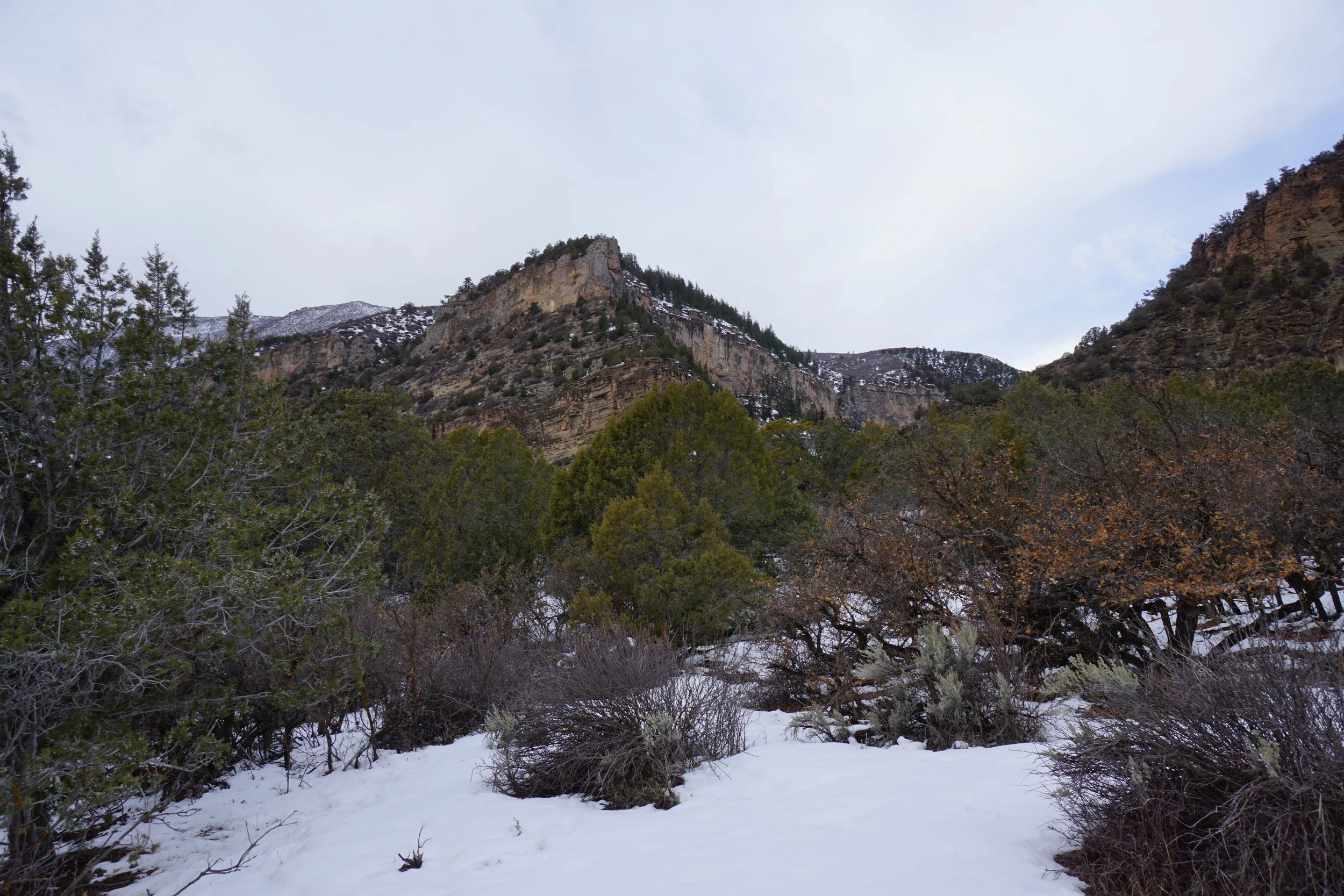
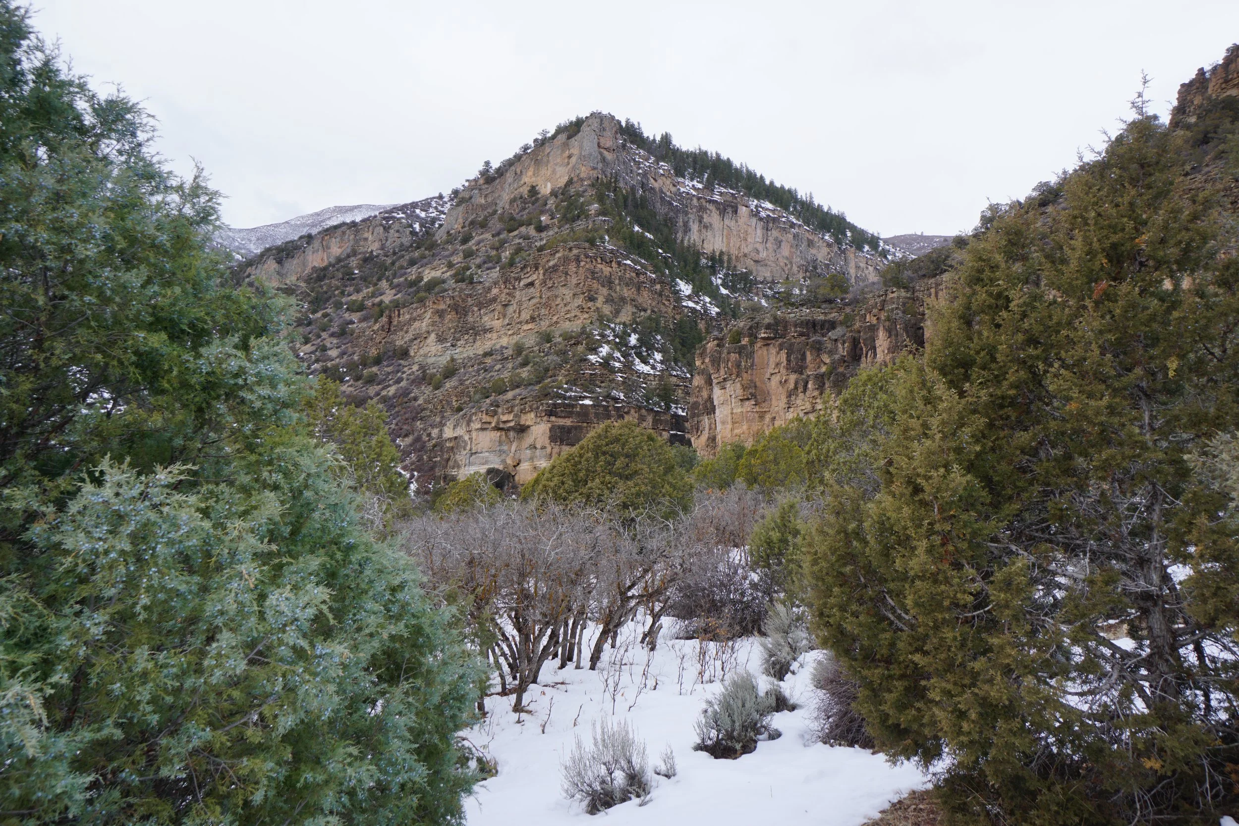
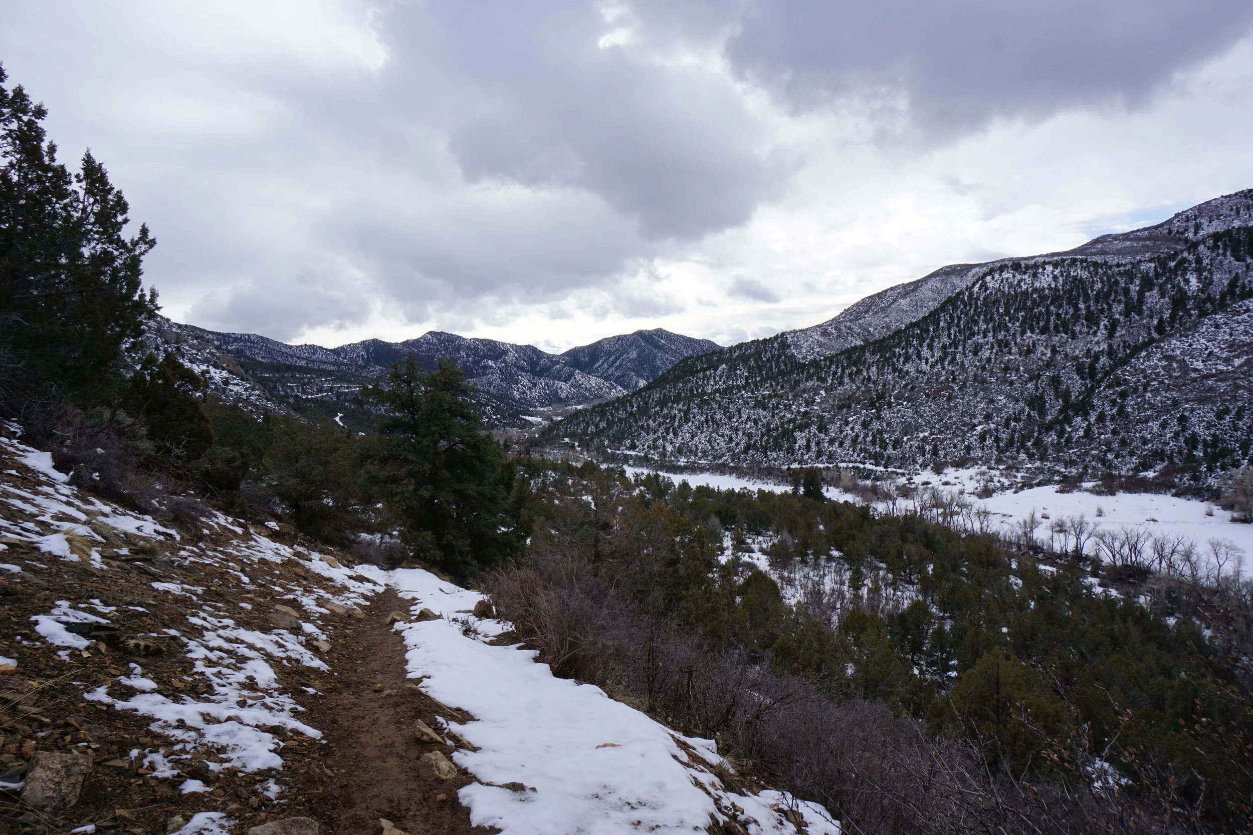
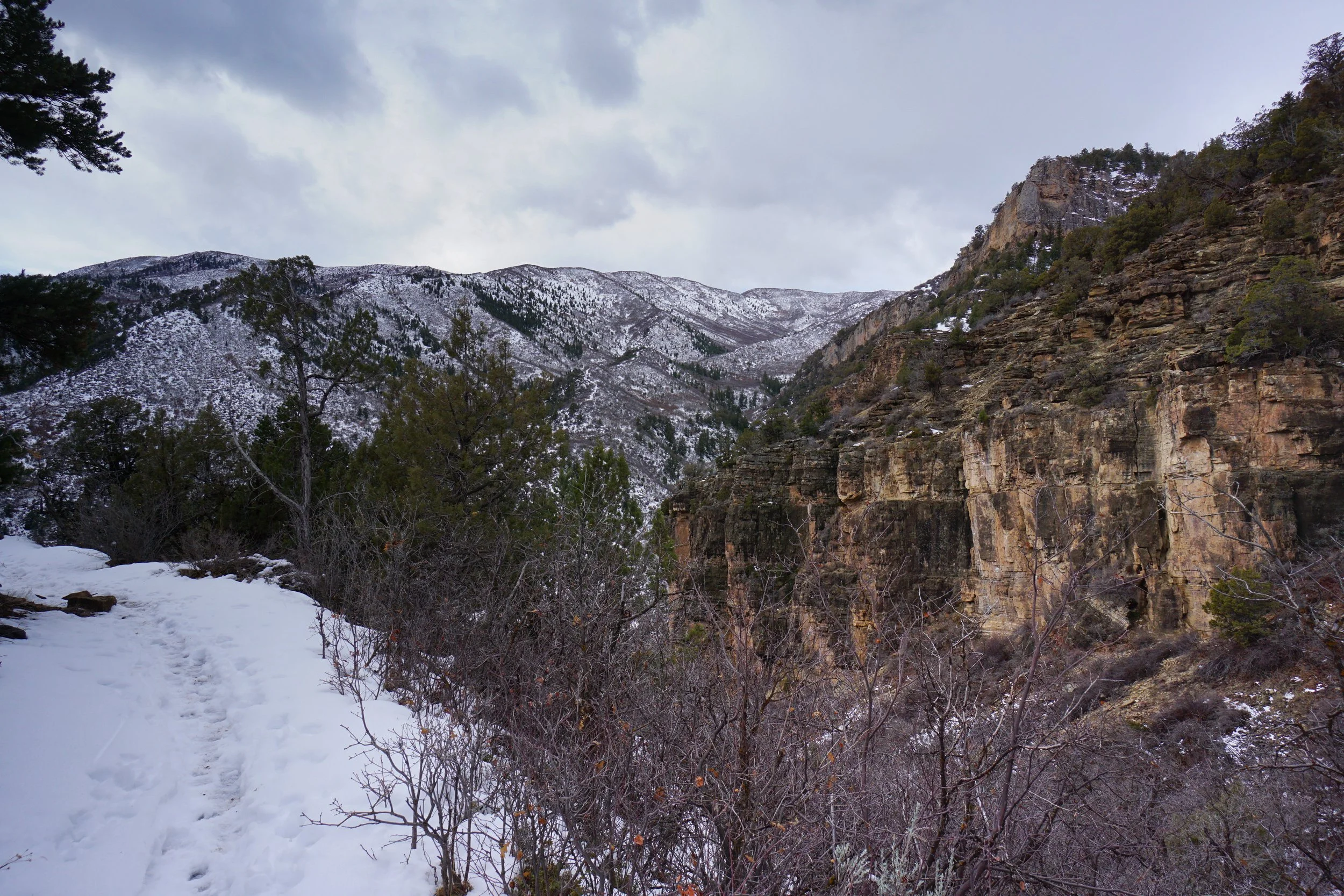
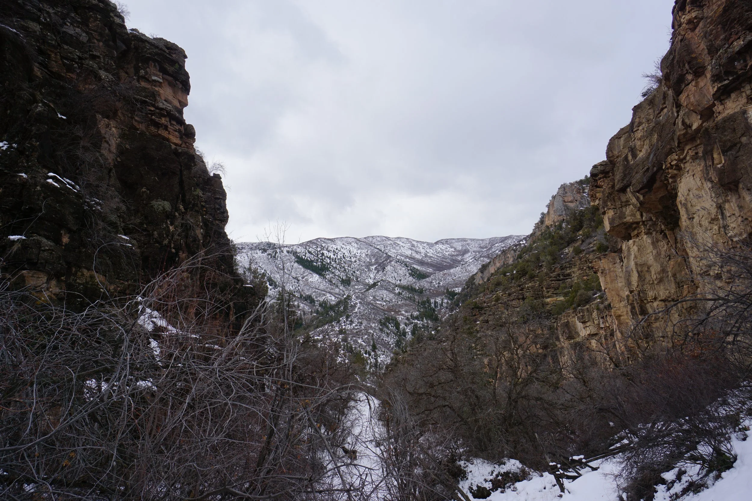
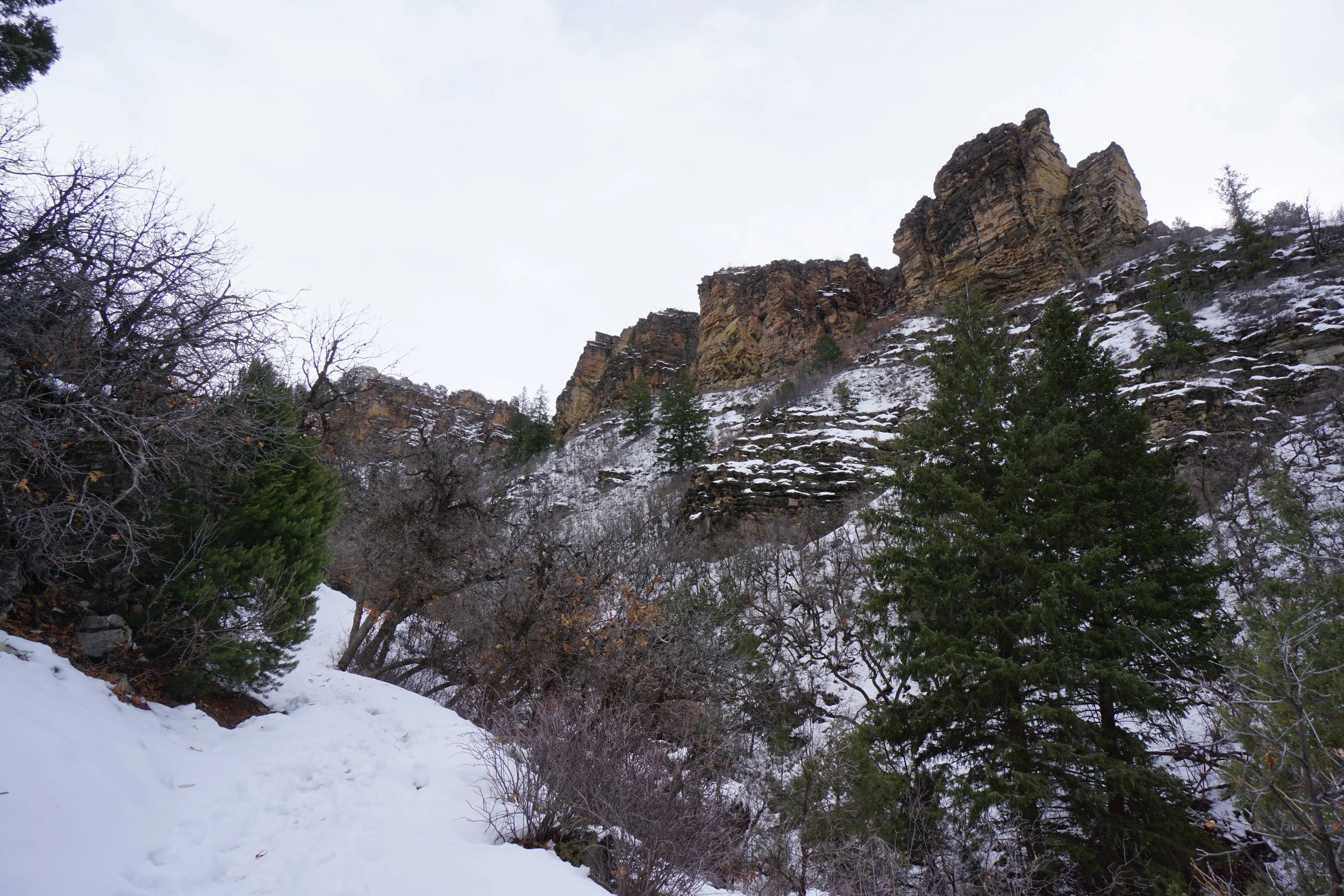
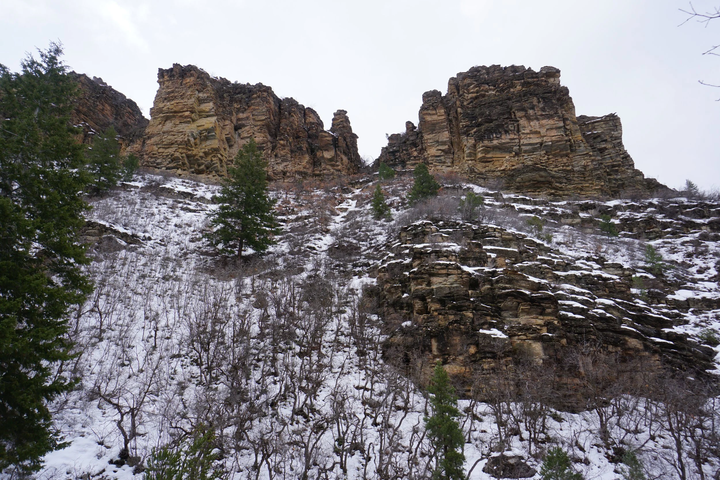
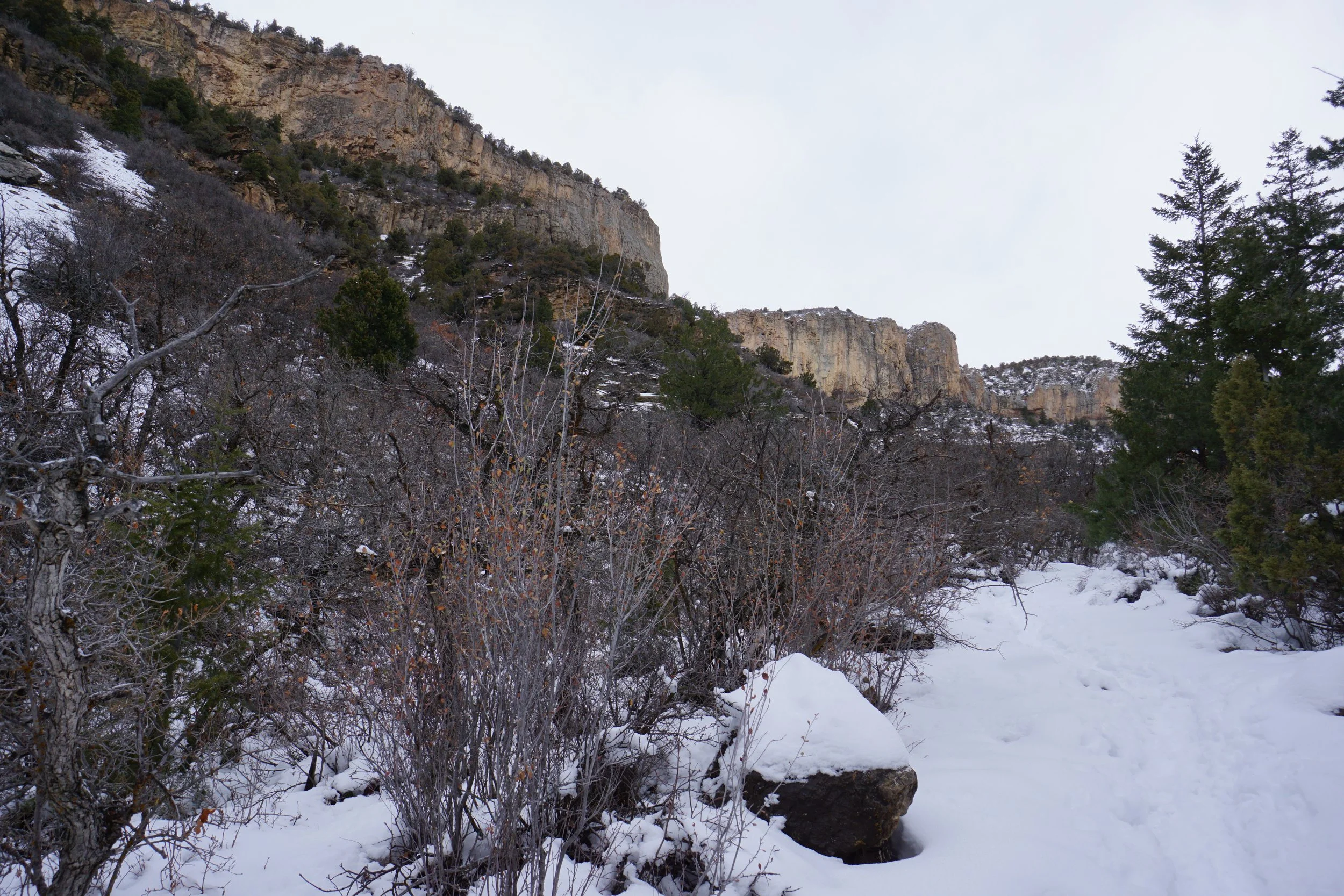
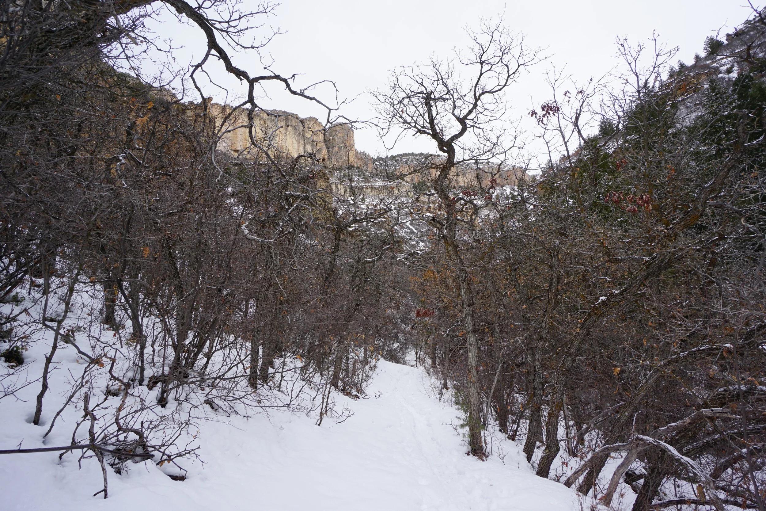
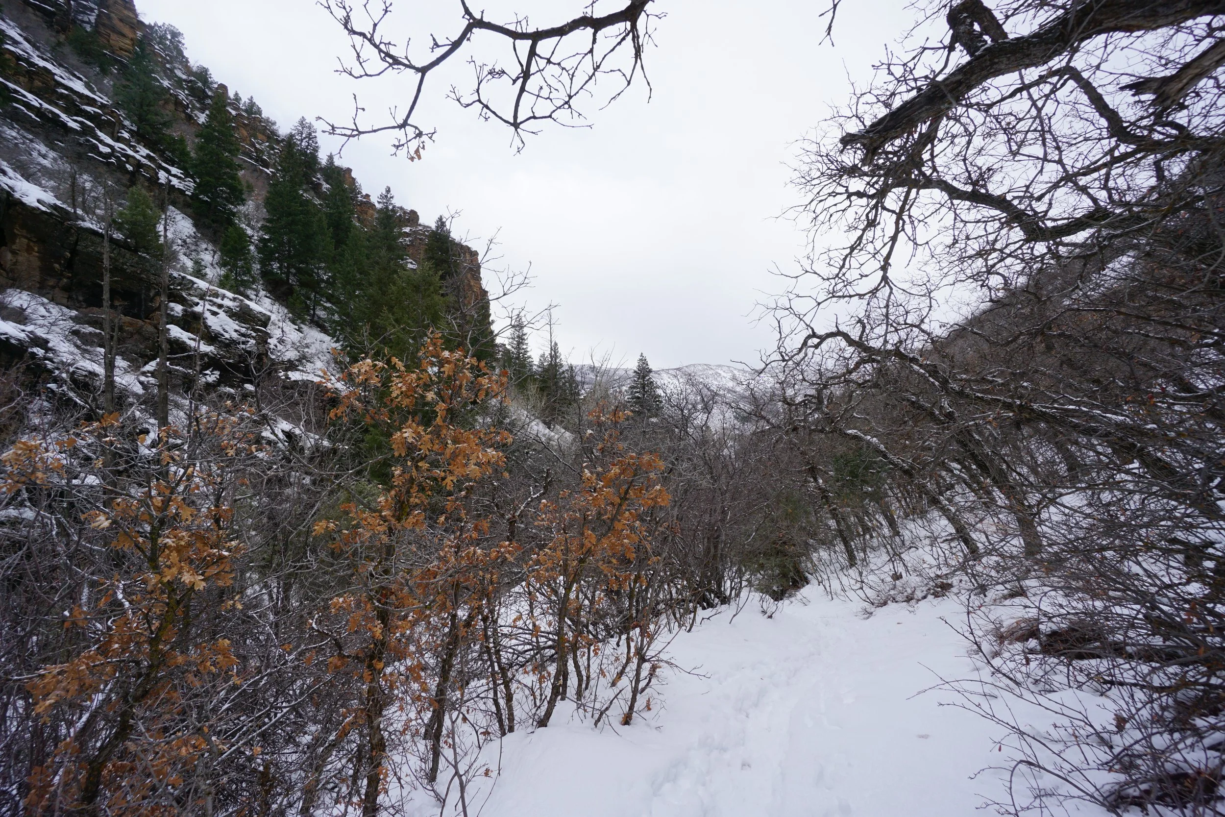
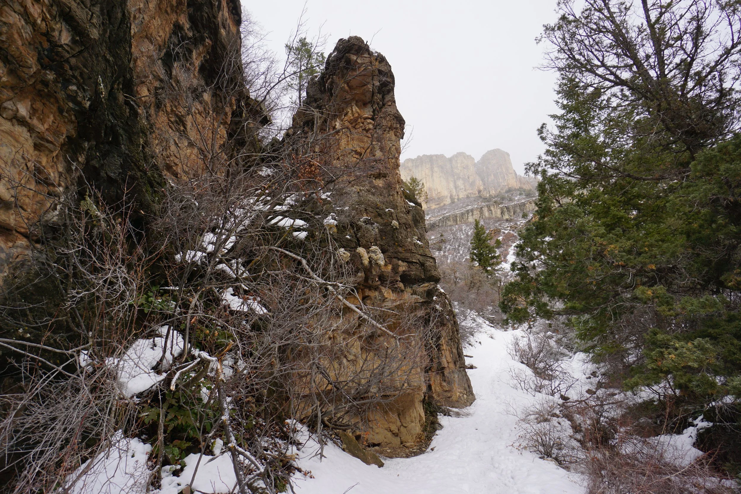
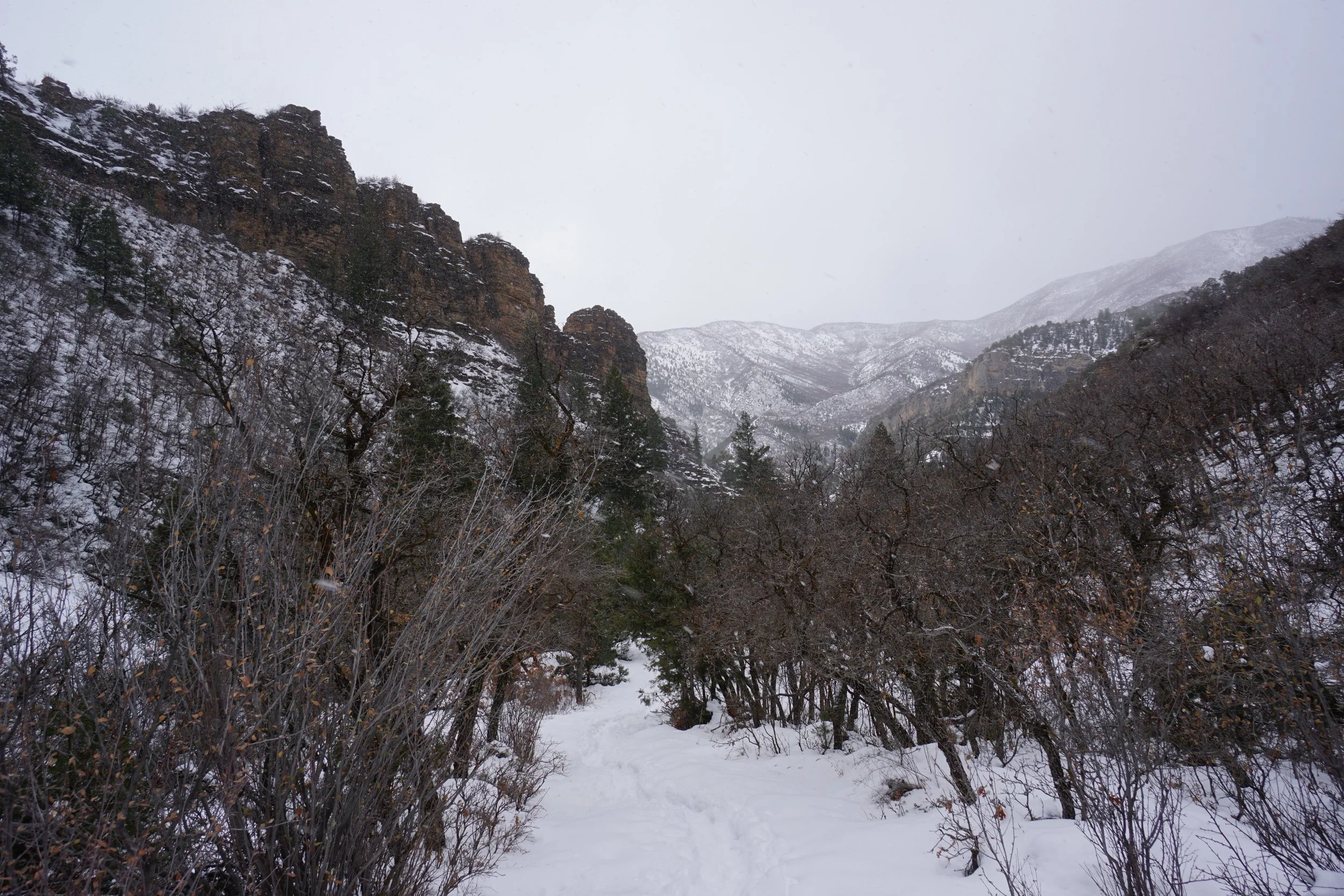
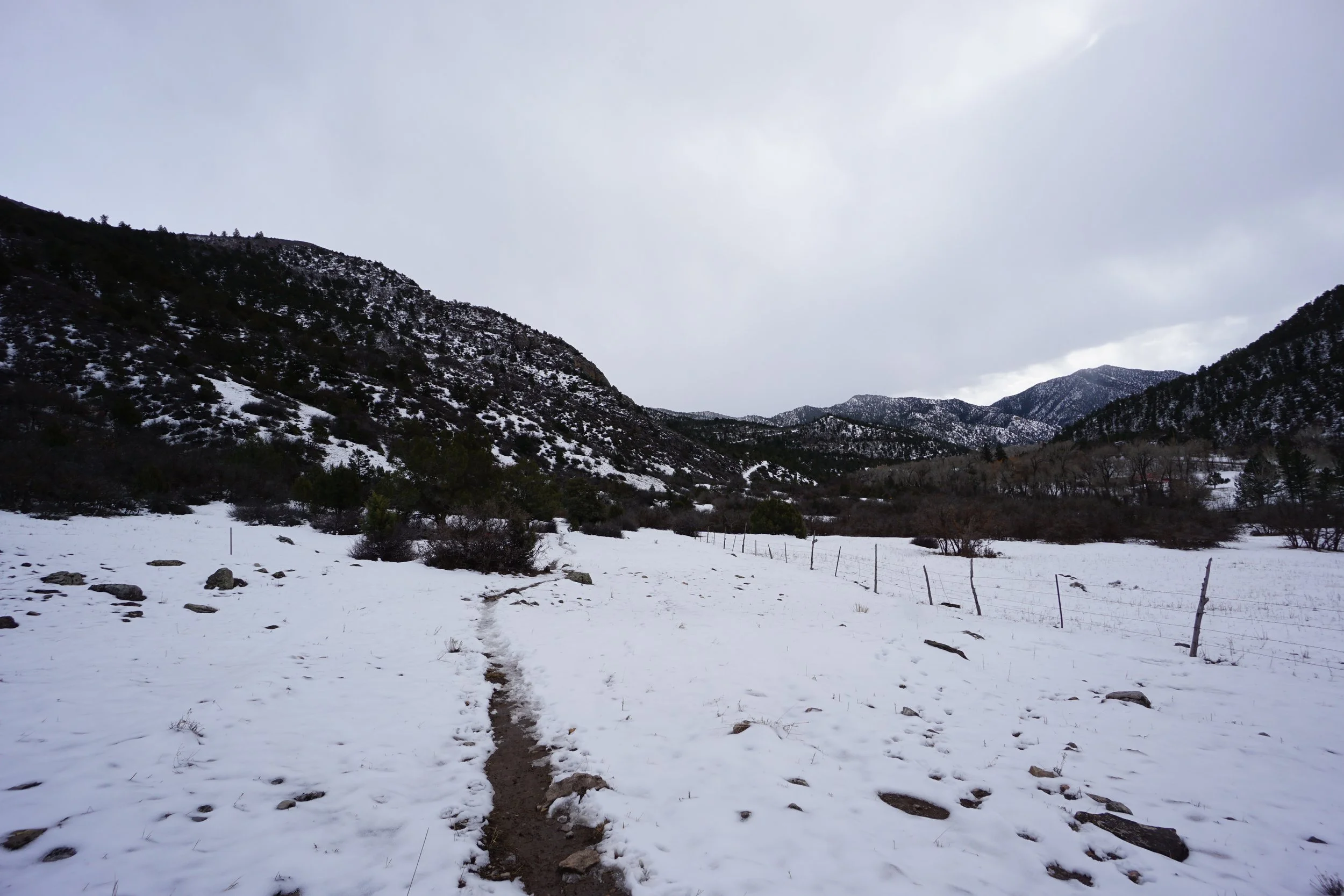
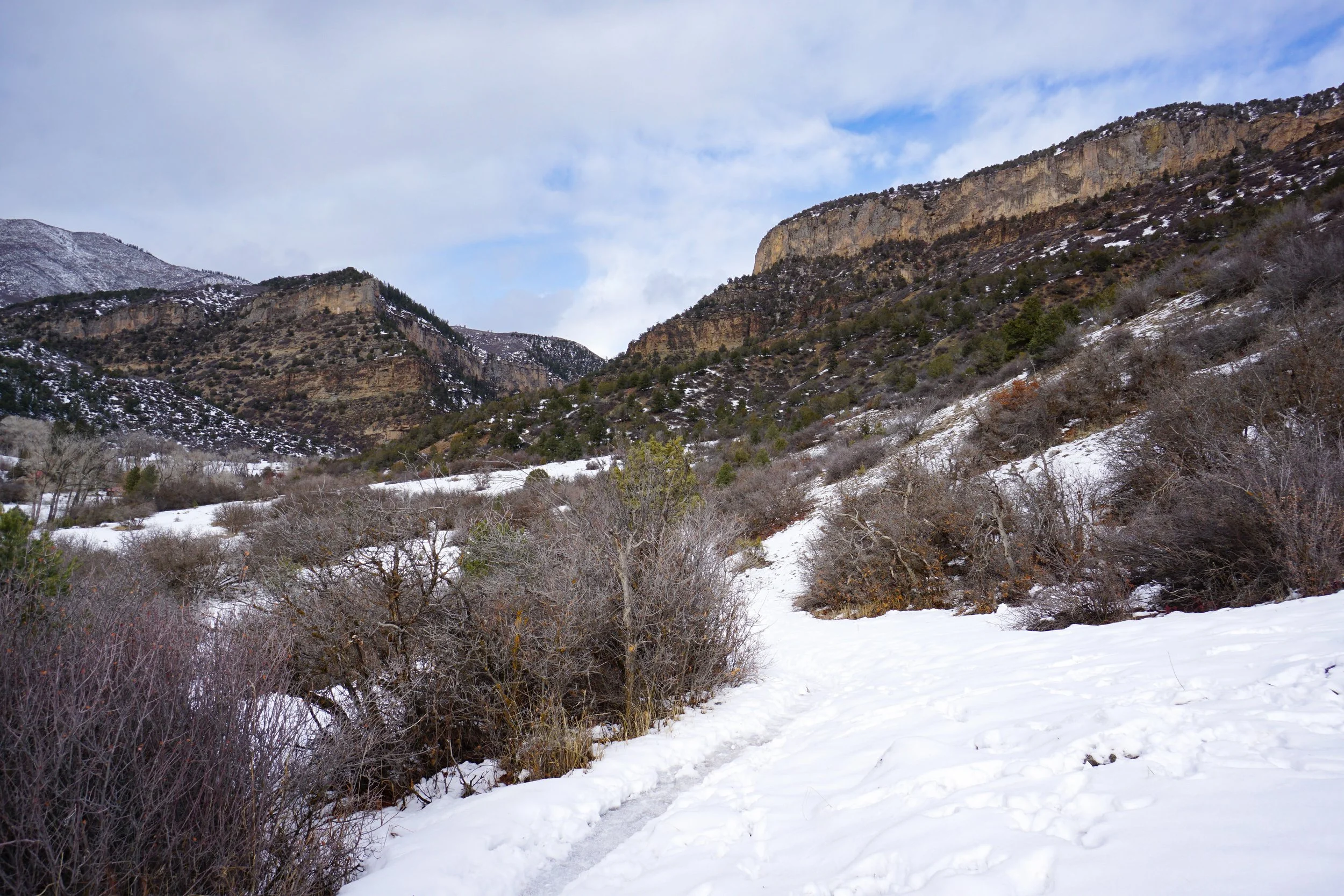
I hiked this trail for about 1 mile, then turned back when the snow really started to fall. The first mile is incredible, absolutely worth hiking in any season. The trail starts at the Clinetop Trailhead and gradually climbs up through sagebrush towards the looming Clinetop Mesa ahead. As you near the mesa walls, the rock formations begin to take shape and the deep canyon that becomes Hadley Gulch becomes visible to the west.
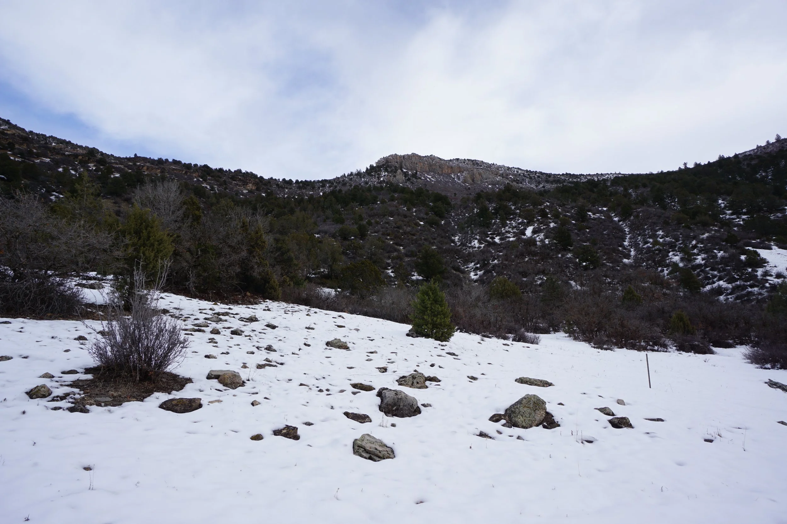
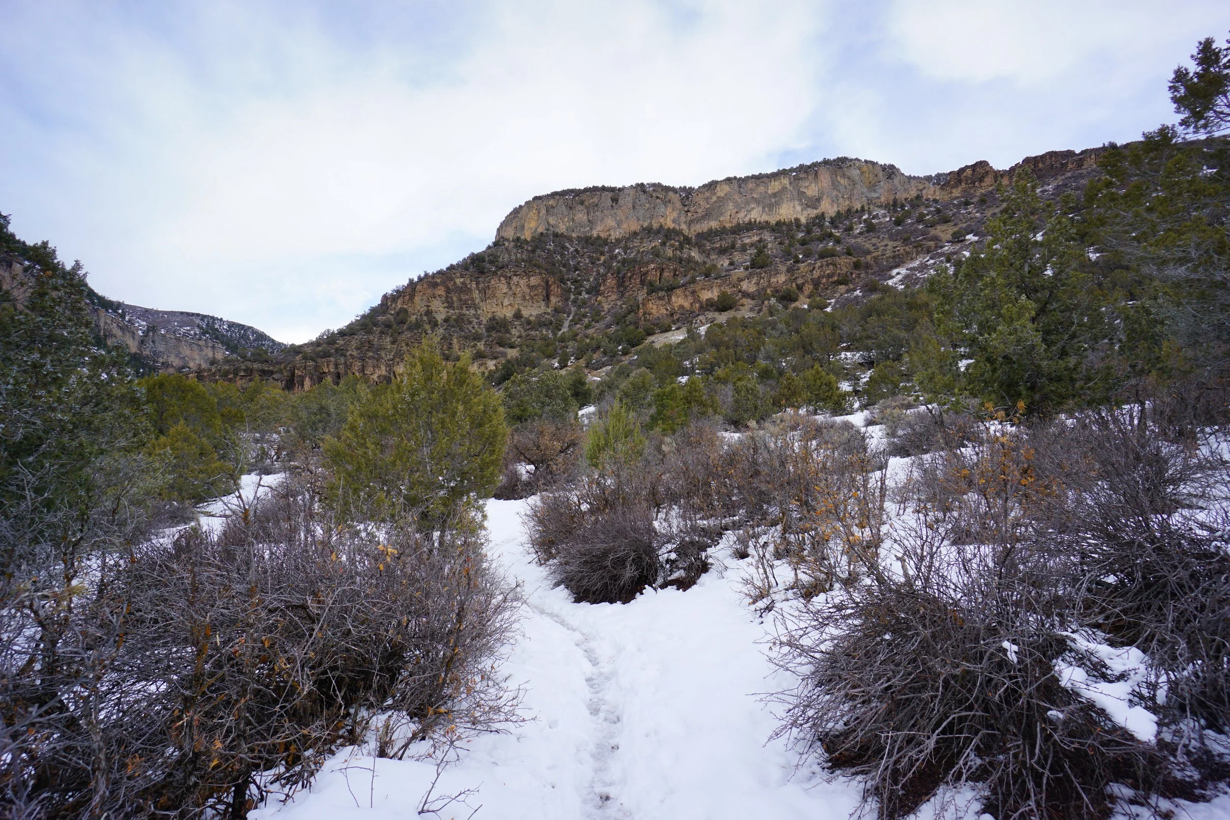
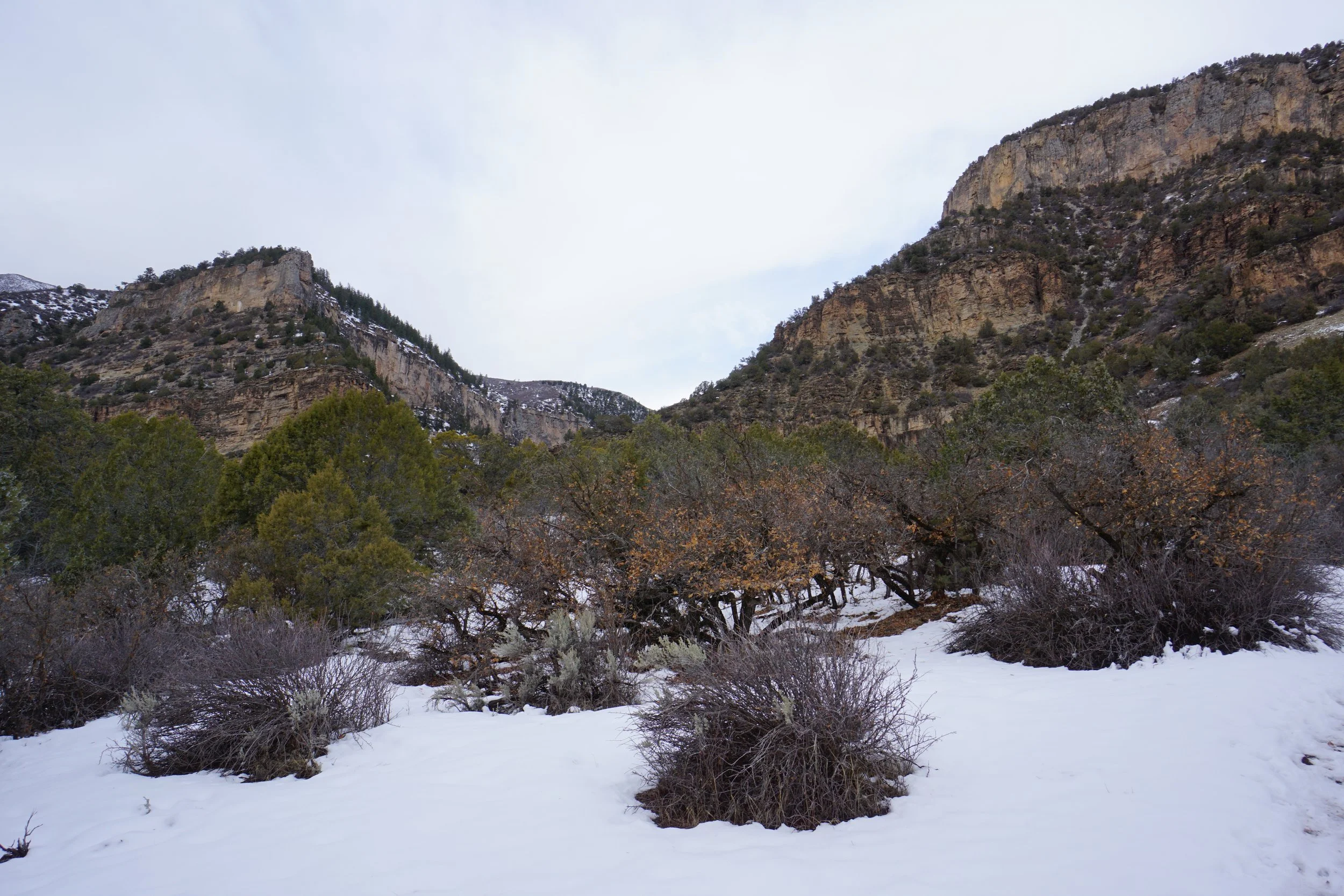
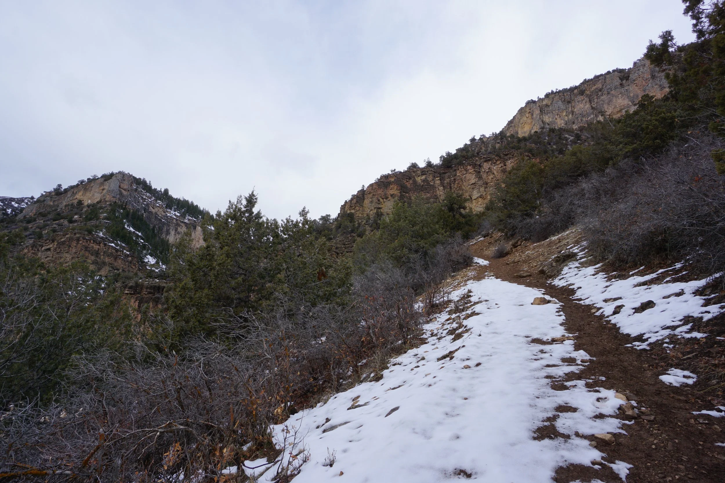
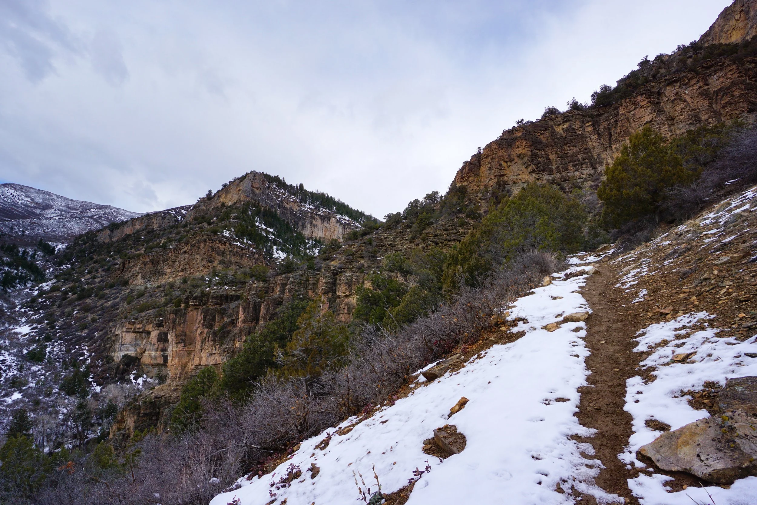
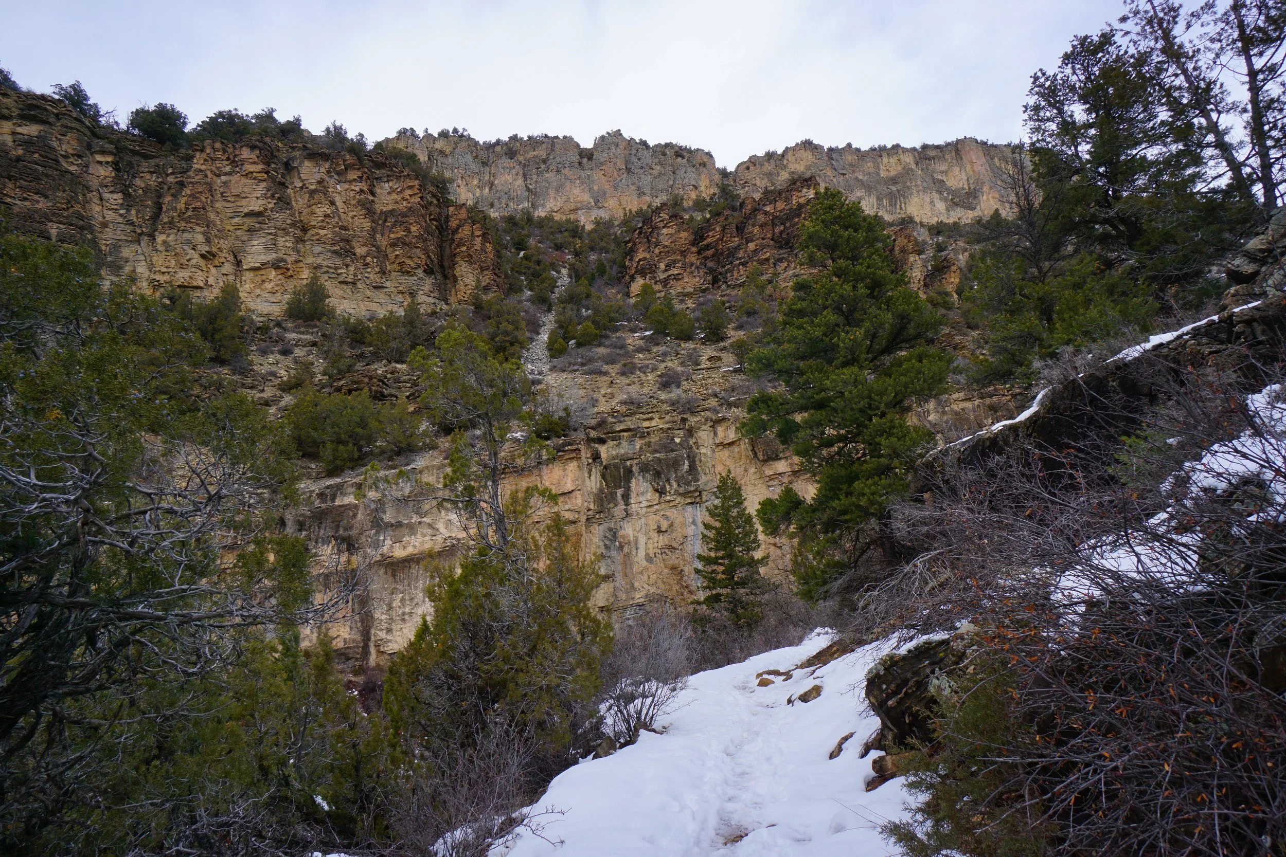
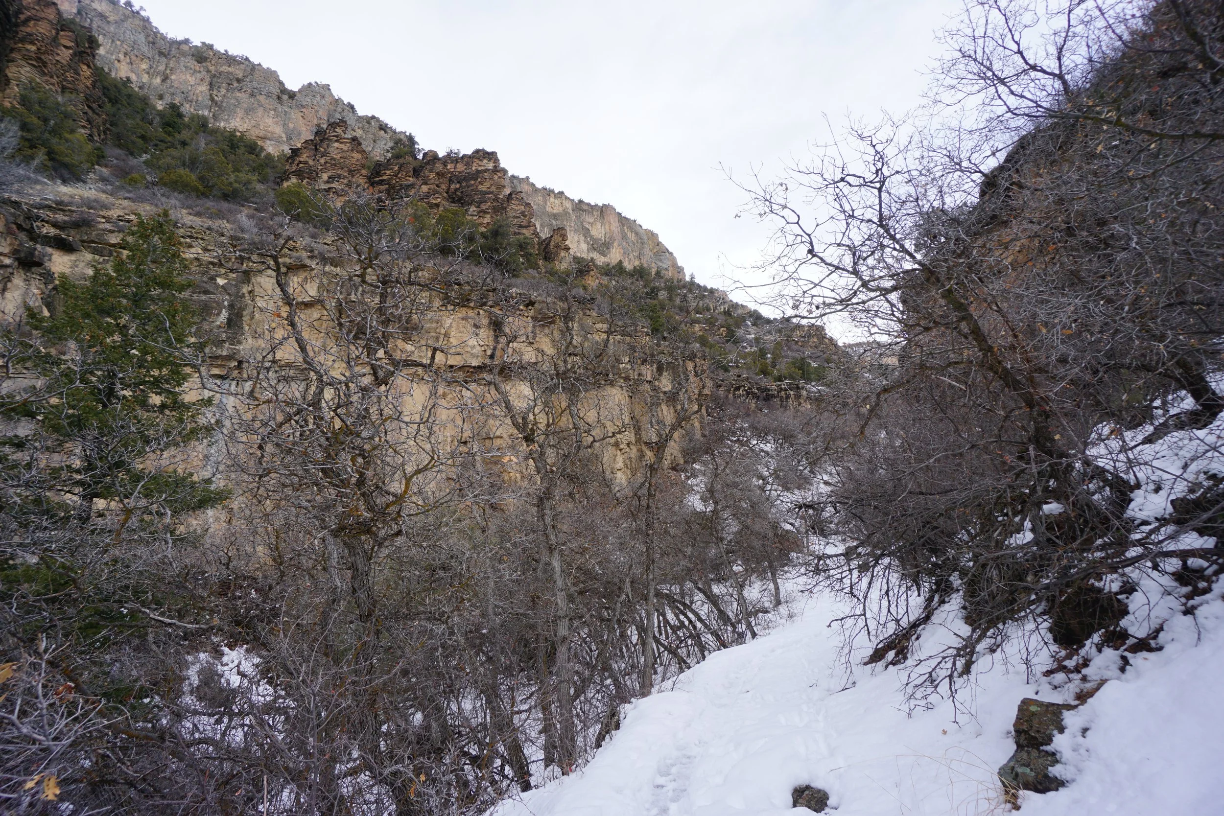
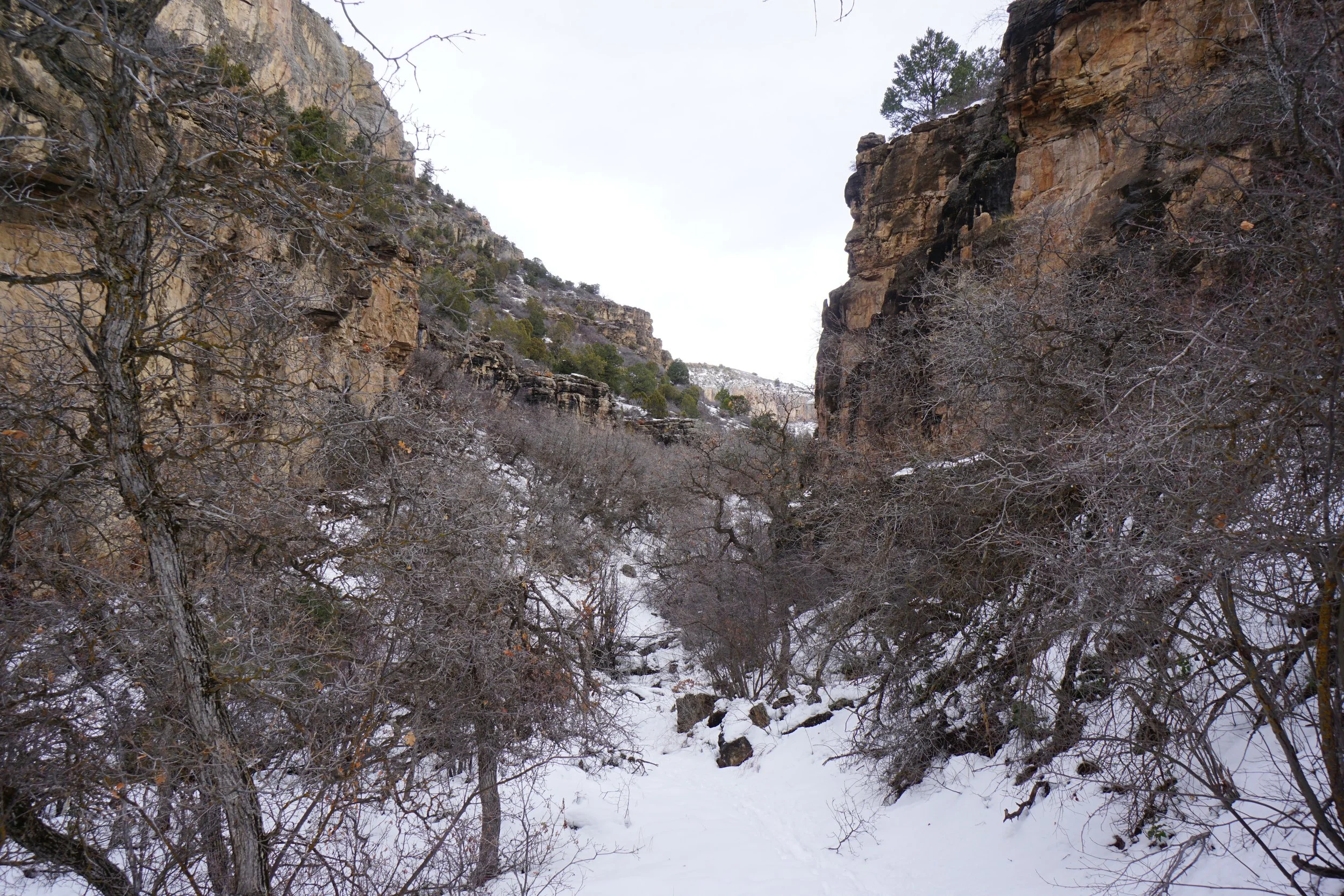
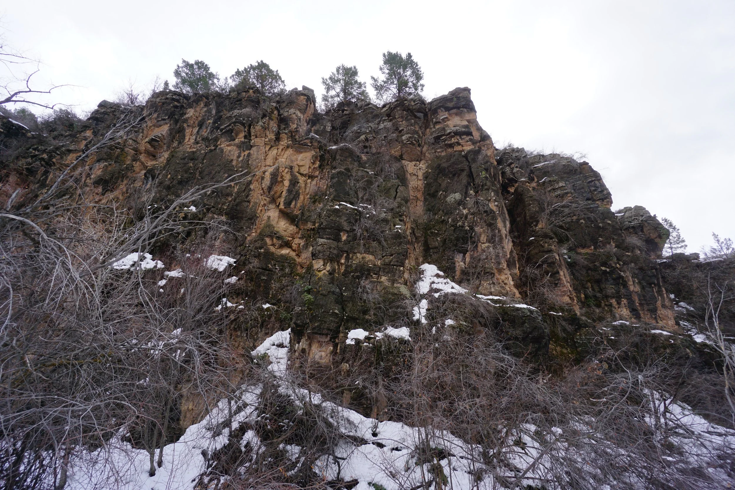
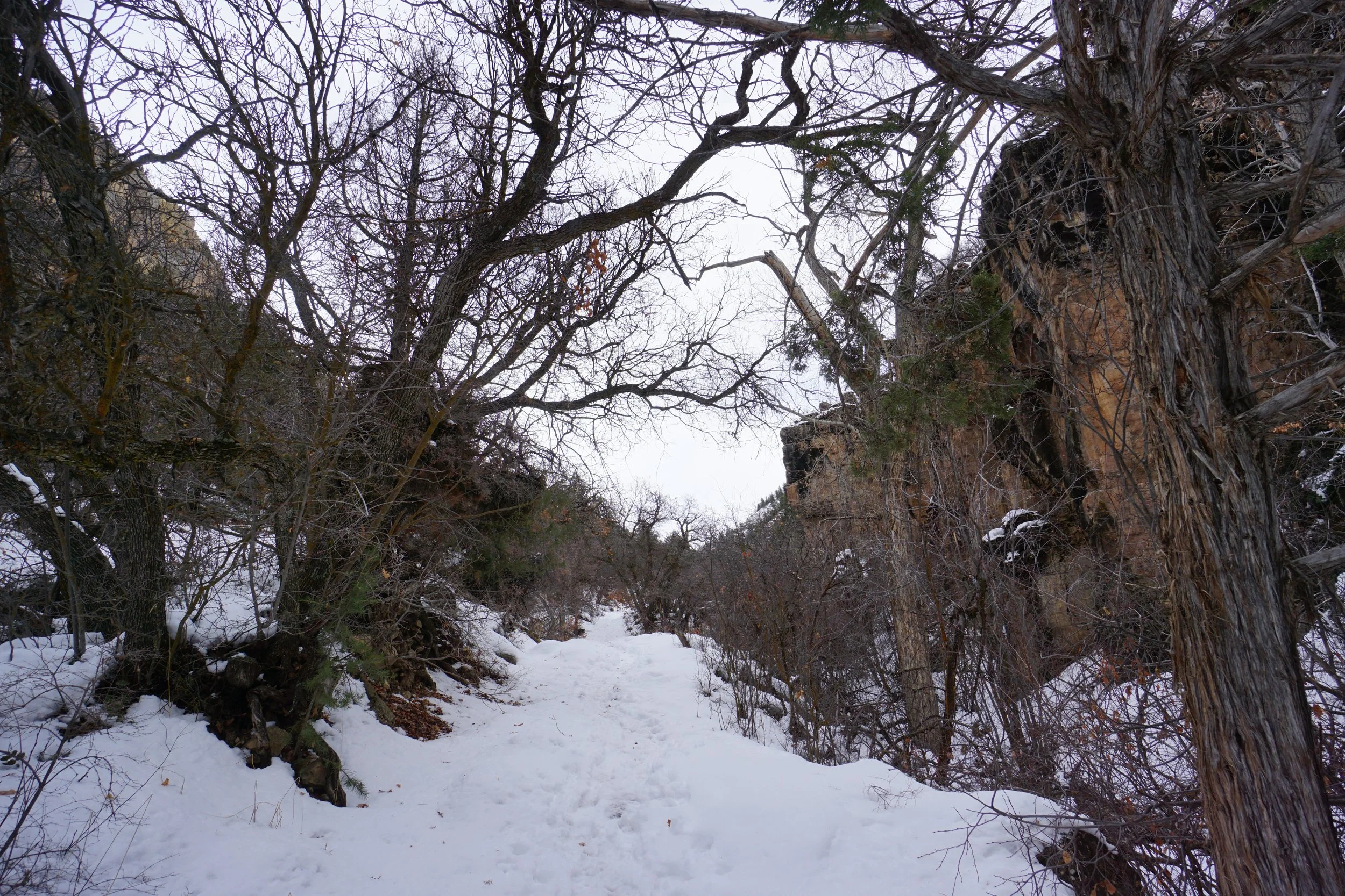
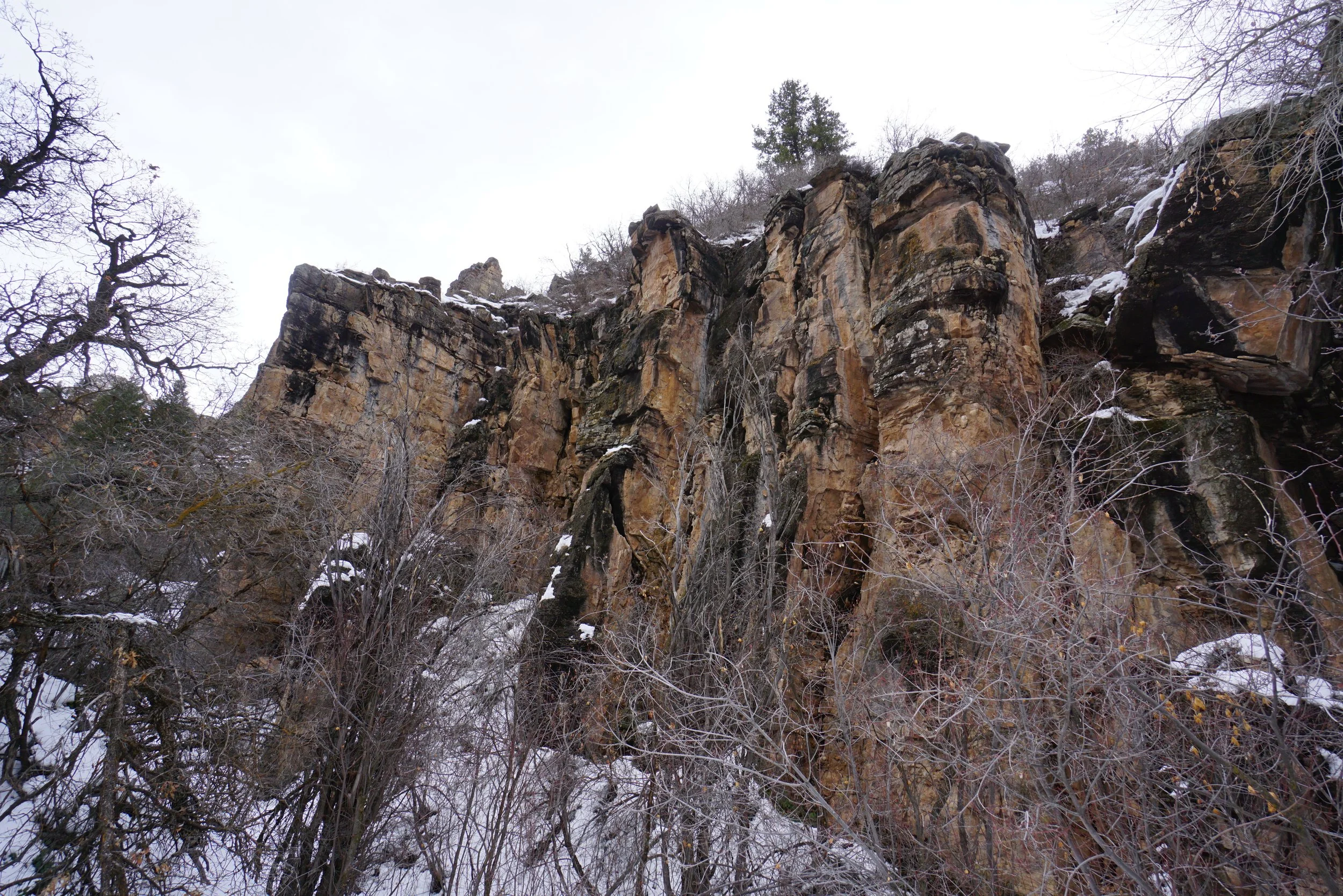
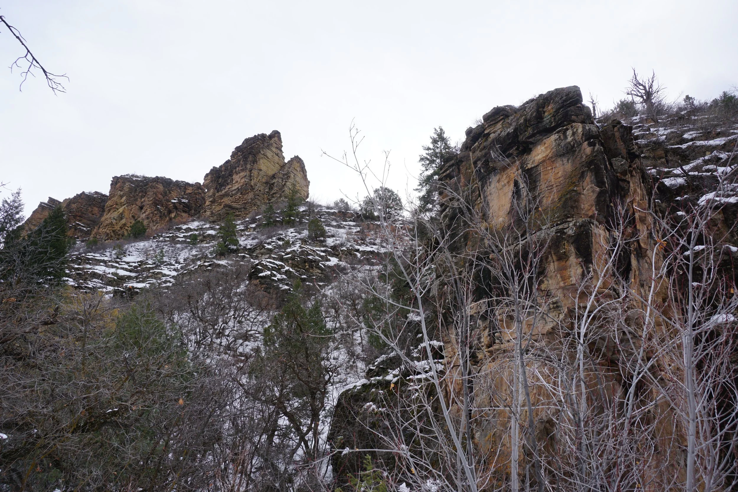
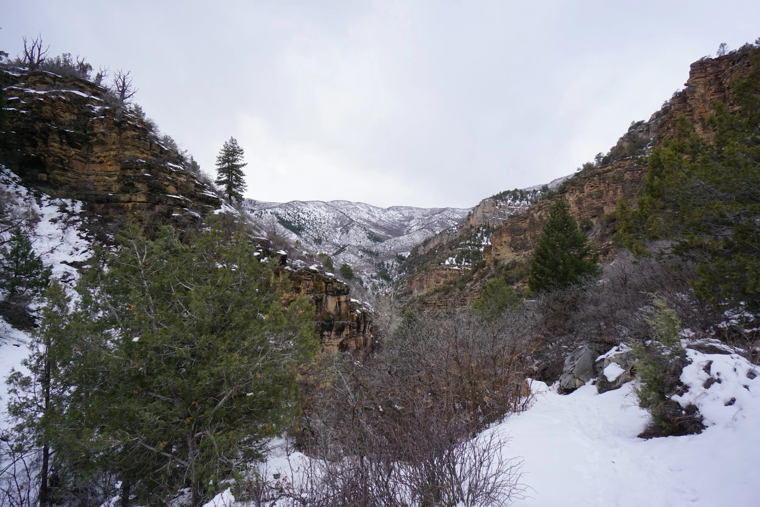
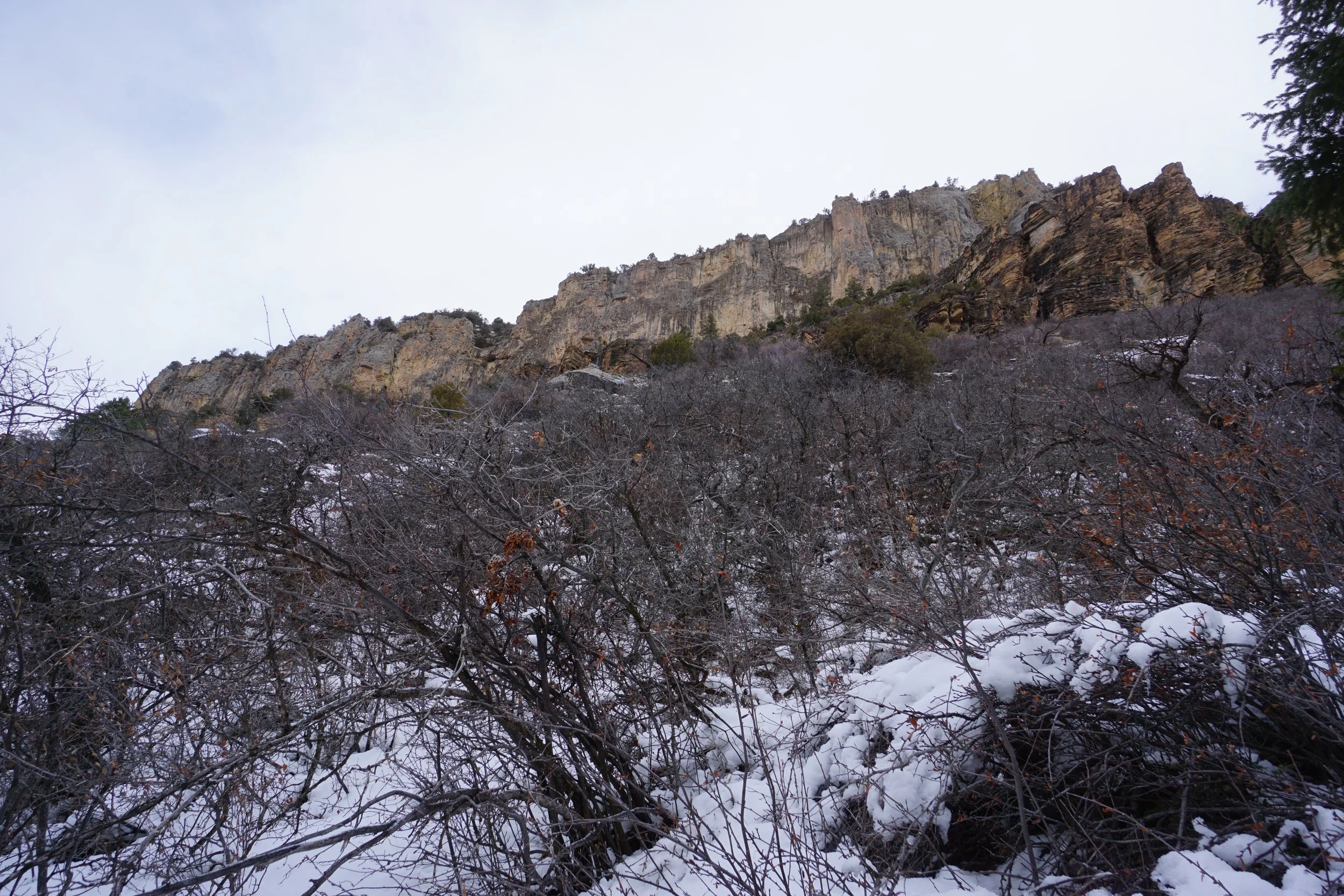
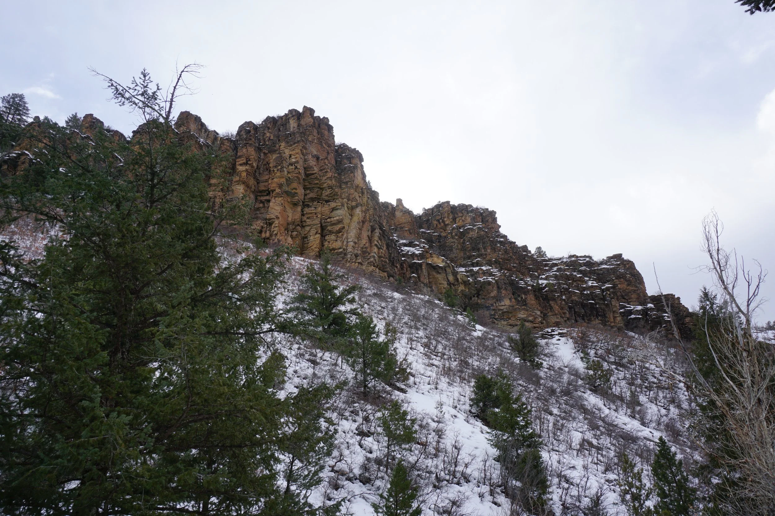
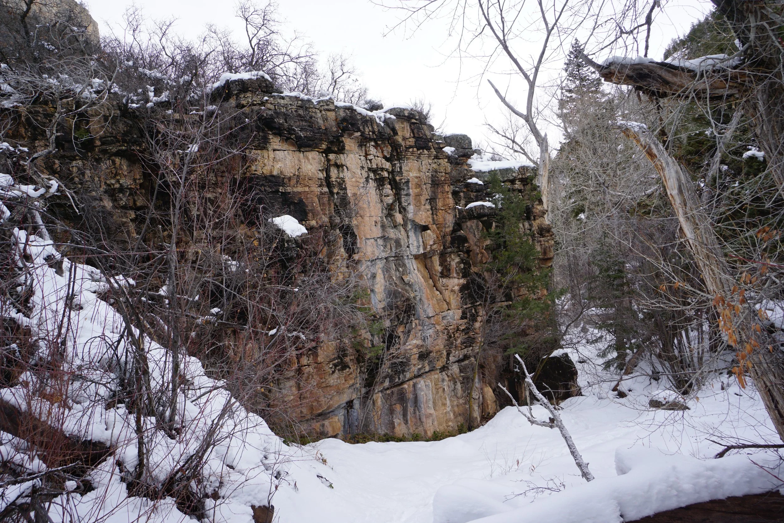
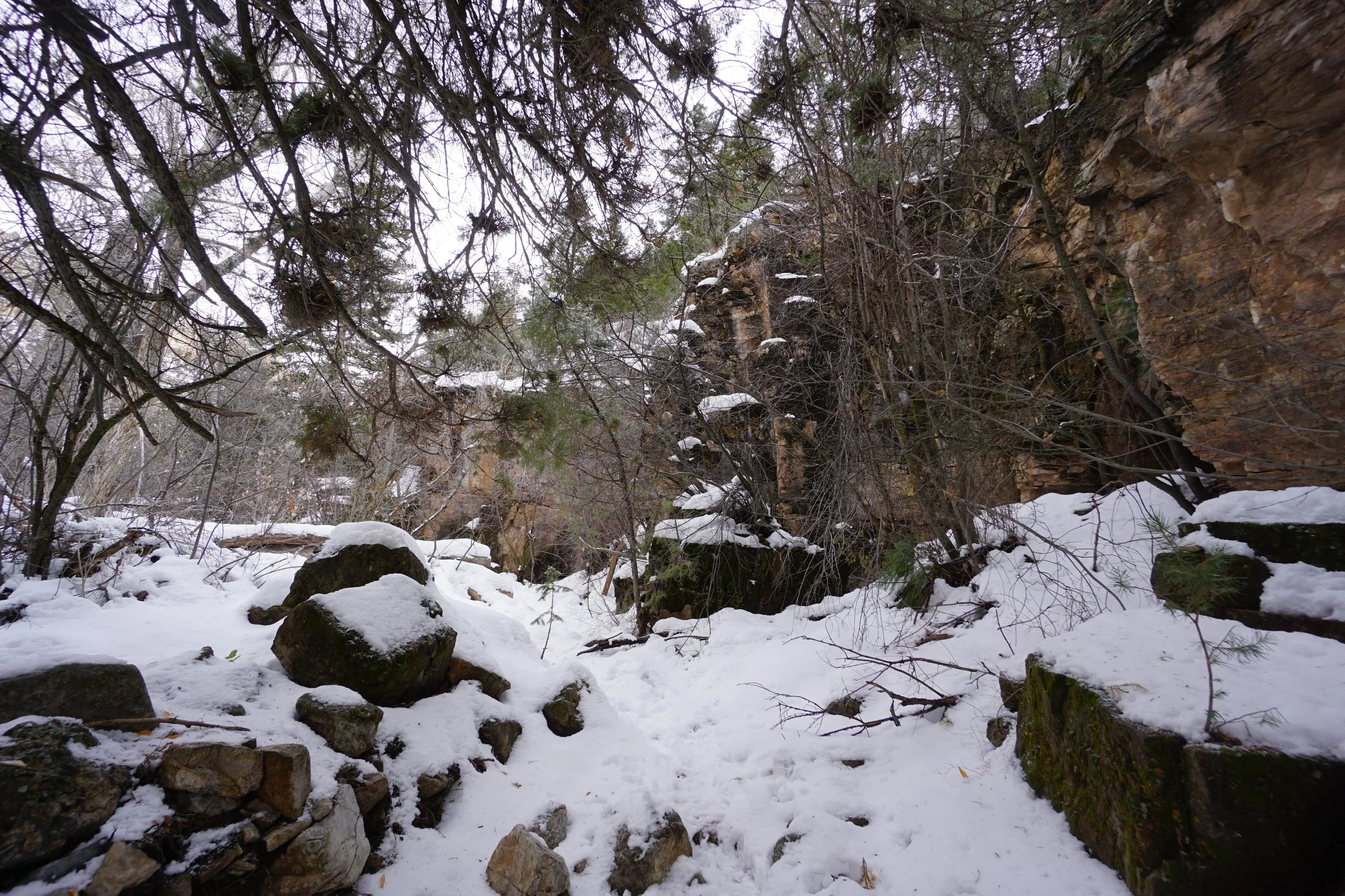
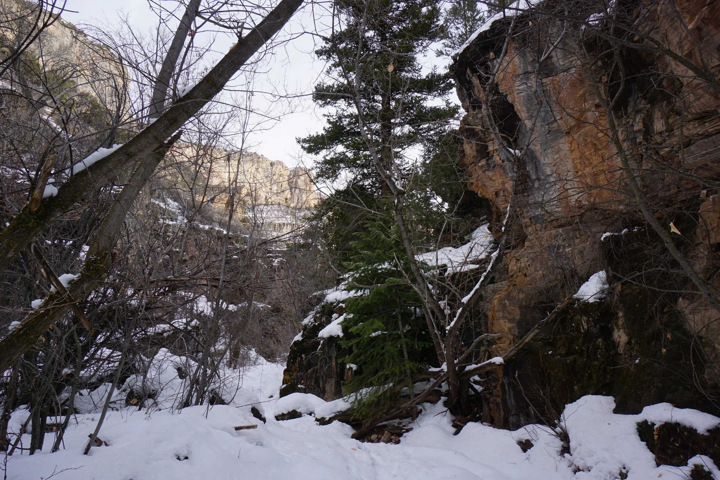
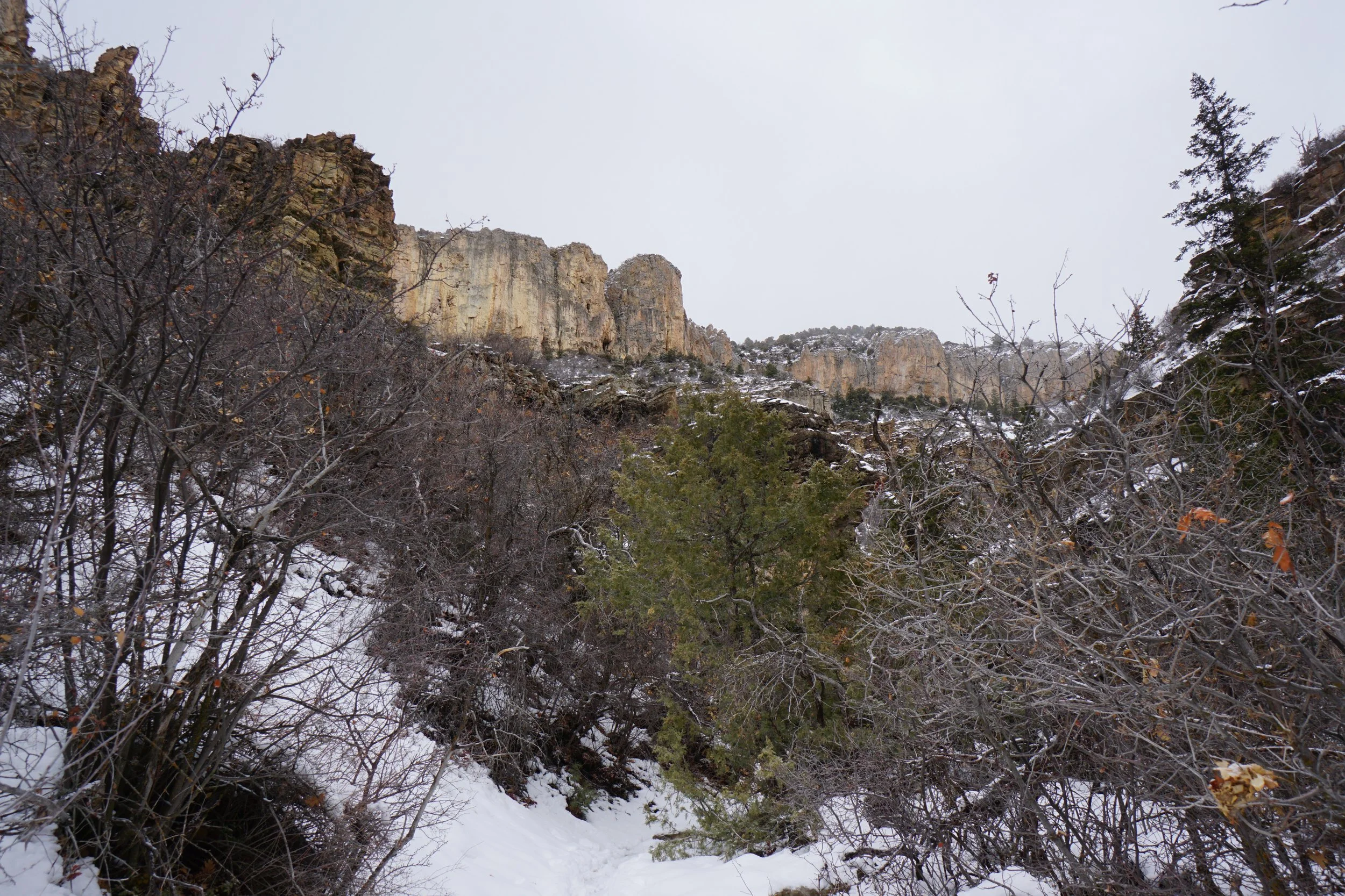
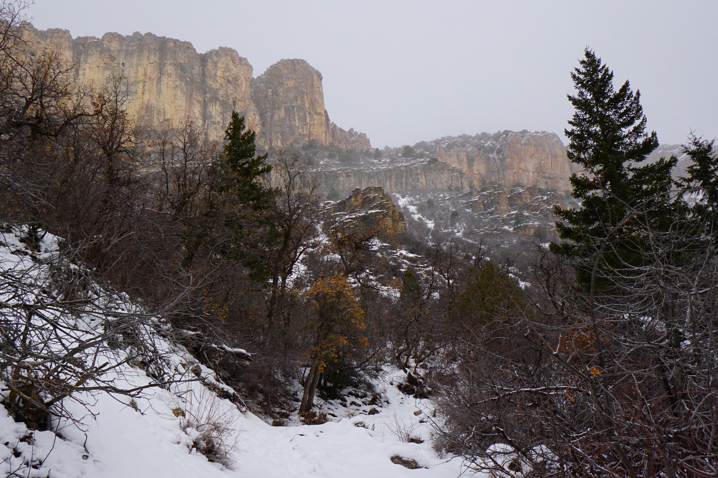
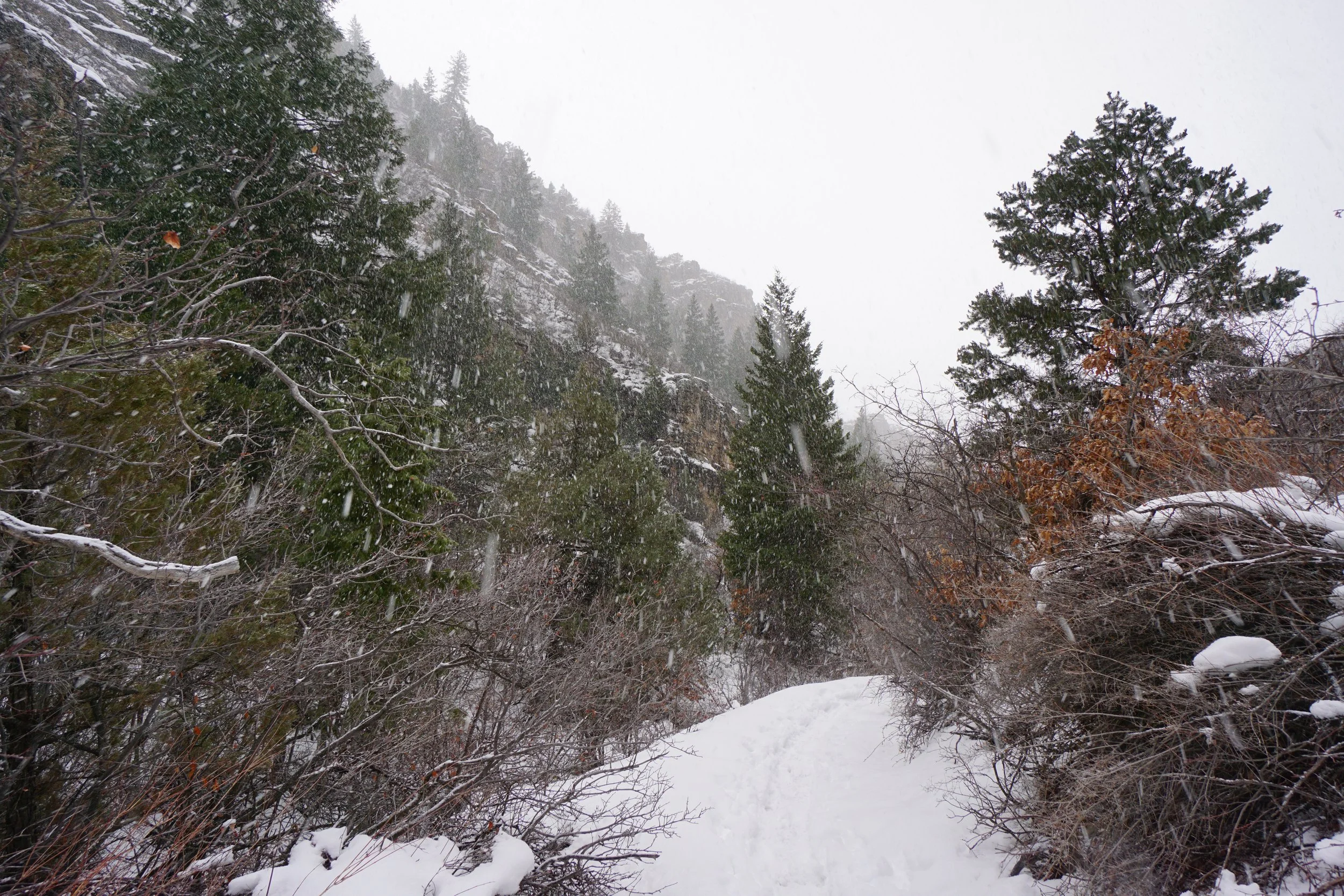
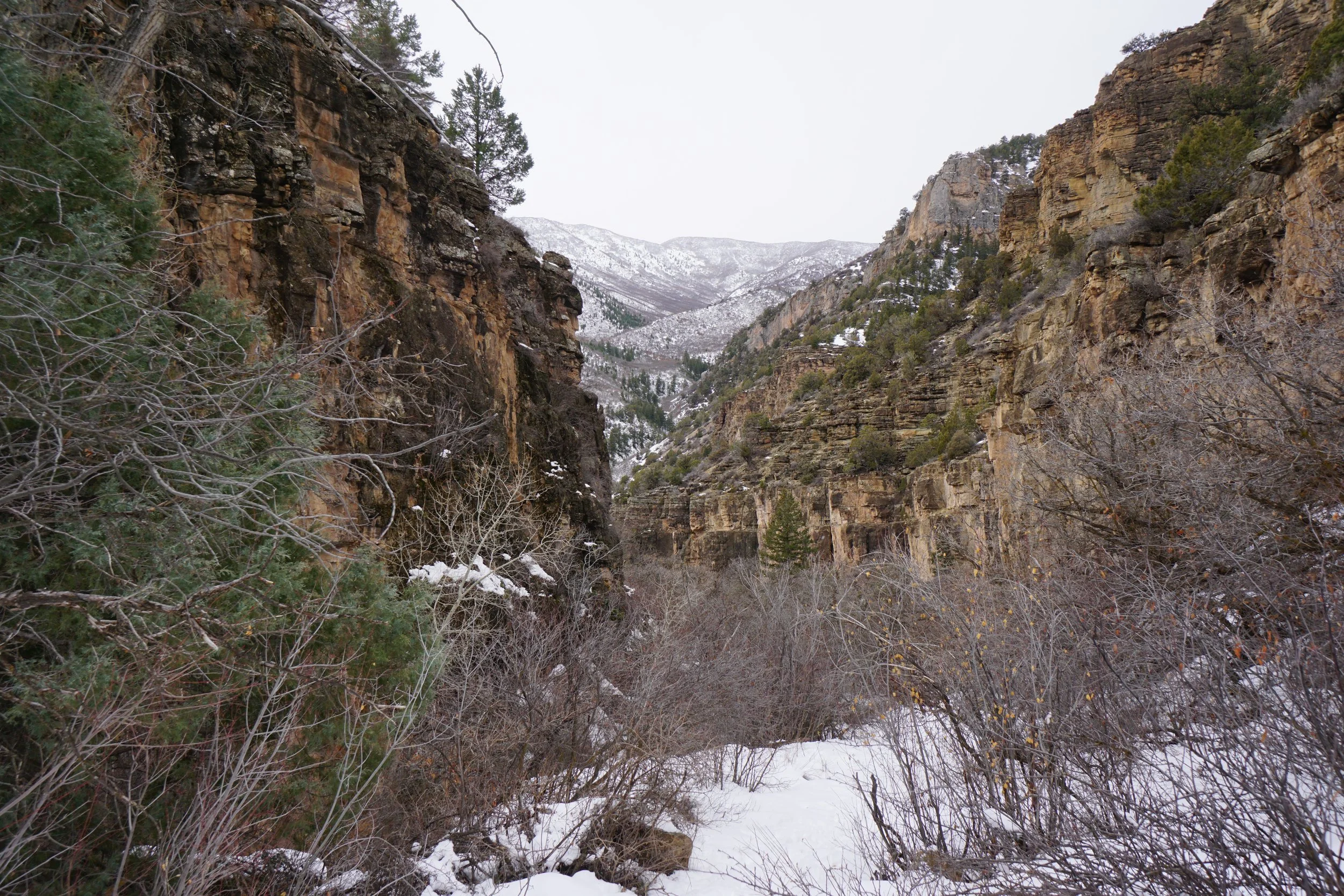
When you turn into Hadley Gulch, you’ll be surrounded by rock walls with spires and pinnacles galore. The trail is moderate in this section with some steep sections but overall pretty mild. Scrub Oak and evergreens provide some additional shade along the gulch. As you approach the one mile mark the trail tops out and becomes a bit flatter as you work your way deeper into the gulch. Soon cliffs tower ahead of you building excitement for what's to come. Each turn through the narrow gulch brings you closer and closer and…that’s about all I saw, the snow came in and the towering mesa became invisible…bummer.
I turned back at this point, but I am eager to revisit this trail, maybe in the springtime. It was beautiful and a great example of the White River Platueau’s unique topography. This trail is a good alternative to the busier trails in Glenwood Canyon as the geology is similar but not many people know about it.