Courthouse Mountain
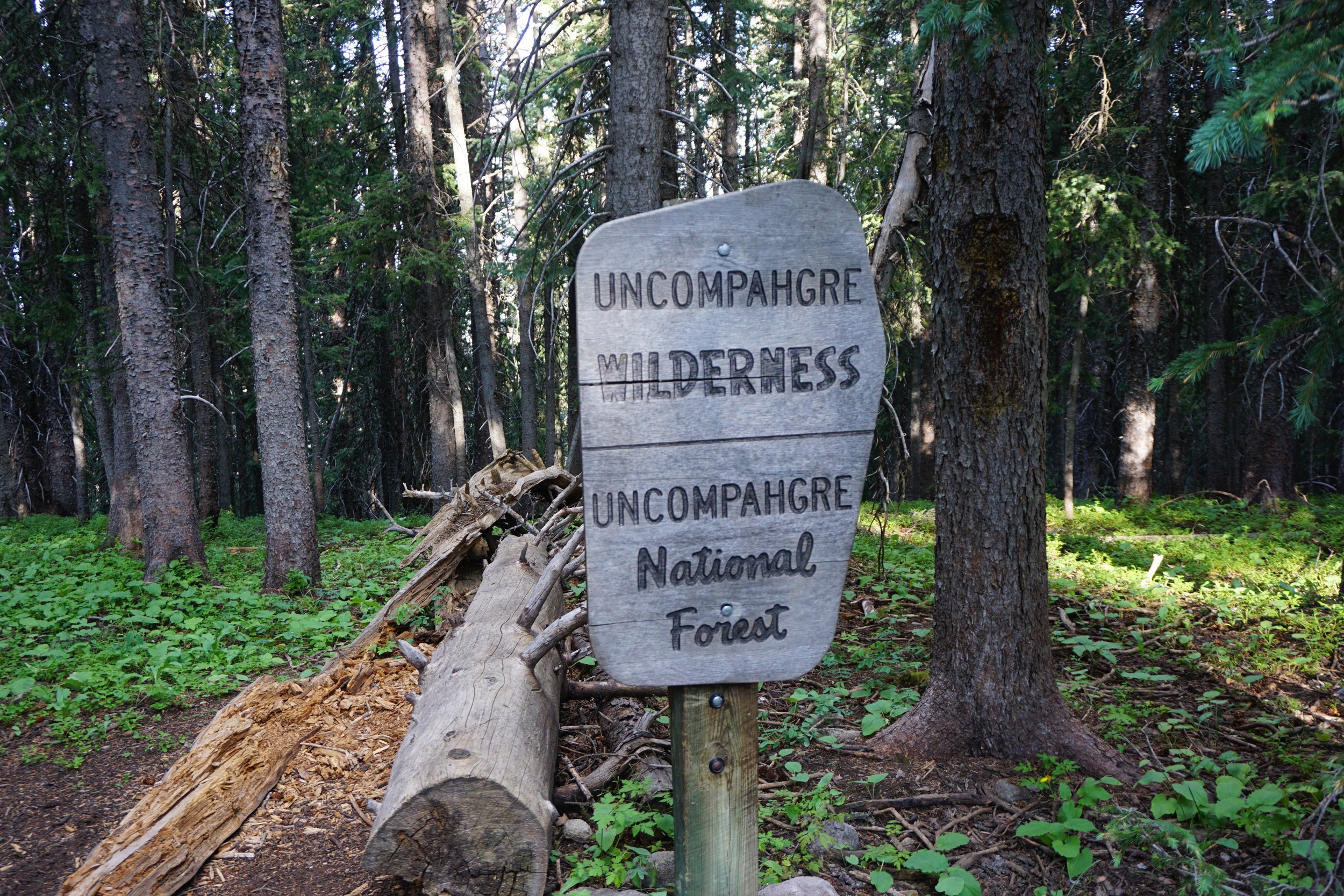
Uncompahgre Wilderness, Uncompahgre National Forest
Date Hiked: July 26, 2025
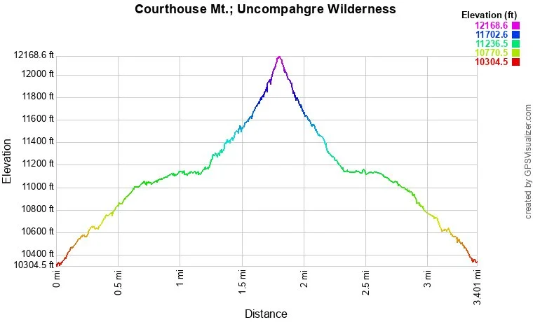
Distance: 3.2 mi (RT)
Elevation Gain: 1,730 ft
Elevation Min/Max: 10,432 to 12,088 ft
Trailhead Lat/Long: 38.13323, -107.55909
Managing Agency: U.S. Forest Service
Fee: None
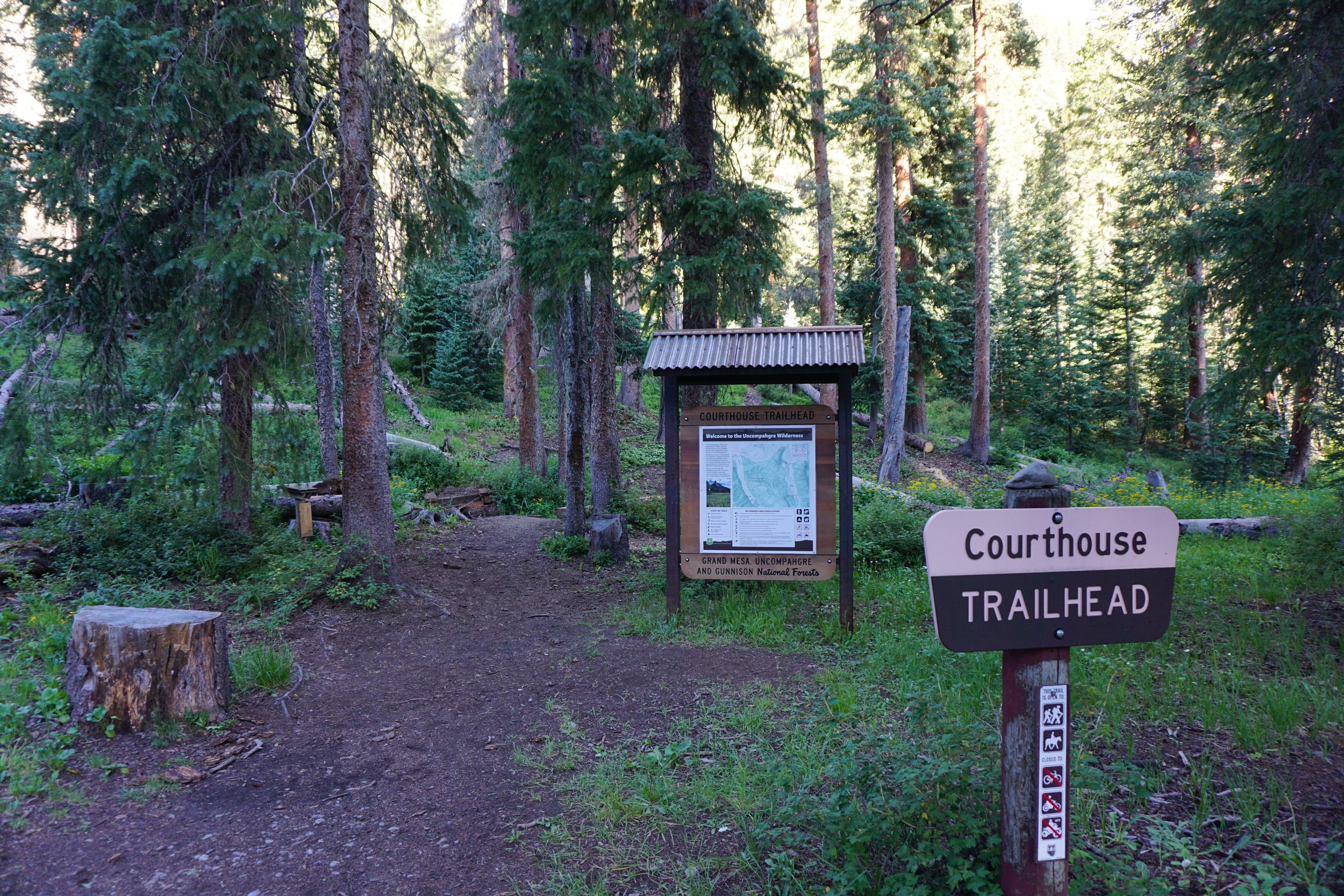
Directions:
From Ridgway, CO, head north out of town on Hwy 550 and turn right (east) onto CO 10 (Owl Creek Pass Road). This good dirt road is incredibly scenic and an adventure by itself, especially in the fall! CO 10 becomes FR 858 and weaves its way up to Owl Creek Pass. Co 10 and FR 858 is about 15 miles of good dirt road and in good conditions most vehicles should be fine, though SUV or tougher is recommended. At Owl Creek Pass, turn right on FR 860, a bit rougher, for 1.5 miles to the Courthouse Trailhead on the right. Parking is a bit tight and may require some maneuvering amongst the trees. There are some dispersed campsites along the way and across from the trailhead. Alternatively, you can get there from Hwy 50 west of Curecanti NRA by making your way to Silver Jack Reservoir and continuing up to Owl Creek Pass, this route is spectacular!
Hike Description:
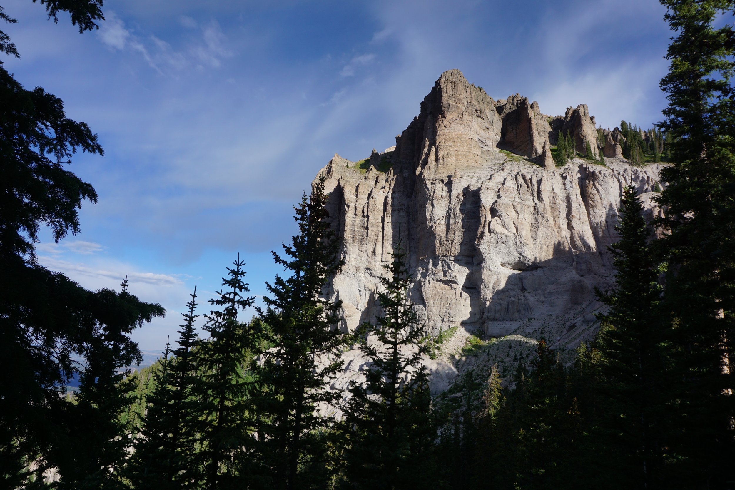
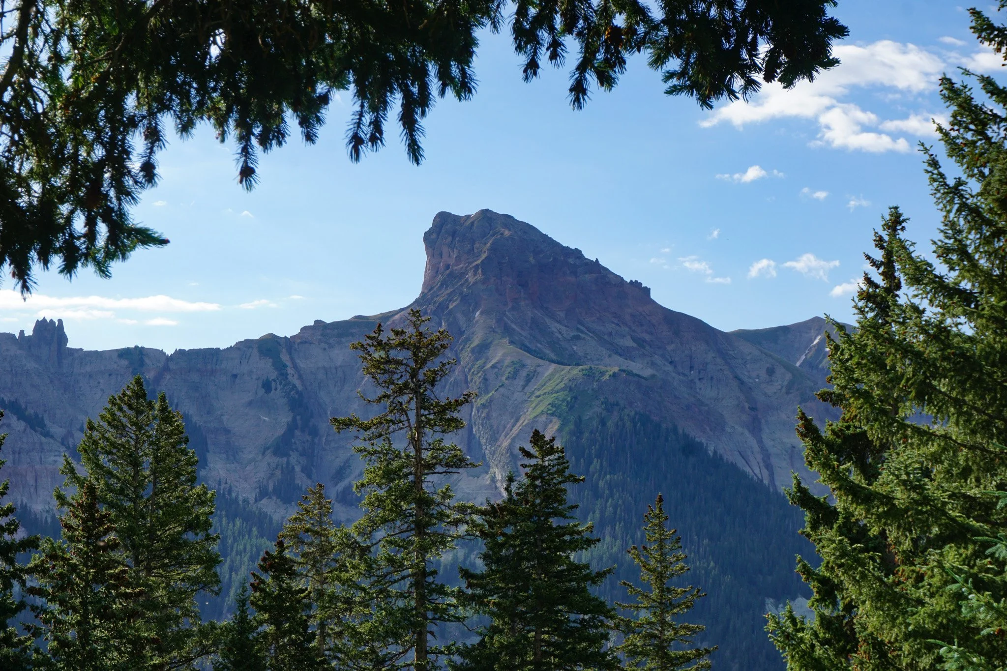
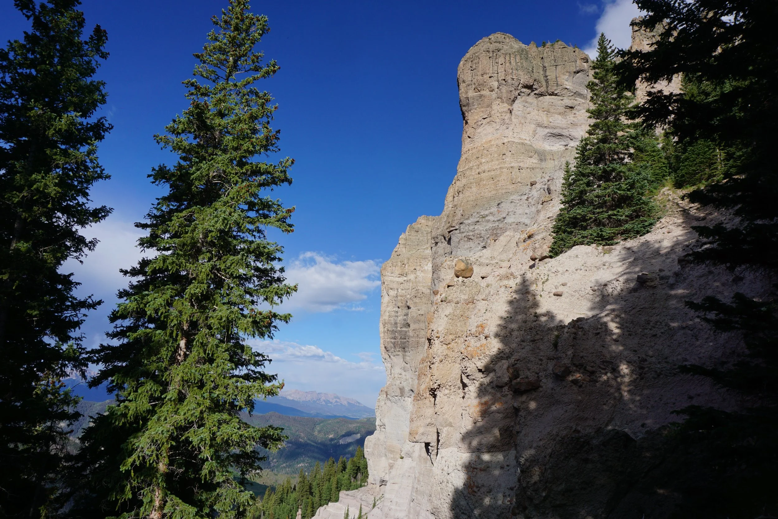
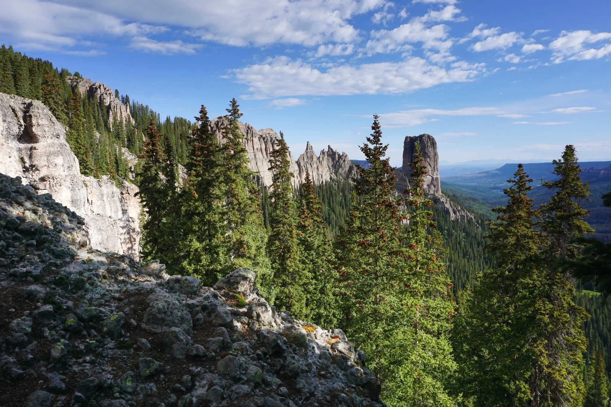
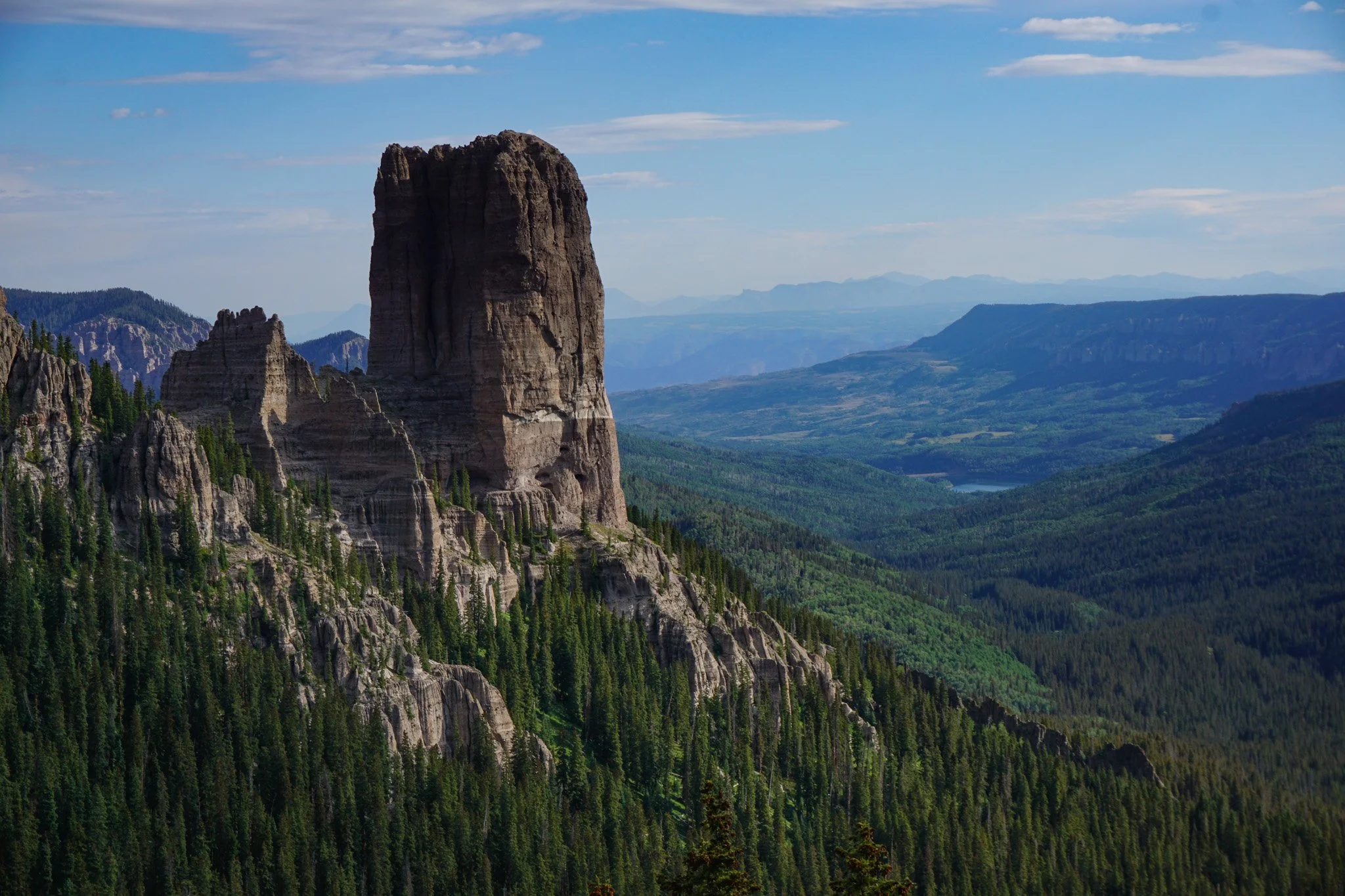
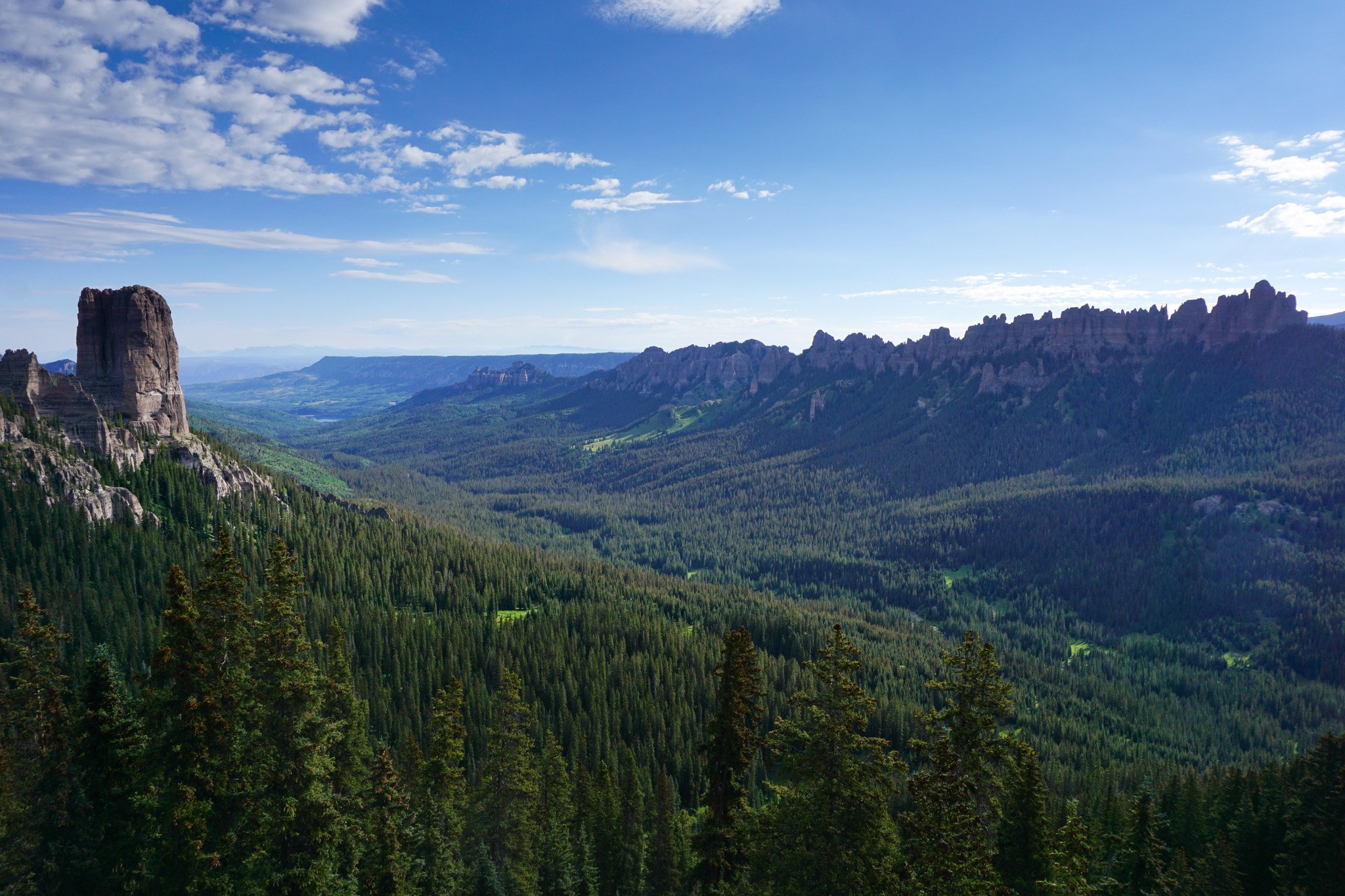
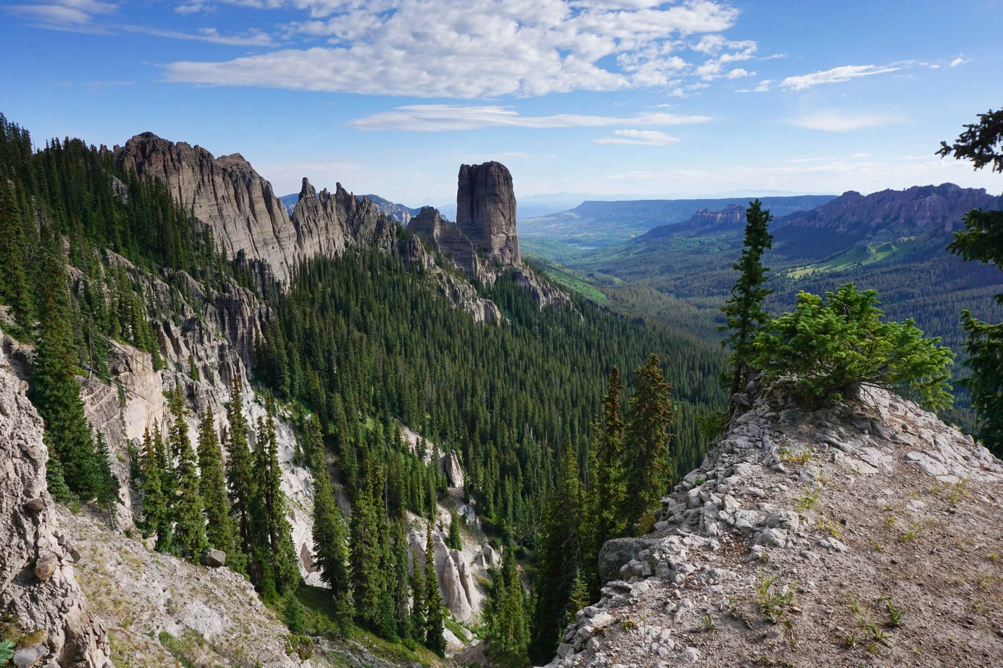
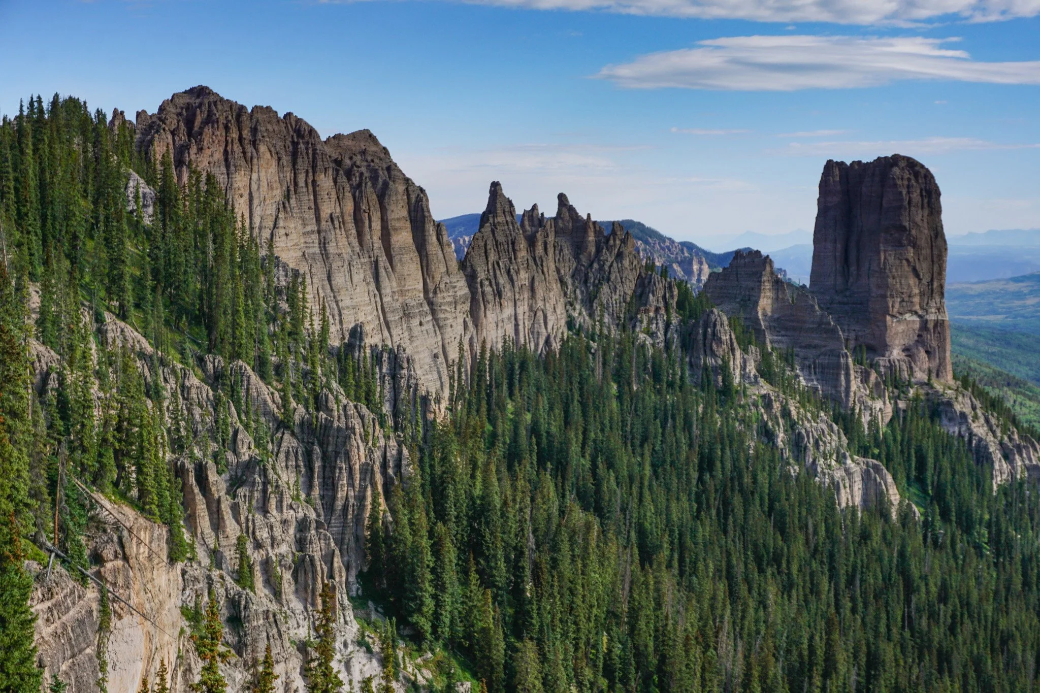
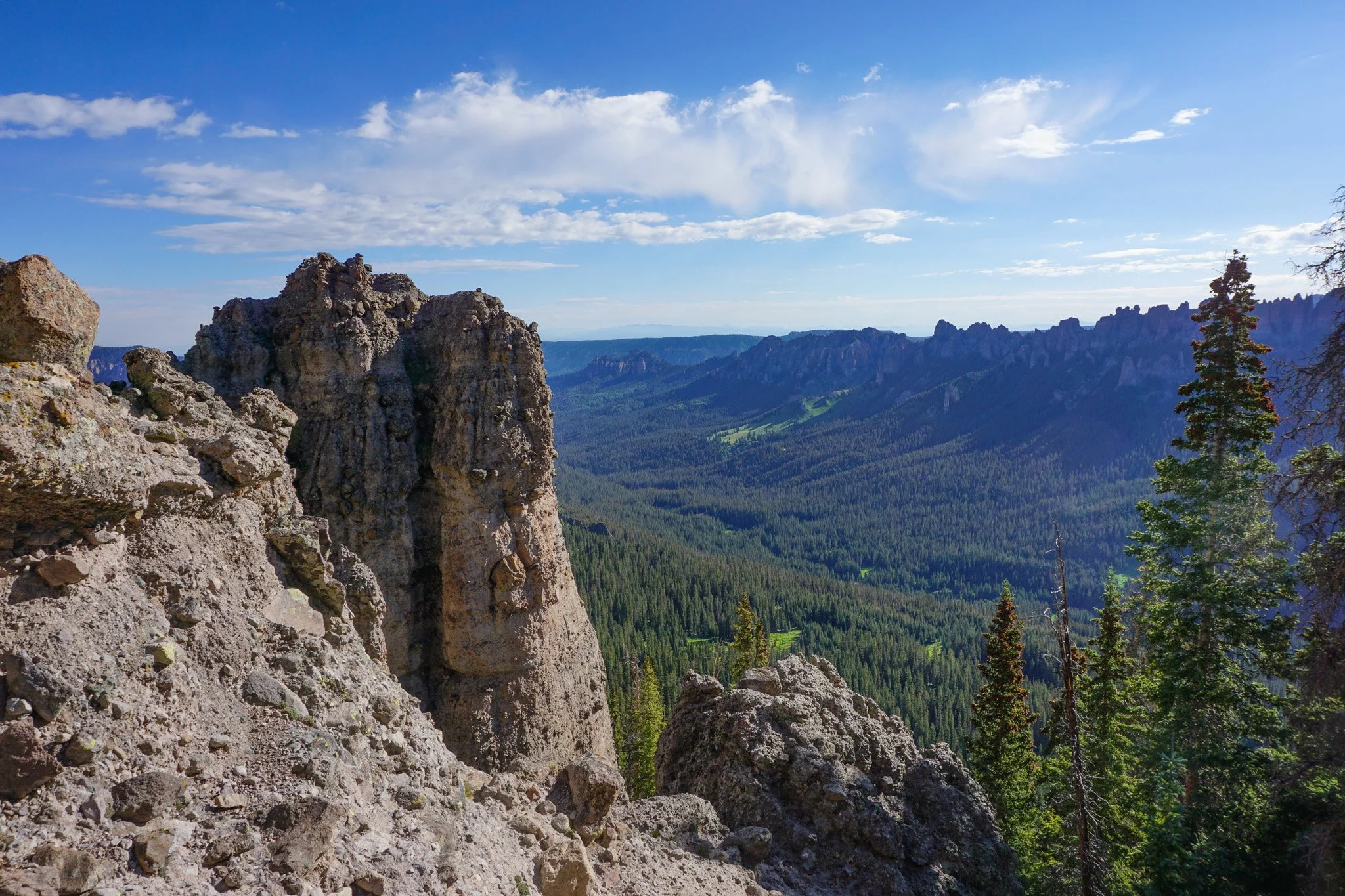
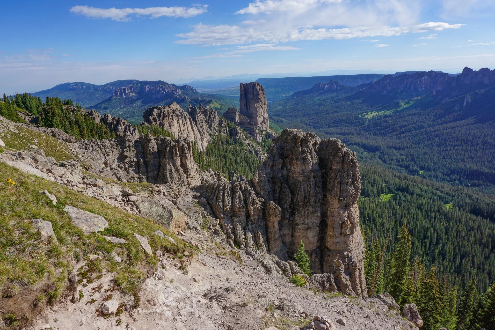
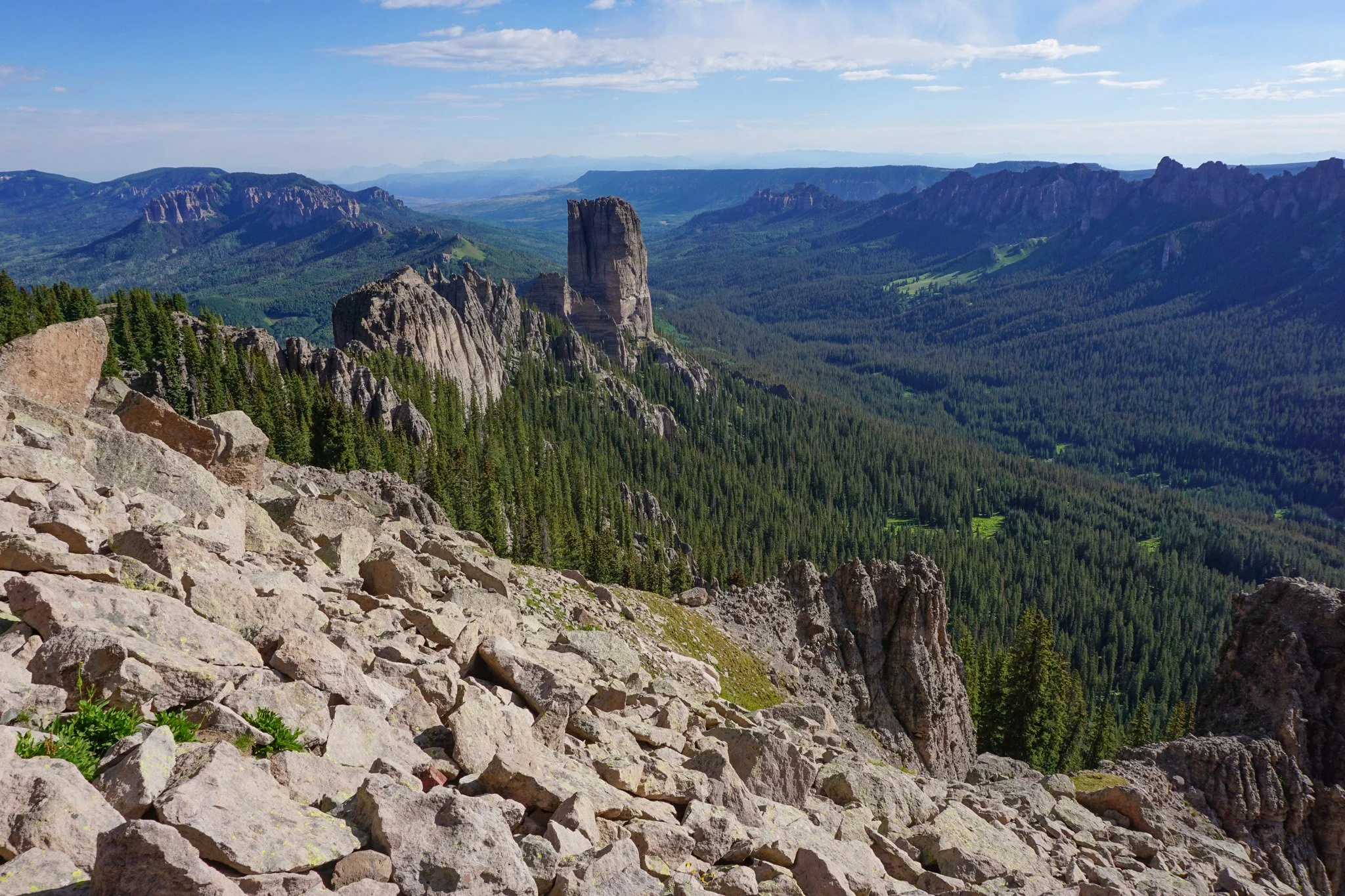
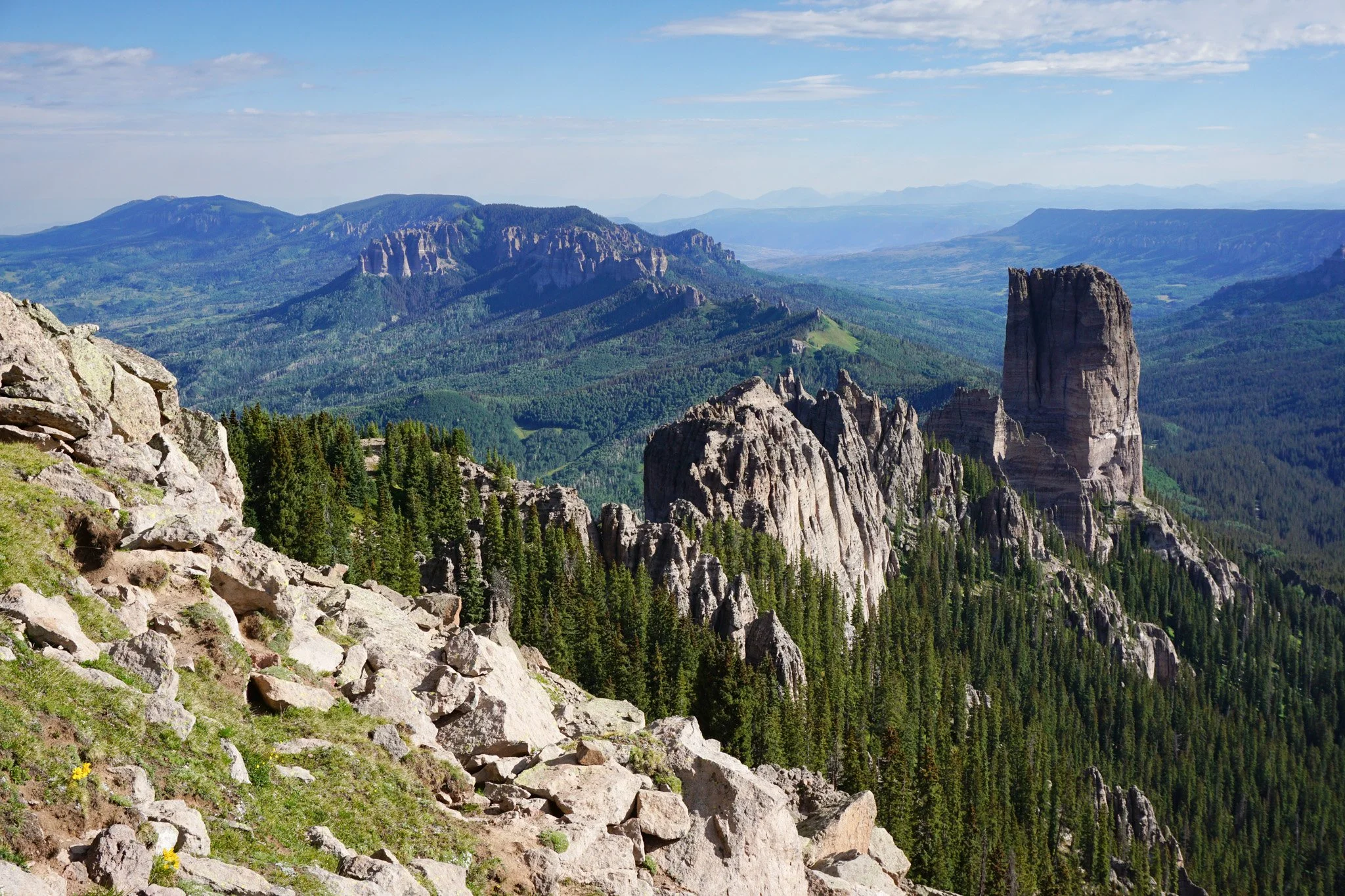
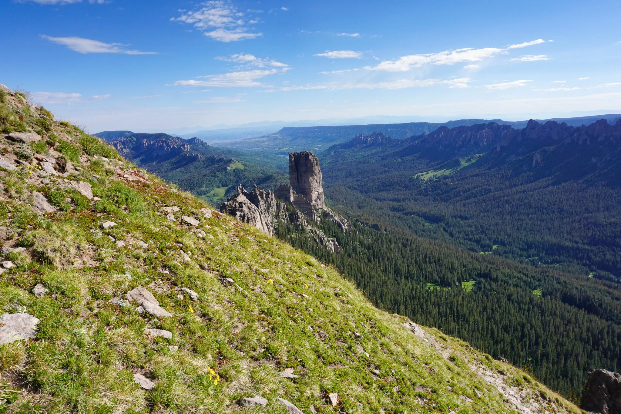
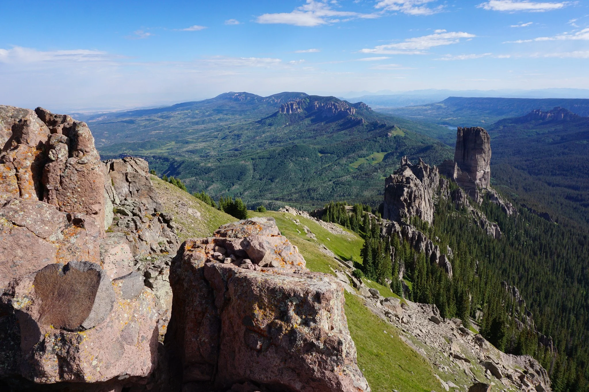
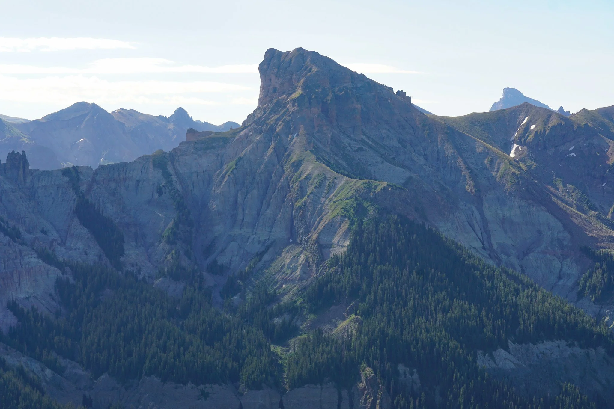
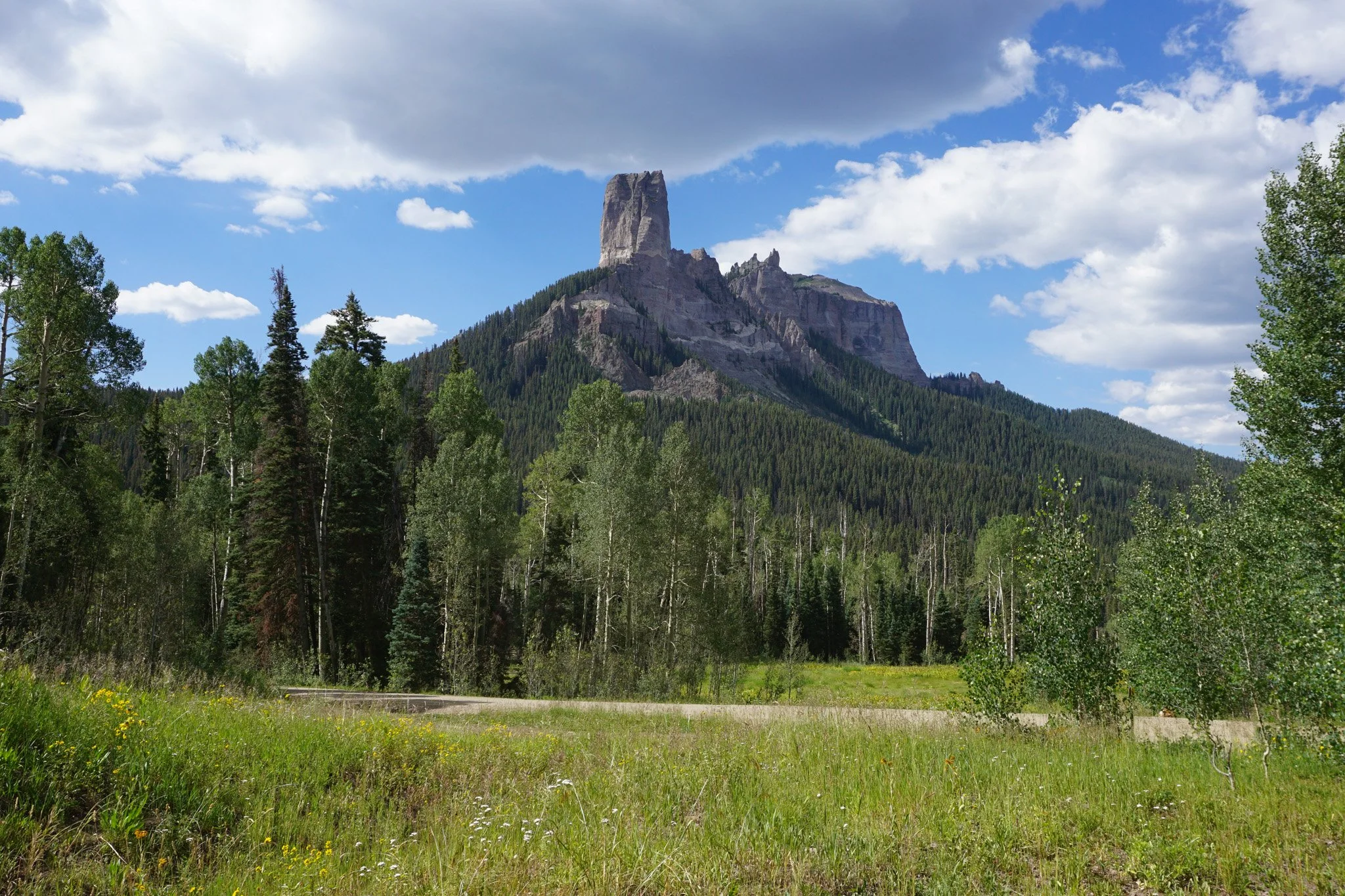
Courthouse Mountain is the perfect introduction to the Cimmaron Range of the San Juan Mountains. It’s a tough little trail, steep and a bit spine tingling at the top, but it’s short and the view from the top provided a stunning overview of the Cimmaron Range. The peak is located at the western edge of the range and shares a ridgeline with the iconic Chimney Rock, which is often seen from below, but even more impressive from above.
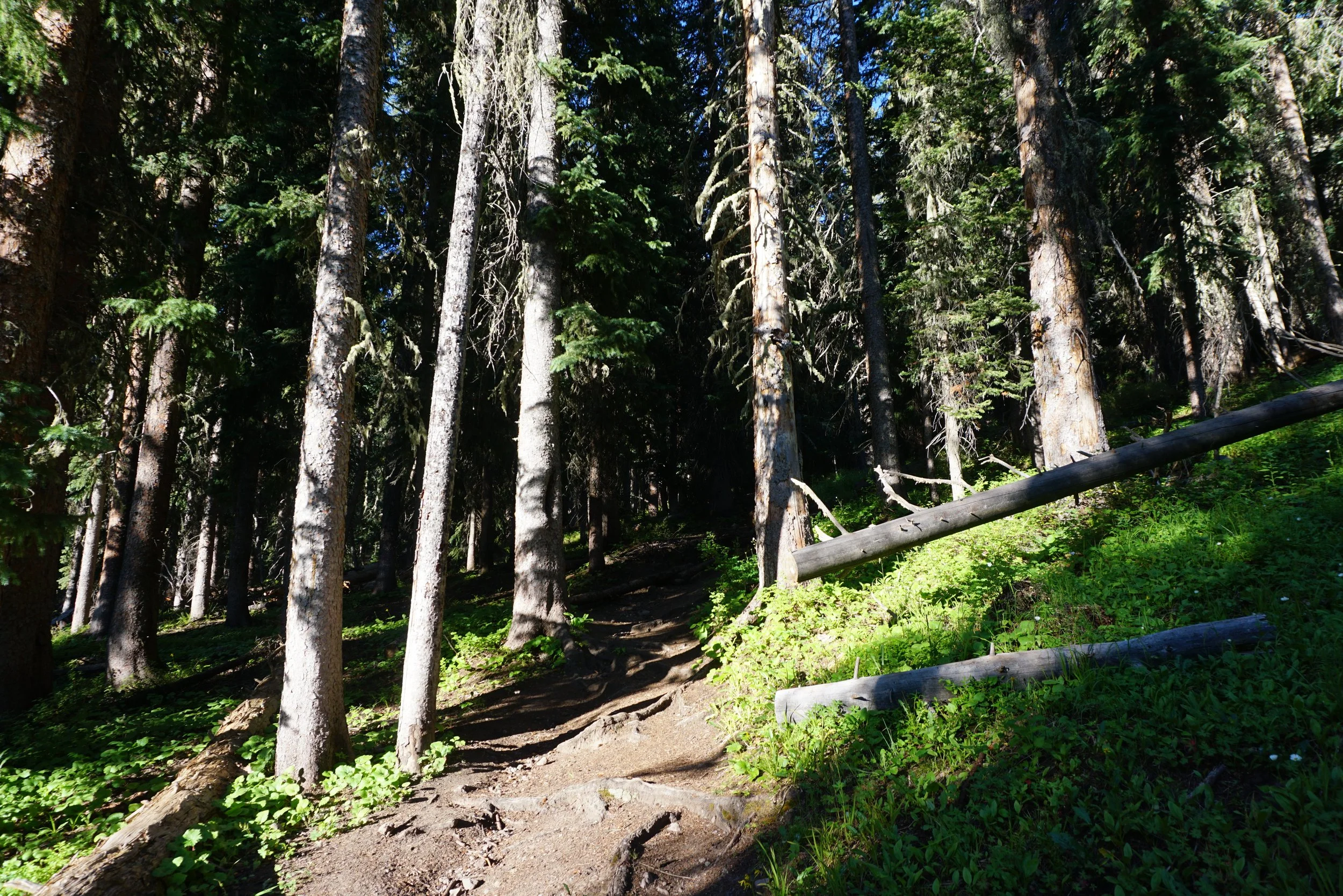
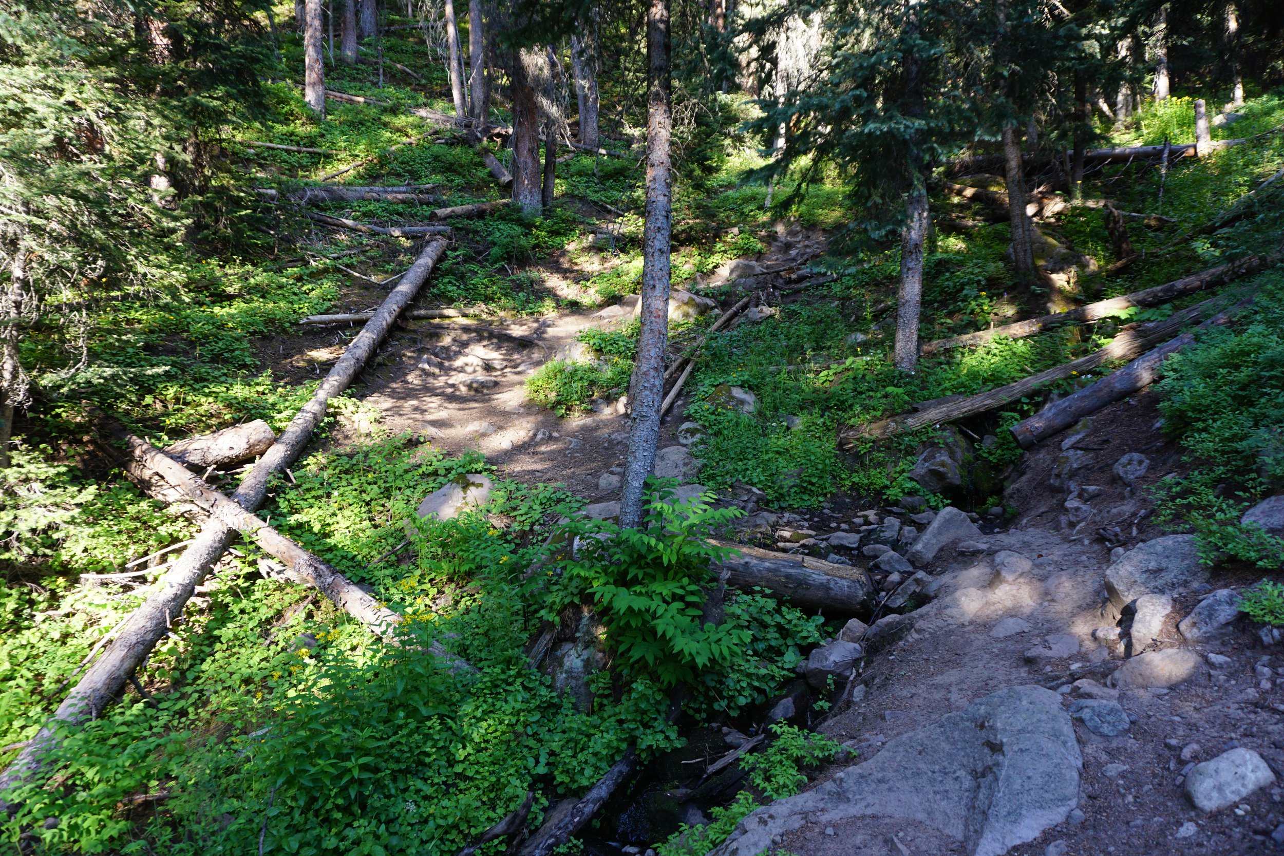
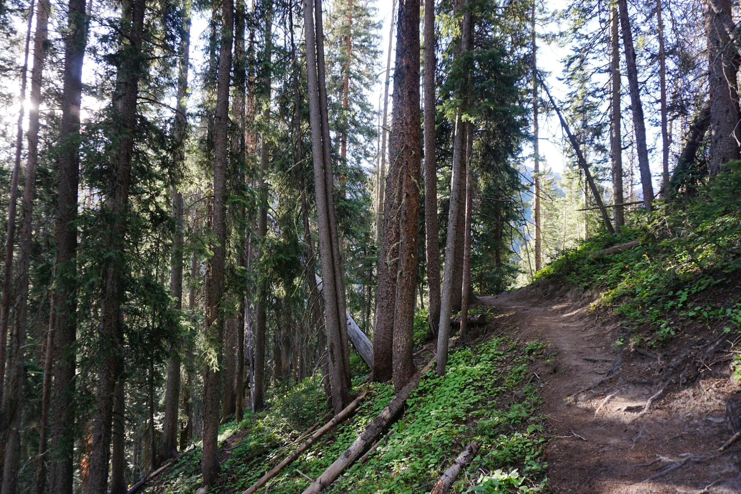
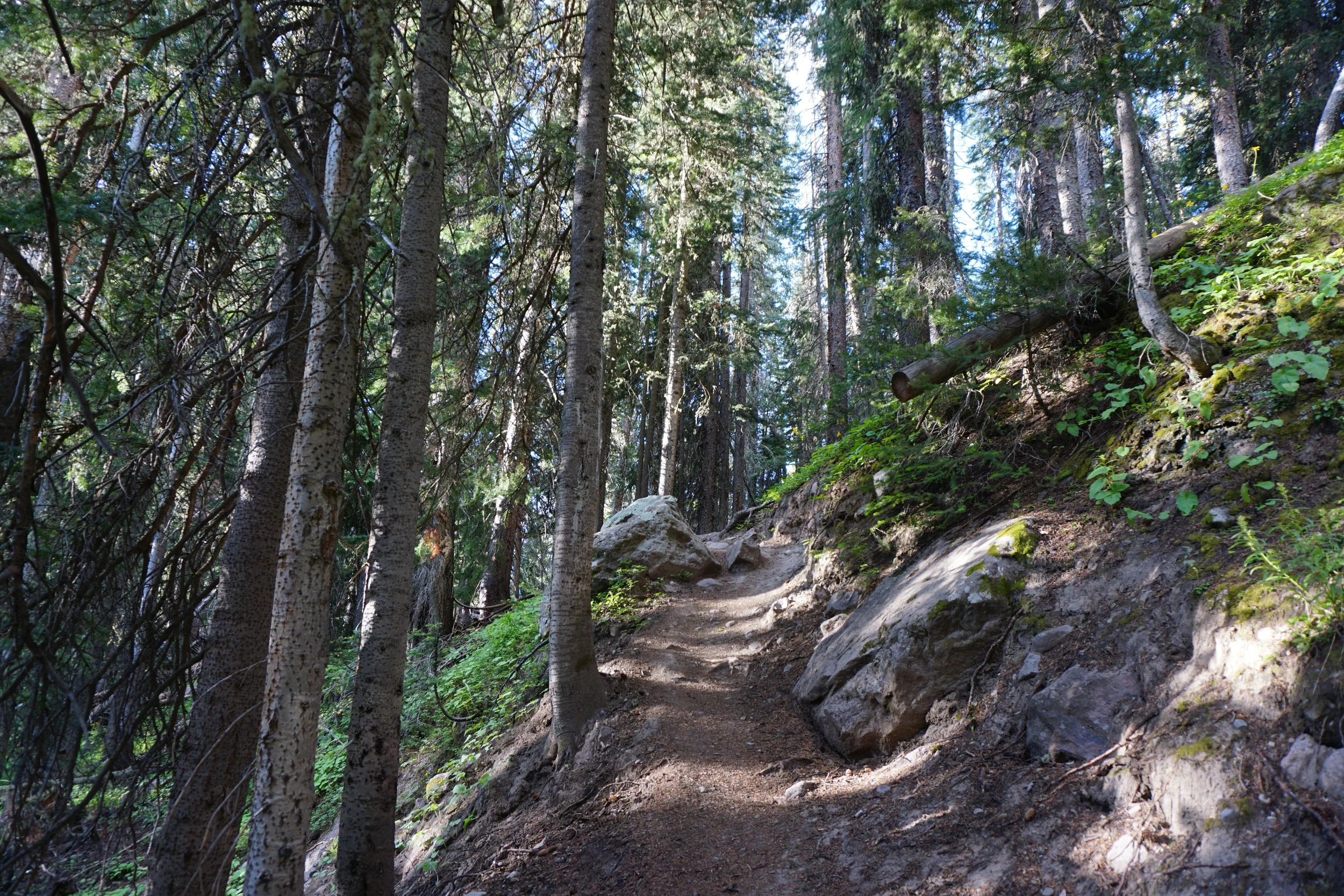
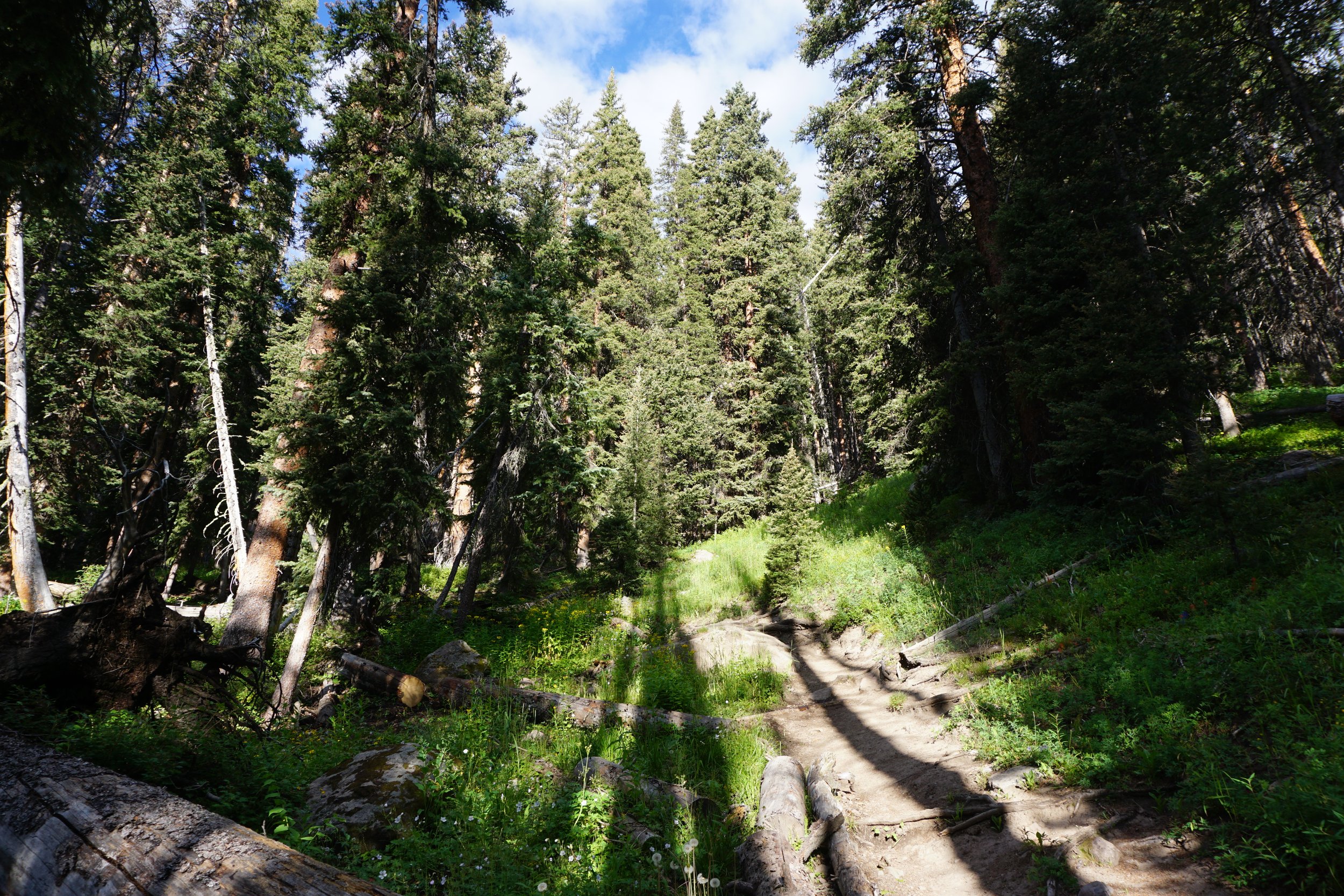
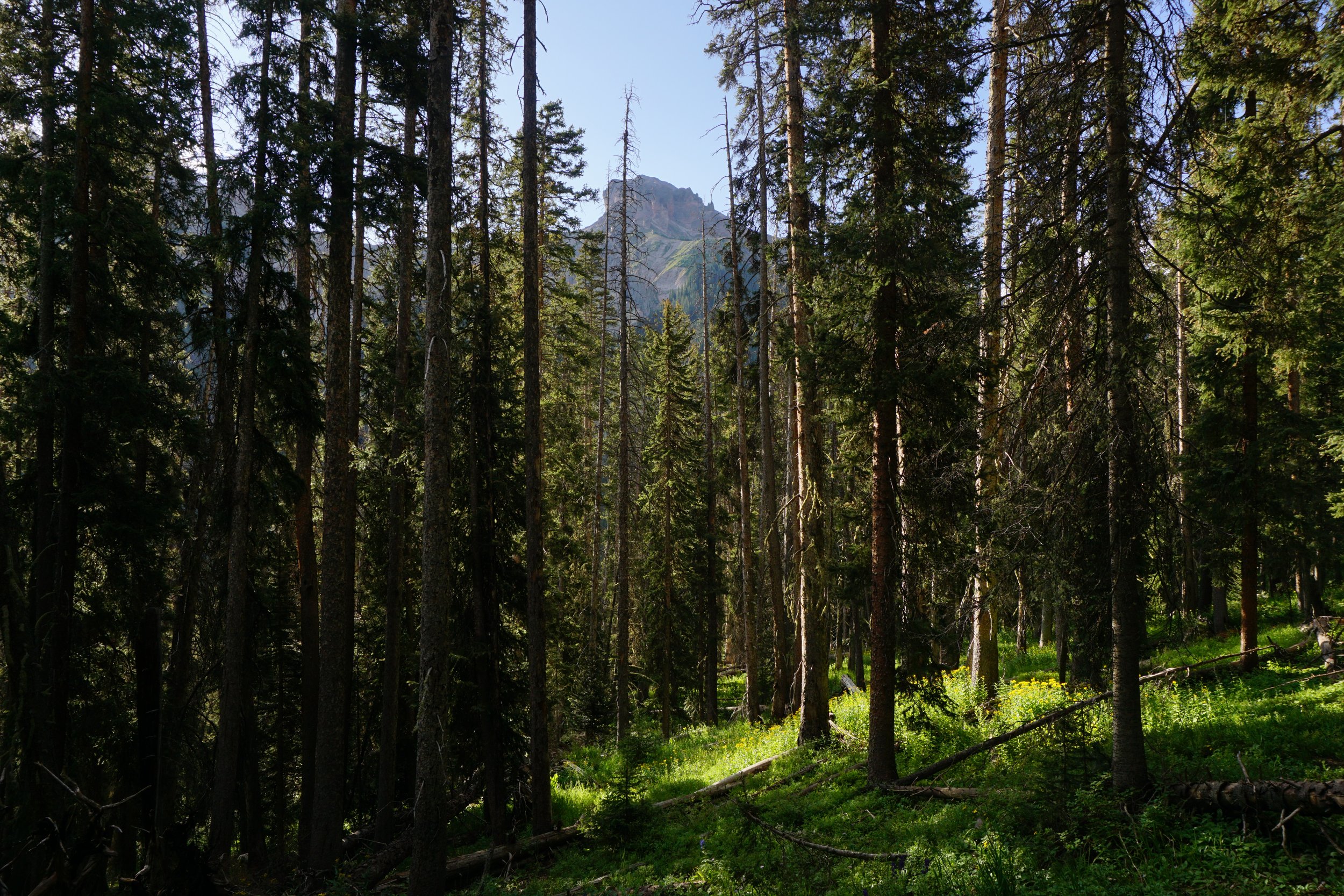
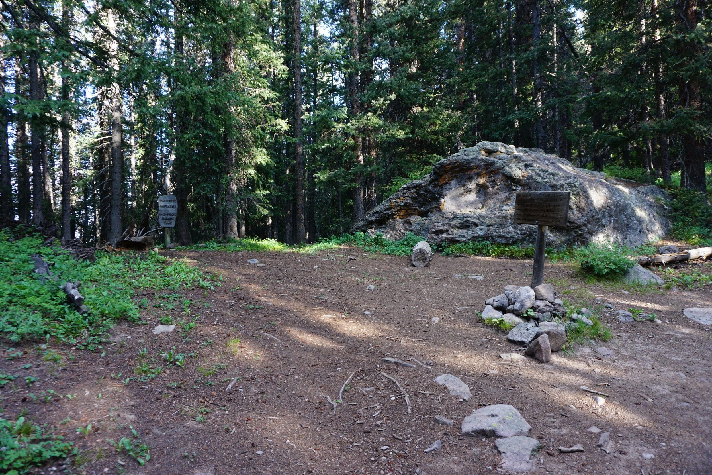
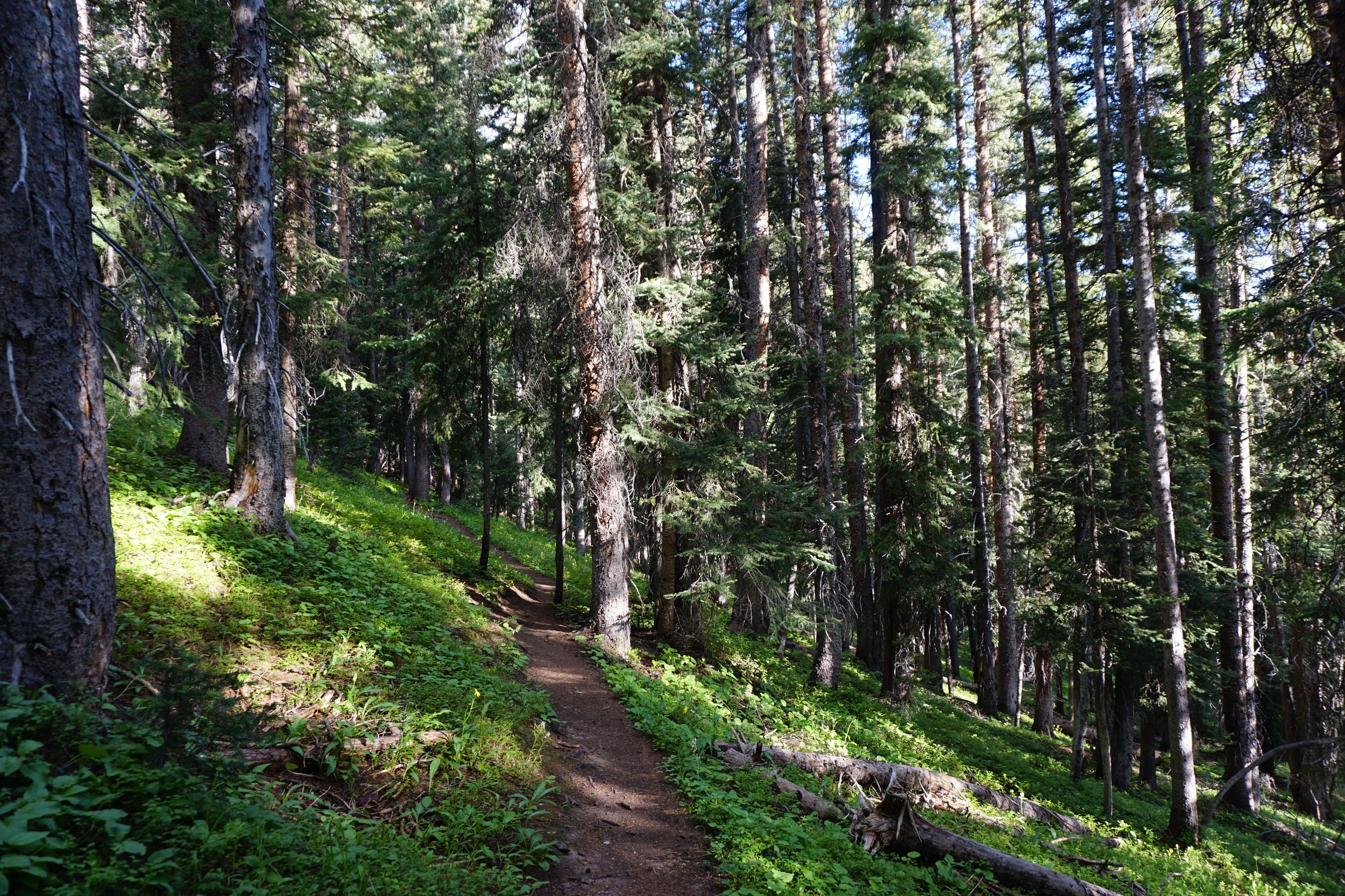
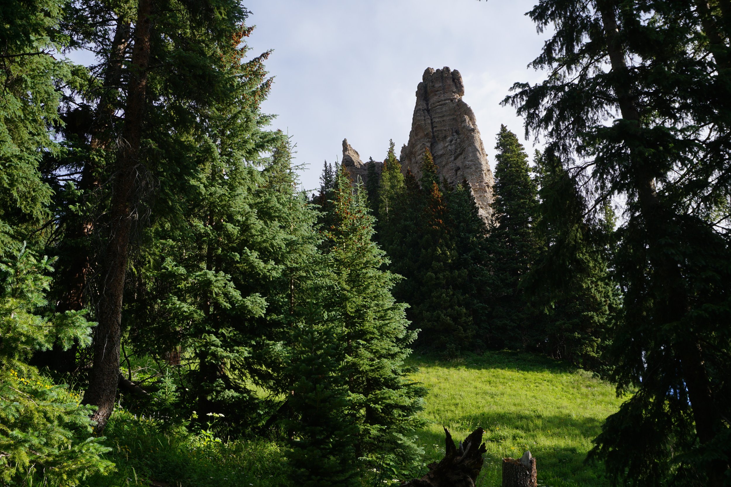
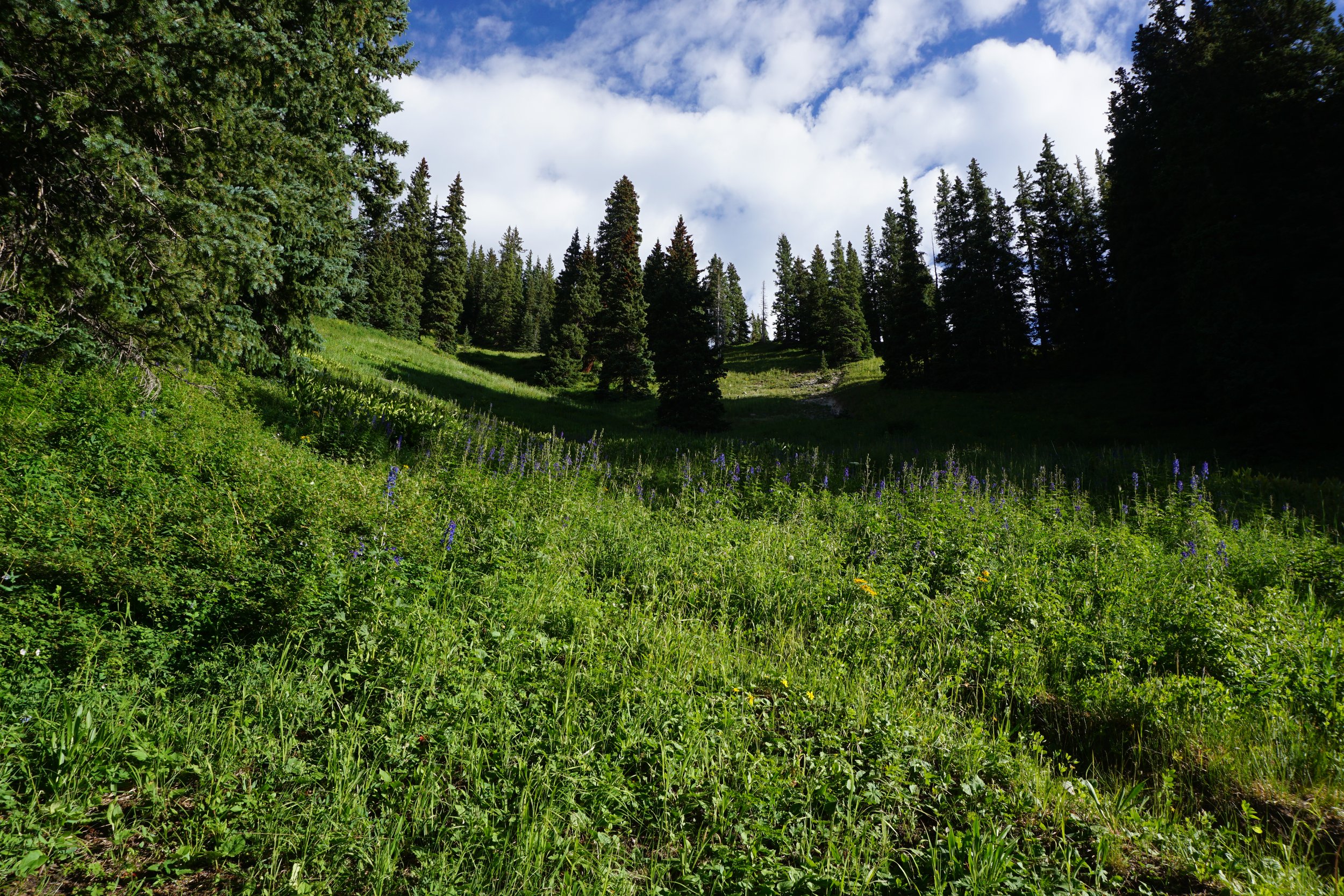
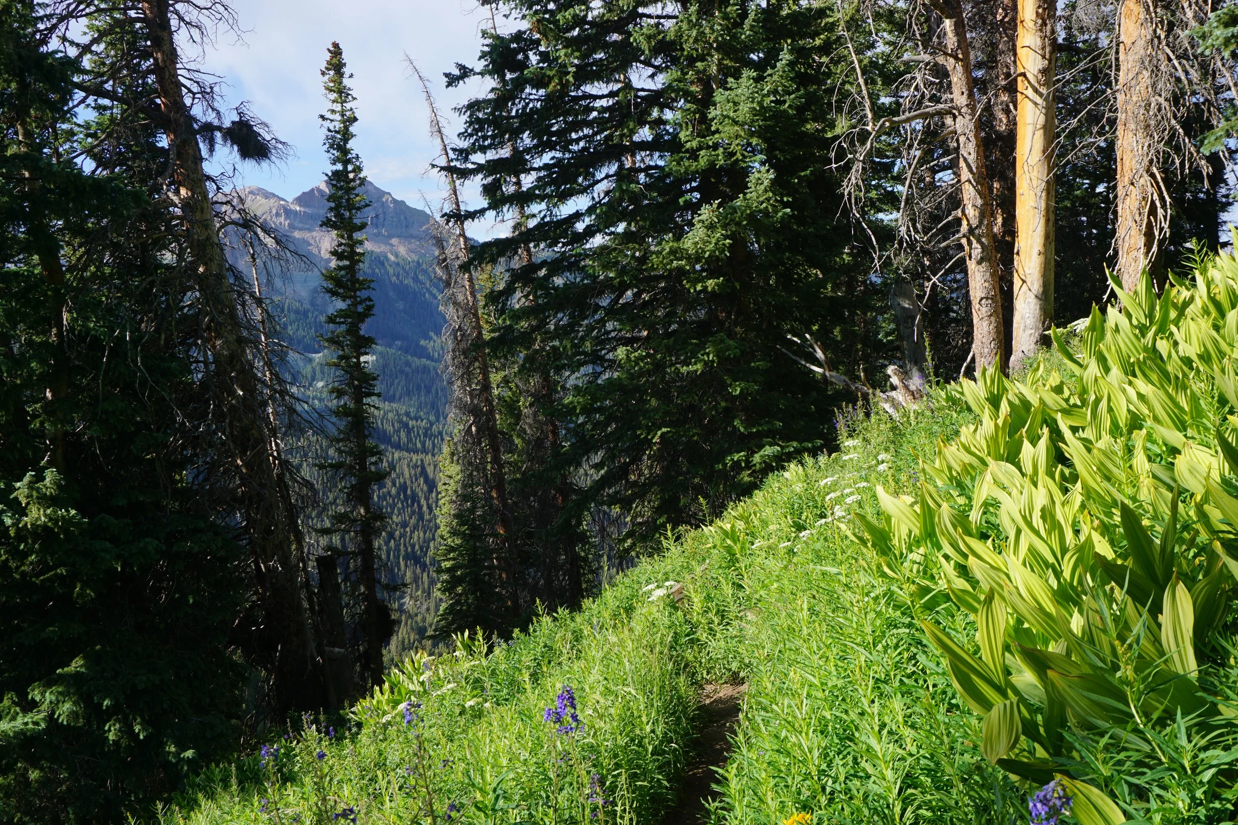
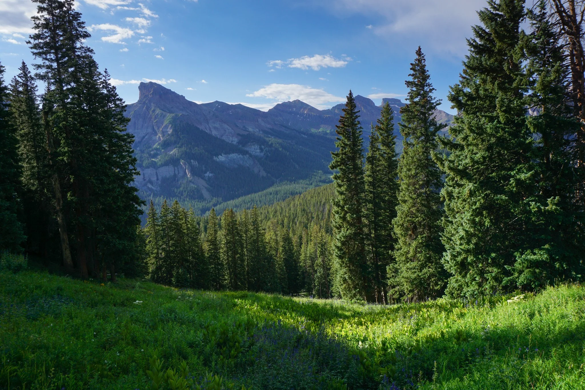
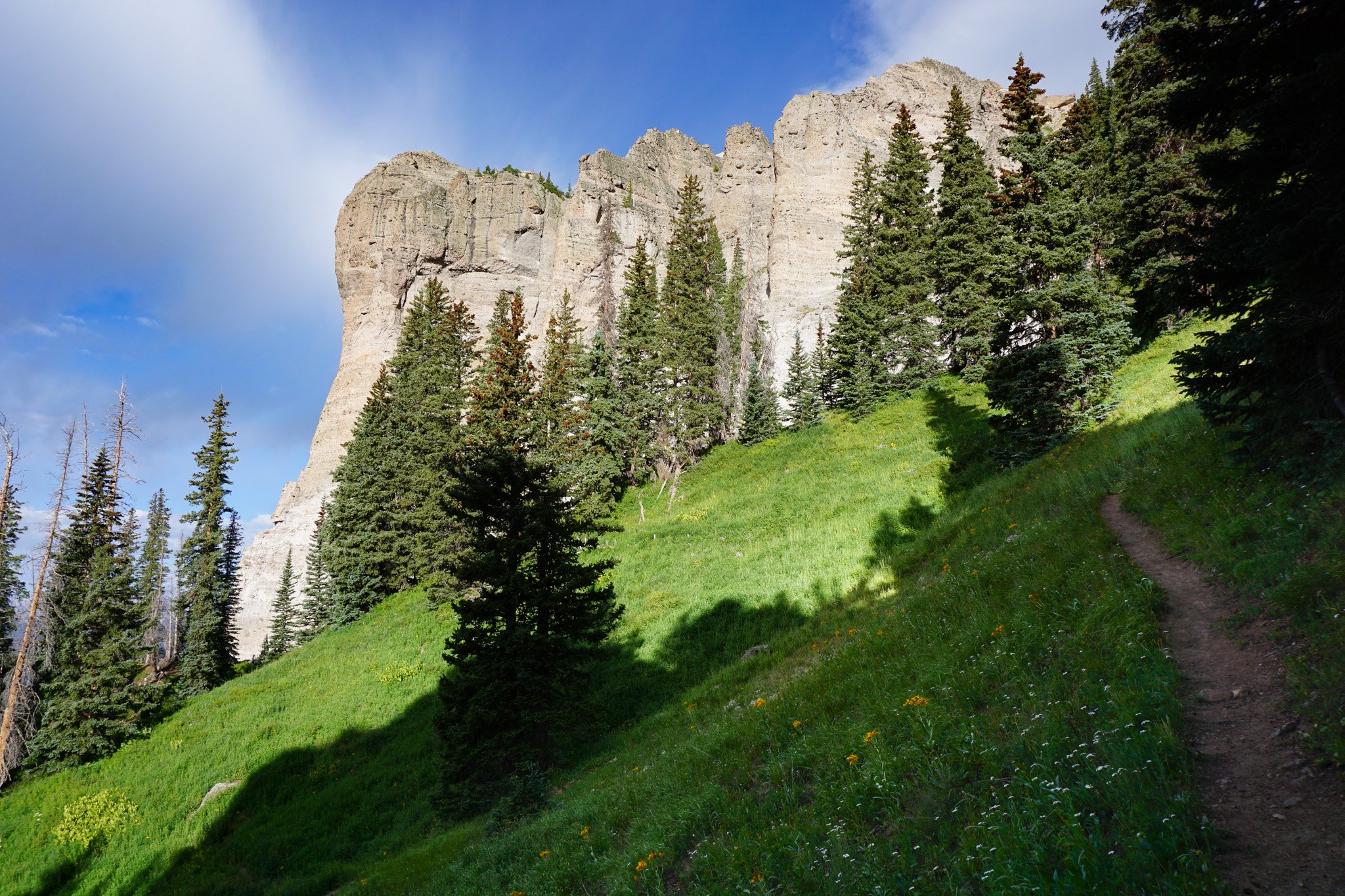
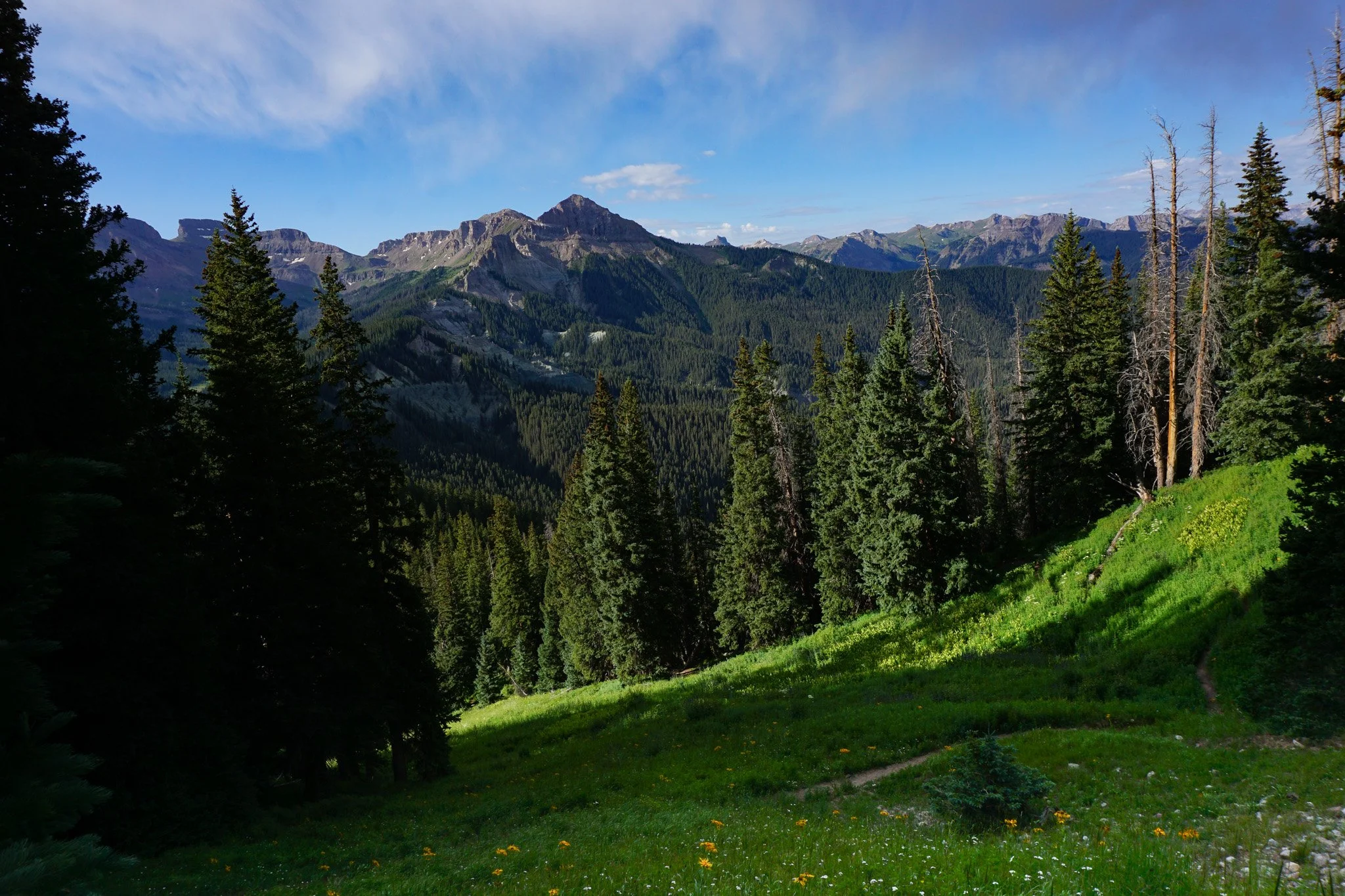
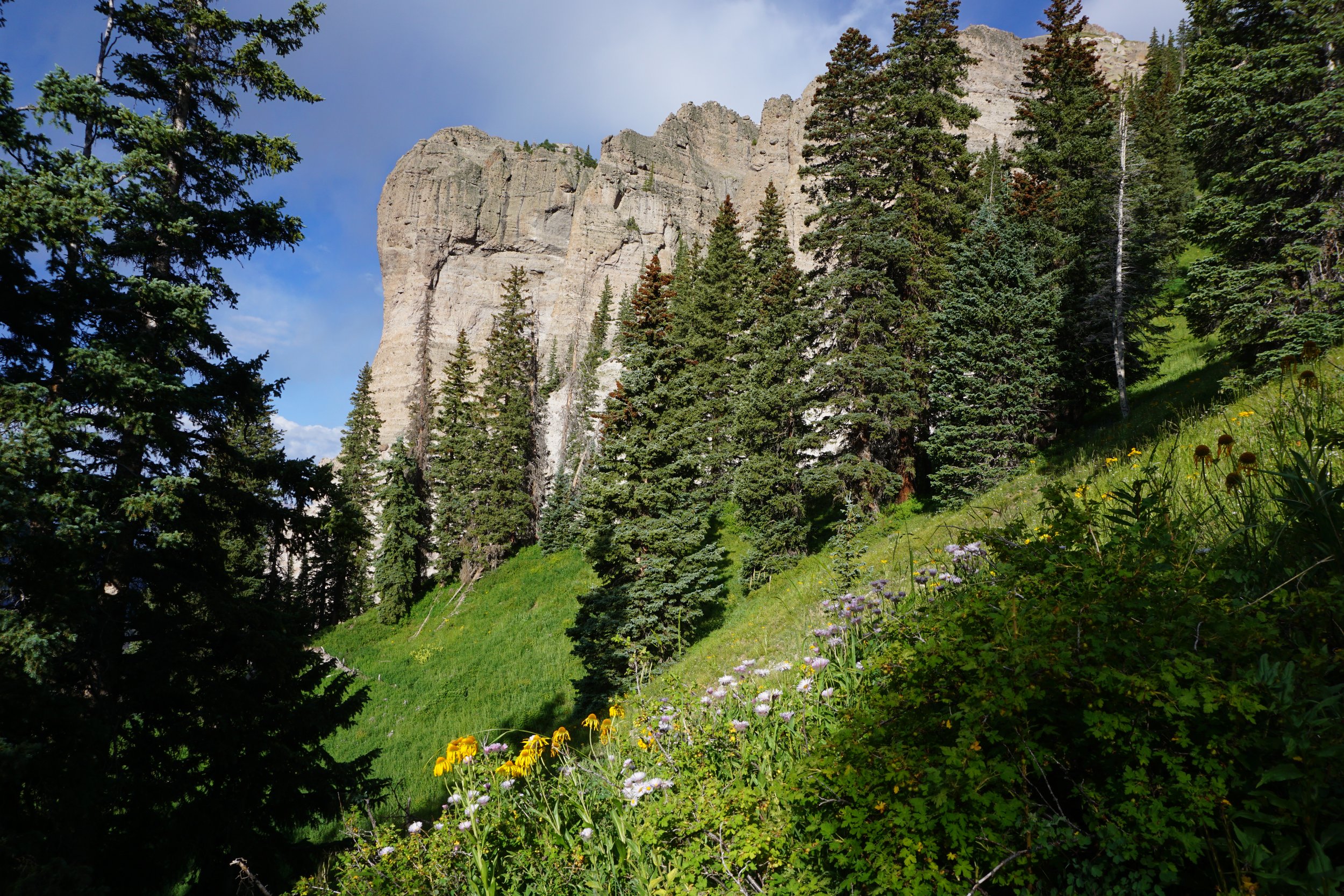
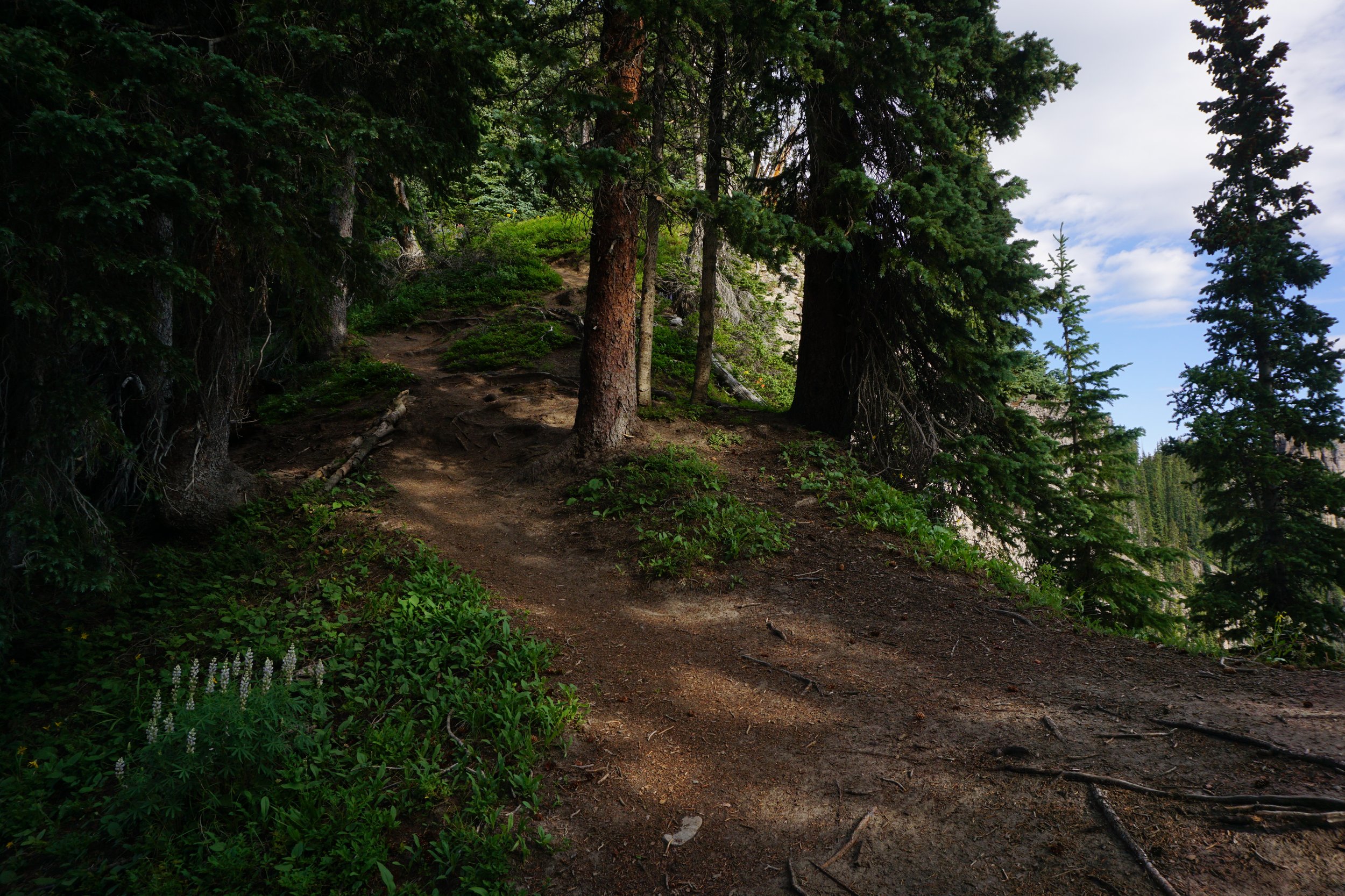
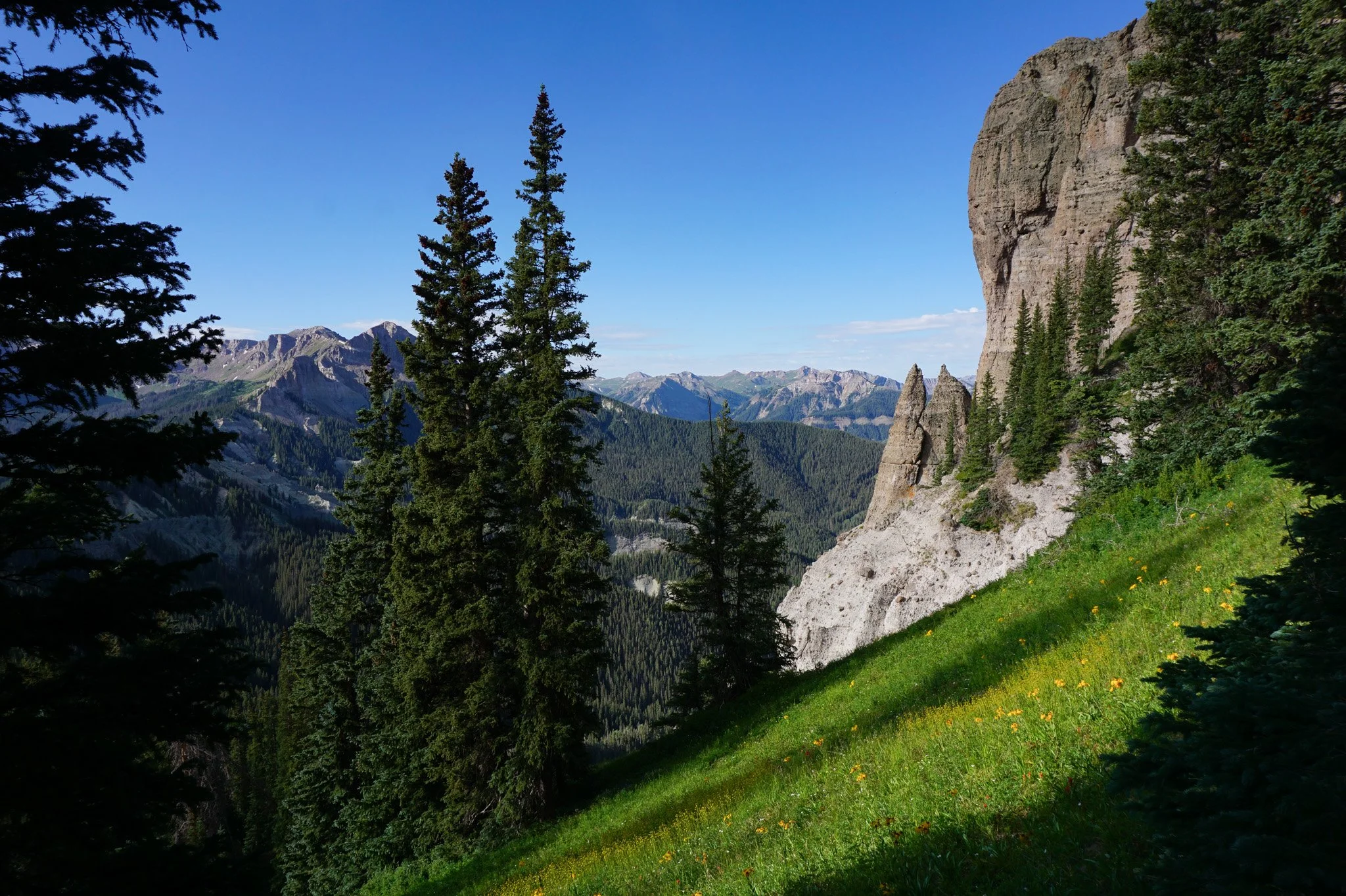
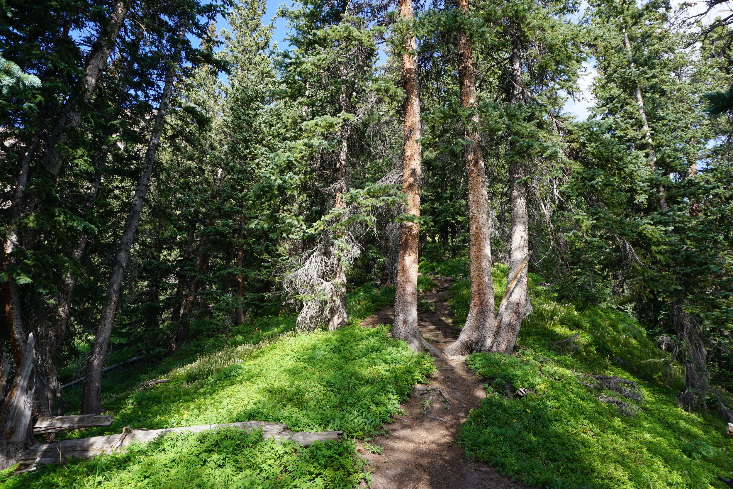
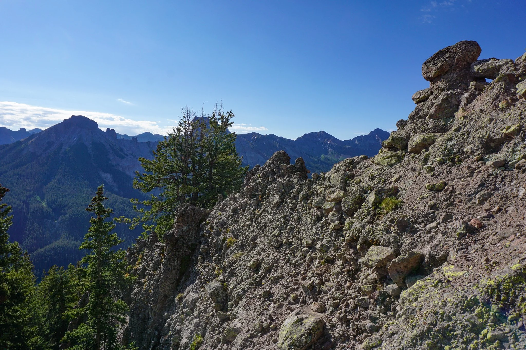
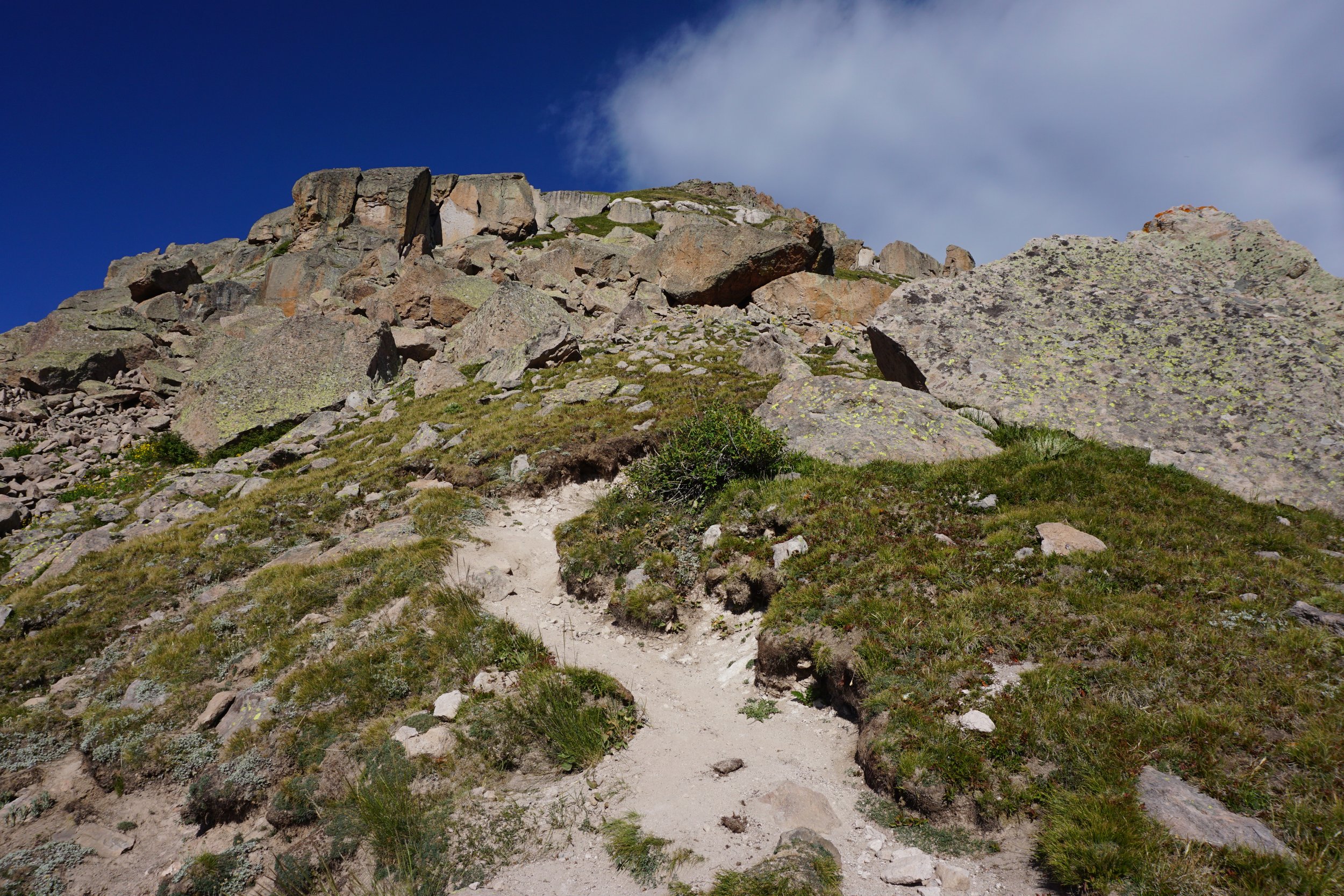
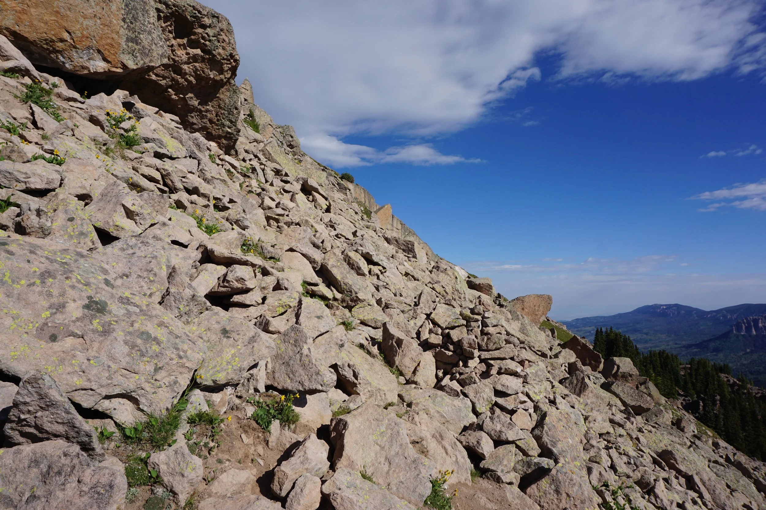
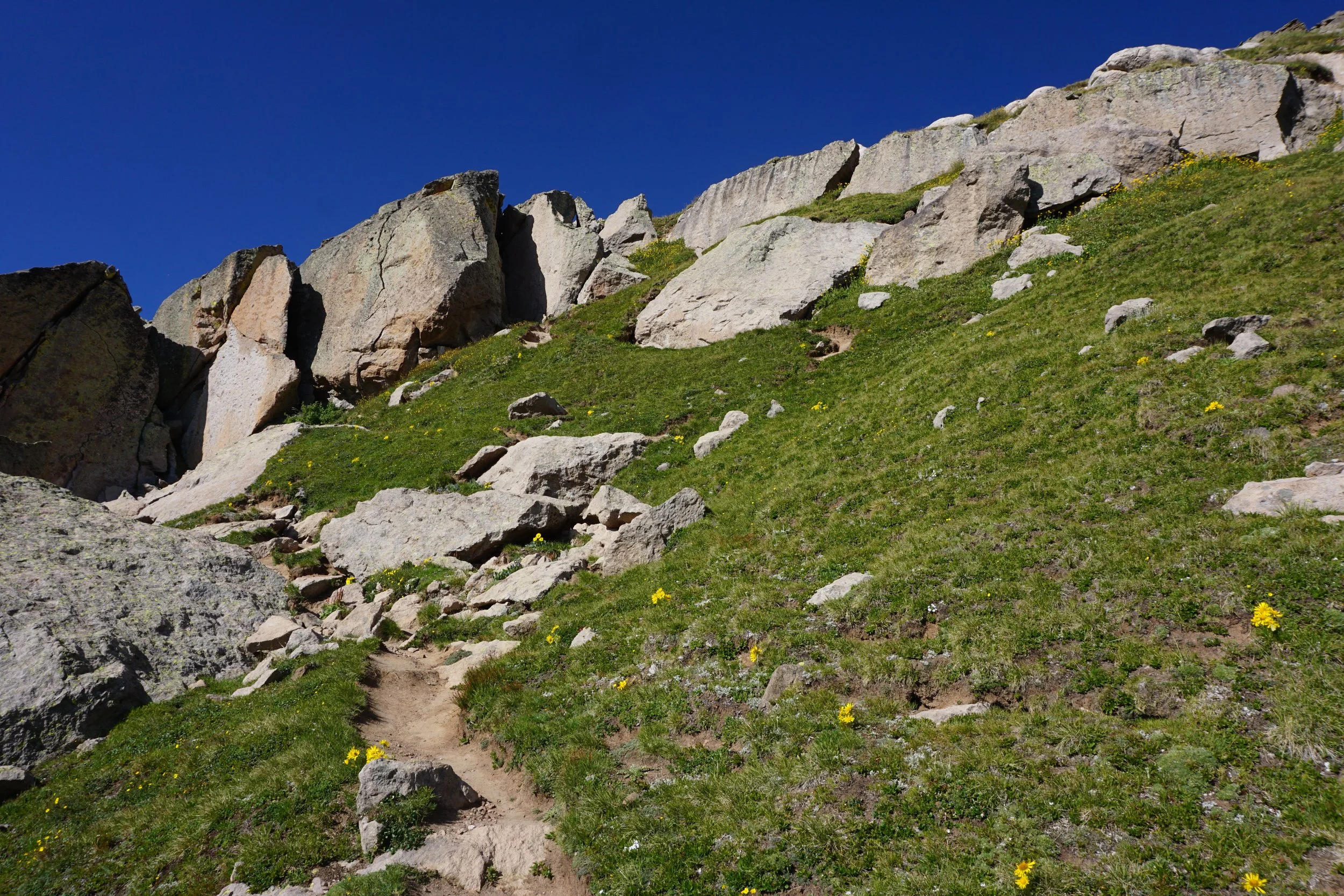
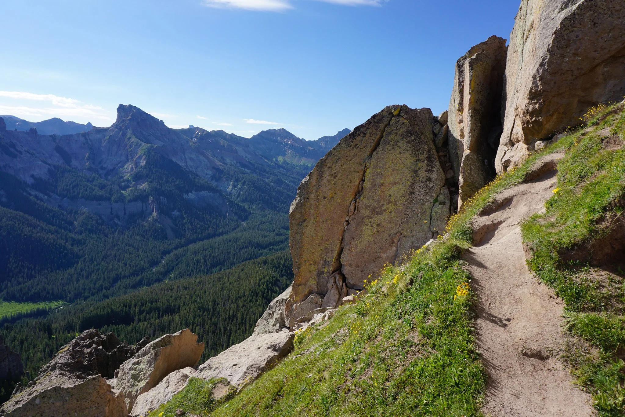
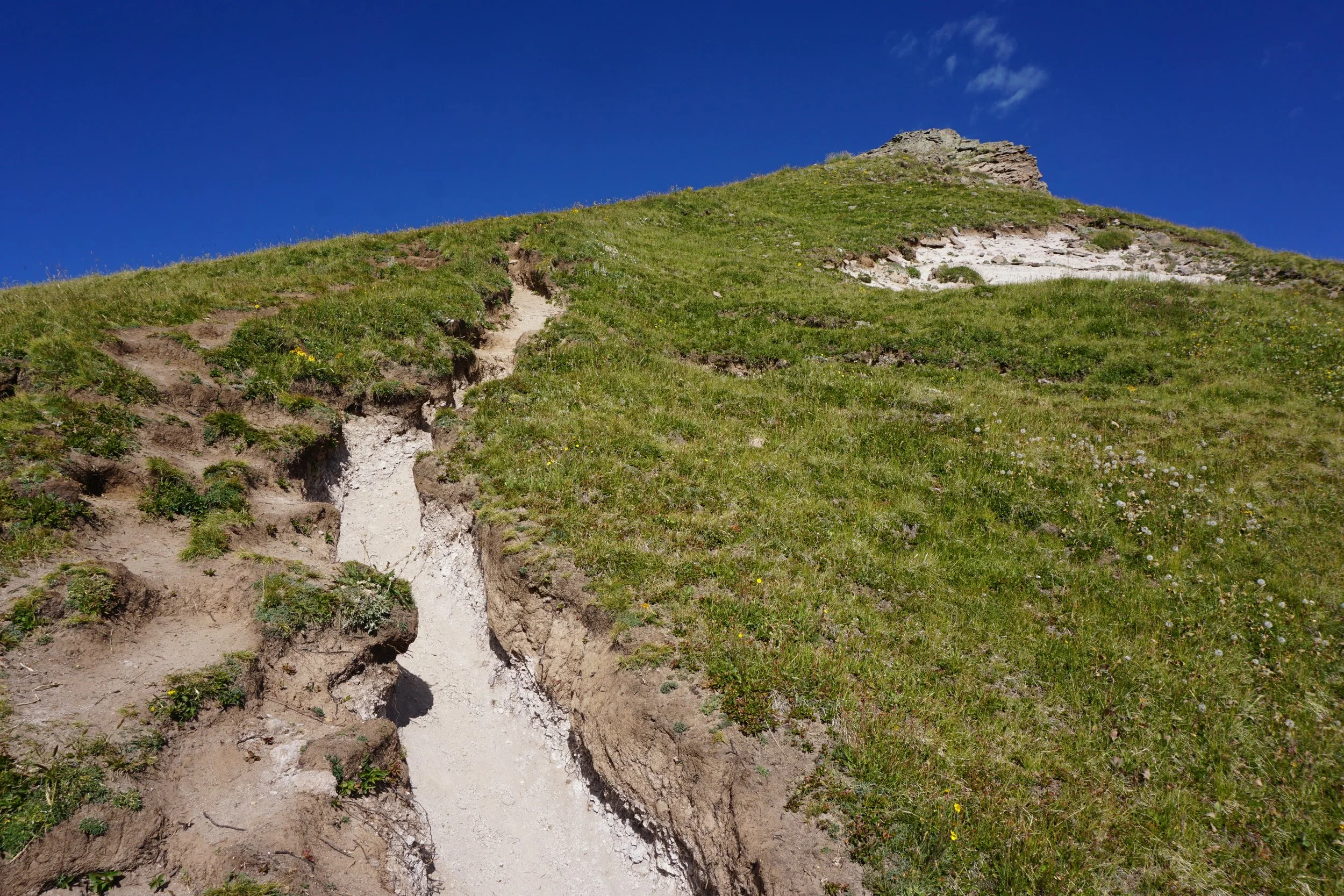
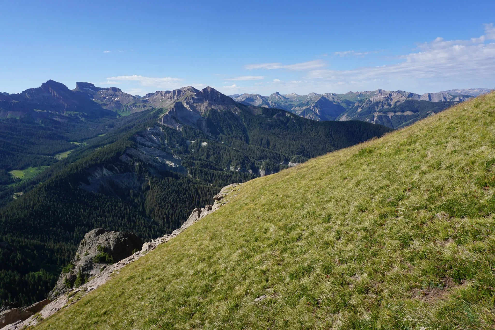
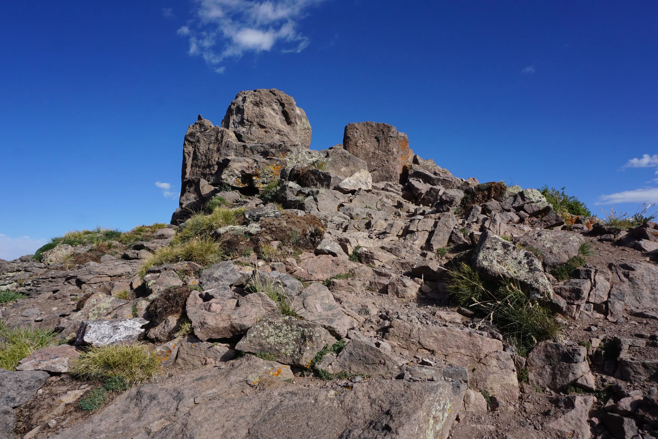
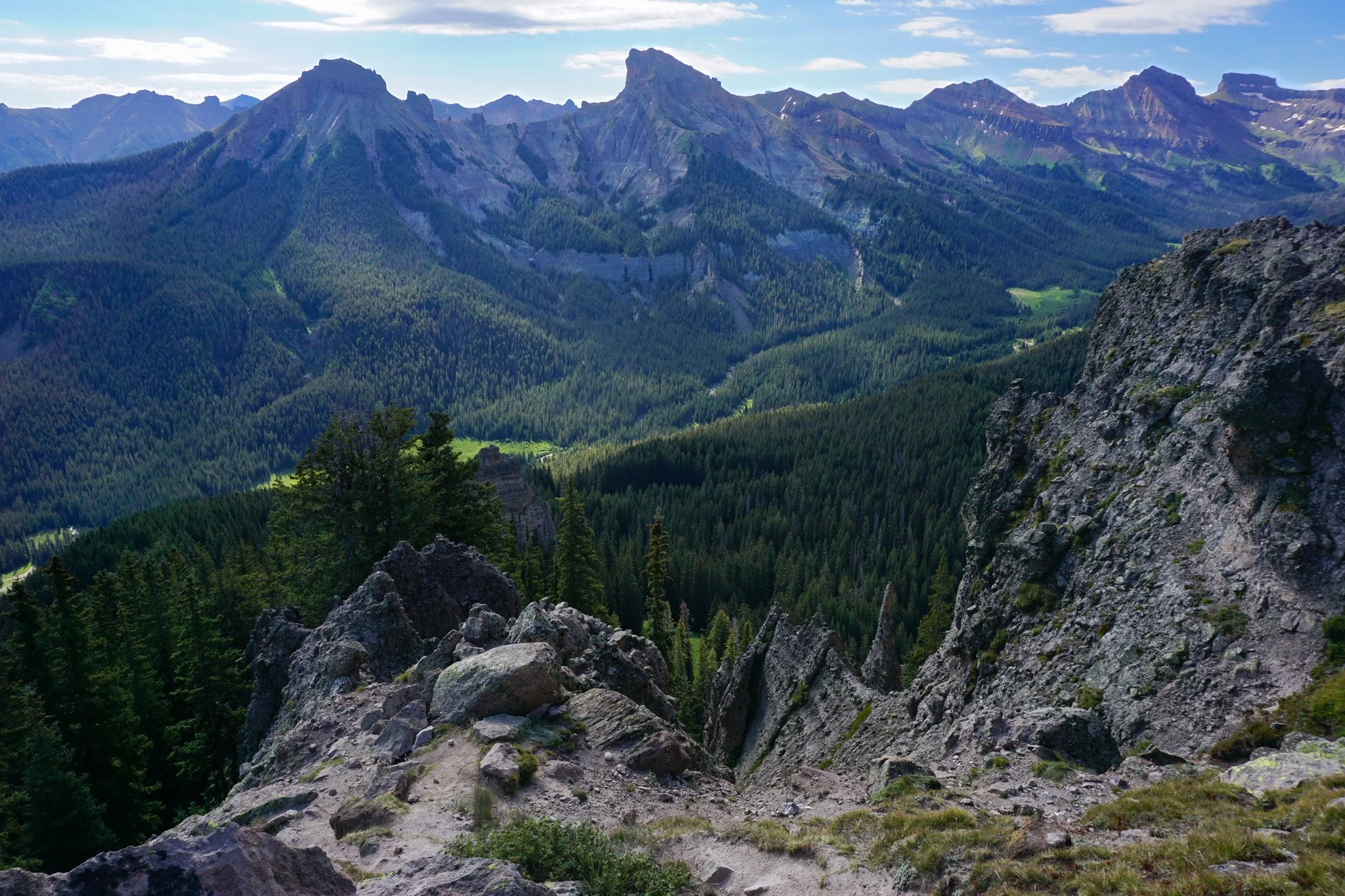
The hike starts 1.5 miles south of Owl Creek Pass in thick pine forest and immediately starts to gain elevation. After 0.7 of a mile, you reach an unnamed pass and enter the Uncompahgre Wilderness. A right turn takes you up onto the ridge and soon you are humbled by the massive rock cliffs and spires at the base of Courthouse Mountain. The trail zigs and zags up along the base of the cliffs and past gulches filled with wildflowers in the mid-summer. Before long, the views across the valley open up and just get better and better. Eye level with Chimney Rock, the vegetation starts to thin a bit more and the rockiness of the remaining trail starts to become apparent.
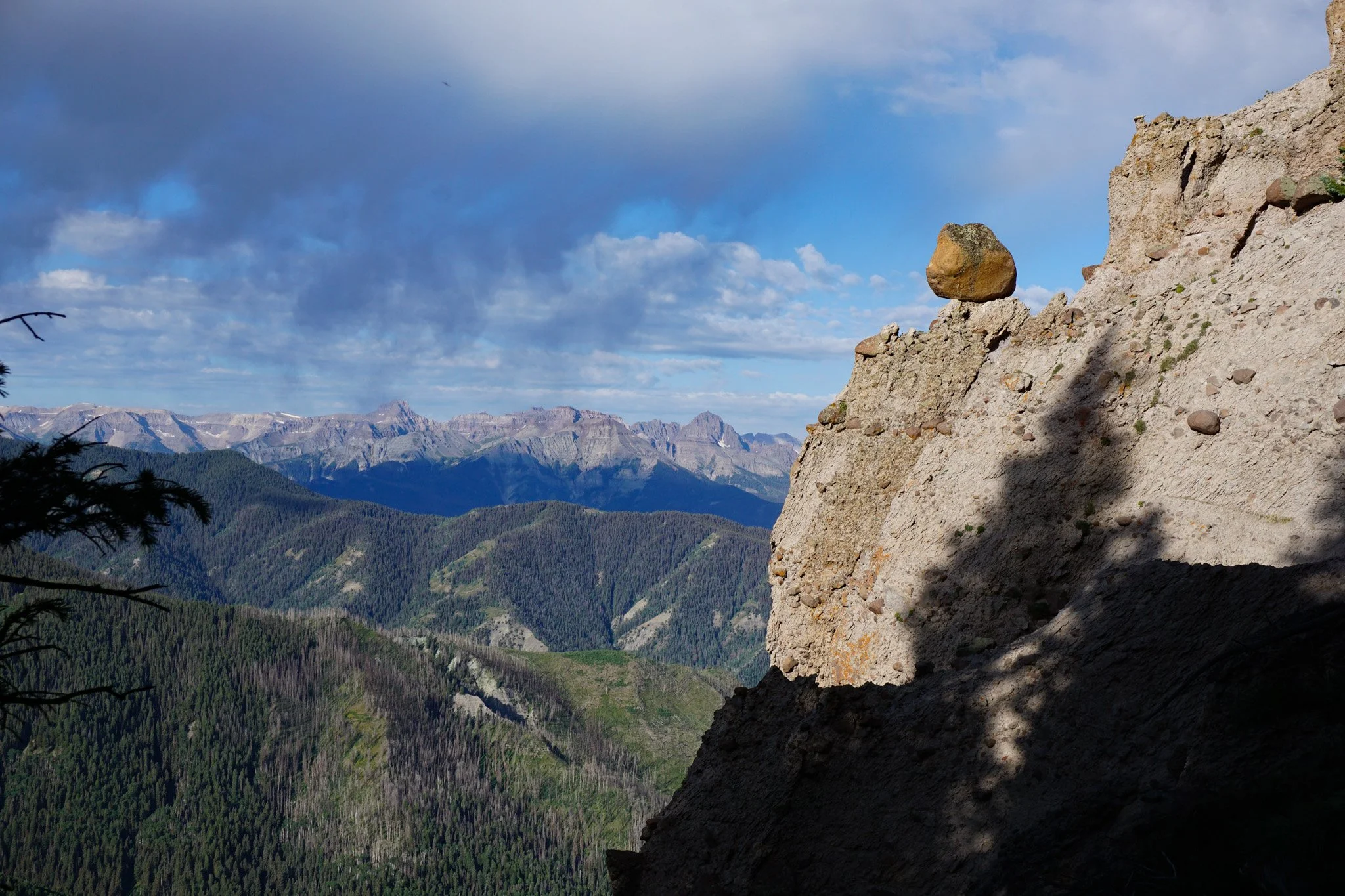
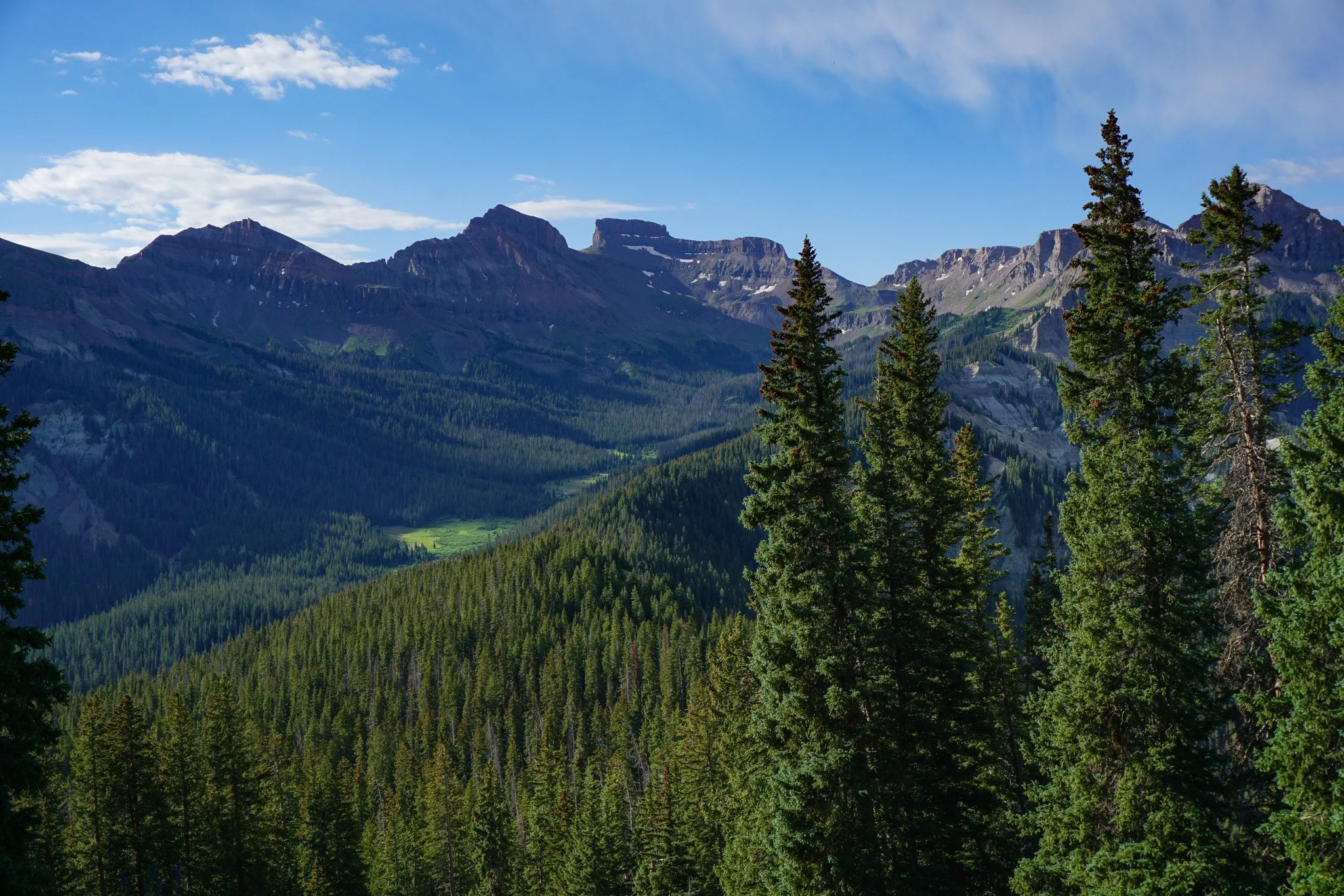
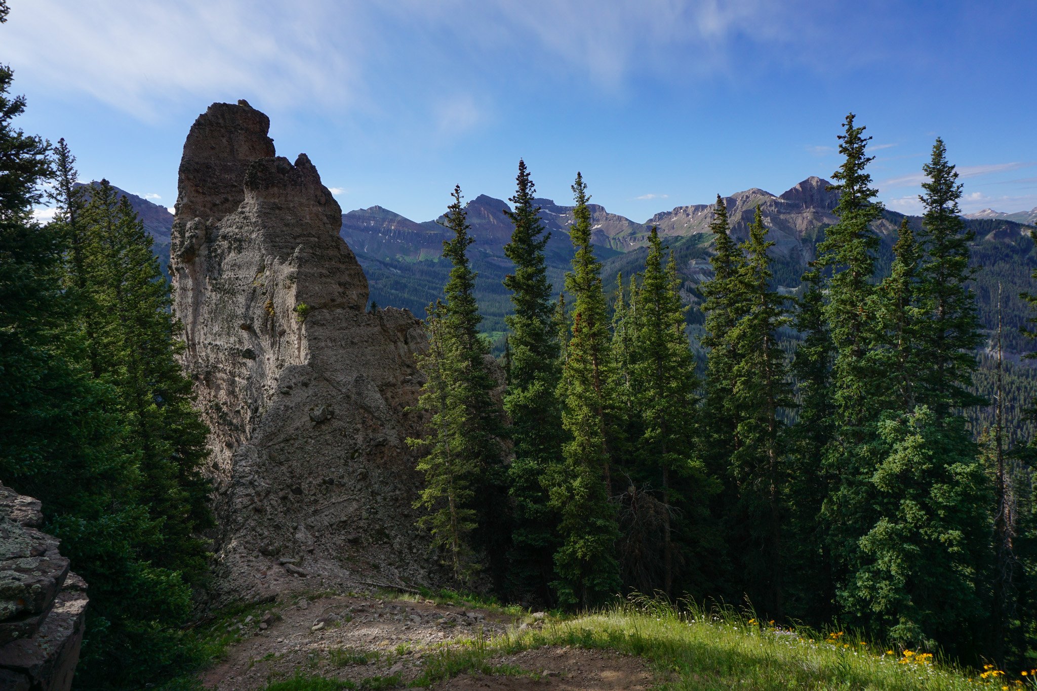
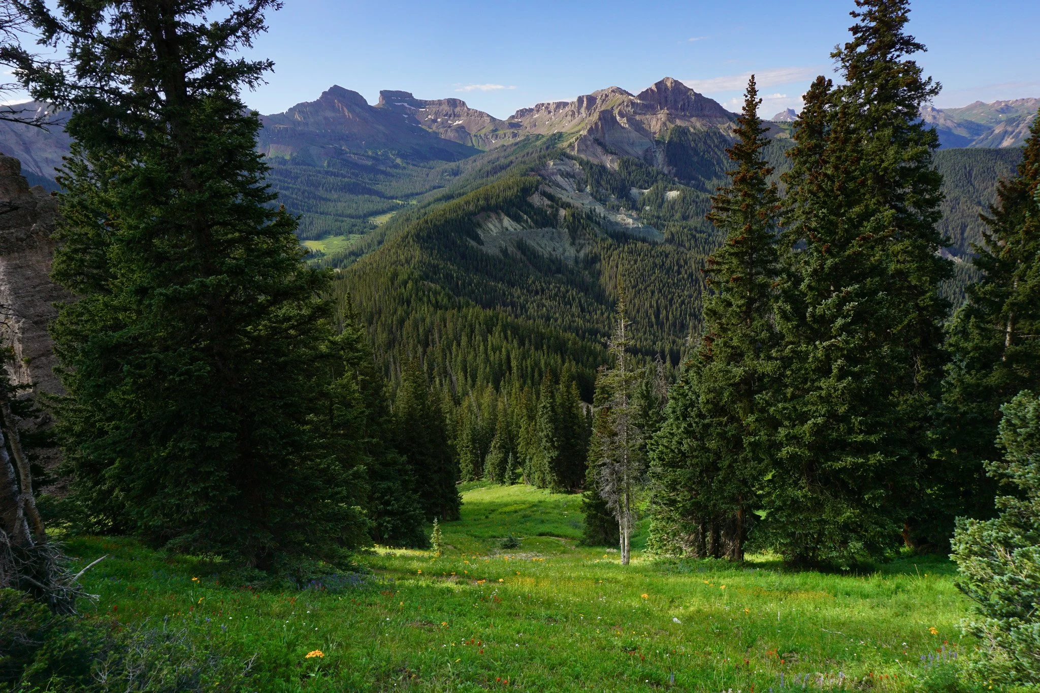
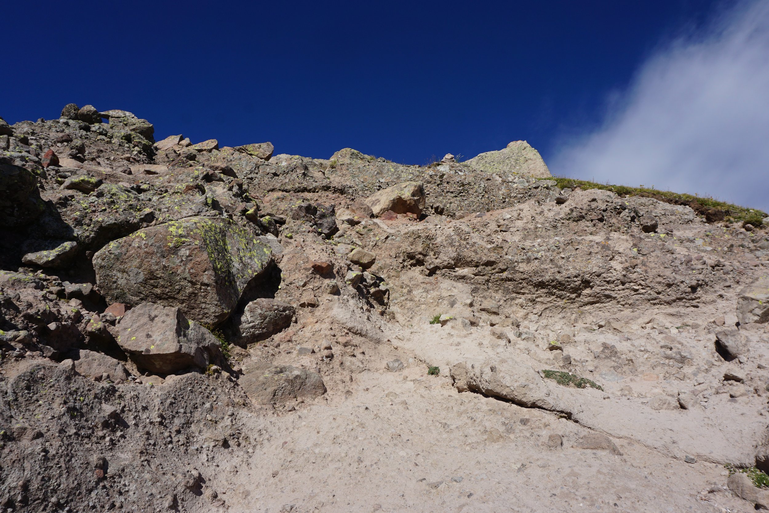
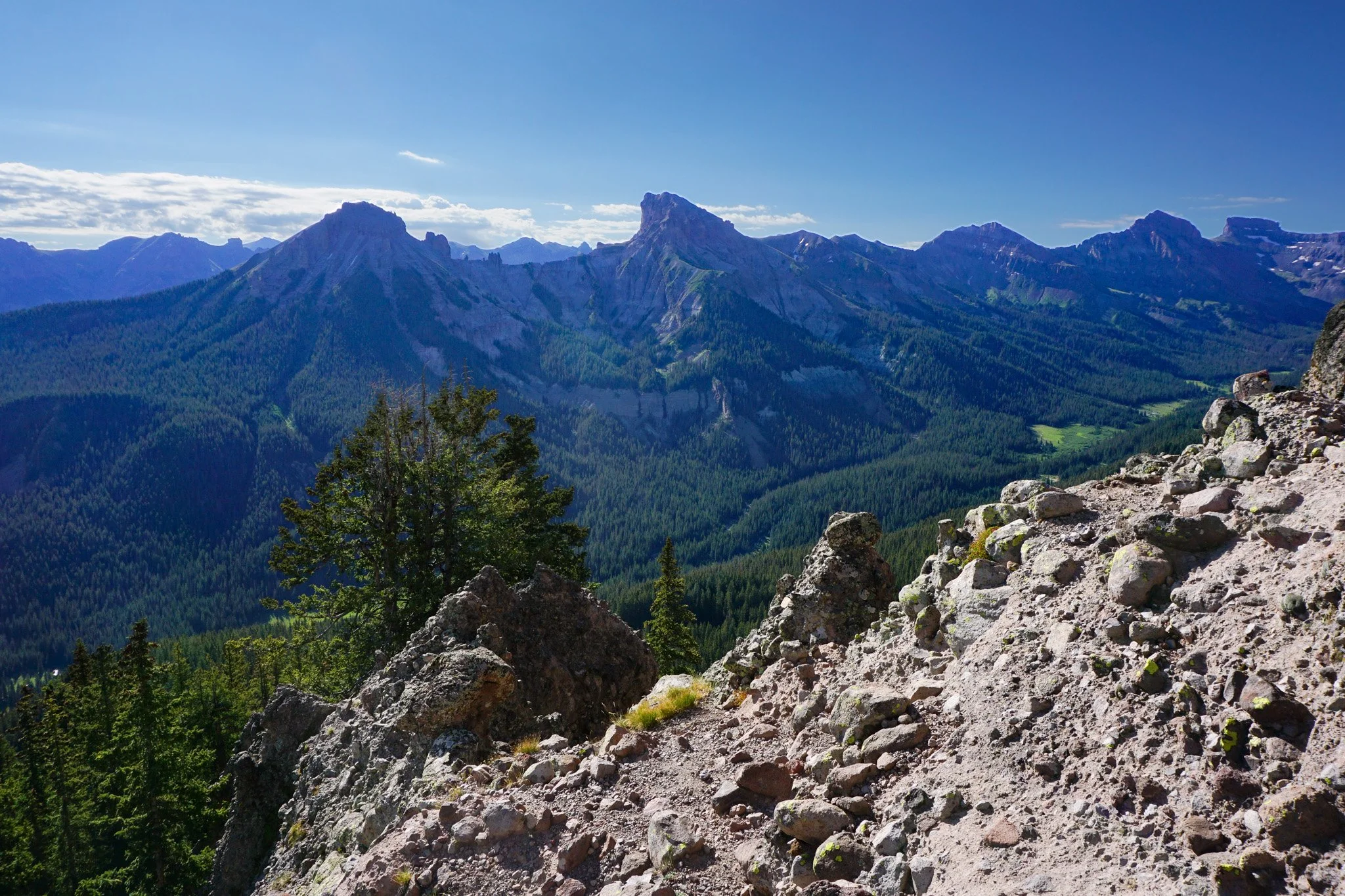
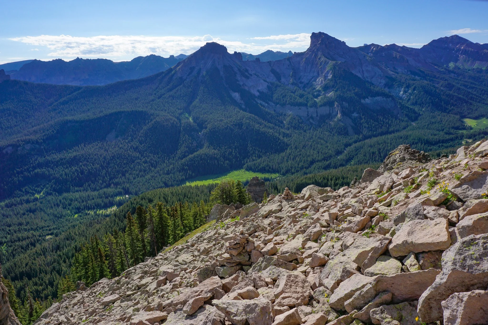
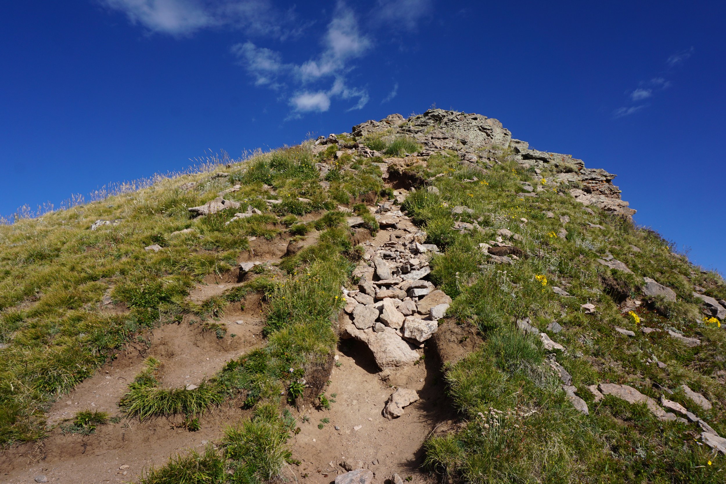
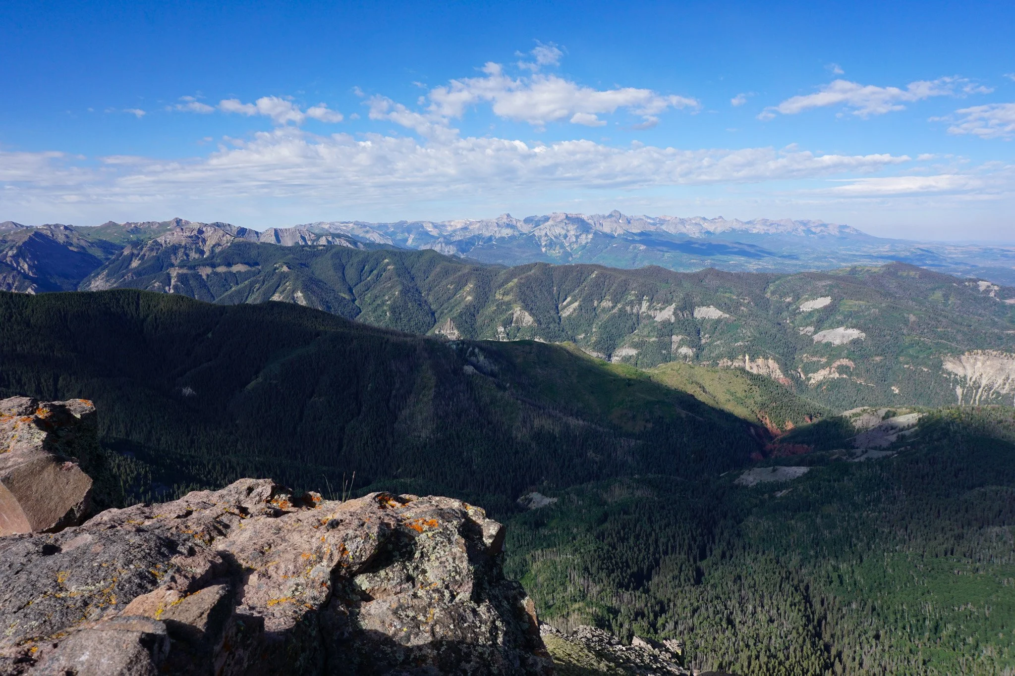
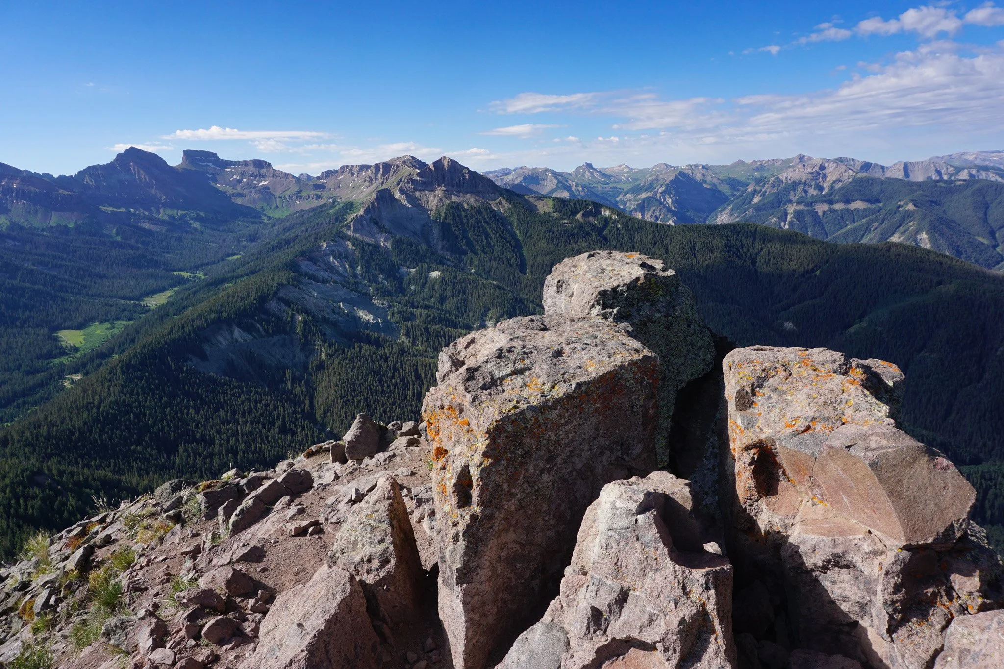
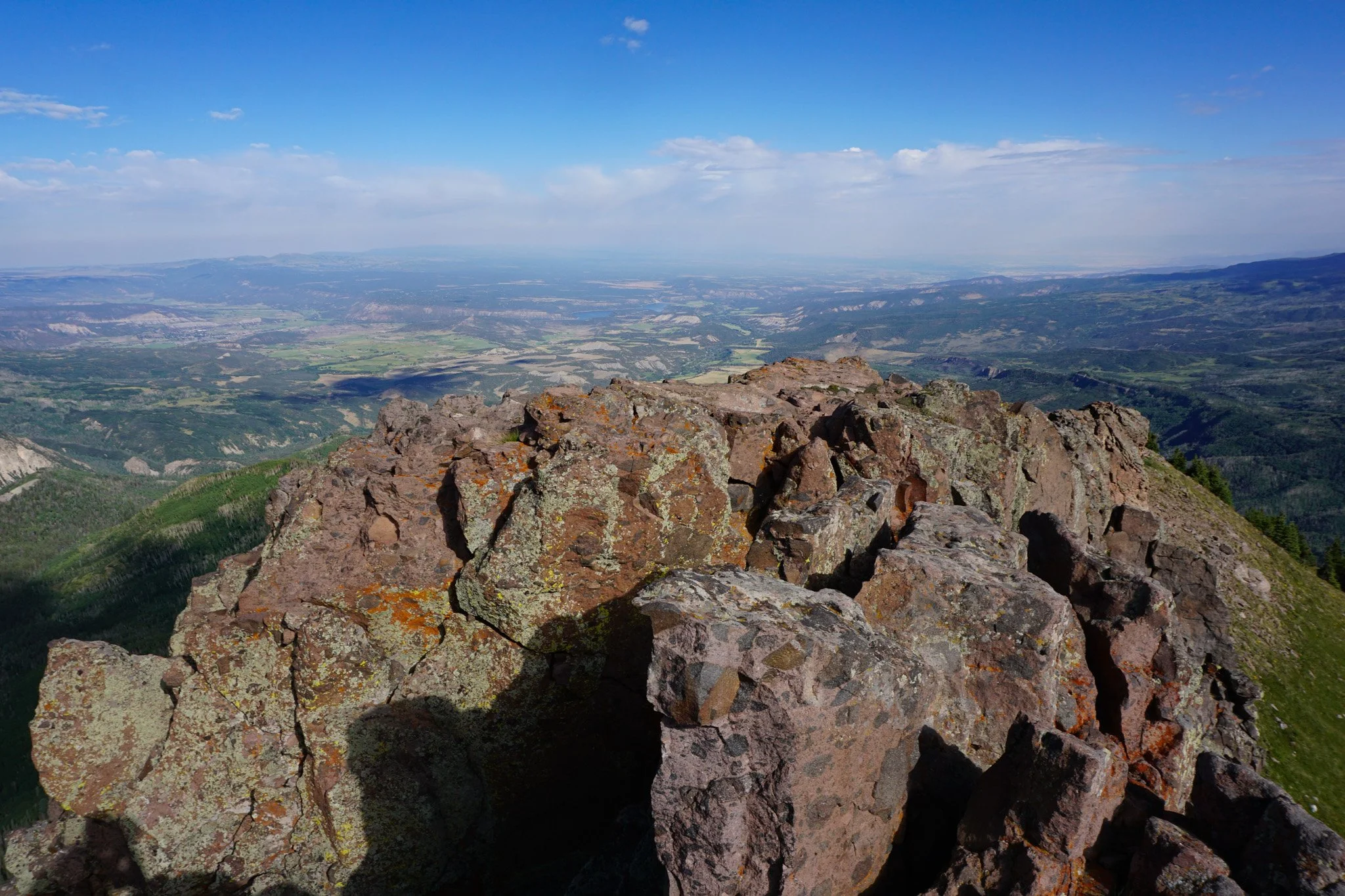
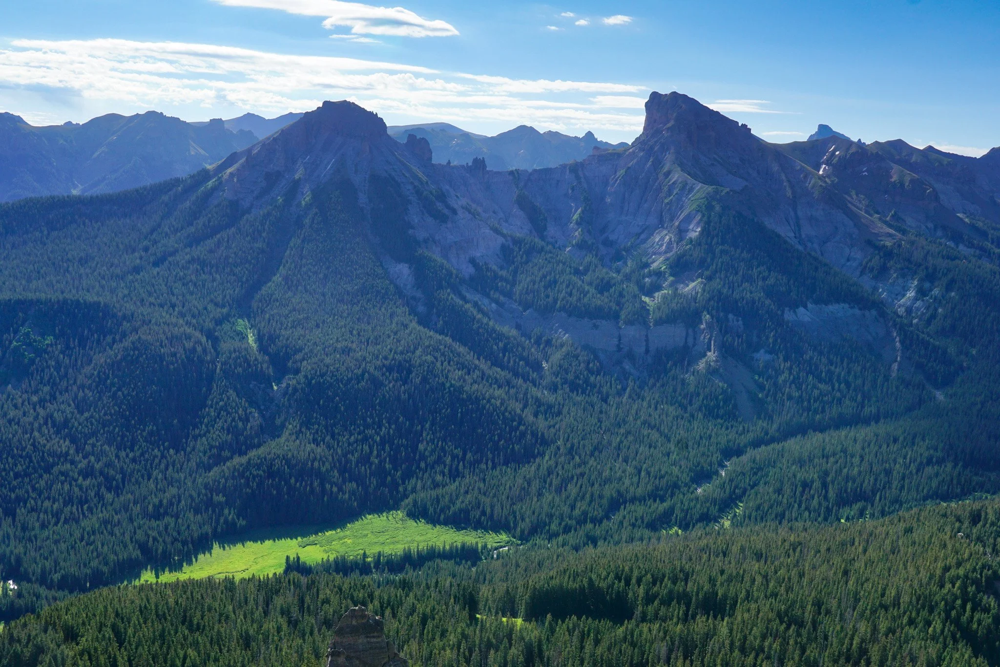
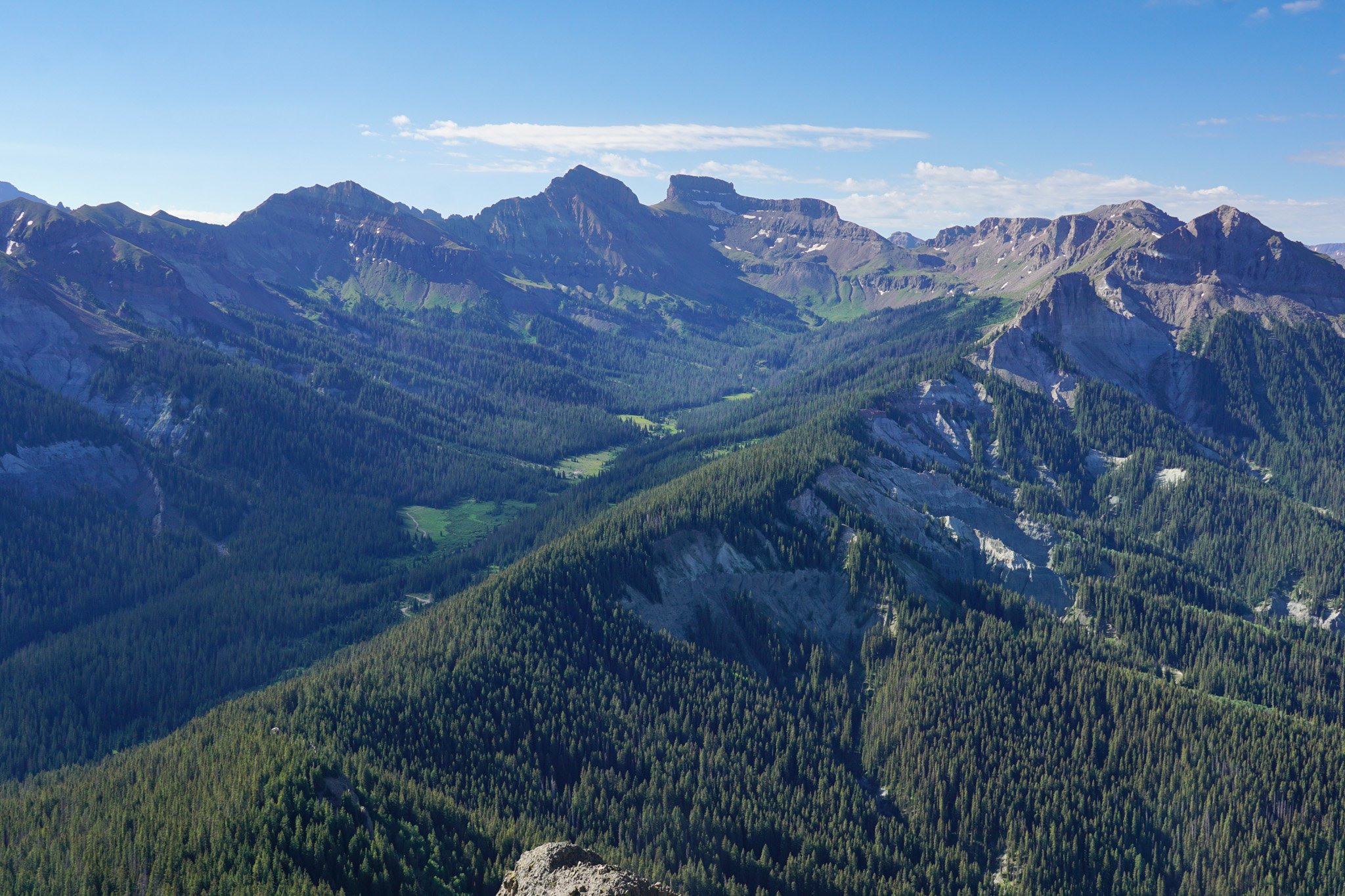
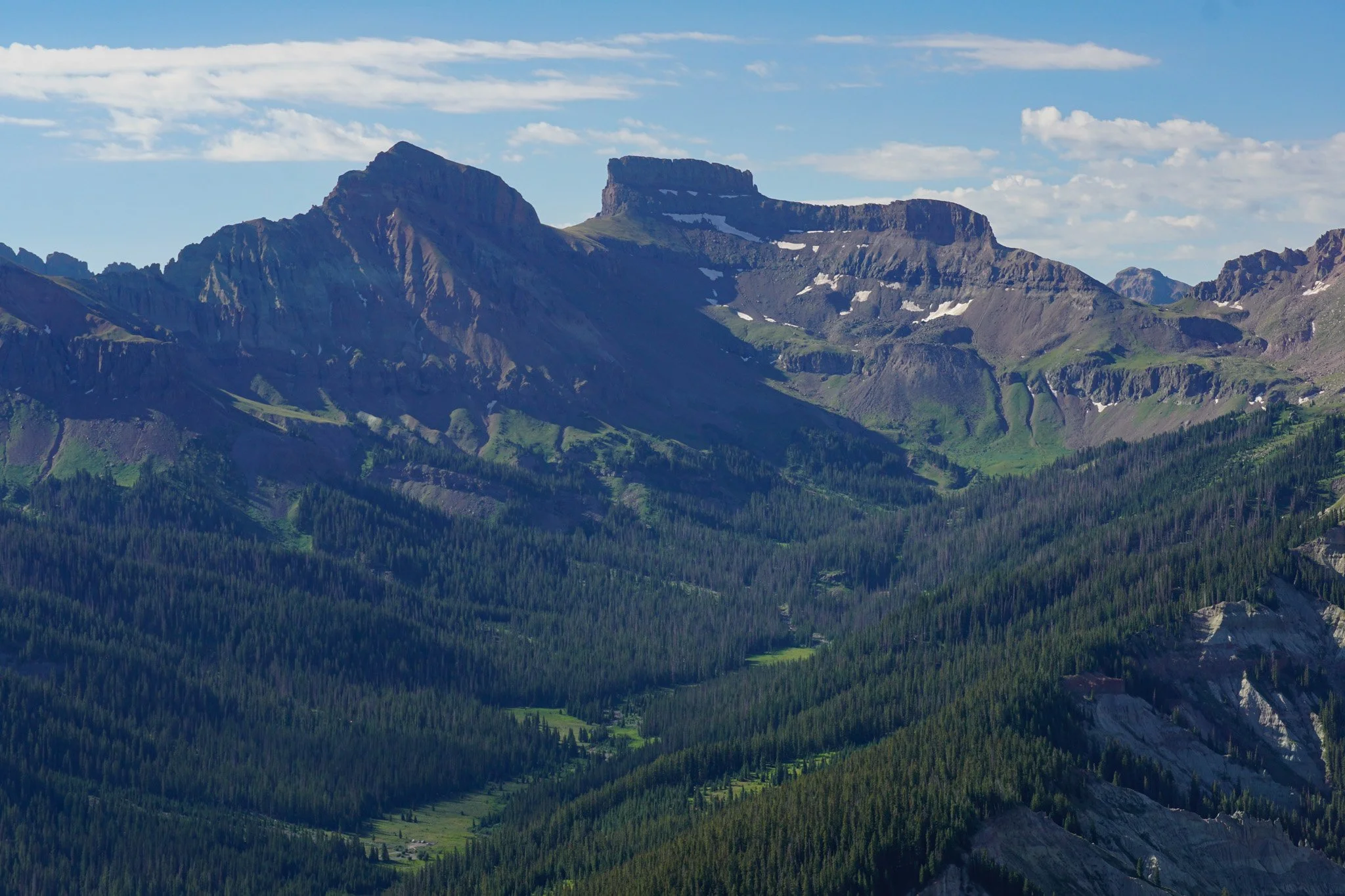
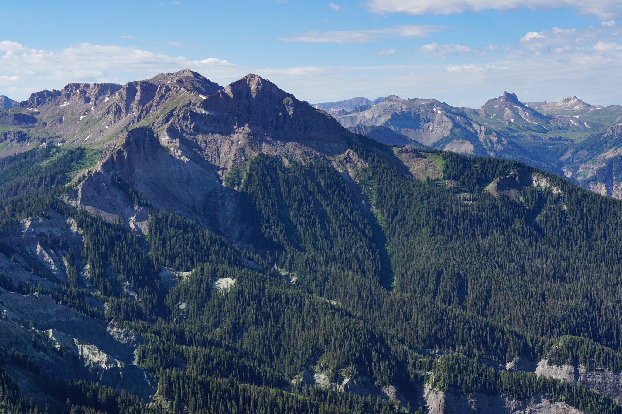
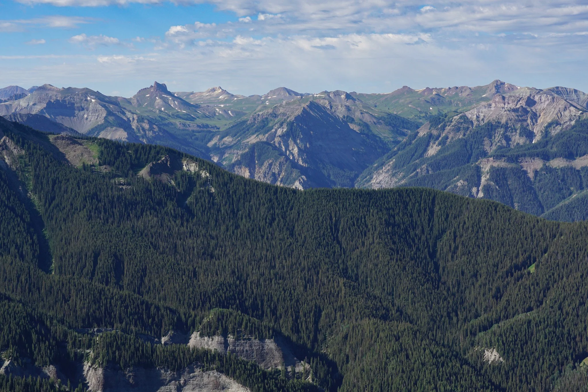
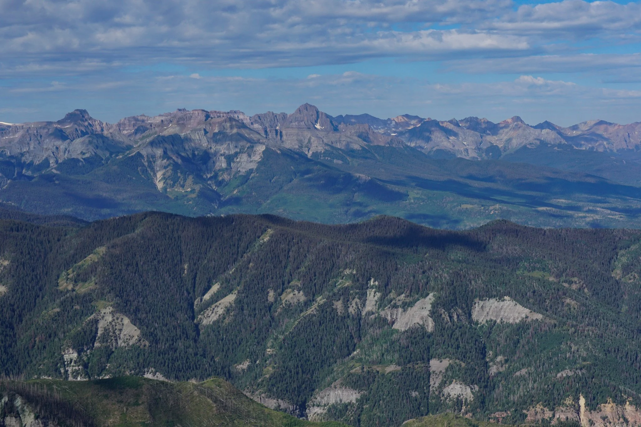
You abruptly transition from forest to rock as the trail cuts through sections of subalpine grasses. This is about the time that vertigo will set in for some of us…just keep pushing and breathing. A narrow path of dirt and rock leads you straight to the rocky summit. The summit provides the jaw dropping views that make this hike worth the effort. To the north you are looking down on Chimney Rock, to the west the Colorado Plateau begins to stretch off into infinity, and to the southwest, the Sneffels Range stands mighty and imposing. However, the best view (in my opinion) is to the east where the remarkable Cimmaron peaks - Precipice, Redcliff, and Coxcomb are on full display. In the distance you can just make out the tips of Wetterhorn and Uncompahgre Peaks. These peaks will make you want to grab your backpacking gear and head off into the wilderness for the next week.
The hike down is tough on the quads but pretty straightforward with a great opportunity to re-experience the scenery. The hike is only 3 miles roundtrip, but at 1,700+ of elevation gain, it’s not easy by any means.
The Cimmaron Range is a hidden gem in the San Juans. So much attention is drawn by the Sneffels Range and the Grenadiers that the Cimmarons are almost forgotten by most tourists…all the better. I can’t wait to get back and dig deeper into these magnificent valleys and majestic peaks.