Travois > Evening Sun Loop
Centennial Cone Park
Date Hiked: November 17, 2013
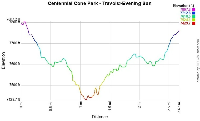
Distance: 2.67 miles (Round Trip)
Elevation Gain: 400ft
Elevation Min/Max: 7,430 to 7,807ft
Managing Agency: Jefferson County Open Space
Fee: None
Directions:
The Travois trail starts from the Camino Perdido Trailhead, aka, the northern TH for Centennial Cone Park. From Denver/Boulder and Hwy 93 head west on Golden Gate Canyon Road toward Golden Gate Canyon State Park. Make a left on Robinson Hill Road and a left on Camino Perdido Road to the Park entrance.
Hike Description:
Note - The park alternates between hiking use and biking use on weekends so check the park's website before heading out.
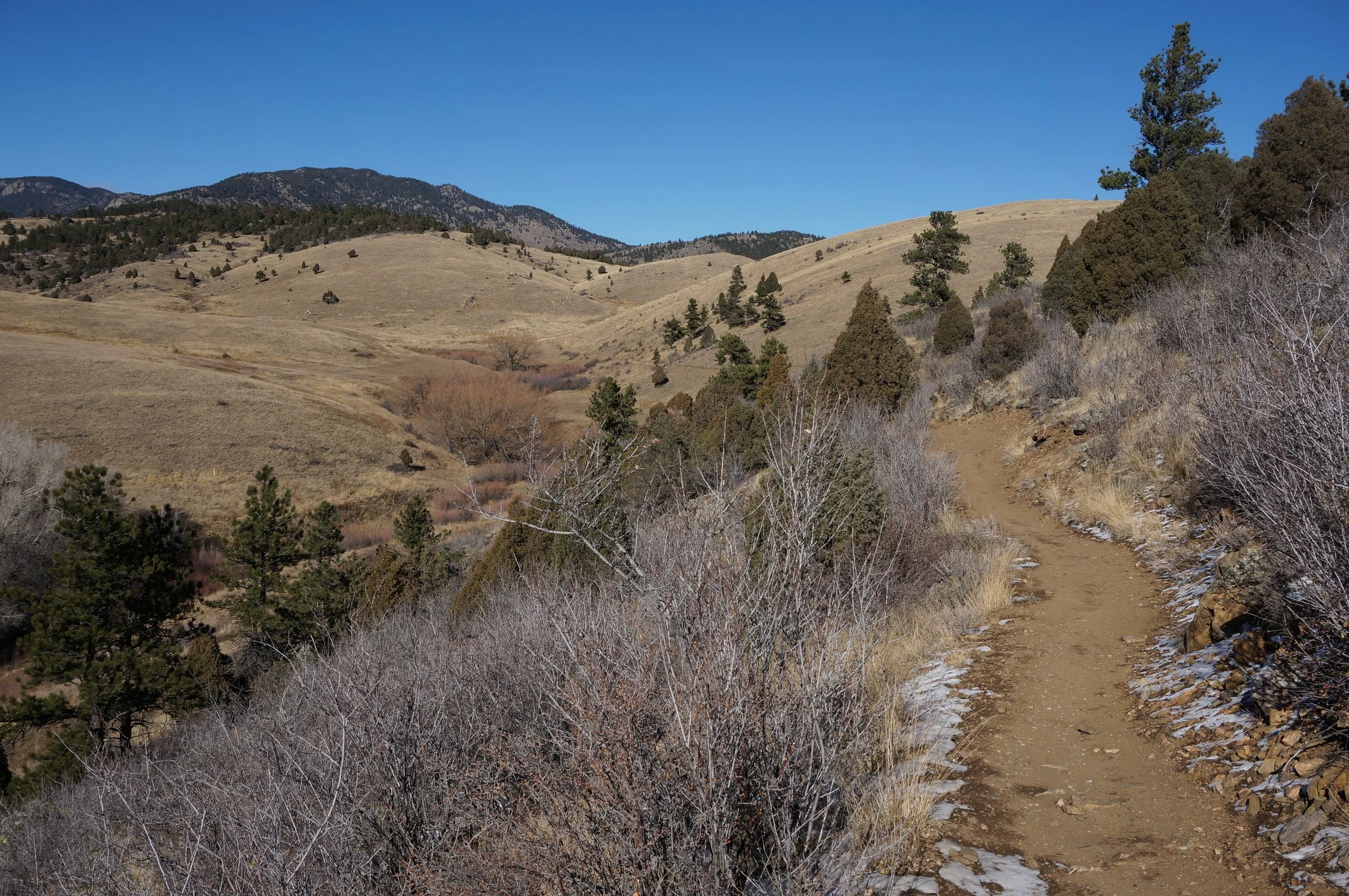
Centennial Cone Park is a beautiful and expansive open space area. While the main park loop clocks in at roughly 12 miles, there are number of shorter loops that provide for quicker excursions into the park. The Evening Sun side trail forms such a loop with the longer Travois Trail.
The Travois trail descends from the parking lot through rolling hills. Keep left at the trail junction with the Evening Sun trail to stay on the Travois Trail. The next part of the trail skirts the side of a deep canyon before it ascends to a pass and the 2nd junction with the Evening Sun trail. From this point you can take the Evening Sun trail back up to the Travois trail or continue on the Travois trail for as long as you like.