Red Canyon (Lost Ranger Trail)
Mount Zirkel Wilderness, Routt National Forest
Date Hiked: July 16, 2022
Distance: 7 mi (RT)
Elevation Gain: 1,000 ft
Elevation Min/Max: 8,432 to 8,903 ft
Trailhead Lat/Long: 40.71494, -106.55776
Managing Agency: U.S. Forest Service
Fee: None
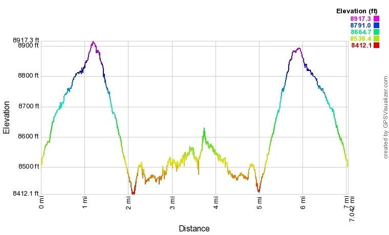
Red Canyon (Lost Ranger Trail) Elevation Profile
DIRECTIONS:
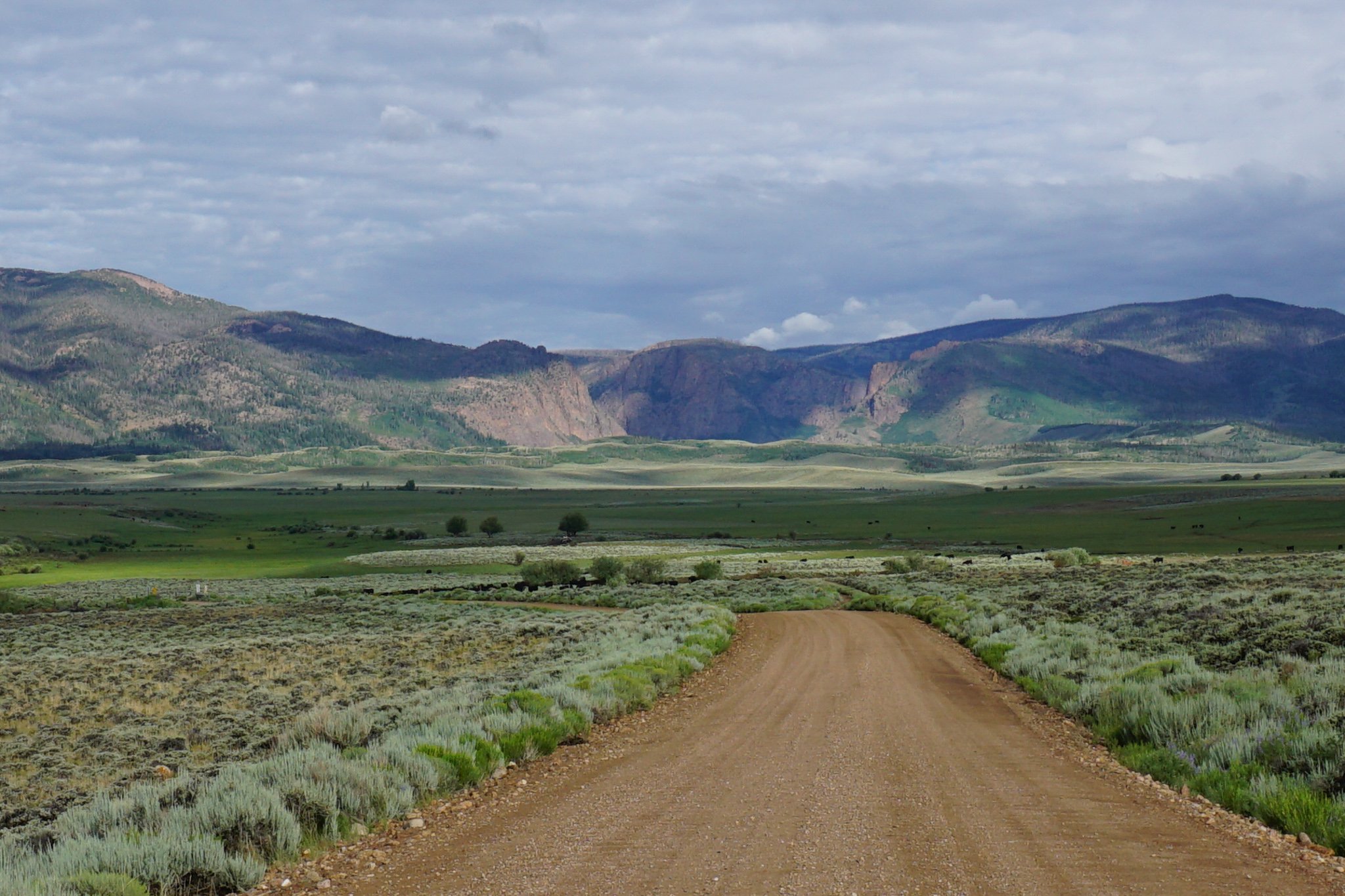
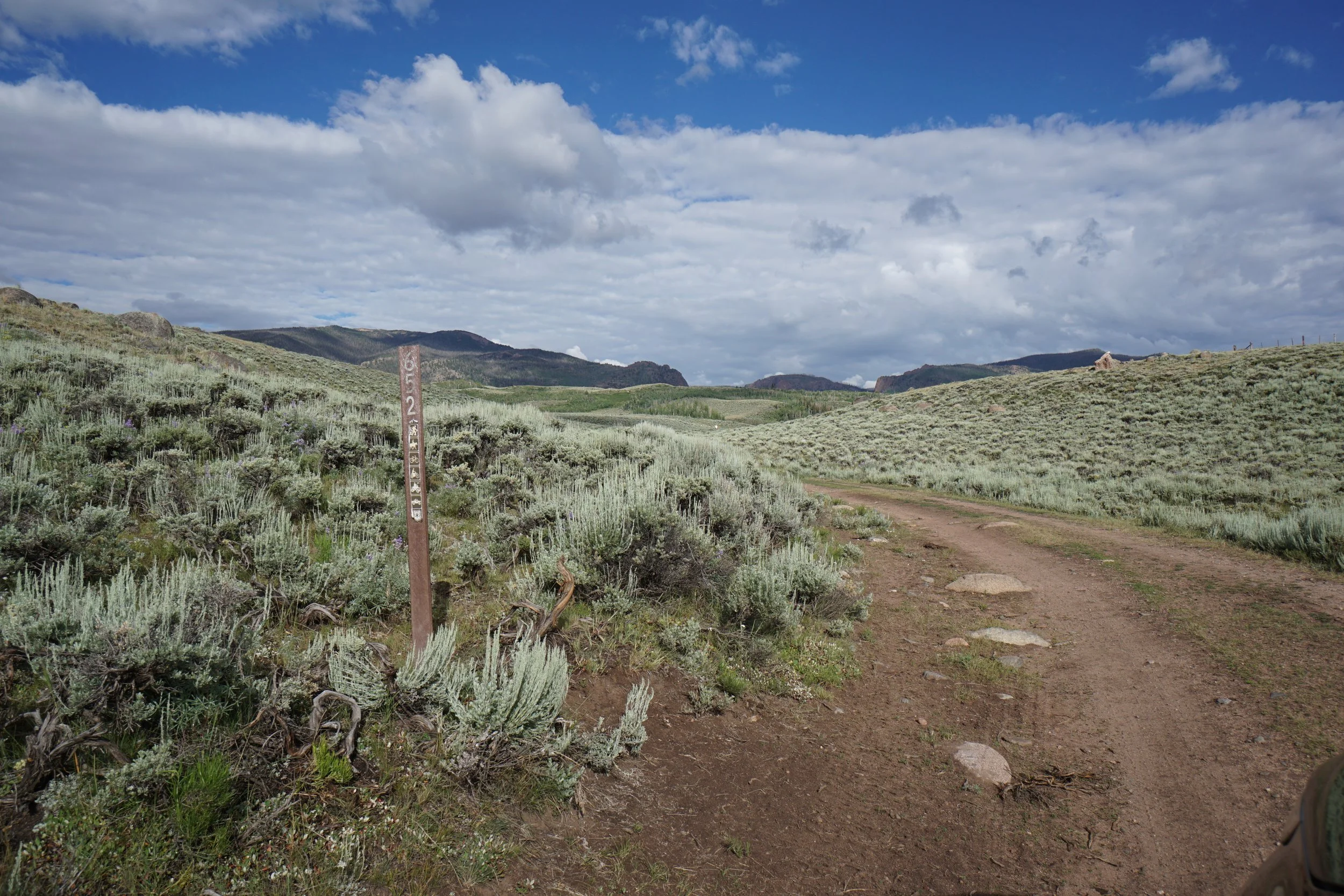
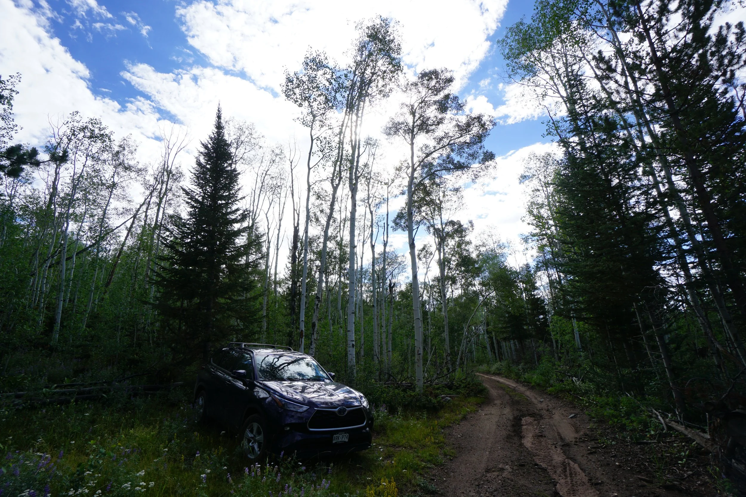
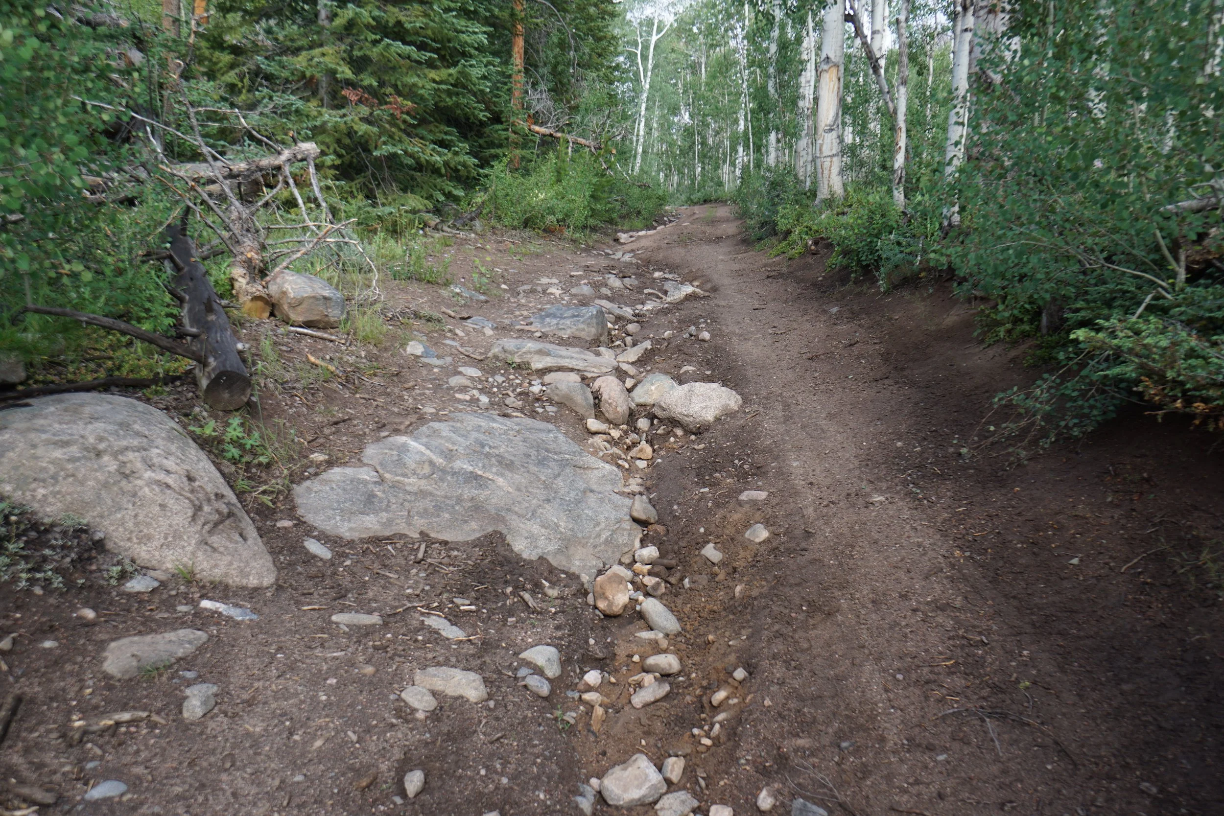
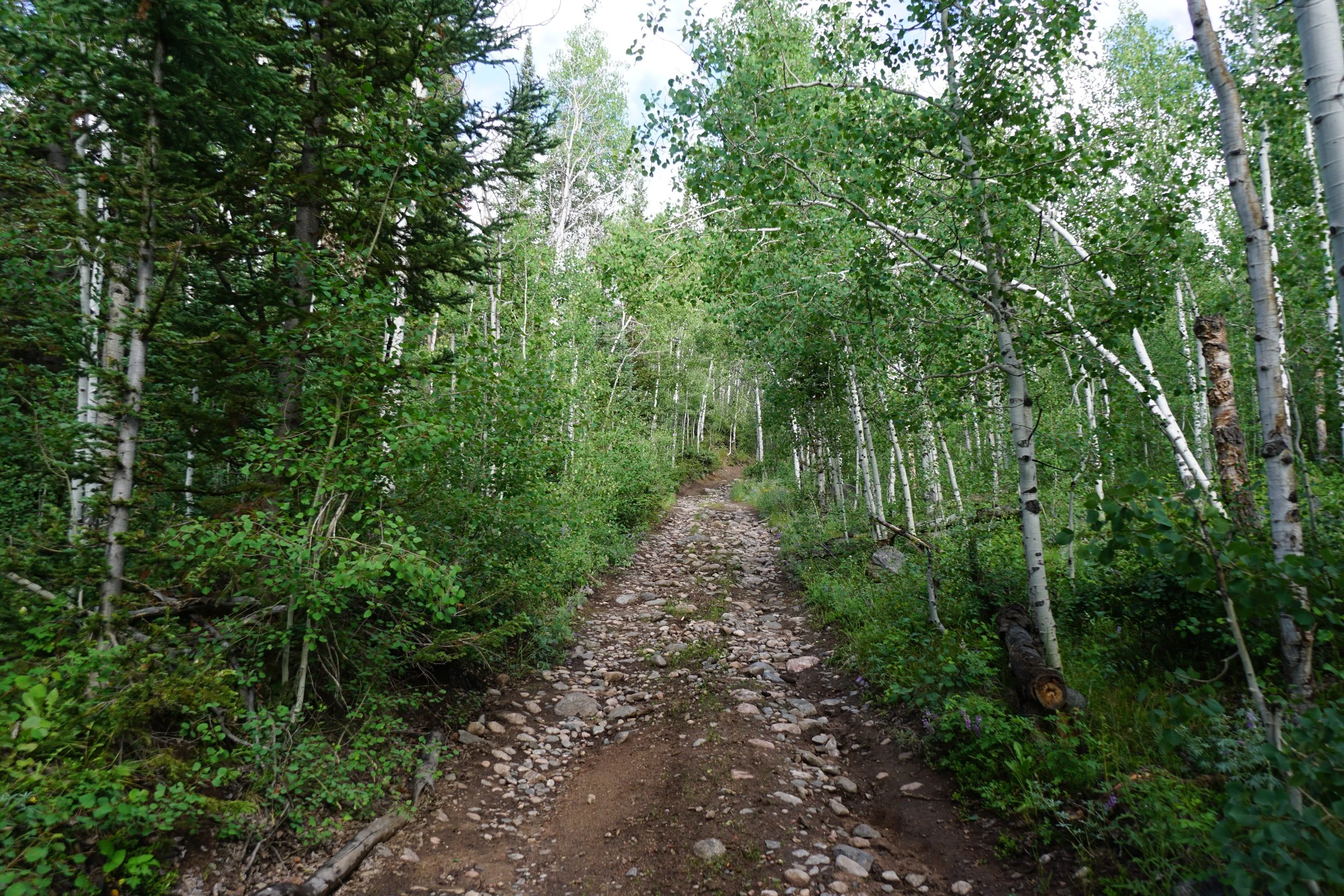
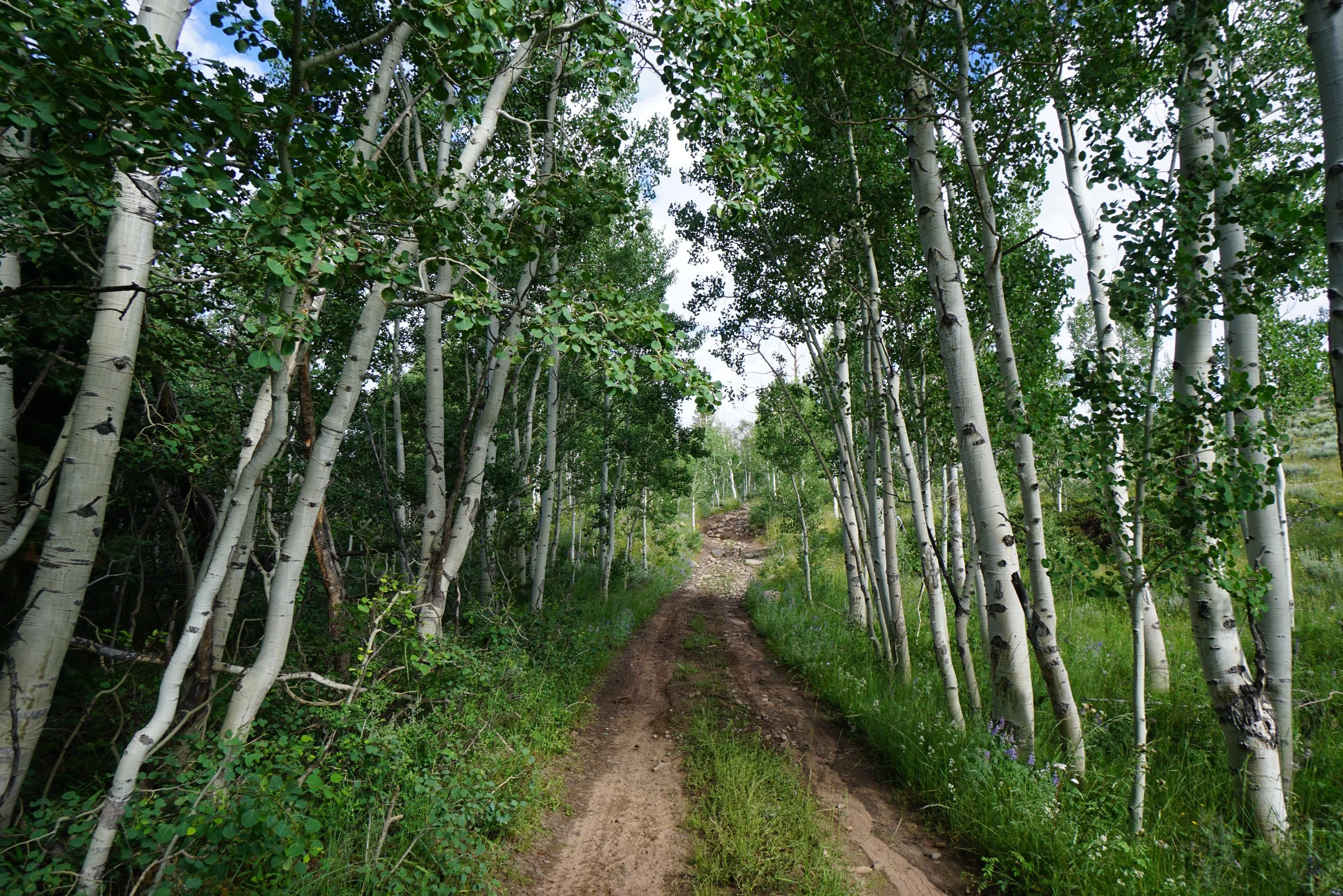
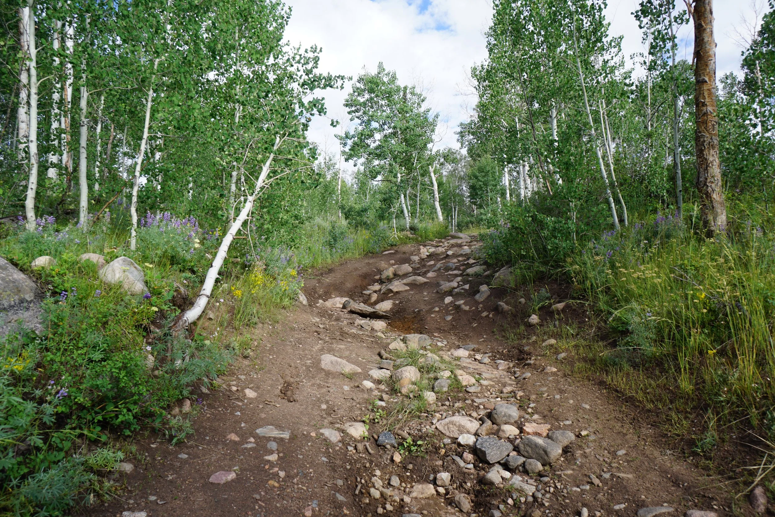
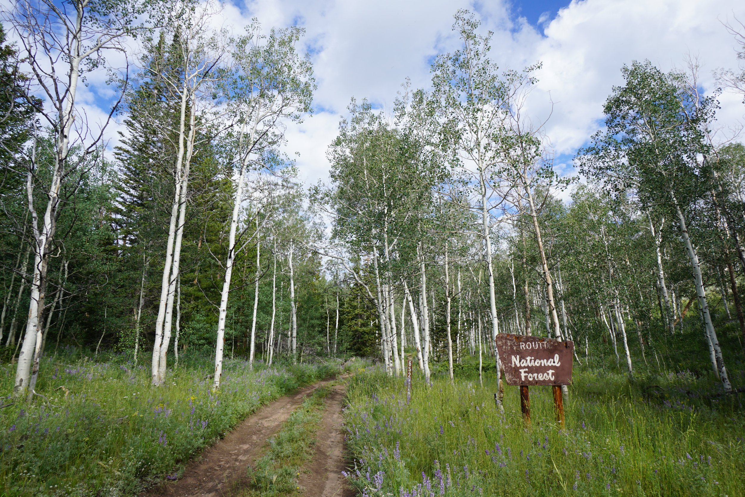
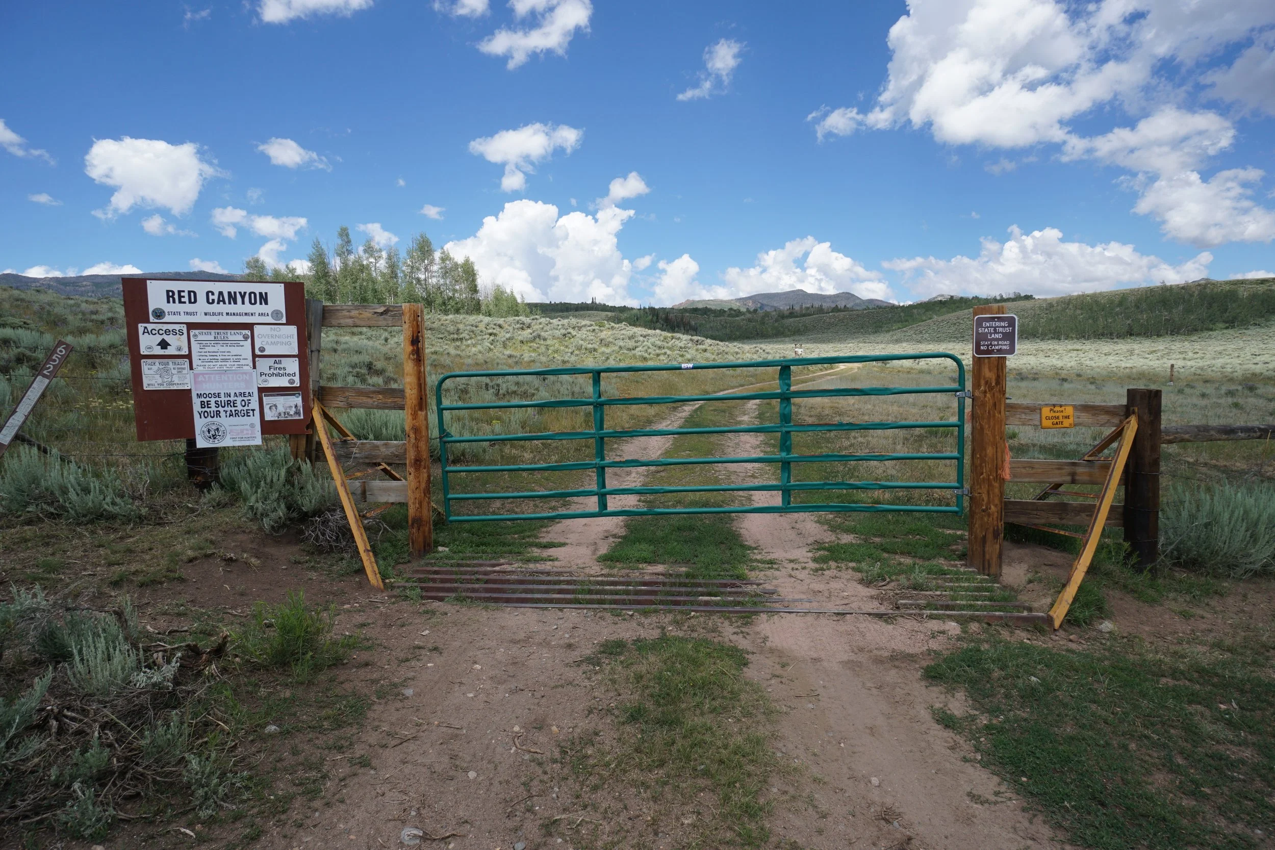
Access to Red Canyon is…interesting. It’s not that difficult to get about a mile from the trailhead, but it’s just about impossible for most vehicles to reach the actual trailhead. From just south of Walden, head west on County Road 12 for 9.5 miles. At Delaney Buttes Lake, turn north onto CR 20 passing by the State Wildlife Area. Stay on CR 20 for 5 miles. Look for an old (?) oil and gas operation on the right side of the road. It may be hard to see from here but Road 652.1 heads north over the hillside. The road is a narrow 2 track road that is rutted enough to require a high clearance vehicle, it’s not too bad in good weather. Continue for about 1.5 miles to the boundary of the State Trust Lands. Here you need to open the gate to continue driving, be sure to close the gate behind you! I was able to drive about half a mile past the gate. I have a newer Toyota Highlander and had no problem up to this point. There is an obvious spot where the road starts to deteriorate. Large boulders, erosion, rutting, made me stop. Luckily there was a place to pull off the road and park, but they are far and few between. As I hiked a saw a few other trucks parked along the side of the road and a burly Dodge Ram pretty close to the trailhead. From where I stopped, it was about a mile of easy hiking to the trailhead, not too bad…
HIKE DESCRIPTION:
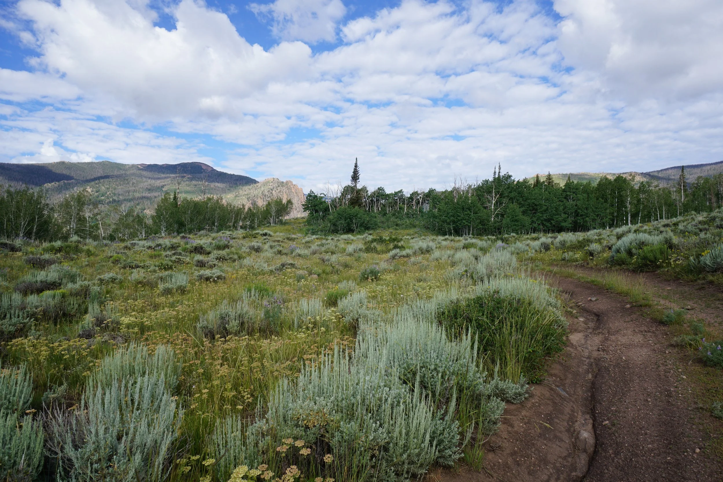
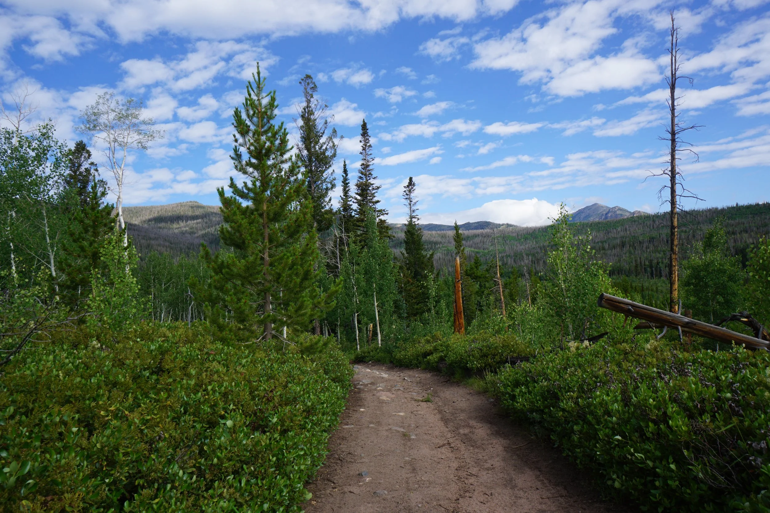
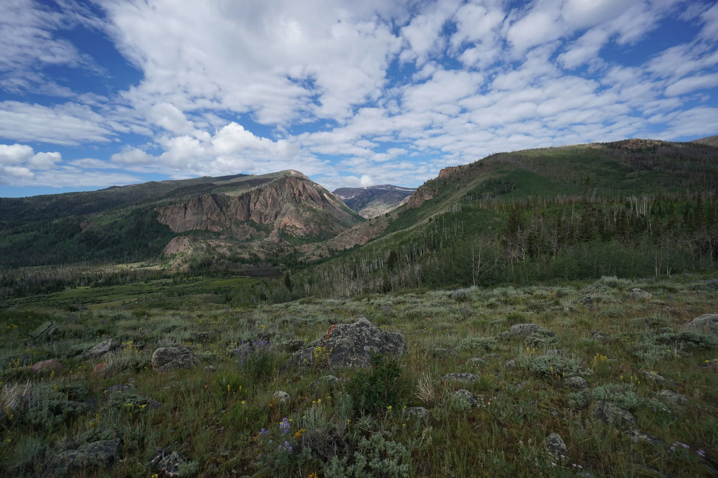
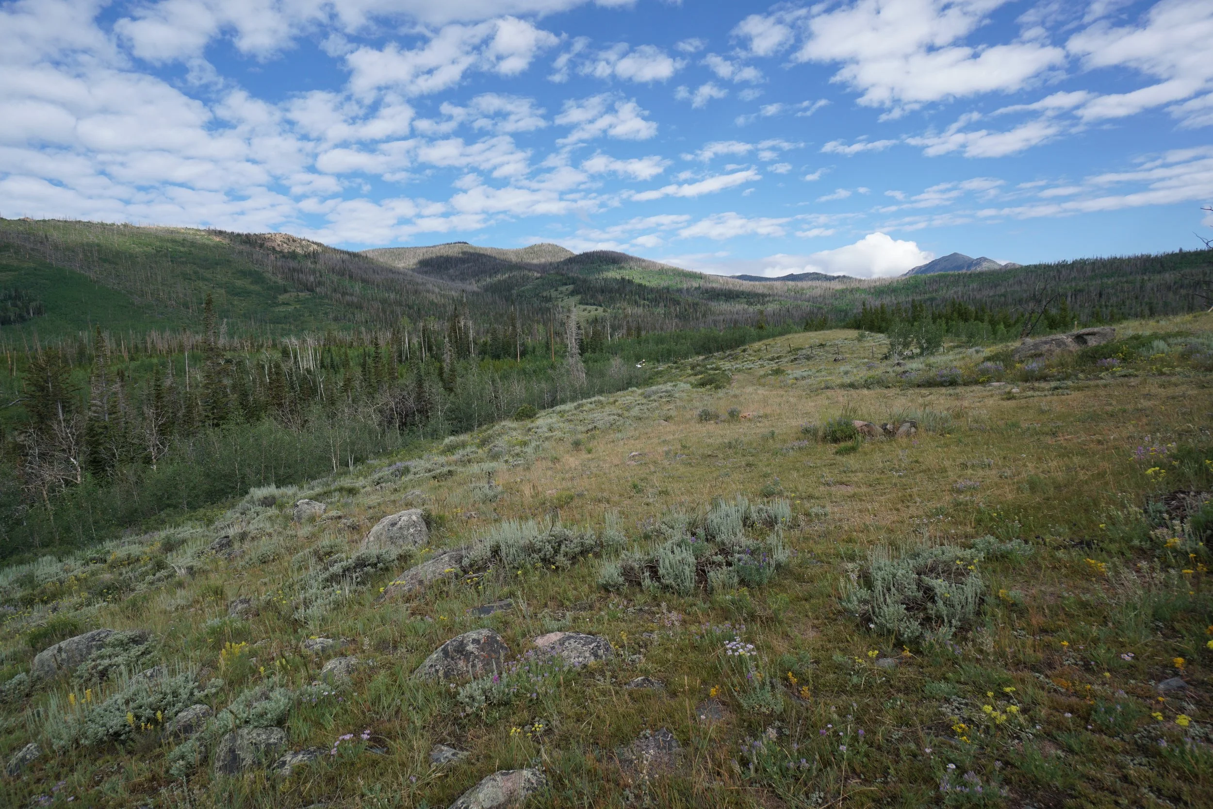
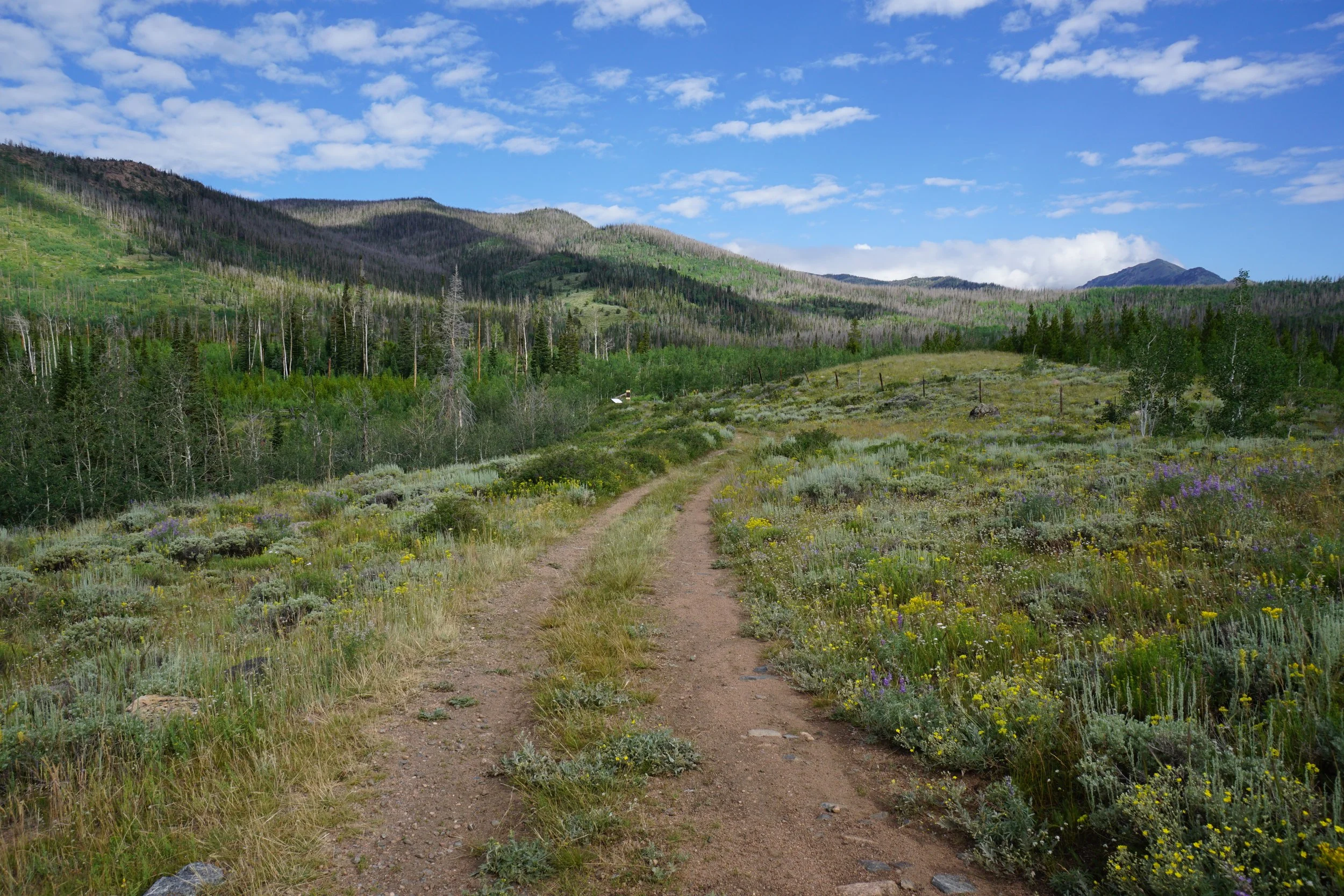
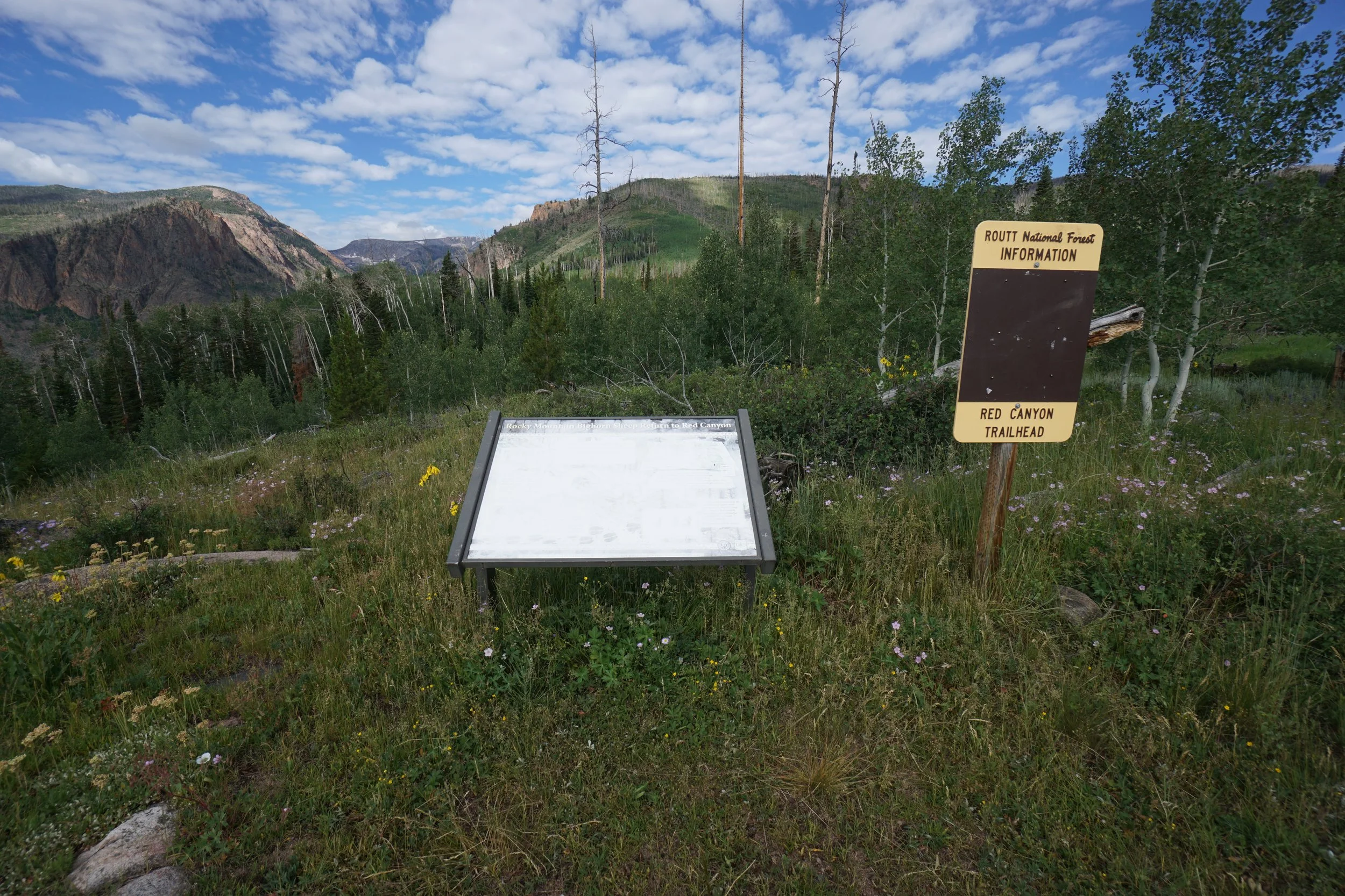
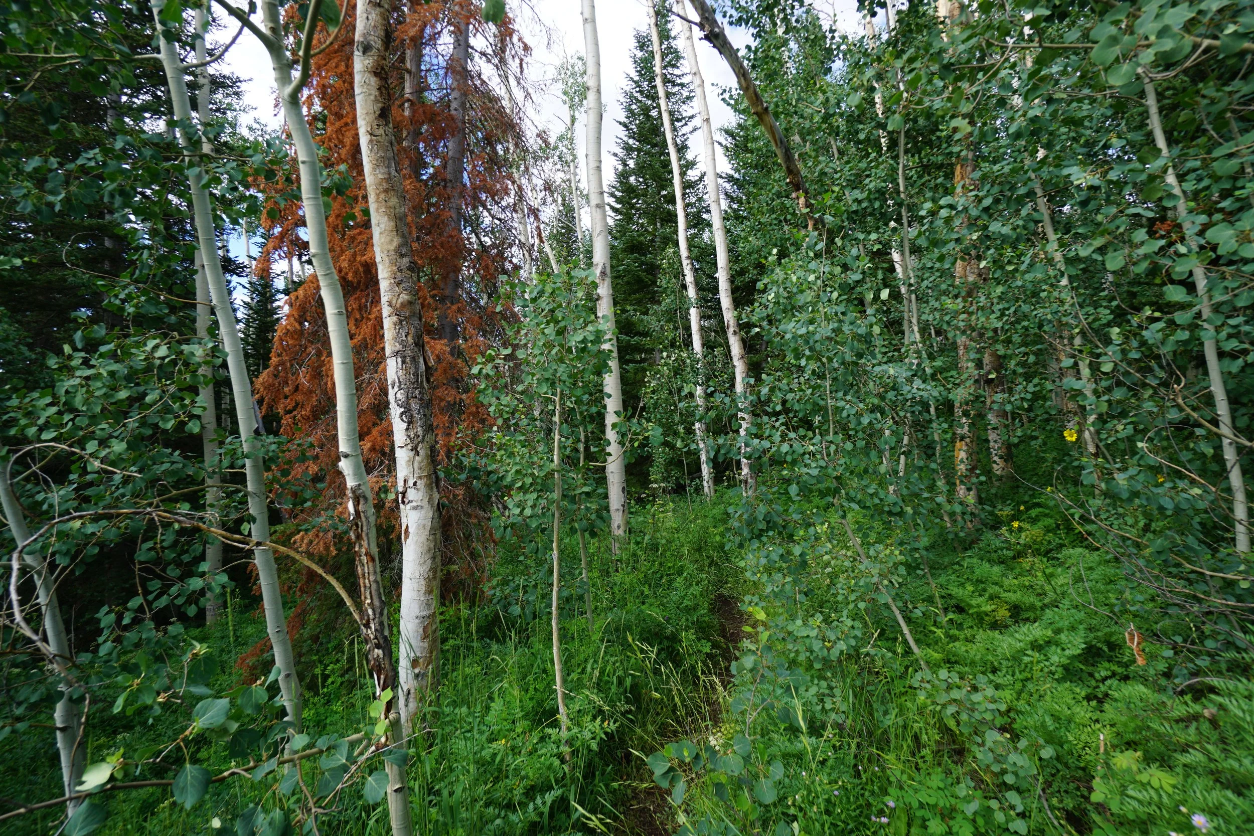
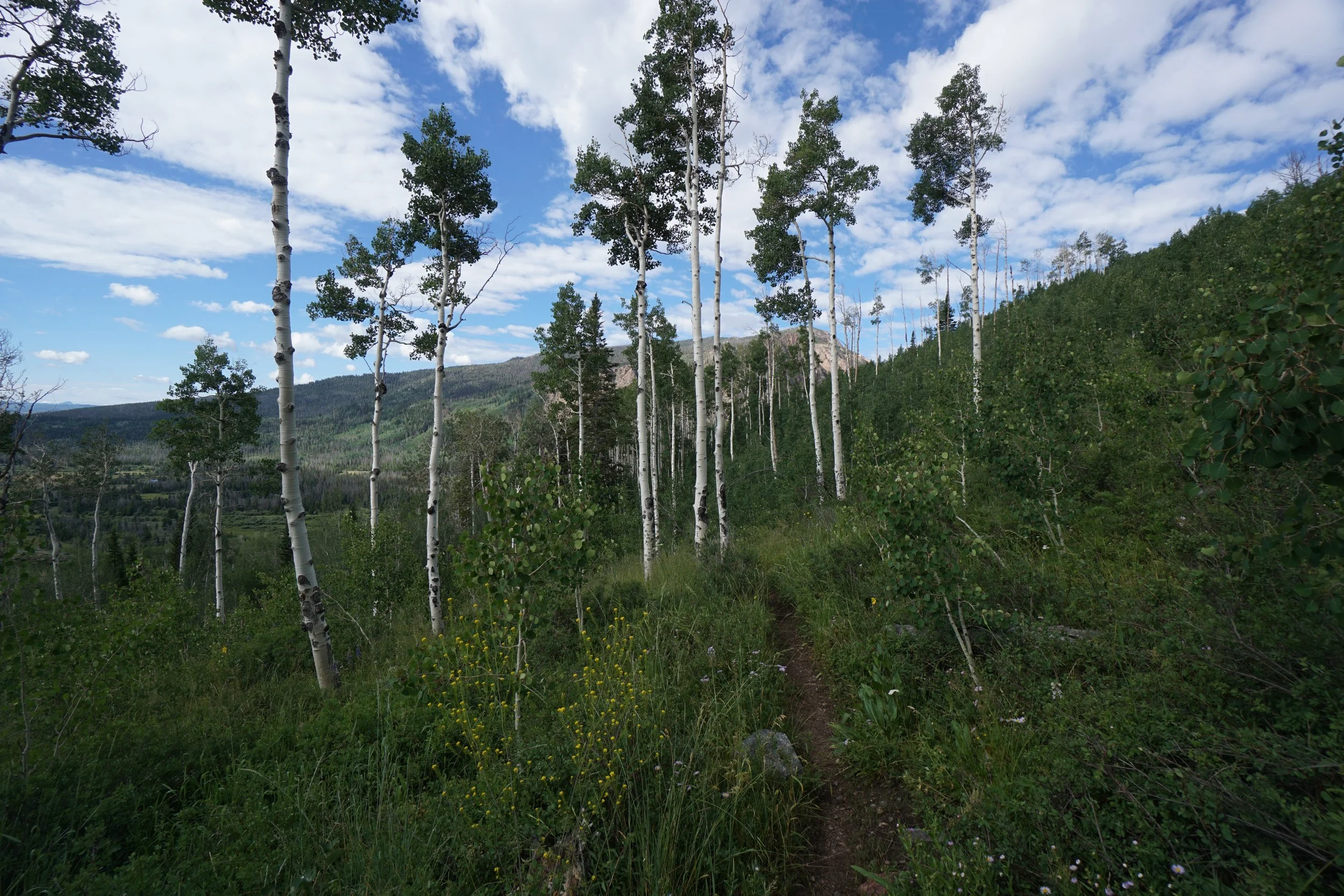
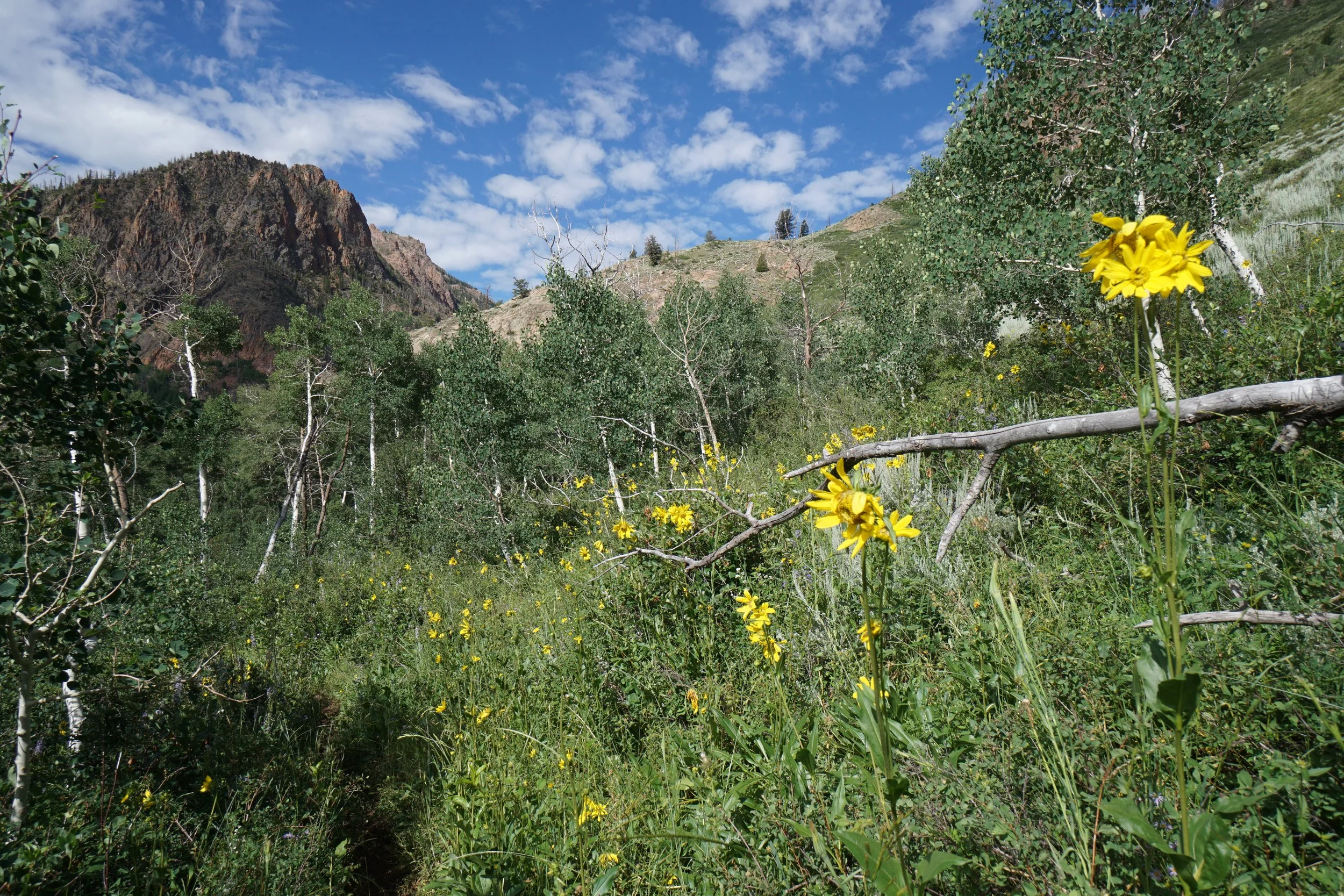
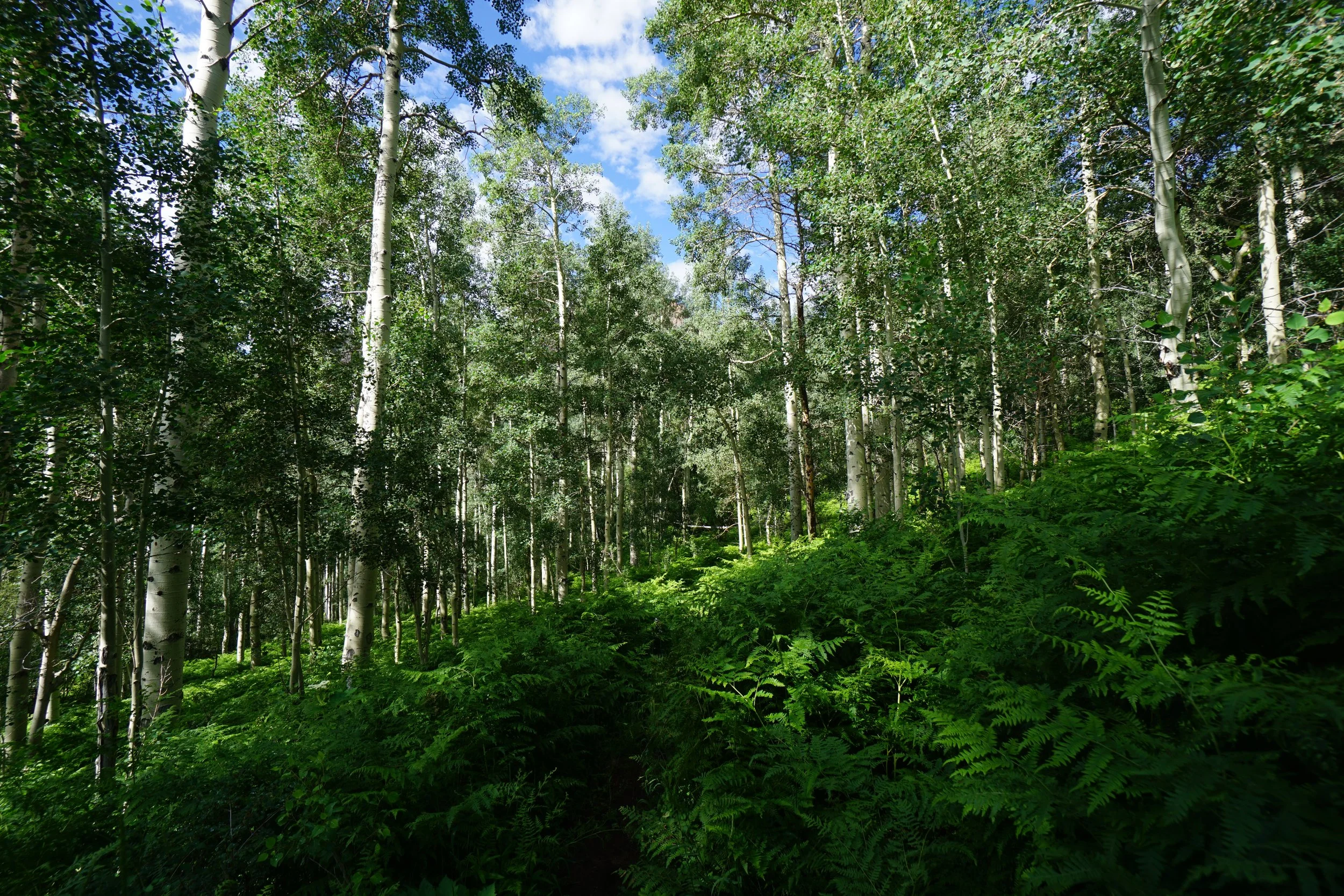
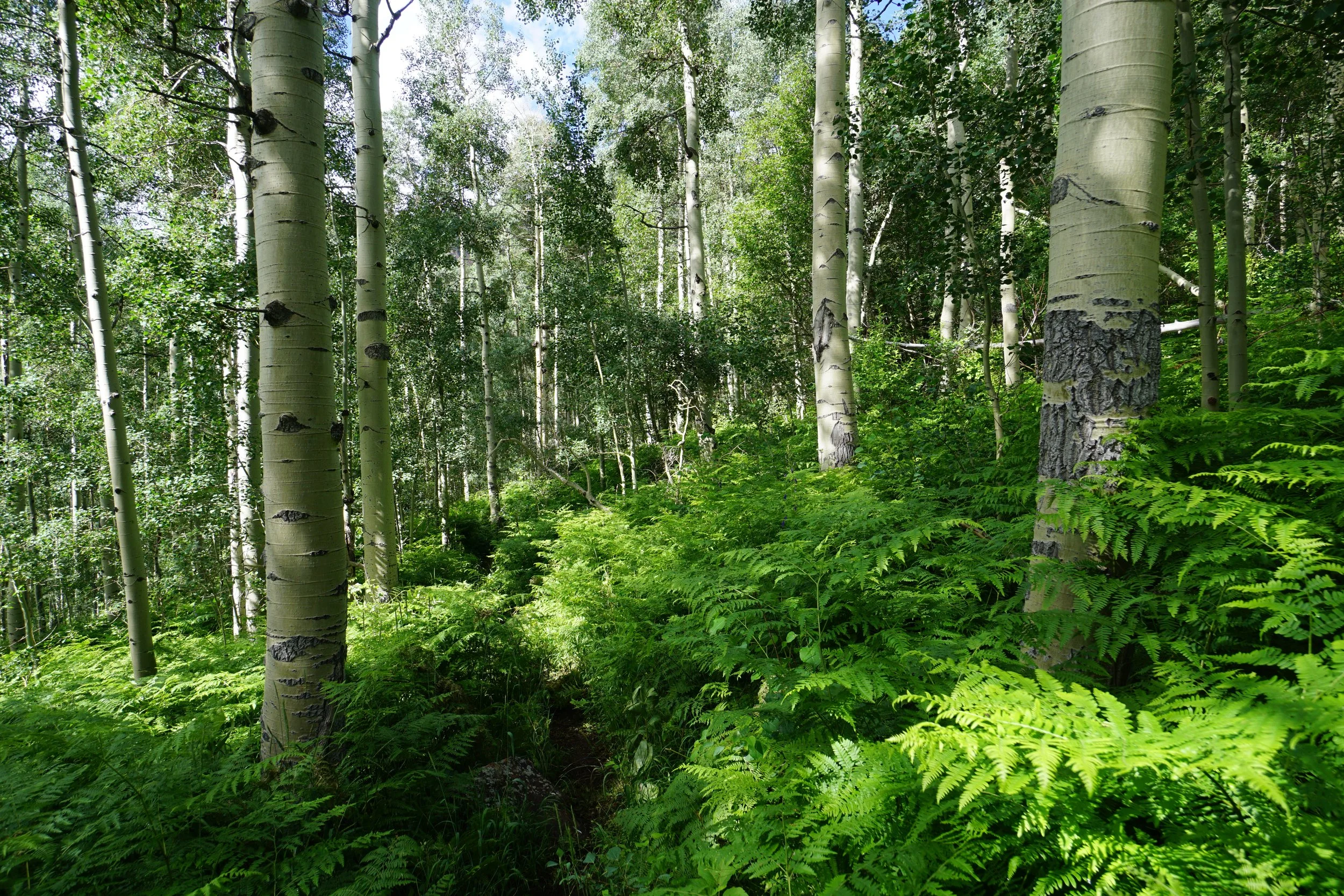
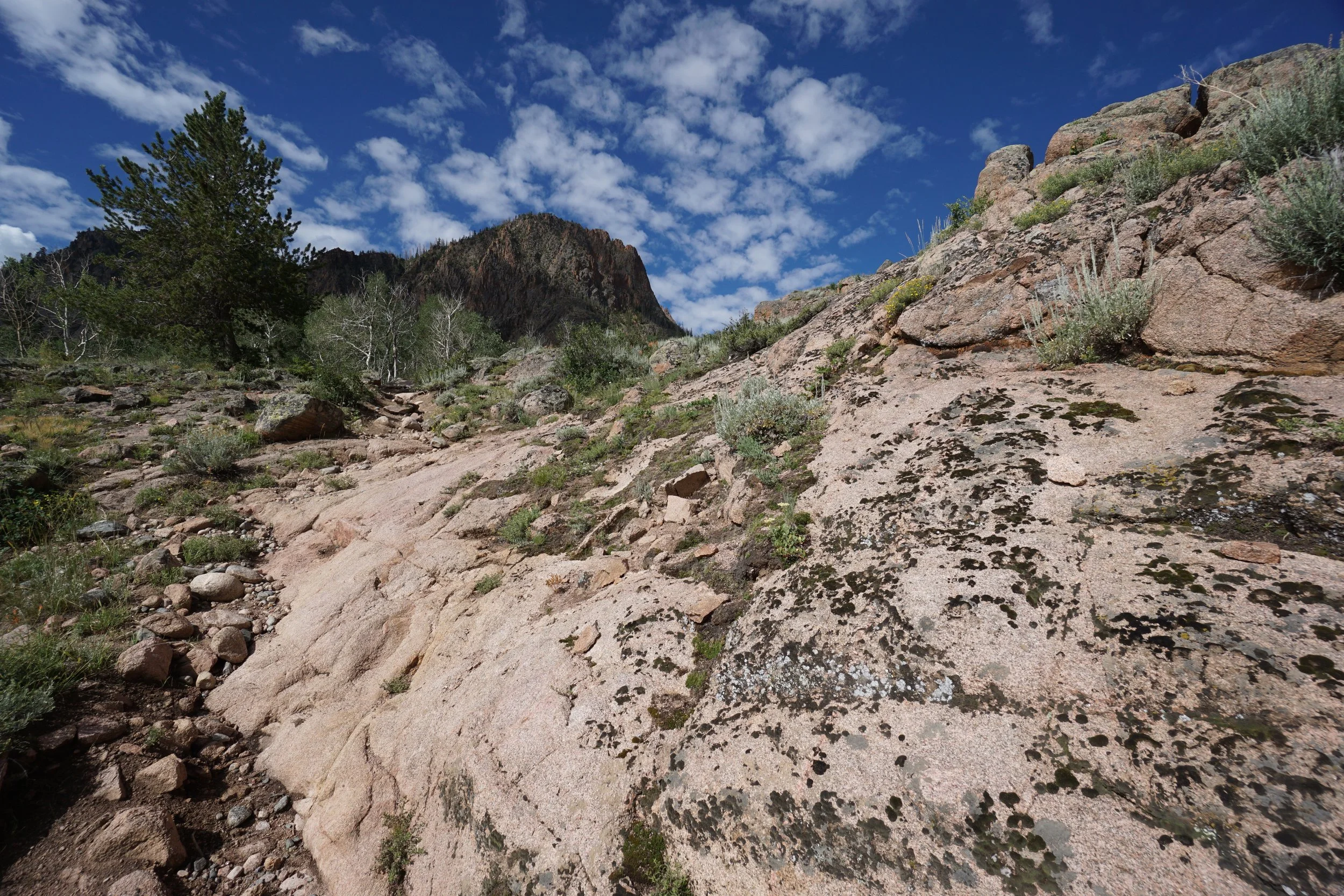
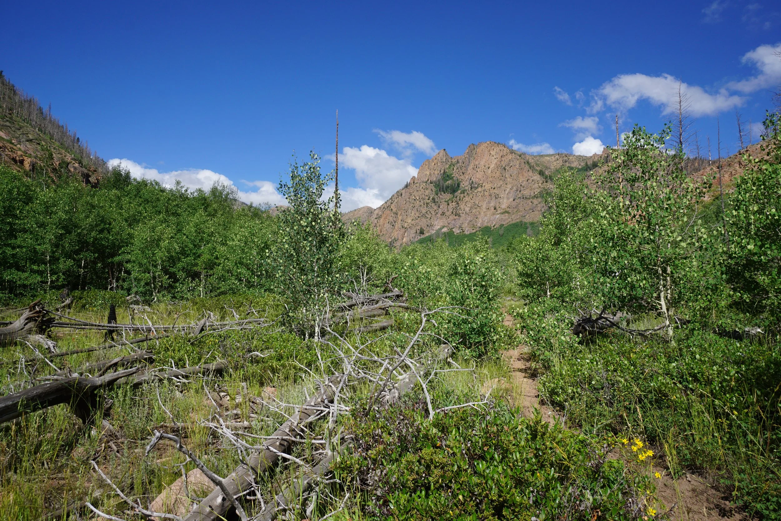
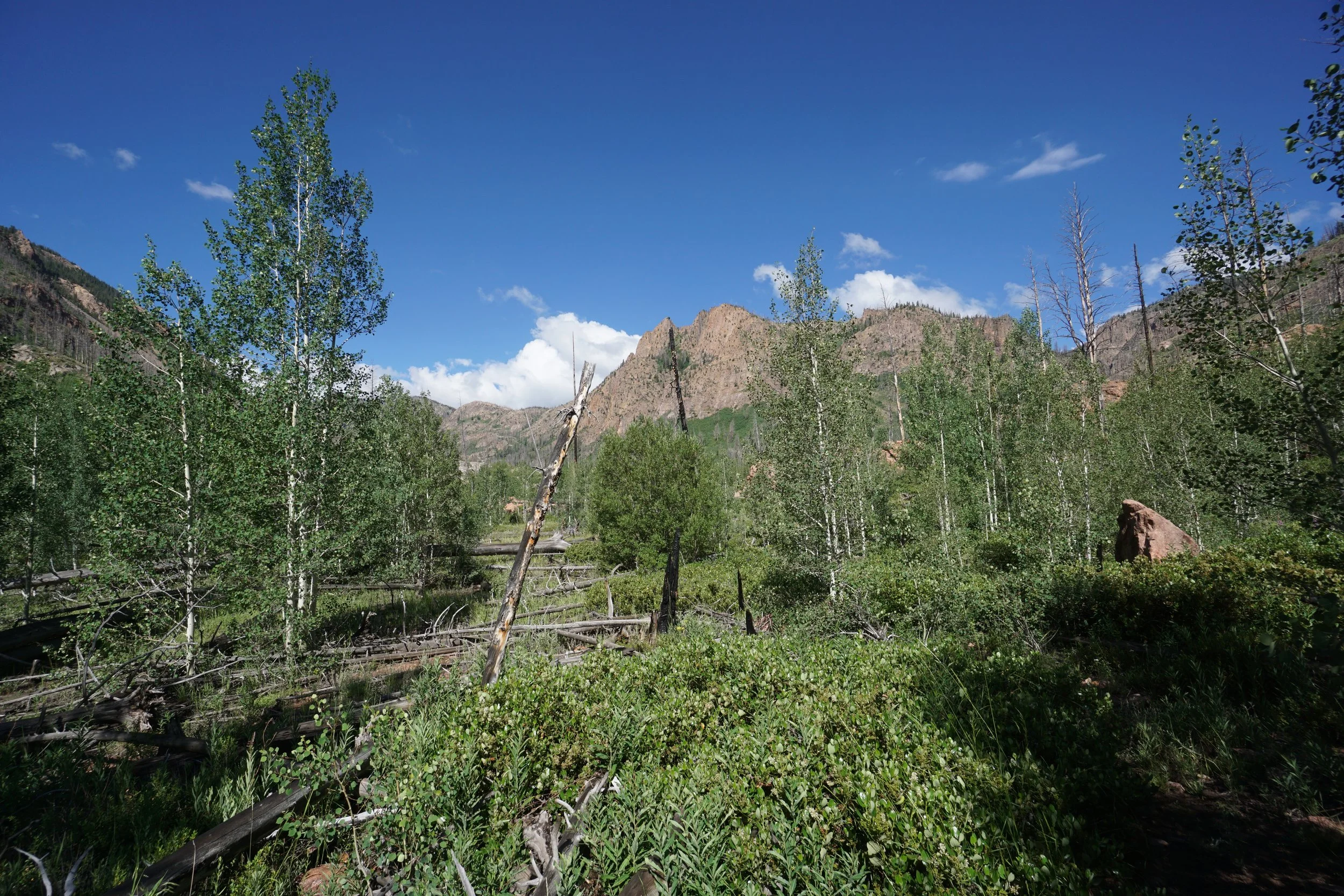
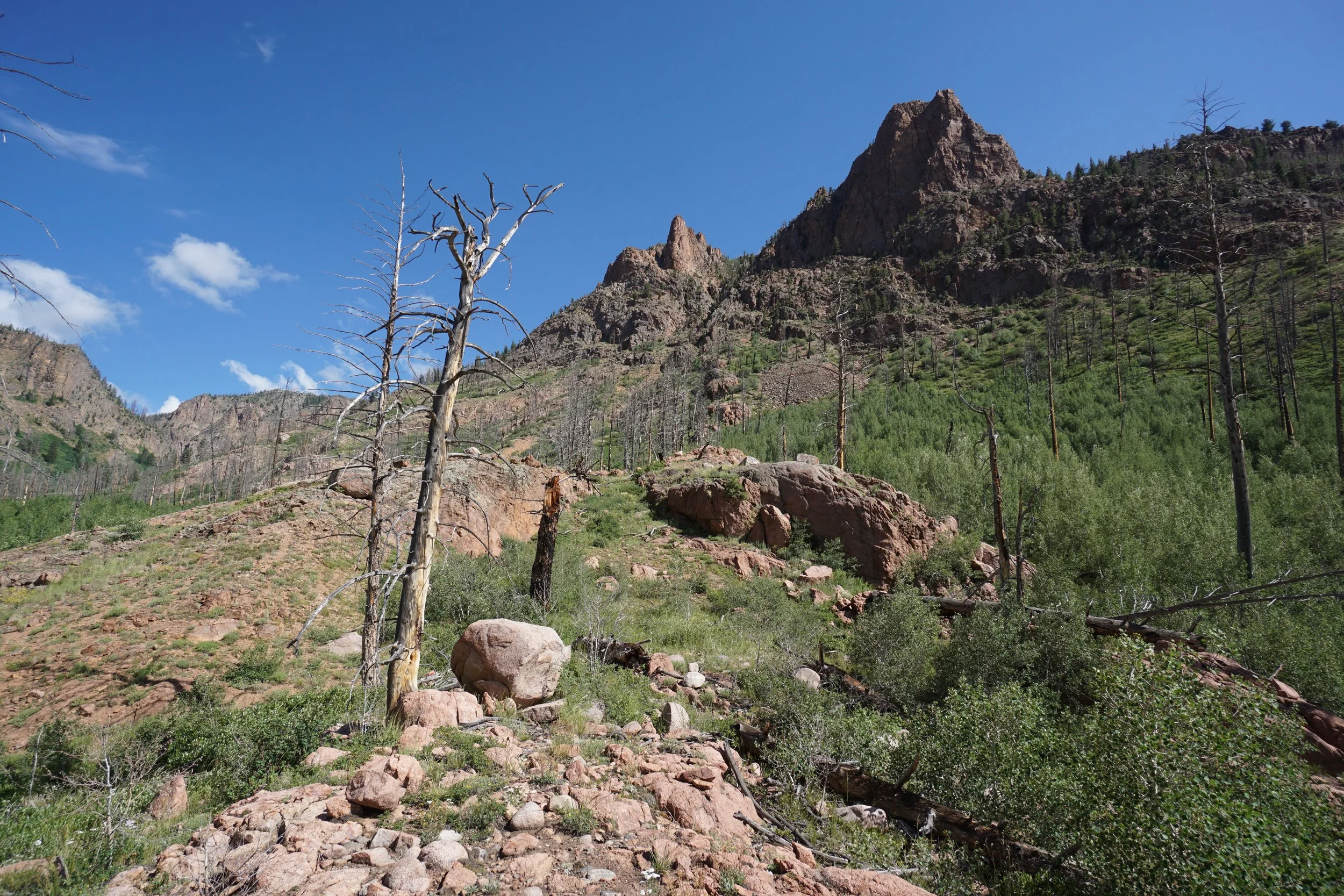
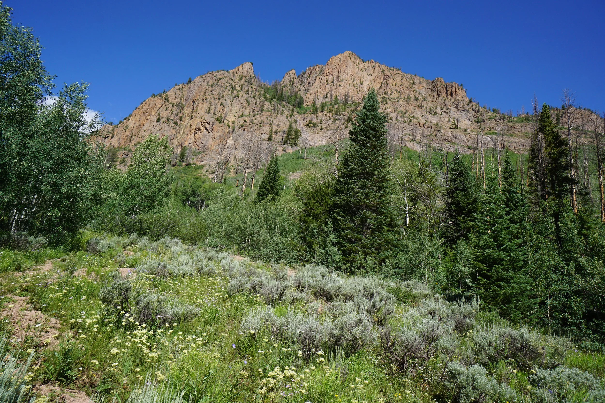
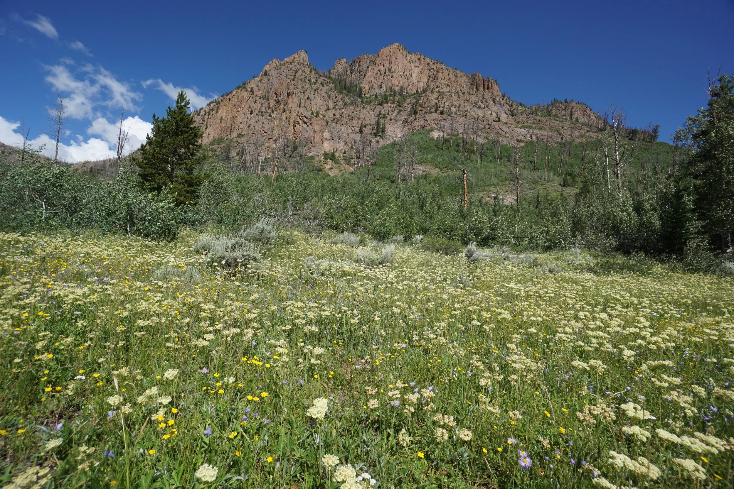
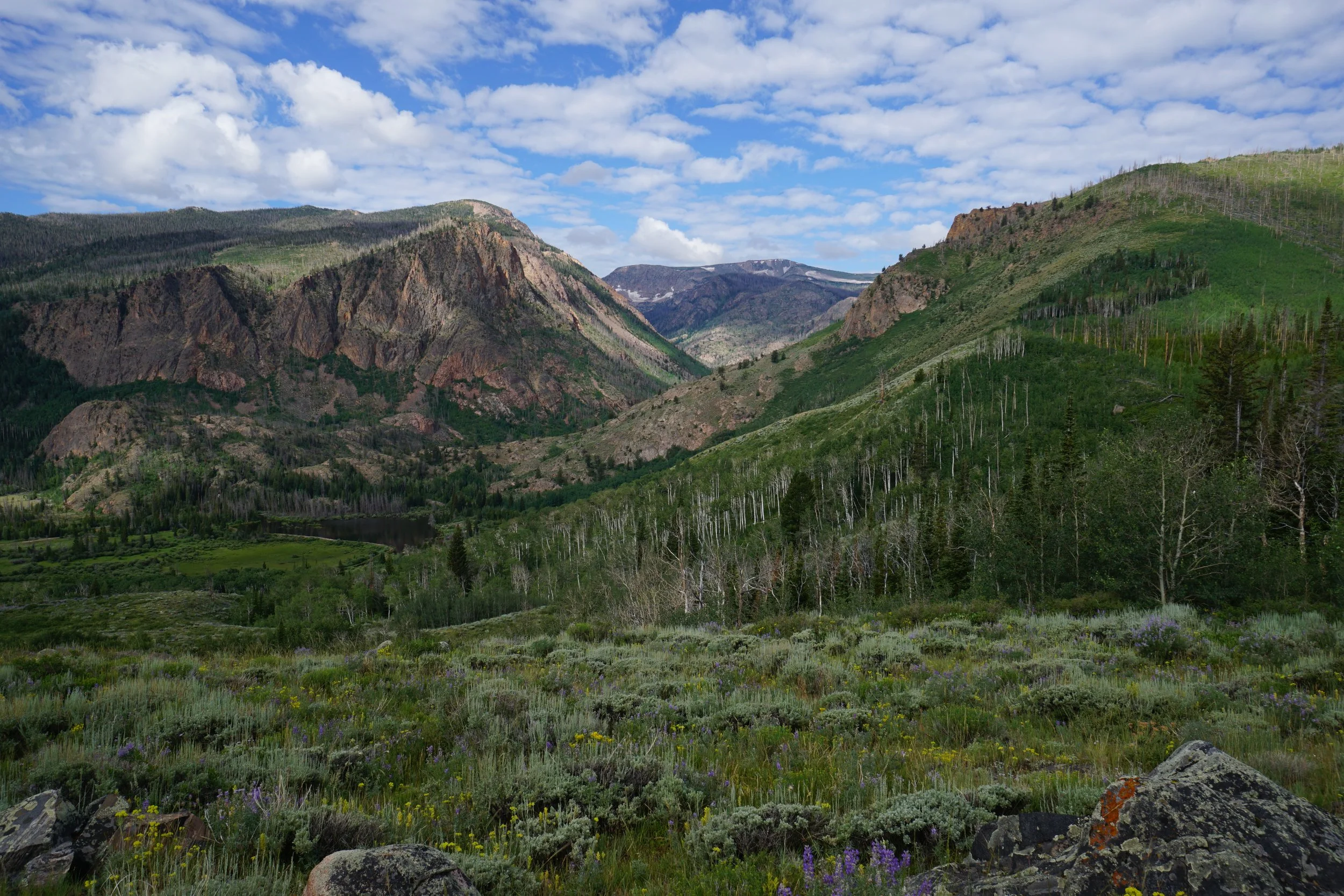
Red Canyon…wow… This hike is a hidden gem in the Mt. Zirkel Wilderness. I couldn’t find much on the internet before heading out for this hike and I happy surprised. I glimpsed a view of red canyon from the roads near Walden on a previous visit to the area so exploring this canyon was on my wish list. The trail that runs through Red Canyon is the Lost Ranger Trail. Getting to the Red Canyon Trailhead is a bit of an adventure in itself, see the directions above. Most vehicles can get about a mile or so from the trailhead, so expect to hike along the beautiful road for a bit. The road is lined with aspens and has some great views. The best view of Red Canyon is arguably from the top of the hill right before you reach the trailhead.
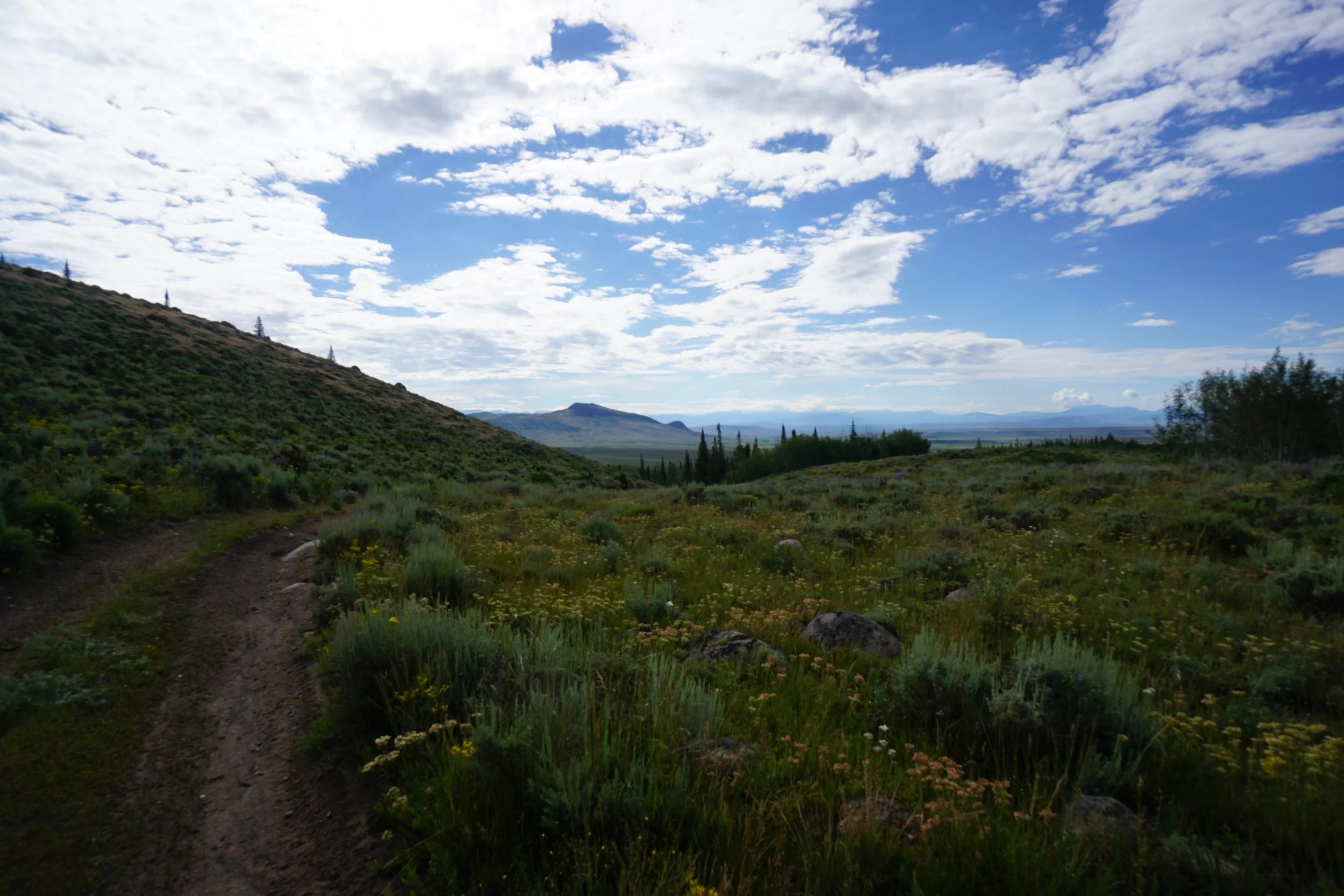
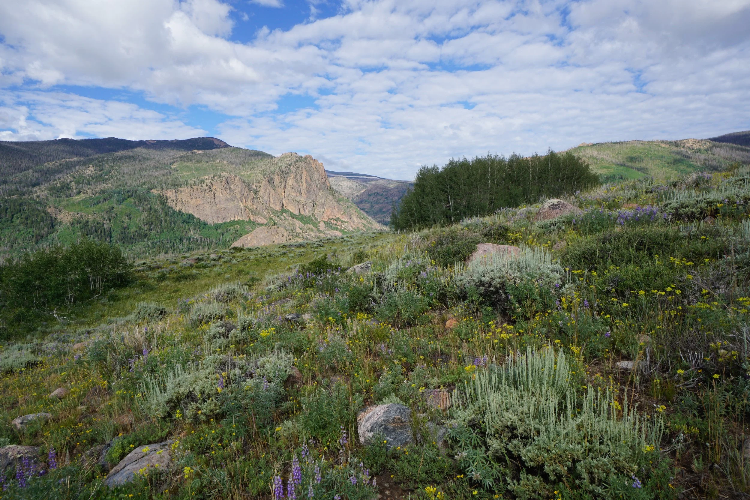
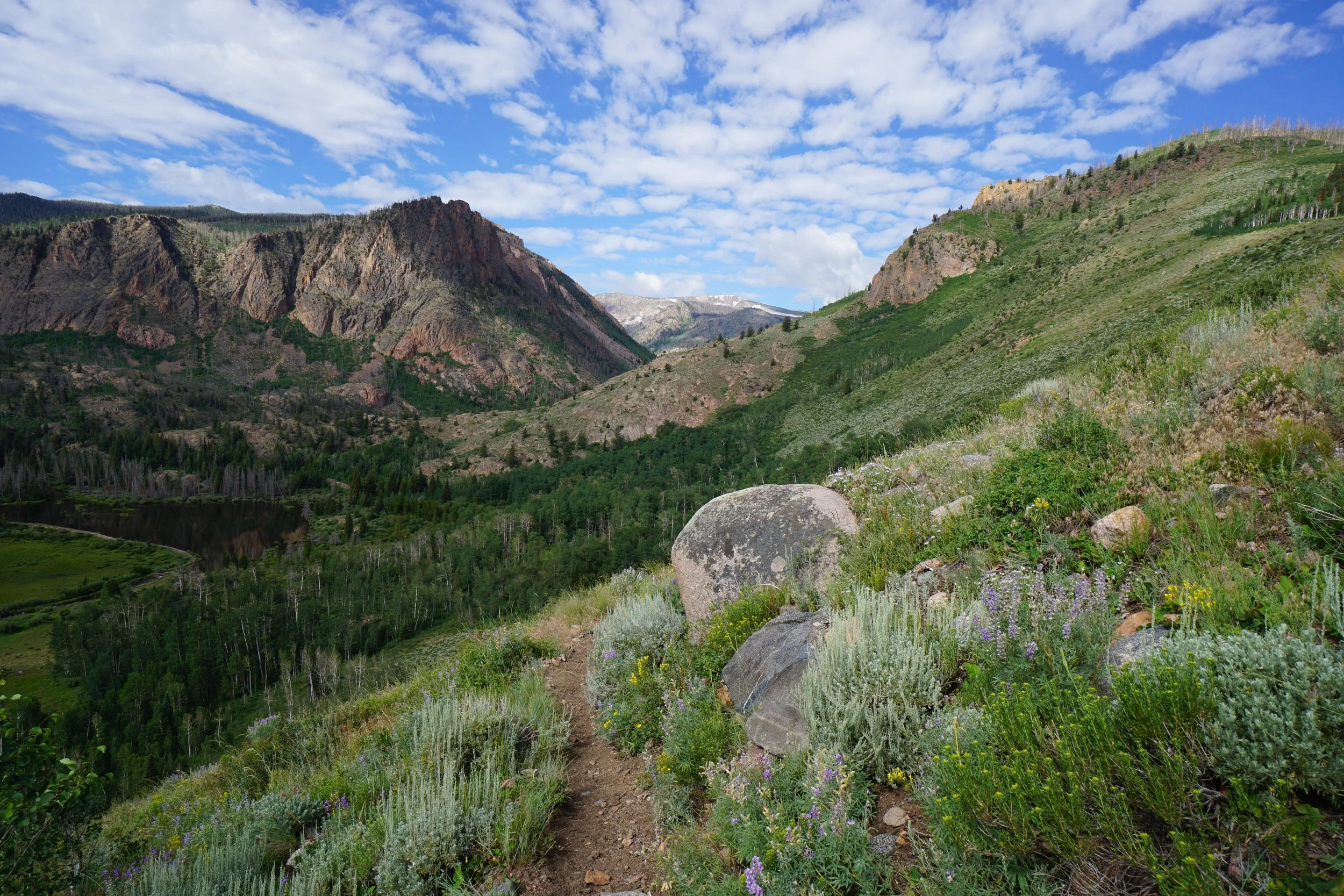
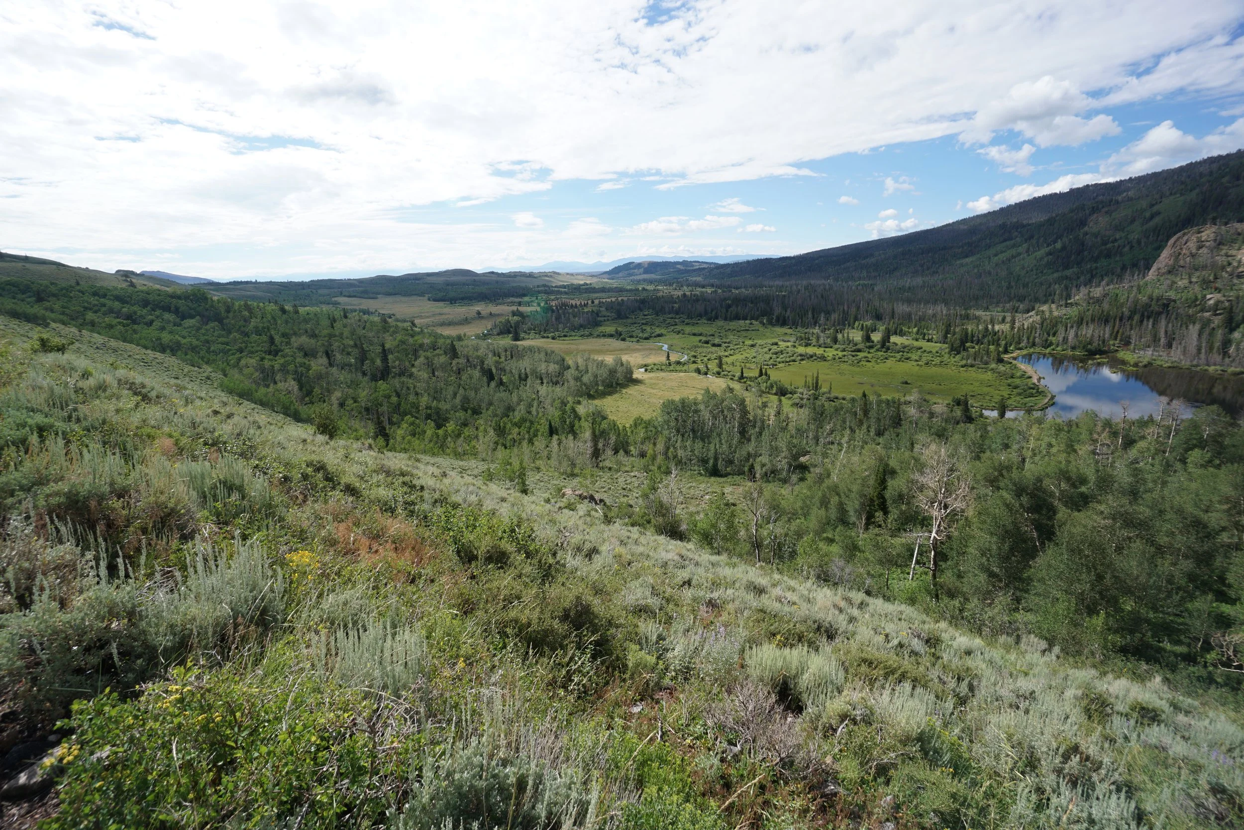
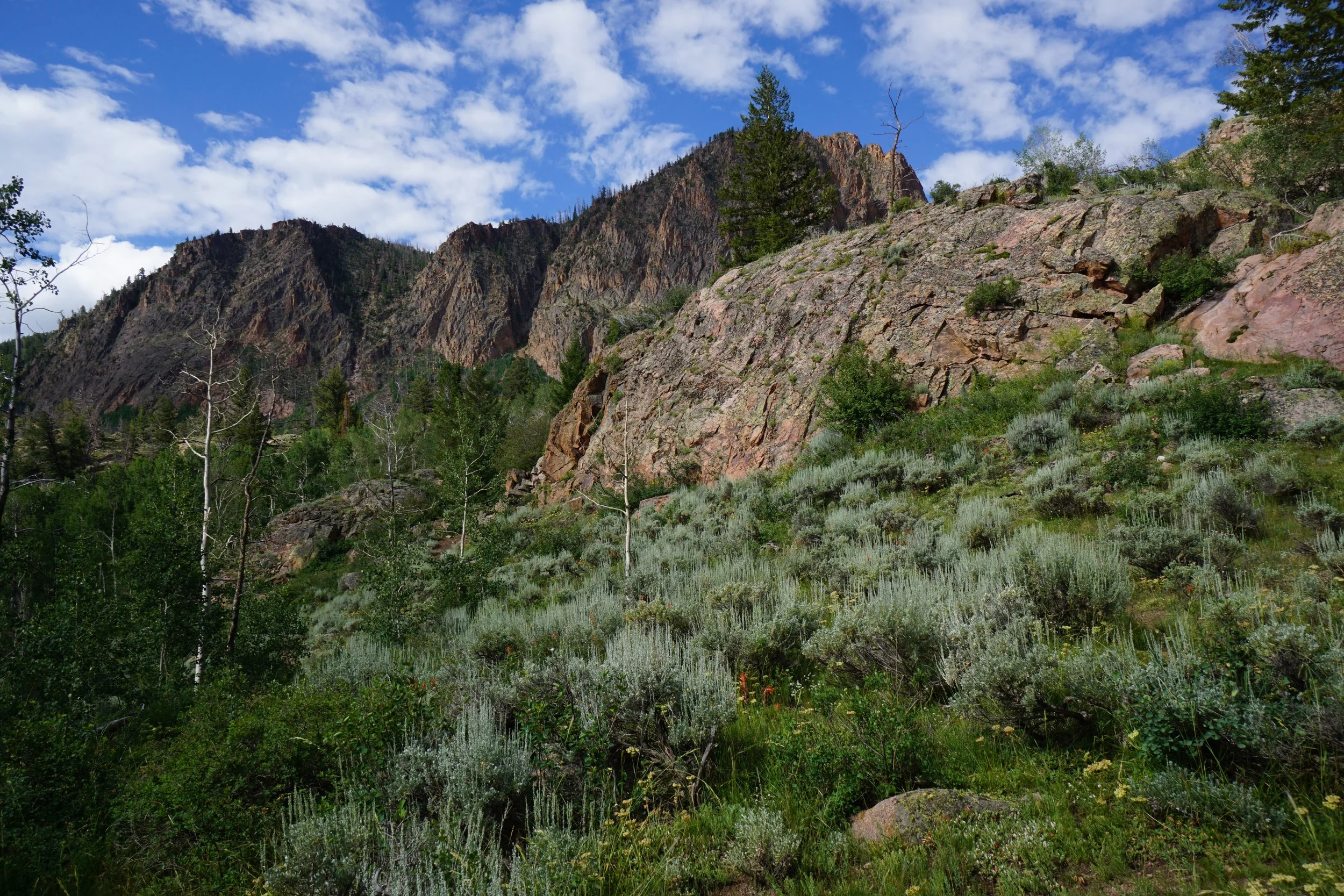
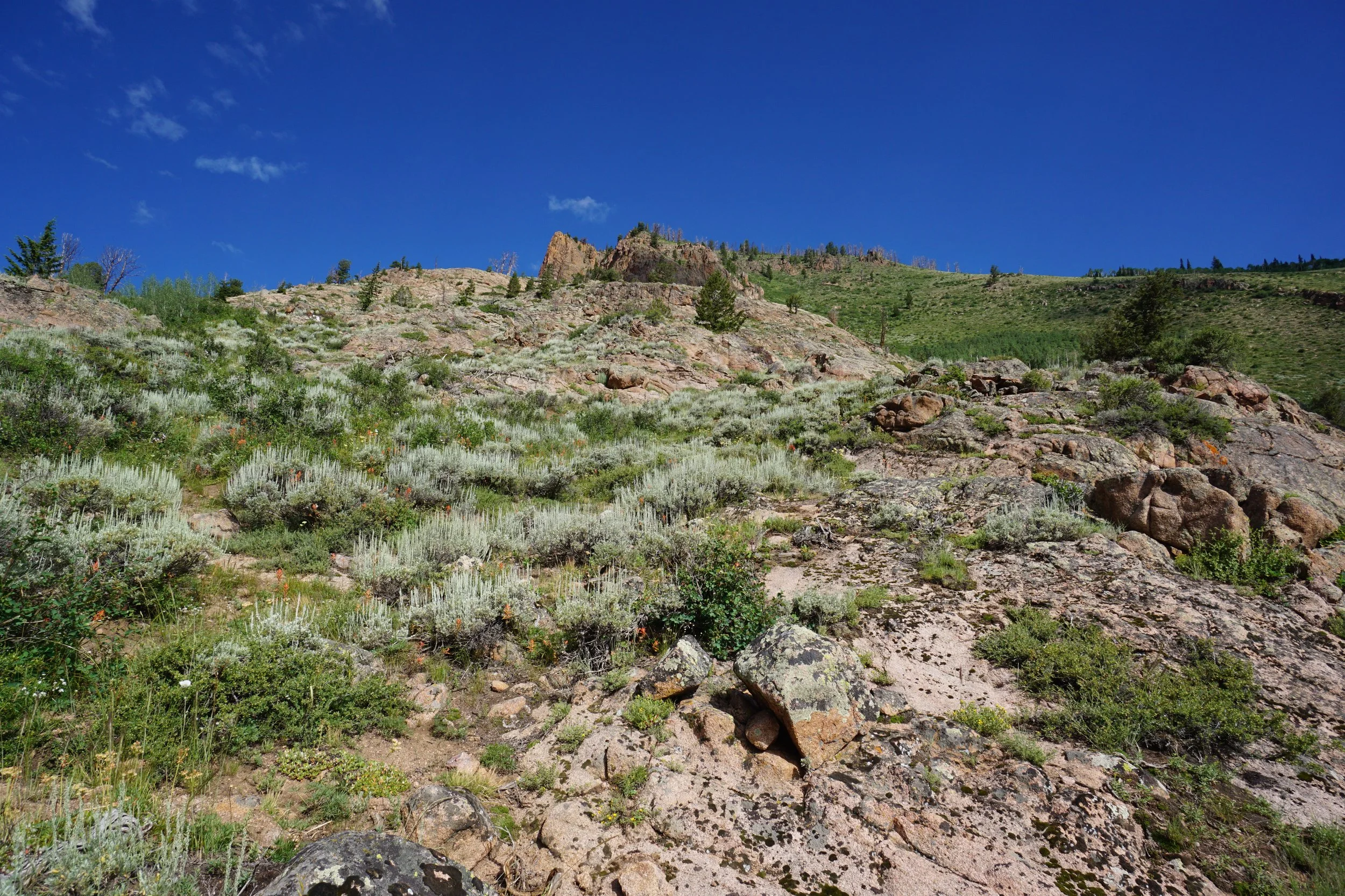
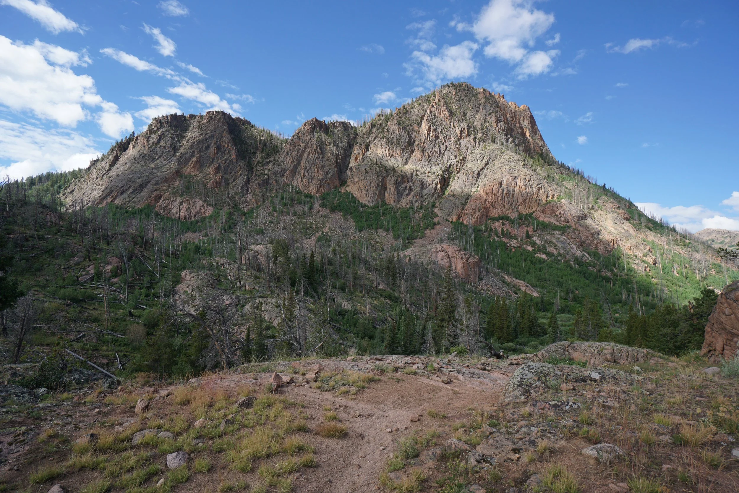
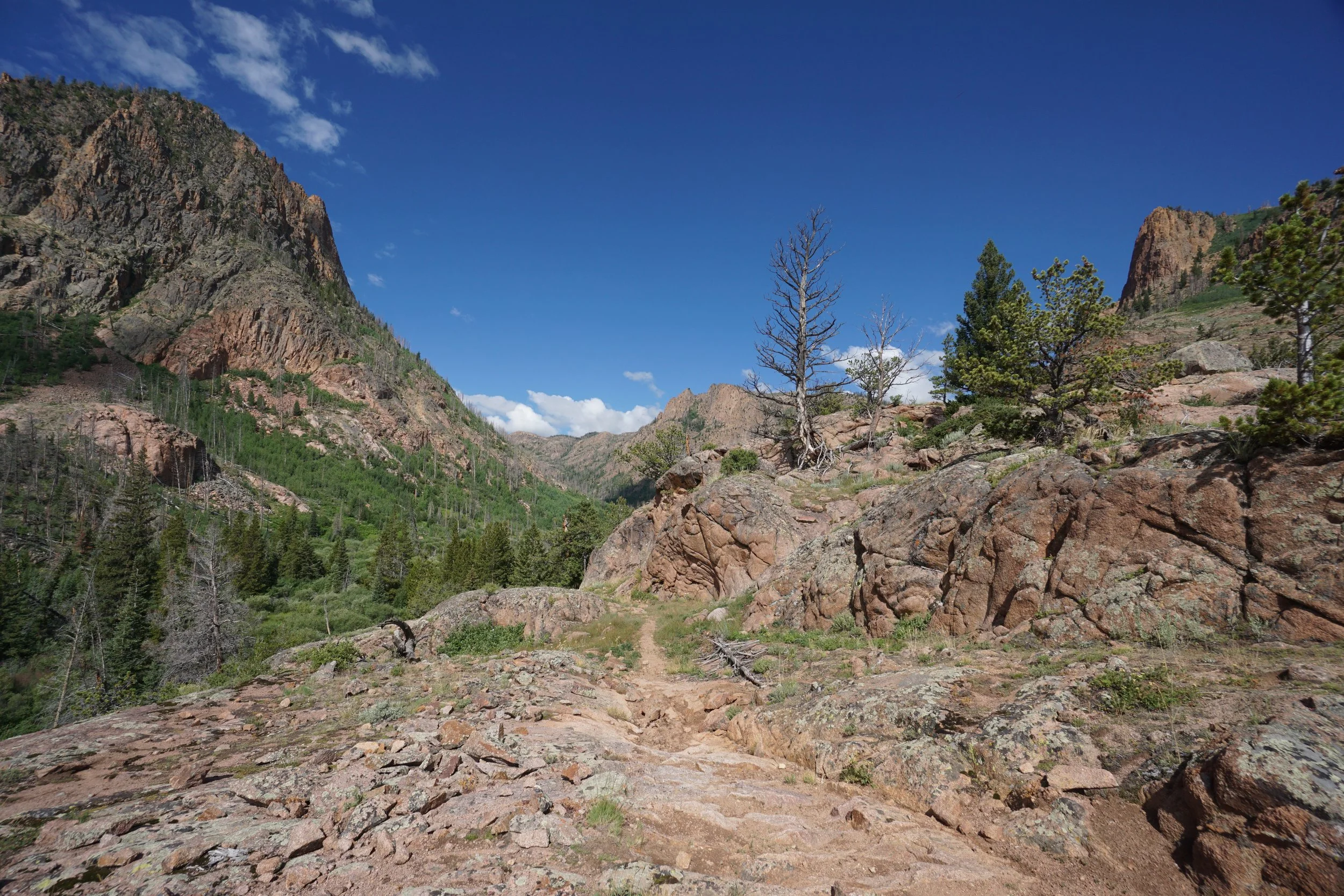
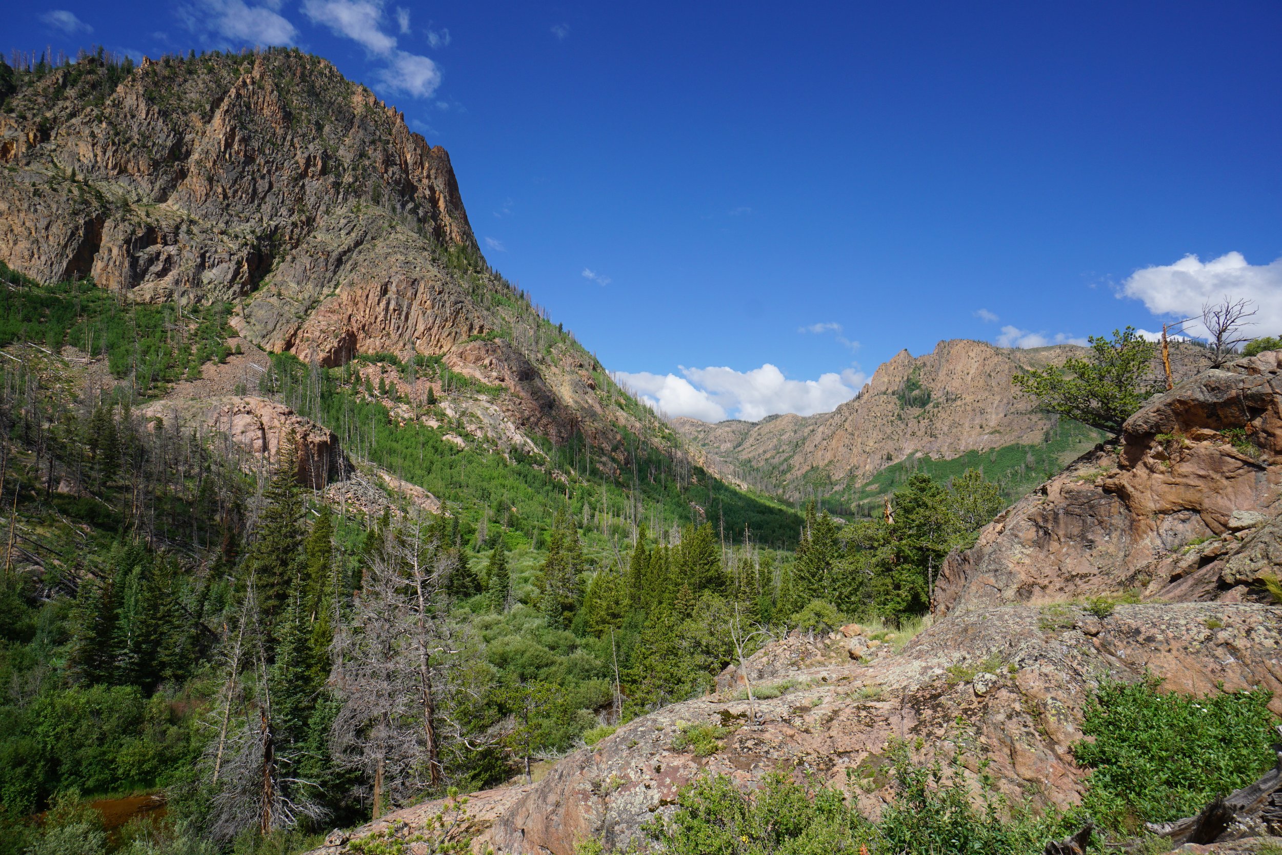
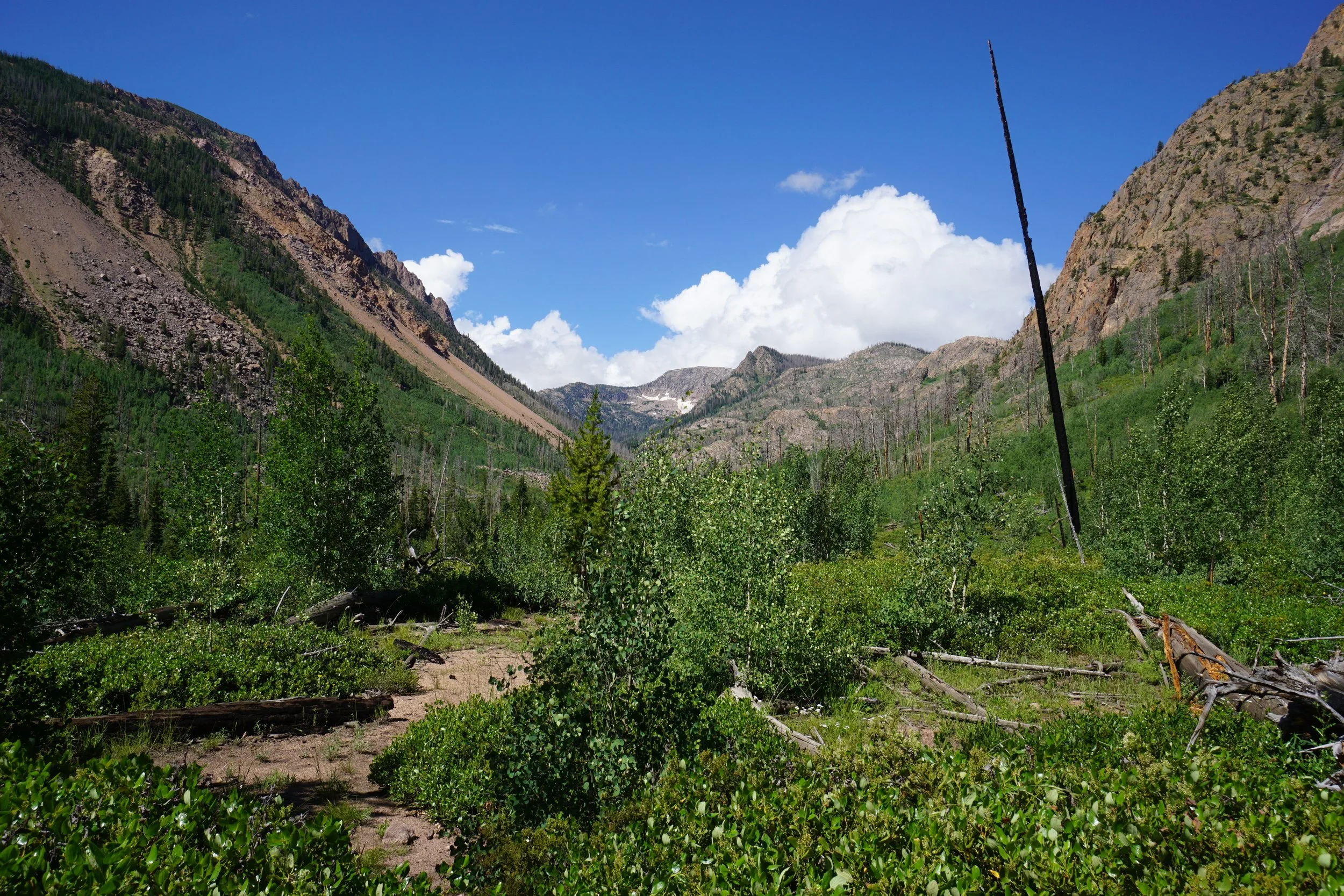
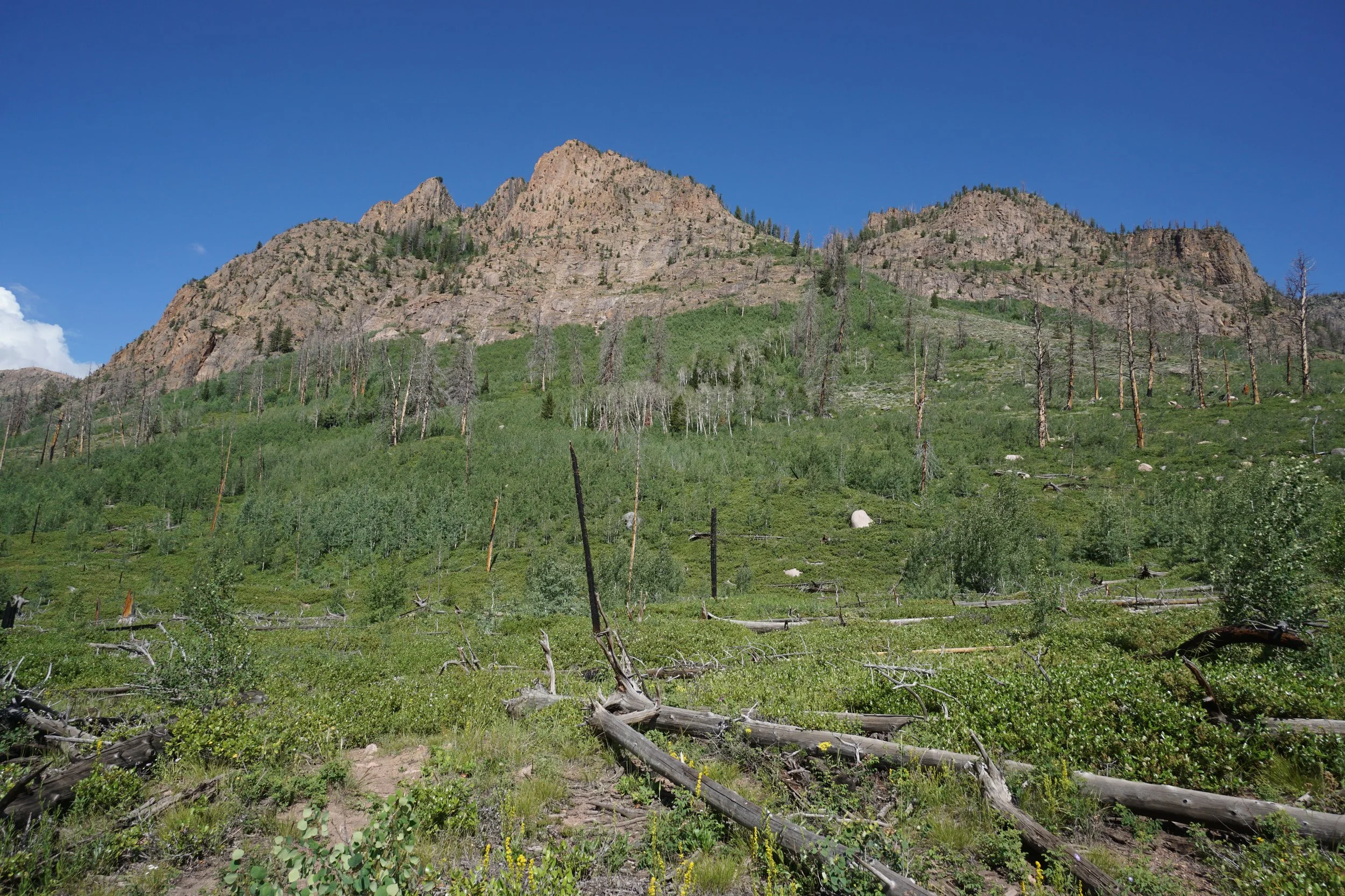
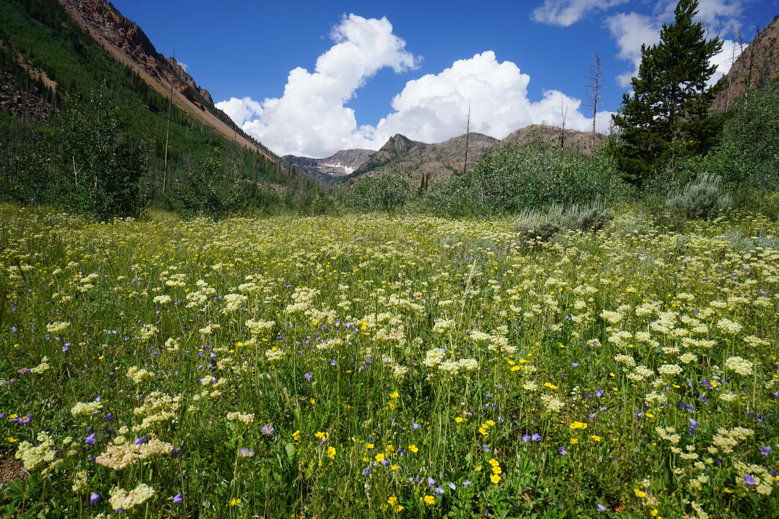
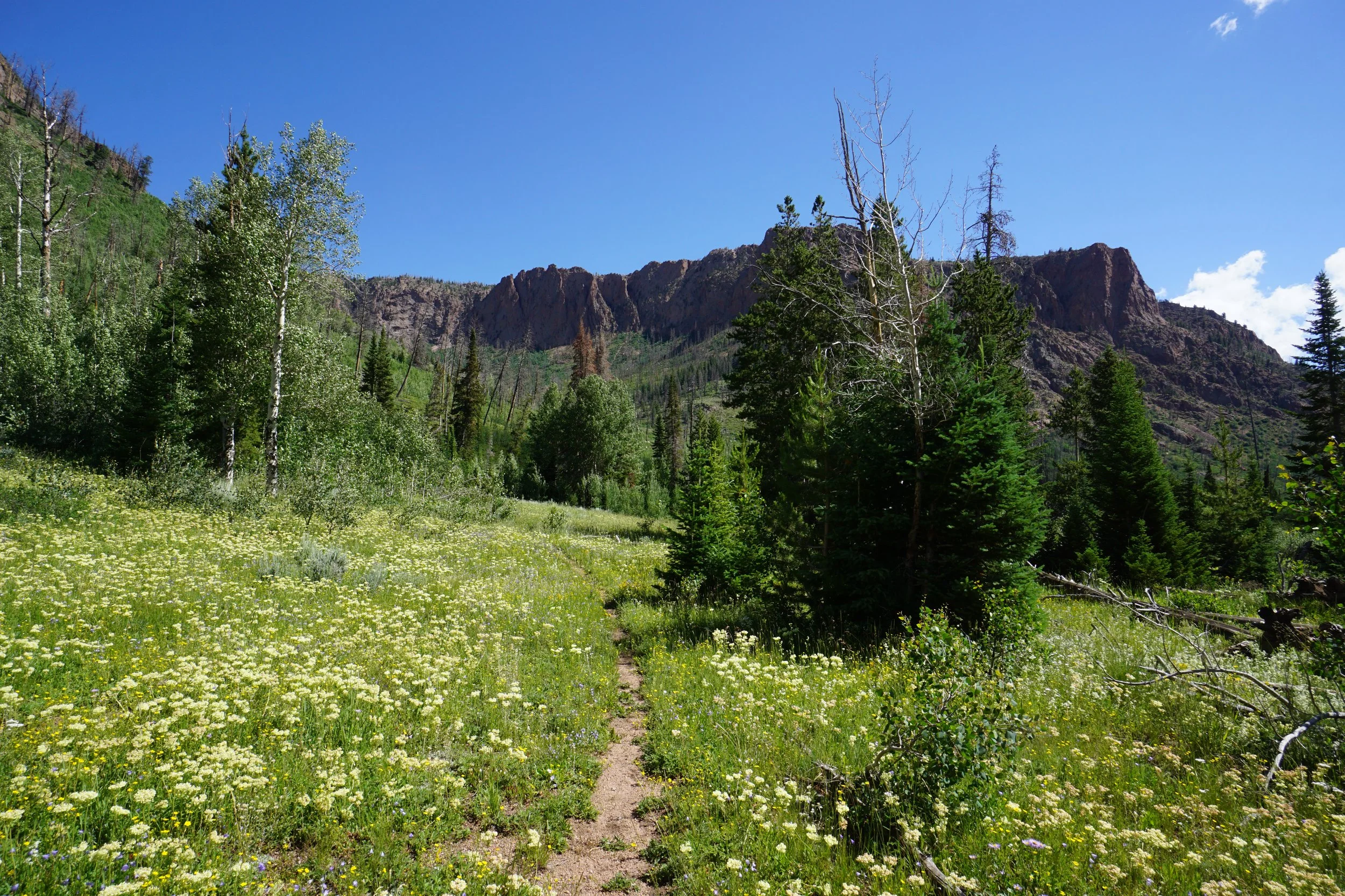
This trail is not often hiked and it shows from just about the beginning. The first mile of this hike drops down about 500 ft to the mouth of Red Canyon. The views from this portion are incredible, the gates of the canyon are stunning. The trail cuts across the hillside alternating between sagebrush and aspen forest. The views to the east are also beautiful looking out over North Park. The trail is overgrown but easy enough to follow in this section. As you approach the canyon, the views get better and better.
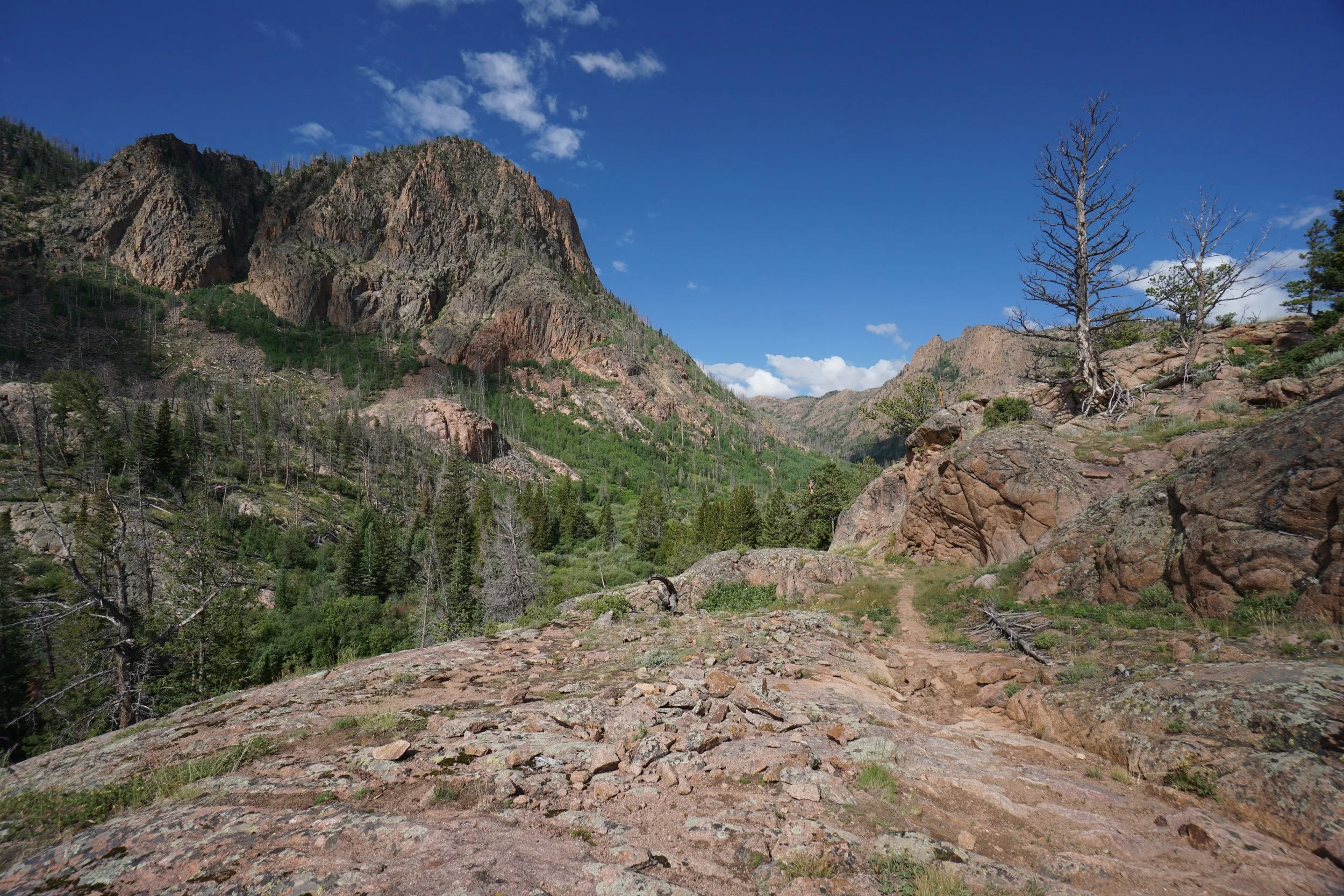
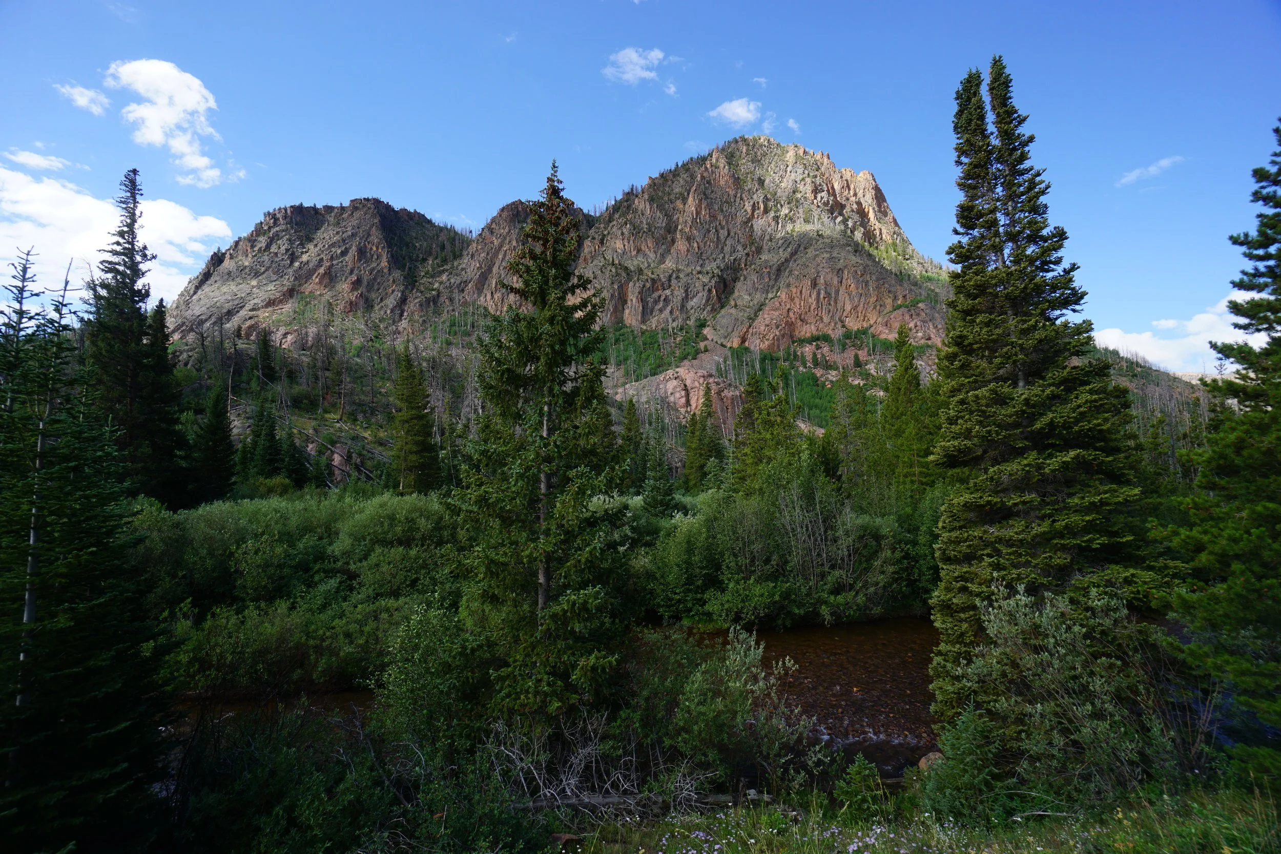
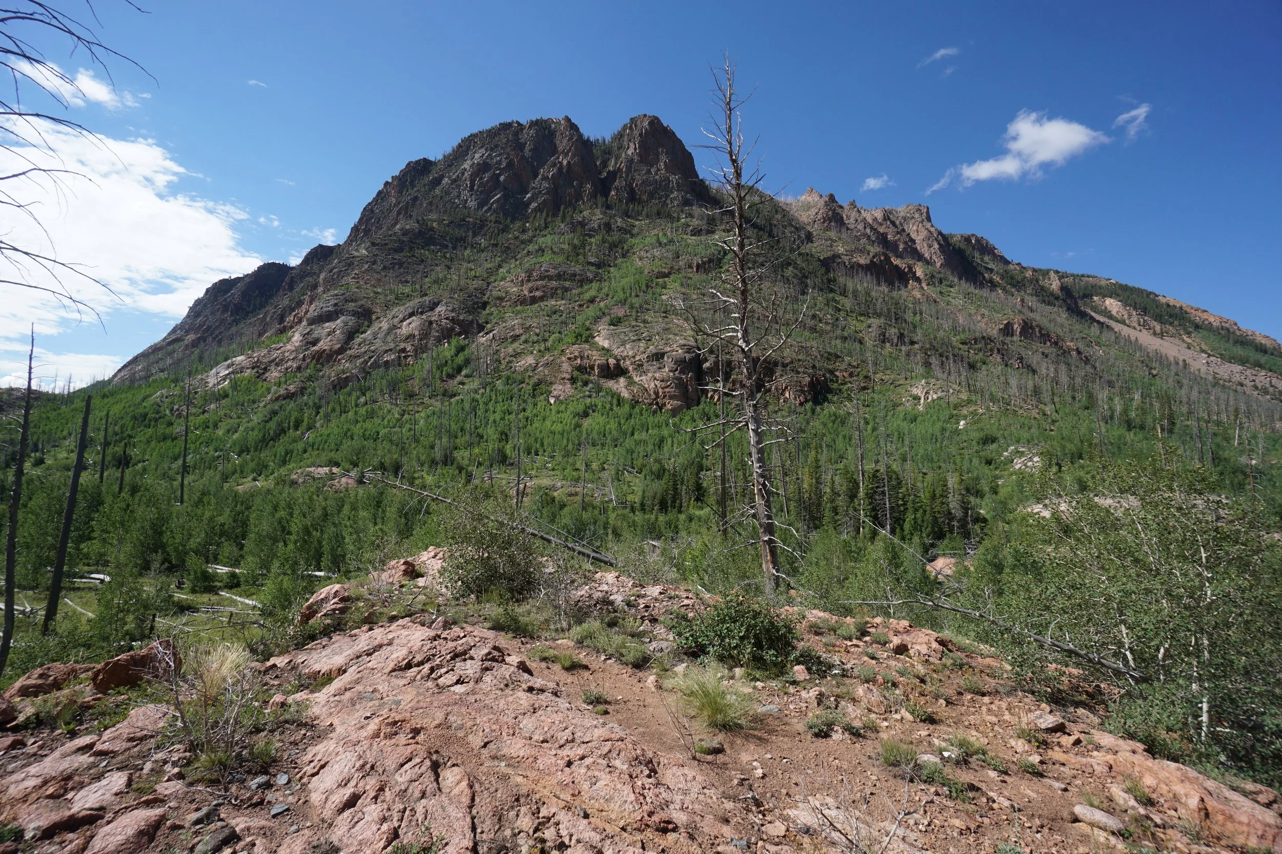
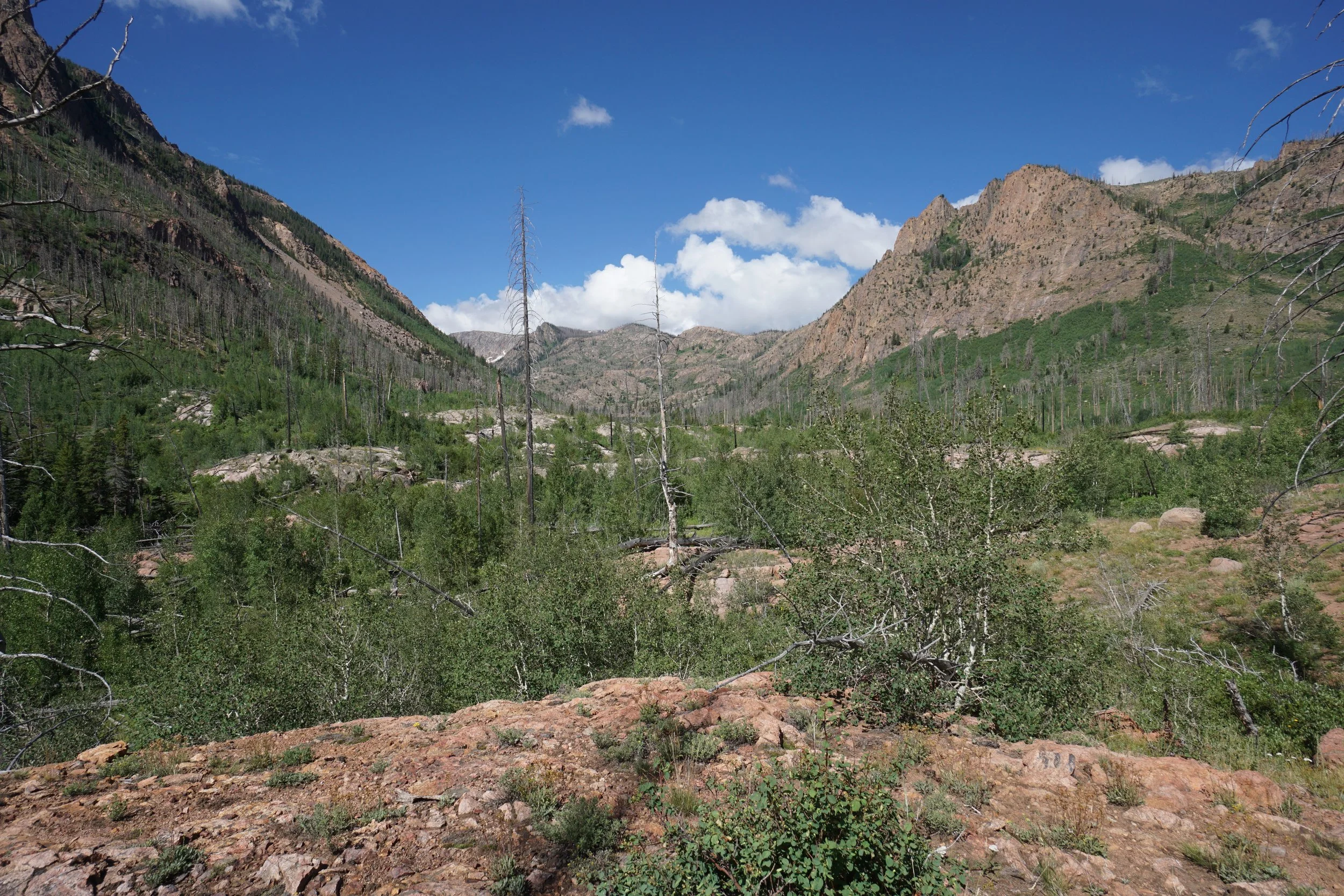
When you reach the bottom of the trail you’ll be over Red Canyon Reservoir and you’ll reach a rocky area where you need to climb a bit before entering the canyon proper. This canyon feels more like being in Moab than the Zirkels. The towering red rock cliffs are spectacular, photos and words don’t do it justice. The mouth of the canyon is massive. Hike down to Roaring Fork Creek and enter Red Canyon.
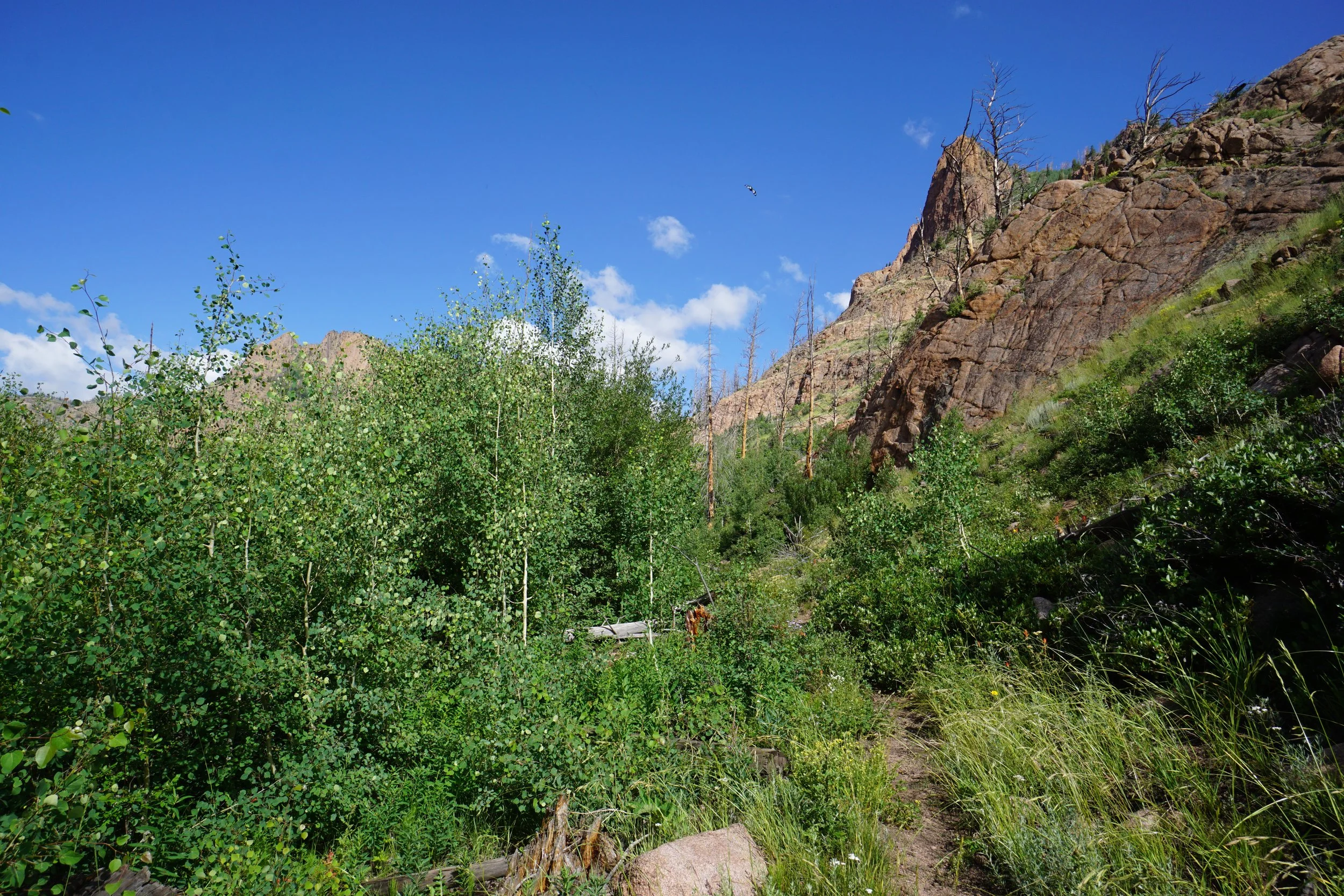
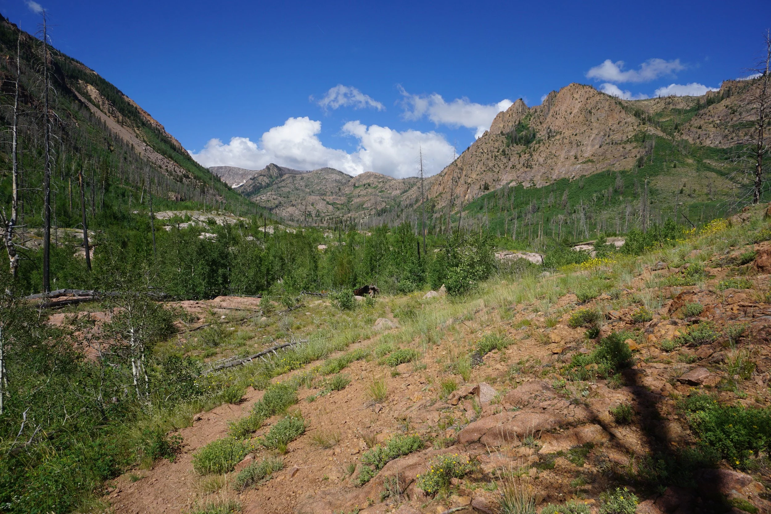
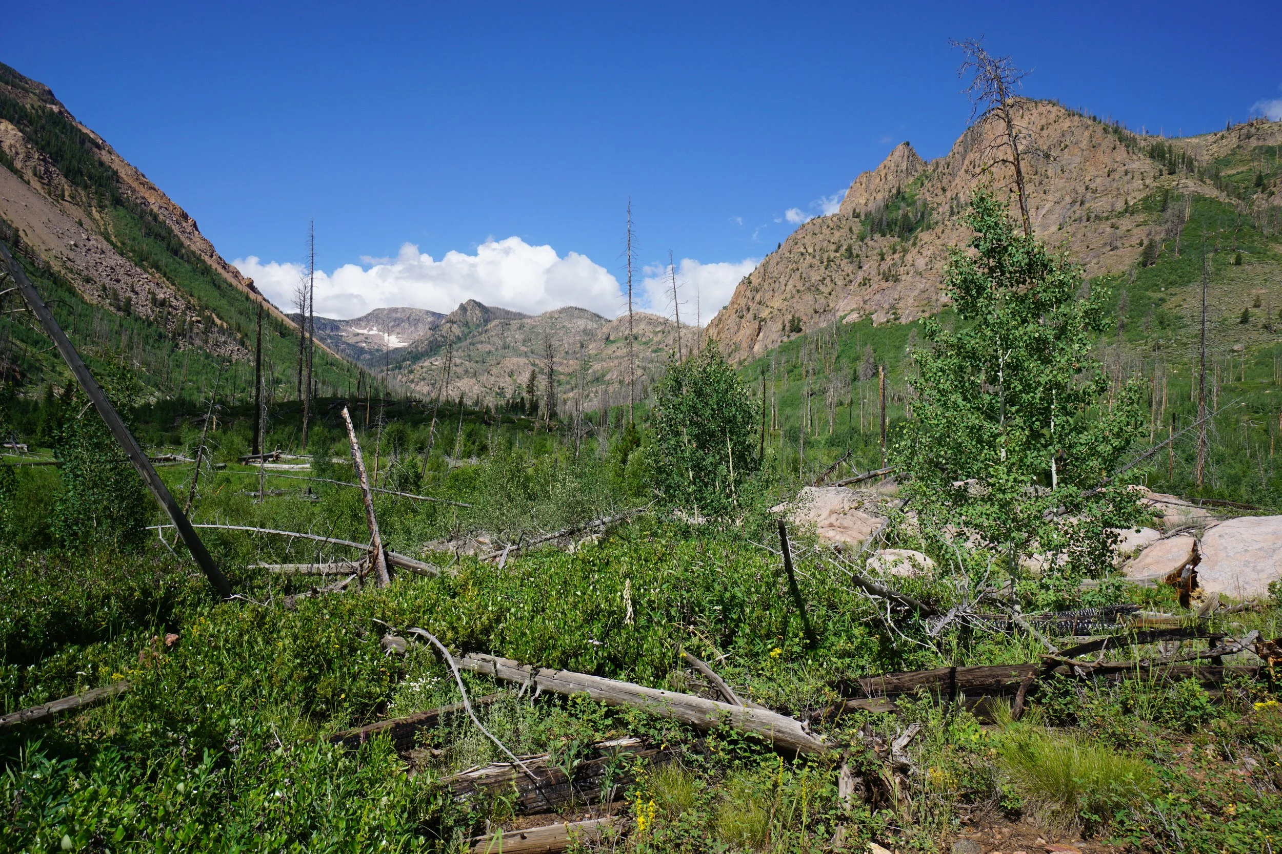
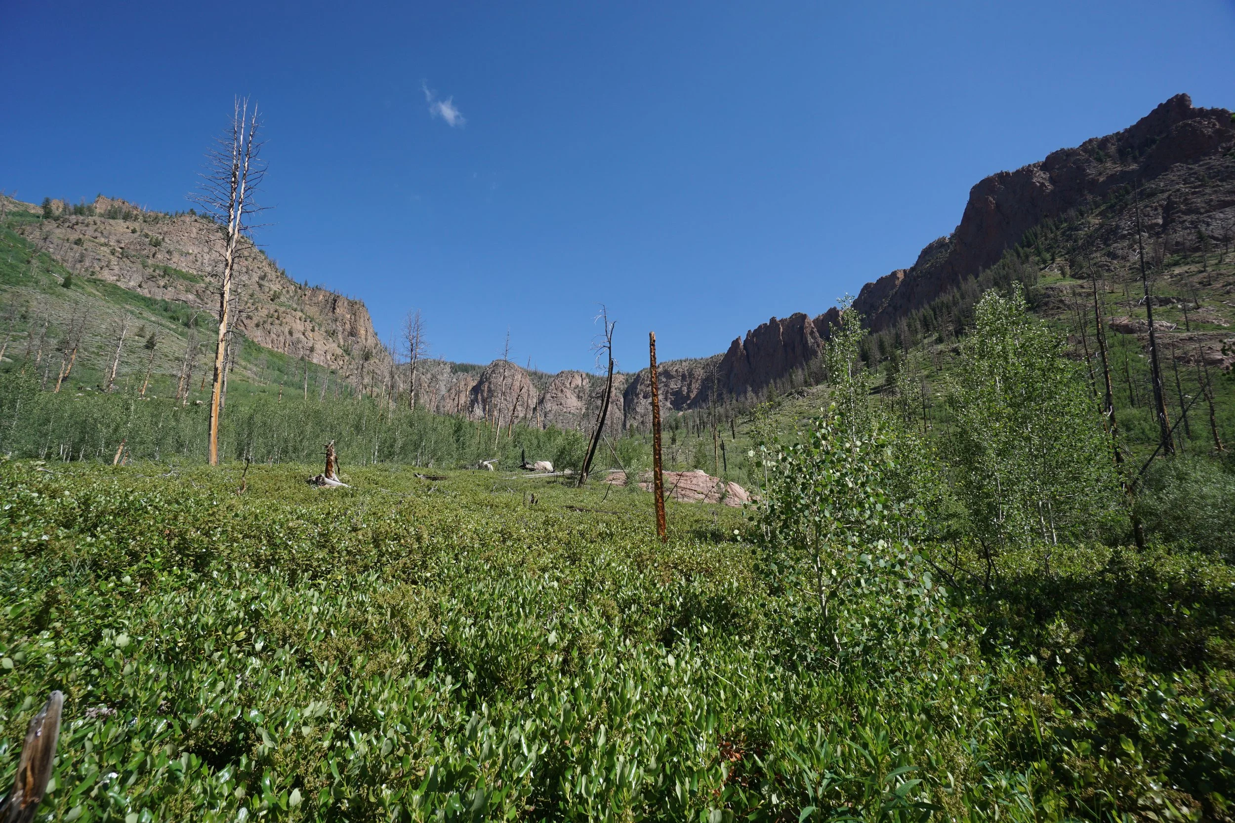
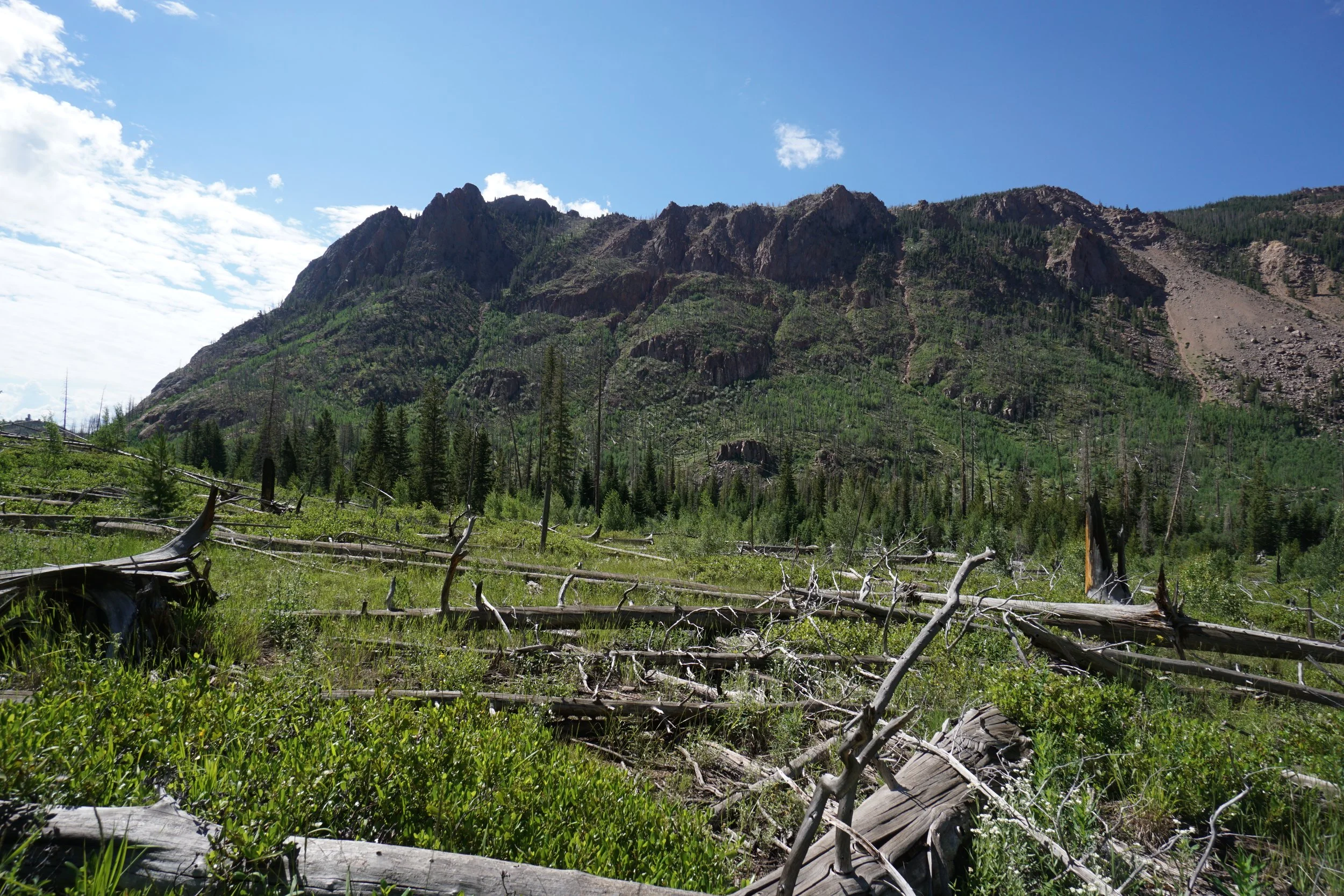
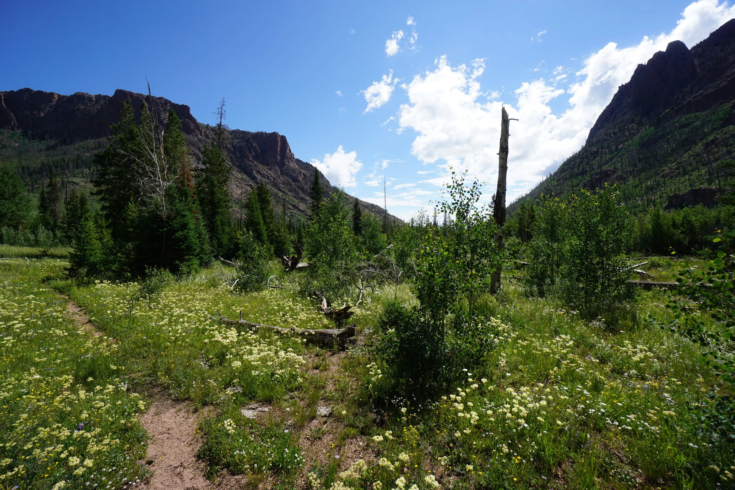
The trail from here on out generally follows the creek and the canyon floor. At time (in the summer) this trail is heavily overgrown. You’ll be pushing through vegetation for a good portion of your hike. As you push through the canyon, the views continue to inspire. The canyon walls are monstrous. When you get into the Mt. Zirkel Wilderness (no sign) you’ll be able to see up the canyon to the higher elevation Continental Divide in the distance. Eventually the trail leads up to the Divide but it’s a long 6.5 miles (one way) to the Continental Divide Trail. I hiked about 2 miles into the canyon to the point just before the hike starts to climb up the northern wall of the canyon. At the low point, there is an incredible field of wildflowers and this seemed like a good place to start the return climb out of the canyon.
Save some energy for the return hike. After pushing back through the vegetation you need to climb 500 up feet back to the trailhead. It’s pretty steady and not too bad of a climb. Once at the trailhead, walk back along the road to wherever you parked.
Red Canyon is really a hidden gem. I’d love to return and backpack further into the canyon, I bet the views from the top of the north wall are incredible.