Greenbelt Plateau
Boulder Open Space & Mountain Parks
Date Hiked: September 4, 2012
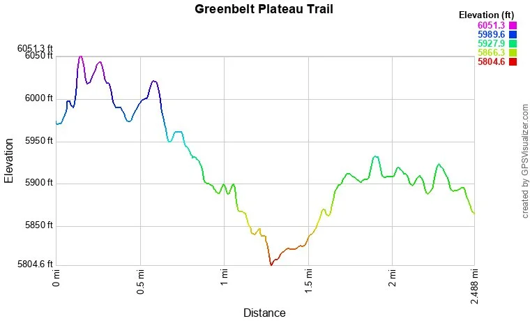
Distance: 2.5 mi (RT)
Elevation Gain: 200ft
Elevation: 5,805 to 6,051
Managing Agency: City of Boulder Open Space & Mt. Parks
Fee: None
Directions:
From Boulder head south on Hwy 93, past Marshal Mesa and turn left (east) on 120th Ave and immediately left into the small parking area for the trailhead.
Hike Description:
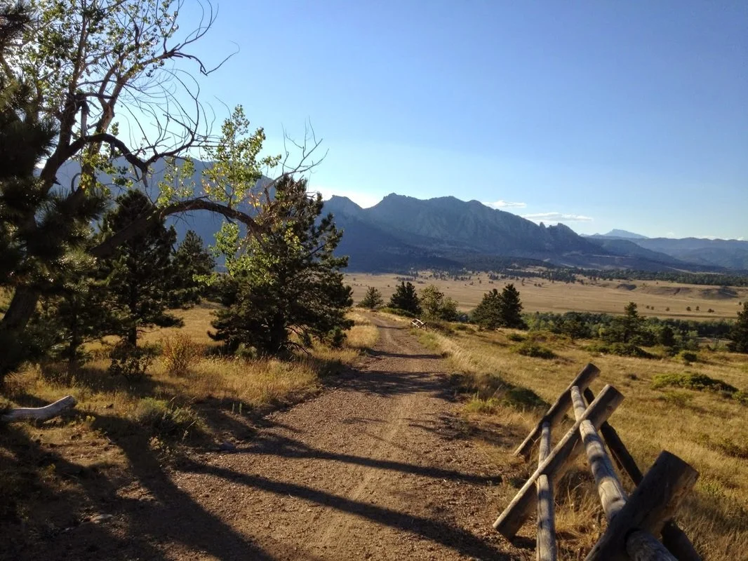
The Greenbelt Plateau Trail is really just a connector trail. It connects Marshall Mesa to the High Plains Trail or the Flat Irons Vista Trail. However, the trail itself is a nice easy hike with great views of the Foothills south of Boulder, including Eldorado Canyon, S. Boulder Peak, Bear Peak, Green Mountain, and the Flatirons. From the trailhead on 120th Ave, follow the trail straight north as it steadily rises to a saddle and descends down to connect with the Marshall Mesa Trail. From here you can also cross Hwy 93 (carefully!) to link up with the Community Ditch Trail, which has amazing views! Otherwise, head back the way you came for a quick 2.5 mile hike.